I90 Survey & Engineering - TTQ Queretaro
←
→
Page content transcription
If your browser does not render page correctly, please read the page content below
i90
Survey & Engineering

Hardware Description
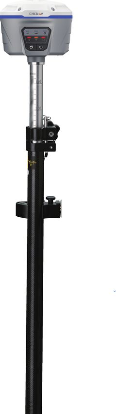
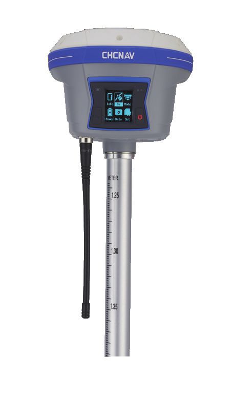
i90
The i90 GNSS receiver offers integrated IMU-RTK technology to provide a robust
and accurate GNSS positioning, in any circumstances. Unlike the standard MEMS
based GNSS receivers, the i90 GNSS IMU-RTK combines state-of-the-art GNSS
IMU-RTK RTK engine, calibration-free professional IMU sensor and advanced GNSS tracking
GNSS capabilities to dramatically increase RTK availability and reliability.
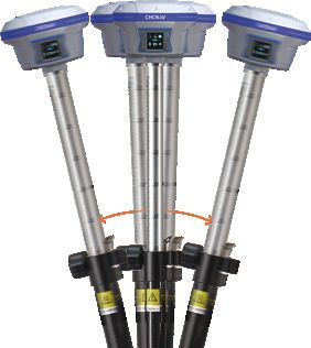
Receiver The i90 automatic pole-tilt compensation boosts survey and stakeout speed by up to
20%. Construction and land surveying projects are achieved with high productivity and
reliability pushing the boundaries of conventional GNSS RTK survey.
UHF Antenna
Serial Port
USB Port
Battery Door
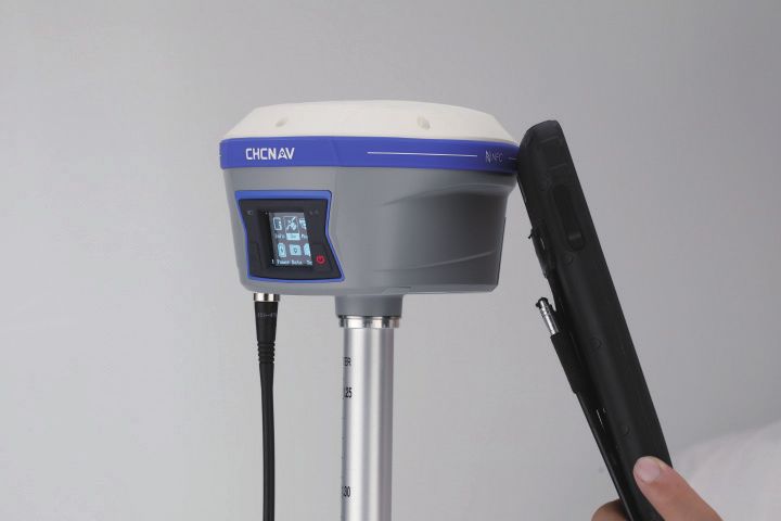
Wi-Fi
4G Modem
Bluetooth
IMU
Satellites LED
Correction LED
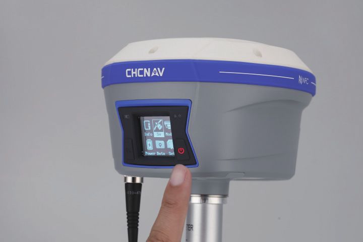
Function Button
Power Button
i90
Survey & Engineering
Core Technology

 624 channels- Full GNSS                  Extended connectivity
 The embedded 624-channel GNSS            The i90 GNSS combines high-end
 technology takes benefit from all GPS,   connectivity modules: Bluetooth, Wi-Fi,
 GLONASS, Galileo and BeiDou signals      NFC, 4G and UHF radio modem. The
 and provides robust RTK position         4G modem brings ease of use when
 availability and reliability.            working within RTK networks. The
                                          internal UHF radio modem allows
                                          long-distance base-to-rover surveying
                                          up to 5 km.

Hassle-free IMU-RTK surveying             High accuracy. Always.
                                          The i90 GNSS build-in IMU ensures
 No complicated calibration process,      interference-free automatic pole-tilt
 rotation, leveling or accessories are    compensation in real-time. 3 cm
 necessary with the i90. Just a few       accuracy is achieved with pole-tilt
 meters walk will initialize the i90      range of up to 30 degrees.
 internal IMU module and enable RTK
 survey in difficult field environment.

                                                                                       i90
                                                                      Survey & Engineering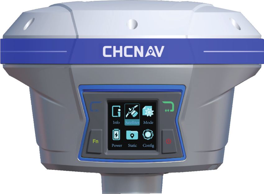
Specifications
                     GNSS Performance(1)                                                                     Communication
Channels                624 channels                                       Network modem                  Integrated 4G modem
GPS                     L1 C/A, L2C, L2P, L5                                                              LTE (FDD): B1, B2, B3, B4, B5, B7, B8, B20
GLONASS                 L1, L2                                                                            DC-HSPA+/HSPA+/HSPA/UMTS: B1, B2, B5, B8
Galileo                 E1, E5a, E5b                                                                      EDGE/GPRS/GSM 850/900/1800/1900 MHz
BeiDou                  B1, B2, B3                                         Wi-Fi                          802.11 b/g/n, access point mode
SBAS                    L1                                                 Bluetooth®                     v4.1
QZSS                    L1, L2, L5                                         Ports                          1 x 7-pin LEMO port (external power, RS-232)

                       GNSS Accuracies(2)                                                                 1 x USB Type-C port (data download, firmware update)
                                                                                                          1 x UHF antenna port (TNC female)
Real time               Horizontal: 8 mm + 1 ppm RMS
                                                                           UHF radio                      Standard Internal Rx/Tx: 410 MHz to 470 MHz
kinematics (RTK)        Vertical: 15 mm + 1 ppm RMS
                                                                                                          Transmit Power: 0.5 W to 2 W
                        Initialization time: < 10 s
                                                                                                          Protocol: CHC, Transparent, TT450
                        Initialization reliability: > 99.9%
                                                                                                          Link rate: 9600 bps to 19200 bps
Post-processing         Horizontal: 2.5 mm + 1 ppm RMS
                                                                                                          Range: Typical 3 km to 5 km
kinematics (PPK)        Vertical: 5 mm + 1 ppm RMS
                                                                           Data formats                   RTCM 2.x, RTCM 3.x, CMR input and output
Post-processing         Horizontal: 2.5 mm + 0.5 ppm RMS
static                                                                                                    HCN, HRC, RINEX 2.11, 3.02
                        Vertical: 5 mm + 0.5 ppm RMS
                                                                                                          NMEA 0183 output
Code differential       Horizontal: 0.25 m RMS
                                                                                                          NTRIP Client, NTRIP Caster
Autonomous              Horizontal: 1.5 m RMS                              Data storage                   32 GB internal memory
                        Vertical: 3 m RMS
Positioning rate        Up to 10 Hz                                                                               Electrical
Time to first fix(3)      Cold start: < 45 s                                 Power consumption              5 W (depending on user settings)
                        Hot start: < 10 s                                  Li-ion battery capacity 2 x 3400 mAh, 7.4 V
                        Signal re-acquisition: < 1 s                       Operating time on       UHF receive/transmit (0.5 W): 6 h to 9 h
RTK tilt-compensated    Additional horizontal pole-tilt uncertainty        internal battery(4)            Cellular receive only: up to 9 h
                        typically less than 10 mm + 0.7 mm/° tilt                                         Static: up to 10 h
                                                                           External power input           9 V DC to 28 V DC
                             Hardware
Size (L × W × H)        159 mm x 150 mm x 110 mm
                        (6.3 in × 5.9 in × 4.3 in)
Weight                  1.26 kg (2.77 lb)
Environment             Operating: -40 °C to +65 °C (-40 °F to +149 °F)
                        Storage: -40 °C to +85 °C (-40 °F to +185 °F)
Humidity                100%
Ingress protection      IP67 waterproof and dustproof, protected
                        from temporary immersion to depth of 1 m
Shock                   Survive a 2-meter pole drop
Tilt sensor             Calibration-free IMU for pole-tilt compensation.                                               *Specifications are subject to change without notice.

                        Immune to magnetic disturbances.
                        EBubble leveling
Front panel             4 LED indicates
                                                                            (1) Compliant, but subject to availability of BDS ICD and Galileo commercial service definition.
                        1.46'' OLED Display
                                                                                GLONASS L3, BDS B3 and Galileo E6 will be provided through future firmware upgrade.

                          Certifications                                     (2) Accuracy and reliability are determined under open sky, free of multipaths, optimal GNSS
                                                                                geometry and atmospheric condition. Performances assume minimum of 5 satellites, follow
                                                                                up of recommended general GPS practices.
FCC Part 15 (class B Device), FCC Part 22, 24, 90; CE Mark;
                                                                            (3) Typical observed values.
NGS Antenna Calibration; MIL STD 810G, Method 514.7;                        (4) Battery life is subject to operating temperature.

                                                                           © 2020 Shanghai Huace Navigation Technology Ltd. All rights reserved.
                                                                           The CHC and CHC logo are trademarks of Shanghai Huace Navigation
                                                                           Technology Limited. All other trademarks are the property of their
                                                                           respective owners.

                                                                           – Revision January 2020

                                                                           Shanghai Huace Navigation Technology Ltd.
                                                                           599 Gaojing Road, Building D
                                                                           Shanghai, 201702, China
                                                                           +86 21 54260273 WWW.CHCNAV.COM
You can also read