Introduction to QZSS and applications - UNICG Workshop on GNSS January 19, 2021 Satoshi Kogure - UNOOSA
←
→
Page content transcription
If your browser does not render page correctly, please read the page content below
Introduction to QZSS and
   applications

UNICG Workshop on GNSS
    January 19, 2021
        Satoshi Kogure
 National Space Policy Secretariat
Cabinet Office, Government of Japan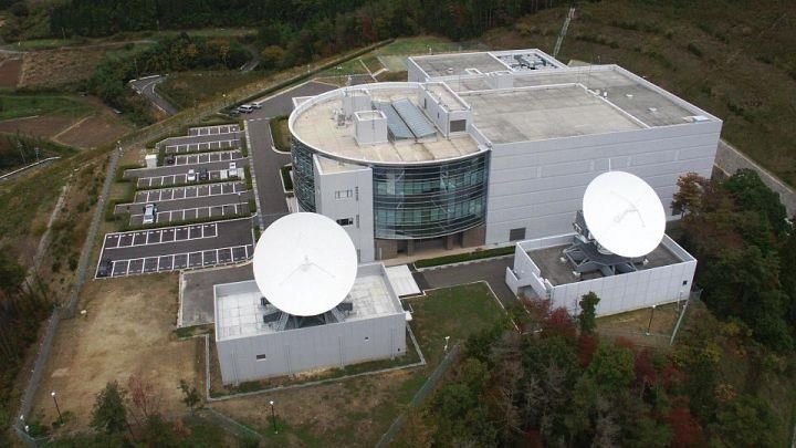
Contents
1.       QZSS Overview
     •    System
     •    Program schedule
2.       Services and Performances
3.       Future Expansion to 7SV constellation
4.       Application demonstrations
5.       Summary

                                                 1
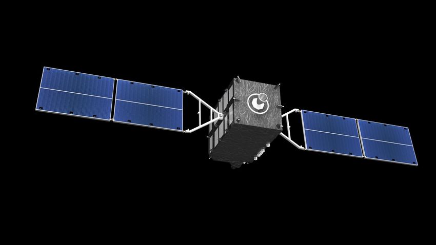
1. QZSS Overview -System-
QZS-1 QZS-2, 4
◼ Constellation:
1 GEO Satellite, 127E
3 QZO Satellite (IGSO) QZS-3
◼ Ground System Equator
2 Master Control
Stations
◼ Hitachi-Ota and Kobe
7 Satellite TTC Stations
QZSS Control Center, Hitachi-Ohta,
◼ Located south-western
islands
Over30 Monitor Stations
around the world
2
1. QZSS Overview -Current Services-
◼ Functional Capabilities:
GPS Complementary (Ranging signals)
GNSS Augmentation (Error corrections)
Messaging Service (Disaster relief, management)
◼ Coverage: Asia and Pacific region
Augmentation service covers only Japan
◼ Experimental service provides error corrections in Asia Pacific region
40
50
60
QZSS-1
QZSS-2
10
QZSS-4
QZSS-3
(127E)
One or more QZSS SVs over 10 degrees elevation angle 3
1. QZSS Overview -Development Plan-
QZSS Program Schedule (latest)
     JFY         2015   2016     2017     2018     2019    2020    2021   2022         2023~

                  Replacement of Michibiki
 1st Michibiki                                                       Launch No.1R
                                                                     satellite
                        In-Operation

                    Launch No.2,3,4
    QZSS
   4-Sat.                                                 QZSS Service
 Constellation           Official Service Launch
                             on Nov 1, 2018                           SBAS Service

    QZSS                           Development / Design (Additional 3 Sats.)        QZSS Service
   7-Sat.
 Constellation

                                                           Today
                                                                                                   4
2.QZSS Performance -PNT Service-
▌Performance(SIS Accuracy)
                             [ Evaluation Period ]
                              2018/09/01~ 2020/08/18

                             [ Evaluation Results ]
                              Specification: Less than 2.6 m (95%)

                                          Average       Best day       Worst day
                              QZS-1       0.55 m         0.41 m         4.61 m*
                              QZS-2       0.77 m         0.43 m         2.32 m**
                              QZS-3       0.79 m         0.49 m          1.77 m

                              QZS-4       0.85 m         0.60 m        5.11 m***

                             * Due to the anomaly of a onboard atomic clock
                             ** Interruption of navigation message upload on 2020/06/19
                             ***Interruption of navigation message upload on 2020/03/31

                             Improvement of the ranging accuracy of
                             QZS-1 to 4 is now on going.
                                                                                      5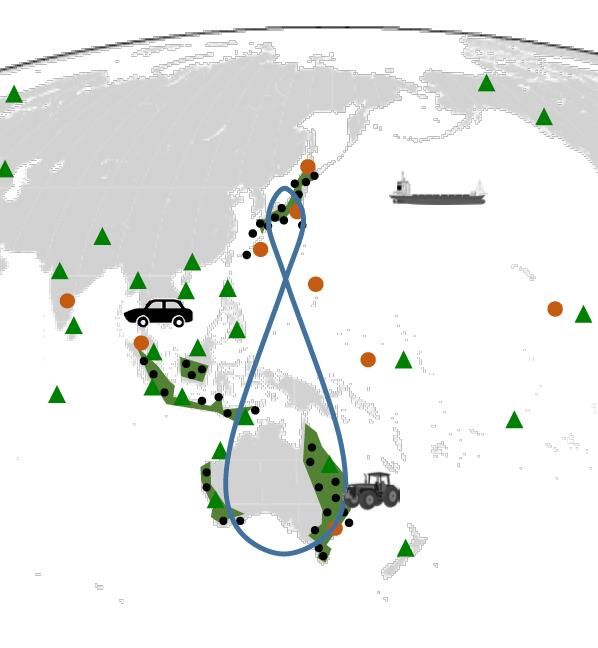
2.QZSS Performance -SLAS Service-
▌Service Area of SLAS

                     monitoring station:
                       Sapporo
                       Sendai
                       Hitachi-ohta
                       Komatsu
                       Kobe
                       Hiroshima
                       Fukuoka
                       Tanegashima
                       Amami
                       Itoman
                       Miyako-jima
                       Ishigaki-jima
                       Chichi-jima

                           Service Area is the area surrounded by the red line.
                           The left-axis is latitude, and lower-axis is longitude.
▌Accuracy of SLAS
           positioning errorm(95%)
                                                                     Remarks
          horizontal        vertical
                                             EL mask : 10°
           ≤ 1.0 m                ≤ 2.0 m    User range error caused by user’s receivers and
                                             user’s situation : 0.87 m(95%)

                                                                                               6
2.QZSS Performance -SLAS Service-
▌Recent Test results
・ Using the GNSS-based control stations in GNSS Earth Observation Network System (GEONET)
operated by Geospatial Information Authority of Japan as a rover.
・Evaluation period: 2018 May 10 (24 hours)
・Evaluation point: Gushikawa, Okinawa Pref.
・Signal subject to augmentation: GPS(L1-C/A),QZSS(L1-C/A)
・The graph shows error figures by time transition, the table shows statistical figures.
                Positioning Accuracy (Horizontal)

                                                    m(95%)
                                                              Positioning
                                                                               m(95%)
                                                               Accuracy

                                                               Horizontal         0.66
                Positioning Accuracy (Vertical)

                                                                Vertical          0.88
                                                    m(95%)

                                                                                          7
2.QZSS Performance -CLAS Service-
Overview of CLAS (Centimeter Level Augmentation Service)
                       GNSS                             Quasi-Zenith Satellite System
                                                               (QZSS: JPN)

      Positioning Signal
                         Altitude
                         500km                             ③Broadcast via satellite
    ①Error in Positioning                               (or on ground communication)
          Signals

Orbit clock, Biases,                  ④                      ②Create augmentation data
Ionosphere,                                                       and compress
Troposphere

                                     ④ Positioning errors
                                        corrected by
                                        each receiver
                                              CORS
                                      (Continously Operationg      Server and facility
                                        Reference Station)             for CLAS
                 Users

                         Specification on positioning accuracy
                                H ≤ 6.0 cm (95%), V ≤ 12.0 cm (95%) (Static)
                                H ≤ 12.0 cm (95%), V ≤ 24.0 cm (95%) (Kinematic)         8
2.QZSS Performance -CLAS Service-
▌Recent Test results (mobile use)
・ Evaluated from positioning results earned from a mobile vehicle mounting both general RTK and
CLAS receivers in open-sky condition maneuver.
・ Difference between CLAS positioning results and RTK positioning results are evaluated (defined
as error figures)
・ Error is evaluated by content (direction),
 the graph shows error figures by time transition, the table shows statistical figures

                       May 10th 2018
                 0.2
                 0.1
   Positioning
                                                                                         Error content
   error         0.0
   E-W (m)         -
                                                                                                         cm(rms)
                 0.1
                   -
                                                                                          (Direction)
                 0.2

   Positioning
                 0.1
                 0.0
                                                                                          East-West        2.0
   error
   N-S (m)         -
                                                                                         North-South       1.8
                 0.1
                   -
                 0.2
                0.1
   Positioning
   error        0.0
                                                                                            Vertical       4.2
   Vertical (m)   -
                0.1
                   -
                 0.2 5:00   5:15   5:30   5:45     6:00      6:15   6:30   6:45   7:00

                                                 Time(UTC)

                                                                                                                   9
3. Future Expansion to 7SV constellation
Service Requirement for future 7SV constellation (1/2)
1. Position, Navigation and Timing (PNT) services
⚫ Open service with Navigation Message Authentication(NMA)
◼ Step by step approach to improve performance, as new observables, ranging
measurements with using Inter Satellite Ranging (ISR) as well as two-way ranging
system, are to be applied.
◼ Final goal of SIS-URE specification is 30 cm (95% probability)
Phase (Year) SIS-URE(95%)* Note
2023-2026 2.6m Only L-band observables collected at monitoring sites.
2027-2035 1.0m After JAXA’s validations for new POD engine with ISR and
two-way ranging between SV and ground TTC station
2036- 0.3m After all 7 SVs will have ISR and two-way ranging on board
equipment
*: Average of 7SVs
⚫ Authorized service (Encrypted signals for authorized users) is under
investigation.3. Future Expansion to 7SV constellation
R&D for 7SV QZSS – additional observables for precise POD and integrity
monitoring on board
⚫ Technical goals to improve accuracy, availability, integrity:
• Improving orbit and clock estimation accuracy by adding new observation data
• Improving availability by robust satellite system design
• Enhancing integrity by monitoring L-band signal on orbit
2-Key Technologies
Two-way Ranging (Ground - Inter Satellite Ranging
Satellite)
Cancel propagation delay due to
ionosphere and troposphere and
separate orb. and clk. errors
Improve orbit estimation
(especially along track) accuracy
by reducing DOP3. Future Expansion to 7SV constellation
Service Requirement for future 7SV constellation (2/2)
2. Augmentation services
⚫ Both existing services, Sub meter Level Augmentation Service (SLAS) and
Centi-meter Level Augmentation Service (CLAS) are to be provided in
domestic area via current four SVs with same specifications.
⚫ MADOCA based PPP augmentation service will cover Asia Pacific region.
3. Messaging services
⚫ Disaster and Crisis management Report (DCR) service, a kind of Early
Warning Service (EWS) will be expanded to Asia Pacific region.
◼ Common format is now being investigated with EC and other providers under ICG
correspondence group.
High accuracy augmentation (MADOCA-PPP) and Early Warning Service
into wider area in Asia Pacific region will be operational after 2023
123. Future Expansion to 7SV constellation
Domestic Service and Wide Area Service for carrier phase positioning
QZSS :region
CLAS on L6D MADOCA-PPP
on L6E • CLAS (Centimeter Level
Augmentation Service) is being
provided via L6D signal.
• Employs the dense GNSS CORS in
service area.
• CLAS for Japanese territory started
in 2018.
CLAS
:region
QZSS orbit • Experimental augmentation on PPP
with MADOCA has been provided
via L6E signal on QZS-2/3/4.
• MADOCA: Multi-GNSS Advanced
Demonstration tool for Orbit and
MADOCA-PPP Clock Analysis is a precise POD
engine developed by JAXA.
• Operational service will start around
2023 at the latest with same
QZSS coverage area , Compact SSR format as CLAS
Asia Pacific region
134. Future Expansion to 7SV constellation
▌QZSS Constellation Design
QZS-5
QZS-5
QZS-1R
QZS-1R
North pole
QZS-6
QZS-3
QZS-6(GEO) QZS-3(GEO) QZS-7(QGEO)
QZS-7
QZS-2 South pole
QZS-2
QZS-4
QZS-4
Center Longi.
Orbit SV
(deg.)
7-QZSS Ground Track
GEO(2-sats) QZS-3, 6 127E, 90.5E
QZS-1R, 148E(nom)
QZO(4-sats)
QZS-2, 4, 5 139E(nom)
QGEO(1-sat) QZS-7 185E(nom)
*QGEO: Quasi Geostationary Earth Orbit (i>1deg, e=0.008)
144. Future Expansion to 7SV constellation
HDOP for 7 healthy SV with 10 degree EL mask
• The highest priority is to
provide good geometry
(HDOP).
– Japan and surrounding area
should have good HDOP, less
than 2.6 on 95 percentile.
• SBAS user requirements on
the number of GSO
satellites is satisfied.
– More than 2 GSO SV for LPV
service to be provided by
Japanese Civil Aviation Bureau
4 IGSO + 2 GSO +1 QGSO*
constellation will be completed
around 2023
*: QGSO Quasi-Geo Synchronous Orbit
Geosynchronous orbit with small eccentricity and inclination
15 64. Future Expansion to 7SV constellation
▌Visibility in Tokyo
164. Future Expansion to 7SV constellation
■ Visibility in other Asian cities
Sky plot at Jakarta Sky plot at Bangkok
10
30
60 70
70 degree
Sky plot at Singapore
64 degree
10
30
60 70
74 degree
174. Future Expansion to 7SV constellation
Latest status
⚫ The procurement process for QZS-5, 6, and 7 has started in the end of
March, 2019.
⚫ Update of ground control segment will follow soon.
Further challenges for future expansion
⚫ Reliability, availability improvement for whole total system
Long-term replacement plan
Back-up satellites, less ground infrastructure for system resilience
improvement
⚫ Sustainable system architecture
further reductions satellite weight, size and cost, and more effective
ground control segment
⚫ Alternative PNT4. Applications demonstrations
Autonomous driving Smart Agriculture
Autonomous sailing Drone logistics
194. Applications demonstrations
Simplification of Rail Traffic
Automatic Berthing System
Management System
wharf
http://www.mlit.go.jp/common/001215815.pdf
KYOSAN ELECTRIC
Construction in the ocean Wearable Devices for Sports
precise distance
at golf course
MASA
TOA Corporation 20Available Receiver, chipset for QZSS use
MADOCA-PPP
available
CLAS available SLAS, EWS available
Please check List of products that support the QZSS is shown;
QZSS.go.jp
https://qzss.go.jp/en/usage/products/list.html
Most of smart phone can track QZSS
21Multi-GNSS Asia
Multi-GNSS Asia is an international community led by Japanese initiative which
promotes multi GNSS in the Asia and Oceania regions and encourages GNSS service
providers and user communities to develop new applications and businesses. The
MGA also works together with the communities in Asia and Oceania regions in
achieving SDGs through technical support on GNSS via seminars for policy makers,
capacity building and more.
Steering Committee Members
DISCOVER
Annual Conferences & Exhibitions in the Asia-Oceania Region
LEARN CONNECT
Webinars, Regional Workshops, Hackathons and more Build Networks and stay tuned with the latest movements in
GNSS
https://www.multignssasia.com/MGA - Enhancing online activities and networking
RPD (Rapid Prototype Developing) Challenege is a program for young professionals
and students. It is an idea conpetition with actual H/W, S/W design, development and
demonstration.
5 Month Online Capacity Online Lecture and Info
Building Program Webinar
Sharing5. Summary
• QZSS is Japanese regional navigation satellite system to improve
not only GNSS availability but also accuracy and reliability
– 4 satellite constellation: Three IGSO and one GEO satellites
– Providing PNT, augmentation and messaging services
• On Nov 1st 2018, Japanese Government officially launched QZSS
service.
– The service performance has satisfied with the specifications.
– Application demonstrations were conducted.
• Future expansion to 7 satellite constellation
– Started procurement process for additional 3 satellites
• An IGSO, a GSO and a QGSO satellite will be added to the existing constellation
– Service requirements were established
• Cover Asia Oceania region for PNT services
• Extension of High accuracy augmentation (MADOCA-PPP) and Early Warning
Service into AP region is being operational services
24Thank you for your attention!
For more information, please visit our web site
https://qzss.go.jp/en/
25You can also read