Iron Mining In the Penokee Range- What's at Risk - Penokee Range
←
→
Page content transcription
If your browser does not render page correctly, please read the page content below
Iron Mining
In the Penokee Range-
     What’s at Risk

                  Penokee Range
                      © Dale A. Thomas/NP Studios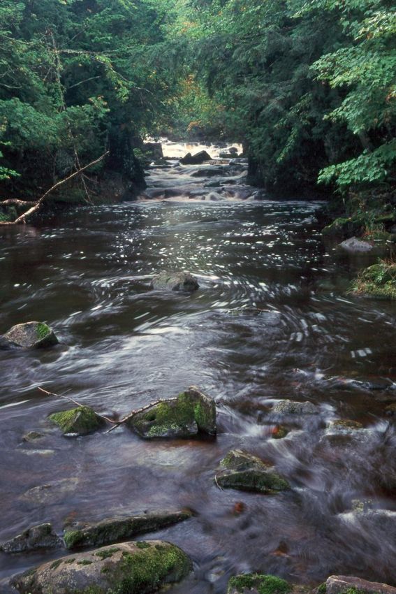
Introduction
   The Penokee – Gogebic Range extends 25 miles in far northern Wisconsin, through Iron
   and Ashland counties. The range consists of two steep, parallel ridges that dominate the
   local landscape rising 1200 feet from nearby Lake Superior. The topography of the area
   and the variety of soil conditions result in a wide range of habitat that supports a diverse
   group of species and natural communities.

   For decades, this property has been managed for hardwood timber production, including
   maple and yellow birch. Pine, hemlock, ash and aspen are also on the property. Currently,
   the majority of the land is enrolled in Wisconsin’s Managed Forest Law. Managed Forest
   Law requires a management plan to sustain production of timber products and large areas
   for public recreational uses, including hunting, hiking, and snowmobiling.

   The forests provide habitat and hunting opportunities for upland birds and big game
   including, ruffed grouse, white-tail deer and black bear. The forests are close to the state’s
   reintroduced elk herd. Many of the streams on the property are Class I trout streams with
   naturally reproducing populations of brook, brown and rainbow trout.

   The majority of the Penokee Range is owned by RGGS Land and Minerals out of Houston
   Texas and La Point Mining Co in Minnesota. Together, these companies control a narrow
   22-mile, 22,000 acre band in the Penokee Range from southwest of Hurley, WI to about six
   miles west of Mellen, WI. The Cline Group, out of Florida, has secured an option to obtain
   the mineral rights held for this property and has created a subsidiary called Gogebic
   Taconite (G-TAC) to move forward with the mining of iron.

Why is this land important
The Penokee mining land encompasses:
      Nearly 35 square miles of northern
      hardwood forest,
      Fifty-six miles of perennial river and
      stream frontage on more than 20
      waterways,
      Frontage on English and Beaver lakes.

It is in close proximity to
          Copper Falls State Park,
          The Nature Conservancy/DNR
          cooperative project at Caroline Lake
          State Natural Area,
          Devil’s Creek State Fishery Area,
          Segments of the North Country National
          Trail.

This land helps maintain the forest cover in a
landscape that links the Chequamegon-Nicolet
National Forest in northern Wisconsin to the
Ottawa National Forest in the Upper Peninsula
of Michigan. This land provides habitat for wide
ranging mammals, such as timber wolves and
Pine martins, and for breeding populations of                                     View from top of
migrant songbirds, such as the black-throated
blue warbler.                                                                    Mount Whittlesey
                                                    © Dale A Thomas/NP Studios
                                                                                                    2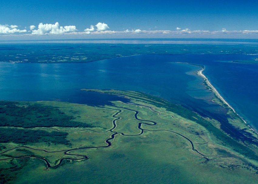
The Penokee Range is identified as an important area of high conservation significance due
                     to its unique geology; many rare plants, animals and forest communities; and high quality
                     recreational opportunities (WI Land Legacy Rpt, 2006). This landscape was included in the
                     DNR’s Forest Legacy Assessment of Need (2001); The Wisconsin Wildlife Action Plan
                     identified the Penokee Range as an Important Bird Area and a Conservation Opportunity
                     Area of Continental Significance to maintain a large continuous climate change resistant
                     forest (2008).

                     The Penokees have also been identified by The Nature Conservancy and its partners in the
                     Great Lakes Ecoregional Plan (2000) as a large block of forest important for declining forest
                     birds such as the golden-winged warbler, blackburnian warbler and goshawk. The forests
                     also provide an important function in maintaining the quality and quantity of water that
                     eventually empties into the Kakagon/Bad River Sloughs – a United State Department of
                     Interior designated National Natural Landmark.

    Mount
    Whittlesey
© Matt Dallman/TNC
                                                            © Scott W. Mulcahy                           © Scott W. Mulcahy

                             © Robert A. Kleppin             © Lawrence Michael    © Robert A. Kleppin

                                                                                                                              3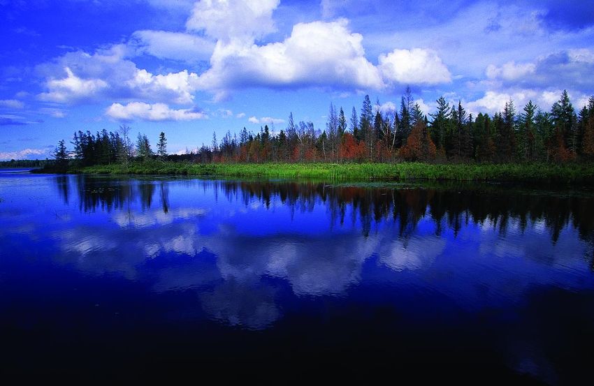
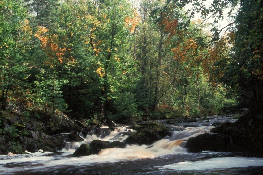
Bad River
© Matt Dallman/TNC
Risks to Unique Water Resources
The Penokee mining land has the potential to impact a large portion of the headwaters of
the Bad River watershed. Fifty-six miles of perennial, and 15 miles of intermittent waterways
flow through the mining land. Due to their high elevation and close proximity to Lake
Superior, the Penokees average over 200 inches of snow a year. The quantity,
temperature, and nutrients of this water have significant impacts on water resources
downstream including the Bad River, the Kakagon/Bad River sloughs and finally Lake
Superior.
The Bad River flows through a wide variety of habitats in a relatively short span. Starting in
the forested heights of the Penokee range it quickly drops through deep forests in Copper
Falls State Park and over the escarpment into spectacular canyons and waterfalls. Below
Copper Falls, the Bad River flows through lowland forests and out to the sloughs where the
river meets Lake Superior. Segments of the Bad River, Kakagon River, Bear Trap Creek,
and Wood Creek are all designated as Outstanding Natural Resource Waters by the State
of Wisconsin. These systems are all dependent on surface and ground water that originates
in the Penokee Range. The Bad River also provides important spawning habitat for the lake
sturgeon and many game fish.
At the mouth of the Bad River are some of the largest and highest quality coastal wetlands
in the Great Lakes. The 16,000-acre Kakagon/Bad River Sloughs, which have been called
Wisconsin’s Everglades, are an ecosystem of national significance and were designated as
a National Natural Landmark by the U.S. Dept. of the Interior in 1983. The Kakagon-Bad
River Sloughs are home to many threatened and endangered species such as the Piping
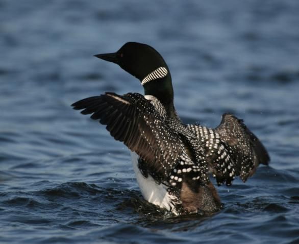
Plover, Trumpeter Swan, Yellow Rail, Bald Eagle, wood turtle, and ram’s-head lady-slipper
orchid.
4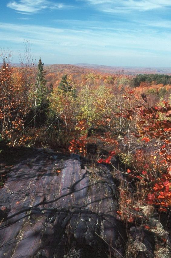
The Penokee range is also a key piece of the land for
                            drinking water. This area makes up the headwaters of
                            the drinking water source both surface and
                            groundwater, for the Municipalities of Ashland, Mellen,
                            Highbridge, Marengo, Odanah, and Upson.

                            Finally the rise in elevation of the Penokees creates the
                            hydrologic pressure that supports the abundance of
                            artesian wells found along the Chequamegon Bay
                            shoreline. Within Lake Superior itself, the ground
                            water upwellings generated by this hydrologic pressure
                            are critical spawning areas for many great lakes fishes.
                                                                                  © Ryan Brady

  Long Island,
  Lake Superior
© Gerald H. Emmerich, Jr.

                                                                    Piping Plover

                                                             Chequamegon Bay
© Ted Cline

                                                                                                 5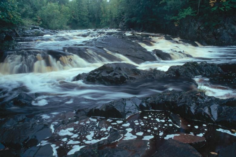
The following rivers/streams flow through the Penokee mining property (E and O indicate
that portions of these waterways are designated as Exceptional or Outstanding
Resource Waters):

Apple Creek                   Edies Creek                    Montreal Creek
Bad River (E and O)           Erickson Creek                 Opergard Creek
Ballou Creek (E)              Gehrman Creek                  Potato River (O)
Barr Creek (E)                Gravelly Brook                 Rocky Run
Camp Six Creek                Happy Creek                    Rouse Creek
City Creek                    Hardscrabble Creek             Tafelski Creek
Devils Creek (E)              Javorsky Creek (E)             Tyler Forks (E and O)
Dunn Creek                    Krause Creek (E)               Several unnamed

                                                                                          6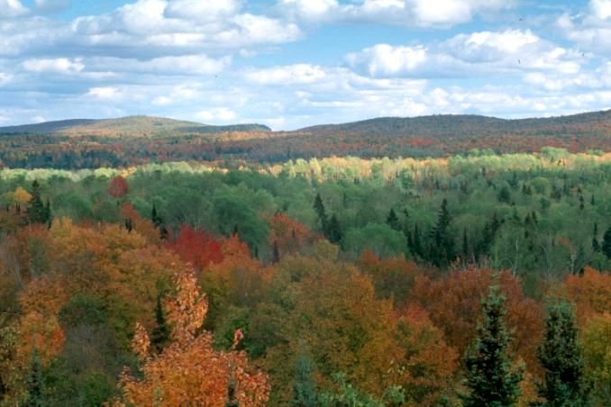
Kakagon Sloughs

  Tyler Forks
© Dale A. Thomas/NP Studios

    Tyler Forks Falls
     © Dale A. Thomas/NP Studios
© Dale A Thomas/NP Studios

                                                                    Tyler Fork Falls
                                   © Dale A. Thomas/NP Studios
                                                                                   7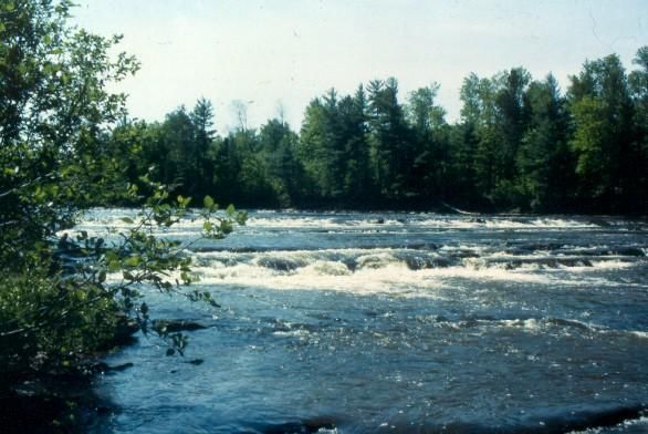
Conclusion
This document gives a short summary of the natural resources that have the potential to be
impacted by mining activities in the Penokee Range. It is critical that these unique resources be
identified, the threats to them recognized, and all efforts made to protect them. The Nature
Conservancy believes there are many questions that need be answered to make sound policy
decisions on this issue.

         What is the exact location and extent of actual strip mine
         Expansion plan – what is the potential scale of this mine 5, 10, 50 years
         How much water (actual) will this mine use, where will it come from and how will it be returned
         to the system
         What will be leached from the exposed rock, how will this be contained from reaching surface
         and ground water and how will it be treated
         What impact will this mine have on surface and ground water
         How does the groundwater move away from this site and what impact will that have on local
         communities
         How will the mine impact surface water, quality, quantity, timing and temperature
         How will this project impact endangered species

It is our hope that due diligence is done so that thoughtful and informed decision are made on how to
proceed with any mining operation in this area. It is an area of the state that The Nature Conservancy
and its partners have been working in for a long time and we hope our experience can help inform good
policy decisions on this issue.

                                                                                                    © Howard Moon

                                                                         Caroline Lake,
                                                                Headwaters to Bad River
                                                                                                       Contact:
                                                  © Gerald H. Emmerich, Jr.
                                                                                               Casey Eggleston
                                                                                        The Nature Conservancy
                                                                                             633 W. Main Street
                                                                                            Madison, WI 53703
                                                                                            ceggleston@tnc.org
                                                                                                  608-316-6412

 ©Gerald H. Emmerich, Jr.                                                                                      8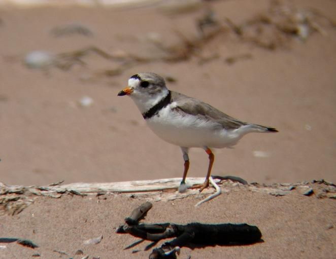
You can also read