Killarney Lake Park MANAGEMENT PLAN - Final Draft February 2020 - Fredericton.ca
←
→
Page content transcription
If your browser does not render page correctly, please read the page content below
Final Draft February 2020

Killarney Lake Park
    MANAGEMENT PLAN
Prepared for the City of Fredericton by

The Planning Partnership

2020
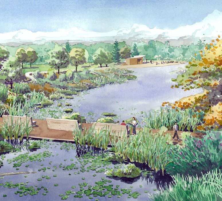
TABLE OF CONTENTS
  1Background............................. 02
   1.1 Killarney Lake Park in Context................................... 03
   1.2 Purpose......................................................................... 05

                                                                                               Killarney Lake Park Management Plan
   1.3 History........................................................................... 07
   1.4 Engagement – Community & Stakeholders............. 10

  2Where We Are Now................ 12
   2.1 Planning Context - What Guides the Plan.................... 13
   2.2 Fredericton’s Park System.......................................... 15

  3Where We Want To Go........... 16
   3.1 Opportunities and Challenges................................... 17
   3.2 Management Strategy: Accommodating Ecology and
       Recreation to Foster Sustainability............................ 19

  4How We Get There................. 20
   4.1 Management Zones.................................................... 21
   4.2 Management Approaches.......................................... 38

   4.3 Implementation Plan................................................... 52

    Appendix................................. 55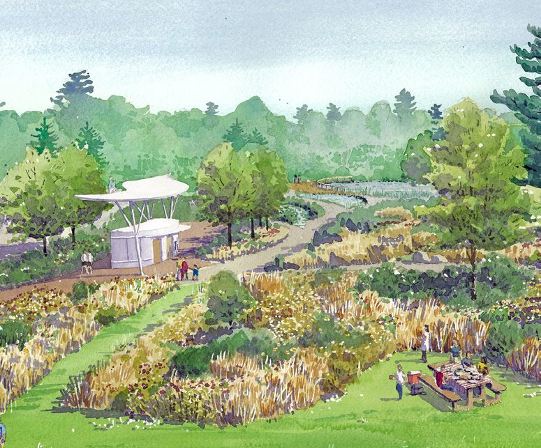
2
                                      1
                                           1
    Killarney
           Killarney
               Lake Park
                     LakeManagement
                          Park Management
                                     Plan Plan
                                             How We
                                                 Background
                                                    Got Here

                                                               1 Background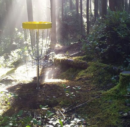
1.1 Killarney Lake Park in Context
    Killarney Lake Park today is, by far, Fredericton’s biggest park at

                                                                               Background
    about 645 hectares. This urban treasure represents over 55% of the
    City’s public parkland. Killarney Lake Park is a Regional destination
    for hiking and off-road cycling, as well as cross country skiing, and
    is only growing in popularity with a professionally designed ski trail
                                                                                    1
    system and proposed plan for off-road cycling.

                                                                               Killarney Lake Park Management Plan
    The park is appreciated by Frederictonians for its natural
    environment areas and its diverse recreational opportunities. It
    has something for everyone, including swimming in Killarney Lake.
    Very few cities can boast a park of this magnitude and significance,
    especially with a natural lake. Killarney Lake Park is important in
    achieving goals set by the City’s growth strategies, in providing
    access to natural green spaces for health and recreation.

    The park serves many people. It is both a city wide destination and
    local community asset. The park is visited daily by the people of
    Fredericton, but also by people from Atlantic Canada and beyond.
    Its attraction lies in its amazing variety of landscapes and activities:
    swimming, skiing, biking, hiking, snowshoeing, picnicking, and
    appreciating nature in its many forms.

    Killarney Lake Park is over twice the size of New York City’s Central
    Park. Given its size, scale, location, natural features and capacity,
    Killarney Lake Park has great responsibility to serve the City of
    Fredericton, and it is imperative to create a management plan for
    the park that ensures it will be healthy, vibrant, and sustainable for
    the generations to come.

                                                                                             3
Background

                                                  Killarney
                                                 Lake Park
     1                                                                                                            ~645 ha
Killarney Lake Park Management Plan

                                                        St. John River
                                                                                         City Hall

                                                                           Downtown

                                                                                                                                    N

                                      Killarney Lake Park is 645ha, over twice the size of New York City’s Central Park at 341ha.

       4
1.2 Purpose
   The plan is meant to be a guiding document that sets the framework
   for the evolution of a Regional park. The plan will guide future

                                                                         Background
   decisions, key projects and investments under a common vision
   developed by the community and staff. The purpose is to:

   •   Identify significant natural features within the park and              1
       establish a system for classifying how land is used: Management

                                                                         Killarney Lake Park Management Plan
       Zones. The natural features will help define what recreational
       opportunities are appropriate and to what intensity they
       should occur.

   •   Operate the park as a balanced ecological and recreational
       destination.

   •   Provide the basis to develop an Eco-tourism and Sport tourism
       Strategy.

   •   Manage change in the park as the City’s population grows and
       pressure on the park increases.

   •   Design all elements to be inclusive and accessible.

   •   Provide recommendations for park wide initiatives that
       improve the user experience and help resolve conflict.

   •   Provide recommendations for capital projects.

   •   Provide guidance for near, medium- and long-term projects to
       be further defined in the future.

                                                                                       5
Background

     1
Killarney Lake Park Management Plan

                                                             Education

                                                   Circulation      Infrastructure

                                         Ecology                               Recreation

                                      This plan is rooted in the goal of achieving the right balance
                                      between ecology and recreation. What we build, the way people
                                      move and what we learn about the park grow from there.

                                      Roots of the Plan
       6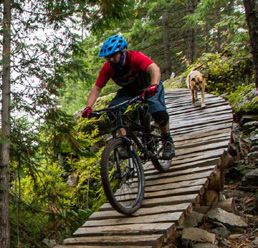
1.3 History
    Killarney Lake has long been a centre of attraction in the region.

                                                                                  Background
    Prior to the establishment of the park proper, the lake was used
    for recreational purposes such as swimming and boating. Over
    time the lake became overgrown and in the 1970s the Fredericton
    District Labour Council revived the lake and beach for use. This
                                                                                       1
    was followed by the Fredericton Recreation Department adding

                                                                                  Killarney Lake Park Management Plan
    change rooms, toilets, a small playground, and better parking
    facilities. To improve recreational opportunities, the lake has been
    stocked with fish, mostly brook trout, annually in the spring and
    fall since 1958 for fishing.

    The birth of Killarney Lake Park as it exists today can be attributed
    to the 1977 Fredericton Municipal Plan, which stated, “it will be the
    intent of the City to ensure the provision of a large passive park (similar
    to Odell Park) on the north side of the Saint John River encompassing
    Killarney Lake, the rifle range and stream valley slopes connecting the
    two.”

    In creating a large urban ecological and recreational park, the
    City had support from the Fredericton Field Naturalists’ Club,
    Fredericton Fish and Game Association, the Fredericton Kiwanis
    Club, and the City of Fredericton Tree Commission. In 1979,
    Zoning By-Law 450 was adopted. Under this By-Law, 750 hectares
    was zoned for park purposes and the city began to purchase
    land for the park with rough boundaries defined by watersheds,
    physical landforms, property lines, and desirable access points. In
    1981, the Community Services Committee asked City Council to
    establish a board which could oversee the development of a park
    in the Killarney Lake Region. The result of this was by-law (no. 562)
    appointing the Killarney Lake Advisory Board.

                                                                                                7
Three primary criteria were established:
1. Protect the Killarney Lake watershed area
2. Link the park with the rifle range
Background
3. Link the park with Marysville
A detailed resource analysis was conducted in 1982 followed by a
1 field inspection by naturalists in 1983. Through the development
Killarney Lake Park Management Plan
of the plan, background information was made available to St.
Mary’s First Nation, Fredericton Tree Commission, North Side
Rotary Club, and Fredericton Orienteering Club.
Map from Killarney Lake Proposed Killarney Lake Park
Park and Recreational Area Development Concept
Conceptual Plan, 1985
8Partnership with St. Mary’s First Nation
Killarney Lake Park lies within the traditional territory of the
Wolastoqiyik First Nation. The management, development and
Background
improvement of the park should include St. Mary’s First Nation as an
important partner and contributor. A long parcel of St. Mary’s First
Nation lands bisects the park in a north-south direction, dividing
the park proper into two discrete parcels. This is an opportunity 1
for the City of Fredericton and St. Mary’s First Nation to collaborate
Killarney Lake Park Management Plan
in the stewardship of these natural lands. Future opportunities for
collaboration and partnerships with St. Mary’s First Nation should
be explored. Developing and maintaining continuous corridors for
habitat, wildlife, hydrological function and public access across
these lands is an important principal of this management plan
along with a comprehensive trail network.
A collaborative partnership regarding the development of Killarney
Lake Park, will advance truth and reconciliation between the City
of Fredericton and St. Mary’s First Nation.
91.4 Engagement — Community and
Stakeholders
There were a series of engagement events which were organized
Background
by the City as public forums to capture the ideas and aspirations
of the residents of Fredericton. From May of 2017 to October of
2019 park users, special interest and user groups, school children,
visitors, and interested individuals were engaged in the visioning
1
process that led to these Management Plans. The process also
Killarney Lake Park Management Plan
included in-depth discussions with City, government officials,
agencies and specialized consultants.
Residents:
Conducted an on-line survey on existing park use and future
themes for development.
Conversations:
Gathered thoughts and ideas from schools, special interest groups
and staff regarding ecology and recreation in the park. Groups
included Wostawea Cross Country Ski Club, River Valley Cycling, St.
Mary’s First Nation, Fredericton Disc Golf, Fredericton Naturalists,
UNB, and the Department of Natural Resources.
Workshops:
Delivery of design concepts at a community workshop at Willi
O’Ree Place that resulted in park development ideas and park
management suggestions.
Open House:
Hosted a feedback session at the Convention Centre which allowed
all participants to review and comment on the articulation of their
ideas (Draft Plan Format).
101
Killarney Lake Park Management Plan Background
1112
2
Killarney Lake Park Management Plan Where We Are Now
2 Where We Are Now2.1 Planning Context — What
Guides the Plan
Fredericton Municipal Plan (January 2020)
Where We Are Now
Killarney Lake Park was acquired by the City for the specific
purpose of providing further recreational use, given the limitations
imposed on Odell Park by the Provincial Act to Dedicate certain
lands in the City of Fredericton as a public park (Assented, 1954).
In 1985, the City prepared the Killarney Lake Park and Recreational
2
Area Conceptual Plan, which has guided decision making since.
Killarney Lake Park Management Plan
That document is at the very end of its planned timeframe, and it
is time to create a new Management Plan.
The City of Fredericton’s Municipal Plan emphasizes that parks
and natural areas are integral public infrastructure contributing to
a liveable, dynamic and economically vibrant City. Key objectives
related to Killarney Lake Park include:
• Develop a City-wide network of trails, parks and natural areas.
• Provide sufficient space for programs and facilities for year-
round recreation and leisure.
• Provide programs, services and facilities that are responsive,
accessible and affordable.
• Develop tourism opportunities on both sides of the river.
13Fredericton Growth Strategy (Adopted by Council
June 2017)
The Growth Strategy identifies the community’s vision to retain
Where We Are Now
and enhance the environment and activity in Fredericton’s parks.
Key objectives related to Killarney Lake Park include:
• Design for active and passive use by people of all ages and
abilities in all seasons.
2 • Protect valued and significant natural features.
Killarney Lake Park Management Plan
• Develop a park system with a diversity of parks that celebrate
nature and encourage a range of outdoor and indoor sport
and recreational activities in all seasons.
The Recreation Master Plan (November 2008)
This plan provides detailed guidance on the development and
enhancement of recreation systems in the City.
By-Law No L8, A By-law Respecting Parklands
Code and conduct in all municipal parks are mandated through
this by-law and overseen by the Director responsible for Parks.
Trails / Bikeways Master Plan
The plan envisions a well-connected network of cycling routes
throughout the downtown core and extending to the suburban
fringes of the City.
142.2 Fredericton’s Park System
Fredericton has an extensive network of parks and public open
Where We Are Now
spaces. A diverse, well designed park system plays a key role in
improving the quality of life for residents and visitors alike. There
are 1350 hectares of designated parkland in Fredericton. Some
parks serve their immediate neighbourhoods with children’s
playgrounds and informal grass fields and trails. Other parks are
community wide parks with pools, tennis courts and sports fields.
2
There is also an extensive waterfront trail along the St. John River.
Killarney Lake Park Management Plan
Each of these parks and open spaces has a specific relationship to
its local neighbourhoods and to the broader City that is reflected
in its facilities and capacity.
Regional parks are a new concept in Fredericton’s park hierarchy
that reflects the special nature of Odell and Killarney Lake Parks.
The park hierarchy has four general categories:
Regional Parks (Odell & Killarney Lake)
Municipal Parks (Carleton & Wilmot)
Neighbourhood Parks
Pocket Parks
The City meets residents recreational needs with a system of parks
and open space well distributed through the City. Regional parks
will serve as the anchors to the park network and simultaneously
provide residents and visitors diverse recreational opportunities.
Odell Park is 160 hectares, representing 12% of municipal park
space. Killarney is 645 hectares, representing 56% of municipal
park space.
1516
3
Killarney Lake Park Management Plan Where We Want To Go
3 Where We Want To Go3.1 Opportunities and Challenges
Opportunities
One of the oldest uses of Killarney Lake Park is still among its best:
Where We Want To Go
swimming. It is one of the few places in the City where families
can safely swim in a natural body of water. It is also a major
winter destination with some of the best cross-country ski trails
in the City and the Maritimes. Killarney Lake Park has tremendous
opportunity for other recreation and tourism uses.
Scale 3
• The scale of the park is vast, and it can accommodate a wide
Killarney Lake Park Management Plan
range of active recreation, for competitions, sport tourism,
and other economic development activities.
• The scale helps ensure there are no conflicts between uses,
such as between walkers and bikers, because there is plenty
of room for each.
Sports and Active Outdoor Recreation
• There is plenty of space for a variety of outdoor sporting
activities in both summer and winter.
• An example of the above is a conceptual plan for off-
road mountain biking (2017) that can be developed into a
comprehensive trail system in the park.
City Ownership
• With the development of the municipal plan is an opportunity
to re-zone three parcels of City owned land surrounding the
lodge and parking area into park land. This land has been used
as parkland since the lodge was built and should continue to
be treated as parkland in the forseeable future.
• Building a positive working partnership with St. Mary’s First
Nation in areas of mutual interest.
17Challenges
Killarney Lake Park’s size and scale create opportunities, and at the
same time, pose challenges.
Scale
Where We Want To Go
• The size of the park makes Killarney Lake Park difficult for
people to access.
• The size and location of maintenance areas make it hard for
City staff to properly access and maintain the park.
• There is a high proportion of invasive species in the understorey
3 of Killarney Lake Park’s forests which is difficult to access and
Killarney Lake Park Management Plan
control.
City Ownership
• The current municipal boundary of the City of Fredericton does
not fully encompass the boundary of Killarney Lake Park. While
the City owns the park land and will continue to operate it as
a municipal park, it is the City’s goal to bring the entire area of
Killarney Lake Park within the municipal boundary through a
boundary adjustment (see Proposed City Boundary Expansion
map in Appendix, page 57).
• Two distinct park areas straddle the St. Mary’s First Nation
lands.
• There is the potential for a planned, future municipal
transportation corridor to further segregate different areas of
the park. While the corridor is not likely to happen during the
lifespan of this managment plan, many of the recommended
projects will need to be mindful of this future development
plan (see Future Transportation Connections map in Appendix,
page 56).
183.2 Management Strategy:
Accommodating Ecology
and Recreation to Foster
Sustainability
Where We Want To Go
Killarney Lake Park and Odell Park sit at the top of the park
hierarchy in a system of parks that is both diverse in recreational
opportunities and vast in terms of land.
These parks are being considered together because in 1985,
council adopted the Killarney Lake Park and Recreation Area 3
Killarney Lake Park Management Plan
Conceptual Plan. The intention of this plan was to develop a
park capable of providing the recreational needs that Odell Park
did not have the capacity to absorb. Much work has been done
over the past decade to acquire additional land for park use and
develop areas for play and sport. Killarney now has the capacity
to take this development to the next level, that of a regional sport
/competition hub. This management plan offers the means toward
that goal.
These parks are designed to complement one another toward a
sustainable future. Killarney Lake Park will prioritize more intensive
recreational activity and Odell Park will prioritize a balance
between environmental health and human use. This approach will
ensure that established recreational activities continue to thrive
at the appropriate scale and as new activities are introduced, they
are thoughtfully located. Finally this strategy allows Killarney Lake
Park the potential to become a regional sport tourism hub and
national destination for sporting events.
Killarney will continue to support its current recreational
programming, and be given the opportunity to grow the intensity
of these activities. This will ensure that Killarney will not only be a
regional hub, but a potential Canada-wide destination for sports
tourism.
1920
4
Killarney
KillarneyLake
Lake Park Management Plan How We Get There
4 How We Get There4.1 Management Zones
The land area within Killarney Lake Park has been classified
How We Get There
according to four management zones: Conservation, Natural
Environment, Recreation and Sport Tourism. Each has a different
approach to the type of activities that the area can support, and the
kind of management that will be used to steward the natural and
cultural resources. This is based on an analysis of the ecological
sensitivities of the existing conditions of the park. 4
Killarney Lake Park Management Plan
ZONE 1 ZONE 2 ZONE 3 ZONE 4
CONSERVATION NATURAL RECREATION SPORT
ENVIRONMENT TOURISM
21Map 1: Ecologies/Natural Features
ST
K
RY
OO
BR
ST MA D AM
ER
AV
BE
BEAVERDAM
BROOK
ESKER +
RIDGE FOREST
How We Get There
KILLARNEY LAKE
& RECHARGE ZONE
UPLAND
REGENERATIVE
WOODLAND
COMMONS POND
SKIING + DISC
GOLF
4 LODGE
Killarney Lake Park Management Plan
M
O
cC
N
A
G
H
Y
SPORT BR
OO
TOURISM K
MOUNTAIN
BIKING McCONAGHY BROOK
LOWLAND
& BEAVER DAMS
REGENERATIVE
WOODLAND
RO OK
EY B
ARN
K IL L
STREAM
NA
WETLANDS
SH
WA
AK
LOWLAND
RIV
REGENERATIVE
ER
WOODLAND
SEASONALLY
WET AREAS
EET
STR
DA
NA
CA
MOUNTAIN
BIKING
TWO
NA
TI
ON
S
CR OS SI NG
Established Ecologies
St. Mary’s First Nation
Water Bodies - Watercourses, Lakes &
Wetlands
22Map 2: Management Zones
ST
K
RY
OO
BR
A M
ST MA
E RD
AV
BE
How We Get There
LODGE
4
Killarney Lake Park Management Plan
M
O
cC
N
A
G
H
Y
BR
OO
K
RO OK
EY B
ARN
K IL L
NA
SH
WA
AK
RIV
ER
EET
STR
DA
Management Zones
NA
CA
Zone 1: Conservation (160 ha - 25%)
Zone 2: Natural Environment (327 ha - 51%)
TWO
Zone 3: Recreation (155 ha - 24%)
NA
TI
ON
S Zone 4: Sport Tourism/ (3 ha - 0.5%)
CR OS SI NG
Operations Hub
Water Bodies - Watercourses, Lakes &
Wetlands
St. Mary’s First Nation
Vehicular Access & Parking
23Use by Management Zone
The chart below identifies the uses that are permitted in each management zone. The
four zones represent a gradation in use from, at one end of the scale, more ecologically-
oriented uses, to the other end of the scale with more human-centred uses. Uses within
the Conservation and Natural Environment Zones are restricted to low-impact activities
that do not compromise ecological processes, whereas uses within the Recreation and
How We Get There
Sport Tourism Zones are higher impact and more varied, as these Zones are located where
ecological function is manageable. While Conservation and Natural Environment Zones
permit similar uses, in Conservation Zones priority is given to the ecology, for example, by
requiring trails to be elevated boardwalks above the sensitive forest floor.
4
Killarney Lake Park Management Plan
CONSERVATION NATURAL RECREATION SPORT
Use ENVIRONMENT TOURISM
Walking trails P P P P
Ecological & cultural heritage interpretation P P P P
Wildlife viewing P P P
Biking * P P P
Skiing (informal, ungroomed) P P P P
Skiing (groomed trails) P P
Snowshoeing P P P P
Hiking P P P P
Trail running P P P P
Trail heads P P
Disc golf P P
Parking P P
Children’s play area P
Sports fields P P
Picnic shelter P
Lodge P P
BBQ stations P
Washroom P P
Maintenance yard P P
*at edges of conservation zone for short distances where no alternative exists
24Management Zone 1
160ha
(25% of total Killarney Lake parkland)
How We Get There
CONSERVATION
The first management zone is defined by areas that must be
driven by ecological needs. These are the areas where we frame
and direct a user’s experience. It is important that meaningful
interactions between people and these natural environments 4
Killarney Lake Park Management Plan
continue, but these are the particularly important areas where
people and activities will be limited to prioritize natural processes.
The sorts of activities allowed in this management zone are as
follows:
Walking Trails – To access these areas.
Elevated Boardwalk – To minimize ground disturbance.
Guided Trails – To frame and direct movement and limit off-
trail opportunities.
There are a variety of ecological units that comprise the
Conservation zone within Killarney Lake Park. The following
ecological units can occur singly or in combination with each other.
25Key Features — Zone 1
Killarney Lake & Recharge Zone
How We Get There
Characteristics
Water from the adjacent esker infiltrates here, recharges
groundwater and supports healthy forest development
Significant habitat and evidence of breeding fauna
4 Deer habitat, particularly for overwintering
Killarney Lake Park Management Plan
Objective
Preserve the sensitive forest and groundwater recharge area
Minimize human disturbance
Key Management Items
Close unsanctioned trails over time
Convert sections of existing trails to raised,
guided trails where sensitive ecologies exist, to
limit compaction and other disturbance
Operations staff are responsible for implementing
trail types appropriate to conditions including:
raised & guided and typical with chipped granular
surface. Refer to Trail Types on page 48
Restrict human access during spring breeding and fall
migration periods
26Esker and Ridge Forest
How We Get There
Characteristics
Remnant glacial feature and source of
the water for the recharge zone
Ridge line follows the length of Beaverdam Brook
Most dramatic slopes in Killarney Lake Park
4
Killarney Lake Park Management Plan
Objective
Preserve semi-mature trees along the ridge
Minimize human disturbance, particularly
erosion which can degrade the slopes
Key Management Items
Close unsanctioned trails over time
Convert sections of existing trails to raised,
guided trails where sensitive ecologies exist, to
limit compaction and other disturbance
Operations staff are responsible for implementing
trail types appropriate to conditions including:
raised & guided and typical with chipped granular
surface. Refer to Trail Types on page 48
Develop a series of overlook locations to take advantage
of scenic views or areas of outstanding natural beauty
Monitor forest edges for invasive species
and remove them immediately
27Streams and Water bodies
Characteristics
Permanent streams and riparian systems,
How We Get There
including beaver ponds
Important tributary watercourses
Objective
4 Create healthy riparian systems including a
Killarney Lake Park Management Plan
continuous, woody biomass transition from
surrounding woodland to the water feature
Establish an ecological buffer zone around water
features to help improve water quality
Allow the woodland to continue natural
succession and regeneration
Minimize trails
Key Management Items
Remove invasive species
Monitor and manage species composition to create a
successional ecology of native vegetation in disturbed areas
Allow beaver dams to continue in watercourses to
assist with water management and quality
Do not remove fallen trees and vegetation from
water bodies as they provide important habitat
Operations staff are responsible for implementing
trail types appropriate to conditions including: raised
& guided and typical with chipped granular surface.
Trails will be perpendicular to the riparian zone to
minimize impacts. Refer to Trail Types on page 48
Decommission any trails within the buffer
zone that follow the water feature
Monitor forest edges for invasive species
and remove them immediately
284
Killarney Lake Park Management Plan How We Get There
29Management Zone 2
327 ha
How We Get There
(51% of total Killarney Lake parkland)
NATURAL
ENVIRONMENT
Zone 2 is defined as areas that while still rich in natural features,
4
the natural features themselves are less sensitive to development
Killarney Lake Park Management Plan
and recreation. These areas allow for some increased level of
activity. Staying on the trails will still be encouraged, but the
associated level of disturbance is deemed to be less significant to
the adjacent natural features.
The sorts of activities allowed in this management zone are as
follows:
Walking Trails – To access these areas
Activity Trails – To access these areas with more intensity
Biking
Skiing
Hiking
Trail Running
The key natural features that comprise Zone 2 are as follows.
30Upland and Lowland Regenerative Woodland
Characteristics
How We Get There
Area was formerly logged and forest succession
is in progress to varying degrees
Upland areas are represented with more hardwood species
Lowland areas are typically mixed forest species with
more low oxygen and moisture tolerant species
4
Killarney Lake Park Management Plan
Objective
Allow the woodland to continue natural
succession and regeneration
Sensitively place new trails for human enjoyment
Key Management Items
Monitor species composition Succession
In areas of lowest ecological function,
consider selective planting to The process of biological
accelerate successional ecology of communities evolving over
native vegetation, in combination time is succession. In a forest,
with invasive species removal
there are certain plants that
Re-assess area in 20 years for potential specialize in colonizing bare
patches to reassign, as capacity
allows, to Conservation zone ground, followed by those that
are specialized for intermediate
Operations staff are responsible for
stages because they out-
implementing trail types appropriate
to conditions including: existing logging compete the colonizers. Lastly
roads and typical with chipped granular are climax species, which, if left
surface. Refer to Trail Types on page 48
undisturbed, will dominate the
forest in perpetuity.
31Management Zone 3
155 ha
How We Get There
(24% of total Killarney Lake parkland)
RECREATION
The third management area is defined by areas that can support
4
a greater intensity of activity. The park is greatly loved for its
Killarney Lake Park Management Plan
recreational opportunities, and these more intense activities
should be thoughtfully located and designed so as to preserve
the ecological functions of the park to the greatest extent
possible.
The sorts of activities/infrastructure allowed in this management
zone are as follows:
Trail Heads
Ball Fields
Disc Golf
Outdoor Theatre
Picnic Shelter
Washrooms
Lodge
Beach Use
Parking
Cross Country Ski Terrain Park
Biking
32How We Get There
Objectives
Provide for human use and enjoyment,
for people of all ages and abilities
Create a Gateway Commons at the main park entrance
that provides parking, visitor services, and a range of
recreational, educational and interpretive opportunities 4
Killarney Lake Park Management Plan
Create new park gateways and trail
heads from surrounding streets
Create linkages between activity areas
Create Accessible routes to major destinations
Provide for ski and bicycle trails and tracks
Design and build a cross country ski terrain park
Key Management Items
Rake and maintain sand at the beach. Import sand as required
Monitor water quality to protect swimming
Develop a public education program to encourage
behaviour that safeguards water quality
Carefully plan new walking trails, ski trails, disc golf
and bike tracks to minimize ecological disturbance.
Consult with the bike users and determine whether
recreational and or competition level bike trails,
bike parks are still an area of interest
Operations staff are responsible for implementing trail
types appropriate to conditions including: existing logging
roads, typical with chipped granular surface, ski trail,
and single track bike. Refer to Trail Types on page 48
33Cross Country Ski Trails and Disc Golf Course
Objectives
How We Get There
To develop competition-calibre cross country ski
race course and associated recreational ski trails
To develop an international-standard 18 hole disc golf
course within the cleared ski trail areas (summertime use)
4
Key Management Items
Killarney Lake Park Management Plan
Operations staff are responsible for implementing
trail types appropriate to conditions including: existing
logging roads, typical with chipped granular surface, and
ski trail. Refer to Trail Types on page 48 Please refer to
the Killarney Lake Trail System Conceptual Designz
Work within the existing, cut ski trail
corridors wherever possible
Develop loops of varying length and
challenge to appeal to all skill levels
Clear shrubs, seedlings and successional
vegetation from the ski trails and disc golf
While some existing ski trails are in Conservation and
Natural Environment zones, all new trails should be
in the Recreation zone. Ski trails are the widest type
of trail and should be placed to minimize ecological
disturbance to habitat patches and large tree specimens
Work with local disc golf groups to site and design the course
34Mountain Bike Competition Course and Tracks
Objectives
How We Get There
To develop competition-calibre mountain bike and cyclocross
race courses and associated recreational bike tracks
Key Management Items
Operations staff are responsible for implementing 4
trail types appropriate to conditions including: existing
Killarney Lake Park Management Plan
logging roads, typical with chipped granular surface, and
single track bike. Refer to Trail Types on page 48
New bike tracks should be in Recreation zones. They
should not be cut through Conservation zones except
for brief stretches where required for access
Carefully locate new competition bike tracks, and the
access tracks leading to them from the Gateway Commons/
Sport Tourism zone, to minimize ecological disturbance
Clear debris and fallen trees from tracks
Partner with local cycling groups to plan,
design and maintain the tracks
Develop loops of varying length and
challenge to appeal to all skill levels
35Management Zone 4
3 ha
How We Get There
(0.5% of total Killarney Lake parkland)
SPORTS TOURISM / OPERATIONS HUB
The fourth management area is for Killarney Lake Park alone.
4
This zone is meant to embrace larger events that have different
Killarney Lake Park Management Plan
requirements in order to proceed. With this would come the
need for expanded parking areas and facilities in general in
order to support the pressures of an event of this scale. In the
Sport Tourism zone, infrastructure and permitted uses are
focused on human recreational value.
The sorts of activities/infrastructure allowed in this management
zone are as follows:
Event parking that can expand and contract
Operations Hub to promote sports tourism and increase
scale of events
36Competition Hub
Objective
How We Get There
Create a centralized destination for high intensity
competitive outdoor sports with a focus on
cross country skiing, cycling, and disc golf
Utilize existing infrastructure and provide opportunities
for new shared infrastructure to support events,
such as the Lodge, washrooms, and parking
4
Ensure flexibility for different events
Killarney Lake Park Management Plan
Provide power, water and event infrastructure
Provide direct vehicular and/or pedestrian connections
to the park entrance, parking (permanent and
overflow), washrooms, and competition trails
Key Management Items
Provide large open grassed areas for parking,
staging, spectators, and event facilities
Develop an operations manual for planning, hosting,
and clean-up of sport tourism events including
circulation, logistics, and site servicing
Mow turf areas and remove vegetation
Create overflow parking lots in the grass areas
that can be used for recreation when not needed
for parking. Delineate their edges with trees
After significant parking events in the overflow
parking lots, patch seed native grass species
Periodically evaluate compaction within overflow parking
lots and engage light decompaction where necessary
Snow should be removed mechanically, where
necessary, rather than chemically
Operations staff are responsible for implementing trail
types appropriate to conditions including: raised and
guided, typical with chipped granular surface, ski trail,
37
and single track bike. Refer to Trail Types on page 484.2 Management Approaches
The plan proposes a two-tiered approach to managing the
How We Get There
development of Killarney Lake Park; Traditional and Adaptive.
The first tier (traditional management) is applied largely to
managing infrastructure projects and meets the corporate
objectives around delivery of our services. This approach ensures
the allocation of resources to existing and future planned asset
4 implementation.
Killarney Lake Park Management Plan
Adaptive management ensures a more timely response to threats
on our resources. It is applied to the unknown occurrences that
affect the natural resources in our parks. Its advantage comes in
the form of research, metrics and a constant cycle of learning as
solutions are implemented. It requires collaboration from UNB,
GNB and other municipalities with similar issues. An example of
where we are applying this approach is in dealing with the Emerald
Ash Borer, as it will affect a large portion of the forest in Killarney
Lake Park. A City-wide plan for this pest is in progress and UNB
has been a partner with the City in developing an inventory and
location of ash within the park.
38Two-Tiered Park Management Strategy
How We Get There
MANAGEMENT APPROACHES
4
Killarney Lake Park Management Plan
Traditional Management Adaptive Management
What we know What we don’t know
(Predictive) (Adaptive)
• Playgrounds • Pests and diseases
• Buildings • Storm damage
• Ball diamonds • Climate change
• Trails • Flooding
39Management Strategies for Killarney Lake Park (All Zones)
Use of motorized equipment by the general public such as all
terrain vehicles, snowmobiles, and drones should be prohibited.
How We Get There
Limit loud noised during sensitive spring breeding periods.
Create resilient vegetation communities.
Ensure the overwhelming majority of new vegetation is native
to New Brunswick. Use non-native vegetation only within the
4 permitted Recreation and Sport Tourism/Competition Hub Zones
and where it has no invasive potential (e.g. for floral display).
Killarney Lake Park Management Plan
Ensure it is carefully monitored.
Mitigate against pests, disease and invasive species by promoting
diverse, native vegetation (including native species, associations
and spacing).
Develop an Integrated Pest Management (IPM) plan for identified
and unknown pests. Avoid broadcast chemical controls.
Develop ties to local plant suppliers to secure local plant materials
that are adapted to Fredericton’s environmental conditions.
Use caliper trees within Recreation and Sport Tourism zones,
and seeding, live staking, and small calliper plantings within
Conservation and Natural Environment zones.
Catalyze successional forests (ie. Use forest species that are found
in healthy and comparable nearby forests) in areas without
sufficient vegetative cover, or immature cover, such as steep
slopes. Use inexpensive whips to maximize coverage.
Foster regenerative woodlands in disturbed areas.
Develop a monitoring program for potential invasives (e.g. Asian
Long Horned Beetle) Adaptive Management Approach).
Preserve and enhance higher potential habitat patches through
the park.
Develop species-specific management plans to encourage rare/
keystone species (Adaptive Management Approach).
Develop importation guidelines for soil and vegetation that
specifies source, quality, structure, texture and chemistry, and that
are free from unwanted seeds.
40Concentrate invasive species removal in Conservation zones.
How We Get There
Avoid the removal of dead trees, as they provide important habitat
and food sources. Fell dead trees where there is a risk to human
health. Leave the biomass to decompose.
Encourage habitat development and naturalization of adjacent
properties to create regional ecological linkages.
Prevent development that might negatively impact Killarney Lake 4
water quality.
Killarney Lake Park Management Plan
Preserve and enhance hydrological connection to Nashwaak River.
Regional Ecological Linkages
Eastern Mixed Forests
Killarney
ok Lake
ro
Killarney B
er
a ak Ri v
hw
as
N
Saint John River
Odell
UNB
Woodlot
Eastern Mixed Forests
41Projects & Initiatives for Killarney Lake Park (All Zones)
Trails (see map on page 49)
How We Get There
Develop a comprehensive trail/track network for multiple modes
of active transportation connecting park gateways and interiors,
with a choice of routes and levels of challenge.
Construct the raised and guided trails (boardwalks) through Zone
1: Conservation to support maintenance vehicles. Not all of the
raised and guided trails, as indicated on Map 4: Future Trails
4 will be elevated boardwalks. This will be implimented based on
site-specific needs, for example, in areas of steep slopes, stream
Killarney Lake Park Management Plan
crossings, and sensitive ecological function
Establish expanded hiking trails.
Partner with RVCA to develop new mountain bike trail system.
Provide guided trails through Conservation zones that include
fencing along the sides.
Develop secondary gateways at other access St. Mary’s First Nation
Land to Cliffe Street, Two Nations Crossing, and Canada Street.
Remove obstructions from trails such as fallen trees.
Block informal and unsanctioned trails with brush barriers or
temporary fencing. Use signs to educate park users why the trail
is closed.
Use non pH altered granular for new trail construction.
Furniture
Develop a family of furniture that have a consistent visual language,
quality workmanship, ruggedness, longevity, and locally sourced
materials for seating, fencing, lighting and waste disposal.
Provide permanent lighting plan only within the Recreation and
Sport Tourism zones, not for interior trails. Provide night-sky
compliant lighting to mitigate avian conflicts.
Locate waste and recycling receptacles at park gateways and
follow City maintenance access requirements.
42 Enhance existing picnic area with new tables and BBQs.Signage
How We Get There
Develop a comprehensive information and wayfinding sign system
to inform visitors about Killarney Lake Park and its features, to
help make their experience more enjoyable.
Develop standards for sign placement, size, height, materials and
graphic language.
Follow Provincial, City and/or Regional Park standards for graphics 4
on signs. Follow City branding guidelines for signs.
Killarney Lake Park Management Plan
Use universal pictoral signs wherever possible, with less emphasis
on written communication.
Develop a management plan for updating signs, rotating signs
seasonally, repair and replacement.
Wayfinding Signs
Develop a comprehensive trail marking system including
directional arrows, maps, distance and difficulty markers.
Identify appropriate uses (walking, mountain biking,
snowshoeing, skiing) on all major trails.
Provide orientation signs at all trail crossings.
Provide an overall park trails map at all park gateways.
Develop a temporary wayfinding system for event competitions
for all users: athletes, spectators, officials and support
personnel.
Interpretive Signs
Provide information about the unique ecological and cultural
features of Killarney Lake Park.
Inform the public about the role and value of dead and fallen
trees as habitat.
43Regulatory Signs and Etiquette
Locate permitting, parking, park rules and access control signs
immediately adjacent to their associated use.
How We Get There
Consolidate regulatory signs to a single display wherever
possible.
Use permissive signs and positive messaging where access is
invited (e.g. “Please walk on the grass”).
Information Signs
4
Provide operating hours, park boundaries, emergency
Killarney Lake Park Management Plan
information and temporary event signs at park gateways.
Identify which trails are accessible to first responders.
Other Instrastructure
Construct boardwalk at Beaver Ponds / Marsh.
Develop dedicated shared event infrastructure (host ski, bike,
triathalon, and disc golf events).
Create scenic viewing platforms.
Enhance all trail crossings of permanent water features with
new bridges.
Develop the Marysville parking access.
Develop the Two Nations Crossing parking access.
Construct new Disc Golf course within existing ski trails.
Ensure all new structure and select path meet accessibility
standards.
Other Initiatives
Collaborate with and include the First Nation community in the
planning and operations of the park.
Create a web-based portal for Killarney Lake Park that provides
user information and links.
44Develop an eco-tourism strategy for Regional Parks that is
integrated with the City’s broader tourism strategy and initiatives.
Establish summer camp programs.
How We Get There
Support programs initiated by community groups (i.e. nature,
recreation programs).
Create an asset management database to measure existing
conditions such as natural features, flora and fauna, patterns of
use, and infrastructure. Identify evaluation criteria to identify gaps
and forecast future needs.
Develop an operations and maintenance plan with a seasonally
4
Killarney Lake Park Management Plan
based schedule, maintenance standards, protocols and
responsibilities. Seek partnerships with local groups and
volunteers.
Develop an environmental emergency response plan for storms,
wind, ice, flooding, drought, fire and disease events. Fredericton
is concerned for the impact of invasive forest pests on not only
parkland but the Urban Forest as well. The City has a history in
managing invasive forest pests, beginning in the 1950’s with the
arrival of Dutch Elm Disease. Presently, pests of concern include
but are not limited to Emerald Ash Borer (EAB) and Hemlock
Woolly Adelgid (HWA). Parks and Trees division will be increasing
monitoring, sampling and communication efforts and preparing
action plans necessary in managing response to these particularly
devastating invasive forest pests. The planning process is ongoing
inviting input from groups such as Natural Resources Canada,
Canadian Food Inspection Agency, University of New Brunswick,
Fredericton Tree Commission and the citizens of Fredericton.
Develop a forest fire prevention strategy.
Explore partnership opportunities that are compatible with the
use and enjoyment of Killarney Lake Park.
Work with the University of New Brunswick and agencies to create an
ecological habitat inventory to understand species representation,
breeding and migration. Create a wildlife management plan with
a focus on limiting human access to sensitive areas during key
periods.
Develop a garbage and recycling strategy.
Protect water quality in Killarney Lake for swimming.
45Map 3: Existing Trails in Killarney Lake Park
(developed as part of the 1985 Killarney Lake Park Conceptual Plan)
RY S T
K
OO
BR
M
DA
ST MA
R
A VE
BE
How We Get There
4 LODGE
Killarney Lake Park Management Plan
M
O
cC
N
A
G
H
Y
BR
OO
K
RO OK
EY B
ARN
K IL L
NA
SH
WA
AK
R IV
ER
EET
STR
Management Zones
DA
NA
Zone 1: Conservation (160 ha - 25%)
CA
Zone 2: Natural Environment (327 ha - 51%)
Zone 3: Recreation (155 ha - 24%)
Zone 4: Sport Tourism/ (3 ha - 0.5%)
TWO Operations Hub
NA
TI
ON
S Water Bodies - Watercourses, Lakes &
CR OS SI NG
Wetlands
Management Zones
St. Mary’s First Nation
Zone 1: Conservation (160 ha - 25%)
Vehicular Access & Parking
Zone 2: Natural Environment (327 ha - 51%)
Main Trail
Zone 3: Recreation (155 ha - 24%)
Ski Trail
46 Zone 4: Sport Tourism/ (3 ha - 0.5%)
Operations Hub Trail Outside of Park Boundary
Water Bodies - Watercourses, Lakes &
WetlandsMap 4: Future Trails in Killarney Lake Park
RY S T
K
OO
BR
M
DA
ST MA
R
A VE
BE
How We Get There
LODGE
4
M
O
cC
N
A
G
Killarney Lake Park Management Plan
H
Y
BR
OO
K
RO OK
EY B
ARN
K IL L
NA
SH
WA
AK
Management Zones
RIV
ER
Zone 1: Conservation (160 ha - 25%)
Zone 2: Natural Environment (327 ha - 51%)
EET
Zone 3: Recreation (155 ha - 24%)
STR
Zone 4: Sport Tourism/ (3 ha - 0.5%)
DA
Operations Hub
NA
CA
Water Bodies - Watercourses, Lakes &
Wetlands
St. Mary’s First Nation
Vehicular Access & Parking
TWO Multi-use Trail, 1.2-5.0m
NA
TI
ON
S Multi-use Trail (Ski Trail),
CR OS SI NG
6.0-12.0m
Please refer to
Management Zones the Killarney
Multi-use Trail
(Single Track Bike), 0.5-1.0m Lake Trail System
Zone 1: Conservation (160 ha - 25%)
Conceptual Design
Trail Outside of Park Boundary
Zone 2: Natural Environment (327 ha - 51%)
Secondary Gateway
Zone 3: Recreation (155 ha - 24%)
Parking will be provided at certain trail head locations
Zone 4: Sport Tourism/ (3 ha - 0.5%) determined by staff during implementation.Not 47
Operations Hub all trail heads are maintained during winter. The
Water Bodies - Watercourses, Lakes & location of trail heads may change over time.
Wetlands
St. Mary’s First NationTrail Types
How We Get There
4
Killarney Lake Park Management Plan
3-5m 3-5m
Multi Use Trail Multi Use Trail, Typical
Gravel Surface (existing logging road) Chipped Granular Surface
1.2 - 3 m 0.5-1m
Raised Boardwalk, Guided Single Track Bike
Wire Mesh/Wood Surface Natural Surface
6 - 12 m
Ski Trail
Natural Surface
48Projects & Initiatives
KILLARNEY LAKE PARK COMMONS
1 Beach Boardwalk and Seating
Develop a boardwalk walkway
along the edge of the beach with
seating along its length
Continue to import sand to maintain
How We Get There
the beach area at its existing size
2 Pavilion
Build an Accessible, signature landmark
building with washrooms, weather
protection canopy, maps, park etiquette,
wayfinding, seating, and trail hub 4
Killarney Lake Park Management Plan
Construct showers, change rooms, and
interior spaces suitable for interpretive
programs, lifeguards and/or park staff
3 Natural Play Area
Establish accessible play opportunities
Build a destination level playground
with unstructured play elements on
slopes, stones, logs, straw and earth
Utilize existing and new trees that
provide sunny and shady spots
Provide seating around edges
Apply training City staff receive in
natural playground construction
4 Parking Courtyard & Filtration Buffer
Add tree planting throughout the
parking area and around its edges
Establish formally marked parking
spaces to optimize use
Create vegetation communities between
the parking area and water features
including Killarney Lake and the wetland
that intercepts and filters runoff and
pollutants before it reaches the water
Ensure design is compatible
with winter operations 495 Boardwalk and Wetland
Develop an enhanced wetland at the outlet
of Killarney Lake to act as a natural filter
between the lake and Killarney Brook
How We Get There
Follow Provincial regulations protecting
wetlands and water courses (WAWA).
Obtain permits required for development
within 30m of watercourse (WAWA)
Develop an Accessible boardwalk
connecting to the beach boardwalk
4 and to Killarney Lake Loop Trail
Killarney Lake Park Management Plan
Provide seating along the boardwalk
6 Accessible Boat Launch
Create an Accessible boat dock and
launch at the Killarney Lake Rotary
Centennial Lodge for small, human-
powered boating on the lake
7 New Woodland Edge
Re-establish forest along St Marys Street
to create a more naturalized edge and
frame the spaces within the park
8 Ski Terrain Park
Create a ski terrain park with moguls
for young skiers to practise
50Conceptual Plan for Killarney Lake Commons
4
t
s Stree
3
ry
St. Ma
2
1
How We Get There
7
Killarney Lake 4
Killarney Lake Park Management Plan
5
6
Brookside Drive Shared Sport
Tourism/
Killarney Lake Operations Hub
Main Entrance 4 Rotary Centennial Lodge
Entrance to potential Ski Terrain Park
future maintenance
expansion site (see
Possible Parking
and Maintenance
Expansion map in
Appendix, page 59)
514.3 Implementation Plan
Recommendations range from short term to long term and are
How We Get There
to be achieved, through incremental investment over the next
25 years and beyond. Many projects are simple inexpensive
interventions that contribute to the overall vision, and together
they will add to the larger whole.
Over time, new Secondary Plans will be developed for new or
4 expanded recreational uses such as disc golf and mountain
Killarney Lake Park Management Plan
biking. These plans will be guided by this management plan but
undertake use-specific feasibility analyses and develop detailed
recommendations for implementation. An example of this is the
2016 Killarney Lake Park – Bike Trail Feasibility Study by Alpine Bike
Parks. “The plan’s goal was to assess the feasibility of developing
a mountain bike trail system at Killarney Park that would serve as
a resource for the community and a sport tourism destination.
This is the initial stage of due diligence to ensure that any
further investment in the project will work towards a sustainable
long-term goal.” (Judd de Vall – Alpine Bike Parks, Principal).
The feasibility study also recommends further steps including
construction drawings. This study should be considered along with
this management plan in order to provide the most sustainable
future for the park.
Everyone has a role to play in implementing this plan. The City of
Fredericton will take the lead role, providing operations, staff, and
capital budget. Staff considerations include condition of assets,
outside funding and private donations. It will be crucial to support
community groups and residents who want to contribute to the
planning, and maintenance of the parks, whether helping with
fundraising, park advocacy or planning small projects. Leveraging
the passion of the community will have a huge impact on the
quality of outcomes that can be achieved by this plan.
52Short Term (5-10 years)
How We Get There
Order of Magnitude Cost
Natural Play Area $100-400,000
Disc Golf Plan & Course $70-90,000
Parking expansion (Lodge Lot overflow) $60-120,000
Woodland edge along Killarney Road $100-200,000
Trail enhancement (Disc Golf)
4
Killarney Lake Park Management Plan
Secondary Entrances - Trail Head off Two-Nations Crossing
Annex Park Boundary
Revise Park Boundary – re-zone areas east of the lodge, obtain
boundary adjustment from Province of New Brunswick
Plan & Build Cross Country Ski Terrain Park
Pavilion and Boardwalk
Trail Enhancement – (Mountain Biking)
Medium – Long Term
Accessible Dock
Event Infrastructure
Secondary entrance –Marysville
Lakeside Parking Courtyard
Boardwalk and Wetland
Trail Enhancement – X Country Ski Trails, Mountain Biking, Disc Golf
53This Management Plan for Killarney Lake Park is a long term
How We Get There
vision. The ecosystems in the park are by their nature the result
of the long term evolution of natural systems and human use.
The change envisioned by this plan will occur incrementally, over
time, as opposed to a single large up-front investment. The City
of Fredericton will work with partners at the University of New
4 Brunswick and different levels of government, as well as seek
more active participation of citizens and park users, to identify
Killarney Lake Park Management Plan
opportunities to improve the park through funding, volunteer
work, or joint projects. Making a series of small scale improvements
over time is the best approach to ecosystem management, and is a
fiscally responsible way to achieve the goals of the plan.
Project implementation may occur with injections of capital
from the City’s operating budget or government grants, or as
more modest undertakings relying on volunteer contributions
and donations. There are many ways to achieve the principles
and recommendations of this Management Plan, from formal
construction projects involving detailed working drawings and
hiring of contractors, to community tree planting, building and
clean-up projects involving volunteers, and these have different
levels of capital funding requirements. Costing for individual
projects will be better defined during the preparation of Secondary
plans and Construction drawings which will need to also include
detailed geotechnical, servicing, and contractor costs, as well as
City operations and staffing needs.
54Appendix
A
Killarney Lake Park Management Plan Appendix
55Future Transportation Connections
Appendix
A
Killarney Lake Park Management Plan
#
*
#
*
#
*
!
!!
P
!
P
1:25,670
!
!
P
#
*
´
Proposed Crossing
Kilarney Lake Park Future City Boundary Expansion Existing Trail
Future Outer Ring
Road Corridor
Ring Road Realignment Future Trail ! Proposed Trailhead
56
City Boundary Public Street !
P Proposed ParkingRoute
LIBER
TY
148
r
Proposed City Boundary
ROUTE
Miramichi Rive
Expansion
M
DO
EE
FR
IDE
EN
ES
HAZ
K
ION
LA
N
AT
LE
S
AR
EL
RL RLING
STI
TI
DECL
ING
D
AN
EL
JEN KINS
LE
KIN
S JEN
AH
NN
HA
Appendix
D
AN
AH
NN
EL
148
LE
HA
ROUTE
A
Killarney Lake Park Management Plan
treet
Killarney Lake Park
ary's S
Killarney Lake
Saint M
↑
Devon No. 30
Killarney Road
Sources:
N
Esri, Airbus
DS, USGS,
Sources: Esri, Airbus
NGA,DS,NASA,
CGIAR, N
0 0.13 0.25 0.5 0.75 1 P enniac
Km
Penniac Island
Killarney Lake Park
Killarney Road Devon No. 30
City Boundary
Killarney Park Boundary
8
Proposed City Boundary Expansion
y Clark Street Rifle
ne 8
a Range
Ki ll
r
Rin
Sandyville
g
Road
Sources: Esri,
Airbus DS, USGS, 57
NashwaaksisYou can also read