Kings Norton Planning Framework Supporting Document 12 Evidence Base and Issues Birmingham City Council
←
→
Page content transcription
If your browser does not render page correctly, please read the page content below
Kings Norton Planning Framework
Supporting Document 12

Evidence Base and Issues

Birmingham City Council

DTZ
1 Colmore Square
Birmingham
B4 6AJ

  th
16 July 2009
Contents
1.    The Need for a Planning Framework for Kings Norton 3 Estates         1
2.    Kings Norton 3 Estates Strategy and Policy Review                    2
2.1   National Planning Policy                                             2
2.2   Development Plan Policy                                              6
2.3   Supplementary Planning Guidance (SPG) / Documents (SPD)             12
2.4   Other Relevant Documentation and Studies                            14
3.    Kings Norton 3 Estates Socio Economic and Housing Supply Analysis   17
3.1   Geographic Basis for Analysis                                       17
3.2   Population and Age Structure                                        18
3.3   Economic Activity and Occupational Structure                        19
3.4   Educational Provision and Attainment                                21
3.5   Qualifications of the Workforce                                     23
3.6   Migration and Travel to Work Patterns                               24
3.7   Experian Profile                                                    27
3.8   Indices of Multiple Deprivation 2007                                29
4.    Residential Market Analysis                                         35
4.1   Household Size                                                      35
4.2   Household Tenure                                                    37
4.3   Dwelling Type                                                       38
4.4   Social Housing Stock                                                39
4.5   The Nature of Demand and Supply (Social Rented Sector)              44
4.6   House Prices and Sales                                              53
4.7   Incomes and Affordability                                           55
5.    Residential Development Activity                                    57
5.1   Housing Requirement                                                 57
5.2   Pipeline Supply and New Housing Developments                        59
6.    Retail Review                                                       63
7.    Stakeholder issues and aspirations                                  65
7.1   Introduction                                                        65
7.2   The Kings Norton 3 Estates Development Study                        65
7.3   Further Studies                                                     67
7.4   New Futures Programme                                               68
7.5   Planning Framework Consultation Strategy                            68
1.    The Need for a Planning Framework for Kings Norton
      3 Estates
1.1   Birmingham City Council is working in partnership with Kings Norton New Deal for
      Communities to enable the sustainable regeneration of a residential area known as the 3
      Estates, Kings Norton. The 3 Estates are Hawkesley, Pool Farm and Primrose and these
      areas have been subject to a number of interventions of varying scales over the years:
          •   There has been piecemeal development by Housing Associations;
          •   The Estate Action Programme saw the demolition and remodelling of the most
              unpopular housing stock on the Pool Farm Estate in the 1990s;
          •   In 2001 the 3 Estates were selected for inclusion in the Government’s New Deal for
              Communities programme and an allocation of £50m was awarded to facilitate
              regeneration over a ten year period – this has seen an enhanced Decent Homes
              programme funded in Hawkesley and an extensive environmental works programme
              across the 3 Estates overall.
          •   Alongside this, some 1,175 properties have been purchased by tenants under the
              ‘Right to Buy’ initiative.
1.2   Despite these interventions, the breadth and quality of tenure, the overall environment and
      connections and residents’ access to amenities and good quality services, employment and
      training is still unsatisfactory and there is much potential to improve the 3 Estates’ image.
1.3   Recognising that a holistic and co-ordinated approach was required, the partners
      commissioned a Development Study (2005), undertaken by John Thompson and Partners,
      which built on ideas contributed by residents through community masterplanning events in
      1999 and 2001.
1.4   Residents of the estates were consulted on options ranging from minimal interventions to a
      radical approach. The most radical “Big Change” option involving the demolition of up to 1,500
      homes and their replacement with 2,225 new homes for rent, shared ownership and private
      sale was the favoured option.
1.5   Since completion of the Development Study, a review has been undertaken of the implications
      to the City if it were to be implemented. This work identified concerns in respect of the
      Housing Department’s Housing Revenue Account, the loss of around 200 affordable dwellings
      and concerns over the proposed timescales for redevelopment.
1.6   After further extensive work by the Housing Department and Kings Norton New Deal, four
      scenarios were developed and public consultation undertaken, with the result being that a
      refined “Big Change” option was adopted. A detailed planning framework and implementation
      strategy is now required in order to implement the “Big Change” vision.

                                                                                               Page 1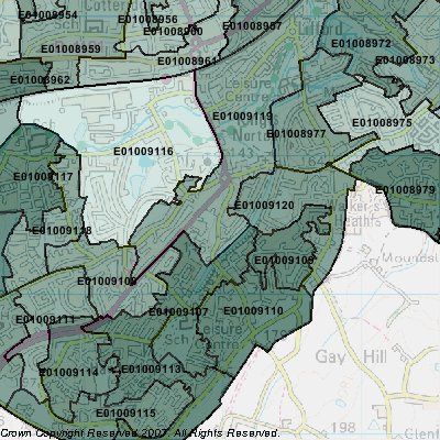
2.   Kings Norton 3 Estates Strategy and Policy Review
2.1 National Planning Policy
     PPS1 – Delivering Sustainable Development (2005)
     2.1.1   PPS1 outlines the objectives of the planning system and the importance of
             sustainable development. It establishes that it should make the most efficient use of
             land and resources and reduce the need to travel wherever possible. Development is
             directed towards existing urban areas, particularly towards sites well served by
             facilities, infrastructure and public transport. The system encourages the reuse or
             redevelopment of previously developed land to help preserve green field sites.
     2.1.2   In delivering sustainable development and communities, PPS1 states that the
             planning system should promote urban regeneration to improve communities,
             facilities, the quality of urban environments and linkages between different uses
             through the creation of vibrant spaces in which people wish to be. This should involve
             raising densities on suitable brownfield sites where the most efficient use of land can
             be achieved through high quality design.
     2.1.3   In terms of policy delivery PPS1 states that Development plans should:
                 •   pursue sustainable development in an integrated manner promoting
                     outcomes in which environmental economic and social objectives are
                     achieved together over time;
                 •   contribute to global sustainability by addressing the causes and potential
                     impact of climate change through policies that reduce energy use emissions.
                     Promote the development of renewable energy;
                 •   take a spatial planning approach that brings together and integrates policies
                     for the development and use of land with other policies and programme,
                     which influence the nature of places and how they function;
                 •   promote high quality design in terms of function and impact over the lifetime
                     of the development;
                 •   contain clear comprehensive and inclusive access policies that consider
                     people’s diverse needs and aim to breakdown unnecessary barriers and
                     exclusions to benefit the entire community; and
                 •   ensure that communities are able to contribute to ideas about how the vision
                     can be achieved.

                                                                                              Page 2
PPS1 Supplement – Planning and Climate Change (2007)
2.1.4   The PPS1 supplement establishes how planning should contribute to reducing
        emissions and stabilising climate change. The key objectives of the document are:
           •   make a full contribution to delivering the Government’s Climate Change
               Programme and energy policies, and in doing so contribute to global
               sustainability;
           •   provide for the homes, jobs, services and infrastructure needed by
               communities, and renew and shape the places where they live and work,
               secure the highest viable resource and energy efficiency and reduction in
               emissions;
           •   deliver patterns of urban growth and sustainable rural developments that help
               secure the fullest possible use of sustainable transport for moving freight,
               public transport, cycling and walking; and, which overall, reduce the need to
               travel, especially by car;
           •   secure new development and shape places that minimise vulnerability, and
               provide resilience, to climate change; and in ways that are consistent with
               social cohesion and inclusion;
           •   conserve and enhance biodiversity, recognising that the distribution of
               habitats and species will be affected by climate change;
           •   reflect the development needs and interests of communities and enable them
               to contribute effectively to tackling climate change; and
           •   respond to the concerns of business and encourage competitiveness and
               technological innovation in mitigating and adapting to climate change.
PPG2 – Green Belts (1995)
2.1.5   The West Midlands Green Belt forms the southern boundary to the three estates.
        PPG2 establishes the extent of Green Belts and explains their purposes. It describes
        how Green Belts are designated and their land safeguarded. It sets out the Green
        Belt land-use objectives and the presumption against inappropriate development in
        the Green Belt. The objectives of PPG2 include:
           •   providing opportunities for access to the countryside for the urban population;
           •   providing opportunities for outdoor sport and recreation near urban areas;
           •   retaining attractive landscapes near to where people live;
           •   improving damaged and derelict land around towns;
           •   securing nature conservation interest; and
           •   retaining land in agricultural and related uses.

                                                                                         Page 3
PPS3 – Housing (2006)
2.1.6   PPS3 sets the national planning framework for delivering the Government’s housing
        objectives and the Government’s goal of ensuring that everyone has the opportunity
        to live in a decent home, which they can afford in a community where they want to
        live. In order to achieve this strategic objective the Government is seeking to:
            •   achieve a wide choice of high quality homes, both affordable and market
                housing, to address the requirements of the community;
            •   widen opportunities for home ownership and ensure high quality housing for
                those who cannot afford market housing, in particular those who are
                vulnerable or in need;
            •   improve affordability across the housing market, including by increasing the
                supply of housing; and
            •   create sustainable, inclusive, mixed communities in all areas, both urban and
                rural.
2.1.7   The document aims to ensure a more responsive system for delivery at the local
        level. The objectives aim to ensure a suitable supply of affordable and market
        housing in sustainable locations (well served by public transport, community
        infrastructure and utilising previously developed land) and built to a high standard.
        PPS6 – Planning for Town Centres (2005)
2.1.8   PPS6 establishes the key objective for town centres as being to promote their vitality
        and viability by planning for the growth and development of existing centres; and
        promoting and enhancing existing centres, by focusing development in such centres
        and encouraging a wide range of services in a good environment, that are accessible
        to all.
2.1.9   Other objectives supporting this include:
            •   enhancing consumer choice by making provision for a range of shopping,
                leisure and local services, which allow genuine choice to meet the needs of
                the entire community, and particularly socially-excluded groups;
            •   supporting efficient, competitive and innovative retail, leisure, tourism and
                other sectors;
            •   improving accessibility, ensuring that existing or new development is, or will
                be, accessible and well served by a choice of means of transport;
            •   remedying deficiencies in provision in areas with poor access to facilities; and
            •   encouraging investment to regenerate deprived areas.
2.1.10 PPS6 continues the ‘town centre first’ approach applied under PPG6 and establishes
       a sequential assessment, need and impact assessment for considering sites in edge
       of centre locations and out of centre locations. Proposals for significant retail
       development in the 3 Estates will need to be supported by a retail assessment.
PPS9 – Biodiversity and Geological Conservation (2005)
2.1.11 PPS9 sets out planning policies on protection of biodiversity and geological
       conservation through the planning system. It sets out the Government’s broad aim

                                                                                           Page 4
that planning, construction, development and regeneration should have minimal
        impacts on biodiversity and enhance it wherever possible.

2.1.12 PPS9 advocates a strategic approach to the conservation and enhancement of
       biodiversity and geology and recognise the contribution that individual sites and areas
       make to conserve these resources. Furthermore, policies should promote
       opportunities for the incorporation of biodiversity and geological features within the
       design of development.
PPS10 – Planning for Sustainable Waste Management (2205)
2.1.13 PPS10 establishes the Government’s objectives for sustainable waste management.
       It states that positive planning has an important role in delivering sustainable waste
       management through the development of appropriate strategies for growth,
       regeneration and the prudent use of resources; as well as by providing sufficient
       opportunities for new waste management facilities of the right type, in the right place
       and at the right time.
PPG13 – Transport (2000)
2.1.14 PPG13 promotes more sustainable transport choices for people and for freight by
       seeking to ensure that jobs, shops, education, health, and leisure facilities are
       accessible by public transport, walking, and cycling.
2.1.15 It also aims to reduce the need to travel, especially by car. This objective can be
       fulfilled by locating a broad range of uses in close proximity to each other. For
       example, focus major generators of travel demand in town centres, or near to major
       public transport interchanges. In design terms it encourages priority to people over
       ease of traffic movement.
PPG17 – Planning for Open Space, Sport and Recreation (2002)
2.1.16 PPG17 encourages the creation of local networks of high quality and well managed
       and maintained open spaces, sports and recreational facilities. The objectives include
            •   promoting social inclusion and community cohesion through well planned and
                maintained open spaces, good quality sports and recreational facilities;
            •   promoting health and well being through open spaces, sports and recreational
                facilities;
            •   promoting more sustainable development by ensuring that open space, sports
                and recreational facilities are easily accessible by walking and cycling and
                that more heavily used/intensive facilities are planned for locations well
                served by public transport.
2.1.17 PPG17 requires a robust assessment of open space needs and provision, which will
       inform open space strategies for the area and allow for the setting of local standards
       that an authority is aiming to achieve. The guidance also establishes how existing
       provision is to be safeguarded.
PPS22 – Renewable Energy (2004)
2.1.18 PPS22 encourages the development of renewable energy facilities including small-
       scale facilities as part of larger mixed-use developments. The document states that

                                                                                        Page 5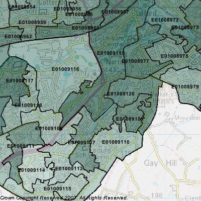
local planning authorities may include policies in local development documents that
              require a percentage of the energy to be used in new residential, commercial or
              industrial developments to come from on-site renewable energy developments. Such
              policies should ensure that requirement to generate on-site renewable energy is only
              applied to developments where the installation of renewable energy generation
              equipment is viable given the type of development proposed, its location, and design.
              Additionally, policy should not be framed in such a way as to place an undue burden
              on developers.
      PPG24 – Planning and Noise (1994)
      2.1.19 PPG24 guides local authorities in England on the use of their planning powers to
             minimize the adverse impact of noise. It outlines the considerations to be taken into
             account in determining planning applications both for noise-sensitive developments
             and for those activities which generate noise. It explains the concept of noise
             exposure categories for residential development and recommends appropriate levels
             for exposure to different sources of noise.
      2.1.20 PPG24 also advises on the use of conditions to minimize the impact of noise. Six
             annexes contain noise exposure categories for dwellings, explain noise levels, give
             detailed guidance on the assessment of noise from different sources, gives examples
             of planning conditions, specify noise limits, and advise on insulation of buildings
             against external noise.
      PPS25 – Development and Flood Risk (2006)
      2.1.21 PPS25 sets out Government policy on development and flood risk. It aims are to
             ensure that flood risk is taken into account at all stages in the planning process to
             avoid inappropriate development in areas at risk of flooding, and to direct
             development away from areas of highest risk. Where new development is,
             exceptionally, necessary in such areas, policy aims to make it safe, without increasing
             flood risk elsewhere, and, where possible, reducing flood risk overall.
      2.1.22 A practice guide to PPS25 was issued in 2008 and provides guidelines on how to
             implement development and flood risk policies by the land use planning system.

2.2   Development Plan Policy
      2.2.1   The Development Plan for the 3 estates comprises the adopted West Midlands
              Regional Spatial Strategy (RSS) and the adopted Birmingham Unitary Development
              Plan (UDP). This section reviews the policies within the Development Plan pertinent
              to the 3 estates, as well as considering all relevant emerging planning guidance
              contained within the West Midlands Regional Spatial Strategy Phase 2 Revision and
              the Birmingham Local Development Framework (LDF).

      West Midlands Regional Spatial Strategy (January 2008)
      2.2.2   This document comprises the adopted RSS (2004) and the Phase 1 revision (Black
              Country, which was adopted in 2008. The policies contained within the document are

                                                                                              Page 6
intended to guide development up to 2021. The strategic objectives relevant to the
three estates are:
• to make the Major Urban Areas of the West Midlands increasingly attractive
places where people want to live, work and invest;
• to create a joined-up multi-centred regional structure where all areas/centres
have distinct roles to play;
• to retain the Green Belt, but to allow an adjustment of boundaries where this
is necessary to support urban regeneration;
• to support the cities and towns of the Region to meet their local and sub-
regional development needs;
• to support the diversification and modernisation of the Region’s economy
while ensuring that opportunities for growth are linked to meeting needs and
reducing social exclusion;
• to ensure the quality of the environment is conserved and enhanced across
all parts of the Region;
• to improve significantly the Region’s transport systems; and
• to promote Birmingham as a world city.
2.2.2 The RSS seeks to achieve an urban renaissance of the major urban areas (including
Birmingham). Policy UR1 establishes how urban renaissance will be implemented by
local authorities, regional agencies and partnerships, which include:
• restructuring land use and transport networks to create employment growth,
new residential environments, improved environmental quality, integrate
transport and join up centres;
• undertaking environmental improvements;
• maximising the use of the existing housing and business stock where
economically and socially viable;
• raising the quality of urban design, architecture and public art and spaces;
and
• increasing accessibility particularly for those currently disadvantaged in
accessing jobs.
2.2.3 Policy UR4 establishes how communities can be involved in all parts of the
regeneration process and how social infrastructure can be delivered in the most
appropriate locations. The policy encourages local authorities to co-ordinate land use
and investment decisions of providers with improved service delivery to:
• ensure that new social infrastructure is developed in or on the edge of an
appropriate level of existing centre and is accessible by all modes by
potential users;
• co-ordinate decisions on schools investment and the provision of new
facilities with residential renewal;
Page 7• provide a range of educational facilities and services across all tiers to
promote urban renaissance;
• facilitate the modernisation of local health services, informed by partnership
working with Primary Care Trusts on local delivery plans and addressing
inequalities in health;
• provide support for a range of business development and education and
training services, targeted at linking local people and businesses to economic
opportunities, including Education Action Zones;
• concentrate development and investment in areas where there is the greatest
need; and
• support the creation of new quality residential environments in areas of
opportunity and encourage the creation of safer neighbourhoods.
2.2.5 The RSS sets out proposals for achieving ‘Communities for the future’ within chapter
six. The most relevant policies are summarised below.
2.2.6 Policy CF1 (Housing within the Major Urban Areas) is designed to deliver urban
regeneration that will deliver sustainable and attractive communities where all groups
in the community have access to good quality housing.
2.2.7 Policy CF3 (Level and Distribution of New Housing Development) states that the
Birmingham LDF should make provision for at least 50,600 additional dwellings net of
demolitions. This figure is significantly higher in the emerging RSS.
2.2.8 Policy CF4 (Phasing of new development) stipulates that levels of new house building
across the Region will be phased to ensure that there is, overall, an increasing level
of housing provision in the period up to 2016. Priority will be given to increasing
development within the West Midlands conurbation early in the plan period to retain
progress on urban renaissance with development in the rest of the Region increasing
at a slower rate.
2.2.9 Policy CF5 (The re-use of land and buildings for housing) affords priority to the
development of brownfield land and the re-use of existing buildings, in sustainable
locations, before allocations on greenfield land are released for development. Local
Planning Authorities through their LDDs should manage the release of sites to meet
the trajectories of house building required under Policies CF3 and CF4. Additionally,
the policy states that local planning authorities should seek to contribute to the
achievement of a regional minimum target for development on previously developed
land of 85%.
2.2.10 Policy CF6 (Making efficient use of land) states that local authorities should set out
density policies in their development plans specific to their areas to reflect local
circumstances and the findings of the housing market assessment.
2.2.11 Policy CF7 (Delivering affordable housing) states that local authorities should keep
under review the need for affordable housing in their area, based on local or sub-
regional housing market and housing needs assessments, using a broadly consistent
approach as advised by government policy and the Regional Housing Executive.
Both social rented and intermediate housing should contribute to meeting needs,
dependent on the particular requirements and market circumstances of an area.
Page 8Opportunities should be sought within the existing housing stock where this would
help the creation of mixed communities as well as through new build.
2.2.12 Policy PA10 (Tourism and Culture) supports the further development and success of
the canal network.
2.2.13 Policy PA13 (Out of Centre Retail) defers the policy framework for out of centre retail
proposals to LDF’s.
2.2.14 Policy UR4 (Greenery, Urban Spaces and Public Spaces) requires local authorities to
develop strategies for the provision of open space based on robust audits of existing
provision in line with PPG17. It encourages adequate provision of accessible high
quality urban green space with an emphasis on:
• improved accessibility and community safety;
• increasing the overall stock of urban trees;
• significantly improving the overall quality of public space;
• enhancing the setting of local residential neighbourhoods in built up areas;
and
• maintaining and enhancing sports, playing fields and recreation grounds.
Birmingham UDP (October 2005)
2.2.15 The Birmingham UDP contains policies that guide development within the city up to
2011 or until the adoption of the LDF Core Strategy and other Development Plan
Documents. The policies particular to the 3 estates are set out below.
2.2.16 Policy HR21 (Housing Regeneration -paragraphs 5.15 – 5.19) covers the entire site.
Paragraph 20.29 encourages the improvement of housing conditions and local
employment opportunities. A regeneration strategy will address current issues on the
estates. On the Pool Farm Estate a Joint Venture initiative with public and private
investment is being implemented in response to current problems. This involves the
release of land and a comprehensive strategy for improving housing and
environmental conditions.
2.2.17 The land to the south and east of the site forms the Birmingham Green Belt. The UDP
establishes the functions of the Green Belt at paragraph 3.41, including to check
unrestricted sprawl of the built up area and to assist in urban regeneration by
encouraging the recycling of derelict and other urban land.
Page 92.2.18 Paragraph 3.14E (sustainable development) establishes the design principles for
achieving sustainable development in Birmingham, which include:
• layouts should minimize reliance on the private car and encourage public
transport, walking and cycling;
• the re-use of buildings wherever possible;
• the use environmentally friendly materials where appropriate;
• maximizing the use of natural heat and light and contribute to local diversity
through design and orientation of buildings and landscaping;
• higher densities should be considered where they do not conflict with other
plan policies;
• minimizing the consumption of water through water saving devices and
practices; and
• buildings should be long-life and flexible for adaption where appropriate.
2.2.19 Paragraph 3.25 (Listed buildings) requires that any development affecting a listed
building should preserve or enhance its character.
2.2.20 Paragraph 3.34 (Canals) recognizes that canals are a major focus for regeneration
and adjacent development should enhance the canal setting. The 3 estates has a
linear open space designation running through the site along the length of the canal
corridor.
2.2.21 Paragraph 3.37 (Nature Conservation Area) states that development which may
destroy or adversely affect any Site of Special Scientific Interest, Local Nature
Reserve or Site of Importance for Nature Conservation identified in the UDP or
subsequently identified will not normally be allowed.
2.2.22 Paragraph 3.47 (Open Space) establishes the city’s policy towards the provision of
open space, which seeks to continue to develop an integrated and linked network of
open space complemented by a system of interlinked walkways utilizing canal
networks. Proposals that adversely affect open space will not be allowed. The UDP
establishes a standard provision by which the adequacy of provision is tested – 2
hectares of open space per 1,000 population. The playing field provision standard is
1.2 hectares per 1,000 population. Children’s play area is expected within 400 metres
safe walking distance of all dwellings. The provision of specific sports and leisure
facilities are based on an identified demand, which is informed by the council’s open
space and sports pitch strategy.
2.2.23 A strategic cycle route dissects the site and runs south down the canal corridor.
2.2.24 Paragraph 3.71 (Water and Drainage) requires that development will be expected to
take account of any effects they might have water and drainage and to consider water
minimisation techniques to conserve water. It is understood that the three estates is
within flood zone one. The more recent PPS25 guidance will require a flood risk
assessment in support of planning applications for development plots over one
hectare in size.
2.2.25 The UDP categorizes employment land into several sub sets with all the employment
land within the 3 estates being classed as ‘other urban’ employment land. Paragraph
4.21 requires a minimum of two years supply of other urban employment land.
Page 102.2.26 In relation to the location of new housing development the UDP expects a minimum of
82% of all new dwellings to be provided on previously developed sites (paragraph
5.25B). The total requirement for new housing (1991 – 2011) is 46,500 dwellings with
a significant amount being provided by redevelopment through clearance.
2.2.27 Paragraph 5.37 (Affordable Housing) states that in order to meet the city’s overall
requirement 35% affordable housing provision is required on sites over one hectare.
However, this policy has been superseded by PPS3.
West Midlands RSS Phase 2 Revision – Preferred Option (2007)
2.2.28 This document partially revises the adopted RSS and when adopted will guide
development within the region up to 2026. The document maintains the objective of
achieving urban renaissance with the most relevant change affecting the three
estates area being the new housing requirements for Birmingham.
2.2.29 The three estates is situated within the central housing market area as shown in the
RSS with its south boundary abutting the southern housing market area. The spatial
strategy directs growth towards Birmingham and other major urban areas. Outside of
the MUA’s growth is directed to ‘settlements of significant development’, which in the
case of Worcestershire focuses on Worcester City and Redditch.
2.2.30 Policy CF1 (Housing within the Major Urban Areas) establishes the need to maximize
new housing development within the West Midlands conurbation and requires public
and private sector bodies to work together to:
• significantly improve the quality of the existing housing stock both through
enhanced renovation programmes and increased rates of development;
• increase the scale and range of new housing development opportunities in
appropriate locations guided by the Regional Housing Strategy and local and
sub-regional housing strategies;
• create and protect well served and attractive urban communities within which
more people will wish to live and invest, through the provision of appropriate
housing types, tenures and densities; and
• ensure appropriate affordable housing.
2.2.31 The RSS suggests a target of 50,600 net additional dwellings to be provided within
Birmingham up to 2026. A priority towards provision within the West Midlands
conurbation is established in Policy CF4.
2.2.32 The RSS establishes affordable housing requirements based upon housing market
areas. Policy CF7 establishes a minimum gross annual provision of 3,800 dwellings in
the central housing market area.
2.2.32 Policy PA6A (employment Land Provision) establishes the requirement for a rolling
five year reservoir of 130 hectares within Birmingham with an indicative long term
requirement of 390 hectares.
Page 11Birmingham LDF Core Strategy Issues and Options (2008)
2.2.33 The LDF Core Strategy is at an early stage in its preparation, however, the document
sets out a number of objectives that the city wishes to achieve during the plan period,
which include:
• to promote Birmingham’s national and international role as a global city;
• to create a more sustainable city that minimizes its carbon footprint and waste
while allowing the city to grow;
• to develop Birmingham as a city of vibrant urban villages, a safer, diverse and
inclusive city with quality local environments;
• to meet the emerging RSS requirements for housing as a minimum, and to
secure a significant increase in the city’s population, towards 1.1 million;
• to create a prosperous, successful economy, with benefits felt by all;
• to provide high quality transportation links throughout the city and encourage
the use of public transport; and
• to encourage better health and well being through the provision of new and
existing sports, leisure, and heritage assets linked to good quality public open
space throughout the city.
2.2.34 The Core Strategy outlines options for the document to support. Each option
recognises the three estates area as a housing regeneration area on the proposals
map. Option one assumes 50,000 new dwellings are provided. Option two assumes
between 55,000 and 60,000 new dwellings are provided, which includes a sustainable
urban neighbourhood development to the north-west of the three estates. Option
three assumes up to 65,000 new dwellings, which assume Green Belt release on land
south of Maypole and land south of Longbridge.
2.3 Supplementary Planning Guidance (SPG) / Documents (SPD)
Draft Playing Pitch Strategy SPG (2005)
2.3.1 This document seeks to ensure an appropriate distribution and provision of good
quality playing pitches and that the quantity of outdoor sports provision reflects the
aim of working towards the standard of 1.2 hectares of formal playing pitches per
1,000 population and exceeds this where there is an identified need for additional
pitches.
Page 122.3.2 The strategy will be used as evidence of need for sports pitch provision and identify
such provision as a priority for monies associated with planning obligations, including
Section 106. Its aims and objectives include:
• ensuring adequate financial provision is made for the long term maintenance
and development of pitch sites;
• improving the quality and capacity of existing outdoor sports facilities;
• contributing to the development of Flourishing Neighbourhoods by
encouraging the provision of high quality facilities serving local needs;
• improving the health and well being of residents;
• addressing personal safety issues and reduce opportunities for anti social and
criminal behaviour;
• providing children and young people with improved sports opportunities
during out of school hours; and
• increasing the demand for and participation in outdoor sports.
Public Open Space in New Residential Development SPD (2007)
2.3.3 The SPD gives clear guidance to prospective developers on the requirements for
public open space. It explains and expands on existing policy contained in the
adopted Birmingham Plan.
2.3.4 The policy requirement for open space will apply to all new residential development of
twenty or more dwellings in Birmingham. There are exceptions where the policy does
not apply e.g. sheltered housing where no children’s play would be sought.
2.3.5 The SPD establishes that where practical to do so, the public open space requirement
will be provided on site. It also recognises that there are certain circumstances where
it may be preferable for all, or part, of the public open space requirement to be
provided as an off-site monetary contribution.
2.3.6 In relation to large scale redevelopments the SPD states that the key aim is to
achieve a good quality environment overall coupled with a good housing stock.
Provision of good quality public open space is an essential part of this. As a general
principle, on large sites, where there is insufficient public open space, redevelopment
proposals will be expected to include new public open space to serve the
development in line with the UDP standard. Where a site is being redeveloped with
more than the existing number of dwellings new public open space to serve the extra
dwellings will be required. Redevelopment does allow the opportunity for poorly
located open space and children’s play facilities to be sited more appropriately. The
overall amount and the quality of open space is an important factor for consideration
on redevelopment sites.
2.3.7 The design and layout of open space should reflect the guidance contained in ‘places
for living’ SPG, which is summarised below.
Page 13Places for All and Places for Living SPG’s (2001)
2.3.8 This document established broad design principles for creating places for all and
include the following relevant objectives:
• creating diversity by creating or building within places that have an accessible
choice of closely mixed complementary activities;
• moving around easily, i.e. places should be linked up with short, direct public
routes overlooked by frontages;
• safe places, private spaces, i.e. places must be safe and attractive with a
clear division between public and private space;
• building for the future, i.e. buildings and spaces should be adaptable to
enhance their long term viability and built so they harm the environment as
little as possible;
• build on local character, i.e. development must consider the context and
exploit and strengthen the characteristics that make an area special.
2.3.9 Places for Living is aimed to be both inspiring and positive in encouraging quality
residential proposals. In addition to the above principles it encourages places not
estates, i.e. successful developments must address wider issues than simply building
houses and create distinctive places that offer a choice of housing and
complementary activities nearby.
2.4 Other Relevant Documentation and Studies
3 Estates Retail Assessment Update (CBRE 2008)
2.4.1 This study updates the initial 2006 retail study which assessed the need for
convenience foodstore retail development in the three estates area. The study also
takes forward the findings of the 2003 Birmingham local centres study, which
identified a gap in foodstore provision in this area.
2.4.2 In qualitative terms the study concludes that the foodstore offer is very limited in the
three estates area with the nearest major foodstores being some distance away.
Therefore, provision continues to be inadequate to meet all but the most basic
shopping needs and qualitative need remains clear.
2.4.3 In quantitative terms the study considers three alternative market share scenarios and
concludes that a full price foodstore of between 4,000 sq m to 4,500 sq m gross
(approximately 2,000 sq m net convenience floorspace) can be supported between
2013 and 2018. This scenario assumes a market share improvement of 7% to
accommodate the new foodstore.
2.4.4 Importantly, the study assumes a new population (increase from net additional
homes) is only 1,250 people. Additionally, it does not take into account the likely
increase in average spending power brought about by the influx of 'wealth' through
higher private home ownership.
2.4.5 The study also concludes that the qualitative benefits associated with a full price store
are significantly higher than any other format.
2.4.6 The study considers the foodstore development and the sequential test set out in
PPS6. The study concludes that there are no suitable sites within existing centres
Page 14and that attention should be drawn toward a site, which is more accessible and
serves the needs of the 3 estates in a sustainable manner. It reiterates that land
fronting Redditch Road could represent a suitable location.
Kings Norton 3 Estates Development Study (JTP 2005)
2.4.7 This study was commissioned by Birmingham City Council and the Kings Norton 3
Estates Community Development Trust and identifies a preferred approach to
regeneration for the 3 Estates area.
2.4.8 The Development Study involved analysis of existing estate in order to agree upon
both the positive and negative aspects of life in the 3 Estates and also to begin to see
the opportunities for improvement which these offered. The underlying aims of the
Community Development Trust (CDT) where expressed as the following seven key
points:
• to provide greater housing choice and quality;
• to provide a better quality environment;
• to improve amenities and service delivery;
• to improve access to employment and training;
• to provide easier social and physical access and linkages;
• to provide closer integration with Kings Norton; and
• to improve the 3 Estate’s image.
2.4.9 The study identified the range of development opportunities which regeneration might
offer, and how these could be fitted into the physical framework upon which
regeneration would be built. This involved a review of the existing housing stock and
consideration of the enhanced services and facilities which could be provided as part
of the regeneration process.
2.4.10 Four alternative approaches were devised and were tested. Approach 4, which
proposed the greatest amount of redevelopment, came closest to fulfilling the vision.
All of the options might be viable in some form, although those which proposed more
redevelopment had the greatest potential for accessing external sources of funding
and as a consequence would offer the greatest potential for success. The approach
which received the greatest level of local approval was approach Four.
2.4.11 The key features of the Preferred Approach were:
• the phased demolition of up to 1,500 of the worst condition and least popular
homes and the redevelopment of their sites to create up to 2,200 new
affordable homes for sale, rent and shared ownership and private sale;
• at least 1,175 remaining Birmingham City Council owned homes brought up
to Decent Homes standard;
• creation of a significant new public open space facing onto the Redditch Road
and leading visitors down towards the heart of a revitalised Study Area;
• a cluster of extended community facilities based around a new or improved
Kings Norton High School, offering lifelong learning opportunities, enhanced
Page 15sports and leisure facilities and health and welfare service provision for the
whole community;
• a new supermarket (20,000 – 40,000 sq ft gross) and associated mixed uses
on a site adjacent to the Redditch Road;
• a joint emergency services Community Safety Centre to enhance community
safety and provide education and employment opportunities;
• new residential development and environmental improvements along the
Birmingham and Worcester canal to create an attractive amenity for everyone
in the area;
• safer and more attractive pedestrian and cycle paths along a network of
green routes; and
• environmental improvements to existing residential areas.
2.4.12 The Development Study identified a number of implementation steps that need to be
undertaken, which included identifying a project sponsor, the preparation of a
masterplan and the appointment of a Developer and Housing Association to take the
redevelopment forward. The study recommended that a further round of consultation
is held with the local community and all key stakeholders to obtain final approval
before the establishment of the Delivery Vehicle and implementation of the
redevelopment works.
2.4.13 The study recommended the Delivery Vehicle should be a Trust style body
representing an amalgam of the City Council, representatives of the NDC, community
members and other relevant stakeholders. The Trust would play a key role in the
development of a Special Purpose Vehicle involving the preferred private
development company and the Registered Social Landlord and would be responsible
for progressing the redevelopment proposed in the masterplan. The study also
envisaged that the Trust could take responsibility for the environmental management
of the 3 Estates and more importantly that it should be formed in such a way as to be
self-sustaining into the future for the long-term benefit of the whole community and
the fulfilment of the CDT’s Vision.
Page 163. Kings Norton 3 Estates Socio Economic and Housing
Supply Analysis
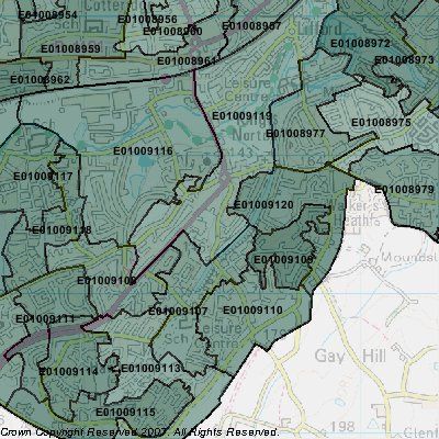
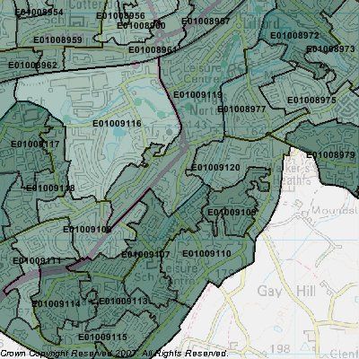
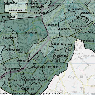
3.1 Geographic Basis for Analysis
3.1.1 The following section offers a socio-economic and housing supply analysis for the
Kings Norton 3 Estates. The study area is benchmarked against its wider market
catchment area, Birmingham and the West Midlands. These are defined as being:
• The Kings Norton 3 Estates New Deal for Communities Area: The Office for
National Statistics has built up a statistical area for the 3 Estates New Deal for
Communities Area utilising the best fitting output areas;
• The Market Catchment Area for the Kings Norton 3 Estates has been defined by
DTZ with reference to ward based migration and travel to work patterns from
2001 Census. It includes the five wards of Kings Norton, Bournville, Brandwood,
1
Longbridge and Northfield (see Figure 3.1) ;
• Birmingham refers to the Birmingham Local Authority administrative area;
• The West Midlands region refers to Herefordshire, Shropshire, Staffordshire,
Warwickshire, West Midlands and Worcestershire.
Figure 3.1 Kings Norton 3 Estates Market Catchment Area
1
As such, the catchment area forms a smaller “sub area” of the South West Birmingham HMA, and the inclusion of
Bournville within the catchment means the borders are not entirely contiguous
Page 173.1.2 Analysis at four geographical levels allows for key indicators from the Kings Norton 3
Estates to be compared with local and regional benchmarks.
3.1.3 All the data referred to in this section of the report is tabulated in Appendix B.
3.2 Population and Age Structure
3.2.1 The total population of the Kings Norton 3 Estates according to the Census in 2001
was 9,685 in 2001.
Figure 3.2 Total Population by Age, 2001
Source: ONS, 2001
3.2.2 Figure 3.2 shows population by age and reveals a younger than average population
in the Kings Norton 3 Estates, with almost 29% of the population under 16 compared
to around 24% in the Kings Norton Catchement Area and in Birmingham as a whole.
Conversley there are notably fewer adults in the core family raising age group of 35-
49, which may be a reflection of family households relocating outside the 3 Estates
when looking to step up the housing ladder.
3.2.3 The 3 Estates is much more similar to the Kings Norton Catchement Area in terms of
representation of the 50-64 age group, which may be a reflection of the higher
popularity of the 3 Estates when members of this age group were forming households
in the early 1960s and onwards.
Page 18Figure 3.3 Population by Ethnicity, 2001
Source: ONS, 2001
3.2.4 The Kings Norton Three Estates has a predominately white population (91.3%), which
is comparable with the wider catchment area (91.7%), but much higher than that for
Birmingham (70.4%), and notably higher than the West Midlands (88.7%).
3.2.5 Whilst of similar proportions, the composition of the Black and Minority Ethnic (BME)
groups varies between the 3 Estates and the wider Catchment Area. The principle
minority ethnic group in the 3 Estates is “mixed” (4.5%), closely followed by Black /
Black British (3.5%), with the other minority groups between them only forming 1% of
the population. In contrast, in the Catchment Area the BME profile is evenly split
between Mixed, Asian/Asian British, and Black/Black British.
3.3 Economic Activity and Occupational Structure
3.3.1 For the purpose of this analysis, the definition of ‘economic activity’ has followed that
provided by the Office of National Statistics, and includes those in full-time and part-
time employment, self employed, unemployed and full-time students. Economic
inactivity includes those who are retired, other students, looking after home/family,
permanently sick or disabled and any others.
3.3.2 The statistics show a notable contrast between the Kings Norton 3 Estates and the
wider market catchment area:
• a lower economic activity rate of 58.2%, against a rate of 65.3% for the wider
catchment area;
• a lower proportion of full-time and self-employed (34% and 3.7% respectively)
than the wider catchment area, and indeed the regional benchmarks;
Page 19• a higher rate (7.3% than the catchment area level of 5.2%) of unemployed (those
classed as unemployed but actively looking for work).
Figure 3.4 Economic Activity
Full-time
Part-time
Employed
Self
Unemployed
Students
Full-time
Retired
Student
home/family
Looking after
sick/disabled
Permanently
Other
Kings Norton 34.0% 11.2% 3.7% 7.3% 2.0% 11.9% 3.2% 10.7% 9.9% 6.0%
3 Estates
Kings Norton 41.5% 11.5% 5.2% 5.0% 2.1% 13.6% 3.7% 6.5% 6.7% 3.6%
Catchment
Area
Birmingham 35.7% 9.9% 5.4% 5.6% 3.0% 12.1% 7.4% 7.9% 7.9% 5.1%
West 40.3% 11.9% 7.4% 3.8% 2.5% 13.9% 4.6% 6.5% 5.7% 3.4%
Midlands
Source: ONS, 2001
3.3.3 The remaining 42.8% of the working age population of the 3 Estates are classed as
economically inactive. Figure 3.4 shows that there is a higher level of those looking
after home/family (10.7%) and permanently sick or disabled (9.9%). This indicates a
high level of benefit dependency with the Kings Norton 3 Estates.
Figure 3.5 Occupational Profile, 2001
Source: ONS, 2001
Page 203.3.4 Figure 3.5 shows that the Kings Norton 3 Estates has lower than average levels of
higher level occupations (such as managers, professionals and associates), with only
22.7% of the working age population in these three areas (compared with the market
catchment proportion of 34.4%). In comparison, the Kings Norton 3 Estates is over
represented in personal service, sales and customer service, plant and machine
operators and elementary work. These occupations account for 51.4% of the
workforce in Kings Norton, compared to 39% in the market catchment and in
Birmingham.
3.4 Educational Provision and Attainment
3.4.1 Kings Norton falls within Birmingham Local Education Authority (LEA). This analysis
focuses on Birmingham schools serving the Kings Norton ward, and those secondary
schools that are attended by 50 or more pupils who are resident in the Kings Norton
ward. Those schools located within the 3 Estates are shown in italics.
3.4.2 There are seven primary schools and two secondary schools in the Kings Norton
ward, in addition to one specific nursery pre-school. It should be noted that there are
a number of private nurseries that operate within Kings Norton.
Figure 3.6 Education Provision in Kings Norton Ward
Name of School Number on Roll Ages Provided For
Kings Norton Nursery School 31 3-5
Fairway Junior and Infant School 81 4-11
Hawkesley CE Junior and Infant School 304 3-11
Kings Norton Junior and Infant School 418 5-11
Primrose Hill Junior and Infant School* 182 3-11
St John Fisher’s RC Junior and Infant School 194 4-11
St Paul’s RC Junior and Infant School 202 3-11
Wychall Farm Junior and Infant School 233 3-11
Kings Norton High School 422 11-16
St Thomas Aquinas RC School** 1221 11-18
* Has special needs provision
** Special focus on maths and computing
3.4.3 In addition to the ten schools listed in figure 3.6, there are also five secondary schools
that serve a sizeable number of Kings Norton residents.
3.4.4 There would appear to be a lack of substantial secondary school provision for the
ward, which may indicate the number of secondary schools outside the ward that
receive residents of Kings Norton (shown in Figure 3.7).
Page 21Figure 3.7 Secondary provision outside the Kings Norton Ward
Name of School Number on Roll Ages provided for Special Focus
Baverstock Foundation
School and Specialist Sports 1300 11-18 Sports
College
Kings Norton Boys School 743 11-18 Science
Kings Norton Girls School 937 11-18 Language
Turves Green Girls School 705 11-16 Technology
Turves Green Boys School 638 11-16 Technology
3.4.5 These schools tend to provide education beyond the required age of 16 (with the
exception of Turves Green Boys and Girls), and offer a wide range of special focus.
While they may focus on one specialism, for example science, language or
technology, they are still required to follow the national curriculum.
3.4.6 To assess the academic achievements of schools in Kings Norton it is necessary to
examine the results of various tests carried out at key education milestones. For
primary schools, the results of Key Stage 2 exams are analysed (these are taken at
the end of year 6, usually before a pupil enters secondary school). Here the
percentage of pupils achieving level 4 (taken to be the average result expected for an
11 year old), is compared.
Figure 3.8 Primary Achievements in Kings Norton
% achieving KS2 level 4 or above in % difference
English and Maths 2006-08
School Name 2006 2007 2008
Fairway Junior and Infant School 37% 50% 78% 111%
Hawkesley CE Junior and Infant
46% 57% 42% - 9%
School
Kings Norton Junior and Infant
91% 95% 77% -15%
School
Primrose Hill Junior and Infant
44% 35% 21% -52%
School*
St John Fisher’s RC Junior and
93% 84% 97% 4.3%
Infant School
St Paul’s RC Junior and Infant
72% 71% 68% -5.6%
School
Wychall Farm Junior and Infant
62% 58% 59% -4.8%
School
3.4.7 Figure 3.8 shows a spread in the proportion of pupils achieving Key Stage 2 level 4 or
above. The most improved results occurred at Fairway Junior and Infant School,
Page 22which has seen an 111% increase in the proportion of pupils achieving level 4.
However, the school with the highest percentage of those achieving level 4 or above
is at St John Fisher’s RC Junior and Infant School. The school with the fewest
number achieving Key Stage 2 level 4 is Primrose Hill Junior and Infant School, with
only 21% of pupils reaching this level.
3.4.8 The average across Birmingham of pupils achieving level 4 in English and Maths was
78% in 2008 (compared with an average of 80% across England). This suggests that
only two schools within the area are achieving this benchmark level or higher
(Fairway and St John Fisher’s). However, table 3.9 does show that there is a great
deal of volatility with these results and as such should be treated cautiously.
3.4.9 For an assessment of Secondary achievement, the average points achieved at GCSE
level (usually taken aged 16) were examined. The points gained reflect the grades
awarded, with the higher the points the higher the grade. For example, an A* (the
highest grade possible at GCSE) would correspond to 58 points, while a G (the
lowest grade) would achieve 16.
Figure 3.9 Secondary Achievements in and serving Kings Norton
% difference
Students Average Point Score
2006-08
School Name 2006 2007 2008
Kings Norton High 286.2 296.6 386.8 35.2%
St Thomas Aquinas RC 367.0 363.8 416.7 13.5%
Baverstock Foundation School
326.4 336.6 346.5 6.2%
and Specialist Sports College
Kings Norton Boys School 370.0 420.2 418.7 13.2%
Kings Norton Girls School 562.5 582.0 432.0 -23.0%
Turves Green Girls School 373.5 419.8 496.8 33.0%
Turves Green Boys School 341.4 367.8 324.6 -4.9%
3.4.10 Table 3.9 shows that the greatest improvement in student’s average point score was
at Kings Norton High School, where there has been an increase of over 35% in the
average point score in the period 2006-08.
3.4.11 The highest average point score is achieved by pupils at Turves Green Girls School
(496.8), which is much higher than the lowest average point score achieved at Turves
Green Boys School (324.6).
3.4.12 The average point score for Birmingham was 409.7 (England with a score of 390) in
2007/08. Table 3.9 shows that three schools in the area – Kings Norton High,
Baverstock School and Turves Green Boys School are below the city wide average.
Although, as with the primary achievements, there does appear to be a great deal of
volatility year on year, and the figures should be treated with care.
3.5 Qualifications of the Workforce
3.5.1 To assess the qualifications of the workforce (those of working age), the various
qualifications are broken down into levels. These are:
• No qualification: no formal academic or vocational qualification;
• Level 1: 1 ‘O’ level pass, 1 x GCSE/CSE any grade, Foundation GNVQ;
Page 23• Level 2: 5 ‘O’ level passes, 5+ GCSE (grades A – C), 5+ CSE (grade 1), School
Certificate, 1 ‘A’/’AS’ level, NVQ level 2, Intermediate GNVQ;
• Level 3: 2+ ‘A’ levels, 4+ ‘AS’ levels. Higher School certificate, NVQ level 3,
Advanced GNVQ;
• Level 4/5: First Degree, Higher degree, NVQ levels 4/5, HNC, HND, Qualified
Teacher/Medical Doctor/Dentist/Nurse/Midwife/Health Visitor;
• Other Qualifications/level unknown: Others qualifications (such as City and
Guilds, RSA/OCR, BTEC/Edexcel and so on).
Figure 3.11 Qualifications, 2001
Source: ONS, 2001
3.5.2 There are notable disparities with the local catchment, wider city and region
benchmarks:
• almost half (46.7%) of the working age population of the Kings Norton 3 Estates
have no formal qualifications, 10 percentage points above the average for the
defined Catchment area (36.3%) and almost 13 percentage points above the
regional average (34%);
• there is also an under representation of residents with higher level qualifications
(those at level 4/5), with only 7.2% of people holding a first degree or equivalent
compared to 15.3% in the wider catchment and 16.2% in the West Midlands
region.
3.6 Migration and Travel to Work Patterns
3.6.1 Household and travel to work migration movements are available from the 2001
Census at ward level. Tables 3.8 to 3.11 illustrate the origin and destination of
household movements and travel to work patterns within Kings Norton in 2001.
Page 24Figure 3.12 Origin of household movements to Kings Norton - one year previous
No of movements % of all movements
Local Authority Ward Name
to Kings Norton to Kings Norton
Birmingham Bournville 161 8.4%
Birmingham Brandwood 149 7.8%
Birmingham Northfield 123 6.4%
Birmingham Longbridge 87 4.5%
Birmingham Billesley 60 3.1%
Birmingham Selly Oak 50 2.6%
Birmingham Weoley 49 2.5%
Birmingham Bartley Green 28 1.5%
Birmingham Fox Hollies 26 1.4%
Birmingham Moseley 25 1.3%
Source: Census, 2001
Figure 3.13 Destination of household movements from Kings Norton - one year
previous
Local Authority Ward Name No of movements % of all movements
to Kings Norton to Kings Norton
Birmingham Northfield 149 7.4%
Birmingham Longbridge 128 6.3%
Birmingham Brandwood 120 5.9%
Birmingham Bournville 103 5.1%
Birmingham Billesley 67 3.3%
Birmingham Weoley 58 2.9%
Birmingham Bartley Green 34 1.7%
Birmingham Kingstanding 27 1.3%
Birmingham Fox Hollies 21 1.0%
Bromsgrove Drakes Cross and
Walkers Heath 21 1.0%
Source: Census, 2001
Page 25You can also read