Sturgeon Lake AREA STRUCTURE PLAN - Bylaw No. 20-865 February 2021 | Draft - Municipal District ...
←
→
Page content transcription
If your browser does not render page correctly, please read the page content below
Sturgeon Lake
AREA STRUCTURE PLAN
                 Bylaw No. 20-865
              February 2021 | Draft
ACKNOWLEDGEMENTS
The preparation of this plan was assisted by a Citizens’ Panel consisting of area
landowners and residents established to review background information, discuss issues,
and to provide feedback on draft versions of the plan. MD Council, Administration, and the
consulting team with ISL Engineering and Land Services wish to thank the Citizens’ Panel
members for their contributions to the project.

                                     Lloyd Burnside
                                     Amy Clarkson
                                      Dan Gorman
                                      Bill Edgerton
                                    Keegan Johnson
                                    Earl Langenecker
                                   Heather McKinnon
                                   Laurena Newman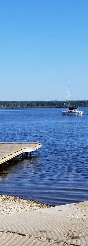
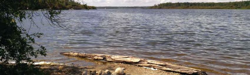
TABLE OF CONTENTS
INTRODUCTION                                           1
1.1 Preamble                                       1
1.2 Plan Area                                      2
1.3 Legislative Framework                          2
1.4 Interpretation                                 2

GOALS AND OBJECTIVES                                   3
2.1 Plan Goals                                     3
2.2 Plan Objectives                                3

RESIDENTIAL DEVELOPMENT                                4
3.1 Introduction                                   4
3.2 Policies                                       4
3.3 Settlements                                    6

RECREATIONAL DEVELOPMENT                             7
4.1 Introduction                                    7
4.2 Development Standards                           7

ENVIRONMENTAL PROTECTION                            10
5.1 Introduction                                   10
5.2 Policies                                       10

AGRICULTURE                                         14
6.1 Introduction                                   14
6.2 Policies                                       14
COMMERCIAL AND INDUSTRIAL DEVELOPMENT 15
7.1 Introduction                     15
7.2 Policies                         15

INFRASTRUCTURE                                      16
8.1 Introduction                                   16
8.2   Servicing                                    16
8.3   Transportation                               17
8.4   Community Health and Safety                  17

IMPLEMENTATION                                      18
9.1 Introduction                                   18
9.2 Policies                                       18

APPENDICES
Appendix A – Glossary
Appendix B - Sturgeon Lake Environmental Background Report

INTRODUCTION
1.1      Preamble
Sturgeon Lake, located in the Municipal District of Greenview No. 16 (Greenview) is
one of only a few readily accessible recreational lakes in northwest Alberta. As a
result, private lands concentrated at the west end of the lake have been the subject of
residential, resort and other recreational development. Agriculture and oil and gas
exploration activity are also major uses in the area and the lake is home to a
significant recreational fishery.
In addition, a substantial portion of the land around the lake is under the jurisdiction of
the Province of Alberta (consisting of Crown land, Williamson Provincial and Young’s
Point Provincial Park), and the Sturgeon Lake Cree Nation which is under federal
jurisdiction. Two historical settlements, Calais and Sturgeon Lake Settlement are
located on the south side of the lake surrounded by Sturgeon Lake Cree Nation lands.
This diversity of land use, coupled with the importance of the lake as a regional
recreational and environmental resource, results in a need to ensure that the lake is
protected from the potentially detrimental impacts of development. In addition, it is
necessary to ensure that development that occurs around the lake is carried out in a
sensitive manner. There are long-standing concerns present respecting water quality,
resulting in a strong desire to prevent further degradation.
The purpose of an Area Structure Plan (ASP) is to provide a framework for future
subdivision and development of a defined area within a municipality. The Sturgeon Lake
ASP is a statutory plan that has been prepared in accordance with Section 633 of the
Municipal Government Act (Act). The original ASP was adopted in August 1985 (Ministerial
Order 485/85) and updates were adopted in June 1991 (Ministerial Order 492/91) and July
2002 (Bylaw 01-344).
Since the ASP was last reviewed in 2002, the area has experienced increased residential
and recreational development pressures that warrant further review. In addition, it is
prudent to review the ASP in general terms to ensure that its policies continue to be
effective and relevant. In order to meet these needs, Greenview Council authorized a
review of the Sturgeon Lake ASP in June of 2018.
A Citizens’ Panel consisting of area landowners and residents was established to review
background information, discuss issues, and to provide feedback on draft versions of this
ASP.

                                           STURGEON LAKE AREA STRUCTURE PLAN | DRAFT          1
1.2      Plan Area                                              1.4       Interpretation
Sturgeon Lake is located approximately 13 km (8 miles)          1.4.1 The policies of this ASP are only enforceable on
west of the Town of Valleyview in Greenview as indicated in     private lands in the Sturgeon Lake area. With respect to
Map 1.                                                          Crown lands, the policies are advisory only, but clearly
Sturgeon Lake is approximately 49 km2 (19 mi2) in size          represent the position of Greenview in the future
and consists of a main basin and a shallow westerly             development or disposition of said lands. This ASP does
extension known as the West Bay. The drainage basin             not apply to the Sturgeon Lake Cree Nation lands.
for the lake is substantially larger, encompassing an           1.4.2 Land use area boundaries are to be considered
area of approximately 570 km2 (220 mi2), the majority of        approximate except where such boundaries coincide with
which is located south of the lake. The lake depth              roads or property lines. Minor deviations may be permitted
averages approximately 5 m (16 ft) and is 9.5 m (31 ft)         without an amendment at the discretion of Greenview if
at its deepest point. The maximum depth of the West             such deviations are not contrary to the purpose and intent
Bay is 3 m (10 ft).                                             of this ASP.
The ASP area corresponds to the Sturgeon Lake                   1.4.3 Compliance with policies in this ASP shall be
watershed as shown in Map 2. The Land Use Concept               interpreted and applied as follows:
(Map 3) identifies Development Areas consisting of all          a. “Shall” and “will” mean mandatory compliance;
private lands that have the potential to accommodate
residential and recreational development area in which          b. “Should” means compliance in principle but is subject
the detailed development policies of this ASP apply.               to the discretion of the Approving Authority where
Lands that are not developable, consisting of Crown land,          compliance may be undesirable or impractical due to
lands that are designated for conservation purposes, or            the specific circumstances associated with a particular
municipal lands that are designated as Municipal Reserve,          issue;
Environmental Reserve, or community purposes are also           c.    “May” means discretionary compliance or choice in the
identified.                                                           application of policy.
                                                                1.4.4 For the purpose of interpreting this ASP, the
1.3      Legislative Framework                                  definitions in Appendix A shall apply. All other words or
1.3.1    Provincial Land Use Policies                           expressions shall have the meanings assigned to them in
                                                                the Act, the MDP and Land Use Bylaw (LUB) or other
The Act requires that all statutory plans, including this ASP
                                                                overarching legislation.
be consistent with the Provincial Land Use Policies.
                                                                1.4.5 In this plan the following acronyms are used:
1.3.2    Greenview Municipal Development Plan
                                                                     ASP       Area Structure Plan
The Act requires that all statutory plans be consistent with
one another. As a result, this ASP has been prepared in              CR        Conservation Reserve
accordance with the broader policy initiatives contained in          ER        Environmental Reserve
Greenview’s Municipal Development Plan (MDP).
                                                                     LUB       Land Use Bylaw
                                                                     MDP       Municipal Development Plan
                                                                     MR        Municipal Reserve
                                                                     MSS       Municipal Servicing Standards
                                                                1.4.6 In the event a matter arises that is not addressed
                                                                by this ASP, then the policies of the MDP shall apply.

2     STURGEON LAKE AREA STRUCTURE PLAN | DRAFT
Jack HINES QUEEN
CREEK Last ELIZABETH PEACE
685 685 l RIVER TWELVE FOOT DAVIS
Lake inaP.P. h He
CardL. PROV. HIST. SITE rt a
George P.P. No rt
So
685
uth
729 Lake GRIMSHAW
732 737 2A St. Isidore
64 Seal
BERWYN
R.
Lake
W
735 Brownvale
hi
684
Cr.
te
CNR
la
Fo R.
Hin
Hea
w
R.
nt )
r
rt Duncans C H
ve
h 2 N ear
es
Utikoomak Lake
art
Bur
Bluesky Cr.
r
Ri
R t
t
I.R. 151A
He
682 Marie- I.R. 155B
am
in
Cr. Reine NAMPA j
nd
Cr
. Ben
Isla
oky
FAIRVIEW e 683 R.
ac Hawkins Mink L.
(Lit t le
R.
J osephi n William McKenzie
Pe Utikoomak Lake
L.
Ri n
Sm
gs
e Cr.
Cr. I.R. 151K At I.R. 155
R.
Ham B ea GIFT LAKE ika
elin Reno m
Mink
eg
er
r he
740
Cr.
725 METIS
Riv
k
ee
Leith
ad
DUNVEGAN
Cr P.P. 744 2 Utikumasis ATIKAMISIS
680 Gift L. R. LAKE SMT.
Jean Gift Lake
Blueberry
art
er Cote L.
Utikuma
He
Frank
v
727 750 Little Horse
Ri
R.
L. PEAVINE Lake
uma
Ksituan Creek 2 ) Lac
(Burnt Fox Creek Pentland SETTLEMENT
Cr.
Utik
Howard Rive
r Cr. Magloire South L.
SPIRIT Tangent lby METIS SETTLEMENT
RIVER Cr. Eaglesham La
Hunting Sutton L. Foster
ddle Kimiwan
Sa L.
n
Cr.
Vixe
RYCROFT CNR Lake WebsterL.
WANHAM FALHER
Spirit GIROUXVILLE DONNELLY
D
739
E N
SPIRIT
.
49
Cr
T. IRI R A
RIVER x Watino McLENNAN
Fo
SM PRA IVE
SMT. R.
Cr.
R
744 WINAGAMI LAKE
LT T
731 Pakashan
ine
SA EAR
Kakut av PROV. PARK I.R. 150D
Litt
Kak Salt
Pe Winagami
.
Lake ut
H
Cr
BIG PRAIRIE Cr e e k
le
nt
Sa
ddle (Bur ) 677 Cr. 679
L.
aw
679 SMT. Halcro Sh
2 Buffalo Bay
677 R. R. I.R. 150C Grouard I.R. 229
49
River
Woking r t
He
a Freeman I.R. 150B HILLIARD'S BAY
rt Grouard I.R. 230
Sou
Hea PROV. PARK
CN
Grouard Mission
Cr.
Guy
724 2
Sm
th
Grouard
Traverse Cr.
Bad
R
LESSER SLAVE
ok
749 Sucker LAKE SMT.
y
733 750
Creek
Maurice HIGH Lesser
s
2A
Gunn
676 . I.R.
Wolfe Cr R. McLeans PRAIRIE
Smoky
Pus L. 150A
Cr. 2 Joussard
Gr a n
L. k
La Glace Jones R
Cr .
N
wa
676 Enilda R.
de
L. C
Cr.
skau
R. Water
674 Kleskun Cr. 736 Hen Giroux
sk
w
Cr.
ado
Lake
Niobe
Drift Pile River Bay
Pr a i r i e
a ni
Ea
Arc
SEXSMITH st
R.
Sh
724 I.R. 150
at
Sto
adia
e
ab
W
ny
672 747 Faust
pil
749
t
ek
Cr.
Pra
on
Dr if t
Cr.
Cre
rm
irie
We
Cre
Cutbank B n
ai
Clairmont Puskwaskau Cl ous t o Cr
r ry
Cl
ea
st
L.
ois
ek
rL Lake ee
St r awbe
Lake k
qu
Be
.
R.
Saskatoon
Bould
Bezanson
Sn
Iro
ar
DeBolt Cr.
ipe
L. Hermit
R.
SASKATOON L.
er C
Cr.
r
Pr
670
P.P. Little L. rpe 43
air
YOUNG'S POINT EAST PRAIRIE
Ha
ie
Little
GRANDE
r
Stump
.
CNR PROV. PARK METIS
pile
Puskwaskau L. h
Ridgevalley
PRAIRIE er
McG
Sturgeon L. Snipe SETTLEMENT Ye l l o
Drift
Riv
S
WEMBLEY
Ma
Cor k ws
River
R. nw S t L. ee
River
u t
ow an
Lake r g e o n Cr.
b
Cr Cr .
el
668
iti Sturgeon I.R. 154A
Wap
on
.
n
Cr
al l
lde
e Cr.
L. 669 y
East
Go nl e
Little
r
ve
VALLEYVIEW
Cr.
WILLIAMSON P.P.
i
Ri
747
K
Mc
O'BRIEN P.P. 40 Swan Sturgeon Lake Sw ea er
Riv
Br
t ho
Cree
666 Lake I.R. 154
uc
us e
e
se
Cr
Sturgeon Lake Cr
k
Prair
665 .
Goo
.
Cr.
Driftpile
Simo I.R. 154B
oky
Sm ek
my
ie
nett 665 Cr.
s
Cre
es
e 43
Econo
Ca Goose Lake
ern
Lig
Sturgeon
Wilson mp Sid
ne
Inv
be
nit
W al l ac e
Cr. Lake ll C Cr. y
e
r. Long Cr.
er
W
Km
Riv
Lake
ils
R.
n
ehor
on
Cr
25 os
Lake ASP
. Creek
t ai n 745 Mo
Cr.
Go
ose
n
Ri
t ain
Mou
CN
ve
Little
Sto
d
R.
r
ll
Grassy
l un
ny
rne
n
Gold
Mou
R
Lake
sp
A
Lato
Cr.
ld
Ante
Cre
Ba
ek . Riv
Big
Cr Little Smoky er
er
g:\projects\15000\15200\15216_sturgeon_lake_asp_review\02_cadd\20_drafting\202_dwg\map_1_sturgeon_lake_asp_location_plan_210209.dwg
Cr.
Riv
Freeman
Ios
p
eg
Lake
Stee
Km
r
(A
un
R ive F r eem
Smo
50
Meekwap
Km
RR
an
Cre
Lake
Sm
ky
ek
Rive
)
75
Giroux
ok
Cr
River
At r
L. ikka ee k
y
734
Km
is e
MD of Greenview
40 mek
R.
Lou
ank Musreau
.
Cutb
Cr
Riv
125
Lake
er
Km
R.
R.
River
s k ahi gan
Cr.
er ett
e
Riv on Iosegun
ll
0
rne
Sim L.
10
a
Crooked
Lato
kw
Cr.
Wa
Raspberry
Ka
Lake
L.
43 .
Cr
FOX CREEK
r
ve
y Sa
Valle
Ri
Creek
Iose
Smoke CARSON-PEGASUS
kw
L.
Two
gun
at a
Deep Chic PROV. PARK
mau
y
kad
Ton
ee
n
er
Carso
Cr. McLeod
Riv Whitecourt
River
Riv Lake
er Clark Pass I.R. 232
Creek Baseline
L.
Cr
er L.
ee
Riv
y
k
947
ok
eek Little
Sm
Cr Smoky
Riv
734 R
er
Sides N
irie C
Pra Lake ad Creek
He WHITECOURT
Creek
Cr.
Cr.
Creek
Stony
rsh Bessie r
Cr.
tte
Ma ve
Be
er
Ri
one
a ve
Riv
r
Sim
Sturgeon Lake
Scale 1:1,250,000
Area Structure Plan
0 10 20 30 40
LOCATION
(Kilometres)
Map 1
Note: The boundary of this ASP corresponds to the
limits of the Sturgeon Lake watershed. The policies
of this ASP do not apply to the Sturgeon Lake
Cree Nation lands or Crown lands as they are
outside the jurisdiction of Greenview. February 2021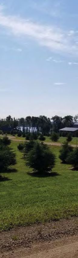
g:\projects\15000\15200\15216_sturgeon_lake_asp_review\02_cadd\20_drafting\202_dwg\map_2_sturgeon_lake_asp_plan_area_210209.dwg
72-24-5 72-23-5
71-24-5 71-23-5
71-25-5 Young's Point
Provincial Park
Sturgeon Lake
Sandy
Cree Nation
Bay
Sturgeon Lake 154A
43 Young's Point
Provincial Park
.
Eastside K
STURGEON LAKE The C
N
(West Bay) Narrows
STURGEON EO
G
Eagle R
U
LAKE
70-23-5
Bay ST
Sturgeon
Heights
Cozy
Cove
Williamson Sturgeon
Provincial Park Lake
Settlement
Calais
70-25-5 70-24-5 43 43
Sturgeon Lake
Cree Nation
Sturgeon Lake 154
Sturgeon Lake
K
CREE
Cree Nation
Sturgeon Lake 154
E
OS
GO
69-25-5 Sturgeon Lake
Cree Nation
Sturgeon Lake 154B
69-23-5
GOOSE
LAKE
69-24-5
LEGEND
ASP Boundary
Provincial Park
First Nation
43 Highway
Note: The boundary of this ASP corresponds to the
68-24-5 68-23-5
68-25-5
limits of the Sturgeon Lake watershed. The policies
of this ASP do not apply to the Sturgeon Lake
LONG
LAKE
Cree Nation lands or Crown lands as they are
outside the jurisdiction of Greenview.
GO
Sturgeon Lake
OS
E
Area Structure Plan
PLAN AREA
Map 2 CR
EEK
Scale 1 : 125 000 SIM
ON
ETT
E
RIV
ER
0 1.0 2.0 3.0 4.0 GRASSY
LAKE
(Kilometres)
67-25-5 SIMO
NET
TE
RIVE
R
67-24-5 67-23-5
February 2021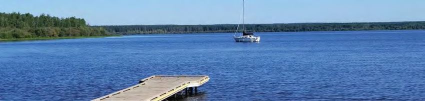
NE14 NW13 NE13 NW18 NE18 NW17 NE17 NE17 NW16 NE16 NW15 NE15
71-25-5 71-25-5 71-25-5 71-24-5 71-24-5 71-24-5 71-24-5 71-23-5 71-23-5 71-23-5 71-23-5 71-23-5
Young's Point
Provincial Park
SE14 SW13 SE13 SW18 SE18 SW17 SE17 SE17 SW16 SE16 SW15 SE15
71-25-5 71-25-5 71-25-5 71-24-5 71-24-5 71-24-5 71-24-5 71-23-5 71-23-5 71-23-5 71-23-5 71-23-5
NE8
NE11 NW12 NE12 NW7 NE7 NW8 NE8 NW9 NE9 NW10 NE10 71-23-5 NE10
71-23-5
71-25-5 71-25-5 71-25-5 71-24-5 71-24-5 71-24-5 71-24-5 71-24-5 71-24-5 71-24-5 71-24-5
NE8
SE11 SW12 SE12 SW7 SE7 SW8 SE8 SW9 SE9 SE10 Sandy Sturgeon Lake SE10
71-25-5 71-25-5 71-24-5 71-24-5 71-24-5 SW10 71-23-5
71-25-5 71-24-5 71-24-5 71-24-5
71-24-5
71-24-5 Bay Cree Nation
Sturgeon Lake 154A
NW5
NE2 NW1 NE1 NW6 NE6 71-24-5 NE5 NW4 NE4 NW3 NE3
71-25-5 71-25-5 71-25-5 71-24-5 71-24-5 71-24-5 71-24-5 71-24-5 71-24-5 71-24-5
SE2
SE6 SW4 SE4 SE3
71-25-5 SW6 SW271-24-5
SW1 SE1 71-24-5 SW5 SE5 71-24-5 71-24-5 Young's 71-24-5
71-24-5
71-25-5 71-25-5 71-24-5 71-24-5 Point
SW6 Provincial
Park
.
NW34 Ck
70-25-5 Eastside e on
NE34 NW35 NW36 Sturgeon Lake The rg
NE36
Holdings NW33
St
u NE33
70-25-5 70-25-5 70-25-5 70-25-5 (West Bay) Narrows 70-23-5
Sturgeon Lake
NW34 NE32 70-23-5
70-25-5
NW33 70-23-5
NE33
43
SE34 Eagle
SW
Bay
34
SW34 SW35 SE35 SW36 SE36 SE32 SW33
70-25-5 70-25-5 70-25-5 70-25-5 70-25-5 SW32 70-24-5
SE34 70-24-5 SE32 SW33 SE33
70-24-5
70-25-5 70-23-5 70-23-5 70-23-5
NE25
Cozy
NE26
70-25-5 NW25
70-25-5
Cove NW28
Boyd's
g:\projects\15000\15200\15216_sturgeon_lake_asp_review\02_cadd\20_drafting\202_dwg\map_3_sturgeon_lake_asp_land_use_concept_210209.dwg
NE29
NW27 NE27 NW26 70-25-5
NW29
NE29 NW28 NE28 NW27 70-23-5
70-24-5 70-23-5 NE28
70-25-5 70-25-5 70-25-5 70-24-5 70-24-5 70-24-5 70-24-5 NE29
NW30 70-23-5
NE25 70-24-5 NE27
SW25 SW28
SE25
SW30 SE29 70-24-5
SE30
SW27 SE27 SW26 SE26 SW25
70-24-5 SW29 70-24-5
70-25-5 70-25-5 70-25-5 70-25-5 Sturgeon 70-24-5 70-24-5 SE28 Williamson
SE25 70-24-5
Heights 70-25-5 SE25
SW30
Provincial Park Sturgeon
NW20
NE20
Lake
NW22 NE22 NW23 NE23 NW24 NE24 NW19 NE19 70-24-5 NW21
NE21 Settlement
70-24-5
70-25-5 70-25-5 70-25-5 70-25-5 70-25-5 70-25-5 70-24-5 70-24-5 70-24-5
NW20
70-24-5 NE20
Sturgeon Lake
SE21
Cree Nation Sturgeon Lake
Calais
SW22
70-25-5
SE22 SW23 SE23 SW24
SE24
70-25-5
SW19 SE19 SW20 SE20 SW21 Sturgeon Lake 154 Cree Nation
70-25-5 70-25-5 70-25-5 70-25-5 70-24-5 70-24-5 70-24-5 70-24-5 70-24-5
SE21
70-24-5
Sturgeon Lake 154
43
NW15 NE15 NW14 NW18 NE18 NW17 NE17
43
NE14 NE13 NW16 NE16
Goose
70-25-5 70-25-5 70-25-5 70-25-5 70-25-5 70-24-5 70-24-5 70-24-5 70-24-5 70-24-5 70-24-5
Ck.
NW13
70-25-5
LEGEND 0
Scale 1 : 50 000
0.5 1.0 1.5 2.0 Sturgeon Lake
Development Area
Municipal Ownership
(ER / MR / Other)
Development Area Boundary
(Kilometres)
Area Structure Plan
Note: The boundary of this ASP corresponds to the
Crown Land Provincial Park ASP Boundary limits of the Sturgeon Lake watershed. The policies
of this ASP do not apply to the Sturgeon Lake
LAND USE CONCEPT
Conservation Lands Cree Nation lands or Crown lands as they are
(Alberta Fish & Game Association) First Nations outside the jurisdiction of Greenview. Map 3 February 2021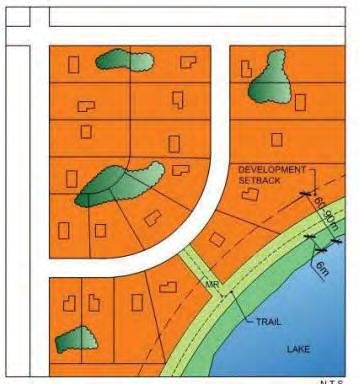
GOALS AND OBJECTIVES
      The goals and objectives of this ASP are as
      follows:
                                                            •   To require the provision of
      2.1       Plan Goals                                      Municipal Reserve, Environmental
      a.   To accommodate a variety of residential              Reserve and Conservation
           and recreational land uses in an                     Reserve for the protection of
           environmentally responsible fashion.                 natural features and wildlife, the
                                                                prevention of pollution and the
      b.    To mitigate the potential impacts of                creation of open space for public
            development on Sturgeon Lake.                       use.
      c.    To preserve and protect the natural        c.   Agriculture
            environment within the ASP area.
                                                            •   To minimize the impacts of
                                                                development on agricultural
      2.2       Plan Objectives                                 operations.
      a. Development Opportunities                          •   To promote agricultural best
            •   To encourage and promote efficient              practices within the Sturgeon
                and well-designed recreational and              Lake watershed.
                residential development.               d. Infrastructure
            •   To consider and plan for future             •   To ensure that infrastructure
                demand for and responsible levels               requirements of proposed
                of residential and recreational                 developments do not exceed
                development.                                    system capabilities and capacities.
            •   To minimize conflicts between land          •   To ensure that developers provide
                uses.                                           a high standard of servicing in an
            •   To provide for potential                        environmentally sensitive fashion.
                convenience store                      e. Transportation
                development opportunities.
                                                            •   To provide for an effective and
      b. Environment and Open Space                             efficient public road network.
            •   To promote environmental               f.   Implementation
                responsibility in the Sturgeon Lake
                area.                                       •   To include mechanisms for the
                                                                administration of the ASP.
            •   To provide for public access to the
                lake for recreational activities by         •   To promote ongoing communication
                ensuring the shore is retained in               between Greenview, the Sturgeon

2.0
                the public domain.                              Lake Cree Nation, the public and
                                                                provincial government agencies in
                                                                any future endeavours.

                                                   STURGEON LAKE AREA STRUCTURE PLAN | DRAFT         3
RESIDENTIAL DEVELOPMENT
3.1 Introduction
Like most recreational lakes, Sturgeon Lake has attracted a wide range of land uses
including permanent and seasonal residences, campgrounds, and provincial parks. One
of the primary land use planning concerns is the accommodation of an increasing demand
for country residential development without affecting the lake environment.
To address this concern, the ASP establishes a Development Area to concentrate
residential development in cluster form to promote an efficient land use pattern, conserve
land in its natural state, and optimize servicing efficiencies.
In previous versions of this ASP, the approach to density was established on a basis of
13 units per quarter section, with 1 unit corresponding to 1 residential lot or 4 campsites/
RV stalls. Discussions with the Citizens’ Panel raised questions with this approach as the
assigned density appeared arbitrary, and likely did not reflect the true site conditions of
the subject lands as the density allowances were not verified through detailed study. It
was the consensus of the Citizens’ Panel that less emphasis be placed on assigning site-
specific densities and more focus placed on the quality of development through the
application of more rigorous development standards and the study of site conditions.
3.2 Policies
3.2.3 Notwithstanding 3.2.2(a), lots
3.2.1 The Development Area shown on smaller than 0.2 ha (0.5 ac) may be
Map 3 is intended primarily for residential considered. Greenview may create a
and recreational purposes. These areas new district in the LUB to
shall, subject to rezoning and subdivision accommodate such small lot
approval, be reserved for: development.
a. Country residential development; 3.2.4 The resubdivision of existing
b. Accommodation, Leisure as lots may be supported provided that
defined in the LUB; the new lots meet the requirements of
the CR-3 District of the LUB and can
c. Municipal parks;
be serviced in accordance with the
d. Seasonal recreational uses, including requirements of Section 8.2.
resorts, RV parks and campgrounds;
3.2.5 A vacant first parcel out of an
e. Public uses; and unsubdivided quarter section may be
f. Commercial uses. permitted in the Development Area
3.0
subject to the parcel being rezoned to
3.2.2 Residential lots in the Development the CR-3 District of the LUB.
Area shall be:
3.2.6 In order to reduce the
a. A minimum of 0.2 ha (0.5 ac) provided
occurrence of piecemeal subdivision
such lots are serviced with municipal or
and to promote cluster development,
communal water and sewer system;
all subdivision exceeding first parcel
b. A maximum of 4.0 ha (10 ac); and out shall be subject to a minor ASP
c. Shall meet the development prepared in accordance with
regulations of the CR-3 District of the Greenview Policy 6001 (Minor Area
LUB. Structure Plan). A minimum density
for an initial phase of four lots per
quarter section is encouraged.
4 STURGEON LAKE AREA STRUCTURE PLAN | DRAFT3.2.7 In order to reduce the potential for erosion and
excess runoff, landowners are encouraged to retain as
much natural vegetation on a site as possible, and where
possible limit development to those areas that have been
previously cleared.
3.2.8 New residential subdivisions shall be designed in
accordance with the following best practices in order to
maximize public shoreline access, minimize environmental
impacts, and ensure long term sustainability:
a. Residential development shall be developed in cluster
form;
b. Residential development shall be served with water
and sanitary sewer servicing in accordance with
Section 8.2. The development must meet the
provisions of Greenview’s Development Guidelines
and Municipal Servicing Standards for the on-site
infrastructure and internal road network;
c. Development is to be designed to integrate with adjacent
developments to improve connectivity and accessibility to
local parks and open spaces by requiring the developer to
provide walking trails, park spaces and green spaces that
will preserve environmental and natural features for public
purposes in accordance with Policy 5.2.8;
d. That vegetated buffer strips be retained between
residential clusters and the lakeshore as per Policy 5.2.17;
and
e. That the provision of common docking and boat launch
facilities be encouraged.
3.2.9 Notwithstanding any other provision of this ASP,
existing undersized lots and existing developments not
meeting the requirements of this ASP shall be allowed
to continue to exist, and the reconstruction of existing
structures will be allowed subject to the development
meeting Greenview’s current requirements.
3.2.10 All developers are required to submit detailed lot
plans, lot grading plans, and stormwater management
plans with their development permit applications or
subdivision applications as applicable.
STURGEON LAKE AREA STRUCTURE PLAN | DRAFT 53.3 Settlements
3.3.1 Land in these areas shall generally be reserved for
The privately-owned land around Sturgeon Lake includes those developments allowed in other Development Areas.
two historic settlement areas established in 1914, Sturgeon
3.3.2 Developments on private lands in these areas shall
Lake Settlement and Calais. These settlement areas
be administered through the DC District of the LUB.
contain a variety of land uses on lots that range in size
Approvals shall be based on the standards for
from 0.11 ha (0.28 ac) to 36.8 ha (91 ac). Uses in these two
Development Areas as established in Sections 3.2, 5.2, 7.2
settlements include single detached houses and a
and 8.2 of this ASP.
commercial campground. In addition, the Government of
Canada purchased two of the larger lots in the Sturgeon 3.3.3 At the discretion of Greenview, except for the
Lake Settlement for the Sturgeon Lake Cree Nation on preparation of technical studies, variances to the
which Band facilities and numerous dwellings have been requirements of this ASP as noted in Policy 3.3.2 may be
developed. applied in Calais and the Sturgeon Lake Settlement due to
the unique nature of these settlements.
Due to the unique nature of the land uses and the parcel
sizes present, Greenview has designated all settlement
lands as Direct Control (DC) in the LUB. The policies in this
section are designed to provide guidance in the
administration of this DC zoning.
6 STURGEON LAKE AREA STRUCTURE PLAN | DRAFTRECREATIONAL DEVELOPMENT
4.1 Introduction
Seasonal recreation and resort development has always had a significant presence in the
Sturgeon Lake area and demand for this form of development continues to increase.
Greenview’s intention is to accommodate this increased demand for recreational and
resort development, such as campgrounds and recreational vehicle parks, without
affecting the lake environment by ensuring such development is undertaken to a high
standard.
The purpose of this Section of the ASP is to establish criteria for evaluating future
recreational and resort development proposals within the Development Areas.
4.2 Development Standards
4.2.1 The maximum allowable size for a iii. Campsites/RV stalls shall be a
resort cabin shall be 71.3 m2 (768 ft2). minimum of 18 m (59 ft) in length.
4.2.2 A site plan for a proposed iv. Each campsite/RV stall shall have a
campground or recreational vehicle park clear pad of minimum 4.0 m (13 ft)
shall be prepared that details internal in width and 6.0 m (20 ft) in length
circulation requirements, road widths, to allow for one table and one
pedestrian circulation, site access and campsite fire pit.
egress, emergency access, parking areas, v. Each campsite/RV stall shall have
storage areas, toilet and laundry areas, one garbage can or an equivalent
recreation areas and campsite areas. central garbage disposal area.
4.2.3 Campgrounds and b. A minimum of 2 barrier-free campsites/
Recreational Vehicle (RV) Parks RV stalls should be provided in a
a. Campsites and RV stalls shall generally campground. Barrier-free campsites/RV
comply with the following requirements stalls shall provide:
as illustrated in Figure 4.1: i. a firm and level dirt, crushed rock or
i. Each campsite/RV stall shall have paved campsite surface;
a minimum area of at least 93 m2 ii. a clear space around the tent pad
(1,000 ft2) with an open and graded and between other fixed elements
parking space sufficient to permit a (i.e. campfire, hook-ups);
clearance of 8.0 m (26 ft) between
iii. a campsite free of barriers and
sides and 6.0 m (20 ft) between
unprotected hazards;
ends of adjacent recreation
vehicles. iv. an accessible path less than 61 m
4.0
(200 ft) to an accessible washroom/
ii. Campsites/RV stalls shall be
vault toilet/wash station;
accessible by means of a driveway
at least 4.0 m (13 ft) wide where the v. an accessible picnic table (i.e.
driveway is for one-way traffic, or at with sufficient knee clearance
least 8.0 m (26 ft) wide where the and clear space) in the campsite;
driveway is for two-way traffic, and and
so constructed to allow the smooth vi. access to fire pit and/or grill.
passage of vehicles.
STURGEON LAKE AREA STRUCTURE PLAN | DRAFT 7Figure 4.1 – Campsite/RV Stall Configurations 8 STURGEON LAKE AREA STRUCTURE PLAN | DRAFT
4.2.4 Site Considerations                                        4.2.6 Waste Management
In determining the appropriateness and suitability of a          a. Roads shall have a good driving surface under all
site for a proposed campground or resort development,               weather conditions. Roads leading to a proposed
the Development Authority shall consider such factors               campground may be required as a condition of
as accessibility, compatibility with adjacent land uses,            development approval, to be brought into a condition
environmental sensitivity and physical suitability and              necessary to sustain the volume and type of traffic to
serviceability of the site itself.                                  be generated by the proposed campground.
a. The development of facilities should occupy no more           b. Within the campground development, a circular one-
   than two-thirds of the proposed site, thereby leaving            way system with gently curving roads, sensitive to
   one-third in its natural state.                                  topography and site characteristics is preferred, and
b. The site should be designed and landscaped in order              shall be “signed” to avoid confusion.
   to minimize disturbance to the natural environment and        c.   Parking is not encouraged on roadways but rather on
   to protect heavy use areas from damage.                            individual camping sites or visitor parking areas.
c.   The site should take advantage of existing clearings             Storage for boat trailers and recreational vehicles shall
     and open areas                                                   also be provided. Most individual campsites should
                                                                      provide two vehicle parking spaces and one trailer
d. The site should be well-drained and located in areas               pad.
   free of standing water.
                                                                 d. Minimum right-of-way widths for internal roads are:
4.2.5 Recommended Facilities
                                                                      i.    One-way:         4.0 m (13 ft)
a. Day Use and Overnight Campgrounds
                                                                      ii.   Two-way:         7.9 m (26 ft).
     i.    The suggested minimum facilities include a central
           sanitary and water station, vault toilets, refuse     e. The use of a cul-de-sac road design should be limited
           containers, picnic tables and fire pits.                 to:

     ii.   Other suggested facilities include individual              i.    Areas allocated for tenting only, or
           electrical outlets, showers, coin-operated laundry,        ii.   Areas where an adequate turning radius is
           playground, grassed open space, and individual                   provided (minimum 24.5 m (80 ft) diameter
           sewer connections.                                               outer dimension).
b. Recreational Resort Facilities
     i.    The suggested minimum facilities include individual
           electrical outlets and water supplies, toilets,
           showers, refuse containers and cooking facilities.
     ii.   Other suggested facilities include individual water
           and/or sewer connections, laundry, picnic tables,
           on-site parking, grocery, and recreation building.
c.   Adequate lighting shall be provided at the entrance to
     the campground and in public areas such as walkways
     to a main service building, washrooms, etc.
d.    Campground and resort facilities shall
      provide improved beach access,
      swimming areas, and boat launch facilities
      where possible.
e.    Vault toilets shall be provided within 91 m
      (300 ft) of 80% of all designated
      campsites.

                                                                              STURGEON LAKE AREA STRUCTURE PLAN | DRAFT      9
ENVIRONMENTAL PROTECTION
5.1 Introduction
Sturgeon Lake is acknowledged as being one of the few lakes in the Upper Peace region
that can support a variety of water-based recreational activities. Its shorelines are also used
for several other purposes including permanent and seasonal residential uses, recreational
and resort developments, and agriculture.
At the same time, however, the lake has historically been the subject of study due to ongoing
concerns of water quality. The lake is naturally highly eutrophic, a condition common to many
prairie lakes, where natural phosphorus concentrations contribute to a high degree of algae
growth during the summer months. In addition, water levels can be highly variable which
contributes to concerns respecting water quality. Although the issue of water level is outside
the scope of this ASP, the ASP must continue to strike an acceptable balance between these
environmental concerns and land use. In addition, there are several natural areas, including
wetlands, watercourses and drainage channels that warrant protection. The presence of these
features, identified at a high level in the Sturgeon Lake ASP Environmental Report (see
Appendix B) prepared by Spencer Environmental Management Services Ltd., warrants further
study at the time of development in order that they can be protected.
The purpose of this section is to address issues related to the protection of the natural
environment. Policies are provided that reflect Greenview’s position on lakeshore and water
protection, through the implementation of such mechanisms as development setbacks, a high
level of sanitary servicing, retention of natural vegetation, and environmental and municipal
reserve dedication.
5.2 Policies
5.2.1 Management of the watersheds is important
within the plan area to protect, restore and ensure
the sustainability of the natural water systems. Any
development that results in the fragmentation of
contiguous natural features, functions and habitat
such as water systems, moraines, forests, wetlands
and wildlife habitat and corridors shall be
discouraged.
5.2.2 Developers must, at the time of application,
demonstrate that a proposed development will not
detrimentally impact the water quality and riparian
areas of all streams, creeks, and Sturgeon Lake.
5.0
Factors that will be taken into consideration when
determining a development application include, but
are not limited to:
Figure 5.1: Illustration of Environmental Reserve
a. The type of land use proposed and the potential
for contamination of the site and groundwater
b. On-site stormwater management; and
c. Site layout.
10 STURGEON LAKE AREA STRUCTURE PLAN | DRAFT5.2.3 Numerous wetlands and other environmentally 5.2.7 Notwithstanding Policy 5.2.6, Greenview may
sensitive lands are present in the ASP area as illustrated consider the development of natural walking trails,
on Map 4. The protection of these features shall be identified at the time of subdivision, within ER lands to
required in accordance with the provisions of this section. provide pedestrian links to public access points on the lake
Only limited development that has a low impact on the and other open space areas.
natural environment, such as walking trails, shall be
5.2.8 At the time of subdivision, Greenview shall
considered.
require that 10% of the land that is the subject of
5.2.4 At the time of subdivision, Greenview shall require subdivision be dedicated as Municipal Reserve (MR).
that a strip of land with a minimum width of 6.1 m (20 ft) MR shall be dedicated in parcel form in order to provide
abutting the bed and shore of the lake, permanent lands for municipal parks and playgrounds, trail corridors,
watercourses, and permanent wetlands be dedicated as or public access points to the lake as illustrated in
Environmental Reserve (ER) as illustrated in Figure 5.1. Figures 5.1, 5.2 and 5.3.
ER dedication is required in order to prevent pollution, 5.2.9 Notwithstanding Policy 5.2.8, Greenview may
reduce the potential for shoreline degradation, and protect acquire MR as money-in-lieu, calculated in accordance with
ecologically sensitive areas and wildlife corridors. This ER the Act that will be invested in the park and open space
may be increased in accordance with the recommendations network.
of an assessment undertaken in accordance with Policies
5.2.12, 5.2.13 and 5.2.14. 5.2.10 If Greenview determines that environmentally
sensitive lands are required in addition to those identified
5.2.5 In addition to lands required under Policy 5.2.4, in Policy 5.2.4, but cannot be justified as ER, then
Greenview may require that the following lands also be Greenview may acquire the additional lands as
dedicated as ER: Conservation Reserve (CR) subject to compensation in
a. Swamps and marshes in accordance with the accordance with the Act. An example of how CR may be
recommendations of a wetland assessment; and applied is illustrated in Figure 5.2.
b. Steep slopes, flood-prone and erosion-prone areas 5.2.11 Greenview may encourage and promote the use of
in accordance with the recommendations of a conservation easements as a means of working with
geotechnical assessment. landowners to protect environmentally sensitive features on
5.2.6 Land dedicated as ER shall be left in its natural state, private lands outside the subdivision process. The use and
although the removal of deadfall may be undertaken by control of these feature areas shall be clearly stated in the
Greenview for reasons of safety, maintenance, or fire risk easement agreement.
provided the intent of the ER is not compromised.
Figure 5.2: Illustration of Conservation Reserve Figure 5.3: Development Setback
STURGEON LAKE AREA STRUCTURE PLAN | DRAFT 11NW5
NE1 NW6 NE6 71-24-5 NE5 NW4 NE4 NW3 NE3
71-24-5 Young's Point
71-25-5 71-24-5 71-24-5 71-24-5 71-24-5 71-24-5 71-24-5
Provincial Park
SW4 SE4
SW6 SE6 71-24-5 71-24-5
SE5
SE1 71-24-5 71-24-5 71-24-5 SE3
71-25-5 SW271-24-5
SW5
Young's Point 71-24-5
71-24-5 Provincial Park
SW6
The
NE36 Sturgeon Lake
NW35 Narrows
70-25-5 NW36
70-25-5
(West Bay)
70-25-5
NW33
NE33
Eagle
Bay
SW
43
SW35 SE35 SW36 SE36 SE32 SW33
70-25-5 70-25-5 70-25-5 70-25-5 SW32 70-24-5 70-24-5
70-24-5
NE25 Cozy
NE26 70-25-5 Cove NW29
70-25-5 70-24-5
NW26 NW25 NE29 NW28 NE28 NW27
70-25-5 70-24-5 70-24-5
70-25-5 70-24-5
43 70-24-5
NW30
g:\projects\15000\15200\15216_sturgeon_lake_asp_review\02_cadd\20_drafting\202_dwg\map_4_sturgeon_lake_asp_enviromentally_sensitive_areas_210104.dwg
NE25 70-24-5 NE27
SW25
SE25 SW28
SW30 SE29 70-24-5
SE30
SW26 SE26 SW25 70-24-5 70-24-5
70-24-5 SW29
70-25-5 70-25-5 SE28
Sturgeon 70-24-5 70-24-5
Heights SE25
SE25
70-25-5 SW30
Sturgeon Lake
NW20
Cree Nation
NE23 Williamson
Provincial
43
70-25-5 NE20 NW21
NW23 NW24 NE24 NW19 NE19 70-24-5 NE21 Park
70-24-5
70-25-5 70-25-5 70-25-5 70-24-5 70-24-5 70-24-5
NW20
70-24-5
NE20
SE21
SE24
SW23 SE23 SW24 70-25-5 SW19 SE19 SW20 SE20 SW21 Calais
70-25-5 70-25-5 70-25-5 70-24-5 70-24-5 70-24-5 70-24-5 70-24-5
SE21
70-24-5
Wetland *
LEGEND
Conservation Lands
(Alberta Fish & Game Association)
0
Scale 1 : 30 000
250 500 750 1000 Sturgeon Lake
Municipal Ownership
(ER / MR / Other)
Landfill
(Metres)
Area Structure Plan
Landfill Setback (300m)
* Source: Services
SLASP Environmental Report, Spencer Environmental Management
Ltd., August 2018. Wetland information obtained from the ENVIRONMENTALLY SENSITIVE AREAS
Crown Land
MD of Greenview via Munisight Ltd., and is based on provincial data.
Map 4
Actual extent of wetlands to be confirmed through further study at time
Development Area Boundary of subdivision.
January 20215.2.12 Prior to development or subdivision approval, 5.2.15 Other than trails, boat launches, public recreation
Greenview shall require the developer to provide a areas and beaches, all development, including on-site
wetland assessment, prepared by a qualified infrastructure, shall have a minimum setback of:
professional, for any development that involves the a. 61 m (200 ft) from the shoreline surrounding the main
potential disturbance of a wetland and requires provincial body of the lake, and
approval under the Water Act.
b. 91 m (300 ft) from the shoreline surrounding the West
5.2.13 All subdivision and development proposed on Bay as illustrated in Figure 5.3.
land adjacent to or containing watercourses and
wetlands shall require a geotechnical study conducted 5.2.16 Notwithstanding Policy 5.2.6, removable docks and
by a certified professional engineer to: boardwalks to access the bed and shore of the lake may be
a. Delineate the municipal top-of bank as defined in the permitted in accordance with the following:
LUB, and a. That the dock or boardwalk be limited to 2.4 m (8 ft) in
b. Consider and make recommendations specifying width and have a maximum terminal platform area of
additional development setbacks to increase the 24 m2 (258 ft2);
separation distance beyond the minimum 6.1 m (20 ft) b. The dock or boardwalk is constructed of materials
identified in Policy 5.2.4. that will not negatively impact water quality by way of
5.2.14 Prior to development or subdivision approval, contamination or degradation;
Greenview may require the preparation of a Biophysical c. The owner has obtained authorization from Greenview
Report, prepared by a qualified professional consisting of to access the bed and shore through municipal lands;
the following: and
a. An inventory of protected areas, identified wetlands,
d. The owner has obtained the appropriate approvals or
and migratory bird sanctuaries,
authorizations from the Province.
b. An inventory of rare plants and ecological communities
after consulting the Alberta Conservation Information 5.2.17 A treed/vegetated buffer shall be maintained
Management System, between the lakeshore and any structural developments.
Where possible this buffer shall be 61 m (200 ft) in width on
c. An inventory of sensitive species after consultation with the main body of the lake and along watercourses feeding
the Province, and the lake, and 91 m (300 ft) on the West Bay.
d. An assessment and analysis of environmentally 5.2.18 Landowners will be required to manage invasive
sensitive areas that considers an ecological network species and noxious weeds on their lands to prevent their
approach, the maintenance and restoration of wildlife establishment and to minimize their spread. The planting of
movement corridors, and required conservation buffers, non-native species is discouraged.
mitigation measures, floodplain and development
setbacks, and transition of land uses from identified 5.2.19 Greenview may work with the Province and
natural living systems. Sturgeon Lake Cree Nation to investigate opportunities for
the installation of additional boat launch facilities.
12 STURGEON LAKE AREA STRUCTURE PLAN | DRAFT5.2.20 Greenview encourages the Province to
continue to monitor and report on lake water
quality, and to monitor water levels.
5.2.21 The following minimum setbacks shall be
maintained from the abandoned landfill site as
illustrated on Map 4:
a. 300 m (984 ft) for all residential and
recreational development in accordance
with the Subdivision and Development
Regulation; and
b. 450 m (1,476 ft) for a water well in accordance
with the Nuisance and General Sanitation
Regulation.
STURGEON LAKE AREA STRUCTURE PLAN | DRAFT 13AGRICULTURE
6.1 Introduction
Agriculture is an important and expanding land use in Greenview. Much of the land base
surrounding Sturgeon Lake is suitable for farming, and with some exceptions, should be
treated the same as other agricultural land in Greenview. Although new development will
result in the removal of some lands from production, it is the intent of this ASP to promote
clustered form development that minimizes impacts on agricultural lands.
The use of such techniques as vegetation retention and the development of settling ponds
may be required to reduce the chances of lake pollution occurring from adjacent land
uses. To protect the quality of the lake water, intensive agricultural uses shall be set back
an appropriate distance from the lake or restricted altogether. The objective is to keep
uses that may pollute the lake away from surface features that drain directly into the lake.
6.2 Policies
6.2.1 The subdivision of lands in the b. The retention and protection of natural
Development Area currently designated as vegetation whenever feasible;
Agricultural One (A-1) in the LUB shall be c. Keeping the extent of the disturbed
limited to the following: area and the duration of its exposure
a. Extensive agriculture; within practical limits. Suitable
stabilization measures should be
b. The first parcel out of an unsubdivided used to protect exposed areas during
quarter section to accommodate an construction and be re-vegetated as
existing residence; soon as possible;
c. The subdivision of a physically severed d. Managing site drainage so that surface
portion of a quarter (a.k.a. a runoff is maintained at pre-
Fragmented Parcel); development rates subject to a
d. Public uses; stormwater management strategy
prepared in accordance with Policy
e. Recreational uses; and
8.2.8;
f. Uses that are accessory to those listed
e. Maintaining a naturally vegetated
above.
buffer along the shore of the lake
The above limitations are not applicable and watercourses in accordance with
to agricultural lands located outside of the Policy 5.2.17.
Development Area.
6.2.3 No confined feeding operations as
6.2.2 Greenview supports land
6.0
defined in the Agricultural Operation
management practices that discourage Practices Act shall be permitted within the
sediment and nutrient loading into the Development Area.
Sturgeon Lake water system. These
practices include:
a. The stripping of vegetation, grading,
or other soil disturbance being done
in a manner which will minimize soil
erosion;
14 STURGEON LAKE AREA STRUCTURE PLAN | DRAFTCOMMERCIAL AND
INDUSTRIAL DEVELOPMENT
7.1 Introduction
Most of the commercial needs of local residents and lake users can be served from
Valleyview, Crooked Creek, Sturgeon Heights and the Sturgeon Lake Cree Nation. As
residential and recreation developments expand, however, there may be an opportunity
for the establishment of small commercial ventures, primarily of a convenience nature.
7.2 Policies
7.2.1 The subdivision and development 7.2.2 The reclassification of land for
of land for commercial uses may be industrial purposes shall not be permitted in
permitted in the Development Area subject the Development Area under any
to rezoning. For the purpose of this circumstances.
section, the types of uses that may be 7.2.3 Greenview shall not support the
supported include: development of oil and natural gas
a. Convenience stores; exploration and extraction activities in the
Development Area. In addition, no such
b. Recreational vehicle and boat storage; activity shall be supported in the ASP area
and
if located within 100 m (328 ft) of the lake
c. Restaurants. or a permanent watercourse draining into
Convenience stores and restaurants the lake.
do not require rezoning if developed
as an accessory use within an existing
development within the Recreation
(REC) District of the LUB.
7.0
STURGEON LAKE AREA STRUCTURE PLAN | DRAFT 15INFRASTRUCTURE
8.1 Introduction
In order to serve the residents of the Sturgeon Lake area, Greenview has recently expanded
the existing sewage lagoon at Sturgeon Heights. The lagoon was originally constructed as an
integral part of an overall sewage disposal strategy for the area. Such a strategy is required
to alleviate an increasing pressure for disposal facilities while at the same time protecting the
quality of lake water by providing sound environmental options for local sewage disposal. The
policies that follow are intended to further these goals, as well as addressing other servicing
needs.
The ASP area is served by three paved roads (Highway 43 and Township Road 704 on the
south of the lake, and the Young’s Point Road (RR 251/Township Road 710) that bounds
the West Bay to the west and north) as well as several gravel roads. Local roads that serve
the interior of the ASP area are connected to these main roads. The purpose of this section
is also to provide policies that will continue to ensure the safe and efficient flow of traffic
through the area.
The use of environmentally friendly technologies and practices will be encouraged in
the design and construction of all infrastructure. This may include the use of Low Impact
Development (LID) standards for storm water management and energy conservation.
8.2 Servicing
8.2.1 Greenview shall require all 8.2.3 Multi-lot subdivisions may be
developments to provide holding tanks or serviced with communal sewage
composting toilets for sewage disposal for: systems provided if they are registered
as a condominium. The maintenance and
a. New residential development upkeep of such systems shall be the
or subdivision located within responsibility of the condominium
a Development Area; association and shall be located on
b. New development or subdivision, common property within the development.
including vacant first parcels out and 8.2.4 New or expanding resort
the resubdivision of existing lots in the developments may be serviced with private
ASP area but outside a Development lagoon facilities that are developed and
Area if the proposed sewage system is operated in accordance with Provincial
located within 91 m (300 ft) of any standards.
watercourse draining into the lake.
8.2.5 Greenview may undertake a
It is intended that all holding tanks be
8.0
feasibility study to assess the potential
installed at locations that are easily options for the provision of municipal water
accessible for a vacuum truck and are to and sewer services in the Narrows and
be pumped out regularly for disposal at a other development nodes within a
licensed facility. Development Area.
8.2.2 Septic fields, treatment mounds, and 8.2.6 In the case of existing development,
other on-site systems may be permitted at Greenview encourages the upgrading of
locations outside of those identified in existing sewage facilities. To this end, as
Policy 8.2.1 provided they conform to the existing developments require
Alberta Private Sewage Systems development permits to renovate,
Standard of Practice. reconstruct or enlarge, such permits shall
be approved with a condition requiring that
a sewage holding tank be installed in
accordance with Policy 8.2.1.
16 STURGEON LAKE AREA STRUCTURE PLAN | DRAFT8.2.7 For all new subdivisions, the applicant shall be
required to demonstrate the availability of potable water 8.4 Community Health and Safety
and/or construct a water system in accordance with the 8.4.1 Fire protection for the ASP area is provided by the
requirements of Greenview’s MSS. DeBolt Fire Station and the Valleyview Volunteer Fire
8.2.8 The design and provisions for storm drainage shall Department, a strong group of volunteer fire fighters serving
take into account the reduction of ditch erosion, the surrounding Sturgeon Lake area. Greenview will work in
environmental damage, and sedimentation of the lake. The partnership with the community and emergency responders
development of storm ponds may be required in in maintaining appropriate emergency response services.
accordance with Greenview’s MSS. 8.4.2 In order to protect the community from
environmental hazard:
8.3 Transportation a. Future subdivision and development shall incorporate
8.3.1 The developer of a subdivision or development fire preparedness measures, such as provincial
shall be responsible for the construction of all internal FireSmart guidelines;
roads in accordance with the requirements of b. Greenview will require an Environmental Assessment
Greenview’s MSS. In addition, the developer may be to ensure measures are taken to mitigate any potential
responsible for the costs of upgrading or widening existing adverse environmental impacts. Greenview will
roads serving the development. adhere to the recommendations set out in the required
8.3.2 The construction of new roads shall not adversely Environmental Assessment, which may include
impact sensitive natural features, recreation areas or restrictions regarding:
historical sites. i. Development of permanent structures,
8.3.3 In order to accommodate development along ii. Removal of vegetation, and
Highway 43, service roads shall be provided in accordance
with Alberta Transportation requirements. iii. The alteration of natural drainage patterns.
8.3.4 The provision, design and construction of all roads
and access points affecting Highway 43 shall conform to
Alberta Transportation standards. The design and
construction of all road improvements shall have regard for
the storm drainage system, and all proposed access points
to developments shall have regard for traffic safety.
8.3.5 Outside of approved public docking and boat launch
facilities, no direct vehicular access to the lake shall be
permitted.
STURGEON LAKE AREA STRUCTURE PLAN | DRAFT 17IMPLEMENTATION
9.1 Introduction
Upon adoption, this ASP shall become the policy document of Greenview to manage
development in the Sturgeon Lake area.
9.2 Policies
9.2.1 The land use designations in this 9.2.2 This ASP should be reviewed at
ASP are considered flexible. However, an ten-year intervals unless changing
amendment will be required to the ASP if: conditions warrant a review prior to that
time. Such reviews may reflect such
a. The intent of a policy is to be changed;
factors as legislative change, changes to
b. A change is proposed to the land use local demand, future servicing, or Council
areas identified in Map 3; or direction. In undertaking such a review,
c. Policies are to be introduced or consideration should be given to:
excluded. a. Local land use changes and emergent
Interested parties and government agencies issues;
will have an opportunity to comment on a b. New best practices and development
proposed amendment in accordance with trends; and
the public hearing procedures under the c. Communication and consultation with
Act. residents and stakeholders.
9.2.3 Greenview will consult with
provincial government agencies and the
Sturgeon Lake Cree Nation as required to
coordinate planning efforts around the lake.
9.0
18 STURGEON LAKE AREA STRUCTURE PLAN | DRAFTAPPENDIX A
Glossary
STURGEON LAKE AREA STRUCTURE PLAN | DRAFT 19Bed and Shore
Land located at and below the normal high-water line of a lake or permanent wetland and where aquatic
vegetation is normally present. Such land is under the jurisdiction of the Province of Alberta.
Cluster Form
An approach to land development where the
main structures on nearby properties are
grouped close together, enabling efficiencies
in servicing and leaving large remnants in an
undeveloped/semi-natural state or to serve as
open space, conservation, recreation, or
public uses.
Communal Water and Sewer System
A system of water and/or wastewater infrastructure that serves a small, localized development, with
capital and operation costs shared among the pool of users.
Composting Toilet
A toilet design in which waste is retained and broken down through natural decomposition into a compost
material, which can then be removed off-site. It uses no water for flushing and so does not require a
connection to water supply, a septic system, or a municipal wastewater system.
Conservation Reserve
Environmentally sensitive lands that are dedicated to the municipality at the time of subdivision in
exchange for financial compensation in accordance with the Municipal Government Act.
Country Residential Use
A use of land in a rural area, not situated in a hamlet, for primarily residential purposes, excluding farm
buildings.
Development Area
Lands identified in the Land Use Concept (Map 3) that consist of all private lands that have the potential
to accommodate residential and recreational development. These lands are the intended target of private
development under this ASP.
Extensive Agriculture Use
A use of land involving the raising or production of any cultivated crops or livestock which utilizes
relatively large areas of land and in which the use of buildings and confinement areas is auxiliary to the
use of the land itself. This constitutes an agricultural operation pursuant to the Agricultural Operation
Practices Act but does not include an intensive livestock use such as a Confined Feeding Operation.
FireSmart Guidelines
A framework for assessing, preparing for and reducing wildfire risk for communities. A guidebook for
assessment and planning is available from the Province of Alberta.
Fragmented Parcel
A portion of a parcel that is physically severed from the balance of a quarter section by a road, railway,
water body, watercourse, ravine or similar feature. A Quarter Section containing a physical severance but
otherwise intact is considered to be unsubdivided.
Invasive Species
A species that is not original to a local area and that tends to spread to a degree believed to cause
damage to the environment, human economy, or human health.
20 STURGEON LAKE AREA STRUCTURE PLAN | DRAFTLow Impact Development An approach to land use planning and engineering design to manage stormwater runoff as part of green infrastructure that is integrated with or makes use of existing natural features and processes to protect water quality. Municipal Water and Sewer System A system of water and/or wastewater infrastructure that is publicly funded and maintained by the municipal government. Typically, this involves large-scale networks of pipes and centralized treatment facilities. Noxious Weeds A plant that causes damage or injury to crops, the natural environment, humans or livestock. Noxious weeds are defined by the Alberta Weed Control Act. Seasonal Recreational Use A use of land intended for occupancy on a short-term basis, which is further not to be continuous nor year-round. Steep Slope Land that exceeds a 15% incline (vertical rise as a portion of horizontal run). Terminal Platform Area The loading/unloading/lounging area of a dock structure. Does not include the walkway that is otherwise only used to access the terminal platform. Vault Toilet A toilet design in which waste is retained and stored (in a “vault”) so that it can be regularly removed and treated off-site. It uses no water for flushing and so does not require a connection to water supply, septic, nor municipal wastewater systems. Wetlands As defined in the Alberta Wetland Policy, wetlands are lands that are saturated with water long enough to promote wetland or aquatic processes as indicated by poorly drained soils, hydrophytic (water loving) vegetation, and various kinds of biological activity that are adapted to a wet environment.
You can also read