Grampians Bushfire Management Strategy 2020 - Fuel management Bushfire Risk Engagement Areas - Safer ...
←
→
Page content transcription
If your browser does not render page correctly, please read the page content below
Grampians
Bushfire Management
        Strategy 2020
                          Fuel management
           Bushfire Risk Engagement Areas
Acknowledgements
    We acknowledge and respect Victoria’s
    Traditional Owners as the original custodians of
    the state’s land and waters, their unique ability to
    care for Country and deep spiritual connection to it.
    We honour Elders past and present, whose
    knowledge and wisdom has ensured the continuation
    of culture and traditional practices.
    We are committed to genuinely partner and meaningfully
    engage with Victoria’s Traditional Owners and Aboriginal
    communities to support the protection of Country, the
    maintenance of spiritual and cultural practices and their
    broader aspirations in the 21st century and beyond.
    We would like to acknowledge the numerous people within
    DELWP, Parks Victoria, the CFA and local governments who
    contributed to the discussions and decision-making processes
    that resulted in this strategy. We would also like to acknowledge
    stakeholder groups and community members for their interest and
    input into this planning process.

   Aboriginal people should be aware that this publication may contain images or names of
   deceased persons in photographs or printed material.

Photo credit
Glenn Rudolph, DELWP
© The State of Victoria Department of Environment, Land, Water and Planning 2020

This work is licensed under a Creative Commons Attribution 4.0 International licence. You are free to re-use the
work under that licence, on the condition that you credit the State of Victoria as author. The licence does not apply
to any images, photographs or branding, including the Victorian Coat of Arms, the Victorian Government logo and
the Department of Environment, Land, Water and Planning (DELWP) logo. To view a copy of this licence, visit http://
creativecommons.org/licenses/by/4.0/

Printed by
ISBN 978-1-76105-006-0 (Print)
ISBN 978-1-76105-007-7 (pdf/online/MS word)

Disclaimer
This publication may be of assistance to you but the State of Victoria and its employees do not guarantee that the
publication is without flaw of any kind or is wholly appropriate for your particular purposes and therefore disclaims all
liability for any error, loss or other consequence which may arise from you relying on any information in this publication.

Accessibility
If you would like to receive this publication in an alternative format, please
telephone the DELWP Customer Service Centre on 136186, email customer.service@
delwp.vic.gov.au or via the National Relay Service on 133 677 or at www.relayservice.
com.au. This document is also available on the internet at www.delwp.vic.gov.au.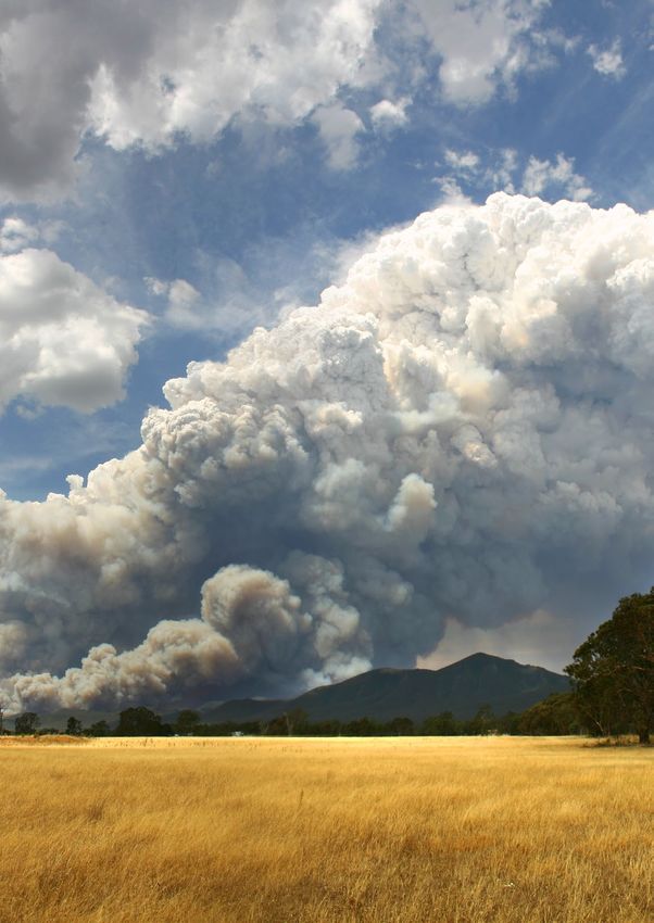
Contents
Abbreviations and Definitions                                2
Introduction                                                 4
  Our shared responsibility to mitigate bushfire risk        5
    Recognising the role of Victoria’s Traditional Owners    6
  Bushfire management planning                               7
    Strategic planning                                       8
    Operational and tactical planning                        9
    Other bushfire management actions                        9
  About this bushfire management strategy                    11
    Method overview                                          12
    Identifying and assessing risk to values and assets      12

Our landscape context                                       14
  Bushfire history and patterns                             18
  Values and assets                                         20
    Human landscape                                         20
    Aboriginal cultural heritage                            22
    Natural landscape                                       24

Our objectives                                              28
Our risk management approach                                30
  Risk in Grampians region                                  30
    Higher risk areas in Grampians region                   30
    Lower risk areas in Grampians region                    31
  Why model house loss?                                     34
  How do we model house loss?                               34

Our fuel management strategy                                36
    Fire Management Zones                                   36
    Ecosystem resilience                                    41
    About our fuel management strategy                      41
    Victoria’s residual risk                                48

Bushfire Risk Engagement Areas                              52
Implementation                                              56
Monitoring, evaluation and reporting                        58
Appendix 1: Program logic                                   60
References                                                  66
2   Bushfire Management Strategy

    Abbreviations and Definitions
     Abbreviation        Term

     APZ                 Asset Protection Zone
                            an area around properties and infrastructure where we intensively manage fuel to
                            provide localised protection to reduce radiant heat and ember attack on life and
                            property in the event of a bushfire

     BMZ                 Bushfire Moderation Zone
                            an area around properties and infrastructure where we manage fuel to reduce the
                            speed and intensity of bushfires and to protect nearby assets, particularly from
                            ember attack in the event of a bushfire

     BREA                Bushfire Risk Engagement Area
                            parts of the landscape where managing bushfire fuels is most effective in reducing
                            risk

     CAR                 Comprehensive, Adequate and Representative reserve system

     CBBM                Community Based Bushfire Management

     CFA                 Country Fire Authority

     DELWP               Department of Environment, Land, Water and Planning

     EMV                 Emergency Management Victoria

     FFMVic              Forest Fire Management Victoria
                            comprised of staff from DELWP, PV, Melbourne Water and VicForests when working
                            in bushfire management on public land

     FMZ                 Fire Management Zone
                            for fuel management purposes, public land in Victoria is classified into four fire
                            management zones: asset protection zone, bushfire moderation zone, landscape
                            management zone, and planned burning exclusion zone

     GMA                 Geometric Mean Abundance
                            an index of the relative abundance of species within a community. As the relative
                            abundance of species changes, so too does the GMA, and this can be used as a
                            measure of resilience

     Ha                  Hectares

     JFMP                Joint Fuel Management Program

     LDNP                Little Desert National Park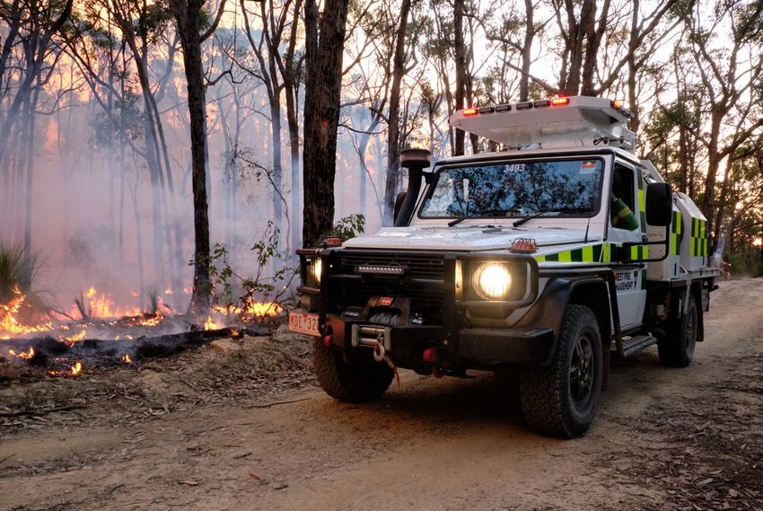
Grampians   3

Abbreviation    Term

LMZ             Landscape Management Zone
                   an area where we manage fuel to minimise the impact of major bushfires, to
                   improve ecosystem resilience and for other purposes (such as to regenerate
                   forests and protect water catchments)

MER             Monitoring, Evaluation and Reporting

MISS            Minimum Impact Suppression Strategy

NCR             Nature Conservation Reserve

PBEZ            Planned Burning Exclusion Zone
                   an area where we try to avoid planned burning, mainly because ecological assets
                   in this zone are primarily intolerant to fire

PV              Parks Victoria

RAP             Registered Aboriginal Party

Residual risk      the amount of risk that remains after bushfires and fuel management activities
                   reduce fuel. Residual risk is used by DELWP as a performance measure

RSFMPC          Regional Strategic Fire Management Planning Committee

SDM             Structured Decision Making

TFI             Tolerable Fire Interval
                   a term which expresses the minimum or maximum recommended time intervals
                   between successive fire disturbance events at a site or defined area for a
                   particular vegetation community. The time interval is derived from the vital
                   attributes of plant species that occupy the vegetation community. The TFIs guide
                   how frequent fires should be in the future to allow the persistence of all species at
                   the site or defined area

VFRR-B          Victorian Fire Risk Register – Bushfire

WCAP            Wimmera Conservation Action Plan
4   Bushfire Management Strategy

    Introduction
    Victoria is one of the most bushfire-prone areas in the world. Victorians are accustomed
    to living with bushfire risk, which is the likelihood and consequence of bushfires. It
    includes the likelihood of a fire starting and spreading across the landscape, and the
    consequences of it impacting the things we value: people, communities, houses and
    farms, infrastructure, our economy and the natural environment.

    Bushfires are driven by three key factors – fuel,         Bushfire risk is influenced not only by how a bushfire
    weather and topography – which together make              behaves, but also by how fire impacts the different
    up the ‘fire behaviour triangle’. These three factors     things that we value. For example, population
    combine to affect how a bushfire behaves: how             growth in and near forested areas increases the
    fast it travels, where it spreads, and how intensely it   bushfire risk, as more people enter areas where
    burns. Fuel management is important, because it is        major bushfires are more likely to impact. The
    the only element of the fire behaviour triangle that      Victorian community is changing in other ways, with
    we can influence.                                         an aging population and decreases in volunteering
                                                              in some areas, leading to an increase in vulnerability
    Bushfire fuels are the leaves, bark, twigs and shrubs     to bushfire. For plants and animals, drought,
    that are burnt by fire. The fuel type, dryness, size,     invasive species incursion, as well as habitat loss
    moisture content and arrangement can all affect           and fragmentation increase the susceptibility to
    the speed, size and intensity of a bushfire. Fuel         negative bushfire impacts.
    management includes planned burning — lighting
    and managing planned fires in the landscape —             Our changing climate – bringing rising average
    and mechanical treatment — mowing, slashing,              temperatures, more hot days and less rainfall –
    mulching and using herbicides. Fuel management            means bushfire risk is constantly increasing as
    activities reduce the amount of fuel across our           fuels dry out and extreme fire weather events
    landscape, decreasing the fire behaviour of               increase. Bushfires with the worst consequences
    bushfires, helping limit their spread and intensity       typically occur during extreme weather conditions
    when they occur, and making it easier for our             (such as during very hot, dry and windy periods).
    firefighters to control them and lessen their impacts.    The disastrous 2019–20 bushfire season, followed
                                                              periods where parts of Eastern Australia –
                                                              extending from Tasmania through Victoria,
                                                              New South Wales and into Queensland – had
                                                              experienced their driest conditions on record. Over
                                                              1.5 million hectares (ha) in Victoria were burnt and
                                                              large areas of eastern Australia impacted.
Grampians       5

                                                                                        Photo credit: Josh Bushell

In Victoria, climate change is forecast to:
                                                      Our shared responsibility to
• extend the bushfire season
• make bushfires larger, more severe, and more        mitigate bushfire risk
  frequent
                                                      While bushfires will always be a threat, Victorians
• make days with an elevated fire danger rating       have demonstrated their ability to work together
  more frequent                                       to plan and deliver activities on public and
• extend the area that experiences extreme            private land to mitigate bushfire risk. As with all
  weather conditions, increasing the frequency        areas of emergency management, supporting
  of these for communities that may have never        communities to be safer and more resilient is the
  or have only infrequently experienced such          shared responsibility of all Victorians, not just of
  conditions                                          government agencies. To best manage bushfires,
• start the bushfire season earlier, with more        it is important that communities and government
  bushfires starting in spring (which may also        organisations come together to understand
  change fire weather conditions that are             bushfire risk, agree on strategies, and then work
  experienced, such as wind speed and direction)      both individually and collaboratively to fulfil their
                                                      individual and shared responsibilities.
• further strain available resources and capacity
  as the bushfire season increasingly overlaps with   Actions that agencies are responsible for include
  suitable weather periods for planned burning.       issuing fire danger warnings and advice, reducing
                                                      fuel through planned burning and mechanical
The impacts of climate change on fire-sensitive       treatments, commissioning bushfire science
habitats and refugia for plants and animals will      research, and recruiting and training firefighters.
become increasingly important to manage.              Actions that community members are responsible
With climate change making many extreme               for include developing and practising a bushfire
weather events more frequent and more extreme,        plan, fully extinguishing campfires, preparing their
the impacts on communities are also likely to         property, and participating in community bushfire
increase. Of 15,700 disasters between 1980 to 2015,   preparedness activities and events. Actions we do
91% were weather related, and 51% of fatalities and   together include building an understanding of risk
79% of economic losses were caused by weather         in our area, sharing information through community
related extremes.1                                    and social channels, developing, practicing and
                                                      implementing plans to protect what is valued most
                                                      by the local community.

                                                      Resilient communities prepare better for bushfires.
                                                      They provide the volunteer workforce essential in
                                                      the response phase, and they are better able to face
                                                      the acute shocks and stresses of a bushfire and to
                                                      recover after it.

1   Department of Home Affairs, 2018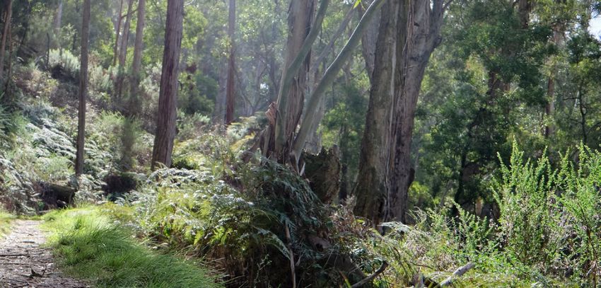
6   Bushfire Management Strategy

    Victoria’s ‘shared responsibility’ approach           guarantee that bushfires will be consequence-free
    recognises that communities:                          for the community. Communities and individuals
    • are best-placed to understand and mitigate          have the responsibility to prepare their own plans,
      their risks and drive preparedness and recovery,    properties and assets to reduce the impact of
      including through their fundamentally important     bushfires. During major bushfires with far-reaching
      volunteer contribution                              consequences, land and fire agencies may not
                                                          always be able to coordinate and deliver the
    • have knowledge, expertise, capability and diverse
                                                          support the community may expect.
      perspectives to work with agencies to mitigate
      bushfire risk
    • have networks and relationships that help
                                                          Recognising the role of Victoria’s
      agencies identify and protect the things            Traditional Owners
      communities value, improve their capacity and
      create meaningful, sustainable solutions.           The Grampians region recognises the Victorian
                                                          Traditional Owner Cultural Fire Strategy, which
    The shared responsibility approach seeks to ensure:   aims to re-establish cultural fire with Traditional
    • the interests, values and expectations of           Owner led practices across Victoria, so Traditional
      stakeholders in, or members of, communities         Owners can heal Country and fulfil their rights
      are understood and considered in the planning       and obligations to care for Country. The Victorian
      process                                             Traditional Owner Cultural Fire Strategy provides a
                                                          set of principles and strategic priorities to facilitate
    • ownership of the planning process and
                                                          greater self-determination for Traditional Owners
      responsibility for implementing strategies are
                                                          and a framework for effective Traditional Owner-led
      broadly shared.
                                                          cultural fire management in Victoria. The strategy
    Shared responsibility does not mean equal             has an important role in informing the Joint Fuel
    responsibility: there are some areas where land       Management Program (JFMP) in consultation with
    and fire management agencies are better-placed        individual Traditional Owner groups. Traditional
    and have more resources and information to            Owners emphasise that cultural fire is applied to
    make decisions and act on them. Equally, while        achieve culturally meaningful objectives, but that
    agencies develop plans and implement programs         risk reduction is often a complementary outcome.
    for mitigation, planning, preparedness, response
    and recovery, governments or agencies cannot

    Photo credit: DELWP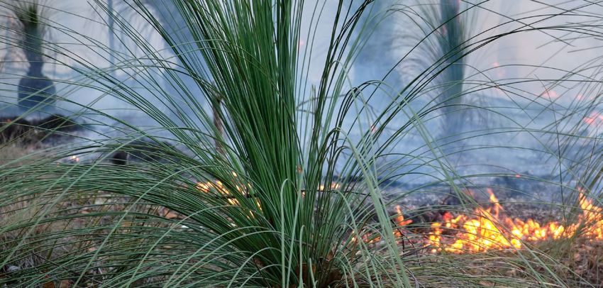
Grampians   7

Bushfire management planning

                                    Strategic planning
                  Considers                           Focuses activity like planned burning
                  long-term timeframes                and mechanical works in the most
                  (10-40+ years)                      effective places to reduce bushfire risk

                  Large geographic
                  scales                                Output = Bushfire Management Strategy

                              Operational planning
                                                      The Joint Fuel Management Program identifies
                  Medium term                         many fuel management activities – planned burning
                  time frames                         and mechanical works – within the strategy area

                  Determines how
                                                      Output = Programs of planned burns,
                  the strategy will be
                                                      mechanical works and engagement
                  implemented to
                                                      over one to three years
                  contribute to the
                  strategic objectives

                                     Tactical planning
                       Short timeframes across                        Output = detailed output
                       small land units                               about how a burn or
                                                                      activity will be conducted
                                                                      to meet objectives.

                       Describes how an individual burn
                       or fuel management activity will
                       be implemented to meet objectives
                       eg. lighting patterns, ignition time,
                       fuel moisture parameters

Figure 1.   Bushfire management strategic, operational and tactical planning for fuel
            management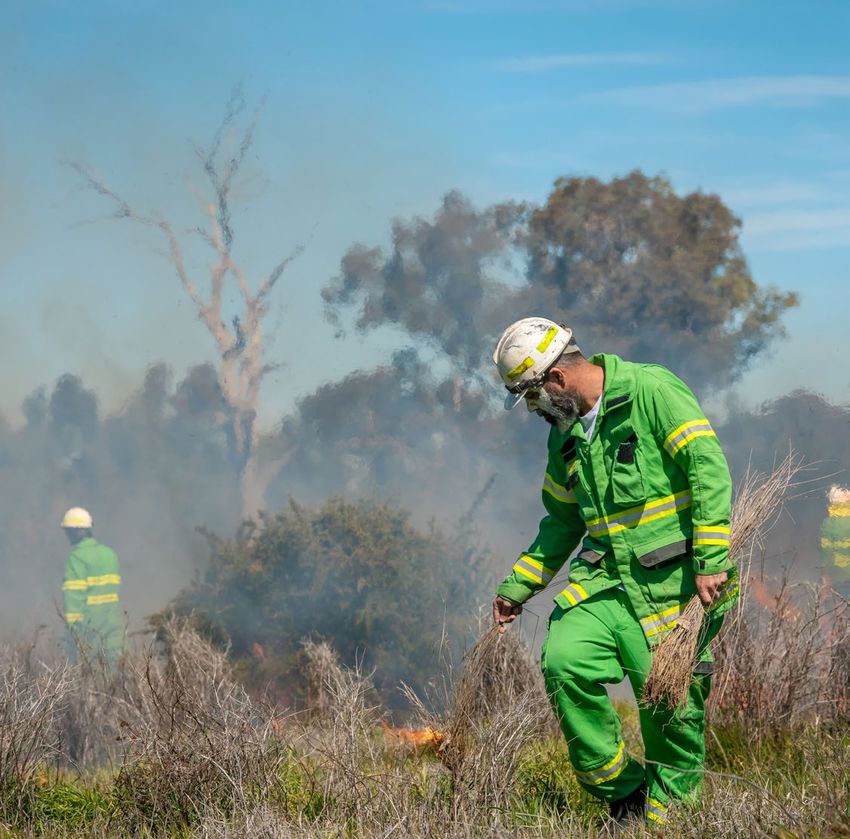
8   Bushfire Management Strategy

    Bushfire management planning occurs at different         eight regional emergency management plans.
    levels, with varying time frames, focuses and            In combination with the municipal emergency
    outputs. Figure 1 shows fuel management planning         management plans, these provide for an
    at strategic, operational and tactical levels.           integrated, coordinated and comprehensive
                                                             approach to emergency management. The Act
    Strategic planning                                       also requires emergency management plans to
                                                             contain provisions providing for the mitigation of,
    The strategic planning process identifies where          response to and recovery from emergencies and
    important values and assets are located across           to specify the emergency management roles and
    the landscape. It considers the current extent and       responsibilities of agencies
    quality of these values and where possible considers   • the Conservation Forests and Lands Act 1987,
    future trends including population, industry and         which requires the Department of Environment,
    environmental change. Strategic planning identifies      Land, Water and Planning (DELWP), through
    objectives for the important values and assets,          the Code of Practice for Bushfire Management
    and develops an approach to manage the risks             on Public Land (2012), to develop a risk-based
    posed to them. The resulting bushfire management         approach to bushfire management on public
    strategies describe landscape zones that focus           land. This document meets the requirements set
    fuel management activities to deliver bushfire risk      out in the Code of Practice to prepare a strategic
    reduction and ecological outcomes.                       bushfire management plan.
    Strategic bushfire management planning takes           • Safer Together: A new approach to reducing
    place within a legislative and policy context which      the risk of bushfire in Victoria (2015), a Victorian
    includes:                                                Government policy, focuses on how effective
                                                             our actions are in reducing risk and not just the
    • the Emergency Management Act 2013, which               amount of activity we undertake.
      requires from 1 December 2020 the Emergency
      Management Commissioner to prepare a state
      emergency management plan and to approve

    Photo credit: Steffen Schultz
Grampians 9
Operational and tactical planning Other bushfire management
This bushfire management strategy informs the actions
development of operational plans, primarily the
This bushfire management strategy outlines our
Joint Fuel Management Program (JFMP). The JFMP
risk-based approach to fuel and ecological fire
is the three-year rolling statewideprogram of fuel
management. However, fuel management is not
management works on public and private lands
the only bushfire management action that reduces
carried out by Forest Fire Management Victoria
bushfire risk and is not always the most effective
(FFMVic) and Country Fire Authority (CFA) to reduce
action to reduce that risk. Fuel management needs
bushfire risk and to maintain the health of native
to be supported with other actions for a number of
plants and animals that rely on fire to survive.
reasons:
Works include planned burning, slashing, mowing
and clearing works, creating and maintaining • Some parts of the landscape have inherently high
fuel breaks, and carrying out maintenance on fire levels of bushfire risk which requires more actions
infrastructure (like fire dams and lookout towers). to reduce that risk
• The ability to reduce risk through fuel
This strategy does not directly address tactical management may be limited in some landscapes
(burn) planning, which is done for individual burns. and there will always be fuel re-accumulation
Tactical planning can include individual burn
• The effectiveness of fuel management may be
objectives, community engagement plans and how
reduced under extreme weather conditions
the burn will be delivered safely.
• Fuel management reduces fire behaviour, it does
not eliminate bushfire. Suppression activities are
always required to control bushfires
Table 1 lists some key actions that agencies and
communities undertake together to manage
bushfire risk and complement our fuel management
approach.
As with fuel management, these actions are
guided by bushfire risk analysis combined
with other information to ensure they are most
effective. Strategies and plans for these actions
are developed through emergency management
planning processes by agencies at the state,
regional and municipal levels.10 Bushfire Management Strategy
Table 1. Bushfire management approaches beyond fuel management
Approach Key actions
Reduce • Education and advertising campaigns (e.g. campfire safety, reporting ignitions)
bushfire • Coordinated, risk-based patrolling
ignitions
• Deterrence for deliberate or negligent ignition – laws/prosecution
through
prevention • Monitoring arsonists
activities • Restrictions – fire danger period and total fire ban triggers, duration and restrictions
(including legislative change)
• Reducing ignitions from powerlines
Increase the • Fire detection (towers, aerial surveillance)
effectiveness • Resourcing, capacity and capability of fire-fighting resources (fire crews, contractors,
of fire incident management teams)
suppression
• Aircraft fleet management: type, distribution, availability and pre-determined dispatch
• Road infrastructure including maintenance of the strategic fire access road network
and network of fuel reduced areas.
• Other fire response infrastructure maintenance including remote water access and
helipads
• Fire readiness including rostered and pre-formed Incident Management Teams and
fire crews
Reduce • Planned burning based on tenure-blind risk
bushfire • Strategic breaks and burn unit boundary standards
spread and
• Flexible delivery of burning (e.g. managed bushfire, unbounded burns)
severity
• Other forms of fuel management (e.g. slashing, spraying, mulching) particularly in
high-risk areas where planned burning is not suitable
• Identify and effectively manage fuel hazard reduction on private bush
Reduce the • Domestic property preparedness in towns, including fire prevention notices, penalties
physical and cost recovery
effects of • Vegetation management on public and private land within or immediately bordering
bushfires in towns including implementation of fire prevention notices
inhabited
• Identification, prioritisation and treatment of risk to critical infrastructure
areas
• Access and egress (roadside vegetation/tree maintenance) pre- and post-fire
• Asset protection (on-ground)
Reduce • Bushfire education programs targeting vulnerable communities including those with
the social identified at-risk or changing demographics, and/or where bushfire risk cannot be
effects of effectively reduced through planned burning.
bushfires on • Recovery planning and relationship building pre-bushfire (e.g. via community groups,
communities scenario events and activities)
• Municipal bushfire plans
• Warnings and advice messaging
• Personal and neighbourhood bushfire plans
Reduce • Community engagement about fire management and smoke impacts
impacts • Planning to minimise impacts on biodiversity, cultural heritage and other values
from fire
• Connections between planning and delivery (e.g. on-ground staff aware of
management
biodiversity/cultural sites and mitigation actions)
actions
• Cross-tenure planning and consultation
• Monitoring effectiveness of mitigations (and subsequent improvement)Grampians 11
• our Bushfire Risk Engagement Areas (BREAs),
About this bushfire which focus on targeted community engagement
management strategy to complement, inform and drive fuel
management and other risk mitigation activities
Victorian landscapes, environments and on public and private land.
communities are diverse and multifaceted, and
Victorian communities have diverse values, The strategy is a supplement to the Grampians
preferences and priorities. This regional bushfire Regional Strategic Fire Management Plan,
management strategy reflects our region’s unique developed by the Grampians RSFMPC, and applies
environments and communities. To develop this to the same Grampians emergency management
strategy, we undertook a regional planning process region footprint. The plan’s agreed vision, strong
that was guided by the knowledge and priorities leadership and greater cooperation between
of experts, stakeholders and community members agencies promotes greater community resilience
from Grampians region. through effective engagement and best-practice
integrated fire management planning.
Between November 2017 and September 2019,
representatives of CFA, DELWP, Parks Victoria, Regional emergency management plans and
Emergency Management Victoria and local municipal emergency management plans are being
governments engaged in a strategic bushfire risk prepared in line with the new amendments to the
management planning process. The process was Emergency Management Act 2013. This strategy will
guided by the Grampians Regional Strategic Fire help inform the bushfire components of these plans,
Management Planning Committee (RSFMPC), now and into the future.
through the regional Safer Together Coordinating
For the purpose of the Code of Practice for Bushfire
Committee and Working Group. They offered
Management on Public Land (2012), the FFMVic
opportunities to stakeholders and the broader
Chief Fire Officer has approved the public land
regional community to be involved in the planning
components of this strategy: specifically, where the
process through both in-person and online
strategy relates to state forests, parks administered
mechanisms.
under the National Parks Act 1975 and protected
Our bushfire management strategy focuses on: public land. These components of the strategy
will directly guide FFMVic’s fuel management
• reducing the risk of bushfires threatening lives,
operations. This strategy replaces the former
homes, the environment and other important
Strategic Bushfire Management Plans for public
values and assets across the landscape
land, published by DELWP and PV in 2014 and 2015,
• maintaining or improving the resilience of which used bushfire risk landscape footprints.
ecosystems
• establishing a shared understanding of bushfire
risk across the sector, based on the latest
science and the extensive knowledge of agency
personnel
• using a 40-year horizon, so long-term ecological
changes and fuel accumulation rates can be
considered in annual operational planning
processes.
The strategic planning process resulted in two
strategies to reduce bushfire risk and maintain
ecosystem health: together, they comprise this
strategy — the Grampians Bushfire Management
Strategy 2020.
The individual strategies are:
• our fuel management strategy, which focuses on
reducing bushfire fuels through planned burning
and mechanical works (mowing and slashing) on
public land
Photo credit: DELWP12 Bushfire Management Strategy
Method overview Identifying and assessing risk to
This document presents the outcomes of the values and assets
strategic bushfire management planning process.
The planning process identified values and assets
The planning process involved considerable across the region and modelled the impact
community engagement — with individuals, bushfires and fuel management would have on
private land managers, businesses, community them. Values are the ultimate durable reasons we
organisations and other stakeholders — to tap into care about managing bushfires, and assets are
their knowledge, understand their priorities, discuss the physical sites that represent these values. For
and evaluate options with them and prepare to example, we value native species, and the locations
involve them in implementing the strategy. of their populations and habitat are the assets we
protect to ensure their continued existence.
In the planning process, we:
To identify the region’s most important values and
• identified the values and assets that are most
assets, we consulted with our partners, stakeholders
important to the residents of and visitors to
and communities, and we drew on specialised data
the region: we grouped these into human
sets including the Victorian Fire Risk Register –
life, economy – industries and agriculture,
Bushfire (VFRR-B) and Victorian Biodiversity Atlas.
infrastructure, nature and heritage
• developed regional objectives: the things we want We used Phoenix RapidFire, which is world-leading
to achieve by implementing the strategy bushfire simulation software developed in Victoria,
• combined local knowledge, bushfire behaviour to model the spread of a bushfire from an ignition
modelling, historical data and the best-available point under the specified weather conditions. This
science to understand how bushfires behave enables us to understand the impact bushfires
in our region and to forecast bushfire and fuel could have on people, homes and other important
management strategy impacts on our most values and assets in our landscape. We modelled
important and at-risk values and assets ignitions and bushfire spread patterns at thousands
of places throughout the region:
• developed and evaluated many potential strategies
to select two — our fuel management strategy • using ignition likelihood models based on
and the Bushfire Risk Engagement Areas (BREAs) historical ignition characteristics and patterns
— that will enable agencies and communities to • using the bushfire characteristics information in
best mitigate bushfire risk to the region’s most the ‘Bushfire history and patterns’ section
important and at-risk values and assets. • under a range of bushfire weather conditions,
including Code Red conditions: a Forest Fire
The planning process was underpinned by the
Danger Index (FFDI) rating of 130 or above. These
International Standard for Risk Management ISO
were the conditions in many parts of the state on
31000. The standard acknowledges that risk can
Black Saturday 2009, and conditions were similar
never be completely eliminated. Bushfires will still
at times during the 2019–20 fire season. Code
occur, and we must all be prepared and ready to
Red conditions are also forecast to become more
respond. However, bushfire risk can be reduced with
frequent and more extreme with climate change.
a high-quality risk management approach.
We also used a new 20-year historical weather
The planning process followed the principles
dataset for Victoria to identify recent changes to
of structured decision making (SDM). SDM is a
the state’s climate and so we could better model
framework that helps people unpack complex
the average frequency with which various weather
decisions, navigate trade-offs and make logical
scenarios occur. This provided some indication of
and transparent choices. It provides a means of
the likelihood of these scenarios occurring in future.
bringing together both scientific information and
We also partnered with climate scientists to forecast
human values to make decisions, through analysis
various climate conditions relevant to bushfires
and inclusive deliberation. The principles of SDM
which will inform future strategic bushfire risk
are particularly useful in decision-making contexts
management planning and preparedness decisions.
characterised by uncertainty, multiple stakeholders
and competing objectives. Broadly, the SDM steps Core measures we used in our planning process
involved included understanding the landscape to predict ecological responses to fire included
context, setting objectives, identifying possible potential changes to the tolerable fire interval (TFI)
management strategies, and estimating and and geometric mean abundance (GMA) of species
analysing the consequences and inherent trade- in a community. We also considered high value
offs of these strategy options. We then selected the ecological areas as part of developing, evaluating
strategy that gives the greatest benefit to the things and selecting bushfire management strategies.
we care about, while balancing the impacts of fuel
management actions on those same values.Grampians 13 Vegetation recovery after fire. Photo credit: Glenn Rudolph
14   Bushfire Management Strategy

     Our landscape context
     The Grampians region is the second-largest region in Victoria, covering an area of
     approximately 20 per cent (4.6 million ha) of the state (Figure 2). The region is bounded
     by the South Australian border to the west, the Loddon Mallee region to the north-east,
     the Metropolitan region to the east and the Barwon South West region to the south. The
     region is home to 4% of Victoria’s population, and it encompasses the local government
     areas of Ararat, Moorabool, Ballarat, Northern Grampians, Golden Plains, Pyrenees,
     Hepburn, West Wimmera, Hindmarsh, Yarriambiack and Horsham. The public land estate
     comprises 21.6% of the regional footprint. The major industries are health care and social
     assistance, agriculture, education and training and retail trade (including tourism).
Grampians 15
Photo credit: DELWP
Figure 2. The Grampians region with local government boundaries and public land tenure16 Bushfire Management Strategy
Local government profiles
Ararat Rural City Hepburn Shire
(population 11,795) (population 15,330)
Ararat is located in the northern area of the Approximately 45% of the shire’s population is
municipality, which also includes the settlements scattered through numerous small townships,
of Pomonol, Elmhurst, Moyston, Warrak, Buangor, hamlets and rural localities, which are often in
Maroona, Mininera, Wickliffe, Lake Bolac, Westmere forested or semi-forested environments. Many low-
and Streathem. The hills extending north and density residential developments have resulted in
west of Ararat have retained areas of remnant significant areas of privately-owned forest. The shire
vegetation identified as being of high and very high has many areas of high-quality soils, which provide
conservation significance including the Ararat Hills the base for important horticultural and cropping
Park and other state parks. The north-eastern area activities. Areas of poorer-quality soils have not
of the municipality contains the Langi Ghiran, Mount been cleared for agriculture and much remains as
Cole and Mount Buangor State Parks and scattered Crown land. The forests are used for firewood and
rural settlements. The Grampians National Park minor forest produce, beekeeping, water-catchment
extends across the north-western corner of the protection, outdoor recreation activities and flora
municipality. and fauna conservation. The shire is renowned for
its mineral springs, with over 72 known in the region.
The population of the Daylesford–Hepburn corridor
City of Ballarat increases greatly during weekends and holiday
periods, as it is a very popular tourist destination.
(population 107,325)
Ballarat is one of Australia’s largest inland cities and
the third largest city in Victoria. The City of Ballarat Hindmarsh Shire
municipality covers an area of 740 square kilometres (population 5,741)
and includes the outlying townships of Buninyong,
Miners Rest, Learmonth and Cardigan Village. Due to The four largest settlements in the shire are Nhill,
being located centrally in Western Victoria, Ballarat Jeparit, Dimboola and Rainbow. The shire’s major
services a large regional population. The municipality industry is agriculture. Many of the businesses in these
includes several parks, reserves and forests including; settlements are highly connected to the agricultural
Woowookarung Regional Park, Mount Buninyong State sector. Jeparit and Nhill experience an increase in
Reserve, Glen Park State Forest, Nerrina Heritage Area population from spring through to autumn. The shire
and a section of Creswick State Forest. contains large portions of two national parks — Big
Desert National Park and Wyperfeld National Park —
as well as other reserves scattered across the shire.
Golden Plains Shire Lakes Hindmarsh and Albacutya and the shire’s other
wetlands and rivers are home to a range of birdlife.
(population 23,120) Lake Hindmarsh also provides many recreational
opportunities, and when the lake contains water it is a
The shire is predominantly rural, with several key spot for locals and visitors to camp.
small settlements servicing local communities
between Ballarat and Geelong. The shire covers
an area of 2,703 km2, and includes the settlements Horsham Rural City Council
of Bannockburn, Dereel, Gheringhap, Lethbridge,
Linton, Berringa, Teesdale, Rokewood and Meredith. (population 19,642)
The shire is the fifth-fastest-growing municipality
Horsham has a population of about 14,543 people,
in regional Victoria, and many residents work in
with the remainder of the population scattered across
Ballarat or Geelong. The shire’s economic base is
the municipality in smaller localities. This municipality
provided through agriculture, retailing, construction
provides a connection between the northern section
and manufacturing. Agriculture is responsible for
of the Grampians National Park, the end of the Great
$144 million worth of output annually, and it employs
Dividing Range and the Little Desert National Park,
25.6% of the shire’s workforce. The main industries are
which abuts the northern boundary. Mt Arapiles-Tooan
agriculture (wool and grain growing, intensive poultry
State Park, Jilpanger Nature Conservation Reserve,
and pig farming), construction and wine-making.
Black Range State Park and Rocklands Reservoir are
also located within the municipality. There are numerous
smaller state forests and nature conservation reserves
scattered throughout and many private bushland blocksGrampians 17
and vegetated roadsides and corridors. The heritage- Pyrenees Shire
listed Wimmera River is the dominant feature of the
municipality, with several smaller rivers and creeks (population 7, 353)
joining it before or close to Horsham. Yarriambiack
Creek is sourced from the Wimmera River upstream The shire includes the towns of Avoca, Beaufort,
of Horsham. Connected to this intricate system of Lexton and Trawalla, and boasts several significant
waterways are a number of recreational lakes. Some are flora and fauna species including Mt Cole and
part of the water management system serving towns Ben Major Grevillea, Legless lizard, 200 species of
and farms in the region. Others are naturally filled lakes protected grasses, White gums and Platypus. The
and swamps that are seasonal. These sites provide a municipality has many state parks, forests and
range of opportunities (such as camping, skiing, hunting reserves. These include Pyrenees Range State Forest,
and fishing) for people. The main season for many of Landsborough Nature Conservation Reserve, Mt Cole
these activities is spring and summer, when the seasonal State Forest, Langi Ghiran and more. There are over
population increases in the area. 50 wind turbines within the shire’s boundaries, with
almost another 200 planned for construction in the
shire. Agriculture is the shire’s main industry, with
81% of land use in the region devoted to agricultural
Moorabool Shire production.
(population 32,311)
Moorabool Shire is a semi-rural municipality nestled West Wimmera Shire
between Melbourne, Geelong and Ballarat. The shire
includes the towns of Bacchus Marsh, Blackwood, Ballan (population 3,903)
and Gordon. Surrounded by State parks and forests the
shire is rich with hiking trails, heritage sites, luscious food Rural land use comprises over 80% of total land use in
and wine, parks and gardens. Seventy-four percent of the shire, with less than 3% used for business, industrial
this shire is water catchment, state forest and national or residential purposes. The main settlements are
park including Lerderderg State Park, Wombat State Edenhope, Kaniva, Harrow, Goroke and Apsley, and
Forest, Brisbane Ranges National Park and Werribee smaller settlements include Serviceton, Chetwynd,
Gorge State Park. The shire is environmentally diverse, Dergholm, Lillimur and Miram. The major waterway is
and its topography is characterised by great ranges, the Glenelg River, which is located in the south of the
plains and rugged river gorges. Some of the many shire. The major land use across the shire is agriculture.
reservoirs in the shire are the Lal Lal, Bostock, Pykes The shire is divided in two by the Little Desert National
Creek, Moorabool and Korweinguboora reservoirs. The Park, which separates the Red Gum grazing plains
shire also includes three major rivers: the Werribee, from the sandy Mallee vegetation. There are a number
Lerderderg and Moorabool rivers. of other public land forests and reserves scattered
throughout the shire, mainly consisting of brown
stringybark vegetation associated with the poorer
soils. A large number of naturally filled wetlands are
Northern Grampians Shire scattered across the southern section of the shire,
(population 11,845) providing a range of recreational opportunities and
significant environmental assets.
The shire lies on the north-east side of the Grampians
National Park and is situated between the rural cities of
Ballarat, Bendigo and Horsham. The main population
centres include; Stawell, St Arnaud, Great Western Yarriambiack Shire
and Halls Gap. During peak tourism periods and (population 6,674)
major events, the visitor population often exceeds the
permanent population. The Grampians National Park, in Rural land use comprises over 90% of the shire,
particular, experiences a large number of both domestic and less than 3% is used for non-agricultural
and international visitors over the summer period. The business, industrial or residential purposes. The
Grampians National Park (Gariwerd) is also one of main population centres of the municipality are
the richest Aboriginal rock-art sites in south-eastern Warracknabeal, Murtoa, Hopetoun, Minyip, Rupanyup,
Australia. The municipality covers some 590,000 ha of Woomelang and Beulah. There are a number of small
a wide range of land types, from steep, mountainous, farming communities located throughout the shire,
forested country to flat grazing and cropping lands. The which produces one quarter of Victoria’s total grain
settlement of Halls Gap contains large areas of privately production (predominantly wheat and barley) and
owned remnant vegetation. The municipality contains is also noted for its production of lamb and wool. In
several endemic flora species, including the Pomonal recent years, the shire has also become rich in oilseed
Leek Orchid. The main watercourse is the Wimmera and legume crops. Areas of poorer-quality soils have
River, and there are a number of water storages not been cleared for agriculture, and much remains
including Lake Wartook, Lake Fyans, Lake Bellfield, Lake as public land. Floristically rich, these localities are
Lonsdale and Teddington Reservoir. prized habitats for native fauna. The forests are used
for beekeeping, water-catchment protection, outdoor
recreation activities and flora and fauna conservation.18 Bushfire Management Strategy
hectares and approximately 47% of the Grampians
Bushfire history and patterns National Park. Since 2006, Grampians National Park
The largest 2% of fires that have been recorded has experienced another 2 large scale fires, both
within the Grampians region are shown in Figure 3. caused by lightning. These 3 fires have impacted
Larger fires have occurred routinely at two locations roughly 85% of the Grampians National Park and
in the Grampians region: the Big Desert and the have had significant impact on communities,
Grampians National Park. This is likely due to these tourism and agriculture in the region.
landscapes being remote, challenging for firefighting
The eastern half of the Grampians region is where
and having high amounts of continuous vegetation.
the greatest bushfire risk sits, particularly for
Historically, south-western Victoria has suffered settlements in and around the Wombat State Forest
huge losses of property in bushfire events (such as and Lerderderg State Park, such as Daylesford,
the 1942 fires in the Western District that destroyed Trentham and Gisborne. In 1983, on Ash Wednesday,
over 500 houses), and bushfires have also had a fire claimed seven people’s lives in the Macedon,
a huge impact on the local pastoral industry. In East Trentham area. The fire reached a final size
recent years, there have been significant house of 29,500 hectares, destroying 157 homes and 628
losses from bushfires in the northern Grampians other buildings. Whilst fires of this size have not
and the Enfield area. occurred since, the potential consequence of large
fires in this area remains high.
Within the region, there are significant contrasts
between the bushfire history of different areas. The area south of Ballarat is also high risk, driven by
For example, there are no major fires on record in the Enfield State Park and surrounding state forest.
Yarriambiack Shire, whereas Hepburn Shire has This is due to the larger population that resides in
a record of building losses to bushfire. In the last these localities, as well as the number of settlements
10–15 years, there have been many major fires in located near forests.
the Grampians and Little Desert National Parks,
In the western half of the Grampians region, a larger
which are particularly prone to lightning ignitions.
number of property losses are likely to occur within
One example is the Mt Lubra fire which ignited by
settlements, due to the density of the population.
lightning in the Grampians National Park on the
The highest loss within this area is modelled to
20th of January 2006. The fire resulted in the loss of
occur in Halls Gap, due to the density of population
3 lives and hundreds of buildings. Over a two-week
and its location within the Grampians National Park.
period, the Mt Lubra fire had burnt over 127,000Grampians 19
Figure 3. Bushfire history for the Grampians region, 1980–2019
The Mt Lubra bushfire burnt 47% of the
Grampians National Park in 2006 and
resulted in the loss of 3 lives.
Photo credit: Glenn Rudolph20 Bushfire Management Strategy
Critical infrastructure values
Values and assets
The Grampians region includes several critical
Here we describe the most important features of
infrastructure values that have a higher risk
our landscape that informed our strategy.
of impact from bushfire. They include Ballarat
University and Technology Park, the State Library
Human landscape Storage Facility and several communications towers
(such as those on Mount Cole and Mount William)
Life and property (Figure 4).
The population of the Grampians region is about
214,600 people. The major population centres are
Ballarat, Horsham, Bacchus Marsh, Ararat, Stawell,
Daylesford, Hepburn and Beaufort. Parts of the
region experience a significant influx of tourists
over weekends and holiday periods, particularly
Daylesford, Hepburn Springs, Halls Gap and the
Grampians National Park.
Figure 4. Critical infrastructure, assets, systems and networks in the Grampians regionGrampians 21 Economic values The Grampians has different economic characteristics across the region including mineral resources, dryland farming, service industries and manufacturing. Agriculture is a major land use in the region, and over half of Victoria’s grain is grown in Yarriambick Shire. The Daylesford – Macedon corridor and Halls Gap are major tourism centres on weekends and during holiday periods. Horticulture and viticulture are important industries, especially in Hepburn Shire (Figure 5). Figure 5. Generalised land use in the Grampians region
22   Bushfire Management Strategy

                                                               A Wimmera Co-operative Management Agreement
     Aboriginal cultural heritage                              was formalised in 2005. This agreement is between
     The Registered Aboriginal Parties in our region           the State and the Wotjobaluk, Jaadwa, Jadawadjali,
     (Figure 6) are:                                           Wergaia and Jupagalk Traditional Owners, with
     • Barengi Gadjin Land Council Aboriginal                  Barengi Gadjin Land Council Aboriginal Corporation
        Corporation                                            as the representative body. The agreement
                                                               established the Winyula Council to advise the
     • Gunditj Mirring Traditional Owners Aboriginal           State on the management of those lands. The
       Corporation                                             relationship is now maintained directly between
     • Eastern Maar Aboriginal Corporation                     Barengi Gadjin Land Council Aboriginal Corporation
     • Dja Dja Wurrung Clans Aboriginal Corporation            and PV. Co-managed lands under this agreement
     • Wathaurung Aboriginal Corporation                       include: Lake Albacutya Park, Lake Hindmarsh Lake
                                                               Reserve, Little Desert National Park, Mount Arapiles-
     • Wurundjeri Woi Wurrung Cultural Heritage                Tooan State Park, Wimmera River Heritage Area
       Aboriginal Corporation.                                 Park and Wyperfeld National Park.
     Well-known Aboriginal sites in the region include         In the Grampians Region, Kara Kara National Park
     Langi Ghiran; Lal Lal Falls, believed to be the earthly   and Hepburn Regional Park are jointly managed
     home of Bunjil, the Creator to most Victorian             with Dja Dja Wurrung under a Recognition and
     Aboriginal groups; and Taylors Rock in the Mt             Settlement Agreement. The agreement also covers
     Arapiles-Tooan State Park. The Grampians National         joint management of other parks extending into
     Park (Gariwerd) is one of the richest Aboriginal rock-    the Loddon Mallee region. Joint management is
     art sites in south-eastern Australia. In addition, the    overseen by the Dhelkunya Dja Land Management
     region has many Aboriginal cultural heritage sites        Board. Hepburn Regional Park encompasses
     including ceremonial gathering places, burial sites,      Mt Franklin, one of the most significant cultural
     scar trees and artefact scatters.                         heritage places in Victoria.

     Figure 6.    Traditional Owner groups in the Grampians region
Grampians 23
Lal Lal Falls, believed to be the earthly
home of Bunjil, the Creator to most
Victorian Aboriginal groups.
Photo credit: Josh Bushell24 Bushfire Management Strategy
Native vegetation in the eastern side of the region
Natural landscape has been highly disturbed and fragmented in many
The region’s 1.052 million ha public land estate is areas, particularly during the Gold Rush from 1851
comprised of a network of parks, reserves and state to the late 1860s as well as from grazing, cropping,
forest, which is built upon the national criteria for timber harvesting and urban development. During
a comprehensive, adequate and representative the Gold Rush, many forests right across the
(CAR) reserve system of Australia’s forests (Figure 7). goldfields underwent intensive digging and clearing,
The forests and parks in the region are diverse and accompanied by extensive timber cutting for
include heath desert in the west, rocky outcrops in infrastructure and firewood.
the Grampians National Park, fragmented forests
south of Ballarat and wetter forests near Macedon.
Parks and reserves are primarily managed for
nature conservation, ecosystem services and
recreation. State forest is managed for a greater
diversity of purposes including biodiversity
conservation, water catchment services, timber
harvesting, firewood production, minor produce
and apiary use. Recreation and tourism are also
an important and increasingly popular use of
state forest, with many active and passive pursuits
commonplace across the Grampians region.
Photo credit: Steffen SchultzGrampians 25
Figure 7. Native vegetation by land tenure in the Grampians region
Photo credit: Steffen Schultz26 Bushfire Management Strategy
South-eastern Red-tailed Black-
Cockatoo
The South-eastern Red-tailed Black-Cockatoo important for the health of the highly flammable
is a rare, large, nomadic cockatoo found only in stringybark woodlands: bushfires are common and
south-west Victoria and south-east South Australia. the vegetation’s reproductive cycle depends on
The Victorian and Commonwealth governments fire. However, fire damage to the tree canopy (or
recognise it as threatened, and it is one of Victoria’s crown) also reduces (for about 10 years) the amount
most fire-sensitive fauna species. A national of seeds stringybark trees produce, reducing
recovery team, formed in 1997, coordinates the the cockatoo’s food source. This is particularly
management and recovery of the cockatoo. DELWP important during breeding season, when the
has actively participated in this team since its species’ food requirements are highest. This balance
inception. of limiting crown scorch in stringybark forests from
planned burning operations whilst reducing the risk
The cockatoo is mainly restricted to stringybark
to other assets and maintaining an appropriate
woodlands where it relies on the seeds of Brown
amount of fire for the forest’s ecological health
stringybark and Desert stringybark for food. The
difficult, and one that will be addressed as part of
extent of buloke clearing in the past is an important
the planning process.
aspect of this reliance on stringybark seed for feed,
as buloke is also an important food source. Fire is
Image 1. The South-eastern Red-tailed Black-Cockatoo
is an endangered species found in south-west
Victoria, and it is of cultural significance to
Traditional Owners
Photo credit: Michael SvernsGrampians 27
Greater Glider
The arboreal Greater Glider is found in the wetter Adverse effects on Greater Glider populations
forest within the Wombat State Park. Although subjected to fire can occur due to direct, short-
once considered common, Greater Gliders have term mortality effects and loss of the canopy food
undergone substantial recent declines and are source, as well as longer-term effects on habitat
now listed as threatened under the Flora & Fauna structure and ecosystem function. Both planned
Guarantee Act 1988 (Vic) and Vulnerable under and unplanned fires of relatively low intensity can
the Environment Protection and Biodiversity lead to accelerated collapse of hollow-bearing
Conservation Act 1999 (C’th). trees, which are a key habitat resource for Greater
Gliders. The incorporation of pre-, during, and post-
burn measures to reduce the risk of these impacts
can assist the species resilience in this forest.
Image 3. The Greater Glider is a threatened species
found in the Wombat State Park.
Photo credit: Adam Whitchurch28 Bushfire Management Strategy
Our objectives
What matters most in the Grampians region is These values are the ultimate, durable reasons
discussed in the landscape context section and is why we care about managing bushfires, and they
summarised into the following fundamental values: are what we want to protect and manage through
• Human life bushfire management in the Grampians region.
• Economy The following regional objectives are derived from
• Infrastructure our values and articulate what we are aiming to
• Nature achieve in the Grampians region (Table 2). These
objectives contribute to the overall objectives for fire
• Heritage.
management articulated in the Grampians Regional
Strategic Fire Management Plan.Grampians 29
Photo credit: Glenn Rudolph
Table 2. Grampians region’s values and objectives and how they align with the statewide vision,
policy context and strategic objectives
Vision
Safer and more resilient communities
Policy context
The Victorian Preparedness Goal is A safer and more resilient community that has the capabilities to
withstand, plan for, respond to and recover from emergencies that pose the greatest risk.
The Safer Together policy’s four priorities for reducing the risk of bushfires in Victoria are Community first,
Land and fire agencies working together, Measuring success and Better knowledge = better decisions.
Strategic objectives (Code of Practice for Bushfire Management on Public Land)
• To minimise the impact of major bushfires on human life, communities, essential and community
infrastructure, industries, the economy and the environment. Human life will be afforded priority over
all other considerations
• To maintain or improve the resilience of natural ecosystems and their ability to deliver services such as
biodiversity, water, carbon storage and forest products.
Grampians region values
Human life Economy Infrastructure Nature Heritage
Grampians region objectives
Minimise loss of Reduce the risk of Minimise loss Maximise Maximise cultural
life and property economic drivers of community persistence heritage values
being impacted infrastructure of ecological
by bushfire communities and
speciesYou can also read