Land surface data assimilation at the Met Office and developments in snow depth analysis - LSA SAF
←
→
Page content transcription
If your browser does not render page correctly, please read the page content below

Land surface data assimilation at
the Met Office and developments
in snow depth analysis

Samantha Pullen
Breogan Gomez, Cristina Charlton-Perez,
Richard Renshaw, Brett Candy

Thanks to Patricia de Rosnay (ECMWF)

ISWG/LSA SAF Workshop
Lisbon, 26-28th June 2018

www.metoffice.gov.uk                      © Crown Copyright 2018 Met Office
Outline Met Office NWP systems Current Land Surface DA Developments for the regional model Soil moisture Snow depth (main focus) Snow observations Some of the issues Improving in situ reporting practice and exchange of data
Met Office NWP Systems
                                         Global
  Unified model       • ~10 km, 70 levels, forecast range to 7 days
(UM) coupled with     • Main and update runs 4x per day
   JULES land         • Main DA hybrid incremental 4D VAR
  surface model       • Variational bias correction of satellite radiance
                        observations
                      • Land surface DA – NH snow analysis, SEKF soil
                        moisture, from screen errors in RH and T and
                        ASCAT soil wetness.
                      • Ancillary daily update of aerosols, ozone, LAI

                                           UK
                      • Variable resolution 4 km down to 1.5 km, 70
                        levels, forecast range to 5 days
                      • Lateral boundary conditions from global model
                      • Hourly cycles
                      • Main DA incremental 4D VAR
                      • VarBC radiance obs
                      • No land surface DA as yet – soil moisture
                        interpolated from global model
                      • Ancillary daily update SST, Seaice, LAI/canopy
                        ht, murk sources, ozone
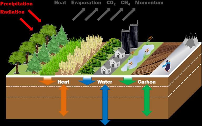
Land Surface Model: JULES
                                           Multi-layer snow module (Essery)

Tiled – sub-grid heterogeneity – fluxes
for each surface type:
                                          Prognostic snow variables:
5 Plant functional types:                     •Snow depth
      •Broadleaf trees                        •Snowpack bulk density
      •Needleleaf trees                       •Number snow layers
      •C3 grass
      •C4 grass                             Within layers:
      •Shrubs                                •Thickness
Plus:                                        •Ice mass
      •Urban (2 types)                       •Liquid mass
      •Inland water                          •Temperature
      •Bare soil                             •Density
      •Land ice                              •Grain size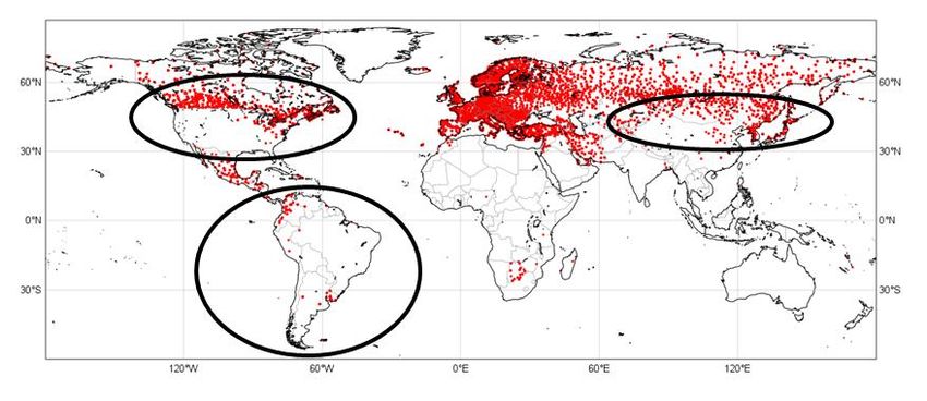
Current Land Surface DA
Soil Moisture Data Assimilation
1.5m Temp (gridded)
Simplified Extended Kalman Filter Soil Moisture Analysis
xib xib Ki yio Η i ( xb )
K i B T T B R 1
1.5m Hum (gridded)
Global analysis every 6h
Jacobians (H) estimated from
JULES model runs via finite
ASCAT soil wetness index differences
B and R matrices are diagonal and
homogeneous
JULES climatology used to fit SWI
to model soil moisture
Implemented 2013
UKV reconfiguration once a day
Reconfiguration into
UKV domain
Breogan Gomez, Brett Candy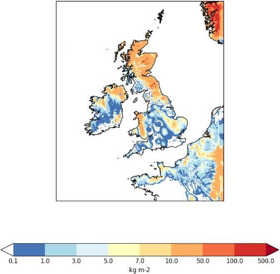
NH Snow analysis
A simple update scheme
NESDIS Interactive Multisensor Snow and Ice Mapping System Operational
(IMS) 2008
4 km, daily, vis/NIR/µwave/analyst, NH, operational, binary snow cover
Daily at
Model snow amount (kgm-2) from 6 hour forecast (0Z T+6) 6UTC
Calculate fractional cover per gridbox from IMS snow cover
Compare presence of snow in obs and model
Remove snow where obs snow-free and model snow-covered
Add snow where obs snow-covered and model snow-free – use
empirical relationship to relate fractional cover to snow amount
S
log 1 f
e c
D=masking depth of vegetation (0.2
m2kg-1)
D
Max. 10 kgm-2
Reconfigure into model to give 6Z T+0 snow amount (analysis)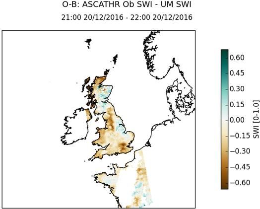
Developments for regional model
Soil moisture DA for the UK NWP system
Simplified Extended Kalman Filter
BUT Native UKV soil climatology not yet
available
1.5 m Temp (from 4DVAR)
B in SWI
1.5 m Hum (from 4DVAR)
O – B in SWI
ASCAT: Soil Wetness Index
Breogan Gomez, Cristina Charlton-Perez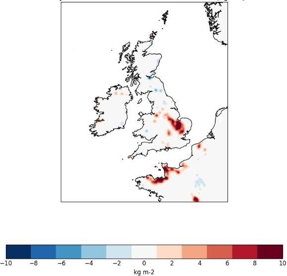
UK snow forecasting
The UK does not experience regular widespread snowfall except
in the Highlands of Scotland
Tends to be transient, often wet, shallow, multiple snowfall/melt
cycles in one season.
Low frequency, but high impact event – accurate analyses and
forecasts of snowfall and lying snow extremely important
Currently no snow observations assimilated in UK model (UKV)
Surface
temperature
biases
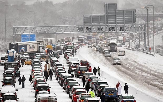
Chaos and disruptionSnow DA for the UK NWP system
Data source Snow depth values
Ground-based Synop W = (B + O)-1b
network
snow depth SD where reported
state of ground 0 m SD from snow-
(snow or no snow) free state of ground
reports
Horizontal correlation length
scale
(L = 5.5 km)
Satellite data
Vertical correlation length scale
0 m SD from snow- (h = 400 m)
snow cover from free pixels
Background error sdev
H SAF (MSG- (σb = 0.03 m)
SEVIRI) daily 0.05 m SD from
Synop observation error sdev
product snow-covered pixels (σo = 0.04 m)
where model snow-
HSAF observation error sdev
free (σo = 0.08 m)
Model first-guess
SD
Optimal
Interpolation Snow depth analysisTest case – observation innovations
17th December 2010
Black = snow-free
Observation innovations
(O – B)
Model SD at ob locations
(B)
Observations entering OI
(O)
Quality Control on O
Reject synop ob if observed Tstar >
278 K and obs snow depth > 1 cm
If multiple reports from same synop
station, use closest to 06Z
Reject satellite ob over mountains >
1500 mTest case – analysis increments
17th December 2010
Quality ControlAnalysis increments
on Increments
Max increment allowed = 37.5 kgm-2 (0.15
Background snow amount Analysed snow amount m)
Positive increment allowed only if model T*
< 281 K
Check for negative snow amounts
No increments on land ice, urban, inland
water tilesAssimilation experiments Case study snow event – snow poorly forecast by UKV November 2016 – 9-10th, excess snow depth and extent in UKV led to strong cold biases in overnight surface temperature minima. Add increments to lowest snow layer to preserve evolved snowpack characteristics as far as possible. Allow JULES to repartition the layers as a result of changes to the total snow amount Examine model output for first few timesteps of forecast run in order to examine model response to incremented snow amounts throughout the snowpack (multi-layer snow prognostic variables) Whole winter season assimilation trial Examine impact on atmospheric forecast variables – forecast RMSE, bias Particular focus on surface and near surface temperatures Validation against independent snow obs where possible Implement Winter 2018/19 (?) or 2019/20
Snow observations
Snow is hard to observe!
          Very heterogeneous on small scales
                                                                                           Currently the only source
                                                                                            of obs of snow amount
                                                                                           suitable for use in NWP

In situ observations of snow depth
high accuracy, snow amount info, (frequent, timely)
sparse coverage, non-representative, inconsistent reporting practice and data exchange, often no zero snow
Satellite-derived snow extent – optical sensors
lots of imagers, global coverage, high resolution, snow-free ground
affected by cloud, no info on amount of snow, limited in low light levels of winter high latitudes, forest

Satellite-derived snow water equivalent – passive microwave
global coverage, unaffected by clouds, snow amount info
can’t detect wet snow, thin layers, thick layers, low resolution, uncertainties high – improved by dynamic grain
size/density parameterisation

Global SWE from satellite identified as “key gap” in the observing system
(http://www.wmo.int/pages/prog/www/OSY/GOS-RRR.html#SOG)

                     Hard for any single snow dataset to fulfil requirements for NWP assimilation –
                     best approach may be to exploit the best features of a number of data sources
                                            to use in a complementary way.
In situ snow depth observations – improving reporting
practices and data exchange
In situ measurements of snow depth are of vital importance for global Numerical Weather
Prediction and are currently the only quantitative observation of snow depth of sufficient quality
for assimilation into operational weather forecasting models.
There is ongoing activity by GCW Snow Watch and COST HarmoSnow to improve the
reporting practices for in situ snow observations, to promote exchange of real-time observations
between member states, and to improve availability of in situ snow depth reports on the GTS.
3 key issues:
1. Many countries do not report snow routinely and consistently or make their observations
available in near-real-time.
2. Snow depth is often reported only when snow is present, with “missing data” used otherwise.
Active reports of zero snow depth provide extremely valuable data for assimilation in weather
forecasting models
3. Some countries have dense national (non-SYNOP) snow observing networks, which could
provide valuable data for global forecasting centres, but do not exchange these data in near-
real-time on the GTS
Following several years of activity, consultation with WMO Member States, and some iterations, a decision was
approved, at WMO EC-69 (May 2017), bringing in important changes to the global observing guidelines:
mandatory requirement - daily (at least) reporting of snow depth, including values of zero where snow is
not present, at all stations where snow is experienced, and the capabilities exist.
requested/encouraged – reporting of snow depth 4 times a day, and exchange of in situ snow reports in
real-time in BUFR on the GTSCourtesy of Patricia de Rosnay In situ snow depth observations
(ECMWF)
GTS Snow depth availability
SYNOP TAC + SYNOP BUFR + national BUFR data
2016 01 15 at 06UTC
National Networks
Snow data
Status on 10-15 December 2013Status on 10-15 December 2013
Additional data from national
networks from up to 7 countries:
Sweden, Romania, The Netherlands,
Status on 10-15 December 2017 Denmark, Hungary, Norway, Switzerland.
Dedicated BUFR for additional
- Improvement in China (since status in de Rosnay et al, ECMWF
national data
NL article 143, 2015)
- Expected improvement over the US (SHEF to BUFR conversion (de Rosnay et al. ECMWF Res.
needed) Memo, R48.3/PdR/1139, 2011)
- Slight improvement in South America(?)
- Overall upward trend since 2013
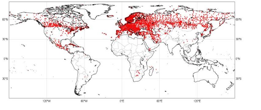
© ECMWFMore zero snow depth reports
Large increase in number of stations and
7th January 7th January
countries reporting values of zero snow 2017 2018
depth in the last year.
BUFR reports on GTS from synoptic network
with
snow depth = 0 m
0600 UTC 7th January: 2017 vs 2018
Promote changed guidance:
Work with NMS observing sections to raise awareness of
new guidelines, encourage adoption of recommended
reporting practice – it’s a cultural change (ongoing –
COST Action on snow: HarmoSnow very much aligned,
provides an excellent platform for promoting awareness
and encouraging action within Europe)
Provide evidence of value:
Use new observations - Impact studies by NWP centres
to show value of additional snow depth obs when they
become available
Long term – considerable increase in valuable observations of
snow depth for use in NWP and research applicationsSummary Met Office runs global and regional (UK) NWP systems Currently Land Surface DA in global model only Soil moisture EKF NH snow analysis LSDA for the UK model in development Soil moisture EKF Snow depth Optimal Interpolation Different sources of snow observations available – differing limitations In situ snow depth reports currently the only observations of snow depth/amount suitable for assimilation in NWP Efforts to improve in situ snow depth reporting practice and exchange of data Best approach for NWP may be to exploit the best features of a number of data sources to use in a complementary way
You can also read