MARINE SYSTEMS - MicroStep-MIS
←
→
Page content transcription
If your browser does not render page correctly, please read the page content below
COMPLEX SOLUTIONS FOR THE REAL WORLD

MARINE SYSTEMS
INTEGRATED MET-OCEAN MONITORING AND FORECASTING SYSTEM

                   MARINE MODELING
                      Tide Modeling          PORT OFFICE                                        Satellite Ground
                                             Central System                                     Station (Thuraya,
                     Tsunami Modeling                            MARINE FORECAST OFFICE           Iridium, etc.)
                     Oil Spill Modeling                               Forecasting Workstation
                     Current Modeling                                    Marine Observer
                    Wind Wave Modeling

                      CONTROL TOWER
                        Met-ocean Displays

                                                               All sensor's
                                                              data to media
                                                                converter

Multidirectional
   Antenna
EXPERTS IN MARINE MONITORING                                                                                                  CONTENT
Maritime industries such as shipping, dredging, fishing,   of development of marine and harbour systems, marine               Measurement and Monitoring Devices                           6
offshore oil and gas continue to grow in response to       surveys, software and hardware development, database
rising incomes and population growth. Newer sectors        and collection systems, modeling and forecasting, early               Third Party Sensors Integrated in our Systems             6
such as offshore deep-water oil and gas, renewable         warning systems. As a certified research organization we
energy, mariculture and seabed mining have begun           participade in various research projects results of which          Automatic Marine Station                                     8
to play a major role in the economy. The growth of a       assist our continuous product development.
sustainable global economy will be constrained unless                                                                         IMS4 Helideck Monitoring System                              9
we develop integrated systems for marine environment       Our core customer groups include, but are not limited
monitoring supporting efficient management of marine       to, marine operators, coastal management authorities,              Integrated marine Monitoring System                         10
resources.                                                 environmental agencies, meteorological departments and
                                                           offices of civil protection. To be able to respond better to the      IMS4 Unified Data Collection System                      10
Marine environment monitoring systems have to withstand    specific requirements and local conditions in each region,
complex and harsh operating conditions. Gathering          we have established several offices worldwide, including              IMS4 Integrated Environmental Database                   12
data from marine environment is both complex and           our Dubai office, MicroStep-MIS FZCO, specializing in
expensive operation. Our portfolio in this area consists   marine monitoring systems and solutions.                              Graphical User Interface | from Web to Smartphone Apps   14

                                                                                                                                 Marine Models and Forecasting Systems                    16

                                                                                                                              Marine Surveying and Habitat Mapping                        18

                                                                                                                              Marine Spatial Database and GIS Applications                20

                                                                                                                              Services for Marine Applications                            23

                                                                                                                                 24/7 Support Center                                      24

                                                                                                                               Marine Systems                                              5
Our portfolio consists

                                                             10+
    of development of marine
    and harbour systems,
    marine surveys, software                        supplied countries
    and hardware development,                          worldwide

    database and collection
    systems, modeling
    and forecasting, early
    warning systems.

             100+
            integrated marine
                 stations

6                          Marine Systems   Marine Systems               7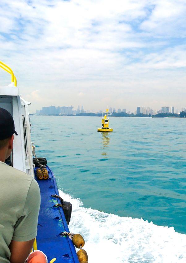
MEASUREMENT AND MONITORING
DEVICES
AMS 111 IV is the fourth generation of MicroStep-MIS              User can decide to configure the slave processor
data loggers. Now it is designed on modular platform              independently and to make not only measurement
which supports different main systems. Basic version              and communication with intelligent sensors, but also
is based on 32-bit CPU. AMS 111 IV mainboard includes             mathematical and statistical calculation independent on
ultra-low-power 32-bit CPU which allows connection to             the state of the main processor or system. This enables
more peripherals to optimize power consumption even               the design of systems with very low power or very high
with Linux based systems.                                         CPU capacity in one data logger.

THIRD PARTY SENSORS INTEGRATED IN OUR
SYSTEMS
Marine sensors can be divided into three main categories          to measure water currents and wave in estuaries shallow
in terms of measurement: sea level and tide, wave and             and deep sea water. The measurements from various
current, and last but not least, the water quality. The sensors   wave and currents sensors have minimal error due to buoy
use variety of approaches from non-contact to immersed,           movement, therefore the integratation of motion reference
acoustic wave and current profilers suitable for stable as        unit for correcting the measurements is possible.
well as the most adverse weather conditions.

                                                                  Water Quality Monitoring
Water Level and Tide Measurement
                                                                                                                                                                       DATA LOGGER
                                                                  The challenge to have accurate water quality data is the
We integrate several types of water level and tide sensors.       biofouling, therefore, we integrate probes with different
Submersible pressure transmitter is intended for very             biofouling control technology, such as mechanical wipers,            METEOROLOGICAL DATA                   MARINE DATA           ANTIVANDALISM SYSTEM
accurate measurement of water level and tide. Non-invasive        copper mesh, and ultraviolet light to prevent marine growth.
radar level sensor represents a highly stable system for
waves and sea level measurement. The downward looking             The multi-parameter instrument allows for the changing of
non-contact sensor uses a microwave radar to measure              the instrument’s sensor load, in-the-field and on-demand.
distance to the sea surface and represents a perfect              It can accommodate many sensor heads on the end-
medium for the extreme demands of the harsh offshore              cap allowing to configure the focus of the research
                                                                                                                                      ATMOSPHERIC           SOLAR      WATER LEVEL      WATER       CAMERA               SIREN
environment. Acoustic water level sensor calculates the true      on an application by application basis.                               PRESSURE           RADIATION    AND TIDE       QUALITY
average level and can be configured via its communication
ports for virtually any site-unique conditions.
                                                                  Vandalism and Tracking System

Wave and Currents Measurement                                     AMS 111 IV could be integrated with camera, siren, and PIR
                                                                                                                                       WIND SPEED       HUMIDITY AND    WAVE AND        WATER                 MOTION
                                                                  sensor in order to detect and possibly prevent unwelcomed           AND DIRECTION     TEMPERATURE     CURRENTS     TEMPERATURE             DETECTION
MicroStep-MIS also integrates several types of acoustic           interventions. For tracking and monitoring the marine
current Doppler profilers (bottom mounting or buoy-based          platform the integrated GPS provides alerts in case of
ADCP), single point current meters and inertial sensors           buoy drifting from specific area.

                                                                                                                                                  VISIBILITY

       8                                                                                                      Marine Systems     Marine Systems                                                                                  9
AUTOMATIC MARINE STATION
MODULAR AND
SCALABLE PLATFORM
FOR ADDITIONAL AUTOMATIC
SENSORS AND FUTURE CAMERA
UPGRADES COASTAL STATION
MEASUREMENT AND
REMOTE MONITORING
OF VARIOUS
DATA FROM THE
ENVIRONMENT DATA LOGGER
MULTIMODE DATA
COMMUNICATION
ATMOSPHERIC
PRESSURE SENSOR
CUSTOMIZABLE WEB
INTERFACE
WAVES AND SEA RAIN GAUGE
LEVEL MEASUREMENT
SENSOR
STATISTICS, GRAPHS,
ALERTS AND RADAR LEVEL
NOTIFICATIONS BASED SENSOR
ON USER-DEFINED
PARAMETERS TIDE GAUGE
SENSOR
PRESSURE WATER IMS4 Helideck screen
LEVEL SENSOR
AUTOMATIC
BUOY STATION
AUTOMATIC
HELIDECK STATION
IMS4 HELIDECK
CAMERA
MONITORING
SYSTEM
ATMOSPHERIC
DATA LOGGER Built on modular and field proven IMS4 AWOS platform,
PRESSURE SENSOR
IMS4 Helideck is optimized to provide real-time weather
WATER QUALITY conditions and monitoring of the helideck motion, thus
SENSOR ensuring the flight and passenger safety.
SEABED MOUNTED
The monitored weather parameters include wind speed
ACOUSTIC DOPPLER
CURRENT PROFILER and direction, air and sea temperature, relative humidity,
barometric pressure, visibility and present weather, cloud
height and wave height. In addition, the IMS4 Helideck
monitors the helideck’s heave, heave velocity, roll, pitch and
MOORED inclination in real-time. The automatically generated helideck
CURRENT METER
reports can be disseminated through various communication
channels or optionally broadcast to pilots via VHF transceiver.
10 Marine Systems Marine Systems 11
INTEGRATED MARINE MONITORING
                                                                                                                                                                                                              MODELING
SYSTEM
IMS4 Marine is an innovative open architecture platform        installations in various countries of Middle East and Asia.
developed to access, monitor and manage met-marine             The system is compliant with applicable regulations
data at a very high resolution. The system has been in         and recommendations and open for adjustment for
constant development since 2000 and it is designed             compatibility with any national practices.
for 24/7 unattended operation. We have more than 100
                                                                                                                                    TIDE MODELING             TSUNAMI                 OIL SPILL           CURRENT               WIND WAVE
                                                                                                                                                              MODELING                MODELING            MODELING              MODELING

                            MEASUREMENT AND                                                                                                                                                                DEPARTMENT
                             DATA COLLECTION
                                                                                                                             INTEGRATED MARINE
                                                                                                                             MONITORING SYSTEM
                                                                                                                                                                        LOCAL NETWORK
                                                                                                    COMMUNICATION                                                                                    PC WORKSTATIONS | REAL TIME DISPLAYS

                                                                                                         RADIO MODEM,
                                                                                                        GPRS, SATELLITE
                                                                                                      (IRIDIUM, THURAGA)
                                                                                                                                                                            INTERNET                      PUBLIC CLIENT

                                                                                                                                        UDCS, CLDB
                                                                                                                                                                                                    WEB BROWSER               MOBILE APP

IMS4 UNIFIED DATA COLLECTION SYSTEM
MicroStep-MIS provides comprehensive solution for              Measured data can be vizualized in the form of text,          the stations and downloads the data. The acquisition can        once the communication is established back.
marine weather data measurement, processing, storage,          tables and graphs such as time series, statistics, or wave    be configured to be either on-line (near real-time) or on
presentation and communication to marine observers, port       spectrum. Automatic or manual creation of standard WMO        hourly, daily or weekly basis depending on the capabilities     The UDCS is open for further extensions and supports
control offices, pilots and other users in form of real time   codes (Buoy, Synop etc.) as well as national proprietary      of the station.                                                 wide range of available types of communication channels,
screens, graphs, WMO codes, alarms and reports.                code forms with data verification is performed by the                                                                         protocols and data formats. The system is extendible to
                                                               system too.                                                   The communication is carried out via telemetry links. In        dual hot failover system.
IMS4 Marine provides real time data collection and archiving                                                                 case of failure, the Unified Data Collection System (UDCS)
with displays customized as per client requirements.           The data acquisition module provides connection with          is able to connect to a station and retrieve any missed data,

      12                                                                                                  Marine Systems      Marine Systems                                                                                                13
IMS4 INTEGRATED
ENVIRONMENTAL DATABASE
The main utilization of IMS4 EnviDB is the storage of all collected met-marine
data in one unified structure to avoid data inconsistencies and discrepancies
and to enable standard and comfortable data access for all users and other
software systems.

The guarantee of data storage quality is the industry-proven Oracle® Database
Server, the world leader in database technologies. Great alternative for smaller
and medium systems is based on solution offered by PosgreSQL. The database
provides its users with long-term archiving and reporting, the data serve as input
parameters for the current and tidal modeling software.

The real-time as well as historical data and early warnings are present everywhere
and everytime they are needed, thus helping decision makers to control and plan
marine transport, industrial operations and environmental protection activities.

We develop integrated systems for measurement of meteorological, oceanographic
and water quality parameters such as conductivity, salinity, water temperature,
turbidity, pH, blue-green algae, chlorophyll, dissolved oxygen. Our ship-board
Automatic Marine Stations have interface capability to ship navigation system for
calculation of true wind speed and direction. MicroStep-MIS provides the turnkey
solution and integration for the measurement, data acquisition and processing,
as well as reporting of marine parameters.

IMS4 Marine is capable to measure, calculate and process oceanographic data
such as water current, tide and wave data. It is scalable for measuring and
processing of other meteorological or water quality data as well.

                                                                                                                       System of Automatic Marine Stations for client in
                                                                                                                       Oman | Wave and Current Stations - onshore installation
                                                                                                                       of jetty part at the shore of the Arabian Sea

      14                                                                             Marine Systems   Marine Systems                                             15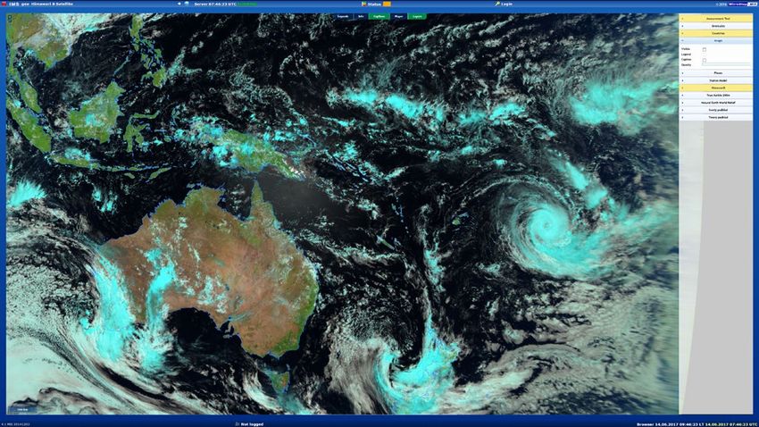
GRAPHICAL USER INTERFACE | FROM WEB TO
SMARTPHONE APPS
The real-time displays are collection of screens installed   Graphical display for all parameters measured at a single         The system is designed to allow integration of satellite data   camera images could be displayed too. Online camera
in the central office. Their main purpose is to display      station or view of one parameter from multiple stations can       with a map of updated real time data from the stations          view as well as multiple camera pictures from all stations
real-time data acquired from in-field Automatic Marine       be configured as per customer’s requirements. Differences         where each station is denoted with an icon. The color of        can be visualized in one comprehensive screen. Display of
Stations and visualize the outputs which shall be used by    in weather evolution between various stations as well             station and measured values are changed automatically           modeling and forecasting data such as areas endangered
marine operators, support decision making processes and      as evolution of one parameter, while other values still in        to reflect the current station status.                          by fog or general weather forecast map enable the user to
generate early warnings in cases of emergency. All screens   sight, are available on a right side, with quick links to other                                                                   browse through different forecasts, parameters, playing
are accessible via any web browser.                          functions.                                                        If communication bandwidth allows, the near real-time           weather movies, etc.

      16                                                                                                   Marine Systems       Marine Systems                                                                                                  17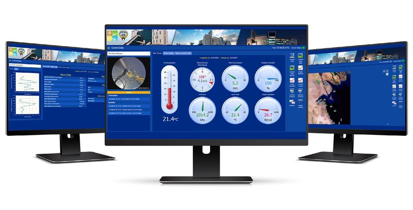
MARINE MODELS AND
FORECASTING SYSTEMS
For studying and modeling water motion, IMS4 Marine could                                                                                3D Modeling for Flushing and Sediment Transport
be integrated with 2D and 3D marine models, outputs of which                                                                             Studies
can be viewed or saved in a unified data platform for further
analysis and data QA/QC.                                                                                                                 Integratation with 3D marine models enables simulation of
                                                                                                                                         pertinent coastal processes such as flushing and sedimentation
Front-end displays and tools are specifically developed and                                                                              to perform coastal specialized studies for supporting the design
customized for interacting with the marine models. This includes                                                                         activities and performing the environmental studies. These
obtaining data from the model (such as water level or current at                                                                         models can be also used to determine the impacts of new
a particular position) as well as, extracting time series data with                                                                      coastal developments on water circulation, flushing, as well as
an option to draw a transection to visualize profile graphs for                                                                          the impacts of the sediment transports on coastal structures
the surface current. Animation of marine parameters such as                                                                              and artificial islands.
velocity, surface elevation changes over time could be prepared
and presented with user friendly displays. Forecast assessment
is included in the system.                                                                                                               Marine Forecasting Solutions

                                                                                                                                         We have implemented many local as well as national level marine
Customized Tidal Analysis and Prediction                                                                                                 monitoring and forecasting solutions. Our solutions include
                                                                                                                                         developing customized systems for marine data collection,
IMS4 ATTide is a custom-built software for tidal analysis and                                                                            management forecasting and early warning application for
prediction. The software is built to run on any 64-bit Windows                                                                           hazardous phenomena such as storm surges and waves.
OS and is simple to load and run. It provides full QA/QC of tide
gauge data, with spike removal, interpolation over allowable                                                                             IMS4 uses numerical models to forecast marine parameters.
gaps, removal of “flatlines”, date shifts, and time (clock) shifts.                                                                      The models generate alerts and warning notifications based on
The software also generates full record of changes.                                                                                      predicted values and according to the pre-set threshold values
                                                                                                                                         of marine parameters. We have experience in development of
The software can choose harmonics automatically, or user can                                                                             SMS and Email services for warning and notifications.
input pre-chosen list. It comes with 112 “built-in” harmonics,
based on the UKHO/IHO set; there is no limit to a number that can
be added to meet local requirements. IMS4 ATTide automatically                                                                           Tsunami Early Warning
senses if input time series is water level (scalar) or current
(vector) time series and operates accordingly. The software                                                                              Tsunami monitoring and early warning system could primarily
generates automatic graphical output of user-selectable time                                                                             incorporate two definite monitoring systems; one for real-time
interval. The data is saved as csv file for easy import into a wide                                                                      monitoring of seismic or other trigger events and the other for
variety of graphics software packages. High and low tides are                                                                            monitoring of the tidal waves.
automatically generated for the prediction.
                                                                                                                                         Integration of the tsunami model provides an improved
                                                                                                                                         understanding of the water level and current response in the
Wind-wave Models                                                                                                                         coastal waters to an earthquake-generated tsunami originating
                                                                                                                                         in the regional seas, gulfs or global oceans. The key parameters
Wave forecasts are extremely important for commercial                                                                                    of interest include water level, current, and arrival time, for
interests on the high seas, mainly for the shipping industry.                                                                            different sites within specific waters area, and for earthquakes
Therefore IMS4 Marine could be integrated with wind-wave                                                                                 of varying magnitude and location.
models to simulate wave heights, periods, and propagation             Early warning system assists meteorologists and
directions for regional seas or global oceans. Wind-wave models       decision makers in forecasting hazardous and
describe the effort to characterize the sea state and predict the     severe weather phenomena such as sea storms
evolution of the wind waves energy using numerical techniques.        or tsunami.

       18                                                                                           Marine Systems      Marine Systems                                                          19
MARINE SURVEYING AND HABITAT
MAPPING
Hydrographic / Bathymetric Surveys Biodiversity Surveys
IMS4 Marine could be integrated with bathymetry survey Biodiversity surveys are undertaken to find out what
data and generation of Digital Terrain Model (DTM). organisms exist in a given area and this research tool
Integrating with the local bathymetry enables fine tuning helps to define areas and species of most conservation
of the marine models for better representation of the model value and need, moreover, it provides data to allow
domain. Integration of the bathymetry allows development effective monitoring and evaluation of implemented
of localized operational models for applications such as oil conservation measures. The data gathered from
spills, search and rescue, flushing scenarios and sediment these surveys is used for numerous purposes such
transport studies. as monitoring endangered populations, evaluating
conservation priorities of an area or bioprospecting.
The DTM data is available as GIS layers for viewing and
sharing with other applications. The DTMs are available for
browsing, viewing as well as input for marine modules and Marine Habitat Surveys
models. IMS4 Marine supports development of customized
marine models based on local bathymetry and shoreline Habitat surveys are conducted using multi-beam sonars,
data. With this feature it is possible to extend IMS4 Marine echo sounders, and remotely operated vehicles. With these
to build marine models with very high resolution model surveys, scientists map, explore and document the physical,
domain with user selectable grid size. chemical, and biological systems. The data are collated with
other habitat and bathymetry data and integrated in IMS4
Marine to model and map the distribution of the marine
Marine Geophysical Surveys habitats. IMS4 Marine maps can be used to quantify the
spatial area of the marine habitats and to monitor whether
We conduct marine geophysical surveys to identify existing the distribution changes over time.
subsurface structural features, geological layers, buried
wreckages, and infrastructure. The surveys can help project
stakeholders to identify subsurface conditions that might Environmental Studies
otherwise remain hidden to traditional bathymetric survey
techniques and underwater investigations by divers. Environmental studies are performed to explore how
physical and biological processes maintain life, and how
humans affect nature. We conduct many environmental
Marine Cartographic Solutions studies, for example but not limited to, measuring the
turbidity parameter near new port under construction
We produce navigational charts for navigation purposes to learn about the effects of dredging and constructing
and entering channels and ports, in addition to show on the marine life and environment, in addition measure Integrated bathymetry and habitat survey data
coastline configurations and the bathymetry of coastal water quality parameter and study the fish kill phenomena,
waters. Moreover accurate charts are essential for proper harmful algal blooms, and oil spills.
planning in support of multiple usage of maritime resources
within national waters. Collection and analysis of field data,
and the transposing of this data on to charts becomes an
essential navigational tool for the maritime industry.
20 Marine Systems Marine Systems 21MARINE SPATIAL DATABASE AND
GIS APPLICATIONS
Coastal zones all along the world are witnessing one of development and sustainability. Sorting and integration the IMS4 Maps process as well as produce the data
the most significant urban and industrial expansion in of land and marine spatial data is a complex procedure in numerous formats such as KML, GML, Shapefile,
human history. The planning and implementation of land which requires interaction with different data sources GeoRSS, GeoJSON, PDF, JPEG, GIF, PNG, SVG and
and marine data collection with an efficient management and testing QA/QC procedures, prior to importing into more formats of output. The 2D data sets can be
of the database is of a great importance for coastal a unified database server. displayed in the forms of colored fields, isolines, wind
barbs. In addition, the data could be edited via the WFS
transactional profile (WFS-T).
Although IMS4 Maps comes with the integrated web
client for previewing data layers, thanks to compliance
with the OGC standards any OGC web service enabled
client software can access the IMS4 Maps server.
Satellite picture from COMS
The IMS4 Maps web client provides users with an
easy-to-use interface to access, browse and animate
various data layers which include but are not limited to:
• Overlay, switch on/off, reordering of the layers
• Setting layer transparency
• Applying custom filtering and styles to layers
for enhanced visualization
• Zoom in/zoom out, pan, rotate functionality
• Browsing the model data through model runs,
forecast times, vertical coordinates
• Smart tooltips showing the actual values, trends
or additional information
• Time dimension animation over multiple layers
simultaneously
Satellite picture from COMS with integrated wind data from the
• Measurement of distances, areas etc. with option
model
to select the specific unit.
Spatial Database Solutions aspects with advanced information and communication
technology. Application domains include air quality,
MicroStep-MIS provides a spatial database server capable meteorology, hydrology, coastal and offshore environmental Marine Navigation Modules
of storing all data in one database repository and using a data. Our integrated platforms support various applications
unique Feature Object Identifier (FOID) for each spatial including emission control and energy efficiency, climate Customized marine navigation modules are developed
geometry from vector maps and nautical charts. MicroStep- change impacts, adaptation, mitigation, sustainable urban based on local bathymetry data and environmental
MIS spatial database imports and seamlessly integrates and regional development. conditions for coastal as well as inland waterways
all geometric attributes by assigning a single FOID to each applications. The modules are based on open NEMA
entity. 0183 and serial protocols with user friendly interfaces
IMS4 Maps and allow the usage of AIS signals, currents, tides
and Internet access to acquire additional information
Integrated Environmental & Survey Database IMS4 Maps is a tool for processing, editing and sharing from specific feature objects included in the ENC S57
of the geospatial data on the web, both static data sets catalogue.
We specialize in the development and promotion of (topography) as well as current, historical or forecast,
WRF forecasting model
Integrated Environmental and Survey Data Platforms meteorological and oceanographic data. Integrating the
combining various environmental sciences and surveying best of the IT as well as environmental science worlds,
22 Marine Systems Marine Systems 23SERVICES
FOR MARINE
APPLICATIONS
MicroStep-MIS offers a turnkey solutions for establishing
complete monitoring system from initial consultation,
design, supply and on-site installation, commissioning,
trials and training. Our experienced team participates or
supports the whole process until the final handover of
the system to client.
On-site support for installation of marine stations includes
services like site clearance surveys, reconnaissance surveys,
offshore engineering and mooring design, site preparation,
anchor and mooring positioning, diving support, cable laying
and subsea installation works.
The marine systems are customized according to client
requirements. MicroStep-MIS’ team of specialists provides
the professional know-how for efficient installation,
commissioning and trials. Our personnel have many years
of experience and accumulated knowledge with marine
systems allowing it to get the marine monitoring systems
on-line and in operating condition as per client’s needs.
Our maintenance services provide a comprehensive support
to clients to ensure continuous and trouble free operation
of the marine monitoring systems. These services include
support to clients on the diagnostics, analysis and reporting
of marine data.
We ensure effective and efficient support on the marine
stations through a planned maintenance program to
preemptively avoid any disruptions to the operations of the
marine stations. In addition to the preventive maintenance,
our services include on-call attendance for any maintenance
issues reported by client. Service reports are provided for
every service attendance both routine as well as on-call
maintenance visit.
You can join the respresentatives of our company at
various expos and conferences which is the great
opportunity to consult the business. One of such events
is Oceanology International (London), the world’s largest
ocean technology exhibition and conference.
24 Marine Systems Marine Systems 2524/7 SUPPORT CENTER
ISO 27001 INFORMATION SECURITY CERTIFICATION MicroStep-MIS Support Centre is responsible for real-time
WIDE RANGE OF TECHNICAL SUPPORT AND monitoring of all customer systems worldwide, so we can
MAINTENANCE OPTIONS detect and fix all the possible issues immediately. In order
SHORT RESPONSE TIME AND HIGH LEVEL OF SECURITY to achieve this objective, we have to built a comprehensive
ICINGA CLASSIC WEB INTERFACE monitoring system. Furthermore, our support team is
REAL-TIME MONITORING OVER VPN receiving all important issues from logs and the current
VARIOUS PLANS FOR CUSTOMERS SUCH AS 24/7 OR 9/5 server condition by email on a daily basis.
MICROSTEP-MIS SUPPORT
Internet Connection
Local Network DMZ
Secure VPN Support
Support VPN Server
Public Station IP
LAN Internet Public Internet
Firewall Router VPN Connection
SSL Encrypted
IMS Server
Secure VPN Support
DMZ
CLIENT HQ
Local Network
26 Marine Systems100+
talented and dedicated
professionals working
together
ISO Quality Certified Company100+
integrated marine
stations
CONTACT US
info@microstep-mis.com
www.microstep-mis.comYou can also read