MARYBOROUGH INTEGRATED WATER MANAGEMENT PLAN - CENTRAL HIGHLANDS WATER, CENTRAL GOLDFIELDS SHIRE COUNCIL, NORTH CENTRAL CATCHMENT MANAGEMENT AUTHORITY
←
→
Page content transcription
If your browser does not render page correctly, please read the page content below
CENTRAL HIGHLANDS WATER, CENTRAL GOLDFIELDS
SHIRE COUNCIL, NORTH CENTRAL CATCHMENT
MANAGEMENT AUTHORITY

MARYBOROUGH
INTEGRATED WATER
MANAGEMENT PLAN
                                              i
November 2018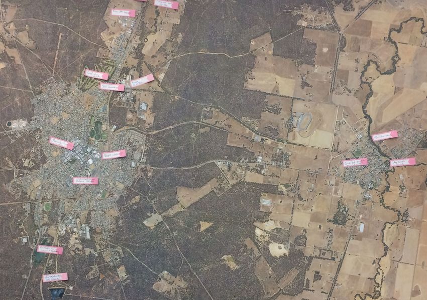
Developed by:

    Prepared by:

    This document has been prepared by E2Designlab and RMCG solely for the benefit of Central Highlands Water and its partners and is
    issued in confidence for the purposes only for which it is supplied. Unauthorized use of this document in any form whatsoever is
    prohibited. No liability is accepted by e2designlab or any employee, contractor, or sub-consultant of this company with respect to its use
    by any other person.

    This disclaimer shall apply notwithstanding that the document may be made available to other persons for an application for permission
    or approval to fulfil a legal obligation.

i   Maryborough Integrated Water Management Plan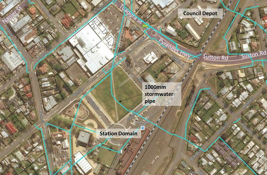
TRADITIONAL OWNER ACKNOWLEDGEMENT

     Central Highlands Water, Central Goldfields Shire Council and North Central
     Catchment Management Authority acknowledge the Traditional Owners of the region
     of Maryborough, the Dja Dja Wurrung. We pay our respect to the Elders of these
     communities past, present and emerging, acknowledging that they have been
     custodians of land and water for many centuries and that their continuing culture and
     contribution is important to the life of the region. We note in preparing and delivering
     on the outcomes of this plan the obligations to the Dja Dja Wurrung under the
     Traditional Owner Settlement Act, including Schedule 16 (NRM Participation
     Strategies) and Schedule 6 (Local Government Engagement).

ii   Maryborough Integrated Water Management Plan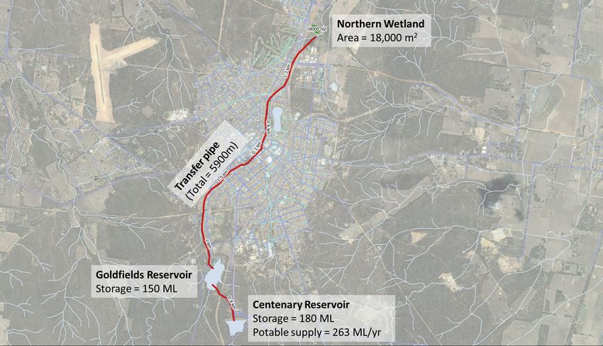
------------------------------------------------------------

      CONTENTS
      ------------------------------------------------------------

      Executive Summary ............................................................................................. 1

      1.    An integrated water management approach for Maryborough .................... 4

      1.1 What is Integrated Water Management?                                                                       4
      1.2 State and Regional IWM Policy Frameworks                                                                   5
      1.3 A partnership approach to IWM in Maryborough                                                               6
      1.4 The IWM Plan structure                                                                                     7

      2.    The case for IWM: Drivers, Vision and Objectives ..................................... 8

      2.1 Snapshot of the urban water cycle and key drivers for change                                               8
      2.2 Objectives for Integrated Water Management in Maryborough                                                16
      2.3 A vision for the future of IWM in Maryborough                                                            17

      3.    Exploring Opportunities: Preliminary Option Assessment ..................... 18

      3.1 Maryborough’s water balance                                                                              18
      3.2 Base case assumptions                                                                                    23
      3.3 Option Identification                                                                                    25
      3.4 Option shortlisting                                                                                      26
      3.5 Shortlisted options                                                                                      29

      4.    Evaluating Opportunities: Option Analysis and Evaluation .................... 31

      4.1 Methodology and Assumptions                                                                              31
      4.2 Option 1: Rainwater tanks supplying rainwater for non-potable use in new homes 32
      4.3 Option 2: Stormwater-fed street trees in new development areas                                           34
      4.4 Option 3: Stormwater-fed street trees in central commercial area                                         37
      4.5 Option 4: Wetland treatment integrated into Lake Victoria                                                40
      4.6 Option 5: Stormwater harvesting from local drain for Station Domain                                      43
      4.7 Option 6: Stormwater harvesting from Lake Victoria                                                       46

iii   Maryborough Integrated Water Management Plan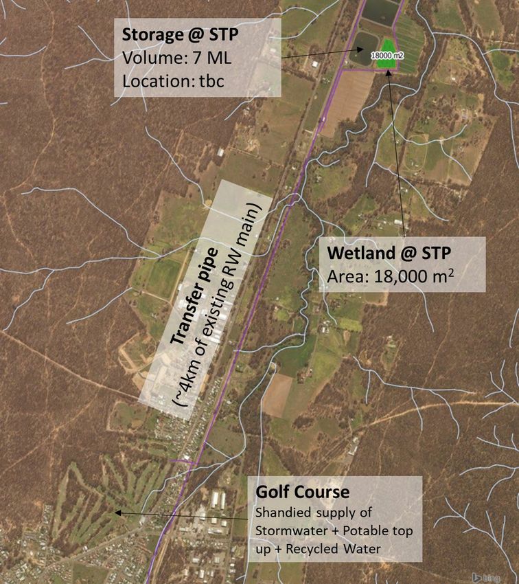
4.8 Option 7: Stormwater harvesting to shandy recycled water supply                                    48
     4.8 Option 8: Stormwater harvesting to supplement potable supply                                       51
     4.9 Option 9: Raw water transfer to shandy recycled water supply                                       56

     5.    Setting a Way Forward:               Recommendations and Implementation Plan 58

     5.1 Overarching partnerships to support delivery of IWM projects                                       58
     5.2 Recommended IWM projects from option analysis                                                      61
     5.3 Recommended ongoing work to support IWM                                                            63
     5.4 Implementation Plan                                                                                66

     Attachments

     Attachment 1 – Stakeholder engagement ......................................................... 71

     Attachment 2 – Preliminary Assessment ........................................................... 75

     Attachment 3 – Rainfall Analysis ....................................................................... 79

     Attachment 4 – Scored Assessment ................................................................. 82

     Attachment 5 – Option 7 Alternatives ................................................................ 84

iv   Maryborough Integrated Water Management Plan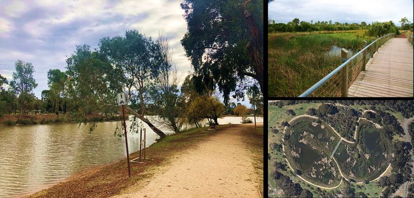
------------------------------------------------------------

    Executive Summary
    ------------------------------------------------------------

    Introduction
    The Maryborough Integrated Water Management Plan explores and sets out
    recommendations for future water management in the Maryborough area. The Plan
    examines the whole urban water cycle, including the management of stormwater,
    wastewater, water supplies and waterways. It also considers how water can be
    managed to deliver community benefits such as enhanced amenity, greener open
    spaces and street trees and enhanced recreational opportunities.

    Water can play a key role in improving liveability and community well-being in
    Maryborough. The town already benefits from recycled water use for irrigation of the
    Golf Course and Princes Park precinct, and is harnessing stormwater runoff from part
    of the town to top-up Lake Victoria in the centre of the town. This Plan explores a
    variety of other initiatives that will further enhance the local economy, improve the
    environment and drive direct benefits to local communities. This Plan has been
    identified as a regional priority in the Central Highlands IWM Forum Strategic
    Directions Statement, which was endorsed by the Water Minister in October 2018.

    A partnership approach to water management
    This Plan has been jointly produced by Central Goldfields Shire Council, Central
    Highlands Water and North Central Catchment Management Authority. It has also
    benefited greatly from the input and support of key local stakeholders including local
    businesses, community representatives and representatives of the traditional owners
    of land in the Maryborough area, Dja Dja Wurrung.

    It is significant and integral that this Plan is developed through a partnership process,
    as this recognises that the urban water cycle is interconnected. Continuation of this
    partnership approach will be key to deliver the vision and the actions outlined in this
    Plan.

1   Maryborough Integrated Water Management Plan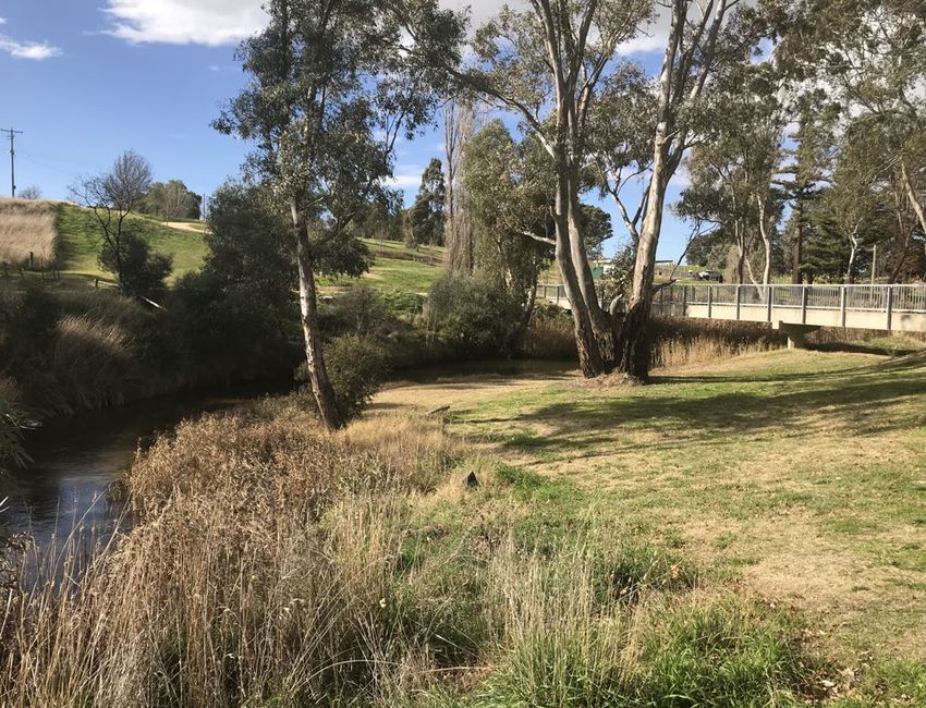
Why integrated water management is important in Maryborough

    There are several key drivers which mean that local and well-coordinated water
    management is important for Maryborough’s future:

        •    Future water supplies: A combination of a changing climate and a growing
             population means that it is likely that additional water supplies for
             Maryborough will needed in the future. Uncertainty regarding the scale of
             impact from future climates means that new supplies could be needed as
             soon as 2023 or not until 2049 to maintain a good level of water supply
             service for Maryborough.

        •    Maryborough is growing: New development in the area places additional
             pressure on water resources but also provides an opportunity to introduce
             new infrastructure and to influence how development is delivered.

        •    Securing recycled water as a long-term resource: The town’s recycled
             water is currently harnessed for irrigation, but algal blooms and high salinity
             can restrict use. Finding solutions to these issues is important so that this
             alternative water resource is fully harnessed.

        •    Recognising stormwater as a key water asset: Increasingly, the impacts of
             urban runoff on the health of waterways are being realised. Following the
             impacts of the drought, urban stormwater has also been recognised as a
             valuable water source. There is further potential to harvest and treat
             stormwater to support local lakes and recreation areas while also improving
             water quality and environmental conditions.

        •    Maryborough would benefit from more street trees and green areas:
             Maryborough has relatively low tree canopy cover and integration of green
             space, meaning that on a hot day, the dominance of exposed paved surfaces
             further increases local temperatures, impacting the health and comfort of
             communities. Water can support the health and cooling effect of trees and
             green spaces, supporting community well-being.

        •    The community appreciates local lakes and waterways, including Lake
             Victoria, Tullaroop Creek and Goldfields Reservoir: Waterbodies and
             waterways are important to the character of the area, and provide a focus for
             recreational activities, walking and tourism. Securing a sustainable source of
             water and maintaining water quality is a key focus for community well-being.

2   Maryborough Integrated Water Management Plan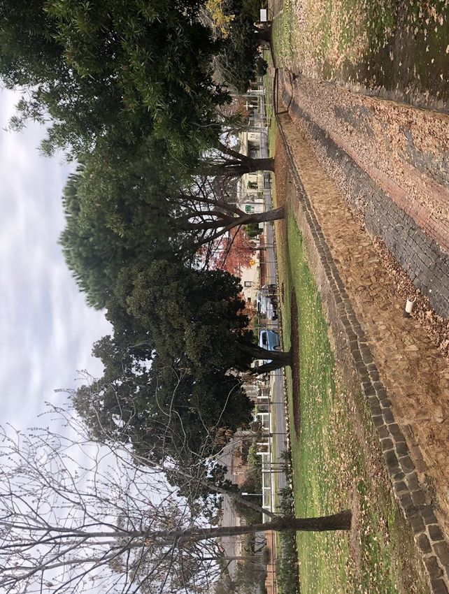
Vision for IWM in Maryborough

     Water supports a resilient Maryborough with a thriving community, a
     prosperous economy, and a healthy environment.

    Excellent opportunities to create a better Maryborough

    This plan identified numerous opportunities for integrated water management at all
    scales, ranging from on-lot initiatives in homes and street-scale greening, to town-
    scale water infrastructure. A shortlisting process was undertaken to identify initiatives
    that were likely to deliver the greatest benefits to the Maryborough community. Nine
    opportunities were examined in detail, and a costed concept design was developed for
    each. An economic evaluation and an appraisal of opportunities against key objectives
    for the area was conducted to inform the recommendations of this Plan. As a result, a
    suite of physical projects as well as a set of actions to support delivery integrated
    water management has been set out in an implementation plan.

     Six focus areas for integrated water management in
     Maryborough

     1. Creating governance and delivery structures to support IWM

     2. Harnessing stormwater for healthier street trees

     3. Greening station domain as a key community asset

     4. Creating a resilient and local alternative water supply network

     5. Improving Lake Victoria for recreation and amenity

     6. Continual improvement of waterways and flood management

3   Maryborough Integrated Water Management Plan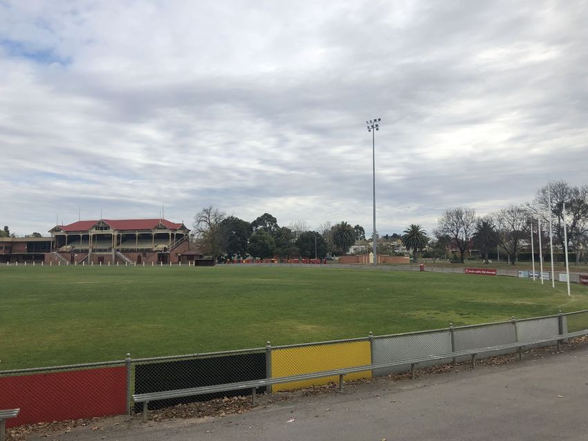
------------------------------------------------------------

    1. An integrated water management
       approach for Maryborough
    ------------------------------------------------------------

    1.1 What is Integrated Water Management?
    Integrated water management (IWM) recognises that interconnected nature of the
    water cycle, and seeks to manage water across the whole water cycle in a
    coordinated manner and improve its interactions with the built and natural environment
    in doing so. Traditionally, three ‘types’ of water have been managed separately; water
    supply, wastewater and stormwater. Roles and responsibilities have similarly focused
    on different types of water. An integrated water management recognises the
    interrelationships between different types of water, and also views water cycle
    management within a specific environmental, social, cultural and economic context –
    recognising the needs of local catchments and waterways, communities and
    industries.

    Figure 1.1: Integrated water management diagram showing the interaction of the three ‘types’ of
    water within a context of urban form and landscapes.

4   Maryborough Integrated Water Management Plan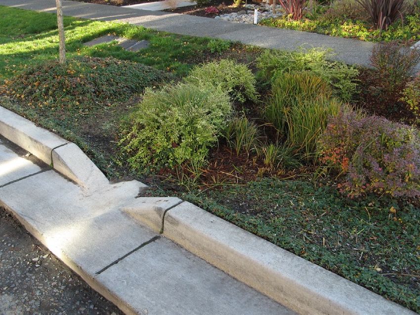
In a built up environment, such as Maryborough, it is important to recognise how the
    water cycle is affected by urban areas. Urban development and formalised water
    supply and management systems have fundamentally altered the natural water cycle
    over time, creating an ‘urban water cycle’. The urban water cycle encompasses water
    supplies extracted from or imported to a local catchment, wastewater and stormwater
    generated locally, and the catchments and receiving environments affected by those
    water cycle interactions. As urban settlements change and grow, additional water
    demands and changes in generation of wastewater and stormwater will have knock-on
    effects on the urban water cycle, requiring forethought and understanding of
    environmental, economic and social influences and sensitivities in the system.

    Figure 1.2: Key elements of the urban water cycle

    1.2 State and Regional IWM Policy Frameworks
    Water for Victoria (Victorian State Government, 2016) is “a framework to guide
    smarter water management, bolster the water grid and support more liveable Victorian
    communities”. Water for Victoria identified eight themes and associated actions to
    implement the policy. One of those themes is ‘resilient and liveable towns and cities’
    and Government provided a commitment to:

    “Adopt integrated water planning across Victoria, with place-based planning
    supporting community values and local opportunities”, and
    “Put integrated water management into practice, working with water corporations to
    develop a common economic evaluation framework, promoting exemplar projects,

5   Maryborough Integrated Water Management Plan
building the capacity of the water sector and local government to participate, and
continuing research to improve urban water management”.
On 8 September 2017, the Department of Environment, Land, Water and Planning
(DELWP) released a document titled ‘Integrated Water Management (IWM)
Framework for Victoria’. The IWM Framework provides guidance aimed at helping
government, the water sector and the community work together to better plan and
deliver solutions for water management across Victoria’s towns and cities.
The IWM framework supports the establishment of IWM Forums in each region to
drive and coordinated delivery of IWM. The Central Highlands Region IWM Forum
was established in March 2018, and has identified the development of the
Maryborough IWM Plan as a priority project in its Strategic Directions Statement 1
(2018).
1.3 A partnership approach to IWM in Maryborough
IWM not only involves a coordinated approach to water management, but also deep
collaboration between a large number of stakeholders, extending to those who are
able to affect and enable urban design, natural resource management, planning and
economic development.
Recognising this, the IWM Plan for the Maryborough area has been jointly developed
by Central Highlands Water, Central Goldfields Shire Council and North Central
Catchment Management Authority in collaboration with key stakeholders and
community representatives. Stakeholders engaged in the plan development are listed
in Attachment 1.
We are thankful for the attendance and participation of representatives of Dja Dja
Wurrung, the traditional owners of land in the Maryborough area, in the Plan
workshops. It has been highlighted that several of the projects as listed in the plan
provide an excellent opportunity in both the planning and delivery phases to further
engage with the DDW to incorporate opportunities to exhibit and educate the
community on some of the local indigenous cultural history of the area.
This IWM Plan focusses on the urban areas of Maryborough and neighbouring
Carisbrook and Flagstaff, but recognises the interconnections with key water systems
outside that area, including the water supply catchments, receiving environments, and
nearby agricultural water users.
1
Central Highlands IWM Forum (2018) Strategic Directions Statement. Published by
DELWP.
6 Maryborough Integrated Water Management PlanFigure 1.3: Focus area for the IWM Plan, encompassing the town of Maryborough and nearby
Carisbrook
1.4 The IWM Plan structure
The Maryborough IWM plan was developed in the following four stages (Figure 1.4).
The report is structured in the same manner and is supported by several appendices
with further detail:
Figure 1.4: Four stages of the IWM Plan development
7 Maryborough Integrated Water Management Plan------------------------------------------------------------
2. The case for IWM:
Drivers, Vision and Objectives
------------------------------------------------------------
2.1 Snapshot of the urban water cycle in the Maryborough
Area and key drivers for change
2.1.1 Urban development and growth
Maryborough and Carisbrook have an estimated combined current population of 9,123
people, with the majority of that population (~8,000 people) in Maryborough. A
relatively moderate growth rate of 0.6% per year is predicted, bringing the total
population in 50 years’ time to 12,304 people. New population will be housed through
a combination of infill development in existing areas and planned new communities on
greenfield land. A total of around 1500 new homes is expected over the plan period.
Central Goldfields Shire Council expect most new development to occur in
residentially zoned land on the northern edge of Maryborough. Growth brings new
water demands, as well as new wastewater and stormwater volumes, but
development also brings opportunities to shape the urban landscape.
Figure 2.1 Recent residential development in North Maryborough
8 Maryborough Integrated Water Management PlanThe main industry in Maryborough is manufacturing, with a dominance of food-related
industries. A cluster of industrial businesses is located in the northern area of
Maryborough, with further lower density industrial land use in the Flagstaff area
between Maryborough and Carisbrook.
2.1.2 Potable water supplies
The Maryborough water supply system is managed by Central Highlands Water.
Providing potable water supply to Maryborough and Carisbrook as well as a few other
smaller settlements in the area, the water supply is currently predominantly drawn
from surface water catchments with some groundwater supply when necessary. The
majority of water supply is sourced from the Tullaroop Creek catchment, with the
water treatment reservoir located to the south of the town of Maryborough, adjacent to
Centenary Reservoir. Central Highlands Water have recently commissioned a Salt
Reduction Plant (SRP) to reduce the salinity of drinking water in the system.
Figure 2.2: Maryborough and District Water Supply Network (Central Highlands Water Urban
Water Strategy, 2017
9 Maryborough Integrated Water Management PlanCentral Highlands Water’s Urban Water Strategy predicts the impacts of population
growth and climate change on water supplies and demands for the Maryborough
system. To maintain the target levels of service for the area, it is expected that
supplementary water supplies will be required in the next 5 to 20 years (see Figure
2.3). Central Highlands Water are currently investigating options for additional supply,
including connection to the Goldfields Superpipe or additional groundwater
extractions.
Figure 2.3: Future supply and demand scenarios for the Maryborough system (Central
Highlands Water, 2017)
2.1.3 Wastewater management and recycled water
The Maryborough wastewater system is managed by Central Highlands Water.
Wastewater from the Maryborough area is collected and treated at the Maryborough
Wastewater Treatment Plant, located just to the north of Maryborough. Treated
wastewater is reclaimed as recycled water (Class C) for local use, providing irrigation
10 Maryborough Integrated Water Management Planwater to the Maryborough Golf Club, Princes Park and local agricultural users via a
recycled water distribution network. Due to the salinity of the water catchment,
wastewater in the area has high salinity, and this is likely to increase in the future
when the Salt Reduction Plant is in operation (and releasing brine to the wastewater
system).
Figure 2.4: Maryborough recycled water network (purple)
2.1.4 Stormwater management and stormwater reuse
Central Goldfields Shire Council is responsible for management of urban stormwater
in the Maryborough Area. The built-up areas of Maryborough and Carisbrook have
underground piped drainage systems, while the outskirts of Maryborough and parts of
Carisbrook do not have a formalised drainage system. Maryborough drains to Four
Mile Creek (commonly known as the ‘Main Drain’) which runs through the centre of the
town and is open air in many sections. Its bluestone lining has historical value and it
forms a well-known landscape feature in the town.
Central Goldfields Shire Council is guided by a Stormwater Management Plan (2002),
and has implemented several improvements to stormwater management in recent
years, including the installation of Gross Pollutant Traps in key sections of the Main
Drain and raingardens in some carparks. During the Millennium Drought, stormwater
from the main drain was diverted to top up Lake Victoria in Princes Park and this
system currently remains in place. Other than litter removal, there is no treatment of
urban stormwater entering the lake, resulting in algal blooms frequently affecting the
Lake.
11 Maryborough Integrated Water Management PlanOther than the diversion to Lake Victoria, stormwater is a largely unharnessed water
resource in the area which could be harnessed for a range of uses. Compared with
pre-development conditions, the creation of the urban areas of Maryborough and
Carisbrook has led to significant increases in stormwater runoff entering local
waterways, fundamentally changing their flow regime and impacting water quality.
Figure 2.5: Comparison of stormwater runoff volumes from a natural catchment and an
urbanised catchment
2.1.5 Local waterways and waterbodies
The urban water cycle for the Maryborough Area affects a number of waterways and
waterbodies. As mentioned above, Four Mile Creek (the Main Drain) which runs south
to north through Maryborough is directly impacted by stormwater from the urban area
of Maryborough. The Creek is highly modified throughout the urban area, and due to
its stone lining and the impact of stormwater flows, it does not have any significant
ecological value. Further to the north, Four Mile Creek is unlined and in an agricultural
land setting, however, the persistent stormwater flows from Maryborough are likely to
have radically changed its flow regime and water quality. Four Mile Creek flows into
12 Maryborough Integrated Water Management PlanBet Creek, which has been identified as a priority waterway by North Central
Catchment Management Authority because of the values it provides.
To the east, the settlement of Carisbrook drains to Tullaroop Creek, which is also
classified as a priority waterway. Tullaroop Creek has amenity and ecological value,
and is well-loved by local residents. The urban water cycle for the Maryborough area
also influences Tullaroop Creek upstream of Carisbrook, where potable water supply
is sourced from Tullaroop Reservoir.
There are also significant urban water bodies in the area that offer amenity, ecological
and amenity value to local community. The most significant of these are Lake Victoria
in the centre of Maryborough and Goldfields Reservoir to the south of Maryborough.
Both of these are well utilised by the community for walking and recreation. As
mentioned above, Lake Victoria is now supplemented by urban stormwater to maintain
lake levels, but it suffers from water quality issues. Goldfields Reservoir is a large
water body which was historically a water supply dam. It is fed by a natural catchment,
but it often suffers from low levels which restrict recreation activities including water
sports.
Figure 2.6: Catchments, key waterways and waterbodies
13 Maryborough Integrated Water Management PlanFigure 2.7: Images of local waterways and water bodies (Clockwise: Main drain, Tullaroop
Creek, Goldfields Reservoir, Lake Victoria,)
2.1.6 Liveability and community well-being
Maryborough has a strong and passionate community, but the town also faces some
socio-economic challenges. Identified statistically as the most disadvantaged
community in Victoria in terms of average income, there is a focus on economic
development and community support in the future. The Committee for Maryborough
was established in 2018 with a vision “to lead Maryborough to be a centre of
excellence for rural, economic and social transformation and renewal.” Initiatives such
as Go Goldfields have also been created to deliver community driven approaches to
improve social, education and health outcomes for children, youth and
families. Maryborough also has an older community with a median age of 50
(compared with 37 in Victoria), and has lower than average levels of physical activity.
14 Maryborough Integrated Water Management PlanWater can support and enable the liveability and well-being of communities in a
number of ways. The most tangible benefits that water could deliver for Maryborough
have been identified as:
• supporting physical and mental health by enhancing community assets for
recreation such as sports fields, lakes and green space;
• supporting wellbeing by stimulating local economies and industries;
• supporting physical activity, climate resilience and enhanced amenity through
urban greening and support of street trees; and
• supporting high quality and affordable housing with effective water
infrastructure.
The enhancement of green space and urban trees is a key opportunity for
Maryborough as only a select number of green areas are irrigated, and council is
planning a program of street tree planting to enhance the entrances to the town and
the central commercial area.
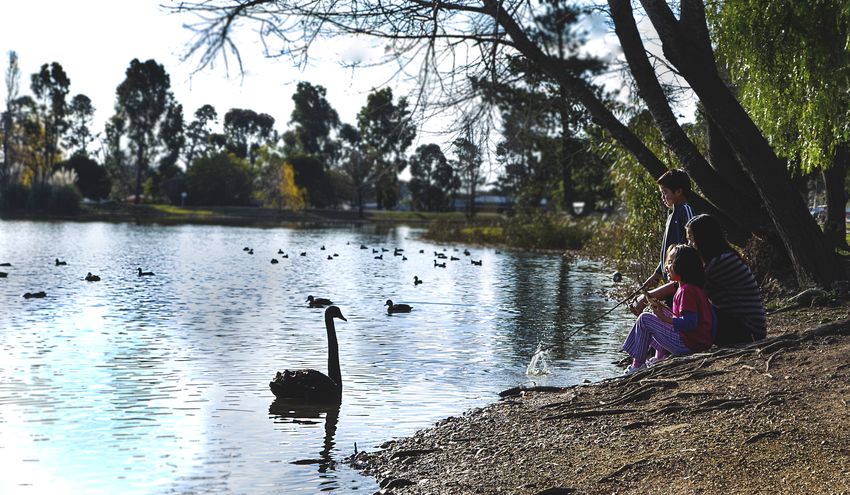
Figure 2.8: Image of Princes Park oval in central Maryborough
15 Maryborough Integrated Water Management Plan2.2 Objectives for Integrated Water Management in
Maryborough
Through the context review and feedback from a workshop with stakeholders and
community representatives, the key objectives for IWM in Maryborough have been
identified (see Figure 2.9) and fall into three themes:
1. A resilient water cycle
2. Healthy landscapes and environment
3. A prosperous community and economy
Figure 2.9: Key drivers for IWM in the Maryborough area in three themes
The drivers and the three themes identified for Maryborough map well to the seven
priority IWM objectives identified by the Central Highlands Region by its IWM Forum
(See Figure 2.10).
Figure 2.10: Central Highlands IWM Forum objectives in three themes
16 Maryborough Integrated Water Management Plan2.3 A vision for the future of IWM in Maryborough
This plan is underpinned by a long history of community and stakeholder input. A
vision was originally formed for IWM in the region through the Ballarat and Region
Ballarat and Region’s Water Future (BRWF) (State Government of Victoria, 2014): “A
greener, more liveable and prosperous water future for the city and towns of the
Ballarat region”.
Through examination of the local drivers and engagement with stakeholders, a vision
has been developed for this IWM Plan:
Water supports a resilient Maryborough with a thriving
community, a prosperous economy, and a healthy environment.
17 Maryborough Integrated Water Management Plan------------------------------------------------------------
3. Exploring Opportunities:
Preliminary Option Assessment and
Shortlisting
------------------------------------------------------------
3.1 Maryborough’s water balance
An important first step is the development of a water balance for the Maryborough
area as a whole. This describes the water demands, regional potable water supplies
and the stormwater and wastewater generated by the area. Stormwater runoff from
the area has been modelled using MUSIC v.6 and based on a 10 year rainfall
sequence, and an estimation of imperviousness across the study area. The key
MUSIC parameters used are show in Table 3.1. Water demands and wastewater
generation is based on scaled figures for the Maryborough network presented in the
Central Highlands Water Urban Water Strategy (2017).
Table 3.1: Rainfall parameters used in catchment runoff modelling using MUSIC v.6
Mean Annual Rainfall 476mm
Rainfall Station 2
81038 Natte Yallock
Period 1988-1997
Interval 6mins
The following figure presents this water balance for current conditions. Currently, the
areas utilise around 980ML/year of potable water sourced from surface water and
groundwater systems in the region. The total volume of treated wastewater from the
areas is reclaimed as recycled water for irrigation of the golf club, Princes Park and
other nearby agricultural areas. Aside from a top up to Lake Victoria, stormwater from
the area is unharnessed as a supply, and it runs off into local waterways, carrying
pollutants with it. The volume of stormwater running off the urban areas compared
with pre-development conditions is approximately 800ML/year. This is referred to as
the ‘urban excess’.
2
The 6 minute rainfall gauge at Natte Yallock was selected as an appropriate reference station to model
rainfall in Maryborough due to the quality and quantity of data available. See Attachment 3 for details.
18 Maryborough Integrated Water Management PlanFigure 3.1: Urban water balance for the Maryborough area showing existing potable water
demands, excess stormwater runoff and recycled water
Expected population growth in the Maryborough area will increase water demands. As
shown by Figure 3.2, the additional demand expected by the end of the plan period
(50 years) is 300ML/year. It should be noted that the total water demand for
Maryborough and Carisbrook shown in Figure 3.2 is less than that shown in Figure 2.3
which shows the total demand for the Maryborough area serviced by Central
Highlands Water which includes surrounding areas such as Talbot.
19 Maryborough Integrated Water Management PlanCurrent and Future Water Demand - Maryborough
and Carisbrook
1400
1200
1000
800
600
400
200
0
2016 2066
Residential water demand (ML/year) Non-residential water demand (ML/year)
Figure 3.2: Expected increases in water demand in the Maryborough area over the plan period
As discussed in section 2.1.2, the potable water supply-demand analysis for the
region has shown that additional water supply resources will be required for the
Maryborough area to maintain target levels of service in the next 5-20 years. The
supply-demand balance is not only affected by increasing demand, but by decreasing
supply due to the predicted impacts of climate change.
In terms of local resources, stormwater is a major water resource that is currently
underutilised in the area. Also, importantly, while recycled water is currently 100%
utilised locally, an already high salinity profile is likely to be exacerbated by waste
streams entering the wastewater system from the recently commissioned Salt
Reduction Plant.
3.1.1 Spatial profile of major water users
Within the urban area, it is also useful to understand the location and spread of major
water users. Figure 3.3 shows the major potable water users in the Maryborough area,
shown as either irrigation demands (open space and recreational areas) or other
demands (industry, processing, agricultural use, major service buildings). In some
cases, these major users of potable water could use an alternative water source as
the quality of water required isn’t as high as potable standard. Green space and
20 Maryborough Integrated Water Management Plansportsground irrigation are well matched to the use of alternative sources. Other users
have been assessed on a case by case basis through the preliminary assessment to
determine if they are likely to have a non-potable water demand which could be met
by rainwater, stormwater or recycled water supply.
21 Maryborough Integrated Water Management PlanFigure 3.3: Location and scale of major irrigation and non-residential demands utilising potable water 22 Maryborough Integrated Water Management Plan
3.2 Base case assumptions
              In assessing IWM options, it is important to compare them to an expected ‘business
              as usual’ scenario, called a base case. This allows us to understand changes in costs
              and benefits compared with the status quo. A base case is different from current
              infrastructure, as the context will change over time. The base case is instead a best
              prediction of the strategies and infrastructure that will be delivered to meet future
              challenges.

              Table 3.1: Base case assumptions

No.   New Development

1     There are currently no specific requirements for water management in new development areas
      in the Maryborough area. It is assumed this will remain the same in the base case.

2     All major developments will trigger Clause 56.07-4 of the Victoria Planning Provisions. Clause
      56:07 references the Best Practice Environmental Guidelines for Urban Stormwater. The best
      practice environmental management objectives for stormwater quality (post-construction) are
      shown below.

          Suspended solids (TSS):          80   per   cent   retention of the typical urban annual load
          Total phosphorus (TP):           45   per   cent   retention of the typical urban annual load
          Total nitrogen (TN):             45   per   cent   retention of the typical urban annual load
          Litter:                          70   per   cent   reduction of typical urban annual load

      For the purposes of this study, it is assumed that all new greenfield developments in greenfield
      areas achieve this target through the use of precinct scale end-of-catchment wetlands (in the
      base of retarding basins).

3     All major developments in greenfield areas construct retarding basins to retard flows from the 1
      in 1.5 year ARI flow (BPEMG requirement) to the 1 in 100 year ARI flow event back to pre-
      developed conditions. New developments in infill areas (residential and non-residential) must
      provide on-site detention (via on-site detention tanks or enlarged pipes)

4     No recycled water is used as an alternative water supply across the new growth areas.

      Water Supply and demand

5     Community and business education around water use will continue to ensure water demands
      do not increase.

        23     Maryborough Integrated Water Management Plan
6 To meet level of service targets, it is assumed that a supplementary water supply resource will
need to be linked to the Maryborough supply system in 2025, when the expected supply equals
demand in a median climate change scenario. The base case assumed this supplementary
water supply will come from the Goldfields Superpipe via a piped transfer. Central Highlands
Water have estimated the cost of the connection and transfer.
7 The Salt Reduction Plant will be utilised when salinity in the water supply exceeds acceptable
levels. Waste brine will be discharged to the wastewater system.
8 It is assumed that no major upgrades are required to treated water supply infrastructure, other
than extensions to new areas.
Wastewater and recycled water
9 The Maryborough Wastewater Treatment Plant process will be improved to prevent frequent
algal blooms occurring, and thereby enabling the use of recycled water for irrigation.
10 The waste brine from the Salt Reduction Plant will elevate salinity levels in recycled water and
will require shandying (diluting) with potable water to ensure sustainable irrigation use. A
shandy ratio of 2:1 (potable water: recycled water) is assumed to be required.
Stormwater
11 The main drain diversion to Lake Victoria will remain in place.
12 No WSUD assets will be built in existing areas (other than those required through new
development planning policies).
Urban greening and amenity
13 Tree planting will be undertaken by Council in Maryborough central commercial area and at the
entrances to the town.
14 New development areas will include verges and street trees (with no irrigation).
15 Green spaces that are currently irrigated with potable or recycled water will remain irrigated,
with no additional irrigated areas expected.
16 Goldfields reservoir will not receive flows from Centenary Reservoir and will remain reliant on
water flowing from its natural catchment.
24 Maryborough Integrated Water Management Plan3.3 Option Identification
A workshop was held with key stakeholders and community representatives to identify
IWM options for the Maryborough area. Integrated Water Management naturally
covers a wide variety of initiatives. Figure 3.3 summaries some of the key types of
IWM projects that were discussed with workshop participants.
Figure 3.4 Possible types of IWM projects and initiatives
The ideas and possible projects that emerged from the stakeholder workshop were
diverse and met with enthusiasm. These ranged from enhancements to local
waterways to large scale alternative water resources for the area.
25 Maryborough Integrated Water Management PlanFigure 3.5 Workshop posts showing locations of projects prioritised by stakeholders
To explore all possibilities, water sources across the following categories were
considered: regional potable supply (PO), rainwater (RW), stormwater (SW),
wastewater (WW), groundwater (GW), and creeks (CREEK). The results of this
process are documented in Attachment 2 as a long list. A long list of 100 opportunities
was identified for the Maryborough area.
3.4 Option shortlisting
The Preliminary Assessment Method for IWM options (DELWP, 2015) was utilised to
assess and shortlist the longlist of IWM options. The key steps in the PAM are an
assessment of the likely scale of benefits of each project, based on the water balance
and a rapid modelled assessment of performance, a high-level assessment of key
cost and deliverability factors. Key performance factors were selected for the analysis
relating to the three primary objective themes as show in Figure 3.5.
26 Maryborough Integrated Water Management PlanFigure 3.6: Key performance indictors from the three objective themes used in the preliminary
analysis of the long list of options
The preliminary assessment is presented in Attachment 2. If a project clearly had a
superior alternative which meets the same objectives in all circumstances it was
considered a low-performance option. Projects which scored highly in one or more
indicator were highlighted for potential selection, and those which had the greatest
overall performance, or which performed very well in two or more areas were selected
for further consideration.
Key insights emerging from the preliminary assessment of IWM projects for the
Maryborough area
• The scale of new development is unlikely to support delivery of alternative water
supply networks for non-potable water supply to buildings. Rainwater tanks could
be delivered in new development areas as a policy option to deliver a local
alternative water supply.
• There are currently limited irrigated open spaces in the Maryborough and
Carisbrook area, and those that are irrigated are either already serviced by
recycled water or are spatially wide spread, making it difficult to make alternative
water supply networks cost-effective.
• There are a number of discreet stormwater harvesting schemes which may be
feasible, whereby a stormwater could be harvested and treated to supply 1-2
ovals. Of those identified, Station Domain was selected as having the most
potential to add community value by securing an alternative water supply for
irrigation.
• The most promising options for recycled water management emerged as the
creation of a shandy with recycled water to improve salinity. The desalination of
recycled water was cost-prohibitive and brine disposal would be a challenge. Raw
water and stormwater were highlighted as potential shandy sources.
27 Maryborough Integrated Water Management Plan• The scale and nature of the operations of the major non-residential water users in
the area, such as local industry, food processing operations and community
centres meant that non-potable water demand was likely to be a relatively small
volume. The most suitable alternative water supply for these users is rainwater
from an onsite collection system and tank. It was found that most major users
already had rainwater tanks on site.
• Options in the settlement of Carisbrook were limited due to the low density nature
of the developed area and limited water demands. The re-invigoration of the
Tullaroop Creek public waterway reserve and the Carisbrook Reservoir were
identified as a project that may provide recreation and amenity value.
• The key water bodies in Maryborough with community value, Lake Victoria and
Goldfields Reservoir, had different water issues. Stormwater treatment could
improve water quality in Lake Victoria, and this could also provide an opportunity
to source water for nearby irrigation. Water supply is the main issue for Goldfields
Reservoir, where raw water and stormwater were identified as possible
contributors. Recycled water was not considered to be a feasible option for
contribution to lakes due to salinity and water quality issues.
• Carisbrook Reservoir was identified for potential either as a flood storage or for
amenity value. Investigation of the reservoir confirmed that a dam safety incident
occurred in 1999, and as a result of piping failure, breaching of the dam and
breaching of the race line, the dam is now considered to be decommissioned and
redundant. Rehabilitation of the dam has been found not to be economically
viable and it has been shown not to provide flood retardation value.
• Options that used stormwater to enhance urban greening performed well against
the IWM objectives for the area.
• A north-south transfer spine was identified as being a potential option to connect
key demands, storages and water sources, with;
o major demands in the north (golf course, Princes Park) and south
(Goldfields Reservoir and some ovals),
o key sources in the north, including the bottom of the urban
catchment and end of the main drain where stormwater could be
harvested and the existing recycled water network, and key
sources in the north with the raw water holdings at Centenary
Reservoir
o a chain of storages also run north to south: Goldfields reservoir,
Phillips Gardens and Lake Victoria, and the golf course water
storages.
• Flood management projects have been identified and taken forward for
Carisbrook and will shortly be identified for Maryborough through the
development of flood management strategies for each town. Accordingly, projects
focused on flood management have not been specifically assessed by this plan.
28 Maryborough Integrated Water Management Plan3.5 Shortlisted options
Using the PAM assessment, nine options were shortlisted for further analysis, which
are summarised in the table below.
Table 3.2: Shortlisted options for analysis
No. Scale Description
Rainwater tanks supplying rainwater for non-potable use in new homes – Introduction of a local policy
1 Lot
requirement
Stormwater-fed street trees in new development - Amendment of council landscape requirements for
2 Street
developers to require passive irrigation of street trees for increased canopy and tree health
Stormwater-fed street trees in central commercial area of Maryborough - Creation of new tree pit designs
3 Street
to provide passive irrigation for greening of the CBD
Wetland treatment integrated into Lake Victoria - Part conversion of Lake for stormwater treatment,
4 Local
improving water quality and amenity.
Stormwater harvesting from local drain for Station Domain and Council Depot - Harvesting of stormwater
from the drain beneath station domain, and natural treatment feature within the domain for amenity.
5 Local
Storage also can be used as a non-potable water pick up point for street tree watering and other council
activities.
Stormwater harvesting from Lake Victoria for Phillips Gardens, Station Domain and Council Depot -
6 Town Harvesting of stormwater via wetland in Lake Victoria to provide irrigation water for Station Domain and
Phillips Gardens. Also provides council depot demands for tree irrigation and other council activities.
Stormwater harvesting from a new Northern wetland to shandy recycled water supply - Harvesting of
7 Local stormwater from via new wetland in north of Maryborough to shandy recycled water to supply princes park
and golf course.
Stormwater harvesting from a new Northern wetland to supplement potable supply - Harvesting of
8 Town stormwater on large scale from new northern wetland, and pumping to Goldfields via pipe along Main Drain
corridor. Transfer to raw water storage in Centenary Reservoir.
Raw water transfer to shandy recycled water supply - Release of raw water from Centenary Reservoir to a
9 Region piped connection along the main drain to connect to the existing recycled water network to shandy recycled
water for Princes Park and Golf Club. Assuming recycled water transfers can be run in reverse.
A selection of other options were also highlighted for their merit, which can be further
considered through ongoing processes:
29 Maryborough Integrated Water Management Plan• Revitalisation of the main drain corridor: The main drain (or four mile
creek) is a stone sealed drainage corridor through the centre of Maryborough.
Many parts of the drain have been daylighted (open-air) and the stone lining
provides some amenity and historical value. As its historical status means it is
unlikely that it can be naturalised and enhanced for ecological value, there
was found to be limited potential for the main drain to be improved to delivery
integrated water management outcomes. The main potential exists in the
corridor on the edges of the drain where additional greening and walking and
cycling access could be created. Further consideration should be given to
improving the corridor as a green link and active transport corridor. This is
best achieved by Central Goldfields Shire Council as a city planning exercise.
• Waterway management strategy for Tullaroop Creek: The settlement of
Carisbrook adjoins Tullaroop Creek, and there are opportunities to enhance
the recreational and amenity value of the foreshore while also improving the
flow and water quality of the creek itself. A waterway management strategy is
recommended that takes a whole-of-catchment approach and considers the
surrounding rural area, flood risk and the Tullaroop reservoir upstream to
determine appropriate improvements. This strategy has been identified as a
priority by the Central Highlands IWM Forum.
30 Maryborough Integrated Water Management Plan------------------------------------------------------------
4. Evaluating Opportunities:
Option Analysis and Evaluation
------------------------------------------------------------
4.1 Methodology and Assumptions
Each of the shortlisted options was taken forward to conceptual design to better
understand the costs and benefits which could be delivered by each option. The built
components and infrastructure required for each option were estimated and sized
accordingly. For those options that include rainwater and stormwater management,
models were created using MUSIC v.6 to predict runoff, reuse and treatment
performance. Cost rates were based on industry standards available from Central
Highlands Water (pipework and storage) and Melbourne Water (stormwater
treatment).
A full lifecycle costing of the options was developed for each option, including capital,
operating and renewal costs to produce a net present value for each proposal.
Performance indicators were also quantified wherever possible. These results were
then fed into two evaluation process:
1. An economic evaluation: A benefit-cost analysis, where benefits have been
monetised and compared with cost as possible.
2. A scored evaluation: An evaluation against the IWM objectives for
Maryborough where scores are allocated to each project based on
performance against quantifiable criteria where possible, and qualitative
judgement otherwise. The methodology and results of this analysis are
included in Attachment 4.
31 Maryborough Integrated Water Management Plan4.2 Option 1: Rainwater tanks supplying rainwater for non-
potable use in new homes
Description
This option considers the application of a mandatory requirement for rainwater tanks for toilet flushing, garden
irrigation and cold water laundry in new homes. Such a requirement could be applied through the planning
system, with a policy requirement from Council or a water services requirement from Central Highlands Water.
Maintenance would be undertaken by the householder.
Figure 4.1: Proportion of household water demands which would be connected to an on-lot rainwater tank
The connected non-potable demands shown in Figure 4.1 make up 35% of a typical new home’s water
demand.
Key analysis assumptions and infrastructure requirements
Rainwater tank effectiveness in providing these non-potable demands was modelled using MUSIC v.6. It was
assumed that 80% of an average 220m2 roof could be connected to the tank. A 4.5kL tank was needed for each
home to provide 70% reliability of supply (i.e. 70% of the annual non-potable demand would be met, with the
remainder met by potable supply).
32 Maryborough Integrated Water Management PlanCost summary
Item Capital Cost ($/house) Operating Cost ($/house/yr)
Tank and pump $2,100 $104
Installation and plumbing $1,700 -
Total $3,800 $104
Key Benefits
A resilient water cycle Healthy landscapes and A prosperous community and
environment economy
• Mains potable water supply • Water Quality: Pollutants will be • Dual-purpose investment: Rainwater
substitution: Rainwater tanks could removed from runoff and therefore tanks will also satisfy the Building
provide 55ML/year of fit-for-purpose water from waterways. The proposal will Regulation six star sustainability
for non-potable water in new homes by remove 137kg/year of nitrogen by the requirements for new homes (where
the end of the plan period. end of the plan period. either a solar hot water or rainwater
• Reduced ‘urban excess’ stormwater tanks are required).
flows: Stormwater flowing from urban • Education: The inclusion of community
areas will reduce by 55ML/year by the managed rainwater tanks heightens
end of the plan period as it is taken up by awareness around water use and places
the tree, or lost to infiltration. communities at the heart of water
management.
Evaluation
Economic Evaluation Scored Evaluation (Total score, range 13-60)
Present Value of Costs: $2,537,710 19
Benefit Cost Ratio: 0.19
33 Maryborough Integrated Water Management Plan4.3 Option 2: Stormwater-fed street trees in new
development areas
Description
Typically, new developments in Maryborough are relatively low density and include a landscaped verge (grass
or pebbled) with street trees included. Research has shown that access to water is important for the growth
and health of street trees. Provision of water will be important to their establishment and to the greening and
amenity of new developments, in turn enhancing health and well-being of communities. Given the typical verge
width there is an opportunity to include a fairly simple mechanism for allowing stormwater that runs off the road
surface to be directed into a sunken tree planting area in the verge via a gap in the kerb. This type of solution is
low-cost, and it has the dual benefit of providing irrigation water to the tree, while also capturing and treating
stormwater runoff.
Figure 4.2: Examples of verge conditions in the new development area Whirrakee Rise (top row) and examples of dropped
kerb verges to facilitate passive irrigation (proposal in Ballarat and built example in Melbourne) (bottom row).
34 Maryborough Integrated Water Management PlanKey analysis assumptions and infrastructure requirements
The proposed design for the stormwater-fed trees is shown in the drawing below. The key component parts
include a sunken grassed area and a dropped kerb inlet. The gradual slope of the sunken area will allow
maintenance and mowing. As standard, a back of kerb perforated drainage pipe is usually included in new
roads, and this inclusion will be important for the system to prevent waterlogging. It is assumed that one tree
would be included outside each new home. Based on canopy growth data, a canopy diameter increase of 2.5m2
to 5m2 is expected due to the addition of passive irrigation. Based on one tree per home, 100 trees are
estimated per km of road.
Figure 4.3: Example cross-section (not to scale) based on ‘Greening Ballarat: Blue Green Infrastructure Action Plan (City of
Ballarat, 2016)
Cost summary
Item Capital Cost ($/km) Operating Cost ($/km/yr)
Creation of sunken area with kerb $ 98,000 $ 470
inlet
35 Maryborough Integrated Water Management PlanKey Benefits
A resilient water cycle Healthy landscapes and A prosperous community and
environment economy
• Reduced ‘urban excess’ stormwater • Street tree health: Passive irrigation • Increased amenity and property
flows: Stormwater flowing from urban will support street tree health and prices: The predicted increase in tree
areas will reduce by 9ML/year by the end enhance canopy diameter from 2.5m to canopy cover in streets could induce a
of the plan period as it is taken up by the 5m in each tree. Adding a total 1.8% increase in property prices.
tree, or lost to infiltration. additional canopy area of nearly • Improved health and wellbeing: Trees
21,000m2 over the plan period. provide shade to encourage walking,
• Water Quality: Pollutants will be and also provide a connection to nature
removed from runoff and therefore to improve mental health.
from waterways. The proposal will
remove 106kg/year of nitrogen by the
end of the plan period.
Evaluation
Economic Evaluation Scored Evaluation (Total score, range 13-60)
Present Value of Costs: $586,132 31
Benefit Cost Ratio: 2.71
36 Maryborough Integrated Water Management Plan4.4 Option 3: Stormwater-fed street trees in central
commercial area of Maryborough
Description
In the existing commercial centre of Maryborough there are currently very few street trees. Street trees are
important for providing shade, amenity and ecological value in an urban area. Central Goldfields Shire Council
have begun a program of tree planting in the commercial area and in key entrances to the town. This option
proposes to include passive irrigation of street trees by modifying the standard design for tree pits. Based on yet
to be completed tree planting in the CBD, it is assumed that 134 trees would be planted over a 1.14km street
length.
Figure 4.4: Aerial view of the centre of Maryborough showing low canopy cover in the central commercial area
Key analysis assumptions and infrastructure requirements
To capture stormwater for street trees in a built up area where there is no grassed verge (as per option 2), the
following elements are needed:
37 Maryborough Integrated Water Management PlanA grated inlet from in the kerb which will allow stormwater flowing along the kerb into the tree while excluding
litter;
A sunken soil area for the tree, to allow water to flow in from the street level. This can be covered at footpath
level by a decorative grate (with a central hole for the tree trunk);
Airspace between the soil surface and the inlet to provide ‘extended detention’ of stormwater, which allows a
greater volume of water to be stored and gradually soak in, assisting with irrigation and stormwater treatment;
Back of kerb drainage linked to the stormwater system to prevent waterlogging. Depending on road design this
may already exist, otherwise it can be introduced along the street when retrofitting a line of tree pits;
An optional component that will further enhance the health of the tree is the inclusion of an extended soil
growing area, using structural soil grates or structural soil mix to extend growing media under the footpath (this
has not been costed in this analysis).
Figure 4.5: Example cross-section of a passively irrigated tree pit appropriate for integration into a commercial area (not to
scale)
38 Maryborough Integrated Water Management PlanCost summary
Item Capital Cost ($/km) Operating Cost ($/km/yr)
Excavation, labour, filter media $ 35,782 $500
Drainage connection $ 117,647 -
Grate structure $ 58,824 -
Total cost $ 212,252 $500
Key Benefits
A resilient water cycle Healthy landscapes and A prosperous community and
environment economy
• Reduced ‘urban excess’ stormwater • Street tree health: Passive irrigation • Increased amenity and property
flows: Stormwater flowing from urban will support street tree health and prices: The predicted increase in tree
areas will reduce by 0.4ML/year by the enhance canopy diameter from 1.5m to canopy cover in streets could induce a
end of the plan period as it is taken up by 3m in each tree. Adding a total 1.8% increase in property prices. This
the tree, or lost to infiltration. additional canopy area of nearly 708m2 value was sourced from a study that
over the plan period. considered residential property but has
• Water Quality: Pollutants will be been transferred for use for commercial
removed from runoff and therefore areas in this context.
from waterways. The proposal will • Improved health and wellbeing: Trees
remove 6kg/year of nitrogen by the end provide shade to encourage walking,
of the plan period. and also provide a connection to nature
to improve mental health.
Evaluation
Economic Evaluation Scored Evaluation (Total score, range 13-60)
Present Value of Costs: $212,208 30
Benefit Cost Ratio: 1.5
39 Maryborough Integrated Water Management PlanYou can also read