MCKAY COMMUNITY FOREST TRAIL PLAN - EUREKA, CUTTEN, MYRTLETOWN, RIDGEWOOD HEIGHTS RYAN CREEK WATERSHED, HUMBOLDT COUNTY
←
→
Page content transcription
If your browser does not render page correctly, please read the page content below
DECEMBER 16, 2020

McKay Community Forest Trail Plan
Eureka, Cutten, Myrtletown, Ridgewood Heights
Ryan Creek Watershed, Humboldt County

                   Humboldt County Department of Public Works
   Prepared by: 1106 Second Street, Eureka, CA 95501
                   (707) 445-7741
                   www.humboldtgov.org/mckay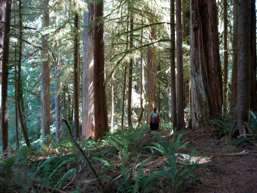
McKay Community Forest Trail Plan

Executive Summary
   •   The County of Humboldt’s McKay Community Forest is envisioned as a place for
       residents and visitors of all ages and abilities to enjoy walking, hiking, mountain-biking,
       wheeling, horseback-riding, learning, and connecting with the natural world. The McKay
       Community Forest Trail Plan proposes a trail network with 31 miles of multi-use roads,
       multi-use trails, hiking trails, and mountain bike trails. Additional trails may be
       considered in the future.

   •   The Trail Plan was prepared with an emphasis on accommodating users with accessibility
       needs to the greatest possible extent, based on the 2013 Accessibility Guidelines for
       Outdoor Developed Areas. A total of 1.5 miles of fully accessible trails and 0.7 miles of
       improved access trails are proposed.

   •   The McKay Community Forest currently contains approximately 1,194 acres, including
       997 acres acquired from Green Diamond Resource Company in August 2014 and 197
       acres acquired from Green Diamond in June 2020. Also in 2020, Humboldt County
       acquired a trail easement on a Green Diamond logging road connecting the Community
       Forest with Eggert Road.

   •   The Trail Plan describes the overall goals, objectives, guiding principles, design
       standards, and construction practices for building sustainable trails to support outstanding
       outdoor experiences for a diversity of trail users. The seven guiding principles are
       connectivity, integration, stewardship, accessibility, diversity, safety, and aesthetics.

   •   A parking area was constructed in Cutten along Northridge Road in 2018 to provide
       dedicated access to the Community Forest. Additional access points will be located
       along Harris Street and within Redwood Acres. Access points are expected to be
       developed near Redwood Fields, Manzanita Avenue, and Walnut Drive within two to five
       years as large parcels are permitted for subdivision.

   •   Trails will be developed incrementally in a logical sequence over the course of several
       years. The first trails to be built and opened to the public will be located near Northridge
       Road, Harris Street, and Redwood Acres. The timeframe for trail development will
       depend on available funding and working through the applicable permitting processes.
       Trail construction will depend heavily on support from the California Conservation
       Corps, the Volunteer Trail Stewards program of the Humboldt Trails Council, and
       Redwood Coast Mountain Bike Association. Connecting the northern and southern
       portions of the Community Forest will require securing an encroachment onto the McKay
       Ranch subdivision which surrounds Redwood Fields. The Trail Plan includes a proposed
       Bike Skills Park near the Northridge parking area.

   •   Expected benefits of the McKay Community Forest include:
        - Providing opportunities for physical activity, discovery, fun, and enjoyment.
        - Providing a refuge where people can connect with nature, experience wildness, and
          observe natural beauty.
        - Providing access to an outdoor classroom.
        - Supporting appreciation of watershed services and modern forest management.
        - Helping to nurture a sense of place in the greater Eureka area and boosting civic pride.
        - Promoting tourism and supporting the local economy.

December 16, 2020
                                                1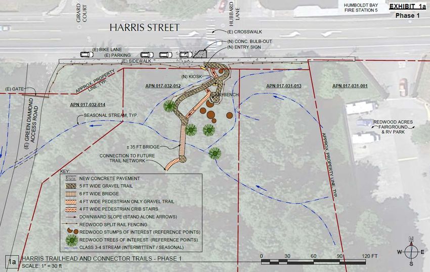
McKay Community Forest Trail Plan

Reflections on Trails

Certain trails are so elegant that they seem to lie sleeping just beneath the surface of the earth.
Rather than being created by us, it is as if these trails unveiled themselves through us. When
humans, bison, deer, and other woodland animals go in search of the shallowest pass in a mountain
chain, they tend to decide on the same route. Who, then, invented the trail? The humans? The
bison? The deer? The answer, it seems, is that no one can claim full credit, because an essential
trail is predetermined by the shape of the topography and the needs of its walkers. Just as
biologists sometimes say that “function precedes structure,” in some sense, a trail precedes the
trail-maker, waiting there for someone to come along and brush it off.

                                   – Robert Moor, On Trails (2016)

At its best, a trail is a unique extension of its site. Much more than merely a connection between
two points, a trail can create a safe and sustainable corridor through the site which brings visitors
into the site’s natural features. A trail can be subtly integrated into its site such that it feels like it
belongs there – complementing the site with its presence – and in the process making us feel as if
we, too, belong there. And the best trails provide a rich combination of landscape, visual and
sensory experiences, intellectual discoveries, and emotions and feelings that continually makes
them enjoyable to use, time and time again.

Trails such as this usually don’t just happen. They are designed to be sustainable, to bring visitors
in contact with the site – to be enjoyable to use.

              – Troy Scott Parker, Trails Design and Management Handbook (1994)

Build it right, build it once.

                          – International Mountain Bicycling Association,
                Trail Solutions: IMBA’s Guide to Building Sweet Singletrack (2004)

December 16, 2020
                                                    2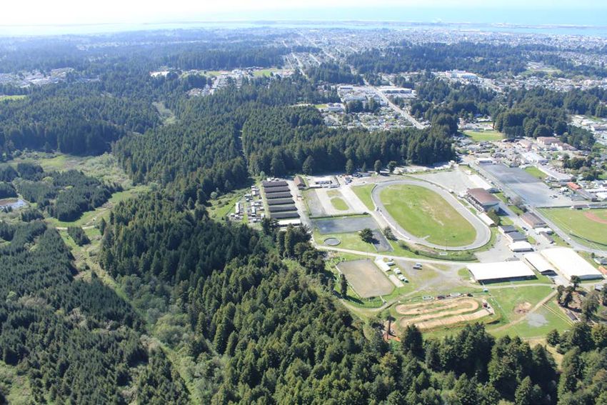
McKay Community Forest Trail Plan

                                  Acknowledgements
                    Ryan Creek/McKay Tract Conservation Partners
        Green Diamond Resource Company                      The Trust for Public Land
                       CAL FIRE                                   City of Eureka

                                       Funding Partners
                        Agency                                    Funding Source
                                                    River Parkways Grant Program
      California Natural Resources Agency
                                                    Urban Rivers Grant Program
      California Wildlife Conservation Board        Forest Conservation Program
      California Department of Housing and
                                                    Housing-Related Parks Program
      Community Development
      California Coastal Conservancy                National Coastal Wetlands Conservation
      U.S. Fish & Wildlife Service                  Grant Program
                                                    Headwaters Fund
      Humboldt County
                                                    Parkland Dedication (Quimby Act) Fees

                                       Planning Partners
      Accessibility Representatives        Charlie Bean         David Beard        Eric Smiley
      City of Arcata                       Dennis Houghton Darius Damonte Mark Andre
      Green Diamond Resource
                                           Craig Compton        Greg Templeton Jeremy Wright
      Company
      Redwood Community Action
                                           Emily Sinkhorn       Denise Newman
      Agency
                                           Mark Allee           Michael Asprey Peter Luvaas
      California Conservation Corps
                                           Raquel Ortega
      Trail Planners and Engineers         Bruce Cann           Chris Whitworth Chris Turner
      Humboldt Trail Council               Volunteer Trail Stewards
      Redwood Coast Mountain Biking
                                           Board of Directors
      Association

                McKay Community Forest Advisory Group (2014-2017)
      Marlene Allen        Cindy Bedingfield         Craig Benson             Dan Ehresman
      Greg Gardiner        Geoff Hales               Dave Hayes               Pete Johnston
      Berit Meyer          Jennifer Rice             Sean Robertson           Bruce Roessler
      Nick Simpson         Emily Sinkhorn            Nancy Stephenson         Karen Suiker
      Yana Valachovic      Rich Yeider

December 16, 2020
                                                3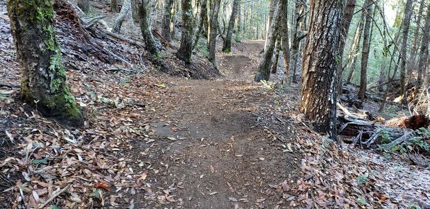
McKay Community Forest Trail Plan

                    Humboldt County Department of Public Works
              Tom Mattson, Director               Robert Vogt, Senior Environmental Analyst
         Hank Seemann, Deputy-Director            Todd Becker, Senior Environmental Analyst
            (Environmental Services)
            Mike Orr, Park Supervisor                Julia Cavali, Environmental Analyst
          Tony Seghetti, Deputy-Director           Angi Sorensen, Associate Civil Engineer
                 (Engineering)
           Jeff Ball, Associate Engineer              Cailan Halliday, Assistant Engineer
      Will Madaras, Engineering Technician

                        Humboldt County Board of Supervisors
                         First District                Rex Bohn
                        Second District              Estelle Fennell
                         Third District               Mike Wilson
                        Fourth District              Virginia Bass
                         Fifth District              Steve Madrone

                        Second District      Clif Clendenen (2008-2012)
                         Third District      Mark Lovelace (2008-2016)
                         Fifth District      Ryan Sundberg (2010-2018)

December 16, 2020
                                              4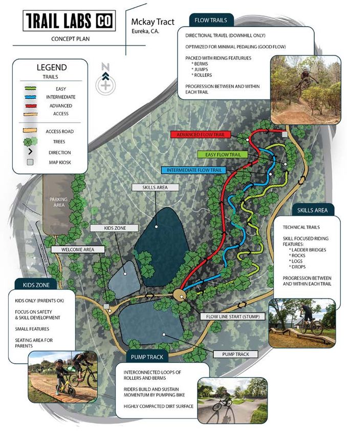
McKay Community Forest Trail Plan

Table of Contents
1   Introduction ............................................................................................................................. 8
    1.1    Purpose......................................................................................................................... 8
    1.2    Background .................................................................................................................. 9
    1.3    Plan Overview............................................................................................................ 10
    1.4    Applicable Planning Documents................................................................................ 11
    1.5    Traveling to the Community Forest ........................................................................... 13
    1.6    Community Forest Road Network ............................................................................. 13
2   Planning Framework ............................................................................................................ 15
    2.1    Vision Statement ........................................................................................................ 15
    2.2    Goals and Objectives ................................................................................................. 15
    2.3    Trail Users.................................................................................................................. 17
    2.4    Trail System Elements ............................................................................................... 18
    2.5    Site Conditions and Features ..................................................................................... 24
    2.6    Guiding Principles ..................................................................................................... 25
    2.7    Evaluation Process ..................................................................................................... 25
    2.8    Trail Design Standards............................................................................................... 26
    2.9    Amenities ................................................................................................................... 37
3   Access Points ......................................................................................................................... 41
    3.1    Short-term Opportunities ........................................................................................... 41
    3.2    Potential Long-term Opportunities ............................................................................ 48
    3.3    Locations Not Currently Considered ......................................................................... 48
4   Trail Network ........................................................................................................................ 50
    4.1    Trail Planning Units ................................................................................................... 50
    4.2    Redwood Acres .......................................................................................................... 50
    4.3    Park Street .................................................................................................................. 50
    4.4    North McKay ............................................................................................................. 51
    4.5    Mid-McKay ............................................................................................................... 51
    4.6    South McKay ............................................................................................................. 52
    4.7    Henderson Gulch ....................................................................................................... 52
    4.8    Northridge .................................................................................................................. 52
    4.9    Accessible Trails ........................................................................................................ 52
    4.10   Eggert Connector Trail .............................................................................................. 52
    4.11   Bridges ....................................................................................................................... 52
    4.12   Bike Skills Park ......................................................................................................... 55
5   Implementation ..................................................................................................................... 56
    5.1    Trail Construction ...................................................................................................... 56
    5.2    Management............................................................................................................... 57
    5.3    Operation and Maintenance ....................................................................................... 57
    5.4    Patrols and Enforcement ............................................................................................ 58
    5.5    Emergency Response ................................................................................................. 58
    5.6    Action Items............................................................................................................... 59
6   Response to Comments ......................................................................................................... 60
7   References .............................................................................................................................. 67

December 16, 2020
                                                                      5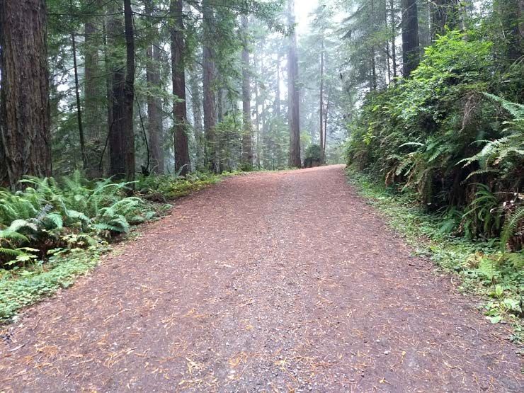
McKay Community Forest Trail Plan

List of Figures
   Figure 2-1       Typical Section for Trail Formed with Imported Rock Material
   Figure 2-2       Berms (Banked Curved)
   Figure 2-3       Rollers
   Figure 2-4       Jump
   Figure 2-5       Tabletop
   Figure 2-6       Roller Double
   Figure 2-7       Drop-off
   Figure 2-8       Rock Garden
   Figure 2-9       Optional Line
   Figure 2-10      Diagram for Full Bench Trail
   Figure 2-11      Community Forest Logo
   Figure 3-1       Harris Street Site Plan Concept
   Figure 4-1       Park Street Undercrossing Conceptual Design
   Figure 4-2       RCMBA Bike Skills Park Conceptual Design

List of Photographs
   Photo 2-1        Multi-use Road
   Photo 2-2        Multi-use Trail
   Photo 2-3        Hiking Trail
   Photo 2-4        Mountain Bike Trail
   Photo 2-5        Accessible Trailhead Signs
   Photo 3-1        Northridge Access Point
   Photo 3-2        Harris Street Access Point
   Photo 3-3        Redwood Acres
   Photo 3-4        Redwood Fields and McKay Ranch
   Photo 3-5        Mid-McKay Subdivision
   Photo 4-1        Wood Bridge
   Photo 4-2        Fiberglass Bridge
   Photo 4-3        Railcar Bridge
   Photo 5-1        Volunteer Trail Builders

List of Tables
   Table 1-1        Management Goals for the McKay Community Forest
   Table 1-2        Applicable Goals, Policies, Standards and Implementation Measures of
                      the Humboldt County General Plan (outside the coastal zone)
   Table 1-3        Applicable Policies of the Humboldt Bay Area Plan (inside the coastal zone)
   Table 1-4        Applicable Policies of the Eureka Community Plan
   Table 2-1        Recreation Goals
   Table 2-2        Recreation Objectives
   Table 2-3        Guidelines for Multi-use Roads
   Table 2-4        Guidelines for Multi-use Trails
   Table 2-5        Guidelines for Hiking Trails
   Table 2-6        Guidelines for Mountain Bike Trails
   Table 2-7        Guidelines for Accessible Trails (AGODA, Section 1017)
   Table 3-1        Proposed Access Points
   Table 4-1        Trail Planning Units
   Table 4-2        Bridges
   Table 5-1        Action Items

December 16, 2020
                                             6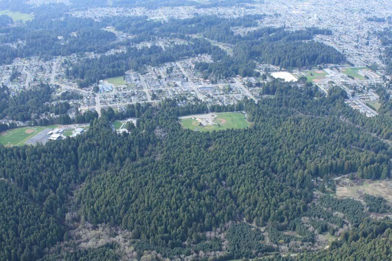
McKay Community Forest Trail Plan

List of Maps
   Map 1-1          Community Forest Overview
   Map 1-2          Ryan Creek Watershed
   Map 1-3          Humboldt Bay Area
   Map 1-4          Northern Section
   Map 1-5          Middle Section
   Map 1-6          Southern Section
   Map 1-7          Ryan Creek Conservation Strategy
   Map 1-8          Coastal Zone Jurisdiction
   Map 1-9          Eureka Community Planning Area
   Map 1-10         Transit Stops
   Map 1-11         Bicycle Routes
   Map 1-12         Road System - North
   Map 1-13         Road System - South
   Map 3-1          Potential Access Points (Short-term and Long-term)
   Map 3-2          Northridge Access Point
   Map 3-3          Harris Street Access Point
   Map 3-4          Redwood Acres Access Points
   Map 3-5          Redwood Fields/McKay Ranch Subdivision Access Point
   Map 3-6          Manzanita Avenue Access Point
   Map 3-7          Mid-McKay Subdivision Access Point
   Map 4-1          Trail Planning Units
   Map 4-2          Proposed Trail System
   Map 4-3          Redwood Acres Trail
   Map 4-4          Redwood Acres Trail (West Side)
   Map 4-5          Redwood Acres Trail (East Side)
   Map 4-6          Park Street Trail
   Map 4-7          North McKay Trail
   Map 4-8          Proposed McKay Ranch Trail Encroachment
   Map 4-9          Mid-McKay Trail
   Map 4-10         South McKay and Henderson Gulch Trails
   Map 4-11         Northridge Trail
   Map 4-12         Accessible Trails – Northridge
   Map 4-13         Accessible Trails – Redwood Acres
   Map 4-14         Future Eggert Connector Trail
   Map 4-15         Bridges

List of Attachments
   Attachment 1     Road and Trail System Inventory (Detailed Figures and Tables)
   Attachment 2     Bike Skills Park Preliminary Design

December 16, 2020
                                            7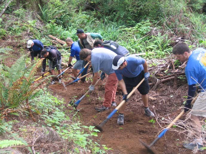
McKay Community Forest Trail Plan

1       INTRODUCTION
1.1 Purpose
The McKay Community Forest (“Community Forest”) is located southeast of Eureka within the
watershed of Ryan Creek, a tributary of Humboldt Bay (Maps 1-1 through 1-3). The Community
Forest is situated along the urban interface with residential and commercial areas of Myrtletown,
Cutten, and Ridgewood Heights (Maps 1-4 through 1-6). The Community Forest was established
in 2014 for multiple purposes including public access and recreation, timber harvest, and
watershed and resource conservation (Table 1-1). The Community Forest is envisioned as a place
for residents and visitors of all ages and abilities to enjoy walking, hiking, mountain-biking,
wheeling, horseback-riding, learning, and connecting with the natural world.

The purpose of this Trail Plan is to provide a blueprint for the development of trails, access points,
and amenities to support recreational and educational activities within the McKay Community
Forest. Trails are intended to be community resources that enable safe travel through the
Community Forest and support outstanding outdoor experiences for a diversity of trail users.

The Trail Plan presents the results of evaluating the opportunities and constraints for developing a
network of recreational trails within the forested landscape of the Community Forest and a set of
access points that integrate with surrounding land use. The Trail Plan provides a “big picture”
view of the proposed trails and access points to ensure a unified trail network. In addition, the
Trail Plan discusses general trail-building principles and practices and presents technical
guidelines to ensure consistency and sustainability.

A draft Trail Plan was released for public review on January 30, 2019, with a comment period
ending March 1, 2019. Comments are summarized in Section 6. The final Trail Plan was revised
and updated based on the comments received.

Table 1-1: Management Goals for the McKay Community Forest (Humboldt County, 2014)
                  Goal 1:               Practice environmentally appropriate, socially
            Forest Stewardship          beneficial, economically viable forest management
                                        Conserve and enhance the environmental values of the
                  Goal 2:
                                        forest to maintain its biodiversity, productivity, and
           Environmental Values
                                        ecological processes
                 Goal 3:                Maintain a working forest that supports timber-related
              Working Forest            jobs and economic productivity on a sustainable basis
                 Goal 4:                Provide high-quality recreational opportunities to
       Public Access and Recreation     support active living and enhance quality of life
                                        Encourage robust public involvement to ensure that the
               Goal 5:
                                        community forest meets the community’s desires and
          Community involvement
                                        interests and is valued as a community asset
                  Goal 6:               Manage the community forest to promote a safe and
                Public Safety           secure environment for families and visitors of all ages
                                        Contribute to an awareness of modern forest
                  Goal 7:
                                        management practices and create opportunities for
                 Education
                                        outdoor educational activities

December 16, 2020
                                                  8
McKay Community Forest Trail Plan

1.2 Background
In 2009, Green Diamond Resource Company (Green Diamond) began working with The Trust for
Public Land (TPL) to develop a three-phase conservation strategy for the Ryan Creek watershed,
which included the concepts of establishing a publicly-owned community forest in two phases
and creating a conservation easement over the majority of the land that will remain privately
owned timberland (Map 1-7).

In August 2014, Humboldt County acquired approximately 997 acres of forestland as the Phase I
acquisition of the McKay Community Forest. The western boundary of the Phase I property is
situated adjacent to residential and commercial areas. The eastern property boundary is defined by
Ryan Creek and Ryan Slough. The northern boundary is situated near Harris Street, Redwood
Acres, and Park Street. The southern property boundary is adjacent to Green Diamond timberland.
The terms “McKay Community Forest” and “Community Forest” refer to County-owned property,
while “McKay Tract” refers to property owned by Green Diamond within the Ryan Creek
watershed.

In June 2020, Humboldt County acquired approximately 197 acres contiguous to the south end of
the Phase I property as the Phase II expansion of the community forest. Also in June 2020, Phase
III of the conservation strategy was completed through establishment of a conservation easement
over 5,976 acres of Green Diamond’s remaining holdings in the McKay Tract. Completion of the
Phase II and Phase III elements included a trail easement on a logging road owned by Green
Diamond to provide a future connector trail from the Community Forest to Eggert Road.

The Community Forest is managed by the Humboldt County Department of Public Works. The
cost of managing the Community Forest will be funded by timber harvest revenue, grants, and
donations.

One of the first priorities for developing the Community Forest after the Phase I acquisition was
to identify appropriate locations for public access, taking into account property boundaries,
topography, watercourses, and proximity to adjacent properties and infrastructure. The property
that became the Community Forest was previously integrated into the larger McKay Tract road
network and did not come with “ready-to-go” access points providing sufficient parking or
gathering areas for public use. A key principle in developing access points is to ensure
compatibility with adjacent property and land use. In addition, there was a need to inventory the
condition of the existing roads and prepare a plan for the permanent road network. Some
informal trails currently exist; however, these trails are not linked to appropriate access points, do
not have a logical configuration, and in many cases are in poor condition. Substantial work over
several years will be needed to establish access points and trails in order to enable the public to
have full access and recreational use within the Community Forest.

Public access points and trails will be developed incrementally in a logical sequence over the
course of several years. The timeframe for trail development will depend on available funding,
volunteer interest, and working through the applicable permitting processes. In June 2018, the
California Conservation Corps (CCC) was awarded grant funding through the state Active
Transportation Program to support two years of trail construction within the Community Forest.
The CCC performed initial site preparation activities from October 2018 through August 2020.
Local organizations expressing interest in actively supporting the development of trails and
recreational opportunities include the Volunteer Trail Stewards program of the Humboldt Trails
Council, Retired Seniors Volunteer Program, Redwood Coast Mountain Bike Association,
Redwood Region Endurance Riders, Boy Scouts of America, and Rotary Club of Eureka.

December 16, 2020
                                                  9
McKay Community Forest Trail Plan
The County will develop a Forest Stewardship Plan and Non-industrial Timber Management Plan
(NTMP) to guide timber harvest activities and watershed and resource conservation. The Forest
Stewardship Plan will be concise, revisable document describing the County’s long-term goals and
objectives for managing the Community Forest. The Forest Stewardship Plan will address how
silviculture, fire risk reduction, wildlife habitat restoration, carbon sequestration, monitoring, and
adaptive management will be implemented over the term of the plan. The Forest Stewardship Plan
will also address how forest management goals and objectives will be integrated with other
management goals and how the County intends to strive for compatibility with the neighborhoods
bordering the McKay Community Forest. The NTMP will be a technical document demonstrating
how the County intends to comply with the California Forest Practice Rules and associated laws
and regulations. Technical studies to support the Forest Stewardship Plan and NTMP include a
forest inventory and analysis, inventory of controllable sediment discharge sites, and geomorphic
and geological analysis. The scheduling goal is to complete these plans in mid-2021 and to
perform the first commercial timber harvest by the end of the 2021 season.
1.3 Plan Overview
The audience for this Trail Plan includes community members, public agencies, and County staff.
The plan will be used as a tool for formulating management decisions, setting priorities, initiating
projects, providing guidance and training, applying for grant funding, and administering
subdivisions on adjacent property. In addition, the plan will be used to support analysis of
environmental impacts under the California Environmental Quality Act and application for
permits and approvals. The plan presents the overall approach for developing the trail network
and is intended to ensure a logical sequence of implementation over time.
This Trail Plan focuses on an initial network of access points and trails to expedite opening the
Community Forest to the public. Additional trail segments, recreational facilities, and amenities
could be developed in future phases. Ideas for recreational facilities that have been brought
forward include the following: logging or railroad museum, nature center, lodge, mountain biking
skills park, ropes course, zip lines, disc golf course, picnic areas, and playgrounds. This Trail
Plan can also be used to support planning for future regional connections to locations such as Elk
River Road, Headwaters Preserve, and the Humboldt Bay Trail.
The grant agreements for the acquisition of the Community Forest property specify that
recreational uses must be compatible with forest conservation and protection. Allowable
recreational activities include walking, running, and hiking; education and research; bicycling on
designated trails; equestrian use on designated trails; walking with dogs; and fishing in
accordance with California fishing regulations. Driving motorized vehicles (cars, trucks,
motorcycles, ATVs) and hunting are not an allowable recreational use.
Preparation of the Trail Plan was informed by feedback from several public meetings held from
2012 through 2014 and input from the McKay Community Forest Advisory Group which was
initiated in late 2014 after the Phase I property was acquired. Planning activities included
consulting with user groups, assessing the existing road network, planning the future road
network, inspecting the property to identify appropriate trail locations and alignments, developing
technical standards, coordinating with adjacent landowners, designing parking facilities, and
planning road upgrades. Humboldt County partnered with the City of Arcata through a
collaborative agreement in which City staff provided valuable assistance assessing conditions and
providing consultation on trail routes, designs, and construction techniques, based on their
experience developing the Arcata Community Forest.
December 16, 2020
10McKay Community Forest Trail Plan
1.4 Applicable Planning Documents
1.4.1 Project Report (Humboldt County, 2014)
Public Works issued a Project Report in April 2014 to support the Board of Supervisors’ decision
whether to accept the Phase I property for the establishment of the Community Forest. The
Project Report presents background information on the property, describes the overall
management approach, and provides a preliminary discussion of access points and trails.
1.4.2 Humboldt County General Plan
The Humboldt County General Plan (October 2017) applies to unincorporated areas outside the
coastal zone. The General Plan contains goals, policies, standards, and implementation measures
for land use planning and development. The northern portion of the Community Forest is situated
within the coastal zone, but the majority is situated outside the coastal zone (Map 1-8). Goals,
policies, standards, and implementation measures relevant to the Community Forest outside the
coastal zone are summarized in Table 1-2.
Table 1-2: Applicable Goals, Policies, Standards and Implementation Measures of the
Humboldt County General Plan (outside the coastal zone)
Goal/Policy/Standard Description
Parks and Recreation. Well maintained and accessible parks offering a
Goal CO-G4
range of popular recreation opportunities and a regional trail system that
meets future recreational and non-motorized transportation demands.
Develop and Maintain County Parks. Secure, develop, and maintain
Policy CO-P9 county parks and recreation areas that are highly accessible to the public
in order to serve the present and future needs of county residents.
Public Recreation. Support acquisition, development and management
of parklands and trails primarily in locations that are highly accessible to
the public in order to serve the outdoor recreation and ADA needs of
Policy CO-P11
current and future residents, and where such uses do not reduce the
agricultural capability, timber productivity and ecological services on
open space lands.
Develop a Regional Trails System. Support efforts to establish and
connect regional trails, particularly in the greater Humboldt Bay and
lower Mad River areas, the Eel River Valley, along the Avenue of the
Policy C-P38
Giants and in the Klamath-Trinity area. The System should include the
California Coastal Trail System and consist of multi-use trails where
feasible.
Equestrian Trails. The Federal Highway Administration “Equestrian
Standard C-S10 Design Guidebook for Trails,” or its equivalent, shall be used as a guide
for the analysis and design of equestrian trails.
Neighborhood Connectivity. Subdivisions shall be designed to promote
road and trail circulation between neighborhoods, schools, parks, and
Policy UL-P8
open space areas. The subdivision ordinance shall specify standards and
limitations for cul-de-sacs, dead end roads, and block sizes.
References:
CO – Conservation and Open Space Element
C – Circulation Element
UL – Land Use Element
December 16, 2020
11McKay Community Forest Trail Plan
1.4.3 Humboldt Bay Area Plan
The Humboldt Bay Area Plan (December 2014) applies to the portion of the Community Forest
situated within the coastal zone. The Humboldt Bay Area Plan contains recommendations,
policies, and standards for land use. Goals, policies, standards, and implementation measures
relevant to the Community Forest inside the coastal zone are summarized in Table 1-3.
Table 1-3: Applicable Policies of the Humboldt Bay Area Plan (inside the coastal zone)
Policy Description
Lower cost visitor and recreation facilities… shall be protected,
Policy 30213
encouraged, and, where feasible, provided. Developments providing public
recreational opportunities are preferred.
The diking, filling, or dredging of open coastal waters, wetlands, estuaries,
and lakes shall be permitted in accordance with other applicable provisions
of this division, where there is no feasible less environmentally damaging
Policy 30233(a) alternative, and where feasible mitigation measures have been provided to
minimize adverse environmental effects, and shall be limited to the
following:
(8) Nature study, aquaculture, or similar resource-dependent activities.
New development within the riparian corridors shall be permitted when
there is no less environmentally damaging feasible alternative, where the
best mitigation measures feasible have been provided to minimize adverse
environmental effects, and shall be limited to the following uses.
Policy 30236(e) (8) Public access trails provided that the length of the trail within the
riparian corridor shall be minimized, where feasible, by rights of way
which cross streams at right angles, which are kept as far up slope from the
stream as possible, which involve a minimum of slope disturbance and
vegetative clearing, and are the minimum width necessary.
1.4.4 Eureka Community Plan
The Eureka Community Plan (1995) contains goals and policies for land use and development,
hazards and resources, and public services and facilities within the Eureka Community Planning
Area. The western portion of the Community Forest is situated within the Eureka Community
Planning Area (Map 1-9). The Eureka Community Plan is a companion document to the
Humboldt County General Plan, which applies to all unincorporated areas of Humboldt County.
Sections 4400, 4410, and 4420 of the Eureka Community Plan address parks and recreation. The
Eureka Community Plan encourages development of two types of facilities, neighborhood parks
and community parks, to enhance quality of life. The Eureka Community Plan defines a
community park (Page 76) as follows:
Community Park – A park or facility developed primarily to meet the requirements of a large portion
of the Planning Area. The location services an area within a three mile radius. The size is generally
from 5 to 20 acres. In addition to neighborhood park elements, a community park might also have
restrooms, large landscaped areas, a community center, a swimming pool, lighted sport fields, and
specialized equipment not found in a neighborhood park.
The McKay Community Forest meets this definition of Community Park because it will provide
an extensive trail network for recreational use by walkers, hikers, bicyclists, and equestrians and
provides opportunities to develop other recreational facilities over time. A portion of the trails,
December 16, 2020
12McKay Community Forest Trail Plan
especially near adjacent neighborhoods, will be designed to accommodate use of baby strollers
and bicycling by children. The high-quality recreational experience provided by several miles of
trails within a forest setting is reasonably expected to attract visitors from at least a three mile
radius. Goals and policies relevant to the Community Forest are summarized in Table 1-4.
Table 1-4: Applicable Policies of the Eureka Community Plan
Policy Description
To provide a well balanced system of park and recreation facilities offering a
Goal 4410 variety of active, passive and cultural recreational opportunities to all residents,
and adequate to meet changing recreational needs of Planning Area residents.
The County should encourage a Parkland Dedication fee to fund development
of new parkland. The County is encouraged to accept dedication of parkland
Policy 4420.1
when a means of securing funding for maintenance, administration and
operation of the parkland is created or available.
Parks should be located and sized and should contain appropriate facilities to
Policy 4420.4
serve both the existing and projected population within each service radius.
Park sites should be provided with adequate water supply, sewer, police and
Policy 4420.5 fire protection services, and should be accessible by foot, bicycle, and
automobile.
Neighborhood and community park and recreation facilities should, to the
Policy 4420.6
extent possible, be located in predominantly residential areas.
To the extent possible, all parklands should be dedicated and held inviolate in
Policy 4420.7 perpetuity, protected by law against diversion to non-recreational purposes and
against invasion by inappropriate uses.
1.5 Traveling to the Community Forest
People will travel to the Community Forest utilizing private vehicles and public transit as well as
on bicycle or by foot. Maps 1-10 and 1-11 show transit stops and bicycle routes, respectively.
1.6 Community Forest Road Network
The proposed road network within the Community Forest is shown in Maps 1-12 and 1-13.
Roads provide the backbone and starting point for planning the Community Forest trail system.
In addition to timber harvest operations, roads are necessary for maintenance vehicles,
construction equipment, patrols, fire-fighting, and emergency response. The proposed road
network includes 11.5 miles of road segments to be retained and upgraded and 2.0 miles of new
road segments. A total of 4.8 miles of historic road segments would be decommissioned or have
already been decommissioned.
Green Diamond utilizes a road-naming convention which applies a unique letter-number
combination to each road segment based on road type. Green Diamond’s main haul road through
the McKay Tract is designated the R-Line. The R-Line intersects with Harris Street west of
Redwood Acres. The majority of the R-Line was retained by Green Diamond and is not part of
the Community Forest. The segment leading from the first gate at Harris Street down to the
second gate where the road splits is Green Diamond property. At the second gate, the R-Line
continues to the left and the 0.23-mile segment from the second gate to the third gate (situated
near a bridge over Ryan Creek) is part of the Community Forest. The remainder of the R-Line,
situated east of Ryan Creek, is owned by Green Diamond and is not part of the Community
December 16, 2020
13McKay Community Forest Trail Plan
Forest. Other primary roads are designated with numbers (e.g., R-1, R-2), and connector spurs
are given further sub-designations (e.g., R-6-1). The roads accessed from Northridge Road are
designated NR-1 and NR-2.
The roads in the Community Forest were developed over the course of several decades in the
context of the overall road network for the McKay Tract. Public Works evaluated the existing
road network to determine which roads should be maintained, which roads should be
decommissioned, and where new roads should be developed. The conditions of the existing road
network are variable. Some roads are legacy roads built prior to modern standards for road
location, design, and construction. The majority of roads are surfaced with native materials with
only a small portion surfaced with aggregate. Some roads are in suitable locations and require
minimal effort for re-opening, while others are in poor condition and require upgrades to varying
degrees. Typical upgrade needs include new stream crossings, road surface drainage
improvements, removal of unstable fill material, and rock surfacing. Some roads are situated in
inappropriate locations and warrant decommissioning.
Public Works adopted the operating unit boundaries and designations established by Green
Diamond, subject to future change or adjustment. Public Works analyzed each operating unit, the
existing road network, and options for accessing each unit for harvest operations (felling, yarding,
and hauling). Public Works looked at the condition of each road and how they are situated in the
landscape, weighing the benefits of maintaining a road against the anticipated cost of upgrades
and potentially feasible alternatives. Detailed information regarding the proposed road inventory
is provided in Attachment 1. The road inventory may be adjusted based on more detailed
assessment of road conditions and management needs. Grants will be pursued to upgrade roads
on an expedited timeframe and to incorporate restoration goals to the extent feasible. At a
minimum, roads within an operating unit will be upgraded concurrent with the first entry into the
unit. The entire road system is expected to be upgraded within 20 to 25 years.
December 16, 2020
14McKay Community Forest Trail Plan
2 PLANNING FRAMEWORK
2.1 Vision Statement
Public Access and Recreation Vision Statement:
The McKay Community Forest enhances the quality of life for Humboldt County residents
and visitors by providing outstanding recreational opportunities. Recreational facilities will
be compatible with adjacent land uses, forest stewardship, resource conservation, and a
working forest. The McKay Community Forest will:
• Provide opportunities for people to maintain and improve health and fitness through
outdoor physical activity.
• Provide recreational trails that enable people to seek challenges and engage in play.
• Provide a refuge where people can connect with nature, experience solitude and
wildness, make discoveries, and observe natural beauty.
• Provide access to an outdoor classroom.
• Support appreciation of watershed services, forest management, and modern timber
harvest practices.
• Nurture a sense of place in the greater Eureka area and boost civic pride.
• Promote tourism and support the local economy.
2.2 Goals and Objectives
Management goals are broad statements about what needs to be accomplished to achieve the
vision. Management goals for public access and recreation are presented in Table 2-1.
Table 2-1: Recreation Goals
Goal 1: Provide an integrated trail system for a diversity of trail users.
Goal 2: Promote a safe and secure environment for visitors of all ages and abilities.
Goal 3: Protect the Community Forest’s natural and cultural resources.
Goal 4: Provide a trail information system.
Goal 5: Foster community partnerships to assist with trail development and maintenance.
Goal 6: Promote trail-oriented tourism and special events.
Goal 7: Pursue linkages with other trails and recreational facilities.
Management objectives represent specific tasks, milestones, or methods for achieving
management goals. Management objectives associated with each management goal are presented
in Table 2-2.
December 16, 2020
15McKay Community Forest Trail Plan
Table 2-2: Recreation Objectives
Goals Objectives
Goal 1: 1-1: Provide multiple access points with parking and other
Provide an support facilities where appropriate.
integrated trail 1-2: Provide a combination of multi-use and single-use trails with
system for a a range of distances, trail features, and challenge levels.
diversity of trail 1-3: Ensure that the trail network is navigable and user friendly.
users. 1-4: Provide accessible trails near access points where feasible
based on terrain and other constraints.
1-5: Provide trail connectivity between different portions of the
Community Forest.
1-6: Establish guidelines for trail development and maintenance.
1-7: Coordinate with the Humboldt County Planning and
Building Department to incorporate proposed long-term
access points into appropriate planning documents.
1-8: Acquire easements to improve access to the Community
Forest.
Goal 2: 2-1: Plan to avoid user conflicts by designing trails with
Promote a safe consideration for appropriate trail widths, passing areas,
and secure visibility, and signage.
environment for 2-2: Develop an ordinance with appropriate rules and regulations.
families and 2-3: Encourage appropriate trail etiquette with signs, brochures,
visitors of all ages and other methods.
and abilities. 2-4: Provide regular safety patrols with a combination of staff
presence and volunteer “eyes and ears.”
2-5: Coordinate with Humboldt Bay Fire, the Humboldt County
Sheriff’s Office, and mutual aid agencies.
2-6: Perform consistent trail inspections and maintenance based on
established standards.
2-7: Ensure safety for trail users during timber harvest operations.
Goal 3: 3-1: Evaluate sensitive resources including rare species and
Protect the important habitat areas and features.
Community Forest’s 3-2: Design and maintain trails to avoid impacts to forest
natural and cultural resources and landscape constraints.
resources. 3-3: Design and maintain trails to discourage short-cutting.
3-4: Design and maintain trails to avoid impacts to adjacent
property.
3-5: Provide interpretation to encourage appreciation of the
forest’s resources and voluntary practices to avoid impacts.
Goal 4: 4-1: Develop and implement a uniform signage system for trails
Provide a trail and access points.
information system. 4-2: Develop trail maps in a variety of physical and digital forms.
4-3: Use naming conventions that are consistent, concise, and
memorable.
December 16, 2020
16McKay Community Forest Trail Plan
Table 2-2: Recreation Objectives (Continued)
Goals Objectives
Goal 5: 5-1: Execute a Memorandum of Agreement with the Humboldt
Foster community Trails Council for regular assistance by the Volunteer Trail
partnerships to Stewards.
assist with trail 5-2: Execute a Memorandum of Agreement with the Redwood
development and Coast Mountain Bike Association for assistance with trail-
maintenance. building and maintenance, and development, operation, and
maintenance of a pump track/skills park.
5-2: Develop staffing capacity to provide coordination and
oversight of volunteer work.
5-3: Maintain a working list of volunteer projects.
5-4: Develop opportunities for financial donations to be applied
directly to specific trail projects.
Goal 6: 6-1: Develop guidelines for trail-related events.
Promote trail- 6-2: Coordinate with organizations that promote local and
oriented tourism and regional tourism.
special events.
Goal 7: 7-1: Evaluate potential connections with the Headwaters Forest
Pursue linkages and Humboldt Bay Trail.
with other trails and 7-2: Pursue collaboration opportunities with Sequoia Park Zoo.
recreational
facilities.
2.3 Trail Users
The McKay Community Forest will be developed with a network of access points and trails to
accommodate a variety of non-motorized recreational uses and a range of ages and abilities, while
minimizing conflicts and environmental impacts. Expected users include foot travel users,
mountain bikers, and equestrians. Users will include people with physical disabilities. The
Community Forest is expected to serve residents and be a destination for out-of-town visitors.
Different types of trail users have different needs and interests, as described below.
Foot Travel Users include hikers, walkers, joggers, runners, wildlife-viewers, people pushing
baby strollers, and people using appropriate mobility devices. Foot travel users are expected to
constitute the largest user group. Travel speeds (miles per hour, mph) will vary from less than
one mph to over six mph, and trip distances will vary from less than one mile to several miles.
Some hikers seek more strenuous routes through diverse terrain.
Mountain Bikers have diverse interests based on age and skill level. Desired routes for biking
will vary from gentle and easy to strenuous and challenging. Travel speeds will vary from less
than two mph to over ten mph. Experienced bikers will seek more remote, less travelled trails
with complexity and technical trail features. Trail designs for mountain bikers can range from
“open and flowing,” with gentle slopes, gradual turns, and long sightlines, to “tight and
technical,” with sharper turns, narrower tread, and natural obstacles (IMBA, 2004; IMBA/BLM,
2018). Proper transitions between trail sections with different types of flow are important.
December 16, 2020
17McKay Community Forest Trail Plan
A new development during the last five to ten years is the increased use of electric motor-assisted
bicycles (also known as “e-bikes”). Electric mountain bikes are sometimes called “e-MTBs.” An
e-bike operates at relatively low speeds with a low-power electric motor to assist in pedaling. E-
bikes are considered consumer products rather than motor vehicles (such as mopeds and
motorcycles). An e-bike has fully operable pedals and an electric motor less than 750 Watts.
Three classes of e-bike have been designated in California based on motor speed and the level of
electric assist. Class 1 e-bikes have motor assist only when the rider is pedaling, and assistance
stops when the bike reaches 20 miles per hour. Class 2 e-bikes can be propelled by the motor
alone without pedaling, up to a speed of 20 miles per hour. Class 3 e-bikes have motor assist
only when the rider is pedaling, and assistance stops when the bike reaches 28 miles per hour.
One of the benefits of e-bikes is they expand opportunities for biking especially for people who
are older or have physical disabilities. Potential concerns about e-bikes include safety, trail
impacts, and social impacts (noise and nuisance). In 2017, the International Mountain Bicycling
Association (IMBA) released the following position statement:
IMBA is supportive of Class 1 eMTB access to non-motorized trails when the responsible
land management agency, in consultation with local mountain bikers, deem such eMTB
access is appropriate and will not cause any loss of access to non-motorized bikes. IMBA
recognizes that changes in design, technology and the numbers of eMTB users is evolving,
and believes these bikes can be managed in a sustainable way for both the environment and
other trail users.
Further review will be needed to determine which trails in the Community Forest are appropriate
for e-bikes. In addition, further review is needed to determine whether e-bikes are considered
Other Power-Drive Mobility Devices under the Americans with Disabilities Act.
Equestrians generally desire wide trails, soft surfaces, generous vertical and horizontal clearances,
and sight distances of at least 100 feet (USDA Forest Service, 2007). Typical travel speeds range
from three to six mph. Staging areas and space for trailer parking at access points are necessities.
Desirable attributes at access points include pull-through parking, wide clearances around
trailheads, and the absence of sharp edges on fences, signs, and buildings. Horses prefer non-
metal bridge decks and can spook easily when other users appear abruptly or approach rapidly.
Trails will be planned to be accessible for people with physical disabilities to the greatest extent
possible. Accessibility is discussed further in Section 2.7.2.
Regulations for control of dogs will need to be incorporated into the ordinance governing
appropriate use and conduct within the Community Forest.
2.4 Trail System Elements
The trail system includes access points, trails, and amenities.
2.4.1 Access Points
Access points (also known as Trailheads) are the formal entryways to the Community Forest
and provide the linkage between the broader community and the forested landscape of the
Community Forest. Access points serve as meeting and gathering areas and provide information
to help people plan their trip. A major access point provides designated off-street parking and
more extensive amenities. A minor access point utilizes on-street parking and provides less
extensive amenities. Access points for the Community Forest are discussed in Section 3.
December 16, 2020
18McKay Community Forest Trail Plan
2.4.2 Trails
Trails provide routes to pass through the Community Forest by foot, bicycle, horse, or mobility
device. For this report, the term “trail” is used broadly to include multi-use roads, multi-use
trails, hiking trails, and mountain bike trails. Trails include the surface tread, underlying
foundation, bridges for creek crossings, and a variety of drainage, slope stabilization, and safety
features.
Multi-use Roads provide vehicle access for management, maintenance, timber harvest, and
emergency response, and serve as trails for recreational use. Multi-use roads are designed for
vehicle loading and clearances which are normally more than adequate for a range of non-
motorized users. One of the benefits of multi-use roads is they provide ample space to
accommodate side-by-side travel.
Multi-use Trails are intended for all types of allowable non-motorized use. Multi-use trails are
designed to accommodate a mixed traffic of users with a range of speeds and abilities.
Hiking Trails are planned in areas with challenging terrain where a multi-use trail is not feasible
or preferred. Hiking trails provide the opportunity to create smaller openings to allow for a more
intimate experience in nature.
Mountain Bike Trails are planned to provide loops with trail features designed specifically to
enhance the mountain biking experience. Mountain bikers often prefer features that are
technically challenging and provide an experience of play and discovery. Examples of bike-
specific features include berms, rollers, jumps, tabletops, drop-offs, and rock gardens
(IMBA/BLM, 2018). Naturally occurring objects such as roots, rocks, and woods are often
incorporated as features of the trail. Mountain bike trails are often kept narrow and have a
preferred direction of travel.
The proposed trail network (Section 4) includes 11.1 miles of multi-use roads, 11.7 miles of
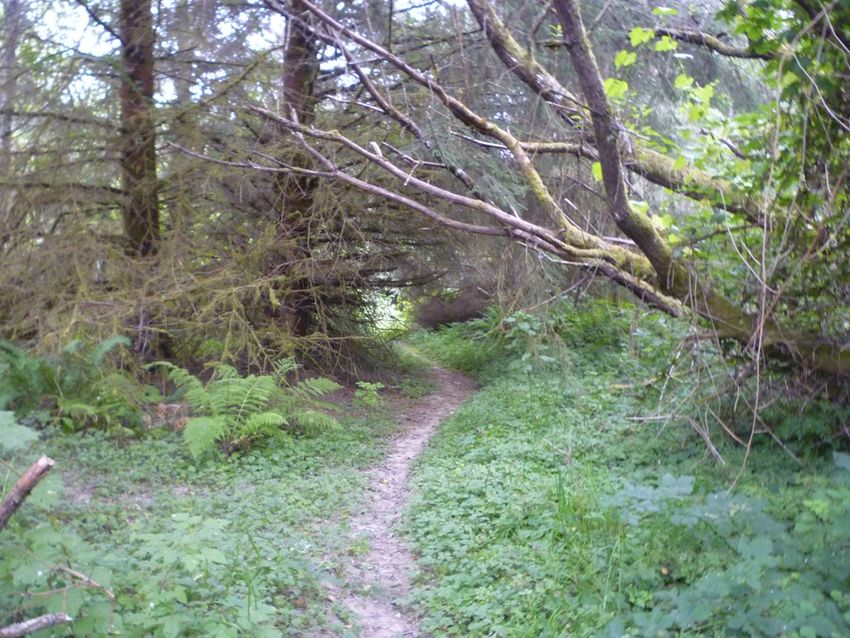
multi-use trails, 1.1 miles of hiking trails, and 5.0 miles of mountain bike trails. Additional trails
may be considered in the future. Equestrian use is expected on the majority of multi-use roads
and multi-use trails. No specific equestrian trails are currently planned. Inclusion of hiking trails
and mountain bike trails is expected to help disperse or separate users and reduce user conflicts.
Multi-use roads and multi-use trails are considered shared-use trails, which are designed to
accommodate all user groups. Signs will be used to promote respectful trail etiquette. User
group organizations can assist in promoting respectful trail use practices among their members.
Hiking trails and mountain bike trails are considered preferred-use trails, which are designed
primarily for one user group but other users are not prohibited from accessing the trails. The
Trail Plan does not propose restricted-use trails, which are designed for one user group with
other users prohibited. A primary goal of restricted use trails is to avoid user conflicts; however,
compliance with restrictions is difficult to enforce. Signs will be used to identify the intended use
of hiking trails and mountain bike trails and indicate that other uses are not recommended.
December 16, 2020
19McKay Community Forest Trail Plan
Useful definitions for trail planning and design include the following:
Trail Tread – The surface of the trail upon which users travel.
Natural Surface Trail – An unpaved trail with tread formed by native soil or imported rock
material (as opposed to a trail paved with asphalt or concrete).
Trailbed – The soil mass providing the foundation for the trail surface. The trailbed includes the
sub-grade (the native soil in the landscape) and may include a sub-base layer (material placed on
top of the sub-grade to support the trail surface).
Trail Corridor – The area along a trail that is maintained clear of obstacles and obstructions to
allow users to travel freely and safely.
Trail Grade – The steepness of a trail segment, measured by rise-over-run and expressed as a
percentage of its length (also known as running slope or longitudinal slope).
Cross Slope – The slope of the trail tread from edge to edge perpendicular to the direction of
travel.
Sideslope – The natural slope of the ground.
Contour Trail – A trail designed in a manner where its grade does not exceed half the grade of
the surrounding sideslope (for example, an 8% trail grade on a 20% sideslope).
Fall Trail – A trail where the grade exceeds half the grade of the sideslope of the surrounding
terrain (for example, a 15% trail grade on a 20% sideslope).
Singletrack – Narrow trails where users normally travel in single file.
Flow – The rhythm or character of a trail.
Control Points – Specific places or features that influence the location and alignment of a trail.
Control points include constraints (e.g., property boundaries), areas to avoid (e.g., low-lying wet
areas, sensitive habitat, steep slopes, potential safety hazards), desirable destinations (e.g., scenic
viewpoints, points of interest), and preferred locations for grade changes and stream crossings.
Turnpike – An elevated trail (also known as a causeway) formed by placing a layer of fill
material above the adjacent ground to accommodate wet soils and poor drainage. Turnpikes can
be “walled” by placing edge materials such as rock or timbers to confine the fill material, or
“unwalled” where edge materials are absent.
December 16, 2020
20McKay Community Forest Trail Plan
Figure 2-1: Typical Section for Trail Formed with Imported Rock Material
The following definitions and illustrations of mountain bike trail features were adapted from
IMBA/BLM (2018) and Architrail.
Berm – A banked and curved cornering feature
(also known as a banked curve) that provides
support for a mountain bike rider when turning a
corner, allowing them to turn in a smooth manner.
Roller – A feature where the trail surface rises and
falls smoothly and is ridable without pedaling.
Rollers can occur singularly or in series. Skillful
riders can use rollers to gain speed and control by
“pumping” them. Rollers can also help disperse
stormwater runoff.
Figure 2-2: Berm (Banked Curve)
Figure 2-3: Roller
December 16, 2020
21You can also read