Measuring What Matters - Setting Measurable Objectives to Achieve Sustainable Groundwater Management in California - Water Foundation
←
→
Page content transcription
If your browser does not render page correctly, please read the page content below
Measuring What
Matters
Setting Measurable Objectives to Achieve Sustainable
Groundwater Management in California
Measuring What
Matters
Setting Measurable Objectives to Achieve
Sustainable Groundwater Management
in California

Juliet Christian-Smith
Kristyn Abhold

September 2015
© 2015 Union of Concerned Scientists
     All Rights Reserved

     Juliet Christian-Smith is a climate scien-
     tist with the Climate and Energy Program
     at UCS. Dr. Christian-Smith specializes in
     water resource management and is an edi-
     tor and co-author of several peer-reviewed
     journal articles and books on water science
     and policy. The focus of her work is provid-
     ing California and U.S. policymakers and
     the public with robust, timely, accessible,
     and policy-relevant information on climate
     science and climate impacts.

     Kristyn Abhold was a Goldman Fellow
     with the Climate and Energy Program at
     UCS. She conducted research with UCS on
     sustainable groundwater management as
     part of a capstone project that completed
     her Masters of Public Policy at the Gold-
     man School of Public Policy, University of
     California, Berkeley. She is also the former
     vice president of the U.S. Water Alliance.

     The Union of Concerned Scientists puts
     rigorous, independent science to work to
     solve our planet’s most pressing problems.
     Joining with citizens across the country,
     we combine technical analysis and
     effective advocacy to create innovative,
     practical solutions for a healthy, safe,
     and sustainable future.

     More information about UCS and the
     Climate and Energy Program is available
     on the UCS website: www.ucsusa.org

     This report is available online
     (in PDF format) at
     www.ucsusa.org/measuringwhatmatters.

     Designed by:
     Penny Michalak

     Cover photo: Kelly M. Grow/CA DWR
     Printed on recycled paper

ii     union of concerned scientists
[ contents ]

 iv   Figures, Tables, and Boxes
 v    Acknowledgments

 1    executive summary

      chapter 1
 3    Measuring Sustainability
 4    Background
 4    Measurable Objectives of SGMA

		 chapter 2
 6    Review of the State of Knowledge and Practice
 6    Define Clear Baselines
 7    Set Quantitative Thresholds
 9    Develop Protective Triggers
 9    Incorporate Regular Measurement and Monitoring
11    Account for Uncertainty
15    Adapt to Changing Conditions and New Information

      chapter 3
20    A Preliminary Framework for Setting Thresholds for Measurable Objectives
23    Step 1: Does the Threshold Exceed an Existing Standard?
23    Step 2: Was the Threshold Developed through a Transparent Public Process?
23    Step 3: Are There Potential Negative Impacts Associated with the
		 Threshold Level?
23    Step 4: Does the Threshold Violate the Thresholds of Any Neighboring Basins?
24    Step 5: Is There High Uncertainty Regarding Actions Proposed to
		 Avoid the Threshold?

                                                                Measuring What Matters   iii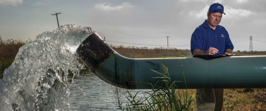
24    Step 6: Does the Threshold Conflict with Any Other Undesirable
                                     		 Result Thresholds?

                                     		    chapter 4
                                     26    Recommendations
                                     26    Common State Framework Needed
                                     28    Summary

                                     29    Appendix: Roundtable Findings on Measurable Objectives
                                     34    References
                                     36    Glossary

iv   union of concerned scientists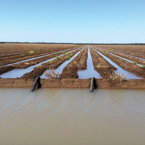
[ figures, tables, and boxes ]

		figures
 5   Figure 1. Groundwater Sustainability in SGMA
14   Figure 2. Fixed Thresholds and Triggers for Groundwater Management
17   Figure 3. The Adaptive Management Cycle
21   Figure 4. Preliminary Framework for Setting Thresholds

		tables
10 Table 1. Examples of Measurable Objectives and Corresponding Thresholds
		 in Groundwater Management
12   Table 2. Examples of Triggers in Groundwater Management
16   Table 3. Different Metrics Used to Assess Groundwater Levels and Storage
18   Table 4. Applying an Adaptive Management Framework to SGMA
22   Table 5. Relevant Policies to Inform Thresholds for Each Undesirable Result

		boxes
 3 Box 1. An Overview of the Phases of Sustainable Groundwater
		 Management Implementation
 4   Box 2. A Simple Comparison of Past and New Plan Requirements
 7   Box 3. Sustainable Yield versus Safe Yield
15   Box 4. Accounting for Uncertainty in the Murray-Darling Basin
24   Box 5. Statutory Requirements for Stakeholder Involvement in SGMA
25   Box 6. Applying the Preliminary Framework

                                                              Measuring What Matters   v
[ acknowledgments ]
This report was made possible through generous support from UCS members and
the California Water Foundation, an initiative of the Resources Legacy Fund. We
would like to acknowledge the essential assistance we received in the development
of this report. For their unparalleled insight, advice, and expertise, we extend our
gratitude to Kate Williams of the California Water Foundation and Bennett Brooks
of the Consensus Building Institute. For invaluable support and guidance during
the analytical process, we thank Michael Kiparsky at the Center for Law, Energy,
and the Environment at Berkeley Law.
We are tremendously grateful to the multi-stakeholder roundtable that helped
inform this report with deep expertise in the field of groundwater management (a
list of the roundtable members is provided in Appendix A). The report was much
improved by the thoughtful comments and thorough review provided by: Eric Av-
erett, Kern County Groundwater Authority; Mary Bannister, Pajaro Valley Ground-
water Management Agency; Jennifer Clary, Clean Water Fund; Paul Gosselin, Butte
County; Sarge Green, California Water Institute at Fresno State; Thomas Harter,
University of California, Davis; Peter Kavounas, Chino Basin Watermaster; Sandi
Matsumoto, The Nature Conservancy; Tara Moran, Stanford University; and Steven
Phillips, U.S. Geological Survey.
Finally, we would like to acknowledge our editor, Leslie Brunetta, for making
the report more readable and Cynthia DeRocco for formatting and layout.
vi union of concerned scientistsviii union of concerned scientists
[ executive summary ]

Over the last century, groundwater extraction in
many parts of California has been largely unregulated.
California’s ongoing drought helped spur the passage
in 2014 of the Sustainable Groundwater Management
Act (SGMA), the first-ever statewide requirement for
groundwater management.

SGMA requires local groundwater sustainability agencies             •   Set quantitative thresholds. Adaptive management
(GSAs) to develop groundwater sustainability plans (GSPs)               literature emphasizes the need for objectives to be
by 2020 or 2022.                                                        measurable and quantitative for two purposes: first,
     California Water Code Section 10727.2(b)(2) requires               so progress can be assessed; second, so performance that
GSAs to set “measurable objectives” in their plans to achieve           deviates from objectives can prompt a change in manage-
“the sustainability goal for the basin.” Yet the legislation does       ment. Thresholds represent a defined target level or
not specifically define measurable objectives or how they               state that will avoid unacceptable outcomes. When a
should be set or evaluated over time. Rather, the legislation           monitored variable approaches or crosses its threshold,
directs GSAs to set measurable objectives that will avoid what          a management entity may respond with a variety of rea-
SGMA refers to as “undesirable results” (such as the chronic            sonable actions to reverse the trend to avoid unacceptable
lowering of groundwater levels).                                        outcomes.
     To understand how GSAs might develop effective mea-
surable objectives and to inform the GSP regulations current-       •   Develop protective triggers. Triggers act as a warning
ly under development by the Department of Water Resources               system, ensuring that a threshold is not crossed. GSAs
(DWR), this report provides a review of the state of knowl-             may identify triggers along a continuum that corresponds
edge and practice related to setting measurable objectives for          with risk, as with green-, yellow-, and red-light triggers.
groundwater management. This review of relevant literature              Furthermore, triggers should be directly tied to manage-
and existing groundwater management plans indicates that                ment actions to avoid undesirable results.
effective measurable objectives do the following:
                                                                    •   Incorporate regular measurement and monitoring.
•    Define clear baselines. In order to understand how to              Monitoring, and learning from what is found, is what fun-
     get to where you are going, you must know where you                damentally differentiates adaptive management from trial
     have been. Consistent baselines can be particularly useful         and error. There are a number of direct and indirect ap-
     when managing a shared resource, such as groundwater.              proaches to measurement. Although indirect approaches
     Clear baselines can help ensure fairness and transparen-           may be preferred in some cases, they inherently introduce
     cy and avoid unnecessary conflict arising due to different         additional uncertainty, which must be explicitly
     definitions of the starting point for management.                  acknowledged.

John Chacon/CA DWR                                                                                        Measuring What Matters      1
• Account for uncertainty. Although uncertainty is inher- networks where data gaps or inconsistencies currently
ent in any long-term planning process, it is critical that exist. In order to treat all basins fairly, the state should
management entities explicitly account for uncertainty require that GSAs have access to some consistent data
and develop a suite of proactive responses to improve or when assessing their groundwater conditions over time.
bracket information.
• Require consistent assumptions to develop sustain-
• Adapt to changing conditions and new information. able yield. SGMA requires that basins achieve a sustain-
Adaptive management is a process centered on learning, able yield by 2040; thus, most basins will use models to
in which natural resource management actions are taken project how changing land and water uses, management
not only to manage, but also explicitly to learn about approaches, and other factors will affect the basin’s water
the processes affecting the system. Adaptive management budget and will use that information to develop a sustain-
is not only a scientific or technical process, but also a able yield. Because assumptions drive modeling efforts, it
social one, which requires institutional structures that will be critical for the state to define some common as-
allow for greater transparency and flexibility. sumptions for use when developing sustainable yield.
The Union of Concerned Scientists (UCS), in partnership
• Develop common metrics and transparent data
with the California Water Foundation (CWF), convened a
management and reporting protocols. Local agencies
multi-stakeholder roundtable to inform this review. The
need state guidance to ensure that basins are using some
roundtable, convened twice, in June and July 2015, involved
common metrics to describe undesirable results and are
voices from counties, water suppliers, agriculture, under-
reporting information in a standardized manner to sup-
represented communities, and environmental interests
port improved interbasin and intrabasin coordination as
throughout California. Based on the dialogue, UCS developed
well as to protect all basin water users. Additionally, local
the following conclusions and recommendations to inform
agencies should be collecting similar types of data and
California’s approach to defining measurable objectives:
reporting data in a format that allows the DWR to enter it
• Develop a state framework. There is need for a com- into publicly available, regional scale modeling tools used
mon framework for setting thresholds and interim mile- to develop water budgets.
stones. This framework must rely on state standards and
The challenges involved in implementing sustainable
policies where they exist and create common rules and
groundwater programs are significant—for the state, in put-
methodologies where there are no state standards (and
ting forward a framework that promotes consistent standards
where basins have great flexibility for setting thresholds).
and approaches while allowing (where necessary) for local
State regulations need to be written so as not to discour-
flexibility, and for each GSA, in understanding and then effec-
age basins interested in exceeding the SGMA-required
tively managing its groundwater usage to avoid undesirable
thresholds that include state minimum standards or
results and achieve sustainable yield. To assist, this review
local thresholds associated with undesirable results.
of the state of knowledge and practice as well as of discus-
• Identify existing data sources for basin conditions. sions with roundtable participants provides the outlines
The state has an important role to play in identifying exist- of a consistent state framework and approach that will
ing data sources that should be used in GSPs. It also should provide greater regulatory certainty and a roadmap for
lead efforts to improve groundwater data and monitoring implementation.
To meet the SGMA goal of sustainable yield
by 2040, California must set measurable
objectives.
2 union of concerned scientists[ chapter one ]
Measuring Sustainability
Groundwater supplies between 30 and 50 percent of Califor-
nia’s water supply, depending on precipitation, and rep-
BOX 1.
resents a storage reservoir that is over three times greater
than available surface water storage. The California Water
Action Plan (CNRA, CDFA, and CEPA 2014) identifies
groundwater as “a critical buffer to the impacts of prolonged
Phases of Sustainable
dry periods and climate change on our water system.” Groundwater Management
Many groundwater basins have historically experienced
significant chronic overdraft and related negative impacts. Act Implementation
California’s ongoing drought helped spur the state to enact
legislation to strengthen local control and management of
The following phases represent a simplified overview of
groundwater basins. Governor Jerry Brown signed the three- how SGMA will be implemented. The State Water
bill package (AB 1739, SB 1168, SB 1319), known as the Sus- Resources Control Board (SWRCB) and Department of
tainable Groundwater Management Act (SGMA), into law on Water Resources (DWR) have developed a complete time-
September 16, 2014. SGMA represents California’s attempt to line of activities and deadlines for compliance with SGMA.
regulate groundwater comprehensively for the first time in Phase 1: Formation of governing bodies.
the state’s history. Local agencies must form local groundwater sustainability
SGMA, which went into effect on January 1, 2015, lays agencies (GSAs) by June 2017.
out a process and a timeline for local agencies to achieve sus-
tainable management of groundwater basins (see Box 1). It Phase 2: Establishment of plans.
also provides tools, authorities, and deadlines meant to lead GSAs in basins deemed high or medium priority must adopt
groundwater sustainability plans (GSPs) within five to seven
to achievement of the legislation’s purpose. For local agencies
years (2020–2022), depending on whether a basin is in crit-
involved in implementation, the requirements are significant
ical overdraft.
and are expected to take many years to accomplish.
While setting measurable objectives is a new require- Phase 3: Implementation of plans.
ment, it is by no means a new concept in natural resource Once GSPs are adopted and approved by the DWR, GSAs
management. This report summarizes the theory and practice have 20 years (2040–2042) to implement them fully and
of setting measurable objectives for groundwater manage- achieve the sustainability goal.
ment, using examples from California and elsewhere. The The DWR and SWRCB may intervene if locals do not
goal is to begin to develop a shared knowledge base and to form a GSA and/or fail to adopt and implement a GSP.
identify key features of effective measurable objectives.
Measuring What Matters 3Background It is impossible to
Groundwater planning is not new to California. Nearly 120 achieve sustainability
groundwater management plans have been developed over
the last few decades; yet, these plans were voluntary, unen- without defining what it
forceable by the state, and did not easily provide new authori-
ties, such as controlling extractions from the groundwater
means and how it will be
basin, to local entities. They did, however, enable eligibility evaluated.
for certain state funding. Existing plans range widely in quali-
ty, but some current groundwater management plans contain
helpful elements. Some groundwater sustainability agencies
(GSAs) will likely use these existing plans as a starting point groundwater management plans developed in compliance
for developing their groundwater sustainability plans (GSPs). with AB 3030 and SB 1938 and the additional measures re-
Therefore, it is important to understand the difference be- quired for a GSP to be in compliance with SGMA.
tween them in planning requirements. GSPs, once completed, must be submitted to the Depart-
The GSP requirements outlined in SGMA represent a ment of Water Resources (DWR) for review. Within two years
dramatic leap forward for groundwater planning in Califor- of submission, the DWR will evaluate each GSP and issue an
nia. Box 2 is a simple comparison of the old requirements of assessment that may include corrective actions to address
deficiencies (California Water Code Section 10733.4). If the
DWR, in consultation with the board, determines that a
groundwater sustainability plan is inadequate or that the
BOX 2. groundwater sustainability program is not being implement-
ed in a manner that will likely achieve the sustainability goal,
the state may intervene (California Water Code Section
Groundwater Management 10735.2). The DWR is required to develop GSP regulations by
Plans Are Improving June 2016. In its recently released strategic plan, the DWR
committed to providing guidance on how it will evaluate
Under SGMA GSPs and technical assistance for the development of plans by
the June deadline.
Implementation of SGMA hinges on a number of critical
AB 3030 and SB 1938 Required Plans to Include: elements of groundwater management, some of which are not
• basin management objectives; clearly defined by the statutory language. One such element is
• basin maps and hydrology; “measurable objectives.” This report argues that measurable
objectives are essential as it is impossible to achieve sustain-
• monitoring of groundwater;
ability without defining what it means and how it will be
• plan to involve other agencies; and evaluated.
• documentation of public involvement.
SGMA Requires Plans to Include:
Measurable Objectives and SGMA
• measurable objectives and interim objective;
California Water Code Section 10727.2(b)(2) requires GSAs to
• description of how these objectives will be achieved; set “measurable objectives” in their GSPs. Measurable objec-
• physical description of the basin (water level, tives are important for a number of reasons, including:
quality, etc.);
• to measure progress;
• monitoring and management provisions;
• to provide a framework within which “undesirable
• documentation of how the plan will incorporate results” will be avoided or remedied (see Figure 1);
other county/city plans; and
• to define sustainable yield for each groundwater basin
• documentation of how the planning process will
(see Box 3, p. 7).
encourage the active involvement of diverse interests.
Indeed, measurable objectives and sustainable yield are
interdependent because SGMA defines sustainable yield, in
4 union of concerned scientistspart, as avoiding undesirable results (see Glossary, p 36, for needs to be included in a GSP, including measurable objectives.
definitions of sustainability goal, sustainable groundwater man- This report explores the implications of measurable objectives
agement, and sustainable yield). Yet the legislation does not spe- in SGMA, proposing a series of criteria for establishing effec-
cifically define measurable objectives or the process by which tive measurable objectives and a preliminary framework for
they should be set and monitored over time. Instead, SGMA how they may be developed and included in GSPs in order to
requires the DWR to adopt regulations to further define what inform local implementation and state regulations.
FIGURE 1. Groundwater Sustainability in SGMA
Measurable Objectives
Sustainable
Management
Sustainabily
Goal
Sustainable
Yield
Prevent “Undesirable Results”
Leveraging of Reduction in Seawater Water Quality Local Depletions
Groundwater Groundwater Intrusion Degradation Subsidence of Surface
Levels Storage Waters
Measurable objectives define the sustainability goal, sustainable management, and sustainable yield, which are intended to prevent undesir-
able results, such as seawater intrusion and land subsidence. Many undesirable results are interconnected and are therefore displayed as
overlapping circles.
SOURCE: DWR 2015.
Measuring What Matters 5[ chapter 2 ]
Review of the State of Knowledge and Practice
To better understand how GSAs might develop measurable tions of the starting point for management. Baselines are the
objectives and to inform the development of the GSP regula- reference points against which GSAs will evaluate change
tions, we conducted an in-depth review of the current state of when setting thresholds and triggers (see the next sections
practice in California and beyond. Our research suggests that for more information about thresholds and triggers).
measurable objectives play a crucial role in evaluating perfor- The baseline is the starting point or current and historic
mance, reducing uncertainty, and improving resource man- condition of a groundwater basin that GSAs will use for set-
agement through time. If objectives are not clear, measurable, ting future measurable objectives and evaluating progress and
and agreed upon at the outset, it will be difficult for resource performance. Thus, baselines will inform the path to sustain-
managers to assess progress and make management ability. There are two primary ways baselines are discussed
decisions. in SGMA:
Our review of existing groundwater management plans California Water Code Section 10727.2 (b)(4)
and literature regarding groundwater management and The plan may, but is not required to, address
adaptive management indicates that effective measurable undesirable results that occurred before, and
objectives do the following: have not been corrected by, January 1, 2015.
• define clear baselines;
• set quantitative thresholds; California Water Code Section 10733.2 (b)(2)
• develop protective triggers that require action before The regulations adopted pursuant to paragraph (1)
reaching a threshold; of subdivision (a) shall identify appropriate methodol-
• incorporate regular measurement and monitoring; ogies and assumptions for baseline conditions
• account for uncertainty; and concerning hydrology, water demand, regulatory
• adapt to changing conditions and new information. restrictions that affect the availability of surface
water, and unreliability of, or reductions in, surface
The following section describes each of these aspects of water deliveries to the agency or water users in the
effective measurable objectives in greater detail. basin, and the impact of those conditions on achieving
sustainability. The baseline for measuring unreliability
Define Clear Baselines and reductions shall include the historic average reli-
ability and deliveries of surface water to the agency or
In order to understand how to get to where you are going, you water users in the basin.
must know where you have been. Consistent baselines can be According to these definitions, the baseline for defining
particularly useful when managing a shared resource such as sustainable yield is a representative assessment of historic
groundwater. Clear baselines can help ensure transparency and current long-term hydrologic, geologic, and manage-
and avoid unnecessary conflict arising due to different defini- ment conditions in the basin, and the DWR is tasked with
6 union of concerned scientistsidentifying appropriate methodologies and assumptions for
describing and assessing these baseline conditions in its GSP BOX 3.
regulations. However, the baselines for addressing undesir-
able results in specific basins may be different because GSAs
have discretion to address undesirable results occurring be- Sustainable Yield versus
fore January 1, 2015. SGMA requires GSAs to address undesir-
able results occurring after January 1, 2015. It is worth noting
Safe Yield
that January 1, 2015, occurs in the fourth year of an excep- Safe yield and sustainable yield are two prominent concepts
tional drought and therefore may best serve as a baseline for in groundwater management. Both concepts, generally,
drought-year conditions. prescribe a relationship between groundwater withdrawal
(outputs) and groundwater recharge (inputs). Safe yield, as
Once baselines are established, GSAs have discretion
commonly interpreted, is focused primarily on groundwater
when defining what constitutes a “significant and unreason-
storage and levels. The objective of safe yield has often been
able” undesirable result and will have a 20-year timeline to to match groundwater withdrawal to groundwater recharge
achieve compliance. However, here again the DWR has an (Alley, Reilly, and Franke 1999). This objective overly simpli-
important role in reviewing GSPs to determine whether they fied the complex hydrological, ecological, and social context
are “likely to achieve the sustainability goal for the basin” and of groundwater management, leading to management chal-
also “whether a GSP adversely affects the ability of an adja- lenges. For instance, several groundwater districts in Kansas
cent basin to implement their GSP or impedes achievement of originally put in place safe yield policies that took a mass
sustainability goals in an adjacent basin” (California Water balance approach (matching long-term average recharge
Code Section 10733). Thus, the DWR may choose to limit rates to groundwater extraction rates). Unfortunately, this
local discretion in order to ensure that sustainable groundwa- led to the dewatering of streams because recharge rates were
ter management can, and will, be achieved statewide. overestimated and did not take into account naturally occur-
ring discharge, such as groundwater that contributes to
streams. The districts therefore revised their policies to
Set Quantitative Thresholds require sustainable yield, which incorporates the needs of
the environment. Bredehoeft, Papadopulos, and Cooper
Past groundwater basin management objectives (BMOs) are (1982) first referred to this oversimplification as the “water
defined as “specific criteria defining the desired state of the budget myth” and the term has since been adopted widely.
basin.” Reviews of existing groundwater management plans In the late 1980s, the concept of sustainable develop-
found that most lacked well-defined targets (RMC 2014, ment—meeting the needs of the present without compro-
mising the ability of future generations to meet their needs—
Nelson 2011). BMOs were often qualitative statements rather
informed a shift to the concept of sustainable yield. Broadly,
than quantitative targets. For example, a BMO included in a
sustainable yield is an attempt to determine a metric that can
plan may be “to protect and enhance the quality of the
ensure the long-term resilience of a groundwater system
groundwater.” Such broad-brush statements are difficult (Rudestam and Langridge 2014). Sustainable yield protects
to measure and track over time and do not clearly define not just groundwater levels but also the multiple ecological
success. and social benefits that groundwater provides, such as
Adaptive management literature and practice emphasize contributing to stream baseflow, maintaining groundwa-
the need for objectives to be measurable and quantitative for ter-dependent ecosystems, and serving as a protection
two purposes: first, so progress toward their achievement can against land subsidence and seawater intrusion (Maimone
be assessed; second, so performance that deviates from objec- 2004). Therefore, sustainable yield typically allows only a
tives can trigger a change in management direction (Williams, portion of groundwater recharge to be withdrawn; it can be
Szaro, and Shapiro 2009). Explicit articulation of measurable thought of as a more conservative approach than safe yield.
SGMA defines sustainable yield as “the maximum quan-
objectives helps to separate adaptive management from trial
tity of water…that can be withdrawn annually from a ground-
water supply without causing an undesirable result,” such as
Reviews of existing chronic lowering of groundwater levels, reduction of
groundwater storage, seawater intrusion, degraded water
groundwater management quality, land subsidence, or depletions of interconnected
surface waters. Therefore, the avoidance of undesirable
plans found most lacked results as defined in SGMA is what separates sustainable
well-defined targets.
yield from safe yield.
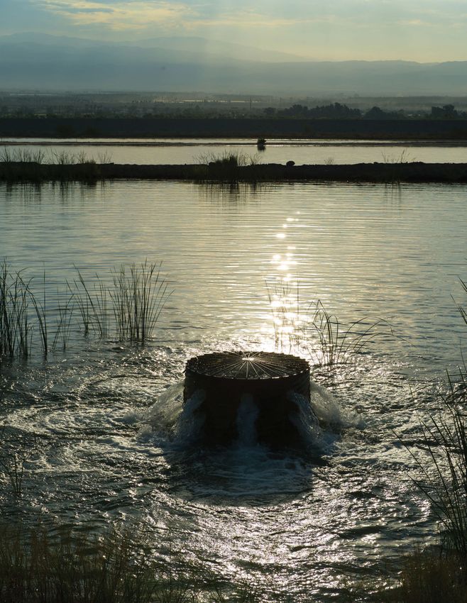
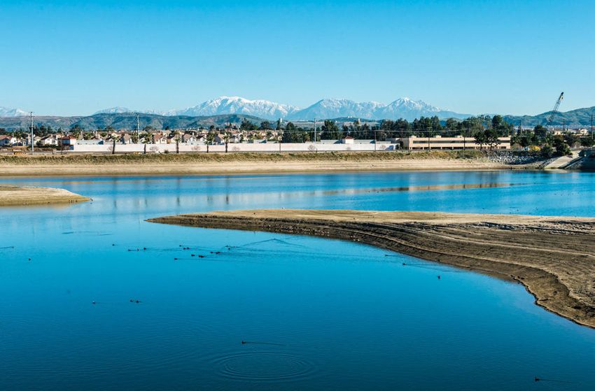
Measuring What Matters 7Florence Low / CA DWR
Anaheim Lake is one of Orange County Water District’s groundwater recharge ponds. Orange County Water District treats wastewater to high standards and then
uses the recycled water to fill recharge ponds, like Anaheim Lake, to replenish the groundwater aquifer below.
and error, because the use of measurable objectives directs (Polasky et al. 2011). Thresholds represent a condition beyond
and justifies exploration of management options over time which the potential for adverse impact is considered unac-
(Williams, Szaro, and Shapiro 2009). ceptable or undesirable. Scientific and managerial interest in
Measurable objectives will need to be identified in every using thresholds for managing natural resources and ecosys-
GSP to avoid and manage each applicable undesirable result tems within an adaptive management framework has grown
listed in SGMA. It is important to note that SGMA does not over the last decade (Groffman et al. 2006). When an essential
simply define the presence of a potentially adverse effect, monitored variable approaches or crosses its threshold value,
such as chronic lowering of groundwater tables, as undesir- a management agency may respond with a variety of reason-
able. Rather, it requires that it be a “significant and unreason- able actions to reverse the trend to avoid unacceptable
able” effect to constitute an undesirable result. In other outcomes.
words, seawater intrusion is not necessarily by itself an Setting quantitative thresholds is not new to ground-
undesirable result, but seawater intrusion beyond a certain water management. A number of existing groundwater
location or above a certain rate may be defined as a “signifi- management plans and other planning documents in Cali-
cant and unreasonable” level of seawater intrusion. Thus, fornia and throughout the United States use thresholds to
each GSP will need to define quantitative thresholds that determine sustainable management practices. In Texas, for
communicate when an undesirable result becomes “signifi- example, thresholds are used to determine “desired future
cant and unreasonable.” conditions” and represent specific goals for conditions, such
A general definition of a threshold is “a defined target as groundwater level, groundwater storage volume, or spring
level or state based on the avoidance of unacceptable flow (Mace et al. 2008). Once desired future conditions are
outcomes or an ecologically defined shift in system status” determined, they are entered into groundwater models to
8 union of concerned scientistsTriggers identify in most commonly based on spring groundwater level declines
(Korus and Burbach 2009). In Australia, triggers are used for
advance how, when, and a multitude of measured variables that correspond with
groundwater levels, water quality, and ecosystem health
why management actions indicators (Anderson et al. 2014). Table 2 (p. 12) contains
take place. a number of trigger examples.
Thresholds and triggers can be set at a fixed value, a
range of values, a trend, or a range of probabilities. For
groundwater management, it is important to note that thresh-
estimate the maximum pumping rates allowable to achieve olds and triggers may vary spatially across a basin, depending
the desired future condition. And throughout various regions on localized conditions and aquifer characteristics.
in Australia, thresholds are called “resource condition limits”
FIXED TRIGGERS
and are used to determine sustainable yield (Anderson et
al. 2014). As groundwater levels fall and rise throughout the year,
Table 1 (p. 10) includes examples of thresholds currently corresponding with dry and wet seasons or growing and
in use and is organized around the six undesirable results nongrowing seasons, the trigger levels remain constant. Fig-
outlined in SGMA. The examples provided in Table 1 are not ure 2 (p. 10) is an example of setting fixed triggers for ground-
meant to represent thresholds that would meet the require- water elevation to avoid crossing a threshold set at the
ments of SGMA; rather, they are provided only to demon- groundwater table’s historic low. There is a yellow-light trig-
strate the diverse forms thresholds can take. ger set at one standard deviation below the average ground-
water elevation, which corresponds to a set of actions to slow
or reverse the trend. There is a red-light trigger set at two
Develop Protective Triggers
standard deviations below the average groundwater eleva-
tion, which corresponds to immediate actions to halt any
A common problem with using thresholds in natural resource
further lowering of groundwater levels. Fixed triggers
management is the tendency to manage at a point just shy of an
facilitate planning and are easier to communicate.
undesirable outcome (Montgomery 1995). For example, some
laws and regulations are designed so that nothing happens un- FLEXIBLE TRIGGERS
til a threshold is crossed (Nie and Schulz 2012). In almost all
As the water level within the basin rises and falls seasonally, the
cases, management entities such as GSAs will want to alter
trigger values rise and fall as well. For instance, here, the red-
management practices before reaching a potentially irrevers-
light trigger during wet years is one standard deviation below
ible or undesirable tipping point. When dealing with uncer-
the average groundwater elevation since, in this example, the
tainty, managers should develop a warning system and take
basin has a goal of refilling the aquifer during wet years to main-
action in response, thus ensuring that a threshold is not
tain a drought buffer. Flexible triggers can respond to inter- and
crossed. Triggers provide an adaptive, yet more structured, de-
intra-annual variability, requiring different levels of protection
cision-making framework by identifying in advance precisely
in wet periods than in dry periods. This approach may optimize
how, when, and why management actions take place (Nie and
groundwater use temporally. However, it may make planning
Schulz 2012). GSAs may want to identify triggers along a con-
more difficult and could be confusing to stakeholders.
tinuum, including green-, yellow-, and red-light triggers.
When managing a resource, it is important to estimate
when an undesirable outcome might occur (threshold) and Incorporate Regular Measurement and
points at which investigative or preventive management Monitoring
actions should be taken (triggers). When a trigger is reached,
certain legal and/or management actions are initiated. GSAs The purpose of a measurable objective is to be a guide to
can outline in their GSPs what actions will be taken at each achieving management goals; therefore, monitoring the status
trigger. This would work toward satisfying the requirements of a measurable objective so that it can be directly related to
of California Water Code Section 10727.2(b)(2). triggers and thresholds is important. Monitoring is the cor-
Thresholds have been used to manage groundwater nerstone of adaptive management (Lyons et al. 2008). The
quantity and quality. Water quality triggers are probably the importance of monitoring, and of learning from information
most widely adopted method of managing the impacts of collected, is what fundamentally differentiates adaptive
extraction on groundwater quality. In Nebraska, triggers are management from trial and error.
Measuring What Matters 9TABLE 1. Examples of Measurable Objectives and Corresponding Thresholds in Groundwater Management
Measurable Objective Document Threshold Example
Groundwater Levels
Central Sacramento County Groundwater The long-term average groundwater extraction rate
Management Plan should not exceed 273,000 acre-feet (AF)/year.
OCWD does not have a “hard cap” on groundwater
Limit groundwater Orange County Water District (OCWD) extractions, but uses economic disincentives
extraction. Groundwater Management Plan to encourage groundwater producers to limit
production to the amount established by OCWD.
Madera Regional Groundwater Reduce groundwater extractions by 150,000 AF/
Management Plan year.
Limit the decline in
groundwater elevation to Groundwater Management Area 1: Desired Average decline in groundwater levels must not
provide for sustainable Future Conditions (Dockum Aquifer) exceed 30 feet over the next 50 years.
yield.
Groundwater Storage
Monterey Peninsula Water Management
27,360 AF of usable storage required.
District
Groundwater Management Area 1: Desired 50% of the volume in storage will remain in 50
Future Conditions (Blaine Aquifer) years.
Achieve a target storage Managed groundwater basin within a 500,000 AF
volume in the future. Orange County Water District Groundwater
volume with triggers when storage levels reach various
Management Plan
points, including reducing pumping.
70,000 AF/year is needed to stabilize the basin and
Eastern San Joaquin Integrated Regional
an average of 140,000 AF/year is needed to refill the
Water Management Plan
basin to 1986-1992 conditions.
Achieve a target reduction Available storage/net overdraft + x = remaining life of
in the “remaining life of Santa Barbara County storage * 0.97 (allows a 3% loss in the remaining life of
storage”. storage).
Seawater Intrusion
Maintain groundwater Groundwater elevations in monitoring wells at the
Fox County Groundwater Management
elevations that prevent coastline must average at least 5 feet above sea
Agency Groundwater Management Plan
further seawater intrusion. level to prevent seawater intrusion.
Maintain chloride The threshold is set at approximately 10% above
concentrations within a South Westside Basin Groundwater the historical maximum concentration over the past
range defined by historic Management Plan 20 years of sampling (1991–2010, with probable
maximums. outliers removed).
Water Quality
Maintain high-quality TDS concentration should not exceed 1,000 mg/L.
groundwater by Central Sacramento County Groundwater NO3 concentration should not exceed 45 mg/L.
limiting contaminant Management Plan Any measurable trace of VOCs in a private or public
concentrations. well should be considered significant.
10 union of concerned scientistsTABLE 1. Examples of Measurable Objectives and Corresponding Thresholds in Groundwater Management (cont.)
Measurable Objective Document Threshold Example
Land Subsidence
Protect against any potential inelastic land surface
Restrict the amount of Central Sacramento County Groundwater subsidence by limiting subsidence to no more than
allowable subsidence. Management Plan 0.007 feet per 1 foot of drawdown in the groundwater
basin.
Reduce the rate of Madera Regional Groundwater Management
Reduce the rate of subsidence by half.
subsidence. Plan
Depletions of Interconnected Surface Water
Groundwater flows will
Water Allocation Plan for the Tindall Limestone Water level decline at the groundwater dependent
support functioning
Aquifer, Katherine (Australia) ecosystem should not exceed 0.05 m/year.
wetlands.
While all GSPs should include measurable objectives and corresponding thresholds to avoid undesirable groundwater conditions, these elements can vary
widely from plan to plan.
Note: Thresholds are only illustrative; they are not necessarily thresholds that would meet the requirements of SGMA.
SOURCES: CITY OF CHOWCHILLA ET AL. 2014; ESJCGBA 2014; SAN FRANCISCO PUBLIC UTILITIES COMMISSION 2012; TWDB 2010; MPWMD 2009; WOODSIDE AND
WESTROPP 2009; COUNTY OF SANTA BARBARA 2008; FCGMA, UWCD, AND CMWD 2007; WATER FORUM 2006; NORTH TERRITORY GOVERNMENT N.D.
There are a variety of measurement approaches for each cannot be seen and there are limitations on the precision and
undesirable result (see Table 3, p. 15). For example, SGMA accuracy of modeling and measurement techniques. As GSAs
prohibits chronic groundwater overdraft but does not specify develop plans, they will need first to determine baselines by
the most appropriate metric for assessing groundwater over- looking at historical data, reading reports and assessments
draft. A metric is the method of measurement used to assess (which may be incomplete), and then projecting how chang-
measurable objectives quantitatively, to set triggers, and to set ing future conditions (e.g., land use, climate change, manage-
a threshold. A GSA could choose to assess groundwater over- ment approaches, water reliability) will impact groundwater,
draft by measuring groundwater extraction or changes with the goal of avoiding undesirable results. Through this
in groundwater elevations, or by employing modeling process, managers should be explicit regarding the level and
techniques. For example, remotely sensed data or electricity location of uncertainty.
consumption may be used as a proxy for groundwater ex- Some uncertainties are relatively small; for instance,
traction. It is important to remember that more indirect agricultural water measurement devices are required to be
measurement techniques will inherently have higher levels accurate only within a range of plus or minus 12 percent
of uncertainty. (California Code of Regulations Section 597.3(a)(1)). Other
uncertainties are typically larger and often less well quanti-
fied, such as uncertainty in our knowledge of aquifer geology,
Account for Uncertainty
future land uses, future water uses, and the impacts of climate
Uncertainty is inherent in any long-term planning process. change on water systems. For example, many studies suggest
Groundwater is a particularly pertinent example because it that climate impacts are having relevant and severe impacts
on hydrology and water systems (DWR 2008). Although
science cannot predict the precise form of these changes,
Uncertainly is inherent outcomes can be bracketed (e.g., best-case and worst-case
in long-term planning,
scenarios), and these risks need to be managed.
Adaptive management provides a process for coping with
including groundwater uncertainty, but it is necessary to identify where uncertainty
lies and to develop approaches to address it explicitly. Trig-
management. gers may be set conservatively to provide for an adequate
Measuring What Matters 11TABLE 2. Examples of Triggers in Groundwater Management
Measurable Objective Document Trigger Example
Groundwater Levels
Trigger 1: when any measured Spring groundwater surface
elevation is below 1 Standard Deviation from the Average of
the time of record utilized for the corresponding BMO
Key Well
Trigger 2: on the second and subsequent sequential years,
when any measured Spring groundwater surface elevation is
below 1 Standard Deviation from the Average of the time of
Basin Management Objective, record utilized for the corresponding BMO Key Well
Glenn County, sub-area 8 Trigger 3: when any measured Spring groundwater surface
elevation is below 2 Standard Deviations from the Average of
the time of record utilized for the corresponding BMO
Key Well
Trigger 1, 2, and 3 actions shall be rescinded by the
WAC when the measured groundwater surface elevations
return to an elevation above 1 Standard Deviation for the
corresponding BMO.
Trigger 1: the historical low minus five feet, rounded down to
Reduce decline in South Westside Basin Groundwater the nearest five
groundwater elevation. Management Plan
Trigger 2: 10 feet below Trigger 1 for all wells
Phase I Trigger has been designated District-wide and the
District has established educational programs, groundwater
monitoring and best management practices.
Phase II Trigger shall occur when spring static groundwater
elevations in 30% of the monitoring network wells have
Lower Platte South declined from the established upper elevation of the
Natural Resources saturated thickness to an elevation that represents greater
District: Rules & than or equal to a percent reduction in the saturated
Regulations for the thickness and has remained below that elevation for a two
Nebraska Groundwater consecutive year period.
Management and
Phase III Trigger shall occur when spring static water
Protection Act
elevation in 50% of the monitoring network wells have
declined from the established upper elevation of the
saturated thickness to an elevation that represents greater
than or equal to a percent reduction in the saturated
thickness and has remained below that elevation for a two
consecutive year period.
Seawater Intrusion
For wells designated for seawater intrusion monitoring:
Maintain groundwater
South Westside Basin Groundwater
elevations to prevent Trigger 1 is the historical low minus two feet, rounded down.
Management Plan
further seawater intrusion.
Trigger 2 is 10 feet below Trigger 1 for all wells.
12 union of concerned scientistsTABLE 2. Examples of Triggers in Groundwater Management (cont.)
Measurable Objective Document Trigger Example
Water Quality
Phase I Trigger has been designated District-wide and the
District has established educational programs, groundwater
monitoring and best management practices.
Lower Platte South Natural
Resources District: Rules & Phase II Trigger shall occur when at least 50% of the
Reduce or eliminate
Regulations for the Nebraska monitoring wells in the network are at or above 50% of the
contaminants.
Groundwater Management and Maximum Contaminant Level for a contaminant.
Protection Act
Phase III Trigger shall occur when at least 80% of the
monitoring wells in the network are at or above 80% of the
Maximum Contaminant Level for a contaminant.
Depletions of Interconnected Surface Water
Trigger Point 1: Monitoring of losses of river water to
groundwater shows a 5 percent increase over the current loss
Limit the loss of rate based on total flow in the river.
Central Sacramento County
interconnected surface
Groundwater Management Plan Trigger Point 2: Monitoring of losses of river water to
flows.
groundwater shows a 25 percent increase over the current
loss rate based on total flow in the river.
Triggers can be used to manage groundwater resources and can be particularly helpful when there are little data or high levels of uncertainty.
Note: Triggers are only illustrative; they are not necessarily triggers that would meet the requirements of SGMA.
SOURCES: LOWER PLATTE SOUTH NATURAL RESOURCES DISTRICT 2014; SAN FRANCISCO PUBLIC UTILITIES COMMISSION 2012; GLENN COUNTY DEPARTMENT OF
WATER RESOURCES 2010; WATER FORUM 2006.
margin of safety to account for uncertain system responses ary buffers are used in Australia’s Murray-Darling basin. Cer-
(Korus and Burbach 2009). Measurable objectives with prop- tain groundwater basins have less data or lower measurement
er metrics and with appropriate triggers and thresholds are accuracies associated with available data. In those areas, the
designed to respond to such uncertainty and help the deci- amount of total groundwater extraction is reduced in order to
sion-making process under uncertainty. ensure that management actions err on the side of being more
It is extremely important that triggers be set to account rather than less protective. The size of the buffer is roughly
for the fact that many management actions (e.g., increasing proportional to the level of uncertainty present (see Box 4,
recharge) require significant time to implement to avoid the p. 16).
large direct and indirect cost of emergency measures. Uncer- Scenario-based planning, which examines different op-
tainty means that the beneficial effects of an action may be tions under a range of possible future conditions, is another
lower (or higher) than expected, which in turn may (or may way to account for uncertainty. In order to address data un-
not) require further action and additional time. Uncertainty certainties, groundwater resources impact studies usually
may therefore increase the time spent finding the appropriate include alternative analyses of different reasonable scenarios
response to a potentially unsustainable situation. In areas of a and/or sensitivity analyses that evaluate a range of possible
basin that are particularly sensitive, or where a large degree outcomes to provide perspective on the range and likelihood
of uncertainty exists about the system, triggers well above the of potential impacts. Scenario-based planning tools may also
threshold to undesirable results may be set. They can be used allow for stochastic modeling that provides probabilistic
as one way to warn early of unforeseen system responses that error bars around possible consequences of particular
might lead to undesirable outcomes. For example, precaution- scenarios (Kiparsky, Milman, and Vicuña 2012).
Measuring What Matters 13FIGURE 2. Fixed Triggers for Groundwater Management
150
Groundwater Surface
140
Elevation (ft)
130
120
110
100
90
1976 1980 1984 1988 1992 1996 2000 2004 2008
In this example, the threshold for chronic lowering of groundwater levels is the lowest groundwater elevation recorded (black line).
Fixed triggers have been set at the land surface elevation (green-light trigger), one standard deviation (yellow-light trigger), and two
standard deviations (red-light trigger) below the average groundwater elevation. The blue line represents the data, which are recorded
depth-to-groundwater measurements over time.
SonoranDesertNPS/Creative Commons (Flickr)
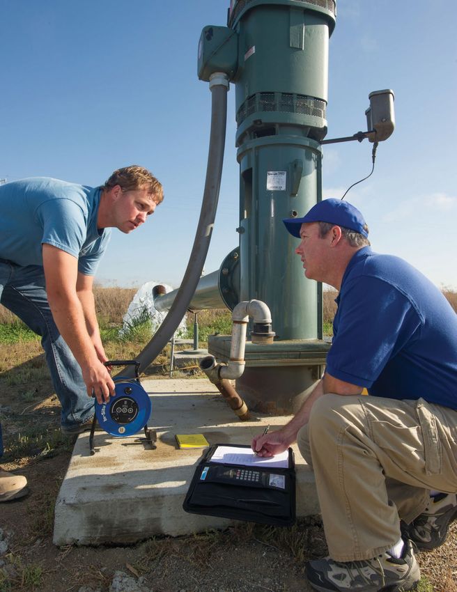
Comprehensive and consistent monitoring and measurement is the cornerstone of adaptive management. The device shown here is used to measure
depth-to-groundwater.
14 union of concerned scientistsAdapt to Changing Conditions and New Several years ago, a group of influential water scientists
Information wrote a paper that challenged the idea of stationarity in an era
of global climate change:
Adapting to new information is a key strategy for implementing “Stationarity—the idea that natural systems fluc-
effective measurable objectives. Although such adaptation is not tuate within an unchanging envelope of variability—is
explicitly mentioned in SGMA, the legislation includes numerous a foundational concept that permeates training and
requirements that are part of an adaptive management frame- practice in water-resource engineering. . . In view of
work (see Table 4, p. 18). For example, SGMA requires GSPs to the magnitude and ubiquity of the hydroclimatic
develop interim milestones that help track progress toward sus- change apparently now under way, however, we assert
tainability goals and provoke course change, if necessary. that stationarity is dead and should no longer serve as
TABLE 3. Different Metrics Used to Assess Groundwater Levels and Storage
Groundwater Levels and Groundwater Storage
Metric Document/Tool Description
All nonexempt wells must install a meter or water-flow-
Metering groundwater North Texas Groundwater
measuring device that can measure within plus or minus 5%
extraction Conservation District
accuracy.
Sacramento Central Operates 29 monitoring wells, which it monitors biannually (1
Groundwater Authority week before and after the 15th of each April and October).
Groundwater Elevation These months represent the typical seasonal high and low for
Monitoring Plan groundwater levels in the basin based on historical data.
Monitoring groundwater
Operates a satellite internet telemetry system at several
wells
groundwater monitoring wells. Each consists of a water-level-
Kings River Conservation
monitoring device that collects groundwater elevations daily
District (KRCD)
and a data transmitter, which sends that data via satellite to the
KRCD.
Satellite measures variations in water stored at all levels above
and within the land surface. However, the spatial (>150,000 km2)
GRACE: Gravity Recovery
and temporal (monthly with a significant time lag) resolutions of
and Climate Experiment
the GRACE fields limit their fine-scale application for sub-basin
water balance assessment.
SEBAL: Surface Energy Uses Landsat satellite data to estimate water used for evapo-
Balance Algorithm for Land transpiration (ET).*
Modeling groundwater usage
METRIC: Mapping
EvapoTranspiration at
high Resolution with
Internalized Calibration Uses Landsat satellite data to estimate water used for ET.*
EvapoTranspiration at high
Resolution with Internalized
Calibration
Electricity meters on Uses electrical consumption to estimate groundwater pumped
Metering electricity usage
groundwater wells from individual wells.
Because groundwater cannot be plainly seen, there are a variety of metrics used to assess groundwater levels and storage, including measuring extraction
or employing modeling.
Note: *Both SEBAL and METRIC require estimating the ratio of groundwater vs. surface water used to meet modeled evapo-transpiration.
SOURCES: NTGCD 2010; SACRAMENTO CENTRAL GROUNDWATER AUTHORITY 2012; ZAITCHIK, RODELL, AND REICHLE 2008; ALLEN, MASAHIRO, AND TREZZA 2007;
WATER FORUM 2006; BASTIAANSSEN ET AL. 2005; KRCD 2005.
Measuring What Matters 15a central, default assumption in water-resource risk
assessment and planning. Finding a suitable successor
BOX 4.
is crucial for human adaptation to changing climate”
(Milly et al. 2008).
In addition to the environment not having stationary Accounting for Uncertainty
in the Murray-Darling
characteristics, other factors may result in groundwater condi-
tions falling outside expected variability, such as changing
economic conditions.
Adaptive management is both a technique and a philosophy
Basin, Australia
that integrates changing conditions in order to manage natural
“[In] areas where minimal information regarding the
resources and ecosystems more successfully (McGowan, Lyons,
groundwater resource is available, less information was
and Smith 2015; Bormann, Haynes, and Martin 2007; Bormann input to the RRAM [Recharge Risk Assessment Method-
et al. 1994). Adaptive management relies on setting objectives, ology] calculation process and hence a higher uncertainty
scrupulously measuring the success of attempts to meet those was associated with the area. For such areas the sustain-
objectives, and then modifying a management plan and its im- ability factor [or groundwater extraction amount] was
plementation to achieve the desired objectives. Over short time reduced, to make an allowance for the potential margin of
spans, adaptive management encourages flexibility, responsive- error associated with the extraction limit determined for
ness, and local decision-making in order to adapt resource plan- that unit and in summary:
ning to the rapidly changing conditions and needs of the • The SF [groundwater extraction amount] associated
environment. Over longer time periods, as new information is with an area with an overall high-risk ranking was
reduced by 50 percent.
developed, adaptive management results in modification and
updating of management plans. • The SF [groundwater extraction amount] associated
The adaptive management framework encompasses with an area with an overall medium risk ranking
three broad phases: Plan, Do, and Evaluate and Respond. was reduced by 50 percent.
These phases include a number of steps that are part of the • The SF [groundwater extraction amount] associated
iterative cycle (see Figure 3). Table 4 (p. 18) demonstrates with an area with an overall low risk ranking are
how each phase of the adaptive management process relates reduced by 25 percent.”
SOURCE: CSIRO AND SKM 2010
to SGMA requirements. SGMA may represent a new frontier
for groundwater management in California; however, the
adaptive management framework it is built upon has been
used for more than 40 years to manage natural resources, in-
cluding water. In the United States, adaptive management
became a popular strategy for federal water and science agen-
cies during the 1990s (Institute for Water Resources 2013).
Although many managers understand the concept of
adaptive management, fewer are familiar with adaptive gov-
Hullwarren/Creative Commons (Wikimedia)
ernance. Adaptive governance facilitates the ability of a man-
agement entity to react to change (Dietz, Ostrom, and Stern
2003). Adaptive management alone will not ensure resilient
and sustainable outcomes, particularly if management enti-
ties are not able to incorporate new information and respond
to changing conditions (Folke et al. 2005). Therefore, it is un-
wise to consider adaptive management as solely a scientific or
technical process; it is also inherently a social process that
Proper groundwater management can help facilitate agriculture irrigation, like requires institutional structures that allow for greater trans-
for the cotton seen here in the Murray-Darling Basin, Australia. parency and flexibility.
16 union of concerned scientistsYou can also read