Local Flood Risk Management Strategy 2015 2021 - Worcestershire - Adopted March 2016
←
→
Page content transcription
If your browser does not render page correctly, please read the page content below
Worcestershire
Worcestershire Local Flood Risk Management Strategy 2015–2021

Droitwich surface water flooding

Worcestershire

Local Flood Risk Management
Strategy 2015 – 2021

Adopted March 2016
Find out more online:
www.worcestershire.gov.uk
                                                                1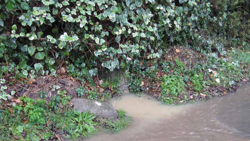
Worcestershire Local Flood Risk Management Strategy 2015–2021

Reedbed and pools, Forest of Feckenham

    Foreword

    The Flood and Water Management Act 2010 placed a                 The Strategy is one of a number of documents being
    number of statutory duties on Worcestershire County              produced to develop our understanding of flooding
    Council in its new role as a Lead Local Flood Authority.         issues including Surface Water Management Plans, asset
    One of these duties is to produce a Local Flood Risk             register and procedure for investigating flood incidents.
    Management Strategy.
                                                                     The Strategy will be reviewed every 5 years to ensure
    In producing our Strategy, we have worked closely                that it continues to provide the strategic direction for
    with partners, local communities, residents and                  flood risk management in the county.
    interested parties to help understand the broad nature
    and extent of flood risk across the county, and the
    interactions between the different types of flood risk.
    This has helped us to improve our own knowledge and
    understanding of flood risk which is reflected in this
    Strategy, and something which we will continue to
    build on over time.

    The Strategy is the overarching document on flood risk
    in the county. It sets the scene for understanding flood
    risk, and the issues and challenges which the county
    faces. It draws together information from a number
    of sources and partners and outlines how we will
    incorporate environmental and sustainability objectives
    into our flood risk work.

    The evidence and information in the Strategy is being
    used to inform our actions, to develop projects and
                                                                                    Councillor Anthony Blagg
    to bid for future funding from central Government
    and other agencies to address flood issues across the                     Deputy Leader and Cabinet Member
    county.                                                                   with Responsibility for Environment
                                                                                 Worcestershire County Council

                                                                 2
Worcestershire Local Flood Risk Management Strategy 2015–2021

Surface water flood alleviation scheme – Avon Meadows, Pershore –

     Executive Summary

     The Flood and Water Management Act (2010) gave Worcestershire County Council a new role as Lead Local Flood
     Authority (LLFA) for Worcestershire. As such the Council is required to publish a Local Flood Risk Management
     Strategy to set out how local flood risk will be managed in the county.

     Worcestershire County Council has adopted this Local Flood Risk Management Strategy to guide the development of
     policy and programmes across its operations and in its work with other organisations, communities and stakeholders.
     Partnership working will be central to delivering this Strategy and as such it has been produced in collaboration with
     the Environment Agency, district and borough councils, Severn Trent Water Ltd and other bodies.

     The Strategy highlights the steps that are to be taken to ensure this happens and it is supported by seven high level
     aims as outlined below:

            1.   Understand and appropriately prioritise flood risk

            2.   Manage and minimise the likely impact of flooding

            3.   Develop and manage effective partnerships

            4.   Inform, develop and implement relevant plans, policies and strategies

            5.   Secure, maximise and prioritise the appropriate allocation of funding and other resources

            6.   Deliver sustainable environmental and economic benefits and contribute to the well being of
                 Worcestershire’s communities and residents

            7.   Develop, maintain and implement the LFRMS action plan

     The Local Flood Risk Management Strategy is accompanied by an action plan that identifies a programme of work
     for reducing local flood risk within Worcestershire. The Strategy and future updates will be informed by ongoing
     programme reviews, flood risk assessments, information from flooding events and the latest technical guidance.

                                                                    3
Worcestershire Local Flood Risk Management Strategy 2015–2021

   Table of Contents

        Foreword .  .  .  .  .  .  .  .  .  .  .  .  .  .  .  .  .  .  .  .  .  .  .  .  .  .  .  .  .  .  .  .  .  .  .  .  .  .  .  .  .  .  .  .  .  .  .  .  .  .  .  .  .  .  .  .  .  .  .  .  .  .  .  .  .  .  .  .  .  .  .  .  .  .  .  .  .  .  .  .  . 2

        Executive Summary  .  .  .  .  .  .  .  .  .  .  .  .  .  .  .  .  .  .  .  .  .  .  .  .  .  .  .  .  .  .  .  .  .  .  .  .  .  .  .  .  .  .  .  .  .  .  .  .  .  .  .  .  .  .  .  .  .  .  .  .  .  .  .  .  .  .  .  .  .  .  .  . 3

        1.	 Background  .  .  .  .  .  .  .  .  .  .  .  .  .  .  .  .  .  .  .  .  .  .  .  .  .  .  .  .  .  .  .  .  .  .  .  .  .  .  .  .  .  .  .  .  .  .  .  .  .  .  .  .  .  .  .  .  .  .  .  .  .  .  .  .  .  .  .  .  .  .  .  .  .  .  .        12
            Introduction  .  .  .  .  .  .  .  .  .  .  .  .  .  .  .  .  .  .  .  .  .  .  .  .  .  .  .  .  .  .  .  .  .  .  .  .  .  .  .  .  .  .  .  .  .  .  .  .  .  .  .  .  .  .  .  .  .  .  .  .  .  .  .  .  .  .  .  .  .  .  .  .  .  .  .  .   12
            Guiding Principles  .  .  .  .  .  .  .  .  .  .  .  .  .  .  .  .  .  .  .  .  .  .  .  .  .  .  .  .  .  .  .  .  .  .  .  .  .  .  .  .  .  .  .  .  .  .  .  .  .  .  .  .  .  .  .  .  .  .  .  .  .  .  .  .  .  .  .  .  .  .  .            12
            Defining Flood Risk  .  .  .  .  .  .  .  .  .  .  .  .  .  .  .  .  .  .  .  .  .  .  .  .  .  .  .  .  .  .  .  .  .  .  .  .  .  .  .  .  .  .  .  .  .  .  .  .  .  .  .  .  .  .  .  .  .  .  .  .  .  .  .  .  .  .  .  .  .  .              13
            Structure of the Strategy .  .  .  .  .  .  .  .  .  .  .  .  .  .  .  .  .  .  .  .  .  .  .  .  .  .  .  .  .  .  .  .  .  .  .  .  .  .  .  .  .  .  .  .  .  .  .  .  .  .  .  .  .  .  .  .  .  .  .  .  .  .  .  .  .                        13
            Review of the Strategy .  .  .  .  .  .  .  .  .  .  .  .  .  .  .  .  .  .  .  .  .  .  .  .  .  .  .  .  .  .  .  .  .  .  .  .  .  .  .  .  .  .  .  .  .  .  .  .  .  .  .  .  .  .  .  .  .  .  .  .  .  .  .  .  .  .  .                     13

        2 Legislative and Policy Context  .  .  .  .  .  .  .  .  .  .  .  .  .  .  .  .  .  .  .  .  .  .  .  .  .  .  .  .  .  .  .  .  .  .  .  .  .  .  .  .  .  .  .  .  .  .  .  .  .  .  .  .  .  .  .  .  .  .                                         15
          National Legislation . .  .  .  .  .  .  .  .  .  .  .  .  .  .  .  .  .  .  .  .  .  .  .  .  .  .  .  .  .  .  .  .  .  .  .  .  .  .  .  .  .  .  .  .  .  .  .  .  .  .  .  .  .  .  .  .  .  .  .  .  .  .  .  .  .  .  .  .  .                 15
          Flood and Water Management Act (2010) .  .  .  .  .  .  .  .  .  .  .  .  .  .  .  .  .  .  .  .  .  .  .  .  .  .  .  .  .  .  .  .  .  .  .  .  .  .  .  .  .  .  .  .  .  .  .  .  .  .                                                           15
          Other Acts, Regulations and Policy .  .  .  .  .  .  .  .  .  .  .  .  .  .  .  .  .  .  .  .  .  .  .  .  .  .  .  .  .  .  .  .  .  .  .  .  .  .  .  .  .  .  .  .  .  .  .  .  .  .  .  .  .  .  .  .                                            16
          Flooding Plans and Strategies .  .  .  .  .  .  .  .  .  .  .  .  .  .  .  .  .  .  .  .  .  .  .  .  .  .  .  .  .  .  .  .  .  .  .  .  .  .  .  .  .  .  .  .  .  .  .  .  .  .  .  .  .  .  .  .  .  .  .  .  .                                  17
          Other Related Plans and Strategies .  .  .  .  .  .  .  .  .  .  .  .  .  .  .  .  .  .  .  .  .  .  .  .  .  .  .  .  .  .  .  .  .  .  .  .  .  .  .  .  .  .  .  .  .  .  .  .  .  .  .  .  .  .  .  .                                            17

        3 Worcestershire Flood Risk .  .  .  .  .  .  .  .  .  .  .  .  .  .  .  .  .  .  .  .  .  .  .  .  .  .  .  .  .  .  .  .  .  .  .  .  .  .  .  .  .  .  .  .  .  .  .  .  .  .  .  .  .  .  .  .  .  .  .  .  .  . 19
          Types of Flood Risk .  .  .  .  .  .  .  .  .  .  .  .  .  .  .  .  .  .  .  .  .  .  .  .  .  .  .  .  .  .  .  .  .  .  .  .  .  .  .  .  .  .  .  .  .  .  .  .  .  .  .  .  .  .  .  .  .  .  .  .  .  .  .  .  .  .  .  .  .  . 19
          Flooding Characteristics of Worcestershire . .  .  .  .  .  .  .  .  .  .  .  .  .  .  .  .  .  .  .  .  .  .  .  .  .  .  .  .  .  .  .  .  .  .  .  .  .  .  .  .  .  .  .  .  .  .  .  . 21
          North Worcestershire (Bromsgrove District, Redditch Borough and Wyre Forest
          District Councils)  .  .  .  .  .  .  .  .  .  .  .  .  .  .  .  .  .  .  .  .  .  .  .  .  .  .  .  .  .  .  .  .  .  .  .  .  .  .  .  .  .  .  .  .  .  .  .  .  .  .  .  .  .  .  .  .  .  .  .  .  .  .  .  .  .  .  .  .  .  .  .  . 21
          Bromsgrove District .  .  .  .  .  .  .  .  .  .  .  .  .  .  .  .  .  .  .  .  .  .  .  .  .  .  .  .  .  .  .  .  .  .  .  .  .  .  .  .  .  .  .  .  .  .  .  .  .  .  .  .  .  .  .  .  .  .  .  .  .  .  .  .  .  .  .  .  .  . 21
          Redditch Borough  .  .  .  .  .  .  .  .  .  .  .  .  .  .  .  .  .  .  .  .  .  .  .  .  .  .  .  .  .  .  .  .  .  .  .  .  .  .  .  .  .  .  .  .  .  .  .  .  .  .  .  .  .  .  .  .  .  .  .  .  .  .  .  .  .  .  .  .  .  .  . 23
          Wyre Forest District . . . . . . . . . . . . . . . . . . . . . . . . . . . . . . . . . . . . . . . . . . . . . . . . . . . . . . . . . . . . . . . . . . . . . .23
          South Worcestershire (Worcester City, Malvern Hills and Wychavon Districts) . .  .  .  .  .  .  .  .  .  .  .  .  .  .  .  . 24
          Worcester City .  .  .  .  .  .  .  .  .  .  .  .  .  .  .  .  .  .  .  .  .  .  .  .  .  .  .  .  .  .  .  .  .  .  .  .  .  .  .  .  .  .  .  .  .  .  .  .  .  .  .  .  .  .  .  .  .  .  .  .  .  .  .  .  .  .  .  .  .  .  .  .  .  . 24
          Wychavon District .  .  .  .  .  .  .  .  .  .  .  .  .  .  .  .  .  .  .  .  .  .  .  .  .  .  .  .  .  .  .  .  .  .  .  .  .  .  .  .  .  .  .  .  .  .  .  .  .  .  .  .  .  .  .  .  .  .  .  .  .  .  .  .  .  .  .  .  .  .  . 24
          Malvern Hills District .  .  .  .  .  .  .  .  .  .  .  .  .  .  .  .  .  .  .  .  .  .  .  .  .  .  .  .  .  .  .  .  .  .  .  .  .  .  .  .  .  .  .  .  .  .  .  .  .  .  .  .  .  .  .  .  .  .  .  .  .  .  .  .  .  .  .  .  . 25
          Rapid Response Catchments . .  .  .  .  .  .  .  .  .  .  .  .  .  .  .  .  .  .  .  .  .  .  .  .  .  .  .  .  .  .  .  .  .  .  .  .  .  .  .  .  .  .  .  .  .  .  .  .  .  .  .  .  .  .  .  .  .  .  .  .  . 25

        4 Organisational Responsibilities . .  .  .  .  .  .  .  .  .  .  .  .  .  .  .  .  .  .  .  .  .  .  .  .  .  .  .  .  .  .  .  .  .  .  .  .  .  .  .  .  .  .  .  .  .  .  .  .  .  .  .  .  .  .  .  .                                             26
          Lead Local Flood Authority . .  .  .  .  .  .  .  .  .  .  .  .  .  .  .  .  .  .  .  .  .  .  .  .  .  .  .  .  .  .  .  .  .  .  .  .  .  .  .  .  .  .  .  .  .  .  .  .  .  .  .  .  .  .  .  .  .  .  .  .  .  .                                26
          Risk Management Authorities . .  .  .  .  .  .  .  .  .  .  .  .  .  .  .  .  .  .  .  .  .  .  .  .  .  .  .  .  .  .  .  .  .  .  .  .  .  .  .  .  .  .  .  .  .  .  .  .  .  .  .  .  .  .  .  .  .  .  .  .                                     26
          Highways Authority .  .  .  .  .  .  .  .  .  .  .  .  .  .  .  .  .  .  .  .  .  .  .  .  .  .  .  .  .  .  .  .  .  .  .  .  .  .  .  .  .  .  .  .  .  .  .  .  .  .  .  .  .  .  .  .  .  .  .  .  .  .  .  .  .  .  .  .  .  .                  27
          Environment Agency .  .  .  .  .  .  .  .  .  .  .  .  .  .  .  .  .  .  .  .  .  .  .  .  .  .  .  .  .  .  .  .  .  .  .  .  .  .  .  .  .  .  .  .  .  .  .  .  .  .  .  .  .  .  .  .  .  .  .  .  .  .  .  .  .  .  .  .  .                     27
          District, City and Borough Councils  .  .  .  .  .  .  .  .  .  .  .  .  .  .  .  .  .  .  .  .  .  .  .  .  .  .  .  .  .  .  .  .  .  .  .  .  .  .  .  .  .  .  .  .  .  .  .  .  .  .  .  .  .  .  .                                             27
          Water and Sewerage Companies .  .  .  .  .  .  .  .  .  .  .  .  .  .  .  .  .  .  .  .  .  .  .  .  .  .  .  .  .  .  .  .  .  .  .  .  .  .  .  .  .  .  .  .  .  .  .  .  .  .  .  .  .  .  .  .  .  .                                            27
          Internal Drainage Boards . . . . . . . . . . . . . . . . . . . . . . . . . . . . . . . . . . . . . . . . . . . . . . . . . . . . . . . . . . . . . . . . .                                                                                           28
          Neighbouring LLFAs . .  .  .  .  .  .  .  .  .  .  .  .  .  .  .  .  .  .  .  .  .  .  .  .  .  .  .  .  .  .  .  .  .  .  .  .  .  .  .  .  .  .  .  .  .  .  .  .  .  .  .  .  .  .  .  .  .  .  .  .  .  .  .  .  .  .  .  .  .                   28

                                                                                                                                   4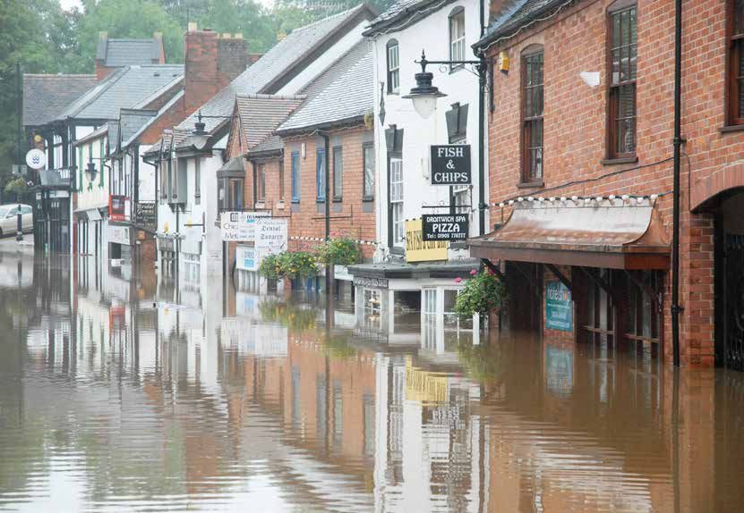
Worcestershire Local Flood Risk Management Strategy 2015–2021

        5 Worcestershire Partnerships .  .  .  .  .  .  .  .  .  .  .  .  .  .  .  .  .  .  .  .  .  .  .  .  .  .  .  .  .  .  .  .  .  .  .  .  .  .  .  .  .  .  .  .  .  .  .  .  .  .  .  .  .  .  .  .  .  .  .                                       29
          Regional Flood and Coastal Committees . .  .  .  .  .  .  .  .  .  .  .  .  .  .  .  .  .  .  .  .  .  .  .  .  .  .  .  .  .  .  .  .  .  .  .  .  .  .  .  .  .  .  .  .  .  .  .  .  .  .                                                      29
          The Worcestershire Flood Risk Management Strategic Co-ordinating Group  .  .  .  .  .  .  .  .  .  .  .  .  .  .  .  .  .  .                                                                                                                      30
          The Worcestershire Land Drainage Group .  .  .  .  .  .  .  .  .  .  .  .  .  .  .  .  .  .  .  .  .  .  .  .  .  .  .  .  .  .  .  .  .  .  .  .  .  .  .  .  .  .  .  .  .  .  .  .  .  .                                                       30

        6 Communities .  .  .  .  .  .  .  .  .  .  .  .  .  .  .  .  .  .  .  .  .  .  .  .  .  .  .  .  .  .  .  .  .  .  .  .  .  .  .  .  .  .  .  .  .  .  .  .  .  .  .  .  .  .  .  .  .  .  .  .  .  .  .  .  .  .  .  .  .  .  .  .  .  . 31
          The Role of Communities and Individuals .  .  .  .  .  .  .  .  .  .  .  .  .  .  .  .  .  .  .  .  .  .  .  .  .  .  .  .  .  .  .  .  .  .  .  .  .  .  .  .  .  .  .  .  .  .  .  .  .  . 31

        7 Planning  .  .  .  .  .  .  .  .  .  .  .  .  .  .  .  .  .  .  .  .  .  .  .  .  .  .  .  .  .  .  .  .  .  .  .  .  .  .  .  .  .  .  .  .  .  .  .  .  .  .  .  .  .  .  .  .  .  .  .  .  .  .  .  .  .  .  .  .  .  .  .  .  .  .  .  .  .  . 33
          Strategic Flood Risk Assessments . .  .  .  .  .  .  .  .  .  .  .  .  .  .  .  .  .  .  .  .  .  .  .  .  .  .  .  .  .  .  .  .  .  .  .  .  .  .  .  .  .  .  .  .  .  .  .  .  .  .  .  .  .  .  .  .  . 34
          The Minerals Local Plan  .  .  .  .  .  .  .  .  .  .  .  .  .  .  .  .  .  .  .  .  .  .  .  .  .  .  .  .  .  .  .  .  .  .  .  .  .  .  .  .  .  .  .  .  .  .  .  .  .  .  .  .  .  .  .  .  .  .  .  .  .  .  .  .  .  . 34
          Emergency Planning . .  .  .  .  .  .  .  .  .  .  .  .  .  .  .  .  .  .  .  .  .  .  .  .  .  .  .  .  .  .  .  .  .  .  .  .  .  .  .  .  .  .  .  .  .  .  .  .  .  .  .  .  .  .  .  .  .  .  .  .  .  .  .  .  .  .  .  .  . 35
          Multi Agency Flood Plans . .  .  .  .  .  .  .  .  .  .  .  .  .  .  .  .  .  .  .  .  .  .  .  .  .  .  .  .  .  .  .  .  .  .  .  .  .  .  .  .  .  .  .  .  .  .  .  .  .  .  .  .  .  .  .  .  .  .  .  .  .  .  .  . 36
          Case Study . .  .  .  .  .  .  .  .  .  .  .  .  .  .  .  .  .  .  .  .  .  .  .  .  .  .  .  .  .  .  .  .  .  .  .  .  .  .  .  .  .  .  .  .  .  .  .  .  .  .  .  .  .  .  .  .  .  .  .  .  .  .  .  .  .  .  .  .  .  .  .  .  .  .  .  .  . 36
          Communication and Engagement .  .  .  .  .  .  .  .  .  .  .  .  .  .  .  .  .  .  .  .  .  .  .  .  .  .  .  .  .  .  .  .  .  .  .  .  .  .  .  .  .  .  .  .  .  .  .  .  .  .  .  .  .  .  .  .  . 36

        8 Actions to Manage Flood Risk . .  .  .  .  .  .  .  .  .  .  .  .  .  .  .  .  .  .  .  .  .  .  .  .  .  .  .  .  .  .  .  .  .  .  .  .  .  .  .  .  .  .  .  .  .  .  .  .  .  .  .  .  .  .  .  .  .  . 37
          National Objectives . .  .  .  .  .  .  .  .  .  .  .  .  .  .  .  .  .  .  .  .  .  .  .  .  .  .  .  .  .  .  .  .  .  .  .  .  .  .  .  .  .  .  .  .  .  .  .  .  .  .  .  .  .  .  .  .  .  .  .  .  .  .  .  .  .  .  .  .  . 37
          Strategic Aims of the Strategy  .  .  .  .  .  .  .  .  .  .  .  .  .  .  .  .  .  .  .  .  .  .  .  .  .  .  .  .  .  .  .  .  .  .  .  .  .  .  .  .  .  .  .  .  .  .  .  .  .  .  .  .  .  .  .  .  .  .  .  . 38
          Designation of structures and features  .  .  .  .  .  .  .  .  .  .  .  .  .  .  .  .  .  .  .  .  .  .  .  .  .  .  .  .  .  .  .  .  .  .  .  .  .  .  .  .  .  .  .  .  .  .  .  .  .  .  .  . 41
          Duty to Investigate Flooding . .  .  .  .  .  .  .  .  .  .  .  .  .  .  .  .  .  .  .  .  .  .  .  .  .  .  .  .  .  .  .  .  .  .  .  .  .  .  .  .  .  .  .  .  .  .  .  .  .  .  .  .  .  .  .  .  .  .  .  .  . 41
          Register and Record of Structures and Features  .  .  .  .  .  .  .  .  .  .  .  .  .  .  .  .  .  .  .  .  .  .  .  .  .  .  .  .  .  .  .  .  .  .  .  .  .  .  .  .  .  .  .  . 42
          Worcestershire Preliminary Flood Risk Assessment . .  .  .  .  .  .  .  .  .  .  .  .  .  .  .  .  .  .  .  .  .  .  .  .  .  .  .  .  .  .  .  .  .  .  .  .  .  .  .  .  . 42
          Worcestershire Surface Water Management Plan .  .  .  .  .  .  .  .  .  .  .  .  .  .  .  .  .  .  .  .  .  .  .  .  .  .  .  .  .  .  .  .  .  .  .  .  .  .  .  .  .  .  . 43
          Early / Quick Win Schemes .  .  .  .  .  .  .  .  .  .  .  .  .  .  .  .  .  .  .  .  .  .  .  .  .  .  .  .  .  .  .  .  .  .  .  .  .  .  .  .  .  .  .  .  .  .  .  .  .  .  .  .  .  .  .  .  .  .  .  .  .  .  . 45
          Localised SWMPs .  .  .  .  .  .  .  .  .  .  .  .  .  .  .  .  .  .  .  .  .  .  .  .  .  .  .  .  .  .  .  .  .  .  .  .  .  .  .  .  .  .  .  .  .  .  .  .  .  .  .  .  .  .  .  .  .  .  .  .  .  .  .  .  .  .  .  .  .  .  .  . 46
          Bromsgrove Town Centre SWMP .  .  .  .  .  .  .  .  .  .  .  .  .  .  .  .  .  .  .  .  .  .  .  .  .  .  .  .  .  .  .  .  .  .  .  .  .  .  .  .  .  .  .  .  .  .  .  .  .  .  .  .  .  .  .  .  .  . 46
          Droitwich Town Centre SWMP . .  .  .  .  .  .  .  .  .  .  .  .  .  .  .  .  .  .  .  .  .  .  .  .  .  .  .  .  .  .  .  .  .  .  .  .  .  .  .  .  .  .  .  .  .  .  .  .  .  .  .  .  .  .  .  .  .  .  . 46
          Prioritising Investment in Sewer Flooding .  .  .  .  .  .  .  .  .  .  .  .  .  .  .  .  .  .  .  .  .  .  .  .  .  .  .  .  .  .  .  .  .  .  .  .  .  .  .  .  .  .  .  .  .  .  .  .  .  . 46

        9 Flood Risk Management .  .  .  .  .  .  .  .  .  .  .  .  .  .  .  .  .  .  .  .  .  .  .  .  .  .  .  .  .  .  .  .  .  .  .  .  .  .  .  .  .  .  .  .  .  .  .  .  .  .  .  .  .  .  .  .  .  .  .  .  .  .  .                                 47
          The Source-Pathway-Receptor Model .  .  .  .  .  .  .  .  .  .  .  .  .  .  .  .  .  .  .  .  .  .  .  .  .  .  .  .  .  .  .  .  .  .  .  .  .  .  .  .  .  .  .  .  .  .  .  .  .  .  .  .  .                                                   47
          Urban Creep  .  .  .  .  .  .  .  .  .  .  .  .  .  .  .  .  .  .  .  .  .  .  .  .  .  .  .  .  .  .  .  .  .  .  .  .  .  .  .  .  .  .  .  .  .  .  .  .  .  .  .  .  .  .  .  .  .  .  .  .  .  .  .  .  .  .  .  .  .  .  .  .  .  .  .  .   49
          Upstream Catchment Management  .  .  .  .  .  .  .  .  .  .  .  .  .  .  .  .  .  .  .  .  .  .  .  .  .  .  .  .  .  .  .  .  .  .  .  .  .  .  .  .  .  .  .  .  .  .  .  .  .  .  .  .  .  .  .                                                49
          Sustainable Drainage Systems (SuDS) .  .  .  .  .  .  .  .  .  .  .  .  .  .  .  .  .  .  .  .  .  .  .  .  .  .  .  .  .  .  .  .  .  .  .  .  .  .  .  .  .  .  .  .  .  .  .  .  .  .  .  .  .  .                                              50
          The LLFA’s role in SuDS .  .  .  .  .  .  .  .  .  .  .  .  .  .  .  .  .  .  .  .  .  .  .  .  .  .  .  .  .  .  .  .  .  .  .  .  .  .  .  .  .  .  .  .  .  .  .  .  .  .  .  .  .  .  .  .  .  .  .  .  .  .  .  .  .  .  .                    51
          Review of Land Management Methods .  .  .  .  .  .  .  .  .  .  .  .  .  .  .  .  .  .  .  .  .  .  .  .  .  .  .  .  .  .  .  .  .  .  .  .  .  .  .  .  .  .  .  .  .  .  .  .  .  .  .  .                                                      52
          Asset Management  .  .  .  .  .  .  .  .  .  .  .  .  .  .  .  .  .  .  .  .  .  .  .  .  .  .  .  .  .  .  .  .  .  .  .  .  .  .  .  .  .  .  .  .  .  .  .  .  .  .  .  .  .  .  .  .  .  .  .  .  .  .  .  .  .  .  .  .  .  .                53
          Worcestershire Asset Register (Register and Record of Structures and Features) .  .  .  .  .  .  .  .  .  .  .  .  .  .  .                                                                                                                        53
          Flood Resilience and Property Level Protection  .  .  .  .  .  .  .  .  .  .  .  .  .  .  .  .  .  .  .  .  .  .  .  .  .  .  .  .  .  .  .  .  .  .  .  .  .  .  .  .  .  .  .  .                                                                53
          Funding and Implementation  .  .  .  .  .  .  .  .  .  .  .  .  .  .  .  .  .  .  .  .  .  .  .  .  .  .  .  .  .  .  .  .  .  .  .  .  .  .  .  .  .  .  .  .  .  .  .  .  .  .  .  .  .  .  .  .  .  .  .  .  .                                 54
          Local Levy Funding . .  .  .  .  .  .  .  .  .  .  .  .  .  .  .  .  .  .  .  .  .  .  .  .  .  .  .  .  .  .  .  .  .  .  .  .  .  .  .  .  .  .  .  .  .  .  .  .  .  .  .  .  .  .  .  .  .  .  .  .  .  .  .  .  .  .  .  .  .  .             55
          Flood Risk Management Funding Plan . .  .  .  .  .  .  .  .  .  .  .  .  .  .  .  .  .  .  .  .  .  .  .  .  .  .  .  .  .  .  .  .  .  .  .  .  .  .  .  .  .  .  .  .  .  .  .  .  .  .  .  .  .                                                56
          Highways Schemes . .  .  .  .  .  .  .  .  .  .  .  .  .  .  .  .  .  .  .  .  .  .  .  .  .  .  .  .  .  .  .  .  .  .  .  .  .  .  .  .  .  .  .  .  .  .  .  .  .  .  .  .  .  .  .  .  .  .  .  .  .  .  .  .  .  .  .  .  .  .               57
          Highway Drainage Capital Scheme Programme  .  .  .  .  .  .  .  .  .  .  .  .  .  .  .  .  .  .  .  .  .  .  .  .  .  .  .  .  .  .  .  .  .  .  .  .  .  .  .  .  .  .  .  .  .                                                                  58
          Skills and Capacity .  .  .  .  .  .  .  .  .  .  .  .  .  .  .  .  .  .  .  .  .  .  .  .  .  .  .  .  .  .  .  .  .  .  .  .  .  .  .  .  .  .  .  .  .  .  .  .  .  .  .  .  .  .  .  .  .  .  .  .  .  .  .  .  .  .  .  .  .  .  .           58

                                                                                                                                 5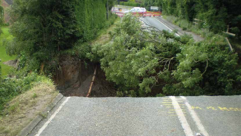
Worcestershire Local Flood Risk Management Strategy 2015–2021

        10 Environmental Objectives .  .  .  .  .  .  .  .  .  .  .  .  .  .  .  .  .  .  .  .  .  .  .  .  .  .  .  .  .  .  .  .  .  .  .  .  .  .  .  .  .  .  .  .  .  .  .  .  .  .  .  .  .  .  .  .  .  .  .  .  . 60
           Strategic Environmental Assessment  .  .  .  .  .  .  .  .  .  .  .  .  .  .  .  .  .  .  .  .  .  .  .  .  .  .  .  .  .  .  .  .  .  .  .  .  .  .  .  .  .  .  .  .  .  .  .  .  .  .  .  .  .  . 61
           The Water Framework Directive . .  .  .  .  .  .  .  .  .  .  .  .  .  .  .  .  .  .  .  .  .  .  .  .  .  .  .  .  .  .  .  .  .  .  .  .  .  .  .  .  .  .  .  .  .  .  .  .  .  .  .  .  .  .  .  .  .  . 61
           Sustainable Development  .  .  .  .  .  .  .  .  .  .  .  .  .  .  .  .  .  .  .  .  .  .  .  .  .  .  .  .  .  .  .  .  .  .  .  .  .  .  .  .  .  .  .  .  .  .  .  .  .  .  .  .  .  .  .  .  .  .  .  .  .  .  .  . 62
           Climate Change  .  .  .  .  .  .  .  .  .  .  .  .  .  .  .  .  .  .  .  .  .  .  .  .  .  .  .  .  .  .  .  .  .  .  .  .  .  .  .  .  .  .  .  .  .  .  .  .  .  .  .  .  .  .  .  .  .  .  .  .  .  .  .  .  .  .  .  .  .  .  .  .  . 63
           Green Infrastructure .  .  .  .  .  .  .  .  .  .  .  .  .  .  .  .  .  .  .  .  .  .  .  .  .  .  .  .  .  .  .  .  .  .  .  .  .  .  .  .  .  .  .  .  .  .  .  .  .  .  .  .  .  .  .  .  .  .  .  .  .  .  .  .  .  .  .  .  . 64
           The Historic Environment  .  .  .  .  .  .  .  .  .  .  .  .  .  .  .  .  .  .  .  .  .  .  .  .  .  .  .  .  .  .  .  .  .  .  .  .  .  .  .  .  .  .  .  .  .  .  .  .  .  .  .  .  .  .  .  .  .  .  .  .  .  .  .  . 65

        Appendix 1: Principal Flood Risk Legislation and Policy . . . . . . . . . . . . . . . . . . . . . . . . . . . . . . . . . . . . . . . 67

        Appendix 2: LLFA Roles and Responsibilities .  .  .  .  .  .  .  .  .  .  .  .  .  .  .  .  .  .  .  .  .  .  .  .  .  .  .  .  .  .  .  .  .  .  .  .  .  .  .  .  .  .  .  .  .  .  .  . 69

        Appendix 3: Risk Management Authorities’ Roles and Responsibilities  .  .  .  .  .  .  .  .  .  .  .  .  .  .  .  .  .  .  .  .  .  .  .  . 70

        Appendix 4: Action Plan .  .  .  .  .  .  .  .  .  .  .  .  .  .  .  .  .  .  .  .  .  .  .  .  .  .  .  .  .  .  .  .  .  .  .  .  .  .  .  .  .  .  .  .  .  .  .  .  .  .  .  .  .  .  .  .  .  .  .  .  .  .  .  .  .  .  . 71

        COVER IMAGE: Droitwich surface water flooding

                                                                                                                            6
Worcestershire Local Flood Risk Management Strategy 2015–2021

   Figures and Tables

        Figures
            Figure 1: Managing Flood Risk . .  .  .  .  .  .  .  .  .  .  .  .  .  .  .  .  .  .  .  .  .  .  .  .  .  .  .  .  .  .  .  .  .  .  .  .  .  .  .  .  .  .  .  .  .  .  .  .  .  .  .  .  .  .  .  .  .  .  .  . 13
            Figure 2: Flood and Coastal Erosion Risk Management Overview .  .  .  .  .  .  .  .  .  .  .  .  .  .  .  .  .  .  .  .  .  .  .  .  .  .  .  .  . 18
            Figure 3: Worcestershire Flood Risk Management Governance . .  .  .  .  .  .  .  .  .  .  .  .  .  .  .  .  .  .  .  .  .  .  .  .  .  .  .  .  .  . 30
            Figure 4: SWMP Process Wheel .  .  .  .  .  .  .  .  .  .  .  .  .  .  .  .  .  .  .  .  .  .  .  .  .  .  .  .  .  .  .  .  .  .  .  .  .  .  .  .  .  .  .  .  .  .  .  .  .  .  .  .  .  .  .  .  .  .  . 43
            Figure 5: Floodspots from all Risk Management Authorities  .  .  .  .  .  .  .  .  .  .  .  .  .  .  .  .  .  .  .  .  .  .  .  .  .  .  .  .  .  .  .  .  . 44
            Figure 6: Source, Pathway, Receptor model  .  .  .  .  .  .  .  .  .  .  .  .  .  .  .  .  .  .  .  .  .  .  .  .  .  .  .  .  .  .  .  .  .  .  .  .  .  .  .  .  .  .  .  .  .  .  .  . 48
            Figure 7: SuDS Mimicking Nature . .  .  .  .  .  .  .  .  .  .  .  .  .  .  .  .  .  .  .  .  .  .  .  .  .  .  .  .  .  .  .  .  .  .  .  .  .  .  .  .  .  .  .  .  .  .  .  .  .  .  .  .  .  .  .  .  . 50

        Tables
            Table 1: Structure of the Strategy  . .  .  .  .  .  .  .  .  .  .  .  .  .  .  .  .  .  .  .  .  .  .  .  .  .  .  .  .  .  .  .  .  .  .  .  .  .  .  .  .  .  .  .  .  .  .  .  .  .  .  .  .  .  .  . 14
            Table 2: LLFA Roles and Responsibilities  .  .  .  .  .  .  .  .  .  .  .  .  .  .  .  .  .  .  .  .  .  .  .  .  .  .  .  .  .  .  .  .  .  .  .  .  .  .  .  .  .  .  .  .  .  .  .  .  .  . 15
            Table 3: Other Legislation and Policy  .  .  .  .  .  .  .  .  .  .  .  .  .  .  .  .  .  .  .  .  .  .  .  .  .  .  .  .  .  .  .  .  .  .  .  .  .  .  .  .  .  .  .  .  .  .  .  .  .  .  .  .  . 16
            Table 4: Flooding Plans and Strategies  .  .  .  .  .  .  .  .  .  .  .  .  .  .  .  .  .  .  .  .  .  .  .  .  .  .  .  .  .  .  .  .  .  .  .  .  .  .  .  .  .  .  .  .  .  .  .  .  .  .  .  . 17
            Table 5: Worcestershire Plans and Strategies  .  .  .  .  .  .  .  .  .  .  .  .  .  .  .  .  .  .  .  .  .  .  .  .  .  .  .  .  .  .  .  .  .  .  .  .  .  .  .  .  .  .  .  .  .  . 18
            Table 6: Flood Responsibilities  .  .  .  .  .  .  .  .  .  .  .  .  .  .  .  .  .  .  .  .  .  .  .  .  .  .  .  .  .  .  .  .  .  .  .  .  .  .  .  .  .  .  .  .  .  .  .  .  .  .  .  .  .  .  .  .  .  .  . 20
            Table 7: Local Aims and Relationship with the National Strategy  . .  .  .  .  .  .  .  .  .  .  .  .  .  .  .  .  .  .  .  .  .  .  .  .  .  .  . 38
            Table 8: SuDS Typology  .  .  .  .  .  .  .  .  .  .  .  .  .  .  .  .  .  .  .  .  .  .  .  .  .  .  .  .  .  .  .  .  .  .  .  .  .  .  .  .  .  .  .  .  .  .  .  .  .  .  .  .  .  .  .  .  .  .  .  .  .  .  .  .  . 51
            Table 9: RFCC Expenditure Worcestershire 2004-2017  .  .  .  .  .  .  .  .  .  .  .  .  .  .  .  .  .  .  .  .  .  .  .  .  .  .  .  .  .  .  .  .  .  .  .  .  .  . 56

                                                                                                                   7
Worcestershire Local Flood Risk Management Strategy 2015–2021

   Glossary

    Term/Word                             Definition
    Act                                   A Bill approved by both the House of Commons and the House of Lords and
                                          formally agreed to by the reigning monarch (known as Royal Assent).
    Catchment                             An area that serves a river with rainwater. Every part of land where the rainfall
                                          drains to a single watercourse is in the same catchment.
    Catchment Flood Management            A strategic planning tool through which the Environment Agency works with
    Plan (CFMP)                           other key decision-makers within a river catchment to identify and agree
                                          policies for sustainable flood risk management.
    Climate change                        The change in average conditions of the atmosphere near the earth’s surface
                                          over a long period of time.
    Defence                               A structure that is used to reduce the probability of floodwater or coastal
                                          erosion affecting a particular area (for example a raised embankment).
    Drainage authorities                  Organisations involved in water level management, including IDBs, the
                                          Environment Agency, and RFCCs.
    Flood                                 The temporary covering by water of land not normally covered with water.
    Flood Plain                           A flood plain is an area of flat land near a river, stream, lake or other open
                                          waterway that is subject to flooding when there is significant rainfall. [2] A flood
                                          zone is a commonly used term in floodplain management. Flood zones are areas
                                          identified by the Environment Agency (EA) and refer to the probability of river
                                          and sea flooding, ignoring the presence of defences. [8] Flood zones are divided
                                          into Flood Zone 1 (Low Probability flooding events), Flood Zone 2 (Medium
                                          probability), Flood Zone 3a (High Probability) and Flood Zone 3b (the Functional
                                          Floodplain).
    Flood Risk Management                 The introduction of mitigation measures (or options) to reduce the risk posed
                                          to property and life as a result of flooding. It is not just the application of
                                          physical flood defence measures.
    Flood Risk Regulations                Legislation, which transposed the European Floods Directive in 2009.
    Fluvial flooding                      Flooding caused by the over-topping of river or stream banks.
    Groundwater flooding                  Occurs when water levels in the ground rise above the natural surface. Low-
                                          lying areas underlain by permeable strata are particularly susceptible.
    Internal Drainage Board (IDB)         A statutory body that provides storm water management by operating and
                                          maintaining an artificial surface water drainage system.
    Lead Local Flood Authority            Upper tier authorities with responsibility to coordinate the management of
                                          local flood risk from surface water, ground water and ordinary watercourses.
    Local Flood Risk                      Local Flood risk includes surface water, ordinary watercourse and groundwater
                                          flooding.

                                                                8
Worcestershire Local Flood Risk Management Strategy 2015–2021

   Glossary

    Term/Word                             Definition
    Main River                            A watercourse shown as such on the Main River Map, and for which the
                                          Environment Agency has responsibilities and powers. Main rivers are usually
                                          larger streams and rivers (like the River Severn or the River Teme), but also
                                          include smaller watercourses of strategic drainage importance (like the
                                          Battlefield Brook in Bromsgrove). A main river is defined as a watercourse shown
                                          as such on a main river map and can include any structure or appliance for
                                          controlling or regulating the flow of water along its course in or out of a main
                                          river. The Environment Agency has powers to carry out flood defence works
                                          applying to main rivers only.
    Mitigation                            The management (reduction) of flood risk.
    Ordinary watercourses                 A watercourse that is not part of a main river including (amongst others)
                                          ditches, drains, cuts, culverts, dikes, sluices and passages, through which water
                                          flows.
    Recovery                              The process of rebuilding, restoring and rehabilitating the community following
                                          an emergency.
    Reservoir                             A natural or artificial lake where water is collected and stored until needed.
                                          Reservoirs can be used for irrigation, recreation providing water supply for
                                          municipal needs, hydroelectric power or controlling water flow.
    Resilience                            The ability of the community, services, area or infrastructure to avoid being
                                          flooded or lost to erosion, or to withstand the consequences of flooding or
                                          erosion taking place.
    Risk                                  The significance of a potential event in terms of likelihood and impact.
    Risk assessment                       A structured and auditable process of identifying potentially significant events,
                                          assessing their likelihood and impacts, and then combining these to provide an
                                          overall assessment of risk, as a basis for further decisions and action.
    Risk Management Authority             Organisations that have a key role in flood and coastal erosion risk management
    (RMA)                                 as defined by the Flood and Water Management Act (2010). These are the
                                          Environment Agency, lead local flood authorities, district councils where there
                                          is no unitary authority, internal drainage boards, water companies, and highways
                                          authorities.
    River flooding                        Occurs when water levels in a channel overwhelms the capacity of the channel.
    Strategic Environmental               Arising from an EU directive and consistent with Government policies on the
    Assessment                            environment and sustainable development, with the objective of providing high
                                          level of protection for the environment and to contribute to the integration of
                                          environmental considerations into the preparation and adoptions of plans and
                                          programmes with a view to promoting sustainable development.

                                                                9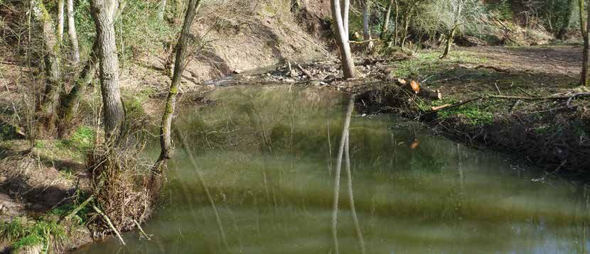
Worcestershire Local Flood Risk Management Strategy 2015–2021

    Term/Word                             Definition
    Sewer Flooding                        Sewer flooding occurs when sewers are overwhelmed by heavy, rainfall or when
                                          they become blocked. The likelihood of flooding depends on the capacity of
                                          the local sewerage system. Land, property and rivers can be flooded with water
                                          contaminated with sewage as a result.

                                          During heavy rainfall, combined sewer overflows (CSOs) can operate which
                                          discharge dilute sewage to watercourses. These are consented by the EA. Also
                                          during heavy rainfall, sewer flooding can occur which can result in this flood
                                          water discharging to a river or mixing with river flooding.
    Strategic Flood Risk                  The assessment of flood risk on a catchment-wide basis for proposed
    Assessment                            development in a District.
    Sustainable drainage systems          Current best practice for new development that seeks to minimise the impact
    (SuDS)                                upon the localised drainage regime, e.g. through the use of pervious areas
                                          within a development to reduce the quantity of runoff from the development.
    Surface water flooding                Flooding from rainwater (including snow and other precipitation), which: is on
                                          the surface of the ground and has not has not entered a watercourse, drainage
                                          system or public sewer.
    Site of Special Scientific            Wildlife and geological sites, which are protected under the Wildlife and
    Interest (SSSI)                       Countryside Act 1981, as, amended by the CROW Act and NERC Act 2006.
    Surface Water Management              A study undertaken in a specified area, which looks at, the risk associated with
    Plan (SWMP)                           local flood risk, resulting in an action plan for managing future risk and resource
                                          allocation.
    Voluntary organisations/              Self-governing organisations, some being registered charities, some
    groups                                incorporated non-profit organisations. They deliver work for the public benefit
                                          using volunteers.
    Watercourse                           A channel (natural or artificial) along which water flows.

                                                                10
Worcestershire Local Flood Risk Management Strategy 2015–2021
Abbreviations
Abbreviation Definition
CFMP Catchment Flood Management Plan
Defra Department for Environment, Food and Rural Affairs
EU European Union
FMfSW Flood Map for Surface Water (3rd generation Environment Agency surface water mapping)
FRM Flood Risk Management
FRMSCG Flood Risk Management Strategic Co-ordinating Group
FWMA Flood and Water Management Act 2010
GI Green Infrastructure
IDB Internal Drainage Board
LDF Local Development Framework
LFRMS Local Flood Risk Management Strategy
LLFA Lead Local Flood Authority
LNP Local Nature Partnership
LPA Local Planning Authority
LRF Local Resilience Forum
LSIDB Lower Severn Internal Drainage Board
NFU National Farmers’ Union
NPPF National Planning Policy Framework
PFRA Preliminary Flood Risk Assessment
RBD River Basin District
RFCC Regional Flood and Coastal Committee
RMA Risk Management Authority
SAB SUDS Approving Body
SEA Strategic Environmental Assessment
SFRA Strategic Flood Risk Assessment
STW Severn Trent Water
SuDS Sustainable Drainage Systems
SWMP Surface Water Management Plan
WCC Worcestershire County Council
WLDG Worcestershire Land Drainage Group
WLEP Worcestershire Local Enterprise Partnership
11Worcestershire Local Flood Risk Management Strategy 2015–2021
Surface water flooding
1. Background
Section 1: The following section outlines the purpose of the Strategy and the guiding principles.
Introduction
1.1 The Worcestershire Local Flood Risk Management Strategy (The Strategy) has been produced to assist in
the understanding and management of flood risk in the county. The Strategy is one of a number of policies,
plans and proposals being developed as part of a more integrated approach to flood risk, which includes
the different responsible organisations working better together to manage flood risk for the benefit of
communities and businesses in the county.
1.2 Worcestershire County Council, as the Lead Local Flood Authority (LLFA), is only responsible for the
management of local flood risk. Local flood risk is defined as surface water, ordinary watercourse and
groundwater flooding, as defined within the Flood and Water Management Act. Therefore, this Local Flood
Risk Management Strategy only addresses local flood risk and the interactions it might have with other forms
of flood risk. Flooding in Worcestershire may be strongly influenced by management in upstream catchments.
Actions within the Strategy will, therefore, need to integrate closely with catchment wide strategies led by
the Environment Agency (see table 4). Reference will, however, be made to national strategies, policies and
approaches where relevant and beneficial to the understanding of local flood risk issues.
Guiding Principles
1.3 The Local Flood Risk Management Strategy will play an important role in formalising an integrated approach
to local flood risk management in Worcestershire by setting out short, medium and long-term goals and
aspirations, which will build on existing knowledge, experience and procedures.
1.4 The Strategy has been designed to ensure that it is accessible for use by both public and private sector
organisations as well as the general public.
1.5 This Strategy for Worcestershire sits in the overarching framework of the National Flood and Coastal Erosion
Risk Management Strategy (National Strategy), which has been prepared by the Environment Agency with input
from the Department for Environment, Food and Rural Affairs (Defra) to reflect government policy. Localism is
at the heart of the National Strategy, recognising that there is a limit to what government and national bodies
can achieve alone, and that national priorities are only part of the picture.
12Worcestershire Local Flood Risk Management Strategy 2015–2021
1.6 The National Strategy encourages more effective risk management by enabling people, communities,
businesses, infrastructure operators and the public sector to work together.
1.7 The following diagram, taken from the National Strategy, demonstrates how the Environment Agency intends
to work with individuals, communities and organisations to reduce the risk of flooding. This approach applies
to all flood risk mitigation, large or small, and is reflected in the approach taken by the Local Strategy.
Understand
the risks
Improve flood prediction,
Manage
warning and post-flood
recovery Flood and Coastal the likelihood
Erosion Risk
Management
Prevent Help people to
inappropriate manage their
development own risk
Figure 1 Managing flood risk1
1.8 The LLFA will work in partnership with the other risk management authorities (RMAs), the Worcestershire Local
Enterprise Partnership (WLEP), the Worcestershire Local Nature Partnership (LNP), local communities, district
councils, neighbouring LLFAs and other stakeholders to build an evidence base for local flood risk management
in Worcestershire.
1.9 Flood risk management can reduce both the risk and impact of flooding and improve our response to
flooding for future occupiers and/or the area in the vicinity of development as an enabler to economic
growth. Strategic development should integrate consideration of flood risk and sustainable drainage to avoid
inappropriate development that could increase the risk of flooding.
1.10 The Strategy will provide the evidence base to target future capital and operational investment to manage
flood risk in Worcestershire. The Strategy is designed to complement other works undertaken by the County
Council and by our partners.
Defining Flood Risk
1.11 Local flood risk is defined by the Flood and Water Management Act as meaning flood risk derived from surface
runoff, groundwater and ordinary watercourses.
1.12 Ordinary watercourses are defined as those which do not form part of a main river. Main rivers themselves
being defined by the Water Resources Act 1991 as being a watercourse shown as such on a main river map and
this includes any structure or appliance for controlling or regulating the flow of water into in or out of the
channel.
1 National Flood and Coastal Erosion Risk Management Strategy for England, May 2011.
13Worcestershire Local Flood Risk Management Strategy 2015–2021
1.13 Flood risk from the sea, main rivers and reservoirs is not defined as local flood risk and is the concern of
the Environment Agency. Such sources of flood risk do, however, need to be considered, as their potential
interaction with those flood risks defined as local to ensure that all joint risks of flooding are assessed at the
local scale.
Structure of the Strategy
Section Title Summary of Context
number
1.0 Background Purpose of the document, background information.
2.0 Legislative and Policy Context National legislation and strategy.
3.0 Worcestershire Flood Risk. Local content.
4.0 Organisational Responsibilities Organisations responsible for flood risk and their
respective roles.
5.0 Worcestershire Partnerships How Worcestershire County Council will work in
Partnership.
6.0 Communities How Worcestershire County Council and partners will
work to support community resilience.
7.0 Planning The role of the planning system and emergency planning.
8.0 Actions to Manage Flood Risk Details of actions that Worcestershire County Council
and its partners are taking to reduce flood risk.
9.0 Flood Risk Management Details of how actions can be implemented and available
funding sources.
10.0 Environmental Objectives Details of how the Local Strategy can be used to achieve
wider environmental benefits.
11.0 Next steps Summary of actions and planned review dates.
Table 1 Structure of the Strategy
Review of the Strategy
1.14 This Strategy has been produced to reflect current legislation and our current understanding of the
management of local flood risk. It will require periodic review to reflect any changes to legislation, increases in
data and understanding and the completion of actions. We propose to review the Strategy every five years.
14Worcestershire Local Flood Risk Management Strategy 2015–2021
Cropthorne emergency road scheme
2. Legislative and Policy Context
Section 2: The following section provides an overview of key legislation, plans and strategies with regard to flood risk
management.
National Legislation
2.1 Flood risk management is governed in England and Wales through a series of different pieces of legislation,
including Acts of Parliament and other regulations. The principal legislative and policy documents are outlined
below with full details in Appendix 1.
Flood and Water Management Act (2010)
2.2 The Flood and Water Management Act 2010 (the Act) designated upper tier / unitary local authorities as Lead
Local Flood Authorities (LLFA) and gave them and other risk management authorities (RMAs) a number of
duties and powers.
LLFA Role Summary of requirements
Duty to publish a Local Flood Risk Develop, maintain, apply and monitor a strategy for local
Management Strategy flood risk management of the area.
Duty to investigate flooding Co-ordinate the investigation of significant flood events.
Duty to produce an asset register Maintain a register and record of structures and features
which have a significant impact on flood risk.
Power to designate flood risk assets Designate structures and features that affect flooding in
order to safeguard them.
Power to carry out works Undertake works to manage flood risk from surface runoff
and groundwater.
Duty to administer and enforce the Land Discharge consent applications for significant changes to
Drainage Act with regard to Ordinary ordinary watercourses and take enforcement action under
Watercourses the provisions of the act as required.
Table 2 LLFA Roles and Responsibilities
15Worcestershire Local Flood Risk Management Strategy 2015–2021
Other Acts, Regulations and Policy
2.3 Alongside the Flood and Water Management Act there is other legislation which gives a range of duties and
powers to the various risk management authorities for flooding.
Legislation Derivation Role
Flood Risk Regulations 2014 Translates EU Flood Directive Environment Agency to prepare, collate
into UK law. and publish flood risk maps, hazard maps,
Preliminary Flood Risk Assessments and
flood management plans for flooding
arising from sea, main rivers and reservoirs.
LLFA to undertake this for other sources of
flooding.
Land Drainage Act, 1991 Outlines the duties and This legislation has been updated in part by
powers to manage land the Flood and Water Management Act.
drainage for a number of
bodies including the LLFA,
Environment Agency, Internal
Drainage Boards (IDB’s).
National Planning Policy National planning policy. Aims to avoid inappropriate development
Framework in areas at risk of flooding, and reinforce
the requirement for sustainable surface
water management in new development.
Table 3 Other Legislation and Policy
2.4 Flood risk management is influenced by a range of other national legislation and policies, the most significant
of which are listed below.
• The Climate Change Act (2008)
• The Conservation of Habitats and Species Regulations (2010)
• The Civil Contingencies Act (2004)
• The Environmental Assessment of Plans and Programmes Regulations (2004)
• The Land Drainage Act (1991)
• The Water Framework Directive (2007)
• The Countryside and Rights of Way Act (2000)
• The Wildlife and Countryside Act (1981)
• The Public Health Act (1936)
• Highways Act (1980)
• Reservoirs Act (1975)
• Water Resources Act (1991)
• Water Industry Act (1991)
16Worcestershire Local Flood Risk Management Strategy 2015–2021
Flooding Plans and Strategies
2.5 Alongside the legislation, there are also a series of plans and strategies relating to flood risk management and
water quality. The most significant of these are outlined below
Name Geographical Area Role
National Strategy for National Produced by Environment Agency, to reduce the
Flood and Coastal Erosion threat of flooding and coastal erosion.
Management
River Basin Management Regional Delivery of Water Framework Directive by improving
Plans ecological status of water bodies.
Catchment Flood Catchment / Region Produced by Environment Agency to identify and
Management Plans agree policies for sustainable flood risk management.
Surface Water Management County and District Assessment of local flood risk.
Plans
Multi Agency Flood Plans County and District Emergency response plan for incidents of flooding.
Strategic Flood Risk District Planning Provides information on areas at risk from all sources
Assessments Authority of flooding and form the basis from which to apply
the Sequential Test and Exception Test (as defined in
NPPF) in development allocation and development
management process.
Table 4 Flooding Plans and Strategies
Other Related Plans and Strategies
2.6 Flood risk management and water quality will also relate to a series of other strategies produced at the local level
which can assist with a partnership approach, and bring additional benefits. These strategies are listed below.
Name Geographical Area Role
Worcestershire Green County Need for and delivery of green infrastructure of
Infrastructure Strategy which sustainable drainage can be part.
Worcestershire Local County Delivery of transport infrastructure and requirements
Transport Plan for highways and sustainable transport design and
drainage.
Worcestershire Climate County Carbon reduction and resilience strategy for the
Change Strategy likely impact of climate change, which includes
flooding.
Worcestershire Strategic County Overarching framework for investment in
Economic Plan Worcestershire's economy through WLEP. Resilience
to flooding events is recognised in this.
Worcestershire County County Sets 4 key areas of focus for the County Council:
Council Corporate Plan Open for Business, the Environment, Health and
Wellbeing and Children and Families.
Table 5 Worcestershire Plans and Strategies
2.7 The Strategy is influenced by and influences a range of other plans, policies and legislation. The links between
other plans, policies and legislation must be considered to ensure consistency whilst avoiding duplication.
Figure 2 (below) illustrates where the Strategy sits in relation to other relevant plans, policies and legislation.
17Overview DCLG Defra Cabinet Office
Planning policy and Flood and Coastal Erosion Risk Management Policy Civil contingencies
building regulations
Environment Agency Strategic Overview - National FCERM Strategy Defra
surface water, groundwater, ordinary watercourses main rivers, reservoirs, sea, coastal erosion (guidance)
Local Development Catchment Flood Shoreline
Planning Multi-agency
Frameworks/ Management Plans Management Plans
Neighbourhood flood plans
Plans
Lead Local Flood Authorities - local flood risk management strategies
(building on surface water management plans, preliminary flood risk assessments, etc.)
Lead Local Flood Coastal erosion risk
Worcestershire Local Flood Risk Management Strategy 2015–2021
Delivery Districts / IDBs: Environment Agency: management authorities/
Land use planning Authorities: surface Local Resilience Forums
ordinary watercourses main rivers and the sea Environment Agency:
18
application decisions water and groundwater coastal erosion
Water companies, reservoir owners, highways authorities
Third Party assets
Department for Communities and Local Government
Department for the Environment Food and Rural Affairs
Cabinet Office
Environment Agency
Lead Local Flood Authorities (county and unitary authorities)
District Councils
Major infrastructure owners and third parties
Figure 2 Flood and coastal erosion risk management overviewWorcestershire Local Flood Risk Management Strategy 2015–2021
Surface Water, Kemerton
3. Worcestershire Flood Risk
Section 3: The following section summarises the types of flood risk and describes the flood characteristics
and historic flood impacts in Worcestershire.
Types of Flood Risk
3.1 Flood risk is varied in nature and extent throughout the county. The county includes the catchments of
important rivers, numerous small streams and minor rivers, plus a network of canals, meaning that flooding can
come from a range of sources.
3.2 The main sources of flooding within Worcestershire are:
• Surface water flooding is also known as pluvial flooding and it occurs when rainfall flows across the surface
of the land, and ponds in low lying areas. It is more commonly associated with high intensity rainfall
(typically greater than 30mm/hr) but is also associated with very prolonged rainfall. It is unpredictable in
both location and severity.
• Highways flooding can be defined as flooding on or from the highway which results from rainfall falling on
the surface of the highway.
• Ordinary watercourse flooding arises from any watercourse not designated as a main river. There is a
large network of small watercourses, streams, brooks and small rivers in the county, both mapped and
unmapped. This type of flooding occurs when the watercourse cannot accommodate the volume of water
resulting in it coming out of its banks. All flooding from rivers is known as fluvial flooding.
• Main river flooding is also known as fluvial flooding and occurs when main rivers are overwhelmed and
flow outside of their banks. Main rivers are normally the large river systems, but can also include smaller
watercourses of strategic drainage importance. Main rivers in Worcestershire include the Rivers Severn,
Teme, Avon, Stour and Salwarpe and the Bow, Spadesbourne, Battlefield and Sugar Brooks.
• Groundwater flooding occurs when the water table rises above the surface of the ground. Flooding of this
type tends to arise after periods of sustained rainfall and can last for long periods of time. The areas most
at risk from groundwater flooding are low-lying areas where the water table is naturally near the surface, or
water raising up from an underlying aquifer or through springs.
19Worcestershire Local Flood Risk Management Strategy 2015–2021
• Reservoir flooding results from a complete or partial failure of a reservoir structure or overtopping. It may
be caused by erosion due to seepage, overtopping the dam, or through damage to the structure itself. This
form of flooding is extremely rare.
• Sewer flooding occurs when the sewer network cannot cope with the volume of water entering it. It is
often experienced during times of heavy rainfall, when large amounts of surface water overwhelm the
sewer network causing flooding. This may have a negative impact on water quality.
3.3 The responsibility for managing the different types of flood risk sits with a number of organisations as outlined
in the chart below:
Flooding source Responsible organisation
Surface water Lead Local Flood Authority
Lead Local Flood Authority
Ordinary Watercourse
Internal Drainage Board
Highways England
Highway
Highways Authority
Groundwater Lead Local Flood Authority
Main river Environment Agency
Reservoir Environment Agency
Sewer Water and Sewerage Company
Table 6 Flood Responsibilities
Upton upon Severn main river flood defence
20Worcestershire Local Flood Risk Management Strategy 2015–2021
Sewer Flooding © Severn Trent Water
Flooding Characteristics of Worcestershire
3.4 Fluvial flooding from the main rivers in the county generates the most media interest with a focus on the
River Severn through Bewdley, Upton-upon-Severn, Stourport-on-Severn, and Worcester City, the River Avon
through Evesham and the River Teme through Tenbury. However, the majority of flood events in recent years
have been caused by intense rainfall leading to surface water and ordinary watercourse flooding.
3.5 The most significant events in living memory are those that occurred in June and July of 2007 when there were
a large number of incidents recorded throughout the county from a range of flooding sources. The flooding
event in 2007 was particularly significant in terms of its impact on people, properties, businesses, infrastructure
and the environment in Worcestershire with over 4,700 properties being internally flooded. It is estimated that
this flooding had an overall cost to Worcestershire of around £6.4 million per week.
3.6 Major surface water and main river flooding has occurred again as recently as February 2014 with further
surface water flooding being experienced in February 2016.
3.7 These events demonstrate the complexity and integrated nature of flooding in the county and expose the
susceptibility to flood risk from many sources. Whilst the events of 2007 were exceptional, they gave insight
into the scale of risk that might be presented as a result of climate change and demonstrate that the strategic
management of flood risk is central to the economic prosperity and longevity of Worcestershire as a place for
people to live, work and visit.
North Worcestershire (Bromsgrove District, Redditch Borough and Wyre Forest District Councils)
Bromsgrove District
3.8 Bromsgrove District contains the headwaters of a number of main rivers which rise in the North Worcestershire
Hills
• The River Salwarpe which flows from Bromsgrove towards Droitwich
• The Gallows Brook, which flows through West Hagley to its confluence with the River Stour in
Kidderminster.
• The River Arrow, which becomes a main river east of Alvechurch and then flows south, towards Redditch,
then to its confluence with the River Alne.
• The River Cole and
• The River Rea
21Worcestershire Local Flood Risk Management Strategy 2015–2021
3.9 The district is also drained by numerous ordinary watercourses, most notably to the north, on the Birmingham
Plateau.
3.10 Bromsgrove also contains sections of two canals: the Worcester and Birmingham Canal which bisects the
district from the north east to the southwest; and the Stratford-upon-Avon Canal of which approximately
700m cuts across the very north eastern corner of the district.
3.11 Although there are no reports of flooding from the Stratford-upon-Avon Canal, overtopping of the Worcester
and Birmingham Canal has been blamed for flooding in Stoke Prior, near Bromsgrove, most notably in 2007.
3.12 In addition, there are numerous pools and reservoirs within the district. The largest are the Upper and Lower
Bittel and Tardebigge Reservoirs, both of which are canal feeder reservoirs.
3.13 Due to its headwater location Bromsgrove district has not suffered from the severe fluvial flooding
experienced further downstream in Worcestershire during June and July 2007. However, due to the number
of watercourses present there have been numerous occurrences of smaller-scale flooding, most notably
flash flooding from rapid catchment response. In many cases this has resulted in flooding of properties and
overwhelming of the road, rail and canal networks and their associated drains and outflows.
3.14 Bromsgrove town has suffered primarily from surface water flooding but the village of Catshill in particular
has flooded from the Marl Brook and Battlefield Brook. There are also multiple occurrences of sewer flooding
within the district. In recent years flood alleviation schemes have been built along the Marl Brook and Callow
Brook.
22
Reservoir and the Worcester & Birmingham Canal © Canal and River TrustWorcestershire Local Flood Risk Management Strategy 2015–2021
Redditch Borough
3.15 The River Arrow bisects the northern half of the borough
from north to south with numerous ordinary watercourses
draining into it. Most of these smaller watercourses have
their headwaters located on the southern extent of the
Birmingham Plateau.
3.16 The southern, more rural, half of Redditch borough is
drained by two main river channels, which flow from north
to south. The western branch is referred to as Swans, or
Elcocks Brook. The eastern branch is referred to as The
Wharrage / Wixon Brook. Downstream of their confluence,
the watercourse is referred to as Swans Brook and, finally
as the Bow Brook. Although there are numerous balancing
ponds located within the borough, the only notable still-
water body is Arrow Valley Lake.
3.17 As Redditch is located at the base of the incline of the
Birmingham plateau and is on relatively flat land, it can suffer
from rapid flash flooding. Sewer Flood © Severn Trent Water
3.18 Multiple accounts of sewer flooding have also been reported within the borough, although largely limited to
Redditch town, Astwood Bank and the village of Feckenham.
Wyre Forest District
3.19 The principal town of Kidderminster is located on the River Stour, which flows through the main town centre.
The Staffordshire and Worcestershire Canal follows approximately the same route as the River Stour and both
have a long history of flooding. However, the town benefits from a major upstream attenuation area which
controls flow rates and flood heights.
3.20 Stourport-on-Severn, the second largest settlement, is located on a number of watercourses. Most notable
is the River Severn, which flows to the south of the main town. The River Stour, one of the River Severn’s
tributaries, joins the Severn at Stourport. Additionally, the Staffordshire and Worcestershire Canal terminates in
Stourport and consequently there are a number of canal basins located near to the town centre.
3.21 Bewdley, the third main settlement, has historically suffered from large flooding events as its sits in the valley
of the River Severn. The west bank of the river has benefited from multi-million pound flood defences along
Severnside North and South. The eastside benefits from temporary defences managed by the Environment
Agency.
Dowles Brook
23Worcestershire Local Flood Risk Management Strategy 2015–2021
3.22 The district also has a network of streams, pools and smaller watercourses which all have the potential to cause
flooding and there is a large water supply reservoir at Trimpley, to the north of Bewdley and in close proximity
to the River Severn.
3.23 The main tributaries of the River Severn within the Wyre Forest district are Dick Brook, Dowles Brook, Gladder
Brook, Hoo Brook, Snuffmill Brook, Riddings Brook, and the River Stour.
South Worcestershire (Worcester City, Malvern Hills and Wychavon Districts)
3.24 The main causes of flooding in south Worcestershire are the main rivers and surface water (either overland or
from sewers). Main river flooding has occurred many times with significant events occurring in 1998, 2000, 2007
and 2014 when several hundred properties flooded on each occasion.
3.25 The floods in 1998 were attributed to a large storm event whilst the November and December 2000 events
were the largest flood events since 1947. In 2007, there were over 1600 recorded incidents of flooding in
Wychavon alone and nearly 200 properties flooded in Worcester. This particular event was a combination of
main river and surface water flooding.
3.26 The main causes of flooding within the villages are the smaller watercourses and surface water flooding from
sewers and overland flow.
Worcester City
3.27 Significant watercourses within Worcester City include the River Severn, River Teme and Barbourne Brook.
Flooding can be caused by any of these rivers singly or in combination plus interaction with several smaller
watercourses and surface water. Canal flooding has also been recorded in the past, which has been attributed
to vandalism of the lock gates.
Wychavon
3.28 Significant watercourses within the area include the River Avon, River Salwarpe, Badsey, Merry and Carrant
Brooks and River Isbourne.
3.29 The main causes of flooding within Evesham are the River Avon, River Isbourne, Battleton Brook, Carrant Brook,
several smaller watercourses and surface water.
3.30 The main causes of flooding within Pershore are the River Avon, several smaller watercourses and surface water
flooding from sewers and overland flow.
3.31 The main causes of flooding within Droitwich are the River Salwarpe, Elmbridge Brook and surface water
flooding from sewers and overland flow. In addition, the Droitwich Canal interacts with the River Salwarpe in
several locations.
3.32 While the impact of flooding from the Carrant Brook is largely felt in Tewkesbury (Gloucestershire) it also has a
significant impact upstream in Worcestershire (e.g. in Beckford). The catchment of this brook is the subject of
an enhancement project involving a number of partners including the Kemerton Conservation Trust, Buglife,
the Environment Agency and the Overbury Estate. Flood alleviation through reintroducing meanders is part of
this project and the Environment Agency has already carried out some work on the Kemerton Estate below
Aston on Carrant.
24Worcestershire Local Flood Risk Management Strategy 2015–2021
Malvern Hills
3.33 Significant watercourses within the Malvern Hills District include the River Severn, River Teme, Kyre Brook, Dick
Brook, River Rea, Hatfield Brook and Pool Brook.
3.34 The main cause of flooding within Malvern is surface water.
3.35 The main causes of flooding within Tenbury Wells are the River Teme, Kyre Brook and surface water. In
addition, a culverted section of an un-named watercourse causes flooding at Bog Lane.
3.36 The main causes of flooding within Upton-upon-Severn are the River Severn, Pool Brook, and surface water
flooding. There is an important flood flow route to west of the town during extreme flood events on the River
Severn, which essentially isolates the town. In 2012 a new permanent flood defence designed to protect 64
properties from a 1 in 150 chance of flooding was completed.
3.37 A small area in the south of Malvern Hills District is included within boundaries of the Lower Severn Internal
Drainage Board. Their responsibilities include leading on local flood and surface water management within this
area.
Rapid Response Catchments
3.38 The Environment Agency has, at a national level, identified Rapid Response Catchments. These catchments are
areas that include rivers or streams (including smaller tributaries and ordinary watercourses) where flooding can
occur without a significant period of warning time. There are three such catchments in Worcestershire:
• Dick Brook,
• Badsey Brook
• Merry Brook.
3.39 The Environment Agency is the lead for managing flood risk in these catchments and the LLFA and other
partners are working in close partnership with them.
Upton-upon-Severn, river Severn in flood
25Worcestershire Local Flood Risk Management Strategy 2015–2021
Highway drainage gully
4. Organisational Responsibilities
Section 4: The following section summarises the roles of organisations responsible for managing flood risk
in Worcestershire.
Lead Local Flood Authority
4.1 The Flood and Water Management Act 2010 introduced a range of roles and responsibilities for flood risk
management, which are summarised below. Full details of the responsibilities of the LLFA are described in
Appendix 2.
LLFA responsibilities:
• Duty to produce a Local Flood Risk Management Strategy
• Duty to investigate flooding
• Duty to produce a record and register of structures and features
• Power to designate structures and features
• Power to carry out works
• Duty to administer applications for consent to work on an ordinary watercourse
• Power to enforce the Land Drainage Act with regard to ordinary watercourses
• Duty to respond to consultation on major planning applications with regard to surface water
Risk Management Authorities
4.2 A number of public bodies and private undertakers have responsibilities for flood risk and they are required to
work in partnership together to manage flood risk and help communities become more resilient to flooding.
Full details of the responsibilities of the risk management authorities are described in Appendix 3.
4.3 The risk management authorities in Worcestershire are
• Worcestershire County Council
(as both the Highways Authority and the LLFA)
• The Environment Agency
• Bromsgrove District Council
26Worcestershire Local Flood Risk Management Strategy 2015–2021
• Malvern Hills District Council
• Redditch Borough Council
• Worcester City Council
• Wychavon District Council
• Wyre Forest District Council
• Lower Severn Internal Drainage Board (IDB)
• Severn Trent Water Limited
• South Staffordshire Water Plc
Highway Authority
4.4 As the Highway Authority, the County Council is responsible for the local road network. Highways England is
responsible for the strategic or trunk road network.
4.5 The Highway Authority has a duty to manage flooding caused by rain falling on the surface of the highway.
4.6 The Highway Authority is also responsible for the management and maintenance of structures on and
underneath the highway. This involves the clearance of watercourses and culverts to ensure the structural
integrity of structures such as bridges and culverts.
4.7 The Highway Authority has the power to carry out works considered necessary to protect the highway from
flooding. These can be on the highway or on land which has been acquired by the Highway Authority for that
purpose. Subject to consent, the Authority may divert parts of a watercourse or carry out any other works on
any form of watercourse if it is necessary for the construction, improvement or alteration of the highway or
provides a new means of access to any premises from a highway. It is also able to adopt SuDS that serve the
highway.
Environment Agency
4.8 The Environment Agency has significant responsibilities, including leading on flood risk management on
Main Rivers. In carrying out its duties, the Environment Agency must have regard to the Local Flood Risk
Management Strategy produced by the LLFA and, like other RMAs, it must also contribute to sustainable
development, co-operate with other RMAs and provide them with information.
4.9 The Environment Agency also has a duty to produce and maintain a National Strategy for Flood and Coastal
Erosion Risk Management and to regulate flooding from reservoirs.
District, City and Borough Councils
4.10 District, city and borough councils have responsibilities which are:
• The power to designate structures and features that affect flooding or coastal erosion
• A duty to exercise their flood risk management functions in a manner consistent with local and national
strategies and to have regard to those strategies in their other functions
• A duty to respond to requests from other RMAs for information
• A duty to co-operate with investigations and scrutiny
Water and Sewerage Companies
4.11 The majority of Worcestershire is covered by Severn Trent Water Limited although South-Staffordshire Water
Plc serves a small area of Bromsgrove district. Their responsibilities include:
• A duty to act consistently with the National and Local Strategies and to have regard to them when carrying
out their flood risk management functions
• A duty to co-operate with investigations and scrutiny
• A duty to co-operate with and share information with other RMAs with regard to flood risk management
functions
27You can also read