Topsoil Resilient soil and water resources Understanding the water beneath your feet - Interreg North Sea Region
←
→
Page content transcription
If your browser does not render page correctly, please read the page content below
Preliminary Final Report

Topsoil
Resilient soil and water resources
Understanding the water beneath your feet
The TOPSOIL project is part of the Interreg North Sea Region Programme with the objective to preserve
and protect the environment against climate change impacts/effects by demonstrating new and/or
improved methods for improving the climate resilience of target sites. The funding is provided by the
European Regional Development Fund of the European Union.

Colophon

Copy: Rinke van Veen, provincie Drenthe
With thanks to all TOPSOIL partners for their contributions
Edits: Deirdre Buist
Film: Jules media
Photography: Leo de Vree & TOPSOIL partners?
Layout and design: Formatting: Stefan David, https://www.stefandavid.be in cooperation
with VMM, Grafische diensten Provincie Drenthe
Pictures: Yves Adams, Leo de Vree, partners in the Topsoil project

June 2020

 2
Preface
Within the North Sea Region, the effects of climate change – more damaging storms, floods and drought
– are hard to predict. Nevertheless, disruption is almost certain. Meanwhile, the effects of climate
change can now be seen on the news almost daily. Take the drought in 2018, with low water level in
rivers and crop damage, as well as flooding as a result of short and extreme thunderstorms. But what
we don’t see is the change below the surface. There’s a slow, invisible process taking place beneath our
feet but with a significant long-term impact on the quality of our environment and on human existence.
TOPSOIL is all about what’s happening underground.

” We believe that by making the interaction between soil, groundwater and surface water more visible,
climate change adaptation should become more efficient.”
With this document we aim to spread the message further, share our approach and our insights and
highlight the urgent needs for adaptation.
We have learnt a lot about the challenges faced in groundwater management resulting from climate
change, and about stakeholder involvement and transnational cooperation. As a result of the pilot
studies, we gained tremendous knowledge, which in turn led to new management plans. For each
of the pilots, tailored to the specific management questions and existing knowledge gaps (some still
exist), steps have been identified to deal with the increasing need for adaptation, while recognizing -
uncertainty and vulnerability. The pilots addressed current pressures (some already severe) - both on
the upper subsurface levels, on groundwater and on surface water. TOPSOIL pilots have shown that
climate change adaptation and sustainable groundwater management requires a stronger cohesion
between land management and water management. The future climate changes will impact all.

Meanwhile the Topsoil project has not finished yet. It has been decided that the TOPSOIL project
will be extended till the end of 2021. In the extension we will provide support to local and regional
groundwater managers to respond better to the need for balancing seasonal changes in groundwater
availability and quality. We will also capitalize the benefits of all TOPSOIL results and further develop
those relevant to local and regional groundwater management stakeholders.

The content of this report is based on the results from 01/12/2015 till 01/05/2020.
Following an introduction to the project itself, (Chapters 1&2) Chapter 3 sums up the insights from a
governance perspective. Chapters 4 specifies the efforts of transnational meetings while Chapter 6
builds the connection to the Sustainable Management Goals.
Main insights linked to the technical challenges are presented in Chapter 5 (technical solutions), Chapter
7 (outcomes) and Chapter 8 (recommendations). More details, references and specific contacts can be
found in Annex 3 “New Management Plans”.
Enjoy the read and feel free to get back to us with any questions!

We hope you enjoy the reading.

Sincerely
The Topsoil Partnership

Topsoil consortium, final conference Horsens (DK) October 2020

                                                                                                          3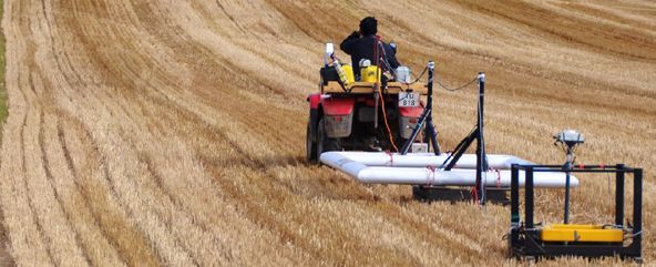
Content Table

1. TOPSOIL: an introduction                                             5
2. Work packages andapproach                                            8
   2.1 Project management (WP1)                                         8
   2.2 Communication (WP2)                                              9
   2.3 Stakeholder consultation (WP3)                                   9
   2.4 Technical field investigations (WP4)                            10
   2.5 Interpretation of data and modelling (WP5)                      12
   2.6 Exploring best governance and practice (WP6)                    13
   2.7 New management plans (WP7)                                      13
3. How does the governance
   system contribute to climate change adaptation in GW management?    14
   3.1. Responsibilities: Who supports adaption to climate change in
        groundwater management?                                        15
   3.2. Data / Knowledge                                               16
   3.3. Technical and other measures                                   17
4. Benefits of transnational exchange                                  19
5. Overview technical solutions in the New Management Plans            21
6. Topsoil as a contribution to the Sustainable Development Goals      22
7. Transnational and regional
   lessons learnt                                                      25
8. Recommendations                                                     29
Annexes                                                                31
1. References                                                          32
2. TOPSOIL partners                                                    32
3. New Management plans                                                34

 4
1. TOPSOIL: an introduction
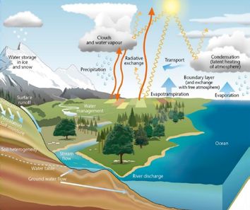
An important part of the water cycle takes part under our feet, within the uppermost 20-30 meters of
the subsurface. Although not visible and not completely understood, the topsoil plays an important
role in our adaptation to the impacts of climate change in the North Sea Region. Scientific studies of the
subsurface, using new techniques and models, should lead to a better understanding of the processes
and the hydrological system, improving adaptation to climate change. This will change our way of
managing water systems.
Figure 1 Climate, soil and water management
The impact of climate change is manifold, e.g. rising sea levels, drought caused by less rainfall and
increased evaporation in summer, less absorption of fertilizers and the effects on soil conditions, heavy
rainfall leading to run off and rising groundwater levels in winter.
TOPSOIL has addressed all these issues and provides a short overview of the main principles in a video
(see figure 2). https://www.youtube.com/watch?v=nk_mK4hduz0&t=2s
Figure 2 Topsoil animation
To tackle the impact of climate change on the subsurface, the TOPSOIL project started in 2015, with
the Central Denmark Region as lead partner. Five countries are working together: Denmark, Germany,
Belgium, The UK and the Netherlands. The project focusses on five shared challenges - building on the
earlier Interreg IV project WaterCAP:
5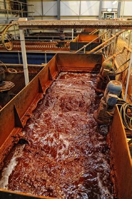
1. Groundwater flooding in towns and agricultural areas

Increase in precipitation will lead to a rise in groundwater level
and flooding in both rural and urban areas. It can damage
houses, infrastructure and crop yield.
.

2. Saltwater intrusion into freshwater reserves.

Rising sea level with saline water intrusion into fresh ground-
water and surface water. This can lead to loss of crop yield,
contamination of fresh water resources and influence the
surface water quality.

3. The need for a groundwater buffer to store excess rain
water for later use.

Less precipitation and higher evaporation will lower the
groundwater level but increase the demand for groundwater.
This will lead to crop losses, lower river levels and less uptake
of nutrients by crops.

4. Better management of soil conditions, to strengthen resilience to extreme rain events and improve
water quality.

More extreme events will lead to more flooding and drought. Degradation of the soil will reduce the resilience
for these events.

5. An unused capacity to break down nutrients and hazardous pollutants in the uppermost layers

A healthy soil can break down nutrients and pollutants. Understanding the system is important to know how
to act when considering the impact of climate change.

These five challenges have been studied in 16 pilot areas (see figure 3) for developing and testing
solutions for managing the uppermost 20-30 meters of the subsurface. This is where we cultivate crops,
build our infrastructure and develop our modern society. This is also where we have infiltration into
our drinking water resources and where pollution spreads from contaminated point sources. The main
hydrological and chemical dynamics are represented in this uppermost part of the subsurface. The
effects of climate change is, therefore, of great importance in this part of the soil and they have a direct
impact on the uppermost layers and on the surface. Because of the direct interaction between land use,
groundwater, surface water and soil, an integrated concept of land and water management is needed.
The five TOPOIL challenges are therefore often interconnected and demand solutions and management
plans that embrace mutual challenges.

 6
Not all five challenges are present in every pilot, although the different countries all face the same
problems more or less. This is also why exchange of knowledge on old and new challenges is so fruitful.
The flooding of towns in particular was a key part of the Danish pilots, while salinization was part of
pilots in Belgium and North Germany. Surface to groundwater connectivity and drought issues were
mainly investigated in England, the Netherlands and the eastern part of Niedersachsen. Water quality
issues were looked at by all the pilots.
More information of the pilots can be found in the pilot catalogue and the midterm catalogue
(https://northsearegion.eu/topsoil/output-library/communication-tools/).

Figure 3   TOPSOIL pilots.

                                                                                                     7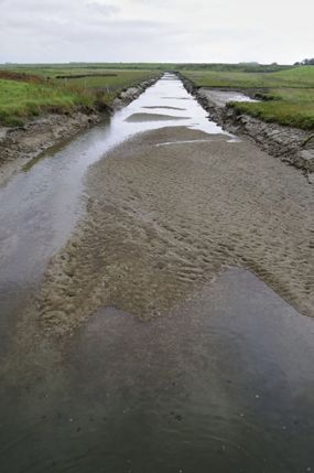
2. Work packages and approach

Figure 4 shows the project structure existing out of different work packages (WP). While communication
about and within the project activities has been a central element, all pilots have used five identical
steps in their approach to maximise the transferability/transnationality of the solutions. These steps are:
1. Consultation of stakeholders to improve the understanding of the challenge and need for new
   service;
2. Implementation of technical field investigations;
3. Interpretation of data and modelling of the existing and new data collected;
4. Exploration of best governance and practice from the five countries involved, in search of new best
   standards;
5. Development of a new management regime.

Figure 4.   Project structure TOPSOIL

The setup of the different components is described below, while further chapters will contain the main
messages.

2.1   Project management (WP1)
The TOPSOIL project is a large project, involving 16 pilot areas and 23 beneficiaries in 5 countries. Being
the only Interreg North Sea VB project with such a strong focus on groundwater, TOPSOIL has been
organized bottom-up to accommodate the rich diversity of partners and the issues being dealt with.
This means that the project coordinator (Central Denmark Region), together with the Work Package
lead partners, provided the frame and the partners identified those themes and issues they needed to
solve in their pilots - and on which they could benefit from transnational exchange. The consortium met
every six months, at meetings hosted by different partners, taking the opportunity to delve further into
the local pilots. Further coordination took place in monthly (telcon or face to face) Steering Committee
meetings. This resulted not only in a more effective delivery than promised in the proposal and also
strengthened trustful working relationships which contributed to efficient reporting towards the funding
bodies. More importantly, it has led to further cooperation - not only transnational - and an informal
technical network on groundwater management throughout the North Sea Region (see also chapter 4
“Benefits of Transnational Exchange”). In figure 5 is an overview of some of the numbers achieved by the
different activities.

 8
5 countries                        24 partners                         16 pilots
 Total budget € 7.342.220           20 Videos                           36 Development and
                                                                        innovation of new techniques
 19 Transnational meetings          21 press releases                   48 Geological and
                                                                        geophysical field work
                                                                        15 Hydrological models
                                                                        developed and tested
 2 Policy days                                                          20 Measures identified

Figure 5    TOPSOIL activities in numbers

2.2   Communication (WP2)
Spreading the message and informing other water managers, regional public and other stakeholders
on activities has been built into TOPSOIL from the very beginning- as communication is even more
central if the subject is not visible as is the case with groundwater and the subsurface. The pilot
projects have played an important role in providing the necessary evidence base and offer an additional
opportunity to interact with the general public and other professionals. While the scientific results were
communicated in technical contexts (see also 2.4) we have presented the objectives, results, benefits
and demonstration projects that have been achieved and implemented to water managers across the
North Sea Region, facilitating the uptake of measures and interaction with the public and stakeholders
in the different pilot project areas- during events (see also 2.3) as well as in numerous publications (see
figure 5).
The TOPSOIL-message is communicated through webpage, social media, videos, articles in professional
papers and press releases. Addressing issues relevant to adapted groundwater management, several
transnational workshops were organized to inform and involve stakeholders from local and regional to
European level (see also chapter 4).

                        Figure 6 Danish stakeholders visit Drenthe

2.3   Stakeholder consultation (WP3)
Stakeholder involvement has been the second key aspect of the TOPSOIL project. At the pilot level,
stakeholder involvement has been critical both to ensure that the pilots are delivered as planned
and that the results are accepted in order to be adapted and have sufficient influence on the future
management of the sites. The Stakeholder Involvement Strategies were based on the Topsoil Guide for
Stakeholder Involvement (see figure 7), which in UK is centred around the well-established Catchment
Based Approach. Each pilot has used this guide to engage stakeholders successfully to the pilots. The
strategy has been part of the project from start to finish because trust is needed when adapting water
management to the effects of climate. Especially when these effects to the soil are not directly visible.

                                                                                                        9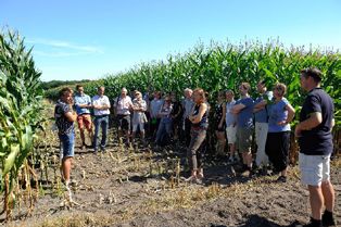
https://northsearegion.eu/media/5658/topsoil-stakeholder-involvement-guide.pdf

Figure 7      Topsoil Guide for Stakeholder Involvement

By using the stakeholder strategy, we have developed:

●     Better awareness of the importance of stakeholder participation within each pilot and familiarization
      with appropriate participatory methods and approaches;
●     Identification of key stakeholders at pilot and project level and ensuring their involvement in project
      activities;
●     A framework for planning stakeholder participation and a critical evaluation of the success of each
      pilot in involving stakeholders;
●     A collated information and dissemination in relation to the approaches taken throughout the project
      and their possible impact on developing “new thinking” and management changes.

The stakeholder involvement process has been carried out throughout the whole project, to ensure
the use of the results after the project has ended. Also, at project level, TOPSOIL has invited key
stakeholders with specific expertise to take part and contribute to transnational partner meetings
and pilot activities, thematic workshops on project challenges, governance challenges and field trips
to discuss pilot implementations. This strong stakeholder approach has been new and challenging
to some of the partners. However, it proved as very beneficial as it helped to build better tools and
improved support for groundwater management. The partners agreed that the extra efforts have been
well worth it (see also chapter 4).

2.4      Technical field investigations (WP4)
To learn more about the subsurface, (geophysical) techniques are needed to build robust models that
simulate groundwater and the interaction with soil and surface water. These special techniques (newly
developed in part) and field investigations have been applied in different pilot areas. The acquired data
contributes to geological and hydrological 3D models.

Within TOPSOIL we have created, innovated and tested new technology with the aim to identify
geological layers and soil characteristics, salinity, pathways for salinity or nutrients/pollution, small
watercourses runoff and hydraulic properties. The investigations are partly done via staff exchange and
close cooperation between the lead of the pilot area and the investigation team.

Structures and processes in the subsurface must be identified in order to do proper and sustainable
management of soil and water. Overview measurements, as carried out by SkyTEM for example, were
implemented in some pilots and show the distribution of freshwater and saltwater in the aquifers, for
instance, while other pilots used results from airborne electromagnetic measurements by BGR (Federal
Institute for Geosciences and Natural Resources) prior to the project’s start, to interpret groundwater

10
conditions. In some pilots, the tTEM system - newly developed by HydroGeophysics Group Aarhus
University - was applied to provide resistivity information in the target depth range of 0–70 m, see figure
below.
Figure 8 Ttem in action
Methods are under development to relate the resistivity distribution in the aquifer covering layers to
clay content and hydraulic conductivity to assess groundwater protection and recharge. In some pilots
the structural layering is surveyed by seismic methods, with special emphasis on shear waves. Approach
and results of activities will be published in a special issue of a scientific journal. An overview of the used
methods in the different pilots can be found in figure 9.
Technical methods Pilots
Seismic survey (S-wave, P-wave) GE-1, NL-3, DK-3
Drillings/ direct push GE-1, GE-2, DK-2A, NL-3
Mapping with EM/radiometry GE-5, BE-1
Ground Conductivity Meter (GCM) GE-5, DK-2A, DK-2B
Towed ground-based transient electromagnetics (tTem DK-1, DK-2A, DK-2B, DK-3
FloaTEM DK-1
Airborne EM (AEM/SkyTEM) BE-1, NL-3
Georadar GE-1
Surface Nuclear magnetic resonance (NMR) GE-1
Electical resistivity (ER) NL-1, GE-1, GE-2, GE-3, DK-1
acoustic doppler sensors GE-4
Tracer experiment NL-2
Dataloggers, turbidity meters UK-2
Borehole depth sampling UK-1
Figure 9 Technical methods
The work has been done in close cooperation with the other WPs, especially WP 3 and 5. The work
builds on different knowledge and new perspectives from beneficiaries.
112.5 Interpretation of data and modelling (WP5) Hydrological and geological tools have been newly developed and applied to model the geology in the shallow subsurface and to prepare the basis for new management. These methods are based on geophysical as well as geological and hydrogeological data that will be integrated and interpreted. With the data and the modelling, we have been able to: ● Analyse the hydrogeological data from the North Sea region on geology, groundwater and surface waters; ● Set up models of varying complexity to analyse the data and hydrogeological systems in question (see also figure 10); ● Carry out predictions of the impact of future changes in land use, water management and climate change on water resources and groundwater quantitative and chemical status according to the Water Framework Directive. Figure 10 Modelling the subsoil Modelling has been used to investigate flooding in urban and rural areas (DK-4 in Odense and DK-1 in Sunds) and to investigate the ability to use groundwater reservoirs as buffers to store water in periods of excess rainfall. The expected increasing problems with saltwater intrusion into coastal freshwater reserves have been investigated through state-of-the-art advanced density-dependent modelling tools (e.g. GE-2 in Germany) in combination with a basic understanding of the geological structures required to make reliable predictions of the risk of saltwater intrusion. The modelling approach is used as a tool to make a robust risk-assessment of a threat from contaminated point sources in future climate changes (DK-4 in Odense). Further, the capacity degradation of nutrients, as well as other hazardous pollutants, in the uppermost layers have been investigated While we are proud to say that we fostered the knowledge base on the subsurface for the different pilot areas, it is also important to acknowlede that the collection and integration of data remains a central challenge. Models needed to investigate and explain the impact of climate change on ground- and surfacewater are as good as the available data. But it not always clear if data is available and what the quality of the data is. So, a better interface between data and models is needed. 12
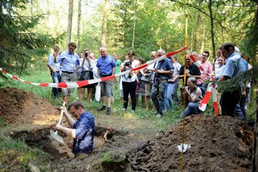
Figure 11   Digging to understand the soil

2.6   Exploring best governance and practice (WP6)
Acknowledging the need to integrate technical results with the institutional and legal requirements, and
with stakeholders needs, governance became a central issue in the modelling project. A Transnational
Governance Team (TGT) was formed, with representatives from all TOPSOIL countries, to explore the
best governance and practice from the five involved countries. One of the goals of the TOPSOIL project
was to develop a European governance toolkit by collecting information on applied governance tools
and their impact. To do so, common central governance issues were collected at the first partner
meeting and discussions were organized on different governance topics. Then the TGT set up a toolkit
in the form of dedicated workshops, providing the floor for the full consortium to discuss and reflect on
management and governance throughout the NSR area and mirror management towards the five pilot
challenges.

To structure these workshops, the case study approach was developed: One partner describes the local
situation and defines governance questions which address the challenges of implementing sustainable
groundwater management. The partners from the different countries prepare a response based on this
case study “What, if I faced the same situation?”. The objective of the workshops is to address each of
the TOPSOIL challenges at least once in such case study approaches.

The results of these meetings, together with the workshop reports are than further developed into
roadmaps for regional management. In the roadmaps, core questions on the main themes in the
workshop (currently often the distribution of responsibilities, monitoring and stakeholder involvement)
are illustrated with examples from the different countries. Workshop reports have been made for later
use within the pilots. The synthesis of the different roadmaps for the discussed challenges are written in
the next chapter.

2.7   New management plans (WP7)
A new management plan has been made for each pilot It is not a management plan in the sense that
it describes the water management in a whole catchment area or in detailed actions / measures. The
management plan reflects the experiences obtained from the pilots. It provides a short summary of the
challenge(s), steps taken, measures identified and recommendations to change management in order
to adapt climate change. Technical reports are available for more detailed information.
The references can be found within the management plans, together with the name of the organisation
that can present more detailed information. An overview of the measures can be found in chapter 5.

                                                                                                       13
3. How does the governance
system contribute to climate chan-
ge adaptation in GW management?
Groundwater experts know that good technical measures, such as small-scale buffering or abstraction
measures, often fail to be implemented due to barriers in the governance context, and not for technical
reasons. These can be regulatory, organisational, institutional (including access to data) or linked to
barriers or stakeholder cooperation.
Figure 12 Parts of the management process (water spiral)
During these TOPSOIL discussions we identified typical governance issues. These issues need to be
addressed during the management process – some repeatedly at different times, some at a specific
point. Figure 12 (above) shows the issues as part of the management process (represented by the water
spiral): during the process, they must be addressed in an iterative way, as part of different main themes,
i.e.
● data / knowledge
● responsibilities
● technical and other measures.
This represents the toolkit which was very helpful by discussing governance issues.
In TOPSOIL each of the themes has acted as a red thread during discussions on saltwater intrusions,
groundwater flooding, water scarcity, soil conditions and improving breakdown capacity. It became clear
that the different issues need to be addressed so that GW management contributes to the adaptation
to climate change.
In the following, we synthesize the results of our transnational governance discussions, workshop
reports and roadmaps, illustrating the main points with examples from the different challenges. With
this we would like to emphasize general needs, in the governance context, to help groundwater
management to increase societal resilience.
More information can be found in the following documents:
● TOPSOIL Roadmap: How to improve regional governance on groundwater flooding
● TOPSOIL Roadmap Nutrient Management: “Improving local implementation of groundwater
protection in the regulatory context of European Directives”
● Workshop Reports “Water Rights…” & Roadmap
● Workshop Report & Roadmaps: Small Scale measure in salinity
● Workshop Report: Exchange Climate Scenarios
143.1. Responsibilities: Who supports adaption to climate change in groundwater manage-
ment?
In constitutional states, many of the tasks in groundwater management are in the hands of local and
regional authorities. The authorities are restricted by the laws in place. For an effective management
approach, legal responsibility must be clear, and in the best case comprehensive: the same institution
(authority, NGO, water provider, other stakeholder) should be responsible and (financially) capable for
identifying the risk and extent, the impact, the (potential) damage and planning and implementation of
solutions.
However, in times of limited resources and new issues such as climate change adaption, responsibilities
cannot always be clearly divided. Water authorities need to involve land managers and other
stakeholders to meet their objectives; land owners feel the need for cooperation in order to protect
their property.
In the context of groundwater flooding, for example, the Danish partners found that the municipality
has no responsibility for rising groundwater caused by sealing the sewer. Restoring a sewage pipe
was expected to lead to rising groundwater levels, since the pipe would act as a drain and would not
carry the groundwater away any more. However, within the current system, a Danish municipality
was not mandated to take action for preventing flooded cellars. Faced with similar challenges in
the Netherlands, authorities would invite stakeholders to engage in the discussion on how to solve the
issue. Stakeholder involvement and sharing responsibility is more strongly established in the Dutch
governance context.
Regarding improving soil conditions and enhancing the breakdown capacity in TOPSOIL, the discussions
on nutrient management emphasized that local stakeholders such as land users and land owners must
not only be involved but also feel motivated to take on the responsibility for protecting groundwater.
For example, by growing maize with grass under sow (see figure 13). Offering financial compensation
is only one tool for this. The knowledge that multiple benefits are linked to a good soil structure can
also be a driver. In any case, monitoring data plays an important role in terms of communicating the
status of the groundwater and the impact of management options. It also became clear that the legal
framework at EU level is the strongest driver for change. For example, farmers identified in the most
vulnerable abstraction areas are often more motivated as they are aware of the (potentially) increasing
legal pressure on their work.
Figure 13 Maize with grass under sow
Also, in the different countries various approaches can be observed towards European requirements. In
the Netherlands, the water authorities expect the farmers’ union to take care of the nutrients problem.
From the perspective of the Province of Drenthe, the union is / should be aware that solving nutrient
15management is linked to the farmers’ “licence to produce”. In Germany, the farmers’ organization expects the water authorities to balance the pressure for water protection with the interest of economically viable agriculture. However, a particular challenge could be identified in all countries: farmers who are not participating in projects often own very large farms and are simply too busy to engage. From the perspective of the water authority, only the threat of new and stronger regulation might act as a driver for water protection. Climate change adaption may require either an adaptation of the legal basis or a good use of the inherent flexibility of some regulations. This may also require a strong role from stakeholders 3.2. Data / Knowledge Developing models and using measured data is a well-established and necessary practice for their calibration or to monitor the status of groundwater. Still, there are several issues which need special attention from a governance perspective. For example, in groundwater flooding and scarcity setting up monitoring networks to assess the impact of measures or observing development in the change of groundwater levels, often requires a combination of local and regional monitoring networks and close cooperation between the responsible authorities. Monitoring with soil conditions and the breakdown capacity of TOPSOIL may require many more monitoring points as local management practice or the heterogeneity of the underground may lead to unexpected transport paths from surface to groundwater. Monitoring the status of groundwater bodies may not be enough for the identification of potential land management approaches. Water providers, being directly impacted by groundwater quality, have often installed more detailed monitoring networks. Even these cannot point exactly towards sources of particular substances and need to be enhanced. Modelling can provide a first bridge to this gap. Figure 14 Recharge and cleaning of abandoned mine-water to protect drinking water wells (UK). 16
However, modelling needs to build on databases. Databases that are accessible for modelling
purposes are important. It has been observed that still, in times of data harmonization and high-level
computational capacities, acquiring data and integrating it into the modelling concepts still takes up the
major part of a project.
Also, the availability of data can be a problem. Soil information is not always freely available. It’s owned
by different companies, not always shared with the public and sometimes protected because of
sensitive information (mining). This makes it hard to get a good up-to-date overview of all available
information.

Data ownership on a field scale is also an issue in some countries. As real, locally measured data needs
to be provided to actually proof the impact of land management on the groundwater, farmers in the
Netherlands are often keen to get samples of their groundwater and are interested in samples on
their farm. In Germany this is a very sensitive issue: generating farm or plot-specific data seems to be
watched more carefully by farmers in Germany as they do not want to become too transparent. They
are also concerned that the data might influence land value, for instance. However, farmers engaged in
a project show a particularly strong interest in learning and are more open to new information.
As climate scenarios are a central tool in modelling assessments related to climate change adaptation,
the transnational exchanges showed that there are different approaches to using climate scenarios. In a
workshop, water managers and modelling scientists identified four main points for further discussion:

1.   How are climate change scenarios to be chosen for regional approaches;
2.   The importance of groundwater modelling to model the entire water cycle within an
     environmental unit;
3.   How to convey the use of climate change scenarios and the implications for environmental
     management;
4.   The implications of climate change scenarios and the management of water quality.

All countries start with IPCC scenarios. Then the local authorities calculate the local scenarios modified
for the region. It became apparent that choosing different scenarios depends strongly on the purposes
for use and are difficult to compare.

3.3. Technical and other measures
Regarding salinity prone groundwater bodies, the extreme droughts and floods over the past years
have shown the weakness of a governance system, i.e. small-scale measures are not seen as a short-
term action in groundwater management. There are no regulations or procedures to approve or
monitor the impact of such measures, or to allow for the fact that many small-scale abstractions could
negatively impact the sustainability of groundwater bodies. Similarly, infiltration measures that might
support the short-term stabilization of groundwater bodies cannot be approved or implemented.

Concerning the shortage of groundwater, abstractions rights played a major role. During transnational
exchanges it became clear that rights for large scale abstractions (> 150.000m³/year) are assigned
based on impact assessments models in all countries. When assessing the impacts of abstractions, both
Nature2000 and the WFD water bodies need to be considered, combined with the effects of climate
change.

                                                                                                          17
Figure 15 Nature2000 and WFD-goals are influenced by abstractions and climate change (NL) Soil and groundwater characteristics are often considered, or a particular form of agricultural management. In the GE-4 pilot, an additional effort for assessing the sum-impact of all small abstractions was also modelled. Climate change impacts are not always systematically considered. However, it is very important not to overexploit the aquifers, because of the expected decreasing available volumes of groundwater in summer. Examples from Belgium and UK showed that it can be very difficult to phase out licenses for groundwater recharge. Controlling abstractions by licensing can include the following approaches: limit the duration of permits; maximise the total volume of the extraction for a region (catchment-based approach); maximise the amount per license. Planning climate change adaptation includes the identification of measures and choosing the right scale while keeping the adaptive potential. Up till now the effects of climate change have not been included in the articulation of environment goals, as in Nature2000 directives or WFD. In water management, groundwater bodies have been considered as slow in responding to measures and weather impacts. At the same time, the current regularity of extreme weather phases points to long term changes due to climate change. A new flexibility in measures and monitoring is required. The greater the shortage of groundwater the more important the use of hydrological models, in combination with monitoring the effects and the extracted amount of groundwater. The groundwater body appears to be more affected by the climate changes than we had expected earlier. The modelling performed in DK-4 pilot shows the possibility of integrating individual components: geology, hydrology, abstractions data, urban and climate data into one modelling tool to achieve a robust risk-assessment from the contaminant point sources. Besides the contamination transport paths in the future climate, this modelling shows the strong connection between water-cycle factors and can be used to predict the impact of climate changes on the system. 18
4. Benefits of transnational exchange

Within TOPSOIL there has been a lot of exchange between partners (see figure 16). The regular partner
meetings have been used to exchange knowledge on, for example, the different investigation methods
for the TOPSOIL survey, the TOPSOIL mapping, the use of models to calculate the effect of climate
change and adaptation measures, and the availability of data. These meetings have also been used to
exchange knowledge on different governance issues. Not only partners were invited for these subjects
but also stakeholders from outside the project: farmers (organisations), municipalities, water companies
and consultancies.

Figure 16   Intensity of international exchange between pilots.

Workshops and knowledge exchange consultations were also organized as stand-alone meetings. In
the beginning of the project Danish partners were welcomed in the Netherlands and Germany to learn
about water management in cities and along the coast. Pilot areas with drought problems also attended
a workshop on groundwater buffering in the Netherlands. In Denmark flooding problems in cities, as a
result of rising groundwater, were discussed with representatives from Germany and the Netherlands.
Bremen hosted an exchange on salinity issues and there were several meetings between Dutch
and German partners (together with stakeholders such as farmers and water companies) to discuss
nutrients loss with maize production. Climate change is a central theme within the TOPSOIL project and
the use of different climate scenarios was discussed in Bremen in 2019.

The exchange of investigation methods between partners was also part of the project. The Danish
company SkyTEM did a survey of the soil in the Netherlands and in Belgium. During the Dutch pilot
regular exchange of knowledge also took place between the Dutch geological institute TNO and Aarhus
University.

The international exchange of knowledge within TOPSOIL has led to new insights in managing the
groundwater system. This exchange has been used to find new solutions, new management methods
and to transfer techniques. Local public waterbodies have also benefited from the international
expertise within the TOPSOIL project. This has impacted the future approach to climate change
adaptation. There has also been continuous cooperation with other European projects.

                                                                                                      19
The international exchange has led to new solutions for water management issues, transfer of
techniques, benefits for public bodies and cooperation with other European projects. Examples are
listed down below.
Finding new solutions
● BE-1: Knowledge on the depth of the fresh-saltwater interface gives farmers a better comprehension
of fresh water availability.
● GE-2: Knowledge on the use of drainage for groundwater buffering has been used to adapt new
drainage options to control the salt-freshwater interface;
● GE-1/2: New ideas and methods on groundwater buffering were found, combined with artificial
groundwater recharge, to reduce saltwater intrusion.
● NL-1.A new permit system on groundwater recharge has been developed based on international
discussion.
● UK-1: Awareness of partner’s sensitivities and possible farm and soil management responses to
agricultural nitrate pollution to groundwater are relevant, both technically and in terms of how to
effectively engage with farmers
● DK-4: Use of the modelling approach as a solution for a climate-robust risk assessment of the
contaminated point sources
● DK-1/2/3: The tTem system has been newly developed by HydroGeophysics Group Aarhus University
to provide resistivity information in the target depth range of 0-100 m.
● GE-4: Managed aquifer recharge (MAR) has been recognized as a basic practical tool.
● GE-4 Work with the Stakeholder Involvement Guideline opened eyes to the systematic involvement
of stakeholder.
● GE-3: We will have a new detailed model to investigate and increase knowledge about the influence
of control parameters on the dynamical freshwater-saltwater interface and the influence of climate
change.
● DK-1/NL-2: Sharing and inspiring each other on legislation for groundwater flooding. Experiences
from the Netherlands are used on a political level to change legislation.
Transfer and use of techniques
● GE-5: The project led to new insights about possible measures to decrease nutrient loss with maize
growth. Exchange of expert knowledge between Germany and the Netherlands has started.
● NL-3/BE-1: The Danish system SkyTEM was used in the Netherlands and Belgium. Knowledge
exchange has started and is ongoing between geological experts from Denmark and the
Netherlands.
● DK-2A and DK-3: t-Tem mapping has proven to be a relevant and strong tool for TOPSOIL
management.
● DK-3: German seismic expertise was used to discover geological layering.
● NL-2: Use of an extreme, recent, hydrological period in order to explain the impact of climate
changes, to gain support for climate resilient management measures.
Benefit for local (semi) public bodies
● NL-3: The Dutch water company (WMD) has been able to exchange knowledge on nutrient loss
in groundwater protection areas, and more specifically related to maize growth and groundwater
monitoring. This has provided new insights regarding the timing of groundwater sampling.
Cooperation with other European projects
● TOPSOIL reaches out to other Interreg North Sea Region projects: Together with six other Interreg
projects on climate adaptation a full application for the project C5a (Cluster for Cloud to Coast
Climate Change Adaptation) has been approved. There is a link with the C2C project.
205. Overview technical solutions in the
New Management Plans.
Within the different pilots, measures have been taken to adapt the effects of climate change. These
measures are listed in the figure below. The challenges have been compressed while challenge 4 (soil
conditions) and 5 (break down capacity) are both strongly connected to water quality. This can refer to
technical measures but also administrative solutions or change in legislation. Some measures influence
only one of the challenges and some measures have an impact on different challenges.
Challenge 1 2 3 4 and 5
Groundwater Saltwater Groundwater Water quality
buffer intrusion flooding
Drought resistant crops ✔ ✔
More efficient use of ✔
chemicals
Level-controlled drainage ✔ ✔ ✔
system
Reduction of drainage level ✔ ✔
Drainage systems ✔ ✔
Infiltrate water (storage ✔ ✔
groundwater)
Soil structure (no compaction) ✔ ✔
Organic material ✔ ✔
No tillage ✔ ✔
Root depth ✔ ✔
Impact yield ✔
Targeted fertilizer allocation ✔
Early/late crops ✔
Irrigation ✔
Controlling abstraction rates ✔ ✔
Controlling options dam for ✔
freshwater-saltwater interface
on river
Raising bottom river beds ✔
Changing coniferous into ✔
deciduous forest
Knowledge vulnerable / less ✔ ✔
vulnerable soils (infiltration
maps)
Preferential flow ✔
Figure 17 Measures within the TOPSOIL pilots
216. Topsoil as a contribution to the
Sustainable Development Goals.
On 25 September 2015, 17 “Goals for Sustainable Development” were adopted by the United Nations
General Assembly at the World Summit on Sustainable Development. These goals set indicators that
must be achieved by 2030. The 17 overall objectives are complemented by 169 sub-objectives. The
TOPSOIL project has various connections to several of the goals and sub-objectives. In this chapter
selected connections are described.
Goal 2: Zero hunger
“End hunger, achieve food security and improved nutrition, and promote sustainable
agriculture”
For sustainable food production the soil is a very important basis. The Topsoil pilots that worked with
the challenge of soil quality and its capacity to break down substances have a clear connection to this
goal. Sustainable agriculture needs data and information about the soil to use fertilizer in the most
effective and ecological way.
Goal 3: Good health and well-being for people
“Ensure healthy lives and promote well-being for all at all ages”
This goal has a close connection to goal 6 with regards to increasing access to clean water and
sanitation to prevent illnesses. While this mainly is seen as an urgent need from a global perspective,
we also need to improve and especially protect the water quality in the North Sea Region. Monitoring
shows that drinkable groundwater is not guaranteed if the current use of fertilizer and pesticides
continues. On the other hand, some Topsoil pilots managed to combine climate adaptation actions with
a recreational benefit for people by creating nice surroundings, with ponds for instance, or developing
an integrated water management that helps to reduce heat stress in cities in summer.
Goal 6: Clean water and sanitation
“Ensure availability and sustainable management of water and sanitation for all”
On a global scale, ending open defecation is the main goal of this issue. But the European Union and
all member states have created their own indicators for Goal 6. In Germany, for example, the Federal
Government has defined objectives in the areas of water supply, sanitation and water protection (SDG6)
within the framework of the German sustainability strategy. Two objectives for improving water quality
have been set for Germany: Reduction of phosphorus inputs into watercourses, and Reduction of
nitrate concentrations in groundwater. These topics were directly addressed by several Topsoil pilot
projects and by transnational workshops.
22Goal 9: Industry, Innovation, and Infrastructure
“Build resilient infrastructure, promote inclusive and sustainable industrialization, and
foster innovation”
The sub goal 9.1 is “Develop quality, reliable, sustainable and resilient infrastructure, including regional
and transborder infrastructure, to support economic development and human well-being, with a focus
on affordable and equitable access for all”. One can see a connection between the flood risk in some of
the Topsoil areas and the resilience of the infrastructure. This is connected with goal 11.
Goal 11: Sustainable cities and communities
“Make cities and human settlements inclusive, safe, resilient, and sustainable”
By adapting cities and regions to climate change, the cities and communities become more sustainable
and resilient. This also applies for rising groundwater levels and the threat of flooding, as well as local
problems caused by droughts.
Goal 12: Responsible Consumption & Production
“Ensure sustainable consumption and production patterns”
The efficient management of our shared natural resources, and the way we dispose of toxic waste and
pollutants, are important targets when aiming to achieve this goal. Encouraging industries, businesses
and consumers to recycle and reduce waste (and water) is equally important, as is supporting
developing countries to move towards more sustainable patterns of consumption by 2030
Goal 13: Climate action
“Take urgent action to combat climate change and its impacts by regulating emissi-
ons and promoting developments in renewable energy”
Considering the potential effects of climate change was an essential part of the Topsoil project.
Goal 14: Life below water
“Conserve and sustainably use the oceans, seas and marine resources for sustainable
development”
Not only in the Topsoil project is it important to keep the whole water cycle in mind when developing
measures. The strong connection between surface water (like rivers) and groundwater was dealt with in
the UK pilot. The high connectivity of the soil with the water made it important in all pilots to keep the
water quality in mind.
23Goal 15: Life on land
“Protect, restore and promote sustainable use of terrestrial ecosystems, sustainably
manage forests, combat desertification, and halt and reverse land degradation and
halt biodiversity loss”
The holistic approach in TOPSOIL also included the investigation of a sustainable water system as part
of solution to climate change adaptation within the Topsoil project.
Goal 17: Partnerships for the goals
“Strengthen the means of implementation and revitalize the global partnership for
sustainable development”.
Transnational cooperation is at the heart of the Topsoil project. During the internal project evaluation
many partners emphasized the benefits of the interregional cooperation and knowledge exchange.
247. Transnational and regional
lessons learnt
The results of the TOPSOIL project were presented, per challenge, on Policy Day in Brussels (March
2019) and at the end conference in Horsens (October 2019). The challenge “soil conditions” and
“break down capacity” are both strongly connected to water quality. The “better management of soil
conditions” and the “capacity to break down nutrients and hazardous pollutants” were combined into
“Healthy soils and nutrient break down”.
Groundwater flooding in towns and agricultural areas.
Because of an increase of precipitation due to climate change, groundwater levels are rising, at least
part of the year. The challenge is to control groundwater levels to prevent flooding both in urban
and agricultural areas. Groundwater flooding can cause damage to private houses (water in cellars),
has an impact on public assets like buildings and roads, and leads to a public alert for flooding. But
flooding can also be affected by human behaviour by changing groundwater recharge or renewal of
sewage systems, for instance. The monitoring system, well known in the Netherlands, seems to be
much needed in Denmark to raise awareness. There is also another urgent and important need: new
legislation on the issue in order to take a responsibility, and to find ways to fund the adaption of the
solutions.
Pilot area in Odense (DK-4) shows that rising groundwater levels in urban areas can also change the
groundwater flow and/or velocity. Problems arise partly because of the increased precipitation and
partly because of decreasing abstraction rates in the waterworks. Rising groundwater levels can affect
contaminations, which are typically located in the industrial areas of the cities. Mobilized contaminants
can affect the quality both of surface water and groundwater. In Denmark it is a particularly crucial
problem, because the groundwater is the only drinking water source and the abstraction wells for the
cities are often located in the city.
In comparison to Denmark, flooding in urban areas is more common in Germany and the Netherlands.
That’s the reason knowledge exchange was very helpful in finding new ways of solving these problems
through discussing approaches, management issues, responsibilities and legislation. Furthermore, new
and innovative investigation methods have been used to get a more detailed overview of the soil. This
helped us to understand the flooding problem.
The other great challenge caused by rising groundwater is the flooding in agricultural areas. The
economic and social consequences are huge. Two problems can be distinguished. First, groundwater
levels are too high to sow or plant in spring or to harvest in autumn as a result of extreme precipitation
over a longer period. Secondly, extreme rainfall can cause floods during growing season, causing a lot of
economic damage.
A holistic approach is needed to solve the problem since different users are affected by flooding and
measures can also influence drought and water quality. Besides, groundwater is also connected to soil
and surface water and this necessitates an integrated methodology. Different steps are needed, as is
shown in the next figure.
Figure 18 Steps to approach groundwater issues
25Flooding can influence private property, which means it is important to decide on the public and private responsibility by flooding. The TOPSOIL project has shown that a detailed modelling approach is necessary in order to identify the risks and choose the right solution for the challenge. Solutions can differ for the different countries (legislation) or even regions. It is difficult to find a solution that suits all. Groundwater is not visible and therefore data is needed to get a mutual understanding. This data sharing is crucial and makes it possible for decision makers to act. Stakeholder involvement is a key factor for mutual understanding of the problem and possible solutions. Saltwater intrusion into freshwater reserves. Climate change will cause sea levels to rise, impacting the fresh groundwater. The challenge is to control salinity in groundwater. Without measures the saline water will intrude further inland and push away the fresh groundwater (see figure 19). This problem can worsen by excessive pumping, intensive drainage, alternative land use, recharge reduction and overtopping. The impacts are saltwater intrusion, contamination of fresh groundwater resources, contamination of fresh surface water due to saline seepage, deterioration of the soil, crop yield losses, economic and social influences on rural and urban communities and negative effects on the ecological balance in streams. Figure 19 Saltwater intrusion Within TOPSOIL we have used innovative techniques to describe the saline groundwater in some coastal areas and combined this with existing data. Stakeholders have been consulted to improve the understanding of the saline challenge. We have discussed best measures to adapt knowledge in this issue, for instance, in the saline workshop in Bremen. 26
Figure 20   Rising sea levels will impact The Swinn on the coast of Belgium

To adapt the impact of rising sea levels we need short- and long-term strategies for water shortage
and the risk of saltwater intrusion. Legislation should be flexible to allow for the implementation of
innovative measures. We need more up-to-date indicators on saltwater intrusion to support policy/
decision making. If we want to keep the same amount of fresh water in the coastal zone, we need
transboundary agreements regarding the provision of fresh surface water to areas facing saline
seepage during dry periods.

The need for a groundwater buffer to store excess rainwater for later use.

In summer the precipitation will decrease and because of higher temperatures the evaporation will
increase, leading to drought problems. The challenge is to make a groundwater buffer to store excess
rainwater from the winter period for later use.

The impacts of drought are seen in crop yield losses, negative impacts on nature, increased demand
for drinking water and irrigation water, and a lowering of river levels and stream velocity. But there is
also an impact on water quality. Because of less yield, nutrients are not assimilated by plants but leach
to the deeper groundwater or impact surface water quality during heavy rain events. Lower river levels
will also have a negative impact on the surface water quality. In 2018 the whole of the North Sea Region
experienced these effects.

To understand the groundwater system better and be able to find locations where rainwater can
be infiltrated, new techniques have been used to map the soil (SkyTEM). Models made have been
discussed with stakeholders because models should be reliable in order to gain understanding and
acceptance for new measures (such as another way of licensing the extraction of groundwater). But
there are no simple solutions for increasing the amount of groundwater.

To identify the influence of different geological settings on runoff from small watercourses, new
measuring techniques were identified, successfully tested and integrated into the monitoring of the
possible effects of groundwater abstraction

                                                                                                         27
There is a need to develop a long-term strategy for groundwater shortage to adapt to the impact of drought. When designing the best strategy, modelling is necessary to make the right decisions and that’s only possible if there is enough data to fill the models. One recommendation would be to make ground(water) data freely available. Most of the land is used by farmers. They should be encouraged to infiltrate more water more often so there will be more groundwater available in summertime. Although measures are taken, we must realize that groundwater levels are changing and that should be included in the EU goals for the WFD and Nature2000. Healthy soils and nutrient break down. One of the elements of climate change is an increase in heavy rain storms. This will lead to an increase of leaching (30% in the UK) but also the loss of pesticides in a flat country like the Netherlands is mainly caused by heavy rain and leaching. The increased leaching is exacerbated by the degradation of our soils due to maximised food production. The challenge is to stop the degradation of the soil and stimulate good soil management. The increased leaching has a negative impact on the quality of the surface water, coastal waters and groundwater. The degraded soils cause reduced resilience for crop demands, rivers flow and aquifer recharge. Soil fertility will be lost and consequently also soil diversity. This will lead to more nutrient loss and a reduction in organic matter and minerals. TOPSOIL has led to an increased collective understanding of soil and groundwater systems as key component of natural ecosystems between the partners and stakeholders. We have demonstrated and delivered measures to support sustainable soils and increase climate resilience. To adapt to the impact of heavy rain on water quality the following points should be taken into consideration: ● Healthy soils are key to sustainable and resilient ecosystems and the economy; ● Promote a framework for delivering sustainable soil and water management, based on the principles of ecosystem services and public goods; ● Complex processes that require open & transparent collaboration to achieve shared understanding are challenging, but essential; ● There is a need for a fair and consistently applied regulatory baseline; ● There is a need for improved soil management supported by appropriate incentive mechanisms, monitoring and good quality, impartial farm advice; ● Review the need for an EU Soil Directive 28
You can also read