INFORMATION TECHNOLOGY SYSTEMS FOR USE IN INCIDENT MANAGEMENT AND WORK ZONES - MARCH, 2006
←
→
Page content transcription
If your browser does not render page correctly, please read the page content below
INFORMATION TECHNOLOGY
SYSTEMS FOR USE IN INCIDENT
MANAGEMENT AND WORK ZONES

MARCH, 2006

A REPORT BY
THE CONNECTICUT
ACADEMY OF SCIENCE
AND ENGINEERING

FOR
THE CONNECTICUT DEPARTMENT OF
TRANSPORTATION
INFORMATION TECHNOLOGY SYSTEMS
           FOR USE IN
     INCIDENT MANAGEMENT
       AND WORK ZONES

                                    A REPORT BY

          THE CONNECTICUT ACADEMY
          OF SCIENCE AND ENGINEERING

ORIGIN OF INQUIRY:                     CONNECTICUT DEPARTMENT OF
                                       TRANSPORTATION

DATE INQUIRY
ESTABLISHED:                           NOVEMBER 19, 2004

DATE RESPONSE
RELEASED:                              MARCH 15, 2006

       © Copyright, 2006. Connecticut Academy of Science and Engineering, Inc. All rights reserved
INFORMATION TECHNOLOGY SYSTEMS FOR USE IN INCIDENT MANAGEMENT
                                                            AND WORK ZONES

This study was initiated at the request of the Connecticut Department of Transportation on
November 19, 2004. The project was conducted by an Academy Study Committee with the
support of Clara Fang, PhD, Study Manager. The content of this report lies within the province
of the Academy’s Transportation Systems Technical Board. The report has been reviewed
by Academy Members Herbert S. Levinson, and Peter B. Luh, PhD. Martha Sherman, the
Academy’s Managing Editor, edited the report. The report is hereby released with the approval
of the Academy Council.

                                                           Richard H. Strauss
                                                           Executive Director

                                           Disclaimer

The contents of this report reflect the views of the author, who is responsible for the facts
and accuracy of the data presented herein. The contents do not necessarily reflect the official
views or policies of the Connecticut Department of Transportation or the Federal Highway
Administration. The report does not constitute a standard, specification, or regulation.

ii                                   CONNECTICUT ACADEMY OF SCIENCE AND ENGINEERING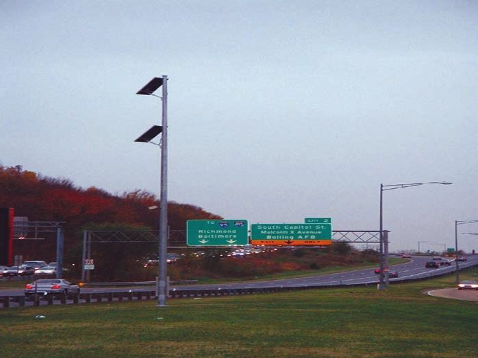
INFORMATION TECHNOLOGY SYSTEMS FOR USE IN INCIDENT MANAGEMENT
AND WORK ZONES

CONNECTICUT ACADEMY OF SCIENCE AND ENGINEERING                  iii
INFORMATION TECHNOLOGY SYSTEMS FOR USE IN INCIDENT MANAGEMENT
                                                     AND WORK ZONES

iv                     CONNECTICUT ACADEMY OF SCIENCE AND ENGINEERING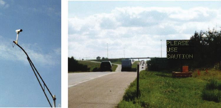
INFORMATION TECHNOLOGY SYSTEMS FOR USE IN INCIDENT MANAGEMENT
AND WORK ZONES

            MEMBERS OF THE STUDY COMMITTEE ON
             INFORMATION TECHNOLOGY SYSTEMS
              FOR USE IN INCIDENT MANAGEMENT
                       AND WORK ZONES
                                    Lisa Aultman-Hall, PhD
           Associate Professor, Department of Civil and Environmental Engineering &
            Director, Connecticut Transportation Institute, University of Connecticut

                                          John J. Collins
              Vice President of ITS & Telematics, Mobility Technologies, Wayne, PA
                        John T. DeWolf, PhD (Academy Member), Chairman
           Professor of Civil and Environmental Engineering, University of Connecticut

                                   Stephen F. Duffy, PhD, PE
          Professor of Civil and Environmental Engineering, Cleveland State University

                                 Michael D. Fontaine, PhD, PE
                   Research Scientist, Virginia Transportation Research Council

                                       Per E. Gårder, PhD
                       Professor of Civil Engineering, University of Maine

                                     John N. Ivan, PhD, PE
            Associate Professor, Department of Civil and Environmental Engineering,
                                   University of Connecticut

                                 Eil Kwon, PhD, PE, PTOE
      Traffic Research/Freeway Operations Director, Office of Traffic Security and Operations
                           Minnesota Department of Transportation

                                         Eva Lerner-Lam
               President, The Palisades Consulting Group, Inc., Tenafly, New Jersey
                                    Paul J. Ossenbruggen, PhD
                Professor of Civil Engineering, University of New Hampshire (ret.)

                                      Tracy Scriba
                      FHWA Work Zone Team Technical Program Manager
                         Federal Highway Administration, USDOT

                                 Gerald Ullman, PhD, PE
           Program Manager, Work Zone and DMS (Dynamic Message Signs) Program
                              Texas Transportation Institute

                                     STUDY MANAGER
                                        Clara Fang, PhD
                      Assistant Professor, Department of Civil Engineering
                                     University of Hartford

CONNECTICUT ACADEMY OF SCIENCE AND ENGINEERING                                               v
INFORMATION TECHNOLOGY SYSTEMS FOR USE IN INCIDENT MANAGEMENT
                                                     AND WORK ZONES

vi                     CONNECTICUT ACADEMY OF SCIENCE AND ENGINEERING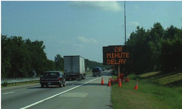
INFORMATION TECHNOLOGY SYSTEMS FOR USE IN INCIDENT MANAGEMENT
AND WORK ZONES

                                 LIST OF ACRONYMS
Acronym      Description
ADAPTIR      Automatic Data Acquisition and Processing of Traffic Information in Real Time
AHAR         Automatic Highway Advisory Radio
AVI          Automatic Vehicle Identification
CCTV         Closed-Circuit TV
CDPD         Cellular Digital Packet Data
CMS          Changeable Message Sign
CSC          Central System Controller
DLM          Dynamic Lane Merge
GIS          Geographic Information Systems
HAR          Highway Advisory Radio
HELP         Highway Emergency Lender Patrols
HOC          Highway Operations Center
IMTF         Incident Management Task Force
ISDN         Integrated Services Digital Network
ITIP         Intelligent Transportation Infrastructure Program
ITS          Intelligent Transportation System
LED          Light Emitting Diode
MUTCD        Manual on Uniform Traffic Control Devices
NCSA         National Center for Statistics and Analysis
NHTSA        National Highway Traffic Safety Administration
NTCIP        National Transportation Communications ITS Protocol
PCMS         Portable Changeable Message Signs
PTMS         Portable Traffic Management System
PVMS         Portable Variable Message Sign
RDS-TMC      Radio Data System-Traffic Message Channel
RISC         Rapid Incident Scene Clearance
RRS          Roadside Remote Sensors
RTTCS        Real-Time Traffic Control System
TIPS         Travel Time Prediction System
TMV          Traffic Management Vehicle
TRANSCOM     TRANSCOM is a coalition of 16 transportation and public safety agencies in the
             New York-New Jersey-Connecticut metropolitan region.
VMS          Variable Message Sign
VSL          Variable Speed Limit
WPDS         Wet Pavement Detection System
WZSAS        Work Zone Speed Advisory System
WZSIM        Work Zone Simulation Model

CONNECTICUT ACADEMY OF SCIENCE AND ENGINEERING                                                vii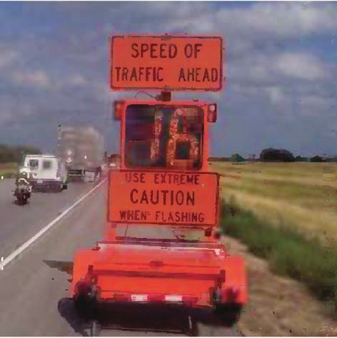
INFORMATION TECHNOLOGY SYSTEMS FOR USE IN INCIDENT MANAGEMENT
                                                       AND WORK ZONES

viii                     CONNECTICUT ACADEMY OF SCIENCE AND ENGINEERING
INFORMATION TECHNOLOGY SYSTEMS FOR USE IN INCIDENT MANAGEMENT
AND WORK ZONES
EXECUTIVE SUMMARY
EXECUTIVE SUMMARY
STUDY OBJECTIVES
The goal of this study was to identify information technology systems that could be utilized
in Connecticut to improve operations to facilitate the safe and efficient movement of traffic
through and around work zones and incident areas. These technologies have the potential to
enhance the safety of motorists and roadway workers, improve the mobility of the traveling
public, and fuel conservation.
The objective of the project was to provide a literature-based best practices review of incident
management and work zone information technology systems and to identify potential
implementation strategies for Connecticut. The project examined the application of information
technology systems for only the state’s limited access highways. The project focused on systems
that can be used for work zones and incident management separately.
SUMMARY OF FINDINGS
An intelligent, or automated, portable traffic management system is an integrated system
which consists of portable variable messages signs (PVMS), vehicle detection systems (such
as detectors, cameras and other surveillance equipment), a computer-based control center
and communication systems. Based on detected traffic information, the system automatically
determines messages to be displayed on the PVMS and may also disseminate the information
through highway advisory radio (HAR) and the internet. A comprehensive review of various
intelligent portable traffic management systems used in work zones and incident management
and speed management technologies used in work zones was conducted; innovative
technologies that have the potential to improve highway traffic operations were also identified.
Interviews were conducted with representatives from departments of transportation (DOTs) in
several states, including Arizona, Arkansas, Maryland, Minnesota, Missouri, North Carolina,
Florida and private industry regarding their experience with and knowledge of work zone and
incident management deployment initiatives and innovative technologies. A number of systems
and deployment initiatives were reviewed, including the well-known Midwest States Smart
Work Zone Program, FHWA’s case studies about the application of intelligent transportation
systems (ITSs) in work zones, and Michigan’s dynamic merge lane systems.
A summary of various portable systems, including their features, deployments, and evaluation
results, if any, has been included in this report. The study also describes Connecticut’s
current operations system based on information and interviews provided by the Connecticut
Department of Transportation (ConnDOT).
A summary of findings regarding the deployment of automated portable traffic management
systems and future possibilities for ITS applications in work zones and for incident management
in Connecticut follows. Suggestions regarding potential innovative technologies for use on
Connecticut’s primary arterial highway system are also included.
CONNECTICUT ACADEMY OF SCIENCE AND ENGINEERING ixINFORMATION TECHNOLOGY SYSTEMS FOR USE IN INCIDENT MANAGEMENT
AND WORK ZONES
EXECUTIVE SUMMARY
Intelligent Portable Traffic Management Systems
Work Zones
It is suggested that general guidelines for installing intelligent portable systems should include
the following:
• Intelligent portable systems should be used only for long-term work zone projects to
achieve expected efficiency and safety benefits.
• The presence of congestion and/or specific safety hazards for at least some part of the
day is the most basic prerequisite for installing intelligent portable systems.
• Diversion messages provided to motorists should, either explicitly or implicitly, identify
potential alternative routes in the area that will significantly improve travel time around
work zones.
• Determining appropriate vehicle detection locations to ensure that actual traffic data
(travel time, speed and delay) are consistent with estimates that are displayed by the
system.
Incident Management
Advanced capability traffic management vehicles (TMVs) similar to those used in a Florida
Turnpike Enterprise pilot project, mostly along a heavily-traveled portion of the Florida
Turnpike, should be considered for use in Connecticut as a tool to better manage traffic incidents,
as well as for use in other disasters and emergencies. These TMVs are equipped with the ability
to transmit live video images and voice communication via digital satellite to traffic management
centers, as well as with internet communications for email and file transfer, and a digital video
recorder. Additionally, emergency responder equipment and supplies are also available on the
TMVs. The number of TMVs and where they should be based should be determined in advance
to ensure that sufficient traffic management vehicles can arrive at an incident location in a timely
manner. Other tools, such as vehicles equipped with mounted variable message signs (VMSs), as
are deployed in other states, could also be considered for use in incident areas.
General Considerations
Several general suggestions regarding the use of portable traffic management systems include:
• The decision as to which traffic management system – intelligent or human-operated
– to use should be based on project goals and objectives, cost and reliability. Human-
operated systems are low cost and have more reliable messages. However, for the
traveling public to have confidence in a human-operated system, the displayed
messages should be current and should accurately reflect existing conditions. In
comparison, intelligent systems can provide current and comprehensive traffic
information such as travel time, speed, delay, but cost and reliability issues also should
be considered.
• ConnDOT should consider conducting a cost-benefit analysis on a pilot study basis
to help determine if the use of portable ITSs is justified. Potential benefits include
anticipated reductions in accidents, travel time, environmental impacts and energy
x CONNECTICUT ACADEMY OF SCIENCE AND ENGINEERINGINFORMATION TECHNOLOGY SYSTEMS FOR USE IN INCIDENT MANAGEMENT
AND WORK ZONES
EXECUTIVE SUMMARY
consumption. Additionally a carefully designed safety evaluation strategy that
quantifies the system’s potential benefits and impacts should be implemented for use
prior to and throughout the system’s deployment.
• The Texas Transportation Institute’s manual on Dynamic Message Signs Message Design
and Display (Duke, 2004) and the Federal Highway Administration (FWHA)’s
handbook on Portable Changeable Message Signs (FHWA5, 2003) should be considered for
use as tools for designing messages to be displayed on PVMSs and VMSs.
• Dynamic lane merge systems can promote the smooth flow of traffic leading into a
work zone by creating a dynamic no passing zone upstream of a construction site
based on detected traffic volume and back-ups. This type of system, especially where
Connecticut’s primary arterial highways are significantly congested, can decrease the
average number of aggressive driving maneuvers per travel time run.
Future Directions
Work Zone Traffic Operations
Information technology could be utilized to improve operations to facilitate the efficient
movement of traffic through and around work zones. The ideal work zone travel information
system for use in Connecticut could consist of a traffic data collection system based on speed
detectors, surveillance equipment, and other emerging ITS technologies; a central control
system located at the state’s traffic management center; wireless communication systems; and
an information dissemination system, including HARs, VMSs, news media, email alerts, etc.
Priorities for work zone traffic operations in Connecticut should include reducing vehicle
speeds (especially truck speeds), preventing recurring long queue back-ups and minimizing the
number of accidents in work zones, as lower speeds can potentially reduce the occurrence of
such accidents. Basic speed display trailers and innovative systems such as variable speed limit
(VSL) and D-25 speed advisory systems, used to warn drivers of downstream traffic speeds, can
also be used as speed management tools.
Incident Management
New and developing ITS technologies have the potential for improving incident management
systems for the purpose of providing provide better motorist advisory information throughout
an incident. The establishment of a comprehensive statewide traveler information system that
provides the public with real-time, accurate information through VMSs, HARs, cell phones,
news media and other technologies and enables motorists to make alternate route or trip delay
decisions when a highway is closed or severely restricted should be considered. Efforts should
be made on a continuing basis to further improve cooperation among the various agencies to
improve incident response performance and the mobility of the traveling public. On-going
training programs that include understanding the priorities and needs of the various response
agencies should be provided for responders. Many issues such as criteria for the use of variable
messages, vehicle positioning at incidents, emergency light disciplines, and vehicle removal
from incident sites, as well as other important issues can be included in these programs. It also
CONNECTICUT ACADEMY OF SCIENCE AND ENGINEERING xiINFORMATION TECHNOLOGY SYSTEMS FOR USE IN INCIDENT MANAGEMENT
AND WORK ZONES
EXECUTIVE SUMMARY
is suggested that consideration be given to exploring the possibility of creating an Open Road
Policy that includes a Rapid Incident Scene Clearance Program similar to that developed by
Florida.
Develop a Complete Traffic Monitoring System for Connecticut’s Interstate System
ConnDOT should examine the question of whether the current number of portable systems
utilized in its operations is sufficient to provide efficient and safe operations on the entire
Connecticut primary arterial highway system. Consideration should be given to creating a
traffic monitoring system that provides complete coverage of the Connecticut interstate system.
Such a system—an ITS architecture initiative in Connecticut—would combine various vehicle
detection technologies and communication systems to provide the information necessary to
assess real-time traffic flow, provide valuable data for the evaluation of new ITS deployment,
and enhance the state’s incident management capabilities.
Innovative Technologies
There is a wide variety of innovative technologies available to better manage the flow of traffic
through both work zones and incident management areas. This study identifies some of these
technologies, including non-intrusive technology for vehicle detection, the integration of vehicle
navigation systems with current traffic conditions, automatic highway advisory radio (AHAR),
work zone intrusion alarms and cell phone tracking for travel time estimation. These systems,
as well as emerging technologies, should be monitored and reviewed on a continuing basis by
ConnDOT for possibility of utilization in Connecticut.
CONCLUDING REMARKS
The effective management of work zone activities and incidents is intended to enhance
safety and operational efficiency for the traveling public and roadway workers. This can
be accomplished through an information technology system that includes ITS applications,
traffic data collection, data analysis, and traffic information dissemination. Innovative ITS
technologies can also be integrated in a complete traffic monitoring system to provide the
underpinning infrastructure for delivering traffic information to the public continuously and
automatically. ConnDOT should consider further study of emerging innovative technologies
and the development of the infrastructure necessary to support such systems in the future while
also accommodating current needs. Also, although beyond the scope of this report, further
study may be appropriate to determine how best to incorporate the tools and systems utilized
for traffic incident and work zone management into the state’s broader disaster emergency
response operations.
xii CONNECTICUT ACADEMY OF SCIENCE AND ENGINEERINGINFORMATION TECHNOLOGY SYSTEMS FOR USE IN INCIDENT MANAGEMENT
AND WORK ZONES
TABLE OF CONTENTS
LIST OF ACRONYMS .......................................................................................... vii
EXECUTIVE SUMMARY ......................................................................................ix
TABLE OF CONTENTS ...................................................................................... xiii
I. INTRODUCTION .............................................................................................1
II. CONNECTICUT OPERATION SYSTEM FOR USE IN WORK ZONES
AND INCIDENT MANAGEMENT...............................................................3
A. Work Zones and Portable Variable Message Signs (VMS) ...................3
B. Incident Management ................................................................................6
C. Real-Time Information and Technology.................................................7
III. PORTABLE TRAFFIC MANAGEMENT SYSTEMS FOR USE
IN WORK ZONES ............................................................................................9
A. Speed Feedback (Speed Monitoring Display) ........................................9
B. Variable Speed Limit Systems (VSL) ......................................................11
C. Traffic Information Advisory Systems...................................................13
D. Dynamic Lane Merge Systems (DLM) ...................................................28
E. Summary of Existing Work Zone Portable Traffic
Management Systems .....................................................................30
F. Suggested Guidance for the Deployment of Portable Traffic
Management Systems in Work Zones in Connecticut ...............30
IV. PORTABLE TRAFFIC MANAGEMENT SYSTEMS FOR USE
IN INCIDENT MANAGEMENT ................................................................33
A. Introduction ...............................................................................................33
B. Existing Portable Systems for Use in Incident Management ..............33
C. The Applicability of the Portable Systems for Use in
Incident Management .....................................................................35
V. INNOVATIVE TECHNOLOGIES ................................................................37
VI. SUMMARY OF FINDINGS AND CONCLUDING REMARKS ..............41
A. Suggestions for the Application of Intelligent Portable
Traffic Management Systems .........................................................41
B. Future Directions Regarding the Use of ITS Applications in
Work Zones and for Incident Management in Connecticut ......44
C. Suggestions Regarding Innovative Technologies ...............................46
Concluding Remarks ....................................................................................47
ACKNOWLEDGEMENTS ...................................................................................49
APPENDIXES .........................................................................................................51
Appendix A ...................................................................................................51
Appendix B ....................................................................................................52
REFERENCES ........................................................................................................55
CONNECTICUT ACADEMY OF SCIENCE AND ENGINEERING xiiiINFORMATION TECHNOLOGY SYSTEMS FOR USE IN INCIDENT MANAGEMENT
AND WORK ZONES
xiv CONNECTICUT ACADEMY OF SCIENCE AND ENGINEERINGINFORMATION TECHNOLOGY SYSTEMS FOR USE IN INCIDENT MANAGEMENT
AND WORK ZONES
INTRODUCTION
I. INTRODUCTION
Motor vehicle crashes were rated as a leading or major cause of death in the United States in
2002, according to a recent report from the National Highway Traffic Safety Administration’s
(NHTSA’s) National Center for Statistics and Analysis (NCSA) (NHTSA, 2005). The need to
cope with incidents affecting traffic has been recognized for decades. In particular, contending
with congestion and incidents in highway work zones has been recognized as one of the
priority tasks of most state transportation agencies. Data from the National Work Zone Safety
Information Clearinghouse indicate that the number of fatalities in work zones has increased
annually since 1999 (http://safety.fhwa.dot.gov/wz/wz_facts.htm). According to the Federal
Highway Administration (FHWA)’s ITS Technologies in Work Zones report (2004), the use of
intelligent transportation systems (ITSs) has been demonstrated to be effective in increasing
safety for both workers and motorists and ensuring a more efficient traffic flow through and
around work zones and incident areas. [See www.its.dot.gov/its_overview.htm for an overview
of ITSs.]
This study identifies technologies and systems that have emerged and are emerging as
potentially powerful tools to assist in managing traffic operations in these areas. Work zone ITSs
usually integrate portable variable message signs (PVMSs), highway advisory radio (HAR),
and vehicle detection systems into a computerized central control system that automatically
determines appropriate messages that are based on current traffic conditions (Fontaine, 2003).
They can monitor traffic, provide real-time traffic information to travelers, and improve incident
detection, response and clearance in work zones.
These technologies have been used throughout the United States in a variety of applications.
For example, variable speed limit systems determine and display speed limits based on detected
traffic information; traffic advisory systems provide speed, delay, travel time and alternate
route information to travelers; and dynamic lane merge systems facilitate efficient and safe
vehicle merging. Some programs and deployment initiatives also have been developed to
implement these technologies. The Midwest States Smart Work Zone program—probably the
best known— was created by Iowa, Kansas, Missouri, and Nebraska in 1999 (Wisconsin joined
in 2001) to deploy and evaluate various ITS-related technologies and systems. FHWA (2004)
also developed a series of case studies to examine the use of ITSs in work zones.
The objective of this study was to provide a literature-based best practices review of
information technology systems for use in incident management and work zone areas and to
identify potential implementation strategies for use of these systems on Connecticut’s limited
access highways.
The project focused on different portable traffic management systems for work zones
and incident management. The scope of the project also included the investigation and
understanding of Connecticut’s current work zone and incident management operating system,
and identification of advanced technologies that have the potential to improve safety and traffic
flow within work zone and incident areas.
Despite the success of ITS technologies in many contexts, it is worthwhile to note that
improving safety and mobility in work zones requires a multi-faceted approach that involves
CONNECTICUT ACADEMY OF SCIENCE AND ENGINEERING 1INFORMATION TECHNOLOGY SYSTEMS FOR USE IN INCIDENT MANAGEMENT
AND WORK ZONES
INTRODUCTION
the cooperation, initiative and innovation of multiple agencies. FHWA recently updated
Regulation 23 CFR Part 630, and renamed the “Work Zone Safety and Mobility Rule” to help
state departments of transportation and local agencies meet current and future work zone safety
and mobility challenges (Scriba, 2005). The rule calls for development of an overall, state-level
work zone safety and mobility policy, standard procedures to support policy implementation,
and procedures to evaluate the impacts of projects and systems.
The report that follows was based on published journal articles, proceedings of conferences and
symposia, and reports as well as information provided by representatives of state DOTs and
federal agencies, professionals in industry and university researchers. The findings of the study
reflect the collective decisions of the CASE Study Committee and do not represent the views,
positions or policies of ConnDOT.
This report is organized as follows. A summary of Connecticut’s existing traffic operational
systems in both work zones and incident management is given in Section II. Section III
addresses various portable traffic management systems for use in work zones. A discussion of
the application of portable systems in incident management is described in Section IV, followed
by a description of some innovative technologies that have potential applications to improve
traffic flows in Section V. The final section provides a summary of findings and concluding
remarks.
2 CONNECTICUT ACADEMY OF SCIENCE AND ENGINEERINGINFORMATION TECHNOLOGY SYSTEMS FOR USE IN INCIDENT MANAGEMENT
AND WORK ZONES
CONNECTICUT OPERATION SYSTEM FOR USE IN WORK ZONES & INCIDENT MANAGEMENT
II. CONNECTICUT OPERATION SYSTEM FOR USE IN
WORK ZONES AND INCIDENT MANAGEMENT
A. WORK ZONES AND PVMSs
The Connecticut Department of Transportation (ConnDOT) is responsible for traffic control
in work zones on Connecticut’s state highway system that involve both short and long term
operations. The short-term work zones that have traffic control performed by ConnDOT
maintenance personnel and some contractors mostly involve maintenance activities such as
pothole patching, bridge inspections, pavement marking installation, applications and other
roadside work such as guard rail repair and mowing. Longer-term work zones involve larger
highway construction projects where the contractor is responsible for traffic control under
the supervision of ConnDOT. All traffic control operations on state highways must be in
compliance with the Manual on Uniform Traffic Control Devices (MUTCD), 2000, and ConnDOT
guidelines.
Currently, a number of PVMSs are being distributed throughout the state. They are usually
located in the vicinity of sites that have a history of high incident occurrence, as well as those
sites that are determined to be potential congestion areas, such as work zones and freeway-
to-freeway intersections or interchanges. In addition to use during incidents and work
zone activities, the PVMSs are also used for special events to inform drivers of delays and
congestion. The requirements for the placement of PVMSs are more flexible than requirements
for the installation of the permanent VMSs, so PVMSs can be more readily deployed within
construction zones or incident areas. ConnDOT uses a 1000-foot roadway sight line guideline
for installation of permanent VMSs so that drivers can see two sign frames, each of which is
displayed for three seconds. Map 1 on page 4 shows the locations of VMSs in Connecticut.
For PVMS, sight distance and frame speed may differ because of particular message needs or
limited location availability.
Figure 1 on page 4 shows a typical PVMS used by ConnDOT. The following list describes
certain capabilities of this product:
• The device is a National Transportation Communications ITS Protocol (NTCIP)
compliant controller which enables the VMS to communicate with ConnDOT’s central
control systems using a federally-adopted communications standard;
• The device includes full matrix displays, in lieu of a specific character matrix, enabling
ConnDOT staff to use different character fonts, including 36-inch characters, if
necessary, in addition to graphics;
• Some devices which allow for 70° viewing angle LEDs are more flexible than 30°
LEDs and afford motorists better visibility, especially when the signs must be quickly
deployed without a careful study of the site location to determine the optimal viewing
angle. This is a significant advantage of this system.
The remainder of this section discusses some of the operational aspects of this type of PVMS.
CONNECTICUT ACADEMY OF SCIENCE AND ENGINEERING 3INFORMATION TECHNOLOGY SYSTEMS FOR USE IN INCIDENT MANAGEMENT
AND WORK ZONES
CONNECTICUT OPERATION SYSTEM FOR USE IN WORK ZONES & INCIDENT MANAGEMENT
Map 1: Variable Message Sign (VMS) Locations in Connecticut
Map courtesy of ConnDOT
Figure 1: A Typical Portable Variable Message System (PVMS)
Photo courtesy of Daktronics (Vanguard® VP-1300 Product Brochure)
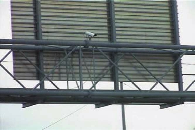
4 CONNECTICUT ACADEMY OF SCIENCE AND ENGINEERINGINFORMATION TECHNOLOGY SYSTEMS FOR USE IN INCIDENT MANAGEMENT AND WORK ZONES CONNECTICUT OPERATION SYSTEM FOR USE IN WORK ZONES & INCIDENT MANAGEMENT Communications - Controlling VMS Messages Some PVMSs owned by ConnDOT allows them to use wireless cellular modems to communicate and control PVMSs from two Highway Operations Centers (HOCs) located in Newington and Bridgeport. The wireless modems enable operations staff to download messages to the signs from the system’s central control software, monitor sign operation for malfunctions and turn messages on and off. In situations where the operations staff is unable to communicate with PVMSs due to cellular reception issues at a particular field location, e.g., Litchfield County, alternative methods are used. The variable sign messages are pre- loaded when cellular communications are active, or the field staff loads the sign messages using a laptop PC. In either case, the messages are turned on and off by the staff in the field. Communication with permanently installed VMSs is accomplished through a fiber-optic connection with dial-up modems serving as a back-up. Communication – Receiving Traffic Information from a Construction Site Currently, telephone communication is the primary method for informing the HOCs of traffic conditions at a construction site. ConnDOT staff receives phone calls from the construction inspection staff regarding traffic delays. However, it has been difficult to quantify the extent of the delays and queue since the on-site personnel are often working within the work zone area and not where the traffic queues form upstream of the work zone area. Solar Power System During the summer, PVMSs that are equipped with solar power systems can run for months without requiring re-charging due to the stronger sunlight and warmer temperatures. Even the best batteries do not hold a charge as well in colder temperatures, when the batteries need to be re-charged every 3-4 weeks. Moreover, the temperature must be monitored closely so that the batteries do not freeze in very cold conditions. Nevertheless, the solar charging systems are still used in the winter as long as the solar panels can be orientated towards the sun’s path. Video Cameras Most PVMSs that are currently in use are not equipped with video cameras. However, cameras are installed on semi-permanent VMSs and planned for use on others along the I-84 corridor westerly from Southington to Newtown in work zone areas for this on-going, long-term construction project. Telephone circuits need to be installed to enable video to be sent back to the appropriate HOC. These circuits allow images from the cameras to be viewed in close to “real time” (30 frames per second). These semi-permanent VMSs were selected since a permanent VMS system along this area of I-84 is not currently in operation and is not scheduled for installation for at least five years. The camera-equipped, semi-permanent VMSs enable HOC staff to monitor work zone and incident delays or events and to provide motorists with traffic and alternative routing information. Also, ConnDOT is evaluating the use of semi-permanent, camera-equipped VMSs for use in other long-term work zones where permanent VMSs are not available. CONNECTICUT ACADEMY OF SCIENCE AND ENGINEERING 5
INFORMATION TECHNOLOGY SYSTEMS FOR USE IN INCIDENT MANAGEMENT
                                                          AND WORK ZONES
CONNECTICUT OPERATION SYSTEM FOR USE IN WORK ZONES & INCIDENT MANAGEMENT

System Constraints
Some of the limitations of this type of PVMS system are as follows:

    • PVMSs are not equipped with a real-time vehicle detection system.
    • PVMSs do not generate messages that can be displayed automatically.
    • Messages usually do not display specific values in terms of delay and queue length, nor
      do they specify alternative routes.
    • Cellular coverage at PVMS sites is not consistent, and trying to send video over cell
      service would not work well due to low transmission speed.
    • The PVMS power system is affected by winter operating conditions: batteries may freeze
      in cold temperatures and solar power is not sufficient. However, ConnDOT’s PVMSs are
      generally stored in maintenance facilities during the winter, unless they need to be used
      for incident management purposes for relatively short periods of time, as they are not
      used in work zone operations due to the very limited nature of these operations during
      the winter.
    • Camera coverage must be provided separately.
    • In certain areas, roadside clear zones are not of adequate width for the safe placement of
      PVMSs.

B. INCIDENT MANAGEMENT
Incident Management consists of a centralized effort focused on detecting, responding to, and
clearing incidents to recover traffic flow. Connecticut’s incident management policy ensures
that highway users receive the maximum possible benefit of an active incident management
program that minimizes the impact of traffic-related incidents. ConnDOT, Connecticut
Department of Motor Vehicles (DMV), the Connecticut Department of Public Safety (DPS), and
the Connecticut Department of Environmental Protection (DEP) are given shared responsibility
and authority for implementing this policy cooperatively and expeditiously through a series of
programmed activities. The agencies involved in implementing this policy have accepted and
agreed to promote the concept of a team approach.

The Incident Management Task Force (IMTF), directed by the Connecticut Transportation
Strategy Board, is working on improving the efficiency, coordination and management of
the response to and clearance of incidents on the state’s highways. The IMTF compromises
representatives from ConnDOT, DMV, DPS, and DEP, as well as representatives from the
Connecticut Chiefs of Police Association, Connecticut Fire Chiefs Association, Towing and
Recovery Professions of Connecticut, emergency management services, and regional planning
organizations with incident management councils. Other agencies, such as the Federal Highway
Administration, the US Coast Guard, public transportation providers, and other groups and
agencies involved in emergency response efforts are invited to send participants either on a
continuing ad hoc basis or as participants in relevant discussions of the IMTF.

6                                   CONNECTICUT ACADEMY OF SCIENCE AND ENGINEERING
INFORMATION TECHNOLOGY SYSTEMS FOR USE IN INCIDENT MANAGEMENT
AND WORK ZONES
CONNECTICUT OPERATION SYSTEM FOR USE IN WORK ZONES & INCIDENT MANAGEMENT
Working together with other agencies in the IMTF, ConnDOT follows prescribed incident
management protocols during each phase of an incident: notification/detection, verification,
dissemination of motorist information, response, site and traffic management, and clearance.
After the first call is received, the incident is verified through the highway camera system,
police, or the media; when applicable the operations center staff activates the VMSs and HAR to
advise the motoring public, contacts ConnDOT management staff and advises TRANSCOM—a
coalition of 16 transportation and public safety agencies in the New York-New Jersey-
Connecticut metropolitan region. TRANSCOM was created in 1986 to provide a cooperative,
coordinated approach to regional transportation management, especially during large
incidents on the major through routes of the states. TRANSCOM maintains a website (www.
trips123.com) for Regional Traveler Information, to notify the public, media and others along
the I-95 corridor from Maine to North Carolina, if required. To improve incident management
response, ConnDOT has developed response protocols for freeway closures which include pre-
planned diversionary routes and traffic control in coordination with local public agencies. Also,
ConnDOT is planning within the next year to gain access to the DPS’s INTERCAD (computer-
aided dispatch) system in an effort to improve incident management notification and inter-
agency coordination.
C. REAL-TIME INFORMATION AND TECHNOLOGY
It is important to provide real-time information concerning travel conditions on Connecticut’s
major highways to drivers during both incident and non-incident periods. Currently, ConnDOT
uses several methods to disseminate traveler information: VMSs, HARs, commercial radio and
television broadcasts, the ConnDOT website and TRANSCOM.
ConnDOT also has implemented an “email to subscribers” system. The state is divided into four
regions, with subscriptions available by region. Additionally, it may also be possible to provide
route-to-route subscriptions to subscribers.
The HAR is controlled by the ConnDOT HOCs. The following criteria have been identified:
• Coverage area—generally a 5-mile radius.
• Terrain affects coverage because the radio signals are line-of-sight and therefore can be
blocked by hills, buildings and dense trees.
• Available frequencies on AM band limit the system’s effectiveness because they are
subject to interference by pirate stations (unlicensed, illegal stations broadcasting in
violation of the law).
• A number of locations are currently in operation and expansion of the system is
planned.
In addition, pending the availability of funding, Connecticut is planning to deploy a 511
telephone traveler information system statewide. By dialing 511, motorists will be able to get a
variety of information on traffic conditions including incident, delay, alternate routes, weather
conditions, transit information, as well as other travel-related information. 511 is a nationwide
number reserved by the Federal Communication Commission (FCC) for traveler information.
CONNECTICUT ACADEMY OF SCIENCE AND ENGINEERING 7INFORMATION TECHNOLOGY SYSTEMS FOR USE IN INCIDENT MANAGEMENT
AND WORK ZONES
Map 1: Highway Advisory Radio (HAR) Locations in Connecticut
Map courtesy of ConnDOT
8 CONNECTICUT ACADEMY OF SCIENCE AND ENGINEERINGINFORMATION TECHNOLOGY SYSTEMS FOR USE IN INCIDENT MANAGEMENT
AND WORK ZONES
PORTABLE TRAFFIC MANAGEMENT SYSTEMS FOR USE IN WORK ZONES
III. PORTABLE TRAFFIC MANAGEMENT SYSTEMS FOR
USE IN WORK ZONES
Intelligent portable traffic management systems have been widely implemented across the
United States. Interviews were conducted with representatives of various state DOTs (including
North Carolina, Arizona, Arkansas, Missouri, Maryland, Minnesota, Florida and others) about
their work zone deployment initiatives and programs. A literature search and review of current
practices also was conducted. This section of the report addresses each system in terms of
features, deployments and evaluation results. It also includes a description of a Speed Feedback
system, which is not considered an intelligent traffic management system, but serves as a
vehicle speed management tool for use in work zones.
A. SPEED FEEDBACK (SPEED MONITORING DISPLAY)
Speed Feedback, also referred to as Speed Monitoring Display, detects and displays the speed of
approaching vehicles to encourage drivers to comply with the reduced work-zone speed limits.
State highway agencies in Iowa, Kansas, Nebraska and Wisconsin deployed Speed Feedback signs
as part of the Midwest Smart Work Zone deployment initiative (http://www.fhwa.dot.gov/
rnt4u/ti/safespeeds.htm). Speed Monitoring Display units are currently utilized by ConnDOT.
One such system that is utilized by the above-referenced states is the SpeedGuard Radar Speed
Reporting system developed by Speed Measurement Laboratories, Inc. (Meyer, 2000). It is a
portable, self-contained trailer unit, equipped with radar to measure the speeds of approaching
vehicles. The recorded speeds are displayed on a 24-inch panel with photocell-equipped LED
numerals that automatically adjust brightness, as shown in Figure 2. The system is powered by
three 12V DC heavy duty marine batteries, which can last for up to a week. The message “Your
Speed” is mounted on the trailer beneath the variable message display. A speed limit sign can be
mounted on a rack above the display or the trailer itself can be placed next to an existing sign.
Figure 2: SpeedGuard Radar Speed Reporting System
From the report “SpeedGuard Radar Speed Reporting System - Nebraska” (McCoy, P.),
with permission from Geza Pesti, Texas Transportation Institute
CONNECTICUT ACADEMY OF SCIENCE AND ENGINEERING 9INFORMATION TECHNOLOGY SYSTEMS FOR USE IN INCIDENT MANAGEMENT
AND WORK ZONES
PORTABLE TRAFFIC MANAGEMENT SYSTEMS FOR USE IN WORK ZONES
The SpeedGuard system was deployed in a work zone along I-80 in Nebraska in 1998 and was
positioned 1,250 feet in advance of the 900-foot lane closure taper (Meyer, 2000). It was found to
be effective in both lowering speeds and increasing the uniformity of vehicle speeds traveling
through the work zone. At 750 feet downstream of the system, the 85th percentile speed and the
mean of the 15 highest speeds were reduced from 65 mph by about 5 mph, enough to be under
the speed limit. The effect was similar for both passenger and non-passenger cars, with a 90% or
greater compliance rate during both day and nighttime operating conditions.
Finally, the SpeedGuard system can also be equipped with an alarm horn to warn the workers
of vehicles approaching at dangerous speeds and a camera for photo-enforcement, although the
latter is illegal in nearly all states. A study in Kansas regarding the Speedguard system (Meyer,
2000) found that when it was used in conjunction with a law enforcement officer for speed
enforcement, the speed of vehicles approaching the work zone was reduced. However, vehicle
speeds increased around 4-5 mph downstream of the patrol car.
McCoy, Bonneson, and Kollbaum (1995) examined the effectiveness of speed displays at a
rural interstate work zone in South Dakota. The speed monitoring display trailer was placed
in the median next to the left traffic lane at the beginning of the merge-area taper. As motorists
approached the merge area, their speeds were displayed on the speed monitoring display.
The study indicated that the speed monitoring display reduced mean vehicle speeds by 4 mph
(i.e., from 60.5 to 56.5 mph). The study also indicated a reduction in the percentage of vehicles
that were exceeding the speed limit through the work zone. The percentage of passenger cars
speeding through the work zone was reduced by 20–25%. The percentage of speeding trucks
was reduced by about 40%.
In a similar study, Garber and Fontaine (1996) used a PVMS with a radar unit to examine speed
reductions at rural interstate work zones in Virginia. In this study, the radar and the PVMS
system were set up approximately 300–600 feet upstream from the merge area. The radar
was carefully placed to detect only one vehicle at a time. Vehicles that drove above a selected
threshold speed activated the PVMS system, which in turn displayed a “YOU ARE SPEEDING,
SLOW DOWN” message. The speeding motorists were videotaped as they passed through the
work zones to capture any vehicle speed changes. This study found that the mean speed of all
traffic was reduced by only approximately 0.7 mph at the PVMS location. Once inside the work
zone, however, this reduction increased to approximately 1.4 mph. The 85th percentile speed
reduction of about 8 mph led to the conclusion that the PVMS system, coupled with a radar
unit, has an impact on reducing speeds of the fastest segment of the driving population.
Recently, Pesti (2005) presented the evaluation study of an innovative speed feedback system
—the D-25 Speed Advisory Sign System (Figure 3)—which was developed by MPH Industries.
Instead of displaying approaching vehicle speeds, the D-25 system reports downstream vehicle
speeds. The system was designed to warn drivers of stopped or slow-moving traffic ahead
and thereby enable them to reduce the speed of their vehicles and to avoid rear-end collisions.
A deployment of this D-25 system consisted of three speed trailers placed at approximately
1/4-mile intervals in advance of a work zone on I-80 near Lincoln, Nebraska. Each trailer was
equipped with an LED speed display, a radar unit for measuring the speed of downstream
traffic, two flashing strobes to warn drivers of downstream problems, a “SPEED OF TRAFFIC
AHEAD” sign mounted over the speed display, and a “USE EXTREME CAUTION WHEN
FLASHING” sign mounted beneath the speed display. The three speed trailers were operated
10 CONNECTICUT ACADEMY OF SCIENCE AND ENGINEERINGINFORMATION TECHNOLOGY SYSTEMS FOR USE IN INCIDENT MANAGEMENT
AND WORK ZONES
PORTABLE TRAFFIC MANAGEMENT SYSTEMS FOR USE IN WORK ZONES
independently. When a traffic slowdown was detected, the strobe lights began flashing. When
there was no slowdown, the strobe lights were off. The results of the analysis indicated that the
speed messages were effective in reducing the speed of vehicles approaching queued traffic
during time periods when congestion was building. After deployment of the system, vehicles
began decelerating sooner and reduced their speed over a longer distance. The change in mean
deceleration due to the speed advisory system was statistically significant at the 95% confidence
level. In addition to the advisory speed messages, vehicle approach speed and trailer location
also significantly affected vehicle deceleration. Due to the limited time available for the field
studies, the long-term effectiveness of the speed advisory system could not be determined.
Figure 3: D-25 Speed Advisory System (Pesti, 2005)
From the proceedings of the Transportation Research Board Annual Meeting (2005): “Alternative Way of Using Speed Trailers:
Evaluation of D-25 Speed Advisory Sign System,” with permission from Geza Pesti, Texas Transportation Institute
Each of these studies examined the effectiveness of the use of a speed display or an advisory
system in reducing vehicle speed. Although each study utilized a different deployment and
evaluation method, most did not identify whether or not their results in speed reduction were
statistically significant. Also, the design of sample size was not revealed in most of the studies.
B. VARIABLE SPEED LIMIT (VSL) SYSTEMS
One of the stereotypical situations from the perspective of drivers is that low speed limits
are posted in very long marked construction work zones where construction activities occur
miles apart. The use of variable speed limits can be particularly useful in these situations. VSL
systems are introduced by dynamically changing the posted regulatory speed limit. They
provide real-time information on the appropriate speed limit for current conditions based on
traffic flow, traffic speed, weather and other inputs. The use of VSL systems in work zones may
result in lower speed variance, greater speed compliance, greater credibility of speed limits and
CONNECTICUT ACADEMY OF SCIENCE AND ENGINEERING 11INFORMATION TECHNOLOGY SYSTEMS FOR USE IN INCIDENT MANAGEMENT
AND WORK ZONES
PORTABLE TRAFFIC MANAGEMENT SYSTEMS FOR USE IN WORK ZONES
improved travel conditions. FHWA participated in cooperative agreements with three states—
Michigan, Maryland and Virginia—to evaluate the use of variable speed limits in work zones,
although the Virginia study was canceled due to legal disputes among technology vendors. The
following summarizes the field test results in Michigan.
Michigan DOT deployed a VSL system in one direction within an 18-mile work zone on I-96
during the 2002 construction season. The VSL system/trailer (Figure 4) used in Michigan was
developed and deployed by NES Worksafe and International Road Dynamics (IRD). This VSL
system/trailer detected vehicle density, speed, and weather. These data were analyzed by a
virtual traffic management center or a field unit to establish and display a condition-responsive
speed limit on signs based on pre-programmed criteria.
As described in the evaluation study conducted by Michigan State University (Lyles, 2003),
the system suffers from a lack of real portability, which limits its ease of use in the often
restricted work zone environment. The results were similar to those that might be expected of
a prototype, as opposed to a fully tested and refined system. Some modifications were made
during the evaluation of the system, including improving communications with individual
VSL trailers and between trailers, flexible vehicle sensors, and the algorithms for setting speed
limits, etc. There were positive effects on average speeds (increased) and travel time (decreased)
through the VSL deployment area. However, the system had relatively minor positive impact
on the effectiveness of driver behavior in work zones in which it was used. Effects on the 85th
percentile speed and speed variance were either undetectable or inconsistent. The percentage
of vehicles exceeding certain thresholds (e.g., 60 mph) did, however, decrease when the system
was in operation. This relatively minor impact may have been due to the topography of the
area and the existence of ramps and bridges associated with a freeway-to-freeway interchange
that resulted in significant restrictions being placed on the speed limits that could be used. For
example, the on- and off-ramps resulted in the need to restrict the maximum speed limit.
The study found that overall travel speeds (and related measures) were often affected more by
the geometry and weaving traffic within the confines of the freeway-to-freeway interchanges
than they were by the posted limits. It was suggested that VSL systems will have different
applicability in different types of work zone situations. For example, they will have more
utility in longer and “simpler” work zones—long zones with short areas of actual work. These
limitations notwithstanding, it was determined that VSL systems can present far more credible
information to the motorist, responding to both day-to-day changes in congestion as well as
significant changes as motorists travel through a given zone.
Regarding the enforceability of VSL, Michigan DOT and the Michigan Department of State
Police (MSP) have the legal authority to set speed limits in work zones within the state. These
agencies have a memorandum of understanding (MOU) in place whereby MSP provides “on
call” extra/strategic enforcement in work zones around the state. Under terms of the MOU,
MSP provided enforcement during the 2002 construction season for the VSL test site when
requested by Michigan DOT personnel. However, the study results concluded that the addition
of enforcement personnel in the VSL deployment area seemed to have no effect on average
speed, speed variance, or percentages of higher-speed vehicles.
12 CONNECTICUT ACADEMY OF SCIENCE AND ENGINEERINGINFORMATION TECHNOLOGY SYSTEMS FOR USE IN INCIDENT MANAGEMENT
AND WORK ZONES
PORTABLE TRAFFIC MANAGEMENT SYSTEMS FOR USE IN WORK ZONES
Figure 4: Variable Speed Limit System (Lyles, 2003)
From the report: “Field Test of Variable Speed Limits in Work Zones (in Michigan)” (Lyles, R.W., W.C. Taylor, and J.
Grossklaus), with permission from Professor Richard W. Lyles, Michigan State University
C. TRAFFIC INFORMATION ADVISORY SYSTEMS
Traffic information advisory systems are systems which use various technologies to detect traffic
flow information in a work zone and provide advance warning to drivers via PVMSs, HAR,
or flashing beacons on fixed-message signs. Sometimes the information is also disseminated
through websites. The messages used to convey the warning vary. Some messages simply advise
drivers of the presence of slow-moving or stopped traffic ahead. Others provide travel time
estimates and alternate route suggestions. In general, three types of messages are used (Fontaine,
2003), as listed below:
• Speed-advisory messages: The upstream PVMSs display a message that alerts drivers
that speeds are slower ahead.
• Travel-time or delay advisory: On the basis of speed data, travel time or delay is
calculated. The message shows an estimation of either travel time or delay through the
work zone.
CONNECTICUT ACADEMY OF SCIENCE AND ENGINEERING 13INFORMATION TECHNOLOGY SYSTEMS FOR USE IN INCIDENT MANAGEMENT
AND WORK ZONES
PORTABLE TRAFFIC MANAGEMENT SYSTEMS FOR USE IN WORK ZONES
• Diversion guidance: A message on possible alternate routes may be displayed or
motorists may be advised to use an alternative route. This is typically determined based
on a delay calculation.
Several such systems have been field deployed and are discussed below.
1) Automated Data Acquisition and Processing of Traffic Information in Real
Time (ADAPTIR)
ADAPTIR is a portable, condition-responsive work zone traffic control system that is capable
of providing drivers with real-time information about work zone traffic conditions via PVMSs
and HAR (McCoy, 2000). It was developed by the Scientex Corporation through a cooperative
agreement with FHWA and the Maryland State Highway Administration. The system was field
tested in Maryland during the summer of 1997 to manage congestion related to beach traffic
at Ocean City, Maryland and at Route 100 upstream of the interchange to I-97 in Hanover,
Maryland in January 1998. Both projects resulted in improvements, such as communications,
to the ADAPTIR. Following these field tests, the system was also utilized in Kentucky, Illinois,
Arkansas, and Nebraska.
The following describes the basic function and evaluation results of the system that was utilized
in the Nebraska deployment:
ADAPTIR is designed to improve the safety and efficiency of traffic operations in advance of a
work zone by advising drivers of lower speeds and delays ahead and encouraging them to use
alternate routes. The solar-powered ADAPTIR has the following components:
• One or more PVMSs upstream of the work zone;
• HAR to provide more detailed information than PVMSs;
• Central system controller (CSC) to run the control software;
• Radar sensors to continuously measure speeds (Figure 5);
• Roadside remote sensors (RRS), as shown in Figure 5, to receive data from radar sensors
and under the control of the CSC, program the appropriate messages for the PVMSs and
HAR.
14 CONNECTICUT ACADEMY OF SCIENCE AND ENGINEERINGINFORMATION TECHNOLOGY SYSTEMS FOR USE IN INCIDENT MANAGEMENT
AND WORK ZONES
PORTABLE TRAFFIC MANAGEMENT SYSTEMS FOR USE IN WORK ZONES
Figure 5: ADAPTIR (ADAPTIR, 2005)
Photo courtesy of the Scientex Corporation (ADAPTIR™ Product Brochure)
Speeds are measured continuously at and downstream of the PVMS. An agency pre-determined
speed differential threshold value is used to determine the message that is displayed. A
speed differential threshold value of 10 mph was selected for the Nebraska deployment. If
the difference between speeds is less than the threshold, the PVMS remains blank. For speed
differences of more than the threshold, a two-phase message was displayed – Phase 1: “I-80E
Advisory XX: YY AM/PM” and Phase 2: “Reduced Spd Ahd XX MPH,” The collected speeds
were also sent to the CSC, which estimated delays every 8 minutes in the off-peak hours and
every 4 minutes in peak periods. If the delay was greater than the 5-minute threshold, the Phase
2 message was changed to “XX Min Delay Ahead.” If the delay exceeded half an hour, the
PVMS message suggested alternate routes with a Phase 1 message “30 Min Delay Ahead” and
Phase 2 “Consider Alt. Route.”
An evaluation study of the Nebraska deployment (McCoy, 2000) showed that ADAPTIR had
no effect on speed and lane distribution of traffic within 2,000 feet of the lane closure taper or
on the numbers and rates of forced merges in advance of the closure taper. Speed advisory
messages during periods of uncongested flow were not effective in reducing speeds, but in
congested areas within a work zone, speeds were reduced. Of the three PVMSs on I-80, the one
located at 7.8 miles upstream of the work zone (before the alternate route interchange) was not
effective, as drivers did not perceive any need to slow down. The other two PVMSs at 3.1 and
1.1 miles upstream had an impact on speeds. The study also suggested that the spacing between
the PVMSs influenced the effectiveness of the speed advisory messages. The diversion message
was only effective in encouraging 3% of the drivers to divert, and did not discourage drivers
from entering the interstate (however, it should be noted that 80% of the drivers were from out
of state). Finally, the use of this system did not affect the number or rate of crashes associated
with this 2-3 month work zone project.
ADAPTIR was also deployed in Illinois and Kentucky. Fontaine (2003) conducted an interview
with field personnel about the ADAPTIR’s deployment in Illinois for a bridge reconstruction
CONNECTICUT ACADEMY OF SCIENCE AND ENGINEERING 15You can also read