Ohio DOT's Ohio/Indiana UAS Center - Enabling UAS Operations - Fred Judson, GISP UAS Program Director - Aviation Council
←
→
Page content transcription
If your browser does not render page correctly, please read the page content below

UAS
Initiative

Ohio DOT’s Ohio/Indiana UAS Center –
      Enabling UAS Operations

        Fred Judson, GISP
      UAS Program Director
   Fred.Judson@dot.state.oh.us

                                    For Documents
                                 http://bit.ly/1QJCZcs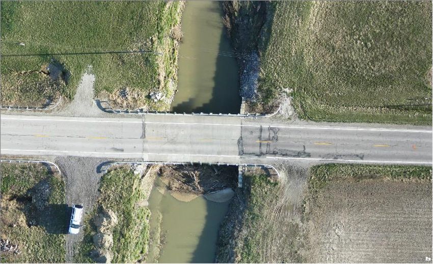
UAS
Initiative

             ODOT UAS Implementation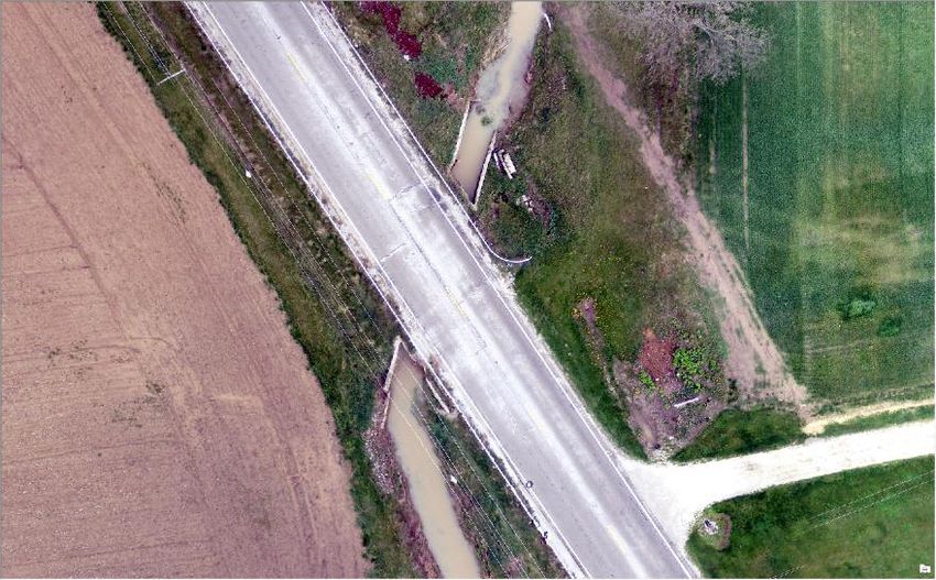
UAS
   Initiative

                     OH/IN UAS Center & Test Complex

Mission
• Promote UAS in Ohio and Indiana
Enabling Flight
• 18 Active COAs
• 23 Approved COAs
• 20 In Various Review Stages
• 10 Aerostat Waivers
• Section 333
Activities
• DOT Training Mapping/Structure
• Vibrant Response
• Assisted Penn State Police
• Guardian Shield
• Performed over 150 flights last year
• Participating in FAA COE with OSU
• FAA/AFRL Ground Based Sense and
   Avoid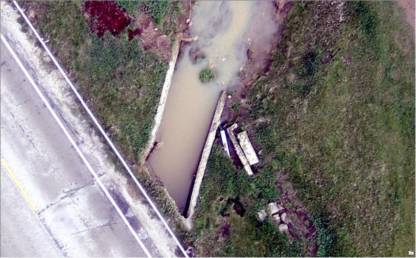
UAS
    Initiative

                 OH/IN UAS Center & Test Complex - Services

•   Operations Experience
•   Business Requirement Study
•   Operations Analysis
•   Airspace Analysis
•   Crew Qualifications
•   COA/333 Preparation/Submission
•   UAS Research
•   Independent Safety Review Board
•   Flight Readiness Review
•   Flight Operations
•   FAA Reporting
•   Data Processing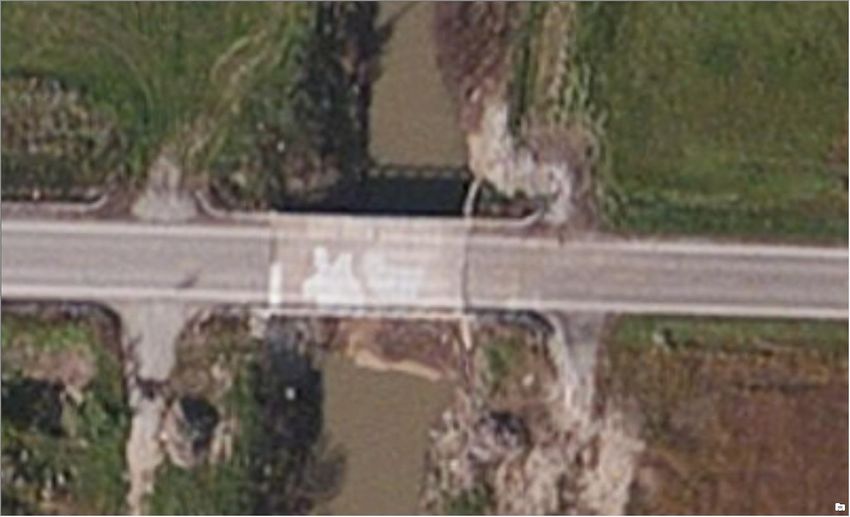
UAS
  Initiative

                        Flight Operations

• Flight
   – Public COA
   – Section 333
          • Civil COA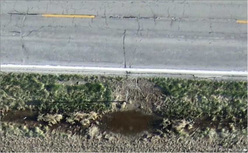
UAS
Initiative

             High Resolution Aerial Photography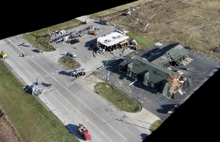
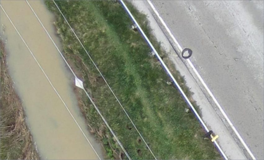
UAS
Initiative

 Natural Disaster Response Mapping – Ohio’s 1st Emergency COA
UAS
    Initiative

                                     Structure Investigation

What We Want
•   Remove Some Risk
•   Perform Our Tasks Efficiently
•   Provide Added Value
Current Issues
•   Regulations
     –   Non-participants
     –   91.119
     –   BLOVS
•   Platform Limitations
     –   Sensors
            •    Avoidance and GPS
            •    Power and Quality
     –   Weather
•   Human Piloting
What We Can Get
•   High Resolution Imagery Typically Difficult to Acquire
•   3D Modeling
•   Thermal Loading
     –   Concrete Delamination
UAS
             Initiative

                                                                                UAS for Mapping

   “One of drones’ many
         boons is to
      democratize the
         process of
   mapmaking. They are
    far cheaper than the
         mapmaking
     technologies they
          replace.”
               –        Enables end
                        users
               –        Disrupts
                        Traditional
                        Services

Name                                    Platform          Software                                           Sensor               AGL     Accuracy Findings                                               Date
Baseline Surveys Ltd.                   C-Astral Bramor   Agisoft Photoscan                                  Sony Nex-7           300'    Accuracy 95% , 1.6" horizontal, 2.7" vertical                   Sept. 2013
                                                                                                             Olympus PEN E-       100'-
Institute for Sustainable Agriculture   MD-4 1000         Agisoft Photoscan                                  PM1                  200'    Mean accuracy between 77%-90% Horizontal                           Mar-14
PIX4D and Helimap Systems               Swinglet Cam      Socet GXP and Pix4D                                Canon Ixus 120IS     500'    0.4"-0.59" Horizontal, 0.39" vertical and RMSE 0.04 to 0.07        Sep-11
                                                                                                             Canon Digital
TU Berlin                               HiSystems MK Okto Bundler, PMVS2, Photoscan                          Ixus 100 IS          165'    Absolute point cloud deviation= 0.78"                                2011
                                                                                                             Canon 550D digital   100-
Univ. Tasmania                          TerraLuma UAV     Opensource and Custom/MVS (Multiview stereopsis)   SLR camera           165'    ±0.67" (but never more than 1.02" horizontal, 1.57" vertical)      May-12
UAS
Initiative
Mapping/Flight Operations Tips
• Slow Shutter Speed
ICE: Image Composite
(HexagonGeospatial)
ERDAS IMAGINE Pro
APS 3D Mapping Suite
(Hexagon Geospatial)
Postflight Terra 3D
Pix4D Mapper Pro
Agisoft Photoscan
Editor (Microsoft)
Inpho UASMaster
(Sensefly +Pix4D)
Ability/ Feature
• Unstable Platform
(Sensefly+Menci)
2D3 (Catalina)
Correlator 3D
EnsoMOSAIC
GeoApp.UAS
GeoApp.UAS
DroneMaper
•
(Trimble)
Camera Resolution
Pro
• Things in Motion
Orthomosaic X X X X X X X X X X X
– Trees (Wind), Water etc. Point Cloud X X X X X X X X X X
Generation
• Little or no Texture Mesh Modeling X X X X
– Sand, Snow Texture
Generation
X X X X X
• Repeating Texture Terrestrial Data X X X X X X X X X X X X
Aerial Data X X X X X X X X X X X X
– Forest, Farm Fields DD D D D D D D C C C C
Desktop/Cloud
• Lighting Changes
– Clouds or Time of Day
• Not Enough Overlap
• Different Software Processing Packages
• Aerial Imagery
– Low altitude causes greater perspective change causing
more post processing to “make it look right” for things that
protrude from the ground.UAS
Initiative
Questions
Fred Judson, GISP Updates:
UAS Program Director • 11250 Airframes
Fred.Judson@dot.state. Approved for New 333’s
oh.us • 9 Day Approval Times for
333’s
• On-line Registrations for
Commercial UAS
• Blanket COA Raised to
400
• On Target for New
Regulations 06/17/16You can also read