Drones for Peace: Part II Fast and Inexpensive Spatial Data Capture for Multi-Purpose Use
←
→
Page content transcription
If your browser does not render page correctly, please read the page content below

Drones for Peace: Part II
 Fast and Inexpensive Spatial Data Capture for
              Multi-Purpose Use

                Kathrine Kelm, Rumyana Tonchovska, Walter Volkmann
                  The World Bank, Washington D.C, kkelm@worldbank.org
                FAO of the UN, Rome, Italy, Rumyana.Tonchovska@fao.org
               Micro Aerial Projects LLC, Gainesville, FL., walter@unirove.com

                        Paper prepared for presentation at the
           “2014 WORLD BANK CONFERENCE ON LAND AND POVERTY”
                  The World Bank - Washington DC, March 24-27, 2014

 Copyright 2014 by author(s). All rights reserved. Readers may make verbatim copies of this
document for non-commercial purposes by any means, provided that this copyright notice
appears on all such copies.

                                               1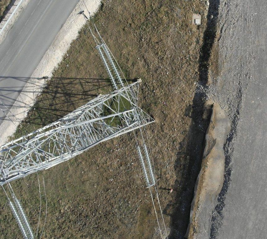
Abstract

A World Bank Europe and Central Asia (ECA) Region innovation grant was awarded to test the use of
unmanned aerial systems (UAS) as a way to accelerate the production of fit-for-purpose spatial data,
thereby allowing local and national government and the private sector to use the up-to-date and accurate
data for multiple purposes. The pilot was conducted in several locations in Albania in December, 2013
and the analysis is presented as a two part series to document the findings and potential applications of
this new technology.

The emergence of small, affordable UAS technology and recent advances in highly automated mapping
techniques promises a widespread enablement of small entrepreneurs and development agencies to enter
the field of mapping. Because of its rapid and easy deployment characteristics, UAS technology is most
appropriate for short notice acquisition of high resolution digital aerial images over small areas. The
combination of highly automated and precise UAV navigation with recent advances in automated image
processing and mapping techniques and the ever continuing effects of Moore’s law on personal
computing performance is rapidly reducing the entry barriers to mapping tasks that have to date been
exclusively performed by centralized resource centers such as international mapping companies and
national mapping agencies.

The pilot study in Albania was designed to test the performance and relevance of UAS technology and
modern modeling techniques in an environment where there is a dire need for new spatial data and for
improvement of the quality of existing spatial data. We found that the enabling advantages of UAS aerial
image acquisition combined with the automated Multi-View Stereopsis (MVS) technique for general and
specific mapping and modeling tasks will find many appropriate applications in support of informed
development design and management at local and national level. In particular we are confident that the
basic methodology applied in our study will result in improved supply of high quality spatial information
to all stakeholders in the fields of infrastructural design, urban and rural planning, resettlement action
plans (RAP), civil contract management, cadastral surveying and property registration, environmental
impact assessments, natural resource monitoring and disaster risk mitigation. We also conclude that with
additional funding we will be able to establish a feasible and cost-effective approach to introduce UAS
and the associated image processing techniques to establish sustainable, decentralized, individualized
mapping capacities across countries such as Albania.

Key Words: UAV, UAS; National Spatial Data Infrastructure; SDI, orthophoto, 3D models

                                                    2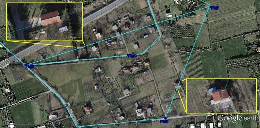
Contents
I.       Introduction ........................................................................................................................................... 4
      Background ............................................................................................................................................... 5
      Operational Characteristics of UAS .......................................................................................................... 5
      UAS to Augment Satellite Imagery .......................................................................................................... 6
II.      Improvement of Operational Effectiveness: Albania Case Study ......................................................... 7
      Infrastructure Development Scenarios ...................................................................................................... 7
      Transport ................................................................................................................................................... 8
      Urban Planning, Taxation, Upgrading of Informal settlements .............................................................. 11
      Agriculture .............................................................................................................................................. 13
      Disaster Risk Management and Response .............................................................................................. 14
      Environment and Natural Resource Management (NRM)...................................................................... 15
      Extractive Industries ............................................................................................................................... 16
      Cost-Benefit Analysis ............................................................................................................................. 16
III.         UAS Potential for Improving Governance ...................................................................................... 17
IV.          Integration of UAS Technology in Projects .................................................................................... 19
      Project and Risk Management ................................................................................................................ 19
      Legal Aspects for UAS Technology ....................................................................................................... 20
         National Legislation ............................................................................................................................ 21
         Liability ............................................................................................................................................... 23
I.       CONCLUSION AND LESSONS LEARNED ................................................................................... 24
References ................................................................................................................................................... 26

                                                                                  3
I.   Introduction
A World Bank Europe and Central Asia (ECA) Region FY14 Innovation Grant was awarded to test the
use of an unmanned aerial system (UAS) as a way to produce faster, fit-for-purpose spatial data (aerial
photographs, digital orthophotos, maps and 3-D models) allowing local and national government and the
private sector to use the up-to-date and accurate spatial data for multiple purposes. The use of UAS
technology can revolutionize the way governments acquire and manage spatial data as well as the manner
in which the World Bank and other development partners design, implement, and monitor their projects
by making these processes more timely, inclusive, transparent, accurate and cost effective. An UAS is a
new tool for improved project design and implementation in which spatial data can be applied to various
fields such as securing property rights, improved infrastructure and related services, better urban planning
and integrated development, and disaster risk management that are at the heart of the World Bank’s
poverty reduction and shared prosperity agenda.

This paper is Part Two of a two part series that presents the results of testing UASs to produce spatial data
for multi-purpose use in Albania in December 2013.1 Part One presents technical aspects and the
application for cadastral mapping, while this paper explores the use of UAS for other applications and
non-technical considerations such as legal issues and project management considerations for using UAS
in a development project context.

As described in more detail in Part 1 of this series, the use of UAS was piloted in three areas in Albania in
December 2013 in order to explore development of a more efficient, accurate and timely spatial data
capture process. A fourth area, live footage along a river after a flood, provides a brief look at
applications in a disaster scenario.

Why in Albania?
In Albania a new computerized system for land administration was developed in 2012 with national roll-
out ongoing. The new system is the first in Europe based on the 'Land Administration Domain Model'
(LADM), which was approved as an official International ISO Standard on 1 November 2012. The
Albanian system has been populated with a good quality data from the systematic first registration
process under the World Bank financed Land Administration and Management Project (LAMP), which
covers approximately 20% of properties in the country. However, for almost 80% of cadastral zones the
existing maps are maintained in paper form and are of poor quality and therefore cannot serve as base

1
 A multi-disciplinary team included the team leader/land lawyer from the World Bank, a UNFAO Information
Technology expert, international surveyors with UAS experience, local surveyors, and international and local
university professors in the fields of GIS and photogrammetry. The team was assisted by the Chief Land
Registration of the Albanian Immovable property Registration Office and the mayor of the Komuna Farke, both of
whom facilitated the field work and access to other information and data sets for the pilot.

                                                       4
maps to build the Albanian National Spatial Data Infrastructure (SDI). The latest available orthophoto
maps were produced in 2007 (i.e. some seven years ago) and, with the rapid urbanization, are now out of
date. Therefore, the benefit from the investments made to introduce the new IT system in Albania cannot
be fully realized until a data quality improvement process is developed.

Background
The costs of producing conventional aerial photographs and digital orthophotos and the performance of
terrestrial surveys can amount to several thousand or even millions of dollars and can use up a significant
amount of a project budget. The time line of a typical procurement of conventional map products such as
a regional or national topographic map series or of wide area coverage of orthophotos from inception to
delivery often consumes a disproportionate amount of time of a development project life cycle.
Conventional mapping projects are highly sensitive to economy of scale. Hence mapping contracts have
tended to be large and most often are allocated to international companies or institutions. Delivery
typically is partitioned into large chunks of information that often arrives too late to be consumed and
analyzed before the information has become outdated. The work done under the Innovation Grant
included testing the introduction of UAS at the local level, as an additional tool for small survey and
mapping companies or local private surveyors, to produce spatial data with high accuracy in a matter of a
few days, AS and WHEN needed. Placing mapping capacities at the local level opens opportunities to
significantly shorten supply lines and to respond much more dynamically to immediate demands for
spatial data.

Operational Characteristics of UAS
UAS now come in small, portable versions, yet can produce accuracy results equivalent to or better than
conventional surveying and mapping methods. UAS add new dimensions to baseline data gathering for
concept development, alternatives assessments (e.g., site and route selection), and environmental and
social impact assessments. Typical data sets that can be acquired include aerial imagery from which
topographic data can be produced and multispectral data through Lidar (laser scanning). Major
advantages are the resolution of the data acquired, speed of capture and delivery, ability to target discrete
areas and repeatability to monitor change.
One of the most valuable by-products of a UAS navigation system is that with little extra effort all sensor
products, be they in the form of air quality measurements,          RGB or infrared imagery or gravity
measurements, can be accurately time-stamped and positioned (geo referenced). Because they are small
(2x2cm) and light (30g) most UAS use stand-alone GPS receivers for navigation. In those areas where
satellite augmentation services such as WAAS for North America and EGNOS for Europe are available

                                                     5
the positioning accuracy of these devices is in the 3 to 5m range – adequate for any mapping tasks at
scales of national topographic mapping series.

GPS yields positions on the WGS datum. Where existing maps are on a national or local datum, the WGS
coordinates have to be converted to the national or local coordinate system with the use of local
transformation parameters. Most countries have or are in the process of establishing national spatial
reference frames based on one of the International Terrestrial Reference Frame (ITRF) versions. The
relationship between WGS84 and ITRF is very well established and coordinate conversion tools to
convert between WGS84, ITRF and most national and sub-national coordinates systems are readily
available on the internet or embedded in mapping and GIS packages. Thus, UAS-derived geo-spatial
observations and raw imagery can in many instances be plotted on national topographic maps.

UAS to Augment Satellite Imagery
The most advantageous consequence of having UAS derived spatial data geo-referenced is that the data
can so easily be rendered in global satellite image servers such as Google Earth, which is an underutilized
tool in the development aid industry. Google Earth is an immensely valuable, free resource and, within
the context of development work, was used as the basic platform for the planning of the pilot study in
Albania. Although Google Earth has some shortcomings (relatively poor spatial resolution at 50 cm, local
distortions, internet access required), the appropriate application of UAS very efficiently overcome these
issues.

Google Earth thus presents a powerful link between non-spatial and spatial data. When starting new
projects the combined use of Google Earth and UAS can, for most purposes, accelerate geo-spatial tasks.
Google Earth provides a rough inventory and subsequent UAS applications immediately start delivering
high accuracy geo-spatial products to satisfy immediate demand. Hence UAS technology integrates
production of geo-spatial base products into the development workflow and there is no need to wait for
blanket mapping coverage.

Because acquisition costs are low, the units are physically small and their operation requires low skill
levels, UAS technology can be easily disseminated (geographically as well as demographically) to
efficiently establish A to Z mapping capacities in countries that don’t have such capacities and are thus in
dire need of improved spatial data.

Since UAS can take off and land in the presence of local stake holders and the spatial products can be
delivered in a matter of days, they will most convincingly bring credibility of maps to citizens. Increased

                                                     6
interest in environment and planning issues will very likely result from increased “map awareness”, “map
acceptance” and increased citizen engagement.

II.     Improvement of Operational Effectiveness: Albania Case Study
This section will build on the findings of Part I of the two part series which focused on the operational
aspects of UAS and cadastral mapping applications. The focus will now turn to aspects related to the use
of this new technology for better project design, implementation and monitoring.

Infrastructure Development Scenarios
UAS can have a significant positive impact on all stages of infrastructure development from feasibility
and design to safeguard compliance and monitoring and evaluation (M&E). At the initial design stage of
a project UAV derived imagery and post processing products such as Digital Elevation Models and 3D
visualization allow engineers to plan and design the most cost effective and logical routes. The spatial
data also provide a snapshot of the assets and social impact that a proposed project will have and allows
for a clear point of reference for Resettlement Action Plans, cut-off dates and compensation calculations.
Periodic follow up flights allow for monitoring of contractor performance and assessments of any
environmental or other impacts that occur. During the post-construction phase of infrastructure projects
UAS can play a significant role in inspections to trigger preventive maintenance actions.

In Albania, the team chose two sites to demonstrate how UAVs can provide critical information for
infrastructure. The first site demonstrates the power of UAV imagery and derived products along a new
highway corridor that also included high tension power lines. The second location covers an area that is
part of a new urban water supply project where land will be acquired but the official property registration
maps and ownership information are out of date or incorrect. The photos and descriptions below provide
concrete examples of how UAS can improve infrastructure development and management.

                                                    7
Energy
Energy: Power Lines and
Towers
Create inventory of assets
Conduct detailed inspections
Document current occupation
and condition of equipment
Assess need for vegetation
clearance
Identify illegal easement
encroachments
Use infra-red survey to detect
insulation problems
Assess conditions after storm
damage and stability
Geo-referenced imagery allows easy inventory, inspection and monitoring of infrastructure assets
(Elbasan Highway corridor, Albania)
Transport
In topographic surveying for engineering design purposes, small UAS can be employed to significantly
reduce the field data collection time. The Albania team acquired sufficient aerial imagery in only 30
minutes to create a very realistic model of an 800m stretch of highway under construction. The model can
be used to create a three dimensional virtual world within which traditional survey work can be performed
“virtually”. Traditionally, topographic surveys are performed either by expensive (economy of scale
dependent) lidar methods or by covering the ground with “spot shots” using either total stations or GNSS
RTK. The team estimates that a seasoned survey crew equipped with total station or GNSS RTK would
need at least two weeks to collect all the data contained in the UAS derived model. Virtually surveying
the terrain entails capturing the details of interest one mouse click at a time, whereas in conventional
surveying each point of interest has to be physically occupied. Considering that an appropriately
configured UAS can be supplied at a cost below that of either GNSS rover or total station and that
relevant image processing software can be purchased for less than US$5000, the gains in efficiency and
economy make a compelling case for including a UAS as an additional tool for general surveying and
mapping purposes.
8
Transport, Pipe Line, Rural
Electrification and Road
Construction:
Conduct feasibility studies
and route planning
Use Digital Elevation Models
for engineering
Profile routes
Monitor contractor
performance and progress
Facilitate land acquisition and
resettlement requirements
The clear imagery allows monitoring of progress and impacts from construction works
(Elbasan Highway Corridor, Albania)
3D and Digital Elevation Models facilitate engineering and design (Elbasan Highway Corridor, Albania)
The aerial imagery from
the test site clearly shows
the pending failure of the
embankment.
9
Water Structures: Although large water structures such as dams, canals, levees, and weirs were not
included as the first phase testing in Albania, UAV imagery can establish a geo-referenced inventory of
water structures and it can also inspect water quality by using multispectral sensors during the flights,
detect leakage and waste, and identify cracks in water structures. One related application did demonstrate
the applicability of UAV technology in a proposed urban water supply project, where engineering works
and land acquisition is planned.

In the case of the 20 ha agricultural area that will be used for the new urban water supply project, the
UAV reduced 3-4 weeks of field surveying to 3 hours (one hour to survey 10 ground control points, one
hour reconnaissance and flight planning, one hour to do four flights). The resulting digital orthophoto
with 18mm GSD and sub-decimeter accuracy was produced locally within 48 hours. The up-to-date and
very accurate maps were combined with several other data sets to demonstrate various applications.

                                                                          Less than one week after
                                                                          capturing the aerial imagery the
                                                                          orthophoto was used in the field
                                                                          to demonstrate how effective it
                                                                          can be in participatory mapping
                                                                          and identification of property
                                                                          boundaries and land rights with
                                                                          the involvement of the local
                                                                          land owners.

                                                     10
The accurate and current
UAV derived maps were
overlaid onto a scanned
image of the existing
registration index maps from
the Immovable Property
Registration Office and clear
inaccuracies could be
identified which impact the
security and tradability of
property rights, and could
impact the project’s
Resettlement Action Plan.
The related 3D model was combined with the 2007 orthophoto that was used for the original
pipeline design and the team could clearly show the changes that have taken place in the last 7
years, including two new houses that had been built and would be affected by the original
pipeline design. Using better spatial data could avoid costly delays and mistakes in such designs
and better support the World Bank’s safeguard policies.
The proposed pipeline running through 2 houses that were not on the 2007 orthophoto (Fushe Milot, Albania)
Urban Planning, Taxation, Upgrading of Informal settlements
Another example is the dense urban setting where the team produced spatial data for approximately 60 ha
of former olive groves and agricultural land that is now an extension of the urbanized capital city. The
local government is desperate for accurate maps and other data to help it provide appropriate services to
its citizens and bring some order to the unplanned and chaotic development that occurred over the past 15
11years. The new maps produced by the team highlight the inaccuracies and poor quality of the existing
registration index maps which supports the claim of the local government officials that the existing maps
and data actually create conflict amongst citizens and between citizens and their local government. In
addition to providing better land tenure information, the 3D models will help the local government and
citizens visualize their environment for improved planning and infrastructure upgrading.
One important observation is that 3D modelling, especially of dense urban areas, requires more intensive
processing power and time. It will also require that oblique shots are included in the initial data capture
and manual linkages and corrections need to be factored into the time and cost estimates.
Google Earth Image dated 16 June 2002 (Komuna Farke, Albania)
UAS-derived Ortho Photo (GSD 2cm) dated December 8, 2013.
12Visualization of UAS-derived 3D-models of same buildings shown above
As the photos above demonstrate, the use of UAS technology allows the production of very accurate
orthophotos and additional visualization tools such as 3D models. By using Google Earth as the platform,
the Albania team took advantage of this free resource that allows almost anyone to open and use the files
(no expensive licenses needed). In addition, the use of Google Earth allows the tracking and change
detection of an area over time. For example, there are more than 8 Google Earth images for the pilot
location in Albania between 2002-2013. This very accurate and easy to understand information can be
used by local governments for many purposes: urban planning, infrastructure upgrading, selecting
locations for schools and hospitals, as well as providing better communications with citizens about their
environment and encouraging their participation in planning and developing their community.
Agriculture
UAS are already used in many countries to support the agricultural industry. Farmers in Japan, Brazil and
Australia use the technology to help increase productivity by providing more accurate information about
their land and production aspects. UASs can be used to survey crops, monitor for disease, and determine
irrigation needs and precision-spray pesticides or fertilizers. The use of such timely and accurate data
will allow better use of resources and help prevent unnecessary run-off and other damage to the
environment. Adding a camera with a multispectral imager expands the potential use to assess plant
stress, productivity, biomass, and to predict crop yield. UAS can also be used to monitor crops and quality
control of claims for subsidies such as those under the EUs Common Agricultural Policy.
The tests in Albania demonstrated that the imagery is sufficient to define boundary lines between fields
and crops, and allows for a clear view of the types of crops planted. It even allowed for counting the
individual cabbages in a field.
13UAS imagery from the test site provides a clear view of the crops and trees in a field. (Fushe Milot, Albania)
Disaster Risk Management and Response
UAS have the potential to become an integral part of emergency response and disaster management
planning due to their rapid deployment and portability capabilities and ability to safely navigate confined
spaces and hazardous environments. Use of a UAS allows identification of critical issues, provides real
time information and more efficient damage identification. The tests in Albania highlighted the benefits
of live video capabilities for immediate and continuous coverage of disaster situations, such as flood or
fire, without endangering the lives of the operators.
A UAS provides real time video to inspect damage after a flood. (Fushe Preze, Albania)
14Environment and Natural Resource Management (NRM)
Use of UAS can have an impact on environmental monitoring and NRM. As with other sectors, the rapid
deployment capability and reduced production times and cost allow for incremental use to facilitate
gathering baseline information and regular monitoring. For example, tests are being carried out in Kenya
and Namibia to help protect threatened wildlife. The UAS is combined with other technologies such as
ground-based sensors, wildlife and patrol tracking devices, custom software and a hotline that allows
members of the public to text crime alerts to authorities, resulting in an integrated approach to reduce
poaching. Use of UASs is also being explored for illegal fishing, especially to monitor the 12-14 mile
range at the edge of international waters where illegal fishing vessels often wait until darkness before
entering restricted areas. Identification and tracking of illegal activity allows for better enforcement and
even provides evidentiary proof of the illegal activity.
In Albania the UAS tests identified an unauthorized waste site in a protected park and the resulting effects
on the environment.
An unauthorized
waste site located in
the capital city
park.
(Tirana, Albania)
15The UAS imagery
captures the
environmental
damage from the
illegal waste site
through the visible
increase in algae
blooms in the
adjacent lake
Extractive Industries
Although not included in the Albania pilot, UAS are increasingly used in the extractive and mining
industry. The ability to reach difficult locations and regularly monitor locations without placing people in
a hazardous environment provides mining companies, governments and NGOs with a tool to better and
more safely manage operations. The associated processing techniques for UAS imagery create realistic
and geographically accurate 3D models that are essential for measuring and monitoring mine stockpiles,
waste dumps, open pits and ground subsidence from underground works.
Cost-Benefit Analysis
Traditionally, the high cost and long processing times associated with conventional, wide area spatial data
acquisition and production were a significant drain on a project budget and could result in mistakes or
delays with project design and implementation because the maps and other data were out of date by the
time they were delivered.
The tests in Albania were designed to explore and demonstrate the multi-purpose potential of the
technology. Bearing in mind that the pilot study was conducted in a developing country, the team was
particularly mindful of the minimum level of investment needed for a sustainable establishment of a UAV
based mapping unit. Hence the team avoided expensive proprietary hardware and software products.
The UAS assembled for the Albania work was a combination of parts from proven companies (for
example, the airframe was designed and built in South Africa, the brushless motors were manufactured in
China and the central open source flight controller hails from a company with premises in Mexico and the
USA) combined with standard commercial components ordered over the internet (for example, the
camera was ordered from amazon.com at a cost of US$ 400). Other components were designed and
16produced by the UAS team in a collaborative forum (for example, the mount to hold the GPS navigation
receiver was designed and printed by the team using a 3D printer).
The price of the platforms used is about half of what a common GNSS rover unit would cost. For the
image processing aspects the team employed the widely used professional version of Photoscan sold by
the Russian firm Agisoft for a price of $3500.
The results exceeded expectations, with the production of a rich data set in less than two weeks of field
work and these data can be used for multiple applications.
Another differentiating aspect between conventional and UAV-based geo-spatial production is the height
from which aerial imagery is obtained. Small UAVs generally fly much lower than manned aircraft. As a
result conventional aerial imagery rarely exceeds a resolution of 8cm while UAV-derived aerial imagery
with sub-centimeter resolution can easily be obtained. The significantly higher resolution of UAV-
captured imagery allows for correspondingly high resolution in the derived geo-spatial products. The high
resolution of UAV-derived geo-spatial products significantly reduces map reading skills and thus allows a
much wider cross-section of stake holders to intelligently analyze content and thus to participate in
planning and other activities. This aspect is particularly effective if UAV-derived products are rendered in
3D with the aid of powerful computer visualization tools. The increased communicability (in the sense of
“a picture speaks a thousand words”) of UAV-derived geo-spatial enjoys better acceptance and credibility
on the side of lay end users of the product.
What is next?
The data produced and lessons learned in Albania were a successful conclusion to the initial phase of
introducing UAS technology into the development project context. A second phase for using UAS
technology and the resulting spatial data are planned in Albania under a joint European Union and World
Bank technical assistance program which is due to continue in late spring 2014, with a focus on
improving cadastre/registration information for the Immovable Property Registration office and further
developing the national Spatial Data Infrastructure. The project will contribute to improve the operational
effectiveness of land administration in Albania including development of a national spatial data
infrastructure compliant with the EU INSPIRE Directive, develop new e-services as part of wider e-
government and good governance strategies; and data quality improvement.
III. UAS Potential for Improving Governance
The UNFAO Voluntary Guidelines on Governance of Tenure of Land, Fisheries and Forests state that
“States should establish policies and laws to promote the sharing, as appropriate, of spatial and other
17information on tenure rights for the effective use by the State and implementing agencies, indigenous
peoples and other communities, civil society, the private sector, academia and the general public.
National standards should be developed for the shared use of information, taking into account regional
and international standards. .
Innovative technology applied to land records and graphics improves knowledge based decision making
and expands means for data dissemination and access to land records. E-governance in spatial data
management is an area of rapid innovation in developed economies, and emerging economies can leap-
frog ahead in this area through exploitation of new technologies. SDI is potentially game-changing for
development as it allows governments to integrate planning, taxation, disaster risk management and
climate change monitoring, mitigation and adaptation in new ways with great savings in time and funds,
while improving overall service and governance.
The key issue faced by most of developing countries is poor data quality and the use of UAS has a role to
play in faster data quality improvement. UAS can serve as an effective tool to collect accurate and
current spatial data that improve services and governance by linking spatial data through e-governance.
Countries throughout the world are taking steps to create and improve the benefits of SDI. For example,
in December 2013, the US Federal Geographic Data Committee approved the National Spatial Data
Infrastructure Strategic Plan 2014-2016 with core guiding principles related to ensuring data from
multiple sources, shared use, open access and interoperability of information systems while respecting
privacy and data protection as well as due consideration for the expected return on investments.
On the European level, the INSPIRE Directive 2007/2/EC of the European Parliament binds EU Member
States to establish and provide geographic data in a standardized way. INSPIRE sets the legal framework
and the technical specifications necessary to overcome existing barriers in the sharing of environmental
information. Such barriers add a significant extra cost to those who need to access and use environmental
information. Many countries in the ECA region have adopted INSPIRE compliant legislation, including
Albania which approved its law in 2012.2
Most countries in the ECA Region are developing initiatives to widen access to and use of geospatial
information, but their maturity and success vary. Land administration information is a fundamental
component of SDIs. The information produced and distributed by cadastre and mapping authorities is an
integral part of SDI and represents above 85 percent of the so-called reference data (base maps) without
2
Law Nr 72/2012, For organization and functioning of National Infrastructure for Geospatial Information in the
Republic of Albania.
18which the SDI could not be built. ECA countries have the basic automated systems to produce, maintain
and share data, and there are further requests from countries to:
1) Develop national SDI compliant with the international standards;
2) Develop new e-services as part of wider e-government and good governance strategies; and
3) Improve data quality.
SDI is seen as part of wider e-government initiatives that reduce duplication of effort, improve quality
and reduce the costs related to geographic information. It makes geographic data more accessible to the
public, increases the benefits of using available data, and establishes key partnerships with states,
counties, cities, academia and the private sector and supports the goals of the UNFAO Voluntary
Guidelines that state “As part of broader public information sharing, records of tenure rights should be
available to state agencies and local governments to improve their services.”
The future World Bank land agenda in ECA supports broad categories, among which are development of
a more integrated approach to land management through land policies that reflect environmental and
sustainable development concerns; improvement of the management of the organization and use of spatial
data; support for governance and the quality and method of services provided; and encouragement of
innovation and the use of SDI or spatial information underpinning new products and services.
IV. Integration of UAS Technology in Projects
Introduction and testing new technology in the development project context in Albania encountered
unique challenges. With regard to the mobilization and use of UAS there are no specific World Bank
institutional policies or guidelines, no laws or regulations in Albania, and generally no industry standards.
As a result, the World Bank team conducted the necessary research into the developing policy and legal
frameworks around the world and engaged a very knowledgeable and experienced UAS technical team
who chose the appropriate equipment for the task. Safety was the priority for all aspects of project
management. The very positive results and flawless operational performance can serve as a benchmark
for future adoption of UAS technology in the development project context.
Project and Risk Management
The UAS market is rapidly expanding and being influenced by several factors. First, with the draw down
on the wars in Iraq and Afghanistan military contractors are looking for new markets for their equipment
and staff. Governments, embassies and private companies will increasingly be inundated with business
development representatives trying to sell their goods and services. Second, many of the big mapping and
software companies are entering the market and producing proprietary equipment and processing
19programs. Finally, the availability and ease of buying UAS components over the internet allows
individuals to assemble their own systems for minimal cost. Thus, decisions had to be made on which
equipment to use, which experts were best qualified to join the World Bank team, and how to operate in a
rapidly changing field.
The strategy of the team for Albania was to push the limits on price in order to identify low cost solutions
that can be readily adopted by and for the local market. Notwithstanding cost considerations, the primary
concern was operational safety and performance. A platform with a light take-off weight of 2.4kg was
chosen to intrinsically limit the risk of personal injury or damage of goods.
Prior to the UAS mobilization the World Bank team held meetings with the national Albanian Immovable
Property Registration Office and with the local government representatives in the test areas to provide the
necessary background information and to receive approval for the work. In addition, the team was
conscious of the social aspects and ensured that the local community was informed about what was going
to happen. The benefits of inclusiveness and transparency were highlighted. Finally, local Albanian IT
and GIS specialists as well as licensed surveyors were included on the team to provide initial capacity
building and to explore the potential for imbedding UAS technology at local level.
In addition, the safety, reliability and performance of all system components were tested prior to travel to
Albania and verified again in the field prior to commencement of production work. In the absence of
national legislation and World Bank guidelines, the team developed and adhered to its own operational
procedures for technical, safety and communications aspects.
Further use of UAS in the World Bank or other development project context would benefit from general
operational guidelines. Since the legal and regulatory framework for UAS operations are very fluid at the
moment and since UAS can be purchased or assembled at a very low cost, the World Bank and other
development partners need to have minimum standards for safety and operations that take into account
social considerations in the country context. These standards are in no way meant to be burdensome, to
restrict vendors or to endorse one system over another. Rather, setting minimum standards related to
equipment and operational safety, field mobilization procedures especially in the absence of a clear
legal/regulatory framework in the client country, understanding the necessary privacy and data protection
requirements and respecting local sensitivities about the use of UAS, will reduce the likelihood of
accidents and associated liability as well as the possibility of a public relations disaster.
Legal Aspects for UAS Technology
UAS technology is a rapidly advancing industry and, as with many new technologies, the legal and
regulatory aspects lag behind. There are currently no international joint certification or operation
20standards and the legal sphere currently lies between the traditional types of highly regulated manned
aircraft under the mandate of civil aviation authorities and the less stringent rules related to hobbyists
flying remote controlled aircraft.
National Legislation
While many governments are attempting to address the issue in a systematic way, the body of legislation
is relatively limited. In the EU, regulations that govern civilian UAS weighing 150 kg or more are
planned for 2016 while UAS less than 150 kg continue to be governed by national legislation of the
member countries. A few examples of EU member state national legislation:
Switzerland: is the most liberal country in the EU with regard to use of UAS. There are few
restrictions for UAVs that weigh less than 30 kg. Aerial photographs are permitted provided that
the requirements for protection of military facilities and the protection of privacy are respected,
and the obligations under the Data Protection Act are met. Cantons and Municipalities may adopt
additional restrictions.
United Kingdom: The Civil Aviation Authority issues permission for commercial use of UAS.
The aircraft must weigh less than 20kg, operators cannot fly higher than 122 m and must keep the
craft in "line of sight".
Germany: The individual states in Germany adopt the rules for use of UAS under the principles
of the federal guidelines "Towards Common Principles of the federal and state governments for
granting permission to unmanned aviation systems” In general, states grant authorization for two
years at a time for UAVs with a take-off weight of less than 5kg.
Romania: in January, 2014 the Ministry of Transport issued temporary regulations that enable
the operation of UAS until the time when the specific package of EU and Romanian regulations
to govern both the certification and operation are issued. The rules and certification requirements
are specified for UASs above 150 kg, from 1-150 kg and for hobby craft less than 1 kg. UAS less
than 1 kg are not allowed to carry filming or data transmission devices.
In the USA, Congress has instructed the Federal Aviation Authority (FAA) to develop a plan for “safe
integration” of UAS by September 30, 2015, although the FAA has already announced that full
integration will not be possible by that deadline and the six test sites for UAS research were only selected
in December, 2013. The agency is still developing regulations, policies and standards that will cover a
wide variety of UAS users. It expects to publish a proposed rule for UAS under 25 kg later in 2014.
21In the meantime, the issue is not well regulated and is becoming highly contentious within the legal and
law enforcement community. There are no clear federal laws or regulations and in early March, 2014 an
administrative judge on the National Transportation Safety Board ruled that the commercial use of small
UAS is in fact legal, despite FAA statements to the contrary. The ruling effectively invalidates the FAA’s
2007 ban on commercial use, although the agency may appeal the ruling.
Other developing legal issues surround air rights and who ‘owns’ the sky above private property. The US
Supreme Court ruled on this issue in a 1946 case (United States v. Causby, 328 U.S. 256) stating that the
navigable airspace is within the public domain. However, with the proliferation of UAS and the capability
to collect better and more invasive data, the ruling may be challenged, especially in the context of Fourth
Amendment search and seizure requirements. In other countries the issue of law enforcement use of UAS
and spatial data collected through UAS technology, especially over privately owned land, will likely be
just as contentious.
The issue of air space and the public domain is also relevant for non-law enforcement and commercial use
of UAS. In the USA the issue is being tested under the Constitution’s First Amendment right to freedom
of speech. A January 2014 case where a journalist used a UAS at an accident scene has already led to
both criminal sanctions and a retaliatory law suit alleging the violation of First Amendment rights of free
speech and free press guarantees. The eventual court ruling for this case could set a specific precedent for
use of UAS in the US.
Individual states are also attempting to legislate the use of UAS with a wide variation in levels of control
including making the collection and holding of photographs from a UAS a crime (New York).
Privacy and Access to Information
The increasing use of UAS technology by government bodies and private companies poses a unique set of
problems. Privacy campaigners are raising their concerns about the proliferation of the technology and
use of the data.
The introduction of SDI and e-government services enhanced with the high quality data collected by UAS
technology raises a number of related legal issues, including data protection and privacy. Data protection,
ensuring that the data collected and held by public institutions are safe from misuse, requires clear
procedures for collection and storage as well as a process to continuously upgrade the data security of
ICT systems and the knowledge and understanding of its operators. The legal framework must include the
obligations and penalties, bot criminal and civil, for breach of data security protocols.
22A more complex issue is data privacy and its relationship to the general trend of increasing access to
information. The right to privacy and the right to access information are both important human rights.
Privacy relates to the protection of individual autonomy and the relationship between an individual and
the government, while the right of access to information allows citizens to obtain information held by
government institutions. Access to information and the new trend for Open Data are key components for
transparency, accountability and governance and are increasing through new ICT systems, including those
for public registers such as land administration agencies. Concurrently, privacy concerns are increasing in
the same context.
Conflicts can arise when there is a demand for access to personal information held by government
institutions and concerns about privacy. Privacy is especially relevant to land administration and
management because so much land information is highly sensitive and UAS technology is improving the
ability to collect faster and better data. Governments have been slow to adopt clear policies and
legislation in order to balance the competing interests and to limit conflicts so that public institutions can
provide improved services within a clear and consistent policy and legal environment. Countries vary
widely in their approaches to making public registers available and several international organizations and
institutions have developed models including the Organization for Economic Cooperation and
Development (OECD) which updated its Guidelines on the Protection of Privacy and Trans-border Flows
of Personal Data in 2013, the Council of Europe Convention 108 ‘For the Protection of Individuals with
regard to Automatic Processing of Personal Data’ (1981) and the EU Data Protection Directive (1995)
with the January, 2012 data protection framework amendment. Although there is no consensus on the best
model there has been some convergence in policies on the relationship between access to information and
privacy laws.
As noted above, each country will need to develop its own policy and framework for balancing the
important rights of access to information and privacy. The urgency becomes more apparent with the
increasing use of UAS technology. While some conflict between the two rights is inevitable, the instances
can be reduced to a minimum with clear and consistent policy statements and implementing laws and
regulations. In the ECA region land administration field there is a trend to allow access to ownership and
other data about a specific property, but only certain authorized groups (i.e. special prosecutors, tax
authorities, financial crimes units) can search the property register information by name.
Liability
Liability and associated insurance coverage with the use of UAS remains an uncertain market. The
existing liability regimes are mainly based on aircraft weight or passengers which is not compatible with
UAS. The European Commission commissioned a study on the liability and insurance requirements
23generated by ‘remote piloted aircraft systems’ (RPAS), with the finding expected in March 2014. The
study aims to consider the current and future risks associated with operating RPAS.
Input from some of the large insurance providers suggests that they want an industry-wide definition of
what constitutes an ‘RPAS’. They note that due to the significant potential hazard, loss and third party
risk, insurers recommend that proper licensing for operators and pilots is needed and that the aircraft have
clear identification and tracking mechanism to the operator so that it is possible to trace the origin in the
event of an accident. Another recommendation is that systems are equipped with a unique
identifier/transponder unit in order to make it visible to air traffic control systems.
In the USA, insurers do not provide coverage for commercial operations related to UAS. National
legislation in the EU clearly attributes liability to UAV operators and some states require a minimum of
insurance coverage. For example, in Switzerland, anyone who operates a UAS must ensure liability
coverage in the amount of at least 1 million Swiss francs for any damages (approx. US$ 1.12 million).
Under the recent Romanian regulation, the Ministry of Transport has clearly stated that all liability lies
with the UAS operator although currently no such insurance policy options exist with Romanian insurers.
Thus, there is still a significant amount of regulation and policy development to be done for insurance
coverage of UAS worldwide.
I. CONCLUSION AND LESSONS LEARNED
Lessons Learned:
1. UAS technology is most suitable and cost effective for small areas, where digital maps and 3-D
models need to be produced in a short period of time with high data quality and accuracy. For
example new infrastructure investments are planned but there are no recent orthophotos and the
existing digital or analogue maps are of poor quality.
2. There are no significant barriers to imbed the technology at the local level and it will
revolutionize the way governments acquire and manage spatial data as well as the manner in
which international organizations and development projects design, implement, and monitor
activities and investments. The ease of deployability, flexibility and affordability will allow for a
decentralized approach and a conduit for technology transfer to both developed and developing
countries.
3. UAS technology is a rapidly advancing industry and the legal and regulatory aspects lag behind.
Data protection and data privacy juxtaposed with the trend for broader public access to
information and open data are some of the issues that the use of UAS is bringing to the forefront.
24UAS is a promising new tool for improved project design and implementation in which spatial data can
be captured in a short time with a low cost and used in various fields and the governments, private
sector, universities, the World Bank, FAO and other development partners could benefit from the
experience in Albania.
UAS derived spatial data enhances transparent, accessible and accountable systems for land
administration and natural resource management and contributes to the national Spatial Data
Infrastructure (SDI) - the information produced and distributed by land cadastre/registration and
mapping authorities is an integral part of SDI and represents over 85 percent of reference data (base
maps).
The team is also preparing an e-learning session for interested governments and institutions, as well as a
series of short video clips for policy/decision makers and technical staff aimed to facilitate better
understanding of the potential applications and present the lessons learned from the Albania experience.
25UAV team on location in Tirana, Albania. December 2013. : (Genti Qirjazi (iKub, Albania), Kathrine
Kelm (World Bank, USA), Walter Volkmann (Micro Aerial Projects LLC, USA), Oliver Volkmann (Micro
Aerial Projects LLC, USA), Grenville Barnes,(University of Florida, USA) ,Rumyana Tonchovska, (FAO,
Italy))
References
1. The EU Data Protection Directive (1995), including the January, 2012 data protection
framework amendment.
2. US Federal Geographic Data Committee. National Spatial Data Infrastructure Strategic Plan
(2014-2016), December 2013.
3. Internet links for UAV laws and regulations: Switzerland:
http://www.bazl.admin.ch/dienstleistungen/02658/; Germany: http://wp1088285.server-he.de/ar-
drone-recht.htm
4. Contribution of Technology for the Improvement of Governance of Tenure in ECA Region,
World Bank Land and Poverty conference, 2013, Tonchovska and Kelm.
5. Directive 2007/2/EC of the European Parliament and of the Council of 14 March 2007
establishing an Infrastructure for Spatial Information in the European Community (INSPIRE),
Official Journal of the European Union, L108, Volume 50, 25 April 2007, European Parliament
and of the Council of the European Union
6. Land Administration in the UNECE Region. Development trends and main principles, 2005, New
York and Geneva, Economic Commission for Europe, United Nations
7. Cadastre 2014 – A Vision for a Future Cadastral System, Kaufmann, J. and Steudler, D, 1998,
Switzerland, Commission 7, International Federation of Surveyors with the Working Group 1 of
FIG Commission 7.
8. Voluntary Guidelines on Governance of Tenure of Land, Fisheries and Forests,
www.fao.org/nr/tenure/voluntary-guidelines.
26You can also read