PLAN TEMPLATE FARM ENVIRONMENT - NZ Landcare Trust
←
→
Page content transcription
If your browser does not render page correctly, please read the page content below
FARM ENVIRONMENT
PLAN
MOUTERE CATCHMENT
                 TEMPLATE
                                                Based on material developed by NZ Landcare Trust and
CORE INFORMATION                                Nelson City Council as part of their Hill Country Erosion
                                                project funded by the Ministry of Primary Industries 2019.

 Owner                   Exemplar B

 Address

 Phone numbers

 Email Address

PHOTO OF FARM, looking down from top boundary

                                                                             FEP Template             1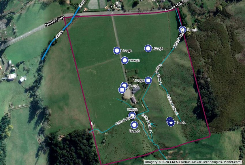
FEP MAP
DESCRIPTION
Location: Neudorf Rd, Upper Moutere
Leased: 2017; farm approx. 150 sheep.
Area: 13.5Ha
Topography: Lower paddocks (approx. 3ha) are flat, poorly drained alluvium pasture with no trees or
vegetation. The middle paddocks (approx. 3ha) are also flat pastureland with no trees but the changing to
imperfectly drained, weak consolidated conglomerate. The top paddocks are moderately steep imperfectly
drained, weak consolidated conglomerate, with gully erosion. There is a small plantation of Olive trees
(approx. 15 trees) which help with erosion.
Waterways: There is a stream across the very bottom west corner of the property, this runs all year round
and becomes quite full in heavy rain. There is erosion on the banks.
There is a (man-made?) pond on the hill area being fed by some spring/wet area most of the year. This has
dried up completely after the last summer.
Developments to date:
Fenced off stream area (2018)
Re-directed the waterways running down the gullies to flow into already created natural and man-
made ditches/streams. This stopped flooding in heavy downpours into the house garden and barn
area.
Started planting Tagaste in lower paddock for shade and fodder
Planted some Poplar poles in gully areas
FEP Template 2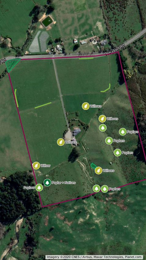
Burton Farmlet
 Boundary

      Boundary

 Waterways/Troughs/Dams

      Dovedale Water Tank
      Tank 2
      Trough
      Trough
      Trough
      Trough
      Trough
      Trough
      Trough
      Trough
      Trough
      Stream
      Critical Water 1
      Critical Water 1
      Critical Water 2
      Critical Water 1b
      Pond
      Critical Source
      Critical Source
                            391 Neudorf Rd, Upper Moutere
      Critical Source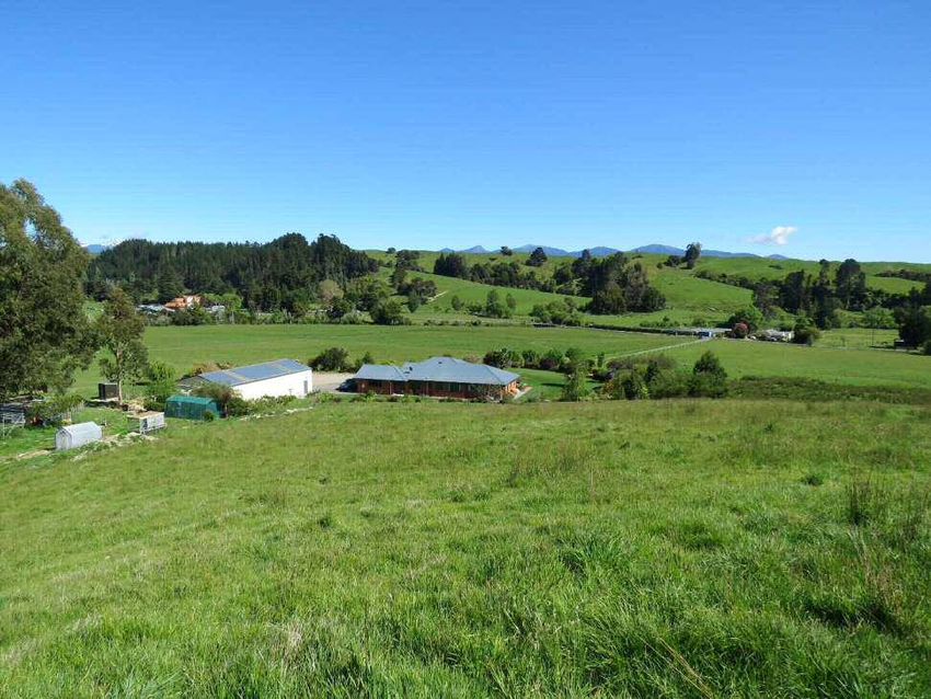
Burton Farmlet
  Boundary

        Boundary

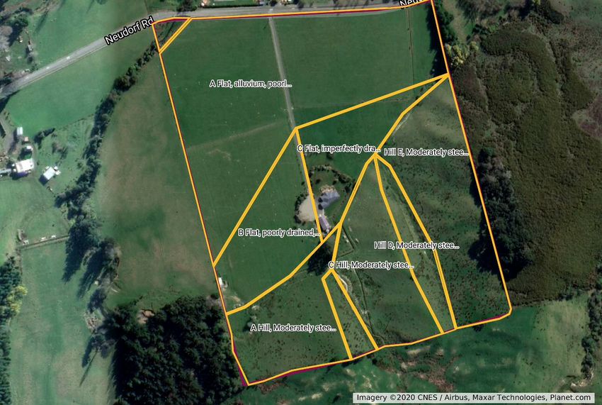
  LMU

        Riparian Area A
        Flat Area A
        Flat Area B
        Flat Area C
        Hill Area A
        Hill Area B
        Hill Area C
        Hill Area D
        Hill Area E

391 Neudorf Rd, Upper
Moutere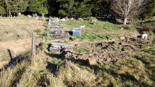
Burton Farmlet
  Boundary

        Boundary

  Plantings

        Wetland Area
        Riparian Stream
        Shelter Trees 1
        Shelter Trees 2
        Shelter Trees 3
        Shelter Trees 4
        Poplars
        Poplars
        Poplars
        Willows
        Poplars
        Poplars
        Poplar + Willow
        Willows
        Poplars
        Willows
        Poplar + Natives
        Willows
        Willow

391 Neudorf Rd, Upper
Moutere
GOOD MANAGEMENT PRACTICES

GMP area                      Implemented Good Management Practises

    For farms with stock

Grazing and winter grazing    Working sheep farm of 100-150 stock plus lambs (100-150). All paddocks grazed
                              rotationally. Lower flat paddocks extensively used over lambing; rotation plan
                              followed to make sure not overgrazed.

Cultivation and Crops         No crops, lower flat paddocks will get topped (left on site) if summer grass gets to
                              long and not able to be controlled by grazing

Fertiliser and nitrogen use   Light fertiliser (not nitrogen) done in 2019. Plus, lime applied 2019 and 2020.

           All farms

Biodiversity                  A sparsely treed 13ha pasture farmlet when leased.
                              Stream area has been fenced off to stop erosion and contamination. Trees starting
                              to be planted for shade/shelter for stock.
                              Wetland area identified and ditches created to diverted winter and storm water
                              flow across land. Pole planting areas mapped out.

Critical Sources              Runoff from hills into gullies all diverted via ditches to waterways, some
                              associated wet areas that have been identified for planting to help control
                              sediment shifting and moisture retention. Areas requiring culverts identified and
                              program started.
                              Critical source into pond identified as a wetland area to be set up. Critical source
                              near barn identified to run into a willow planting for dual purpose with shade and
                              fodder for stock plus moisture/sediment catchment.

Erosion                       Upper paddocks have gully erosion onto critical sources, pole planting areas have
                              been identified to be planted, when sourced (some poles already planted 2018).
                              Stream bank erosion, area is fenced off ready for preparation and planting

Fire Control                  Paddocks are topped if summer grass is unable to be contained by grazing. Fence
                              areas kept clear and electric fences turned off in high fire risk times.
                              1000l water tank and petrol pump set up on trailer permanently in dry seasons

Forestry                      None

Predator control              Minimal requirement, currently pigs on property

Riparian Management           Stream area is fenced off ready for replanting. Some Tagasate trees already planted
                              along fenceline, dual purpose as gives shade for sheep in adjourning paddock.

Rural recycling and           Recycling collected and taken to Motueka Resource Recovery Centre.
chemicals                     Chemicals contained where unable to leak.
                              Green waste either mulched or composted and used around house and garden.

Wetlands                      Small pond area on hill has been identified to be fenced off and planted out as
                              wetland area.

                                                                                                     FEP Template    3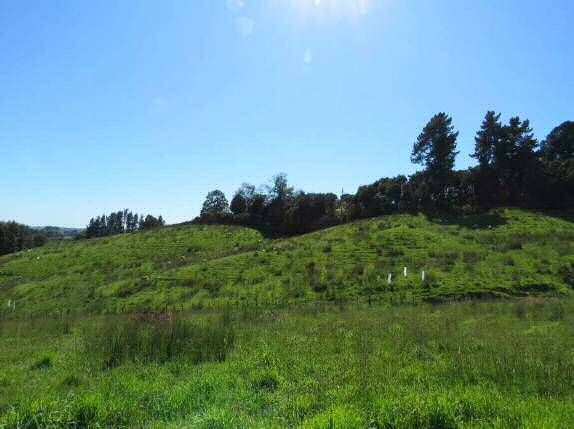
PLANTING AND PLANT MANAGEMENT PLANS

                     Description

Location 1           Riparian Area A on FEP Map, Riparian Stream planting, fenced off, low stream except after
Riparian Stream      heavy rain. Stream runs year round
planting, (Area A)

Area                 870m2
                     Triangle shaped area on either side of stream, between road, neighbours and Stream
                     paddock

Length               Stream length is 44m approx. 2m wide

Fencing              Already fenced from stock with net fencing plus top wire and outrigger, gate for access

Number of plants     Planting density 1.5 m spacing No. plants = (870)/2.25 =387 plants,

Plant species        Natives and 7 Tagasate;
                     40 carex secta, 35 carex geminata, 40 carex varigata, 17 toe toe, 25 swamp coprosma, 5
                     Kahikatea, 7 ribbonwood
                     Roadside of stream: 10 Wineberry, 7 Kahikatea, 17 Manuka, 15 Kanuka, 11 akeake , 20
                     pittosporums, 15 swamp flax, 7 cabbage trees, 8 lacebark (shaded), 9 Mingimingi, 9
                     Coprosma robusta, 15 hebe,
                     Paddock side: 7 Rimu, 7 Toe toe, 7 akeake, 5 cabbage trees, 11 lacebark, 9 ribbonwood, 15
                     manuka
                     7 x Tagasate are along fenceline to paddock, for shade and fodder. 3 trees already planted
                     2019.

Plant management     Clear large weed foliage at least 6 weeks before (e.g. broom and gorse)
plan                 Put out stakes and spot spray 6weeks before. Plant May-to June, include slow release
                     fertiliser. Spray release if required over summer every 8 weeks and then at start of following
                     summer. Water over summer if needed. Keep grass down around plants. Remove covers 1-2
                     years after planting. Monitor for damage by hares, rabbits, pukeko and if needed action as
                     appropriate
                     Tagasate are along fenceline to paddock, for shade and fodder. 3 trees already planted 2019

                     Description

Location 2           Wetland Area in Hill Area C on FEP map, contains a small pond, (source spring?) that currently
Wetland Area,        dries up in the dry summer months, Unfenced.
(Hill Area C)        Very wet area over 2/3rd year with surrounding ground water logged

Area                 pond is approx. 30m2, Area to fence 280m2, area for planting 250m2

Fence                Needs fencing

Number of plants     Planting density 1.5 m spacing No. plants = 250/2.25 =111 plants,

Plant species        Natives and 3 Willow poles
                     15 carex secta, 15 carex varigata , 15 toe toe, , 8 swamp coprosma,

                                                                                                   FEP Template       4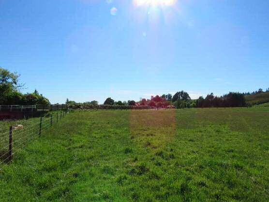
5 Flax, 5 lemonwood, 5 ribbonwood, 7 Kahikatea, 3 Mingimingi, 5 wineberry,
                   Above: 5 Kanuka, 5 manuka, 3 totara, 5 akeake, 7 cabbage trees, 3 lacebarks

                   3 Willow poles on erosion area where a secondary critical source starts

Plant management   Fence area (include gate)
plan               Put out sakes and spot spray 6-8 weeks prior to planting. Plant in winter adding a slow
                   release fertiliser and a cover.
                   Monitor for water requirements and pests
                   Spray release if required when grass gets too long.
                   Remove covers once established

                   Description

Location 3         FEP Map, Eroding Gully in Hill Area D.
Eroding Gully,     Poles required, no fencing
(Hill Area D)

Area               Along a gully, total gully area is 3250m2

Number of plants   17 Poplar Poles and 6 Willow poles

Plant species      8 Poplar for within gully (moist, protected), Pakai, Kawa, Tasman, 9 poplars for drier windier
                   areas of gully area, Kilmog, Argyle, Veronese
                   Willows Tangolo and Kinuvanagi

Plant management   Plant poplars throughout gully in base and up the sides. At lower end where it spreads out
plan               and the surrounding areas gets water clogged to plant willows.
                   If available winter 2020 plant (otherwise winter 2021) in groups of three opposite each
                   other from 5-10 apart depending on place in gully.
                   Protect from sheep with guards
                   Re-ram the poles mid-summer
                   Reduce to single leader 2 years later and prune branches (to 4m) every 3 years

                   Description

Location 4         Hill Area C on FEP Map; South West area on boundary where water source comes from
Ditch stability    neighbour
(Hill Area C)      Steep incline and drainage ditch stability, Poles only, no fencing required

Area               Steep Incline requiring stability approx. 80m2
                   Drainage area/stability approx. 230m2

Number of plants   17 Poles
                   5 Poplar that resistant wind and drought; Veronese, Kilmog, Argyle
                   7 Poplar better with moisture; Pakai, Toa, Kawa
                   5 Willows; Tangolo, Kinuyanagi, Musk Willow

Plant management   Plant poplars in base and lower sides of steep incline, 5m apart.
plan               Plant Poplars and Willows in groups of 3 across base of hills on either side of water course.
                   If available winter 2020 plant (otherwise winter 2021), protect from sheep with guards
                   Re-ram the poles mid-summer;
                   Reduce to single leader 2 years later and prune branches (to 4m) every 3 years

                                                                                                  FEP Template      5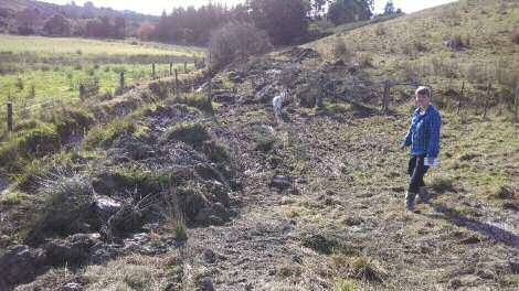
Description

Location 5           West corner of Hill Area A on FEP Map
West corner Hill     Steep Area and Gully, poles + Native trees, no fencing
Area A

Area                 Two sides of erosion gully (east and west), poles on one side, poles + natives on other

Number of plants     15 plants, 8 poles and 7 natives

Plant species        8 Poplar poles; Veronese, Kilmog, Argyle or Tasman
                     7 Natives; Lancewood, Ribbonwood, Rimu, kaikomako, Silver Beech

Plant management     If available winter 2020 plant (otherwise winter 2021), protect from sheep with guards and
plan                 temporary fencing around natives if required.
                     Plant poplars in base and lower sides of west steep incline, 3m apart.
                     Plant Poplars and Natives in groups of 3 across base gully and up on ridges on east side.
                     Re-ram the poles mid-summer;
                     Reduce to single leader 2 years later and prune branches (to 4m) every 3 years, prune natives
                     if required
                     Spot spray if required.

                     Description

Shade Tree Belts     None of the flat paddocks have shelter/shade for stock, two paddocks have wet areas where
Flat Area A, B & C   water collects at certain times of the years

Area                 6 areas of shelter, 4 areas are a line of trees (5-7 trees each) along or near fence lines. The
                     other two areas are of 3 trees(willows) each in a group.

Number of plants     Approx. 26

Plant species        Quick growing trees mixed in with sturdy longer lasting trees as there is no shade at present.
                     Tagaste, Willow, Poplar, Pear, Apple, hazelnuts, mulberry, elm or others as available

Plant management     8x Tagaste already planted. Willows in two groups of 3 for shade and also moisture
plan                 retention, low critical sources areas of paddocks _may also set up one in each group to
                     pollard.
                     Trees planted in winter as sourced, areas temporary fenced off the stock.
                     Trees re-ramed and/ or pruned as per individual tree requirements
                     Spot spray areas to keep pasture grass down, area monitored for damage by rabbits and
                     hares.

ACTION TABLE

                                                                                                       FEP Template    6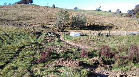
Issue Actions and Dates Priority
2018 1
Area fenced off from stock
2020
FEP Map, Remove large pest plant from area
Riparian Stream Request plants from Moutere catchment area, hopefully 250
(Riparian Area A) Spot spray areas to plant
Plant allocated tress with guards etc
2021
Request second allocation of plants
Plant and maintain all current and past plantings
Poles required, no Reduce erosion by planting poles. 2
fencing 2020
Contacted council to see if had poles available (July 2020),
Eroding Gully indicated there may be limited poles this year but definitely on list
(Hill Area D) for next year.
Plant any Poplar poles allocated (potentially Kawa, which will be
AND planted in more moist areas)
Re ram Poles December 2020.
Steep hill and 2021
drainage ditch Reduce planted poles to a single leader 2021
stability Plant new allocation of poles
(Hill Area C) 2022 onwards
Maintenance of trees by reducing to single leaders and prune as
AND years go on.
Steep Area and Acquire more poles until suffice on the areas
Gully (Hill Area A,
west corner)
2020 4
Carefully map out exact area.
FEP Map Source funding for fencing (TDC/ Landowner)
Wetland Area, 2021
(Hill Area C) Fence area and do any large works required (ie digger if
required)
Source plants from TDC or another local nursery
2021-2022
Plant out
Spray and maintain
2020 3
Some areas are already fenced off with Tagaste planted in 2019
Shade Tree Belts growing.
Flat Area A, B & C May 2020, tagasate seeds sown from local tree to plant out in
2021.
Request Willow poles from TDC for planting in two paddocks,
plant out when receive (2020 or 2021)
2020-2024
Fence of new areas for planting
Source pear, apple, hazelnuts, mulberry, elm or other trees
from local areas to grow to size and plant out
Maintenance of trees already planted
FEP Template 7 Once well-established remove temporary fences.
FEP Template 8BEFORE AND AFTER PHOTOS
Overgrown, ditches with a right-angle turn, flooding debris through gate. 2018
After digger has reshaped waterways to follow more natural flow
View through olive trees of ditch 6 month later
FEP Template 9Stream fenced off from paddock (left)
Poles planted 2018
Left is the small pond area to be turned into wetland. Right is Hill area D at base where culverts still to be placed and
then planting poles up the gully
FEP Template 10You can also read


