REGIONAL MODE SHIFT PLAN BAY OF PLENTY - Keeping our region and our people moving - Western ...
←
→
Page content transcription
If your browser does not render page correctly, please read the page content below
REGIONAL MODE SHIFT PLAN
BAY OF PLENTY

Keeping our region and our people moving

                                           F T
                                 R A
                      D
Waka Kotahi NZ Transport Agency
Published July 2020 | 20-228
NZBN: 9429041910085
ISBN XXX (print)
ISBN XXX (online)
Copyright: July 2020
Waka Kotahi NZ Transport Agency
CONTENTS
 1.0 INTRODUCTION								4

 2.0 BAY OF PLENTY CONTEXT						5

 3.0 DEVELOPING THE REGIONAL MODE SHIFT PLAN			    9

 4.0 IMPLEMENTATION								12

 5.0 FUNDING									15

 6.0 MEASURING PROGRESS							15

 7.0 WESTERN BAY OF PLENTY SUBREGION 				          17

 8.0 WHAT HAVE PEOPLE AND COMMUNITIES TOLD US		   20

 9.0 C
      OLLECTIVE CHALLENGES AND BENEFITS				       21

 10.0 THE FORWARD PLAN 							23

 11.0 ROTORUA LAKES SUBREGION						39

 12.0 EASTERN BAY OF PLENTY SUBREGION				          42

 13.0 SUPPORTING DOCUMENTATION					43

 14.0 OTHER SUPPORTING REFERENCES					             51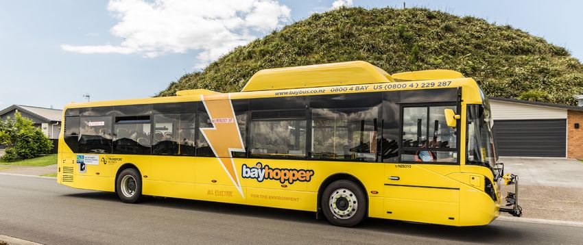
4   Waka Kotahi         Regional mode shift plans BAY OF PLENTY 2020

1.0 INTRODUCTION

Moving people and goods efficiently, safely, reliably, and affordably is
essential to the success of any region, city or neighbourhood.

The Bay of Plenty region has long been desirable for both population immigration (national
and international) and economic growth. Together, the Auckland, Northland, Waikato, and
Bay of Plenty regions are responsible for generating more than half of New Zealand’s GDP,
housing more than half of New Zealand’s population and providing for the movement of more
than half of New Zealand’s people and freight.
This continuous growth has resulted in increased demand for travel that is beginning to
significantly impact on core parts of the regions transport system, resulting in longer travel
times, less reliable trips and capacity and service level issues which have not kept up with the
demands of a growing economy.
The relationship of shaping good urban form supported by a well-integrated transport system
is inextricably inter-linked. Strong cities are built on the movement of people and goods so it
is essential that in any urban planning process, the role of the transport system, in achieving
the urban form outcomes, is clearly articulated.
Moving people differently via mode shift from private vehicles (public transport, cycling,
walking, micro-mobility) has become a significant priority for the region. Especially within the
key urban centres and critical intra-regional connections.
Mode shift is a key national priority, as outlined in the Government Policy Statement for Land
Transport. Keeping Cities Moving, the Waka Kotahi NZ Transport Agency’s National Mode
Shift Plan aims to “increase the wellbeing of New Zealand’s cities by growing the share of
travel by public transport, walking and cycling”.
The Plan focuses on three intervention areas including:
1. Shaping urban form
2. Making shared and active modes more attractive
3. Influencing travel demand and transport choices
Keeping Our Region and People Moving is the Bay of Plenty’s response to the National Mode
Shift Plan. This Regional Mode Shift Plan outlines the collective challenges, benefits and
emerging priorities to limit the regions private vehicle dependency and achieve the following
mode shift objectives:
• Increased travel choice and affordable access for all ages and abilities
• Improved safety for all transport users and modes
• Improved environmental and health impacts including reduction in transport emissions;
  and increased healthy activities
• Improved access to employment, resulting in increased economic productivity
• Improved urban form and amenity, including increased vibrancy and activity
• Improved return on investment including optimisation of the transport system
This Regional Mode Shift Plan builds on significant previous work and is structured with three
distinct sections for each of the Bay of Plenty subregions.
The Bay of Plenty lies in the north-east of the upper North Island where much of the nation’s
Regional mode shift plans BAY OF PLENTY 2020 Waka Kotahi 5
2.0 BAY OF PLENTY CONTEXT
economic and population growth is occurring.
Parts of the region have been experiencing rapid growth for decades which in turn has
resulted in increased demand for travel that is beginning to significantly impact on core
parts of the regions’ transport system. The Bay of Plenty is also a critical tourist destination
with significant cruise ships visiting via Tauranga harbour, linking to key destinations in both
Rotorua and the eastern Bay of Plenty.
The Bay of Plenty is made up of three distinct subregions:
1. Western Bay of Plenty (Tauranga City, Western BoP District)
2. Rotorua Lakes (Rotorua District)
3. Eastern Bay of Plenty (Whakatane, Kawerau, Opotiki Districts)
The western Bay of Plenty plays a key role in the upper North Island as well as critical road
and rail connections to central and wider New Zealand. It is home to the country’s largest
export port, and the subregion’s productive rural and horticultural land resource is a major
contributor to the economy.
Tauranga city is one of the fastest growing urban centres in New Zealand. Nearly 90% of
journeys to work in Tauranga are taken by private vehicles.1 This is a critical challenge for this
part of the region where mode shift is most necessary and where the greatest benefits can be
realised.
The new University of Waikato campus in Tauranga City has been a great addition to the
region. The increase in educational opportunities has resulted in an increased demand for
intra-regional access to the campus facilities. This is often by younger people who do not have
access to private vehicles or other affordable travel options.
Public transport services are delivered throughout the region through urban services in
Tauranga, Rotorua, and Whakatane, supported by intra-regional services between the regions
key centres. School Hopper services are also operated throughout the region. There are
also important inter-regional connections, serviced by commercial bus services, including
Hamilton, Auckland and wider upper and central New Zealand.
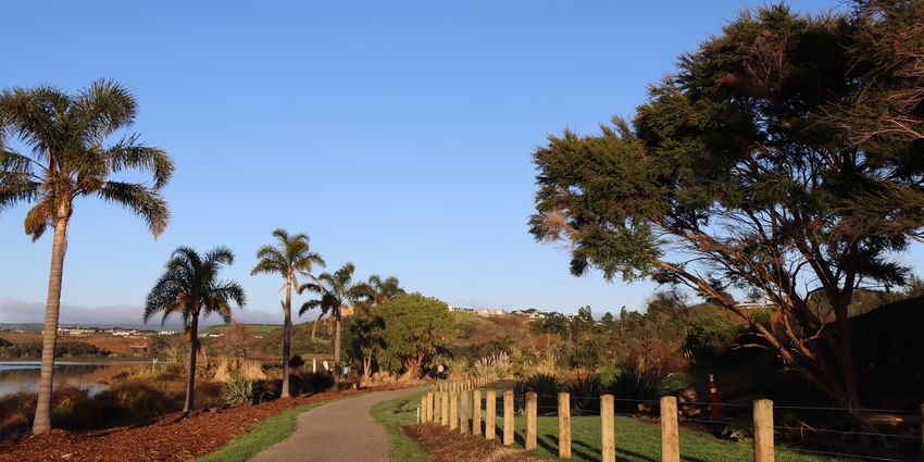
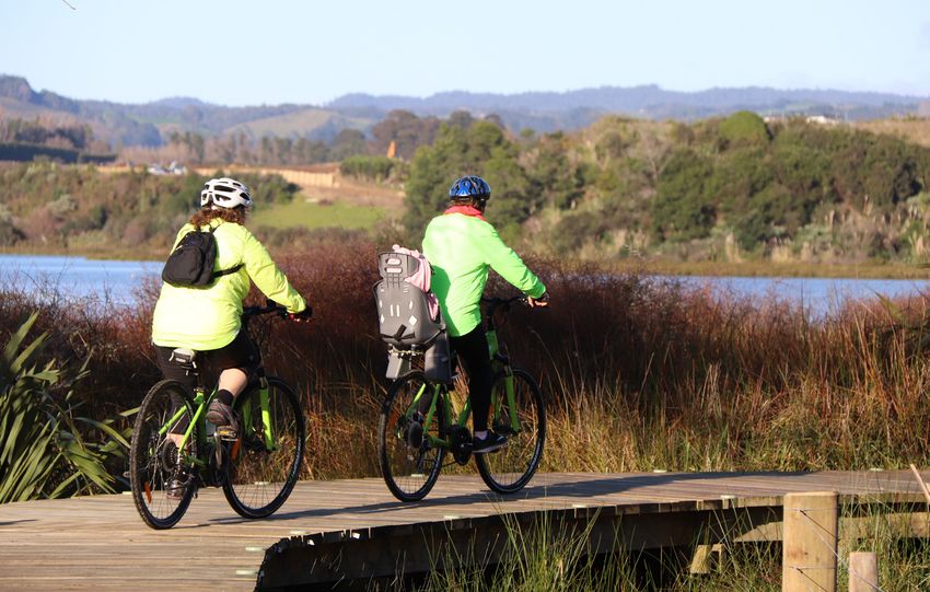
Walking and cycling has been a key focus for the region, with significant investment made
through a number of plans, strategies, and projects. This has seen a strong incremental
increase in mode shift activity across both urban and rural communities.
The connections between key centres in the region is important. With increased growth in
both the west and east of the western bay subregion, as well as the possible increase in house
prices, might see more opportunities of intra-regional travel for employment between places
such as Rotorua and Tauranga.
While Covid-19 will have short to medium term impacts on population growth, economic
growth and tourism, in the longer term, the Bay of Plenty is expected to continue to be one of
the fastest growing regions, playing a critical role in the success of New Zealand.
2.1 IMPORTANCE OF MODE SHIFT
The effective movement of people and goods delivers multiple social, economic, and
environmental benefits. Increasing the share of travel by public transport, walking and cycling
and reducing dependency on private vehicles, not only creates healthier and safer people
1. Waka Kotahi NZ
and communities but supports greater access to social services, employment, education and
Transport Agency
recreation. It can also optimise the use of the current transport system, reducing the need for Arataki, 2020
6   Waka Kotahi                     Regional mode shift plans BAY OF PLENTY 2020

investment in costly new infrastructure.
With parts of the region experiencing rapid population and economic growth, and the region having
one of the highest private vehicle use rates in the country, improved mode shift can help manage
and optimise towards a more balanced strategic transport system.
Many parts of the region’s communities do not have access to a private vehicle or to affordable
travel choices. It is important that a suite of multi-modal options is available to ensure there is
equal access to social and employment opportunities that in turn increases community prosperity
and wellbeing.
With transport emissions making up a significant part of the region’s greenhouse gases, as well as
transport related impacts on noise and air quality, an increase in mode shift can also support a more
environmentally focused approach to travel and in doing so reduce these emissions over time.
All of the Plans outlined in this Report clearly state the need to reduce the regions reliance on
private vehicles, improve connectivity of people, goods and services and deliver a more balanced
multi-modal transport system that supports the region’s diverse needs and expectations.

2.2         REGIONAL DATA SNAPSHOT
FIGURE 1: ARATAKI (WAKA KOTAHI): REGIONAL SUMMARY BAY OF PLENTY REGION

                                                     WAIHI KEY                                    308,499
                                                                                                  REGIONAL
                                                             TAURANGA                             POPULATION17

                                                                        WHAKATANE
                                                                                                  15.2%
                                                                                                  POPULATION
                                                                                                            REGIONAL

                                                                             OPOTIKI              GROWTH
                                                                                                  2013-1817
                                                   ROTORUA
                                                                      KAWERAU
          IMPROVE URBAN FORM
      The population of the western Bay of
                                                                                                  6.6%   OF NATIONAL
                                                                                                  POPULATION17
      Plenty sub-region (Tauranga and Western                                                     2018

      Bay of Plenty) is projected to grow from
      190,000 to 260,000 over the next 50
      years, requiring 51,000 new homes. 80%                                                      5.8%
                                                                                                  DEATHS
                                                                                                          OF NATIONAL

      of this growth is expected in Tauranga
                                                                                                  & SERIOUS
      city.47 Rotorua is expected to receive                                                      INJURIES (DSI)36
      moderate levels of growth over the
      coming decade.                                                                              175      TOTAL DSI36
                                                                                                  ANNUAL AVERAGE
                                                                                                  FOR PERIOD 2016–19

           TRANSFORM URBAN MOBILITY
      The Tauranga urban area is one of the
                                                             TACKLE CLIMATE CHANGE
                                                        Sea level rise and extreme weather will
                                                                                                  7%
                                                                                                  VEHICLE
                                                                                                         OF NATIONAL

      fastest growing urban centres in New              impact the region.                        EMISSIONS37
      Zealand. Nearly 90% of journeys to work
      in Tauranga and Rotorua are taken by
      private vehicle.40
                                                            SUPPORT REGIONAL
                                                                                                  5.6%
                                                                                                  GROSS
                                                                                                         OF NATIONAL

                                                        DEVELOPMENT                               DOMESTIC
                                                                                                  PRODUCT
                                                        Bay of Plenty has some communities        YEAR END
           SIGNIFICANTLY REDUCE HARMS                   with high levels of deprivation and       MARCH
                                                                                                  201818

                                                                                                  4.2%
      Bay of Plenty has a relatively poor safety        unemployment. Access to education,
      record with issues around speeding,               healthcare and employment must                    REGIONAL
      alcohol, drug impairment, people                  improve, particularly in the east and     UNEMPLOYMENT
      not wearing seat belts and run-off                south of the region, to deliver better    RATE
      road crashes.36                                   social and economic outcomes.
                                                                                                  4.1%
                                                                                                  YEAR
                                                                                                        NATIONAL RATE

                                                                                                  END JUNE
                                                                                                  201916
Regional mode shift plans BAY OF PLENTY 2020   Waka Kotahi   7

FIGURE 2: BOP REGIONAL LAND TRANSPORT PLAN ANNUAL REPORT CARD 2018/19

FIGURE 3: STATISTICS NZ CENSUS DATA 2018
8   Waka Kotahi         Regional mode shift plans BAY OF PLENTY 2020

2.3     REGIONAL FREIGHT FLOWS IN THE BAY OF PLENTY
Increased mode shift and a significant change in the way people chose to travel, away from
the private vehicle, can help increase economic productivity.
Mode shift plays an important role in the efficient movement of freight. Freeing up road space
allows freight and people movements, that do not have access to alternative transport options,
to achieve a more efficient and reliable journey.
The ability to generate economic productivity and regional prosperity relies on being able to
move freight efficiently, reliably, and safely through the transport system. This is especially
challenging in high growth urban areas where there is significant demand for competing
modes and trips within the same routes and often at the same time.
The Bay of Plenty region contributed $15.8 billion to the economy in 2018, equating to 5.6% of
national GDP. The region is home to the Port of Tauranga, New Zealand’s largest export port,
which handles 30% of the country’s imports and exports by volume. 83% of the country’s
kiwifruit production is in the Bay of Plenty region2 , where it travels via the local roads to
packhouses then onto the Port of Tauranga via the state highway network.
The Port is a key connection between the upper North Island, central New Zealand, and
international markets, and transports significant volumes of product internally via rail and
road3. The high movement of freight via rail, to and from the Port on both sides of the harbour,
helps reduce the number of heavy vehicles travelling to, from and through the city.
Population growth, the continued level of industry planning and development within the
Auckland–Hamilton–Tauranga triangle, and the recent funding investment through the
Provincial Growth Fund (PGF) and related government programmes, all signal continued
growth in freight flows for the region4.
With the projected growth in freight for the region and need to access to the Port and key
surrounding industrial and commercial centres, comes an increased demand for road space.
It is important that strategic transport routes are optimised to ensure that the best use of the
transport system is being achieved, ie right mode/s, on the right route at the right time.

MAP 1: PROJECTED TRAFFIC FLOWS 2043 - UFTI REGIONAL FREIGHT FLOWS REPORT 2019

                                                                                                   2. Bay of Plenty
                                                                                                       Passenger and Freight
                                                                                                       Rail Investigation May
                                                                                                       2019
                                                                                                   3. This plan does not
                                                                                                       include commentary
                                                                                                       on shifting freight
                                                                                                       movements from road
                                                                                                       to rail
                                                                                                   4. UFTI Bay of Plenty
                                                                                                       Regional Freight Flows
                                                                                                       Report 2019
Regional mode shift plans BAY OF PLENTY 2020               Waka Kotahi   9

3.0 DEVELOPING THE REGIONAL
MODE SHIFT PLAN
3.1     STRATEGIC DIRECTION
3.1.1 Government Policy Statement on Land Transport (GPS)
The Government Policy Statement on Land Transport (GPS) sets out the government’s
priorities for expenditure from the National Land Transport Fund (NLTF) over a ten year
period.
The draft GPS 20215, builds on the foundation of the 2018 GPS with increased focus on
providing people with better transport options to access social and economic opportunities
and delivering highly liveable cities and towns that are people-friendly with healthy
environments that improve wellbeing and economic prosperity
Safety and access are key strategic priorities for the Government and reflect the transport
system that they desire. The GPS signals a shift in government focus towards a more mode
neutral approach to transport planning and investment.
This mode shift plan provides direction for the next Regional Land Transport Plan and National
Land Transport Programme planning period, which will be guided by the GPS 2021.

3.1.2 Draft New Zealand Rail Plan
The draft New Zealand Rail Plan outlines the government’s vision and priorities for rail. The
Plan looks to provide modern transit systems in NZ’s largest cities and enable increasing
volumes of freight to be moved off roads and onto rail. The government’s key objectives are to
reduce carbon emissions, congestion and deaths and serious injuries, as well as delivering jobs
and economic development to cities and regions.

3.1.3 Keeping Cities Moving7
Waka Kotahi NZ Transport Agency has also developed a national Mode Shift Plan “Keeping
Cities Moving”.
The Plan’s objective is to increase the wellbeing of New Zealand’s cities by growing the share
of travel by public transport, walking and cycling.
The three focus areas outlined to support this include:
1. Shaping urban form – Encouraging good quality, compact, mixed-use urban development
will result in densities that can support rapid/frequent transit (and vice versa); shorter
trips between home and work/education/leisure; and safe, healthy and attractive urban
environments to encourage more walking and cycling.
                                                                                                             5. https://www.transport.
2. Making shared and active modes more attractive – Improving the quality, quantity and                          govt.nz/assets/
performance of public transport facilities and services, and walking and cycling facilities, will                Import/Uploads/Our-
                                                                                                                 Work/Documents/
enable more people to use them. This can involve both optimising the existing system (for
                                                                                                                 draft-government-
example, through reallocating road space), investment in new infrastructure and services, and                    policy-statement-land-
providing better connections between modes.                                                                      transport-2021.pdf

3. Influencing travel demand and transport choices – Changing behaviour may also require                     6. https://www.transport.
                                                                                                                 govt.nz/assets/
a mix of incentives and disincentives (or ‘push’ and ‘pull’ factors) to either discourage use of                 Import/Uploads/Rail/
private vehicles (by making them less attractive relative to other options) or making people                     The-Draft-NZ-Rail-
more aware of their options and incentivising them to try something new. This may include                        Plan-December-19.pdf
parking policies, road pricing, travel planning and education.                                               7. https://www.nzta.govt.
                                                                                                                  nz/assets/resources/
                                                                                                                  keeping-cities-moving/
                                                                                                                  Keeping-cities-moving.
                                                                                                                  pdf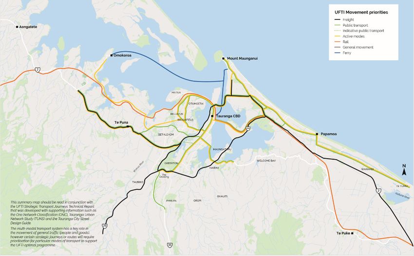
10 Waka Kotahi          Regional mode shift plans BAY OF PLENTY 2020

3.1.4 Arataki8
Arataki is Waka Kotahi NZ Transport Agency’s plan to deliver on the government’s
objectives for the land transport system. It helps guide planning and investment and
more effective partnerships with councils and others to achieve better outcomes for New
Zealand.
Arataki includes five key step changes (over maintaining base levels of service) to meet the
government’s short-term priorities and long-term outcomes.
One of these, Transform Urban Mobility, is focused on shifting from reliance on single
occupancy vehicles to more sustainable transport solutions for the movement of people
and freight.
This step change is relevant to the six major urban growth areas of Auckland, Hamilton,
Tauranga, Wellington, Christchurch and Queenstown where there are current opportunities
to respond to growth and align urban development and land transport.

3.1.5 Arataki Regional Summary: Bay of Plenty9
Waka Kotahi’s Arataki Ten Year Plan includes a regional summary of the Bay of Plenty.
This evidence set shows that
• Tauranga risks an increased dependence on private vehicles and carbon emissions if the
  existing growth patterns of low-density housing and development around the city’s edge
  is not addressed
• maintaining safe and reliable connections to the Port of Tauranga is critical to supporting
  both the regional and national economies
• land use and the land transport system need to cater for the high proportion (39%) of
  Tauranga’s population that is projected to be over 65 years by 2050
• a focus on safety is needed in the Tauranga, Rotorua and Whakatane urban areas
• regional economic growth, particularly in the south and east of the region, is reliant on
  improved access to employment and essential services for remote communities.

3.1.6 Toitu Te Taiao Sustainability Action Plan 202010
Waka Kotahi NZ Transport Agency launched their Sustainability Action Plan in April 2020
which sets out their commitment to environmental sustainability and public health in the
land transport sector. The overall vision is for a ‘low carbon, safe and heathy land transport
system’.
                                                                                                 8. https://www.nzta.
This vision includes:                                                                                govt.nz/planning-and-
                                                                                                     investment/planning/
• a sustainable, multi-modal land transport system where public transport, active or shared          arataki
  modes are the first choice for most daily transport needs                                      9. https://www.nzta.govt.
• towns and cities are re-shaped to reduce reliance on cars and support active, healthy and          nz/assets/planning-
                                                                                                     and-investment/
  shared transport choices
                                                                                                     docs/arataki/
• where people and business require motorised travel, it is low carbon, safe and efficient.          regional-summary-
                                                                                                     bay-of-plenty-
The Action Plan outlines the key steps and levers the Transport Agency will use and                  december-2019.pdf
influence to deliver on reducing transport greenhouse gas emissions; tackle climate change;
                                                                                                 10. https://www.nzta.
support the transition to a low emission economy; and improve public health.                          govt.nz/assets/
                                                                                                      About-us/docs/
                                                                                                      sustainability-action-
                                                                                                      plan-april-2020.pdf
Regional mode shift plans BAY OF PLENTY 2020 Waka Kotahi 11 3.1.7 National Policy Statement – Urban Development A National Policy Statement on urban development (NPS-UD) is currently being developed by the Ministry of the Environment. The NPS-UD recognises the importance of productive and well-functioning cities and understands the importance of planning for urban environments especially in those areas that are experiencing the most significant growth. The relationship of shaping good urban form and a supporting transport system is inextricably inter-linked. Strong cities are built on the movement of people and goods so it is essential that in any urban planning process, the role of the transport system in achieving this is clearly articulated. The NPS-UD will contain national level objectives and policies that local government needs to address through their resource management planning and decisions. The NPS-UD is still in development, SmartGrowth local government partners are currently working with ministry officials on the further drafting of the NPS. 3.1.8 Regional Land Transport Plan (RLTP) 2018 The Bay of Plenty Regional Land Transport Plan (RLTP) was adopted in June 2018. The RLTP sets the direction for the region’s land transport system for the next 30 years with an overall vision to deliver “best transport systems for a growing economy and a safe, healthy and vibrant Bay lifestyle for all”. Urban public transport networks in Tauranga and Rotorua provide an important transport option for commuting, education, recreation, and general transport needs. However, parts of the region are experiencing rapid population growth which is leading to increased demand for travel that is in turn impacting on the public transport service levels achieved on the network. Public transport travel time reliability is decreasing as congestion worsens at key pinch points across the network. Walking and cycling are essential transport options for short to medium length commuter and other journeys in urban areas. These modes also serve recreational and tourism functions, and can contribute to a healthier population, resulting in positive economic and public health outcomes for the Bay of Plenty. 3.1.9 Regional Public Transport Plan (RPTP) 2018 The Regional Public Transport Plan (RPTP) provides guidance and policies that direct the investment in public transport across the Bay of Plenty region. It encourages councils and public transport operators to work together in developing public transport services and infrastructure. The RPTP is guided by policy and strategy set within the national context by the Government Policy Statement on Transport and within the Bay of Plenty’s Regional Land Transport Plan. These documents provide clear direction for investment and policy setting within the public transport context for the Region.
12 Waka Kotahi        Regional mode shift plans BAY OF PLENTY 2020

4.0              IMPLEMENTATION

This Plan is made up of three subregional plans, that together, form the mode shift plan
for the Bay of Plenty region. At June 2020, the Western Bay of Plenty section has been
completed, with the Rotorua Lakes and Eastern Bay sections being undertaken in the next
6-9 months.

                              Bay of Plenty mode shift plan
                               Keeping our region and our
                                     people moving

  Western Bay of Plenty                  Rotorua Lakes               Eastern Bay of Plenty
   subregional plan                     subregional plan               subregional plan

4.1     WESTERN BAY OF PLENTY SUBREGION
The Western Bay of Plenty mode shift plan’s actions are outlined below. Some of these
actions are already within partner council plans and funding programmes while others are
new and therefore require further development.

  SHAPING A           • EEmbed the Urban Form and Transport Initiative (UFTI) through
  SUPPORTIVE             the SmartGrowth Joint Spatial Plan.
  URBAN FORM
                      • Deliver joined up implementation frameworks to give effect
  Short-term
                         to UFTI including the Western Bay Transport System Plan
  priorities
  (1–5 years)            (including Stage 1 System Operating Framework, and later
                         ‘still to be identified business case activities), and wider public
  MAKING SHARED          transport
                      Providing       network
                                   more        reviews.
                                         transport  choice means a greater range of
  AND ACTIVE          alternative
                      • Ensure new  travel options is include
                                        subdivisions  availablesupporting
                                                                in the faceinfrastructure
                                                                            of short- and long-
  MODES MORE          term
                         fordisruption    to the transport
                              public transport,            system.
                                                  and connected   pathways and cycleways
  ATTRACTIVE
                         between streets and neighbouring communities, centres,
  Short term             destinations and public transport routes, to support early uptake
  priorities
  (1-5yrs)
                         of mode shift.
                      • Ensure existing and new commercial and retail centres are
                        designed to support mode shift including efficient operation of
                        public transport services into and around centres.
                      • Complete structure planning and/or business cases for key
                        growth areas including Omokoroa Stage 3 and Tauriko West that
                        include development of an integrated package of multimodal
                        transport and land use interventions to support mode shift by
                        optimising walking, cycling and public transport access.
                      • Commence implementation of the Te Papa Spatial Plan and
                        Indicative Business Case and the Cameron Road multi-modal
                        programme.
                      • Complete the Intensification Plan Change 26, to enable higher
                        density developments and as a result deliver a strong policy to
                        support mode shift.
Regional mode shift plans BAY OF PLENTY 2020 Waka Kotahi 13
MAKING SHARED • SmartGrowth partners to develop a joint engagement and
AND ACTIVE communications strategy and plan to support working closely
MODES MORE with local communities to increase understanding and gain
ATTRACTIVE
support for implementing mode shift (services and amenities)
Short term for local neighbourhoods.
priorities
(1-5yrs) • SmartGrowth partners to investigate a joint approach to
planning, designing, and delivering the subregion’s public
transport activity.
• Review the Regional Public Transport Plan and WBoP Public
Transport Blueprint to strengthen the commitment to public
transport as a key element of the subregion’s mode shift
strategy.
• Develop and undertake a Western Bay of Plenty Public Transport
Implementation Plan to give effect to the UFTI optimal
programme and associated SmartGrowth Joint Spatial Plan
initiatives.
• Further develop the Tauranga Walking and Cycling Business
Case and implement the Tauranga Cycle Plan and draft Western
Bay of Plenty Walking and Cycling Action Plan and develop a
(partner shared) coordinated implementation plan to deliver
connected cycleways and pathways on the identified priority
routes across the subregion.
• Implement the Cameron Road Multi-Modal Study interventions
to increase mode shift along the corridor.
• Continue to work with schools and local cycling groups to
ascertain the best mix of interventions including education to
address safety concerns and perceptions for cycling.
INFLUENCING • Encourage new commercial and/or industrial developments (of
TRAVEL scale) to develop travel demand management plans to support
DEMAND AND the movement of people and goods.
TRANSPORT
CHOICE • Complete the Tauranga City Parking Policy review and the
Short term Western Bay of Plenty public transport fares review and ensure
priorities (1-5yrs) the policies give effect to the subregion’s mode shift objectives,
including good alignment and supporting rules and regulations
across the two policies.
• Investigate how resource management conditions and/or
processes can support the quicker and easier delivery of mode
shift facilities in local communities.
• Complete travel demand packages for Te Tumu and Tauriko
West.14 Waka Kotahi Regional mode shift plans BAY OF PLENTY 2020 4.2 ROTORUA LAKES SUBREGION This section to be completed following development of the Rotorua Lakes Mode Shift Plan. SHAPING A SUPPORTIVE URBAN FORM Short-term priorities (1–5 years) MAKING SHARED AND ACTIVE MODES MORE ATTRACTIVE Short term priorities (1-5yrs) INFLUENCING TRAVEL DEMAND AND TRANSPORT CHOICE Short term priorities (1-5yrs) 4.3 EASTERN BAY OF PLENTY SUBREGION This section to be completed following development of the Eastern Bay of Plenty Mode Shift Plan. SHAPING A SUPPORTIVE URBAN FORM Short-term priorities (1–5 years) MAKING SHARED AND ACTIVE MODES MORE ATTRACTIVE Short term priorities (1-5yrs) INFLUENCING TRAVEL DEMAND AND TRANSPORT CHOICE Short term priorities (1-5yrs)
Regional mode shift plans BAY OF PLENTY 2020   Waka Kotahi   15

5.0             FUNDING
Funding of transport initiatives at a national level are reviewed and planned for every
three years through the National Land Transport Programme. The government provides a
dedicated fund, the National Land Transport Fund, to support the delivery of land transport
investments. The Government expects the transport sector to supplement and support the
Fund by considering the most appropriate funding and financing options.
This is supported at the regional and local levels via the Regional Land Transport Plan
(undertaken every six years) and Council Long Term Plans (undertaken every three years)
and supporting Annual Plans.
The current National Land Transport Programme is for the 2018-2021 period. A number of
mode shift projects for the region are included in this Programme. It is noted that the entire
national programme is currently constrained, resulting in challenges for councils looking to
accelerate any new investments over the 2020-21 period.
Recently, separate sources of potential funding via the Crown have been established
including Crown Infrastructure Partners (CIP) and the Provincial Growth Fund (PGF). At
a local level Councils are also able to seek development or financial contributions from
developers to support transport initiatives.
The updated Government Policy Statement on Land Transport (GPS) post June 2021 is
intended to signal a greater focus and wider flexibility for further investment in mode shift
priorities. A key investment focus through the GPS is to improve people’s ability to get
to places where they live, work and play and to make sure our major cities have transport
networks that are fit for purpose and fit for the future.
The funding requirements to support mode shift, primarily public transport infrastructure
and services, will be challenging. The Urban Form and Transport Initiative (UFTI) in the
western Bay of Plenty includes a significant mode shift programme to support a step change
in the movement of people. It is going to be important, that all partners, both local, regional,
and national, work together on a coordinated approach in the delivery and funding of future
mode shift initiatives.

6.0		           MEASURING PROGRESS
Monitoring delivery and measuring success of the mode shift objectives and priorities is a
core delivery element of this Plan. This will be undertaken via multiple partner processes as
agreed by each of the subregions.
Examples of these in terms of annual monitoring and reporting include:
• Long Term Plans and Annual Plans
• Regional Land Transport Plan
• National Land Transport Programme
Each of the subregional sections outline the key specific reporting processes.
This Plan does not currently include targets, which may be added over time as wider policy
and strategy work is undertaken at both national and local levels (ie reduction of carbon
emissions).
16 Waka Kotahi   Regional mode shift plans BAY OF PLENTY 2020

         WESTERN
          BAY OF
          PLENTY
        SUBREGION
Regional mode shift plans BAY OF PLENTY 2020 Waka Kotahi 17 7.0 WESTERN BAY OF PLENTY SUBREGION The western Bay of Plenty subregion is one of the fastest growing areas in New Zealand with Tauranga being the country’s fifth largest city. The western bay is currently home to around 140,000 people and is predicted to grow to 270,000 people over the next 30-40 years. This continued growth pattern is resulting in significant pressure on the transport system to move people and goods efficiently, safely, reliably, and affordably. The subregion is also home to a higher proportion of older community members than the national average. It is predicted that over the next 15 years, most of the population growth is expected to be in the 65+ age group13. This means the subregion will have to respond to an ageing population’s needs in terms of travel and accessibility. Successful growth management is a high priority for the community as well as local and central government. SmartGrowth and more recently the Urban Form and Transport Initiative (UFTI) is focused on ensuring there is a coordinated and aligned approach to key housing, transport, and urban development issues across the subregion The western Bay of Plenty plays a key role in the movement of freight of goods to the upper North Island as well as critical connections to central and wider New Zealand. It is home to the country’s largest export port, and the subregion’s productive rural and horticultural land resources. Tauranga has also recently opened the University of Waikato campus within the central business district. The campus, over time, will generate increased demand for students accessing the educational facilities. Car ownership is significantly high in the subregion. Public transport use in Tauranga is the lowest of the six main urban centres in New Zealand. While public transport is available, it is underutilised and makes up approximately 2% of all trips.14 The subregion’s layout and topography with a number of narrow peninsulas and harbour crossings has resulted in key pinch points across the network. This has been exacerbated with ongoing growth, often on the city’s fringes creating a high level of congestion for a city of Tauranga’s size. This has not seen relief, even with the significant roading investment made over the last 20 years. The need to move people and goods differently to achieve wider social, economic, and environmental outcomes is becoming urgent. Evidence shows that delivering compact and active urban forms, increasing densities along key transport corridors, and linking key destinations such as home, work, retail, and recreational activities seamlessly via a multi-modal transport system goes a long way to helping achieve the subregions mode shift objectives. A number of key strategies and plans are either under way or have been recently developed to support this. 13. Urban Form and Transport Initiative (UFTI) Foundation Report 2019 14. Urban Form and Transport Initiative (UFTI) Foundation Report 2019
18 Waka Kotahi           Regional mode shift plans BAY OF PLENTY 2020

7.1       DATA SNAPSHOT

  Tauranga has one of the highest         85% of Tauranga’s population       61% of Tauranga’s emissions
  rates of private vehicle use            is within 5km of a key             are related to transportation.
  among New Zealand cities.               employment area, and 98% are       UFTI WBoP Public Transport
  This reliance on private vehicles       within 10km.                       Modeshift Scenarios Report
  impacts on the high carbon              Tauranga Cycle Plan 2018           2020
  emissions in the city.
  Arataki (Waka Kotahi)

  Tauranga is New Zealand’s               Public transport use in            On average it takes
  fifth largest city. Most of the         Tauranga is the lowest of the      approximately two and a half
  growth to date has been low             six main urban centres in NZ       times longer to travel between
  density housing on the edge of          and walking and cycling is         the CBD and key urban
  the city which typically has high       lower than both Wellington and     locations by bus than by car.
  infrastructure costs and places         Christchurch.                      Western Bay Public Transport
  significant pressure on the             UFTI WBoP Public Transport         Blueprint 2017
  transport network.                      Modeshift Scenarios Report
  Te Papa Spatial Plan                    2020

  Our community demographics              Port of Tauranga is NZ’s biggest   Around a third of residents in
  are changing. We expect to              port in total cargo volume and     Tauranga ride a bike for either
  see a higher proportion of our          container throughput. The Port     transport or leisure purposes.
  population over the age of 65, a        handles 42% of New Zealand’s       Tauranga Cycle Plan 2018
  33% increase by 2033.                   cargo and 43% of exports.
  Western BoP Walking and                 Port of Tauranga presentation
  Cycling Plan (draft)                    2019

  42% of Tauranga’s population            2,700 households in Tauranga       Tauranga has the highest single
  live in the two most deprived           (6.4%) do not have access to       occupancy rate in the country
  quintiles.                              a private vehicle and 41% only     for journey to work in a major
  NZ Index of Deprivation 2013            have access to one vehicle.        city.
                                          Census 2013                        Tauranga Transport
                                                                             Programme 2018
Regional mode shift plans BAY OF PLENTY 2020 Waka Kotahi 19 7.2 CURRENT PLANS AND STRATEGIES Significant strategy, planning and policy work has been undertaken in the western Bay of Plenty to support the delivery of government objectives and community outcomes. The key subregional plans and strategies used to support this Plan include: • SmartGrowth Partnership: Urban Form and Transport Initiative (UFTI) • UFTI WBoP Public Transport Mode Shift Scenarios Technical Report 2020 • UFTI Regional Freight Flows Report 2020 • UFTI Strategic Transport Journeys – Strategic Functions Technical Report 2020 • Western Bay Public Transport Blueprint 2017 • (Draft) Western Bay of Plenty Transport System Plan • Tauranga Cycle Plan 2018 • Tauranga Walking and Cycling Business Case (Accessible Streets Programme) 2020 • (Draft) Western Bay of Plenty Walking and Cycling Action Plan • Te Papa Spatial Planning Framework • Proposed Tauranga City Intensification Plan Change 26 • Key Growth Area Structure Planning • Tauranga City Parking Strategy and Policy Review • Bay of Plenty Public Transport Fare Policy Review • Bay of Plenty Regional Passenger and Freight Rial Investigation 2019 • Tauranga Age-friendly City Strategy 2013-2023 • Today Tomorrow: Transforming Public Transport for Ageing Communities 2019 Further detail on each of these plans, as well as the relevant weblinks, are outlined in section 13.0 Supporting documentation.
20 Waka Kotahi         Regional mode shift plans BAY OF PLENTY 2020

8.0		WHAT HAVE PEOPLE AND
      COMMUNITIES TOLD US
A targeted research report was undertaken as part of the Urban Form and Transport
Initiative (UFTI), to review key community engagement and feedback (primarily over the
last 3-5 years) undertaken by the UFTI partners.
The UFTI Targeted Community Insights Report analysed over 30 recent UFTI partner
processes and documents to better understand what people and communities’ value in
terms of how they like to live, work, play, learn and move.
Documents were selected by UFTI partners as a representation of community insights.
Documents included ranged from community plans and surveys, summaries on
submissions, public feedback and face to face conversations.
The report identified six key themes:
1. Lively and Vibrant Communities for People
2. Communities that Move and are Connected
3. Environmentally Responsive Communities
4. Communities that are Inclusive and Prepared for Growth
5. Healthy, Social and Culturally Supportive Communities
6. Future Focused Communities that Engage with People
Personal Mobility and Transport Mobility were prominent themes throughout all the
documents, with a common thread being the need to better coordinate future development
and transportation solutions.
Summary insights in relation to mode shift included:
• People want more safe, convenient, reliable and accessible transport options.
• Shifting to sustainable modes would help reduce congestion, travel time and future-proof
  the transportation network.
• A compact city that is very walkable and cyclable. The streets are treated as public
  spaces and are actively used.
• Public transport should be affordable, connect rural communities and have priority.
• Mobility can be improved by implementing universal design and enhancing pedestrian
  and cycle connections to neighbourhoods, schools and community hubs.
• Transport infrastructure should be built before development.
• A desire to improve cycling and walking networks to facilitate people using alternative
  modes of transport.
• The need to change the reliance of people in new growth areas on having private vehicles.
• Need to consider the future transport option such as autonomous vehicles and allow for
  specialist corridors in new subdivisions.
• Need for an integrated transport policy that puts people before cars.
Regional mode shift plans BAY OF PLENTY 2020 Waka Kotahi 21
9.0 COLLECTIVE CHALLENGES
AND BENEFITS
The following collective challenges, benefits and resulting priority objectives have been
developed from the multiple partners supporting strategies, plans, polices and regulatory
planning.
9.1 CHALLENGES
There are a number of challenges in achieving the subregion’s mode shift goals.
VEHICLE DEPENDENCY MANAGING GROWTH
• Majority of trips (work, education, and • Subregion is experiencing rapid population
recreation) are taken by private or business growth leading to increased demand for travel.
owned vehicles. • Infrastructure and travel costs are increasing
• Public transport use in Tauranga is the as more relatively low-density development
lowest of the six main urban centres in NZ occurs on the fringes of the city, resulting in
and walking and cycling is lower than both challenges to service less dense populations
Wellington and Christchurch. There is also with high quality public transport options.
a lack of quality public transport and cycling • The need to move more people and goods
facilities. through the same routes results in delays that
• The high level of private vehicle ownership is impacting economic productivity.
and the layout of the subregion, with ongoing • Increased need to locate major centres and
growth, means Tauranga experiences a destinations around existing networks and
surprisingly high level of congestion for its hubs to optimise infrastructure and services.
population, even after substantial roading
• Investment in strategic routes to support
investment over the past 20 years.
competing modes and increased demands is
• At times, other modes are not time or cost often planned for and implemented too late.
competitive to private vehicles.
• The subregion has a large rural area with
a dispersed population and relatively low
densities leading to less opportunity for
transport choice.
• Increased demand is impacting on
environmental outcomes through increased
transport emissions and impacts to noise and
air quality.
SAFETY (INCLUDING COMMUNITY INCLUSIVE ACCESS
PERCEPTION) • Lack of multi-modal connections on strategic
• Active mode use has a high representation in routes linked to main employment and retail/
crashes, caused primarily by other vehicles. recreational destinations.
• Lack of dedicated space and quality facilities • Limited travel choice and options for all ages
within key routes to support safe active mode and abilities.
use. • Lack of equitable access to social and
• Perceptions of cycling safety risks acts as a economic opportunities.
disincentive to the uptake of people who want
to cycle more or try cycling without motor
vehicle conflicts.22 Waka Kotahi Regional mode shift plans BAY OF PLENTY 2020
COMMUNITY BUY IN POLICY INTEGRATION AND
• Acceptance and support for modal shift ALIGNMENT
infrastructure, amenity, and services where it • Current policies favour vehicle dependency
has a local effect on a neighbourhood and/or and single occupancy travel i.e. current City
community i.e. bus shelters, interchanges. Plan requires a minimum car parking rate
• Local community acceptance of a change in • Lack of alignment of transport policy and
use of strategic transport corridors to support land use planning i.e. parking minimum
and benefit the wider subregion i.e. Cameron requirements; travel demand management
Road. plans; land use policy to enable high densities.
• Support for local investment being prioritised • New policies and national guidelines required
to deliver mode shift initiatives. to encourage a consistent approach to
achieving mode shift.
CONFLICTING USE, DEMAND, AND FUNDING
CUSTOMER EXPECTATIONS • Increasing infrastructure costs to manage
• Regional freight task projected to significantly growth is impacting on local authority ability
increase which will compact demand on the to fund.
strategic transport network. • The infancy of micro-mobility in NZ means it
• Public transport services currently focused is challenging to find relevant evidence and
on basic access needs, rather than being a data to support national business case and
competitive alternative to private vehicles. investment objectives and requirements.
• Conflict between freight and people
movements, causing increased travel times
and congestion on critical parts of the
strategic transport network.
• In some cases, there is still a negative image
of travelling by bus, despite significant
improvements.
9.2 BENEFITS
The collective set of benefits listed have been derived from a number of the key supporting
strategies and plans for the subregion, that are also outlined in this Plan.
• INCLUSIVE ACCESS - Increased travel choice; affordable and easy access for all ages and
abilities
• SAFETY (AND PERCEPTION OF SAFETY) - Improved safety for all transport users (public
transport, cycling, walking and micromobility)
• ENVIRONMENT AND HEALTH - Improved environmental impacts (reduction in transport
emissions; increased healthy activities)
• PROSPERITY - Improved access to employment; increased economic productivity
• CONNECTED CENTRES and NEIGHBOURHOODS - Improved urban form and amenity;
improved rural community connection; improved vibrancy and activity
• VALUE FOR MONEY - better business case delivery; improved optimisation of the
transport system.Regional mode shift plans BAY OF PLENTY 2020 Waka Kotahi 23
10.0 THE FORWARD PLAN
The following section is supported by the multiple strategies, plans, policies and
programmes underway or implemented in the subregion.
Keeping Our People and Our Region Moving supports the key focus areas outlined in Waka
Kotahi NZ Transport Agency’s Keeping cities moving (National Mode Shift Plan). Included
under each of these, are the western Bay of Plenty’s subregional priorities for action.
NATIONAL WESTERN BAY OF PLENTY PRIORITY OBJECTIVES
FOCUS AREAS
Shaping a • Enable higher density growth and urban development in areas
supportive connected by the multi-modal strategic transport network to
urban form optimise travel choice and use.
• Plan new growth areas to enable higher densities and a good
urban form with a mix of land use and amenity that supports
high quality frequent public transport, walking and cycling.
• Develop commercial centres and significant public facilities
in areas serviced by high quality rapid and frequent public
transport.
• Ensure the urban form and spatial intent is complemented with
a well-integrated transport system.
Making shared • Work closely with local communities to increase understanding
and active and gain support for implementing mode shift (services and
modes more amenities).
attractive • Improve and expand delivery of high quality rapid and frequent
public transport services.
• Increase access and use of walking, cycling and micro-mobility
through journey planning including the ‘first and last mile’.
• Invest in infrastructure and optimisation measures to make
public transport and other active modes, more attractive and
competitive to the private vehicle.
• Prioritise and invest in key routes, areas, and destinations to
create a network of connected pathways and cycleways, that
feel safe for people of all ages and abilities.
Influencing • Integrate policy and regulations to incentivise and prioritise
travel demand mode shift.
and transport • Ensure travel demand management practices are embedded
choices through development conditions in priority mode shift corridors
and destinations.
• Make it safe and easy for people to access options to encourage
a change in the way people travel.24 Waka Kotahi Regional mode shift plans BAY OF PLENTY 2020
10.1 SHAPING A SUPPORTIVE URBAN FORM
Subregional priorities
• Enable higher density growth and urban development in areas connected by the multi
modal strategic transport network to optimise travel choice and use.
• Plan new growth areas to enable higher densities and a good urban form with a mix
of land use and amenity, that supports high quality frequent public transport, walking
and cycling.
• Develop commercial centres and significant public facilities in areas serviced by high
quality rapid and frequent public transport.
• Ensure the urban form and spatial intent is complemented with a well-integrated
transport system.
The integration of land use and transport has been at the forefront of planning in New
Zealand for more than two decades. The importance of good urban form being supported
by a multi-modal transport system has set the tone for many public and private sector
community outcomes and priorities.
A compact city form can deliver many community and government outcomes. However,
the ability to house many more people in the same urban space utilising current
infrastructure is a challenge for many authorities.
To be successful, shaping urban form needs to be based on good urban design principles
with both high density residential living, multi-use development, and good public space and
amenity, supported by frequent, safe, and affordable multi modal options. This also comes
with the need for strong public and private sector partnership and community buy-in.
Mode shift plays an important role in the urban design and development of new growth
areas and centres. By implementing mode shift infrastructure and services as a core part of
the initial stages of subdivision and development, encourages people to choose a different
way to travel as they move to their new home and/or community.
The importance of managing high population growth and resulting increased need for jobs,
facilities, and services, especially in the high growth centres across New Zealand, has seen
a number of growth management initiatives established over the last 20 years. For the
western Bay of Plenty, this was the SmartGrowth partnership established in 2001.
10.1.1 Managing and enabling growth in the western Bay of Plenty
The first SmartGrowth Strategy was developed in 2004 and then further refreshed in 2013
to take a broader approach to the four wellbeings. In 2019, the SmartGrowth partners
launched the Urban Form and Transport Initiative (UFTI) in response to requiring further
collaboration and joint focus on key subregional issues such as housing, transport, and
urban development.
The western Bay of Plenty is currently home to around 140,000 people. The Urban Form
and Transport Initiative (UFTI) is planning for a population of 270,000 people within the
next 30-40 years, growing to a population of 400,000 people.
15. Collaborative partnership between Tauranga City Council. Western Bay of Plenty District Council,
Bay of Plenty Regional Council, tangata whenua and Waka Kotahi NZ Transport Agency.Regional mode shift plans BAY OF PLENTY 2020 Waka Kotahi 25 Implementation of significant growth areas have been underway across the subregion for the last two to three decades to accommodate increased growth, with the majority of these being lower density developments on the city fringe, including Omokoroa, Pyes Pa, Tauriko and Wairakei.. There are also a number of structure and spatial plans underway for future growth areas including the Te Papa peninsula, Te Tumu, Rangiuru, Omokoroa (stage 3) and Tauriko West. A key focus for the subregion is to grow up as well as out. Current rules make it challenging for people to build more compact housing types resulting in the use of land and optimisation of infrastructure not being as effective as possible in managing the projected growth. Achieving higher densities, especially around strategic transport routes, destinations, and nodes, supports the viability of rapid and/or frequent public transport systems. The Te Papa peninsula (from Greerton to the city centre) is the main spine to the subregion. It connects many of the city’s urban residential and employment hubs as well as major educational (schools and university campus), health (Tauranga hospital) and recreational facilities. The need to increase housing densities and move people and goods differently throughout this corridor has become a significant priority for the subregional partners. The Te Papa spatial framework and indicative business case as well as a city-wide housing choice intensification plan change will set the planning and statutory framework to enable more housing choice to meet the city’s changing needs Investment in the supporting multi-modal transport system along the peninsula has also commenced with the Cameron Road multi-modal study which includes short term improvements, from Harrington Street to 17th Avenue, with the aim to provide more ways for people to move safely and easily along the corridor via multi modal options. 10.1.2 Delivering an integrated multi-modal transport system to support urban form Tauranga has one of the highest rates of private vehicle use among New Zealand cities and only 2% of journey to work trips are undertaken by public transport , which with continued population growth is significantly impacting on the efficiency of the transport system. Travel time reliability is decreasing as congestion worsens at key pinch points across the system. The subregion’s growth is premised on the ability for communities to live, learn, work and play, while achieving a high degree of self-containment of local trips. However, the reality is that many people still drive because of unattractive or unavailable alternative options. This is also not helped by significant public and recreational subregional facilities being located on either side of the harbour meaning there is still a significant amount of cross harbour trips being made each day to access work and social and recreational opportunities. Accessing education across the subregion is also impacting on the efficiency of the transport system with many parents choosing not to send their children to their closest schools. It is important that in the planning of new growth areas, educational facilities are an integral part of the urban design elements, supported by multi modal transport options. Being able to offer parents more choice for the safe travel of their children to and from school will greatly assist in the reduction of private vehicle trips in the morning and afternoon peaks. A well performing multi-modal transport system occurs when the strategic role of each of the different routes or journeys are well understood, and those roles are then achieved via a ‘one system’ planning and investment approach.
26 Waka Kotahi            Regional mode shift plans BAY OF PLENTY 2020

The Urban Form and Transport Initiative has identified the strategic functions of the
transport system required to support the subregion’s future urban form and spatial intent.
The function includes consideration and direction on mode priority in key corridors and
journeys across the subregion, particularly where there are competing demands.
MAP 3: UFTI STRATEGIC TRANSPORT JOURNEYS - STRATEGIC FUNCTIONS

  SHAPING A SUPPORTIVE URBAN FORM Short term priorities (1-5yrs)
  • Embed the Urban Form and Transport Initiative (UFTI) through the SmartGrowth Joint Spatial Plan.
  • Deliver joined up implementation frameworks to give effect to UFTI including the Western Bay
    Transport System Plan (including Stage 1 System Operating Framework, and later ‘still to be
    identified business case activities), and wider public transport network reviews.
  • Ensure new subdivisions include supporting infrastructure for public transport, and connected
    pathways and cycleways between streets and neighbouring communities, centres, destinations and
    public transport routes, to support early uptake of mode shift.
  • Ensure existing and new commercial and retail centres are designed to support mode shift including
    efficient operation of public transport services into and around centres.
  • Complete structure planning and/or business cases for key growth areas including Omokoroa Stage
    3 and Tauriko West that include development of an integrated package of multimodal transport and
    land use interventions to support mode shift by optimising walking, cycling and public transport
    access.
  • Commence implementation of the Te Papa Spatial Plan and Indicative Business Case and the
    Cameron Road multi-modal programme.
  • Complete the Intensification Plan Change 26, to enable higher density developments and as a result
    deliver a strong policy to support mode shift.

  SHAPING A SUPPORTIVE URBAN FORM: KEY SUPPORTING DOCUMENTS

  • SmartGrowth Strategy 2013                               • National Policy Statement Urban
  • Urban Form and Transport Initiative (UFTI)                Development (NPS-UD)
    2020                                                    • Te Papa Spatial Planning Framework
  • UFTI WBoP Strategic Transport Journey                   • Tauranga City Intensification Plan Change 26
    (Corridor) Functions Technical Report                   • Structure Plans (Omokoroa Stage 3; Wairakei/
  • (draft) Western BoP Transport System Plan                 Te Tumu / Rangiuru; Tauriko West)
You can also read