RESTORATION FEASIBILITY STUDY - COASTAL TEXAS PROTECTION
←
→
Page content transcription
If your browser does not render page correctly, please read the page content below
COASTAL TEXAS PROTECTION AND
RESTORATION FEASIBILITY STUDY

                       EXECUTIVE SUMMARY
                                                J U NE 2021

 A   long the Texas coast, vital resources critical to the social, economic, and environmental
     welfare of the nation are at risk. When storms damage homes, businesses, infrastructure,
 and the natural environments of the Texas coast, the immediate fallout and the continued
 aftermath affect not only the people who live in these coastal counties, but also the entire
 nation. Due to the importance of the Texas coast, the United States Army Corps of Engineers
 (USACE) has partnered with the State of Texas General Land Office (GLO) to identify and
 recommend solutions. The goals are to reduce risks to communities, public health, and the
          economy; to restore critical ecosystems; and to advance coastal resiliency.
Coastal Texas Protection and Restoration Feasibility Study Final Report                                     Executive Summary

This effort, known as the Coastal Texas Protection and Restoration Feasibility
Study (Coastal Texas Study), was initiated in 2014 to evaluate large-scale coastal               RESILIENCY
storm risk management (CSRM) and ecosystem restoration (ER) actions aimed                Resiliency is multifaceted and
at providing the coastal communities of Texas with multiple lines of defense to
                                                                                           can best be defined as the
reduce impacts from a wide array of coastal hazards. Focused on redundancy
and robustness, the proposed systems provide increased resiliency and are                ability of a specific system to
adaptable to future conditions. This study falls under the USACE’s Civil Works          withstand, recover, and adapt to
Mission, which includes coastal flood risk management and the restoration of                      disturbances.
aquatic ecosystems. This planning effort was conducted in full compliance
with the National Environmental Policy Act (NEPA) and this report includes a                   REDUNDANCY
companion Environmental Impact Statement (EIS).                                          Redundancy is the layering of
This Final Feasibility Report presents the findings and recommendations of
                                                                                        critical components or functions
this years-long study effort by the USACE and GLO. This report supersedes the             of a system with the intent of
previously issued reports, including the 2018 Draft Integrated Feasibility Report        increasing the reliability of the
and Environmental Impact Statement (DIFR-EIS) and the October 2020 Draft                 system, either in the form of a
Feasibility Report and Draft EIS, and represents the most current and complete            backup feature, or to improve
findings of this study effort. After publication of each previous draft, public and        actual system performance.
agency comments were solicited and incorporated or addressed as part of the
report finalization process.
                                                                                               ROBUSTNESS
At the completion of the Coastal Texas Study, and upon approval by the Chief                   Robustness is the ability
of Engineers of the United States Army, a plan would be recommended to                        to perform under various
Congress for authorization and funding. If authorized and funded by Congress,                    possible scenarios.
subsequent phases of the project would include Preconstruction Engineering
and Design (PED), Construction, and Operations and Maintenance, as shown
in Figure ES-1.

ESTIMATED PROJECT SCHEDULE
Study Effort         Request Congressional                                              Local Sponsor
  Initiated         Authorization for Project                                            Maintains
   (2014)                  (Est. 2021)                                                    Project

            STUDY                          DESIGN                            BUILD                   MAINTAIN
        (Feasibility Study/EIS)           (Preconstruction                   (Construction)             (Operations &
                                        Engineering & Design)                                           Maintenance)
                                         Estimated Duration:               Estimated Duration:       Estimated Duration:
                                             2-5 yrs after                10-15 yrs, dependent       Minimum 50 years
                                            Authorization                      on funding

                     Congressional Appropriations for Authorized Projects
Figure ES-1: Coastal Texas Study project phases

                                                               Page 2
Coastal Texas Protection and Restoration Feasibility Study Final Report                                        Executive Summary

                                                                                            Upper Texas Coast
                                                                                            Orange, Jefferson, Chambers,
                                                                                            Harris, Galveston, and
                                                                                            Brazoria Counties
                                                                                            Mid to Upper Texas Coast
                                                                                            Matagorda, Jackson,
                                                                                            Victoria, and
                                                                                            Calhoun Counties
                                                                                            Mid Texas Coast
                                                                                            Aransas, Refugio,
                                                                                            San Patricio, Nueces,
                                                                                            and Kleberg Counties
                                                                                            Lower Texas Coast
                                                                                            Kenedy,
                                                                                            Willacy, and
                                                                                            Cameron Counties
                                                                                            Coastal Zone Boundary

  µ        0       30       60
                              Miles
                                                                                            Outer Continental Shelf

Figure ES-2: Coastal Texas Study area and regions

Authority and Study Area
The Coastal Texas Study was authorized by                ecosystems along the coast of Texas, as shown
Congress in the Water Resources Development              in Figure ES-2.
Act of 2007, which directed the Secretary of the
Army, acting through the USACE, to “develop a            It should be noted that Flood Risk Management
comprehensive plan to determine the feasibility of       (FRM), the management of rainfall induced flooding,
carrying out projects for flood damage reduction,        was omitted from this study as it was determined
hurricane and storm damage reduction, and                that adequate authorities and projects/programs
ecosystem restoration in the coastal areas of the        already exist to address FRM in the study area,
State of Texas.” This study is being conducted by        separate from the Coastal Texas Study. Furthermore,
the USACE in coordination with its non-Federal           it was determined that formulation of FRM specific
sponsor, the GLO. The study area consists of the         measures could be better accomplished through
entire Texas Gulf coast from the mouth of the            more focused drainage basin specific planning
Sabine River to the mouth of the Rio Grande, and         efforts authorized under different authorities.
includes the Gulf and tidal waters, barrier islands,     Although FRM was not included as a component
estuaries, coastal wetlands, rivers and streams,         of this study, rainfall impacts were considered in
and adjacent areas that make up the interrelated         the study process.

                                                               Page 3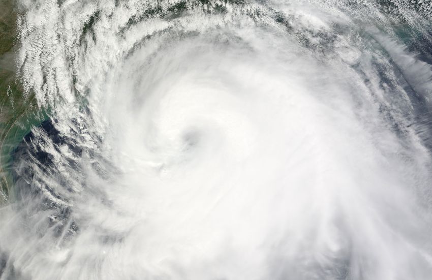
Coastal Texas Protection and Restoration Feasibility Study Final Report                                       Executive Summary

Risks to the Texas coast include hurricane storm surge, coastal erosion, and relative sea level change.

Study Need
The Texas coast is vulnerable to tropical storms and hurricanes that take human
life, flood homes and businesses, and damage coastal ecosystems. The impacts
are devastating to coastal communities. These impacts also extend to the State
and National level. The Texas coast is an economic engine and a vibrant natural
ecosystem which provides vast economic, social, and environmental benefits
to the nation. Specifically, Texas is:
• One of the States where residential, commercial, and industrial infrastructure
   are increasingly vulnerable to coastal storm damage.
• One of the Nation’s top States for waterborne commerce, which is a critical                  THE VALUABLE
   gateway to international trade and provides Texas with a multitude of economic
   opportunities.
                                                                                               TEXAS COAST
• Home to energy production and refining critical to the nation’s consumer,                   BY THE NUMBERS...
   commercial, and military supply of petroleum and related products.

                                                                                                  3,300
• Home to natural environments, and resources of national significance, which
   provide priceless ecosystem services, recreational opportunities, and natural
   buffers protecting communities and commerce from erosion and storm surges.

Without a comprehensive plan to protect, restore, and maintain a diverse coastal
                                                                                              MILES OF ESTUARINE SHORELINE
ecosystem and reduce the risks of storm damage to homes and businesses, the
economy and the health and welfare of Texas' coastal communities will continue
to be at risk from coastal storms.                                                              24% 15.8%
                                                                                                 STATE'S         U.S. PORT
Among a wide array of risks, three primary risks were identified as drivers for                POPULATION     CARGO HANDLED
investment in CSRM and ER on the Texas coast. These interdependent risks include:

                                                                                             30%
• Hurricane storm surge,
• Coastal erosion, and                                                                                      OF US REFINING
                                                                                                            CAPACITY
• Relative sea level change.

The natural environment is interconnected with man-made features on the Texas
coast. Population and industry grew in this region specifically because the natural
features supported economic growth. However, erosion and storm surge impair
physical landforms that are integral to maintaining a barrier between the Gulf of
Mexico and the various bay systems along the coast. Furthermore, relative sea
level change increases the vulnerability of these systems, and the damages
from hurricanes and tropical storms could become more severe as wind speed
is projected to increase with higher sea levels and rising ocean temperatures.

                                                                 Page 4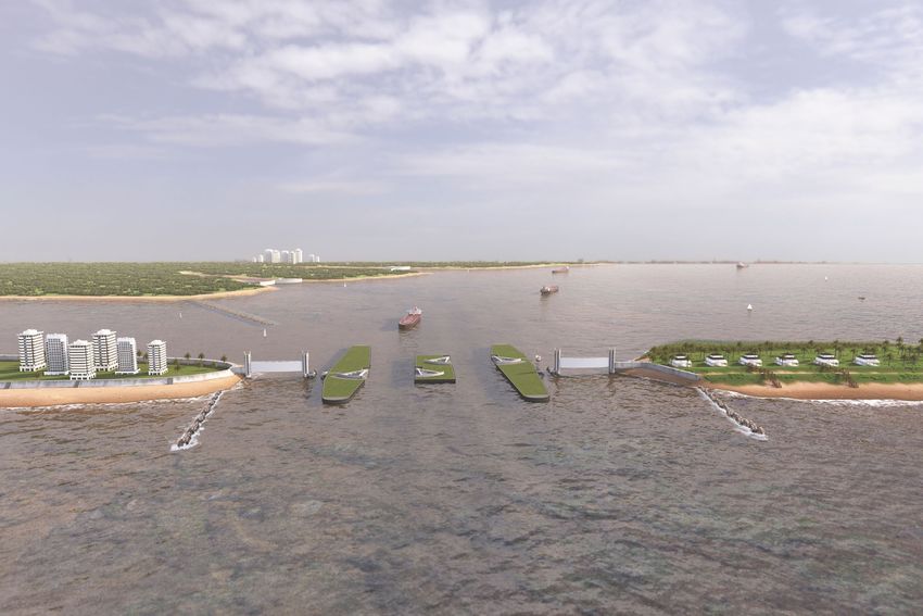
Coastal Texas Protection and Restoration Feasibility Study Final Report                                      Executive Summary

Study Goals and Objectives
In accordance with the legislative authority and intent, and
incorporating public and agency feedback from the scoping
phase, the following high-level goals and objectives were
established for the Coastal Texas Study effort, as detailed
in Table ES-1. Specific to CSRM, the study aimed to develop
and evaluate various coastal storm risk reduction measures
primarily related to the management of storm surges. Specific
to ER, the study aimed to increase the net quantity and
quality of coastal ecosystem resources, such as fish and
wildlife habitat.
                                                                    Vegetated dunes on South Padre Island

                       Goals                                                          Objectives
COASTAL STORM RISK MANAGEMENT                      1. Reduce risk to human life from storm surge impacts along the
Promote a resilient and sustainable economy by        Texas coast;
reducing the risk of storm damage to residential 2. Reduce economic damage from coastal storm surge to business,
structures, industries, and businesses critical to    residents, and infrastructure along the Texas coast;
the Nation’s economy                               3. Enhance energy security and reduce economic impacts of
                                                      petrochemical supply-chain related interruption due to storm
                                                      surge impacts;
                                                   4. Reduce risks to critical facilities (e.g., medical centers, ship channels,
                                                      schools, transportation, etc.) from storm surge impact;
                                                   5. Manage regional sediment, including beneficial use of dredged
                                                      material from navigation and other operations so it contributes to
                                                      storm surge reduction where feasible;
                                                   6. Increase the resilience of existing hurricane risk reduction systems
                                                      from sea level rise and storm surge impacts; and
                                                   7. Enhance and restore coastal landforms that contribute to storm
                                                      surge attenuation where feasible.
ECOSYSTEM RESTORATION                             1. Restore size and quality of fish and wildlife habitats such as
Promote a resilient and sustainable coastal          coastal wetlands, forested wetlands, rookery, oyster reefs, and
ecosystem by minimizing future land loss,            beaches and dunes;
enhancing wetland productivity, and providing 2. Improve hydrologic connectivity into sensitive estuarine systems;
and sustaining diverse fish and wildlife habitats 3. Reduce erosion to barrier island, mainland, interior bay, and channel
                                                     shorelines;
                                                  4. Create, restore, and nourish oyster reefs to benefit coastal and
                                                     marine resources; and
                                                  5. Manage regional sediment so it contributes to improving and
                                                     sustaining diverse fish and wildlife habitat.
Table ES-1: Overall Coastal Texas Study goals and objectives

                                                               Page 5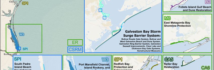
Coastal Texas Protection and Restoration Feasibility Study Final Report                                        Executive Summary

Summary of the Planning Process
The study authorization directed the study team to evaluate both ER and CSRM
solutions. These two purposes recognize that the study area is vulnerable to
storm risk and gradual coastal processes that wear away natural coastal areas
and habitats. To enhance resiliency, measures were generally assembled to:
• Form Multiple Lines of Defense: This strategy recognizes the benefits natural
  landforms provide against coastal storms. By combining various lines of defense
  (e.g. barrier islands, living shorelines, coastal marshes, etc.), redundant levels of
  protection and restoration are provided for both humans and coastal ecosystems.
• Be Comprehensive: The CSRM alternatives were assembled within a systems
  approach to work in concert with other measures considered, connect to
  existing systems, and be adaptable over time. The ER measures were created
  to provide a variety of habitats along the Texas coast and to fill in the gaps of
  other restoration work being conducted across Texas.

The study process occurred in three stages to develop and evaluate project
alternatives and to select and refine preferred solutions, known either as the
Tentatively Selected Plan (TSP) or the Recommended Plan. These stages are
described as follows:
• Conceptual Plans: Evaluates potential measures and assesses effectiveness
  of combined ER and CSRM measures to achieve study objectives.
• TSP Selection: Quantifies and compares benefits and impacts to identify the
  TSP, supporting publication of the 1st Draft Report (2018 DIFR-EIS).
• Integration and Refinement: Refining the TSP, considering public, agency,
  and technical comments, in addition to further technical refinement, to identify
  the Recommended Plan, which was first presented in the 2nd Draft Report
  (October 2020 Draft Feasibility Report), and has been further refined in this
  Final Feasibility Report.

By coordinating efforts across projects and between different entities, the Coastal
Texas Study achieves its goal of identifying the specific projects necessary to fill
in the gaps of a state-wide comprehensive CSRM and ER program.

                                                                                          Example of a beach access point over a dune

                                                               Page 6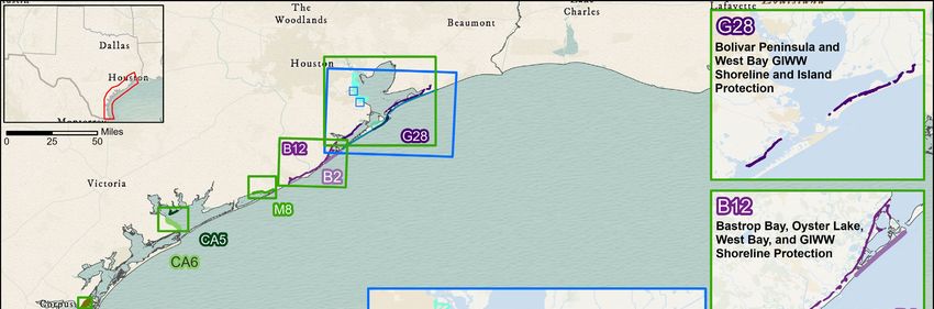
Coastal Texas Protection and Restoration Feasibility Study Final Report                                        Executive Summary

Representatives attend a Community Work Group meeting in May 2019

                                                                    Highway 87 on Bolivar Peninsula and FM 3005 on Galveston
How the Plan has Changed                                            Island. These segments were removed from the plan to
In accordance with USACE planning guidelines and NEPA
                                                                    ensure compliance with existing policies and laws, specifically
requirements, a proactive approach was taken to engage
                                                                    those related to the Coastal Barrier Resources Act (CBRA),
the public, resource agencies, industry, local government,
                                                                    and to minimize social and environmental impacts. Instead,
and other interested parties in the Coastal Texas Study
                                                                    the Bolivar and Galveston beach and dune systems initially
planning process. This included regular and continued
                                                                    proposed as ER measures in the TSP will be increased in size
coordination over the study period, starting in 2014 during the
                                                                    to also reduce storm surge impacts. In addition, among other
reconnaissance phase with a series of Scoping Meetings, and
                                                                    changes at the Bolivar Roads crossing, two smaller deep-
extending through a series of Virtual Public Meetings at the
                                                                    draft navigation gates are now proposed, instead of a single
end of 2020 to review and finalize the Feasibility Report and
                                                                    larger gate, and the overall constriction at Bolivar Roads was
EIS. This also included two formal public comment periods
                                                                    reduced from 27.5% to between 7-10%. Furthermore, the ring
following the 2018 DIFR-EIS and the 2020 Draft Feasibility
                                                                    barrier on Galveston Island was refined to reduce impacts
Report and Draft EIS.
                                                                    to surrounding neighborhoods and enclose more areas. In
Engagement activities have proved integral to the planning          other changes, future nourishment cycles were removed
process, as they have generated thousands of comments and           from the proposed ER features, due to USACE policy, and
suggestions which informed study planners of key concerns           minor revisions were made to individual features as part of
and helped to shape and refine the Recommended Plan. Most           continued feasibility phase preliminary design efforts.
significantly, after the TSP was presented in the 2018 DIFR-
                                                          These revisions and refinements resulted in the identification
EIS for public comment, policy review, and agency technical
                                                          of the Recommended Plan. To support development of the
review, multiple refinements were considered and evaluated
                                                          Recommended Plan, further environmental evaluations
to enhance the performance of the ER and CSRM measures
                                                          were advanced, cost and benefit analyses conducted,
and to further minimize environmental and social impacts.
                                                          and implementation requirements and considerations
Most significantly, the plan now excludes the proposed determined. The following section provides a summary
levee/floodwall segments that would have paralleled State description of the full Recommended Plan.

                                                               Page 7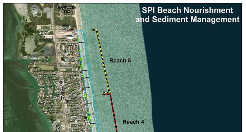
Coastal Texas Protection and Restoration Feasibility Study Final Report                                       Executive Summary

 MULTIPLE LINES OF DEFENSE ON THE TEXAS COAST
   The Recommended Plan includes a combination of ER and CSRM features that function as a system to reduce the
        risk of coastal storm damages to natural and man-made infrastructure and to restore degraded coastal
  ecosystems through a comprehensive approach employing multiple lines of defense. Focused on redundancy and
  robustness, the proposed system provides increased resiliency along the Bay and is adaptable to future conditions.
                            Dickinson Bay                Clear Lake Gate
                           Gate System and Nonstructural   System and
                            Pump Station Improvements Pump Station
    DEFENSES

                                                                                                                                DEFENSES
                                                                                             Ecosystem
BAY

                                                                                                                            BAY
                                                                                             Restoration
                          Galveston Ring
                          Barrier System
    DEFENSES

                                                                                                                                DEFENSES
GULF

                                                                                                                            GULF
                Galveston Seawall                                  Bolivar Roads                    Bolivar and West
                 Improvements                                      Gate System                      Galveston Beach
                                                                                                    and Dune System
               Illustration is representational and not to scale

                                                                                      A representational illustration of multiple
Recommended Plan                                                                      lines of defense
The Recommended Plan includes a combination of ER and CSRM features that
function as a system to reduce the risk of coastal storm damages to natural and
man-made infrastructure and to restore degraded coastal ecosystems through
a comprehensive approach employing multiple lines of defense. Focused on
redundancy and robustness, the proposed system provides increased resiliency
along the Texas coast and is adaptable to future conditions, including relative sea
level change. The Recommended Plan, as shown in Figure ES-3, can be broken                 The Recommended Plan
into three groupings, as follows:                                                        includes a combination of
• A Coastwide ER Plan was formulated to restore degraded ecosystems that
                                                                                        ER and CSRM features that
  buffer communities and industry on the Texas coast from erosion, subsidence,
  and storm losses. ER plan benefits have been estimated with standard habitat              function as a system to
  valuation procedures. The lowest-cost comprehensive ER plan is recommended.             reduce the risk of coastal
  This includes a combination of ER measures proposed at eight locations along           storm damages to natural
  the coast, and include approximately 114 miles of breakwaters, 15 miles of
                                                                                      and man-made infrastructure
  bird rookery islands, 2,000 acres of marsh, 12 miles of oyster reef, and almost
  20 miles of beach and dune. See Figures ES-3 and ES-4 for an overview of the             and to restore degraded
  Coastwide ER Plan.                                                                   coastal ecosystems through
• On the lower Texas coast, a CSRM beach restoration measure on South Padre             a comprehensive approach
  Island (SPI) was formulated in a traditional National Economic Development            employing multiple lines of
  (NED) framework to include 2.9 miles of beach nourishment and sediment
  management. The plan proposes beach nourishment on a 10-year cycle
                                                                                                            defense.
  for the authorized project life of 50 years. The economic analysis confirms
  that beach nourishment is cost effective when considering construction
  costs, benefits, and real estate costs. See Figure ES-5 for an overview of the
  SPI Beach Nourishment and Sediment Management measure.
• On the upper Texas coast, the Galveston Bay Storm Surge Barrier System was
  formulated as a system with multiple-lines-of-defense to reduce damage to
  communities, critical petrochemical and refinery complexes, Federal navigation
  channels, and other existing infrastructure in and around Galveston Bay from
  storm surge. See Figure ES-6 for an overview of the Galveston Bay Storm
  Surge Barrier System.

                                                                         Page 8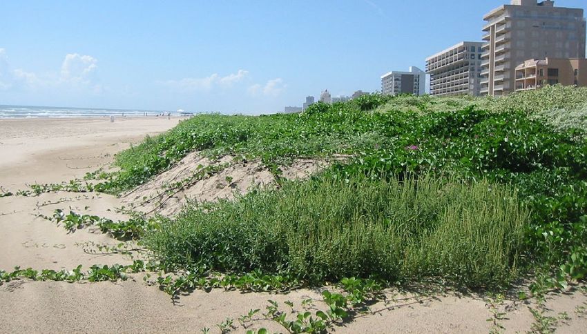
Coastal Texas Protection and Restoration Feasibility Study Final Report                                        Executive Summary

Specific to the upper Texas coast, the Gulf line of defense          • Complementary non-structural measures, such as home
separates Galveston Bay from the Gulf of Mexico to reduce              elevations or floodproofing, to further reduce Bay-surge
storm surge volumes entering the Bay. Components which                 risks along the western perimeter of Galveston Bay (see
make up the Gulf line of defense include:                              Figure ES-12).
• The Bolivar Roads Gate System, across the entrance to
  the Houston Ship Channel, between Bolivar Peninsula                The Galveston Bay Storm Surge Barrier System also integrates
  and Galveston Island (see Figure ES-7);                            with Coastwide ER Plan Measure G28, which protects the
• 43 miles of beach and dune segments on Bolivar Peninsula           shoreline from erosion and restores marshes and oyster
  and West Galveston Island that work with the Bolivar               reefs which enhance the resiliency of proposed adjacent
  Roads Gate System to form a continuous line of defense             CSRM measures.
  against Gulf of Mexico surge, preventing or reducing               In addition, more than 1,378 acres of habitat will be created
  storm surge volumes that would enter the Bay system                or enhanced as mitigation, in order to offset the direct and
  (see Figure ES-8); and                                             indirect impacts of the Recommended Plan (see Figure ES-13).
• Improvements to the existing 10-mile Seawall on Galveston
  Island to complete the continuous line of defense against          In total, the Recommended Plan represents a system-
  Gulf surge (see Figure ES-9).                                      wide risk management strategy for the coastline of Texas
                                                                     integrating structural and non-structural coastal storm
The Bay defenses enable the system to manage residual risks.         damage risk reduction actions with ecosystem restoration
Residual risks are driven by the run-up of water contained           actions to enhance the resiliency of coastal communities
within the Galveston Bay system plus any additional Gulf surge       and the living shoreline from coastal storms.
that overtops the Gulf line of defense. The Bay defenses also
provide further resiliency against variations in storm track
and intensity and relative sea level change. Bay defense
components include:
• An 18-mile Galveston Ring Barrier System (GRBS) that
  impedes Bay waters from flooding neighborhoods,
  businesses, and critical health facilities within the City of
  Galveston (see Figure ES-10);
• 2 surge gates on the west perimeter of Galveston Bay (at
  Clear Lake and Dickinson Bay) to reduce surge volumes
  that push into neighborhoods around the critical industrial
  facilities that line Galveston Bay (see Figure ES-11); and

Conceptual rendering of proposed vertical lift gates that would be
used as part of the Bolivar Roads Gate System

                                                                Page 9
Coastal Texas Protection and Restoration Feasibility Study Final Report   Executive Summary

                                                                                         Figure ES-3: Recommended Plan

                                                               Page 10
Coastal Texas Protection and Restoration Feasibility Study Final Report Executive Summary
COASTIWIDE ECOSYSTEM
RESTORATION MEASURES
Levees and Floodwalls Surge Gates House Raising Buyout Pump
Levees and Floo
Floodwalls and Buyout Stations
Floodwalls
Marsh Beach Oyster Reef Island Breakwater Marsh
Hydrologic B
BEACH AND DUNE RESTORATION
Restoration Restoration RestorationMARSH RESTORATION
Restoration Creation Restoration
RestorationRest
Levees and Floodwalls Levees
Surge Gates
and House
Floodwalls
Raising Surge
Buyout
Gates House Raising
Pump Buyout Pump
Floodwalls Floodwalls and Buyout Stations
and Buyout Stations
Marsh Beach Marsh
Oyster Reef Beach
Island Oyster Breakwater
Reef IslandHydrologicBreakwater Hyd
OYSTER REEFRestoration
Restoration CREATION Restoration
Restoration Restoration BREAKWATER
RestorationRestoration CREATION
CreationRestoration
Restoration Creation Res
Levees and Floodwalls Levees
Surgeand
Gates Floodwalls
House RaisingSurge
Buyout
Gates House Raising
Pump Buyout Pump
Floodwalls Floodwalls and Buyout Stations
and Buyout Stations
Marsh Beach Marsh
Oyster Reef BeachIsland Oyster Reef
BreakwaterIsland Hydrologic
Breakwater Hydrologic
Restoration ISLAND RESTORATION
Restoration
Restoration
RestorationRestoration
Restoration
Restoration HYDROLOGIC
Creation
Restoration RESTORATION
Creation
Restoration Restoration
Figure ES-4: Conceptual renderings of ER measures
Page 11Coastal Texas Protection and Restoration Feasibility Study Final Report Executive Summary
SOUTH PADRE ISLAND BEACH NOURISHMENT
AND SEDIMENT MANAGEMENT
Figure ES-5: SPI Beach Nourishment and
Sediment Management
Page 12^
Coastal Texas Protection and Restoration Feasibility Study Final Report
Page 13
Bay Lines
of Defense
Galveston Ring Barrier System
Clear Lake Gate System
Dickinson Bay Gate System
Nonstructural Improvements
Gulf Lines
of Defense
Bolivar Roads Gate System
Bolivar and West Galveston
Beach and Dune System
Galveston Seawall
0 2½ 5 Improvements
Miles
µ
Figure ES-6: Galveston Bay Storm Surge Barrier System
Executive SummaryCoastal Texas Protection and Restoration Feasibility Study Final Report Executive Summary
BOLIVAR ROADS GATE SYSTEM
Bolivar Peninsula
Galveston Bay
COMBI-WALL
Gulf of Mexico
Galveston Island
SHALLOW WATER
GATE SYSTEM OVERVIEW ENVIRONMENTAL GATES
VERTICAL LIFT GATES DEEP-DRAFT NAVIGATION GATES
Figure ES-7: Bolivar Roads Gate System
Page 14Coastal Texas Protection and Restoration Feasibility Study Final Report Executive Summary
BOLIVAR AND WEST GALVESTON
BEACH AND DUNE
Horseshoe
Gordy Marsh Marsh McFaddin
National Wildlife
Robinson Lake Refuge
Anahuac
^ National Wildlife
Refuge
High Island
Moody National
Wildlife Refuge 87
87
East Bay
Goat Island Gilchrist
87
ay
hw
Hig
Caplen
Bolivar
Peninsula
Goat Island
Crystal Beach Sabine National
Wildlife Refuge
Houston
Dune Field -10
87 Texas City
nk
Ba
New Beach Galveston
ea
ld
H
nd
Sediment ea
bin
Source Sa
Lake Jackson
Outer
Continental -20
0 1 2
Miles µ Shelf
Depth
-30
Oxen Bayou
3005
^ Delehide Cove
Beach Pocket
Park 2
Rd
Galveston 3005 ss
Island SP Pa
is
Lu
a n
iS
in
r m
Jumbile Cove Te
Jamaica Beach
Chocolate Bay
3005
West Bay Sabine National
Wildlife Refuge
Houston
3005
Dune Field -10
Texas City
nk
New Beach Galveston Ba
e ald
n dH
Sediment ea
bin
Source Sa
Lake Jackson
Outer
Continental -20
0 1 2
Miles µ Shelf
Depth
-30
Figure ES-8: Bolivar and West Galveston Beach and Dune
Page 15Coastal Texas Protection and Restoration Feasibility Study Final Report Executive Summary
GALVESTON SEAWALL IMPROVEMENTS
Figure ES-9: Galveston Seawall Improvements
Page 16Coastal Texas Protection and Restoration Feasibility Study Final Report Executive Summary
GALVESTON RING BARRIER SYSTEM
INVERTED “T” FLOODWALL ROAD/RAIL CLOSURE (OPEN) CLOSED SLUICE GATE
EXAMPLE FLOODWALL ROAD/RAIL CLOSURE (CLOSED) CLOSED FLAP GATE
Figure ES-10: Galveston Ring Barrier System
Page 17Coastal Texas Protection and Restoration Feasibility Study Final Report Executive Summary
CLEAR LAKE AND DICKINSON BAY
Figure ES-11: Clear Lake and Dickinson Bay Gate Systems and Pump Stations
Page 18Coastal Texas Protection and Restoration Feasibility Study Final Report Executive Summary
NONSTRUCTURAL IMPROVEMENTS
Figure ES-12: Nonstructural Improvements
MITIGATION SITES
Figure ES-13: Mitigation and sediment source sites
Page 19Coastal Texas Protection and Restoration Feasibility Study Final Report Executive Summary
Environmental Assessment) that supplement the original EIS
NEPA Compliance to examine individual components of the Recommended Plan
To comply with NEPA, a Federal agency must prepare an
in greater detail. The updated assessments would disclose
EIS if it is proposing actions that may significantly affect the
site-specific impacts associated with the proposed solution
quality of the natural and human environment. The NEPA
and identify the avoidance, minimization, and compensatory
environmental review process seeks to facilitate better-
mitigation efforts to lessen adverse effects. In addition, the
informed decisions, focused on avoiding, minimizing, and/
updated documents will undergo formal public review periods
or mitigating potentially negative impacts of Federal action.
and resource agency coordination.
For the Coastal Texas Study, rather than preparing a single
Within the attached Final EIS, measures have either been
definitive EIS as the basis for approving the entire project,
denoted as “Actionable Measures” or “Tier One Measures,”
the USACE will conduct two or more rounds, or tiers, of
as defined below:
environmental review. The “Tier One” assessment (the
• Actionable Measures. The Recommended Plan includes
attached Final EIS) analyzes the project on a broad scale,
several proposed measures that currently have enough
while considering the full range of potential effects to both
design detail to complete the environmental review. These
the human and natural environments from implementing the
are identified in this Final EIS as “actionable measures”,
proposed solutions. The purpose of the Tier One EIS is to
because the EIS provides a complete environmental review
present the information considered in selecting a preferred
consistent with NEPA for these measures.
alternative, describe the comprehensive list of measures,
• Tier One Measures. The measures included in the
and identify data gaps and future plans to supplement the
Recommended Plan that will require Tier Two environmental
data needed to better understand the direct, indirect, and
review are referred to as “Tier One Measures” because this
cumulative effects of the proposed solutions.
report is the Tier One assessment for these measures.
Once refinements and additional information is gathered during
Table ES-2 identifies which measures are Actionable and
the PED phase, the USACE will update the impact assessments
which are Tier One Measures.
and prepare additional NEPA documents (either an EIS or
Recommended Plan Component Actionable Tier One*
ER Measures
G28 – Bolivar Peninsula and West Bay GIWW Shoreline and Island Protection •
B2 – Follets Island Gulf Beach and Dune Restoration •
B12 – West Bay and Brazoria GIWW Shoreline Protection •
CA5 – Keller Bay Restoration •
CA6 – Powderhorn Shoreline Protection and Wetland Restoration •
M8 – East Matagorda Bay Shoreline Protection •
SP1 – Redfish Bay Protection and Enhancement •
W3 – Port Mansfield Channel, Island Rookery, and Hydrologic Restoration •
CSRM Measures
South Padre Island Beach Nourishment and Sediment Management •
Bolivar Roads Gate System •
Bolivar and West Galveston Beach and Dune System •
Galveston Seawall Improvements •
Galveston Ring Barrier System •
Clear Lake Gate System and Pump Station •
Dickinson Bay Gate System and Pump Station •
Nonstructural Improvements •
* Requires additional NEPA analysis and environmental compliance consultation
Table ES-2: Actionable and Tier 1 Measures of the Recommended Plan
Page 20Coastal Texas Protection and Restoration Feasibility Study Final Report Executive Summary
Example of a beach access point over a dune on South Padre Island
Costs and Benefits
Table ES-3 provides a summary of the estimated costs are anticipated to reduce average annual damages by
and benefits of the Recommended Plan. This information $2.31 billion per year (FY 2021 Price Level, 2.50% Discount
is presented separately for each component, including Rate), which represents a significant reduction in anticipated
the Coastwide ER Plan, the South Padre Island Beach future flood damages and supports increased resiliency for
Nourishment and Sediment Management measure, and the the communities along the coast and the local, regional,
Galveston Bay Storm Surge Barrier System. As shown in the and national economy.
table, the Recommended Plan has a total project first cost,
or construction cost, of $28.87 billion at a 2021 Price Level. In addition, the Coastwide ER Plan generates over
Each CSRM measure has a strong benefit-cost ratio (BCR), 21,010 average annual habitat units (AAHUs) through the
2.03 for South Padre and 1.91 for Galveston Bay. A BCR over creation or restoration of thousands of acres of coastal
one indicates that the benefits of the project exceed the habitat, including global, national, state, and locally significant
costs, which is a requirement for Federal investment. Most resources providing unique services, functions, and values. In
critically, if damages from storms were distributed equally addition, restoration efforts enhance the resiliency of natural
across the fifty-year period of analysis, the CSRM measures and man-made systems and increase the effectiveness of
CSRM features along the coast.
South Padre Island
Galveston Bay Storm Total
Beach Nourishment and Coastwide
Surge Barrier System Project
Sediment Management ER Plan
(2043 Base Year) First Cost
(2035 Base Year)
Project First Cost $72,357 $26,128,041 $2,672,733
Total Average Annual Cost $1,904 $1,208,000 N/A
Equivalent Annual Benefits $3,894 $2,306,000 21,010 AAHUs $28,873,131
Equivalent Annual Net Benefits $1,955 $1,097,000 N/A
BCR 2.03 1.91 N/A
FY21 Price Level, 2.50% Discount Rate, Presented in $1,000s
Table ES-3: Total Costs and Benefits of the Recommended Plan
Page 21Coastal Texas Protection and Restoration Feasibility Study Final Report Executive Summary
Tables ES-4 and ES-5 provide the cost apportionment for the project first cost is $17.98 billion. The non-Federal share of
CSRM and ER portions of the Recommended Plan, subject to the combined project first cost is $10.89 billion, pending
credits for lands, easements, rights-of-way, relocations, and Land, Easements, Rights-of-Way, Relocation, and Disposal
disposal areas, detailing the projected split of costs between Areas (LERRD) credits. The combined BCR for the CSRM
the Federal government and the non-Federal sponsor (the measures is 1.91.
State of Texas and/or its local partners).
In addition to these traditional USACE metrics, the
For the overall combined project, the project first cost is Recommended Plan embraces a comprehensive approach
estimated $28.87 billion. The Federal share of the combined to enhancing community resilience, considering the four
Coastwide ER Plan
Total First Cost
FED (65%) 1
NON-FED (35%)2
PED $227,540 $95,363 $322,903
Construction $1,492,330 $624,417 $2,116,746
LERRD -- $106,079 $106,079
Construction Management $89,540 $37,465 $127,005
Total Project First Costs $1,809,409 $863,324 $2,672,733
FY21 Price Level, Presented in $1,000s
1
Federal cost includes approximately $403 million of cost anticipated to be carried by the USFWS.
2
Non-Federal cost includes 35% of the Coastwide ER Plan, excluding the approximately $403 million anticipated to be carried by the USFWS.
Table ES-4: Coastwide ER Plan – Cost Apportionment (Project First Costs)
South Padre Island
Galveston Bay Storm
Cost Share % Beach Nourishment and Total Project First Cost
Surge Barrier System1
Sediment Management
FED NON-FED FED NON-FED FED NON-FED FED NON-FED
INITIAL CONSTRUCTION
PED 65% 35% $1,278 $688 $1,962,653 $1,066,863 $1,963,931 $1,067,551
Construction 65% 35% $5,834 $3,141 $12,858,390 $6,990,747 $12,864,224 $6,993,889
LERRD 2
100% -- $18,328 -- $964,985 -- $983,313
Construction
65% 35% $343 $185 $774,905 $421,277 $775,248 $421,461
Management
SUB TOTAL $7,455 $22,342 $15,595,948 $9,443,872 $15,603,403 $9,466,215
RENOURISHMENT
PED 50% 50% $2,638 $2,638 $67,452 $67,452 $70,090 $70,090
Renourishment 50% 50% $17,587 $17,587 $449,678 $449,678 $467,265 $467,265
LERRD2 100% -- -- -- -- ‐ --
Construction
50% 50% $1,055 $1,055 $26,981 $26,981 $28,036 $28,036
Management
SUB TOTAL $21,280 $21,280 $544,111 $544,111 $565,390 $565,390
GRAND TOTAL $28,735 $43,622 $16,140,058 $9,987,983 $16,168,793 $10,031,605
FY21 Price Level, Presented in $1,000s
1
Non-Federal costs for the Galveston Bay Storm Surge Barrier System include 100% of the costs of the Levee Tie-in located in the CBRA zone.
2
LERRDs are the responsibility of the Non-Federal sponsor. However, LERRDs are subject to crediting against the construction cost.
Table ES-5: CSRM Measures – Cost Apportionment (Project First Costs)
Page 22Coastal Texas Protection and Restoration Feasibility Study Final Report Executive Summary
USACE accounts (National Economic Development, Regional Economic
Development, Environmental Quality, and Other Social Effects) and supporting
the region’s ability to prepare, withstand, recover, and adapt from coastal storms
and to maintain critical social, economic, and support systems. Employed in
a systems approach, the ER features also contribute to resilience; creating,
protecting, or enhancing sensitive and nationally significant ecosystems while
helping to sustain the barriers that the major structural systems (e.g. the Bolivar
Roads Gate System) tie into. The result is a system-wide risk management
strategy for the coastline of Texas integrating structural and non-structural
coastal storm damage risk reduction actions with ecosystem restoration actions
to enhance the resiliency of coastal communities and the living shoreline from Photo of East Galveston Island
coastal storms.
Implementation Requirements and Next Steps
While the GLO has served as the non-Federal sponsor for the feasibility study
phase, due to the scale of the project, a modified arrangement is necessary
COASTAL TEXAS
for the subsequent phases of the project, including PED, Construction, and COSTS & BENEFITS
Operations and Maintenance. The State of Texas (encompassing its various
entities, including the GLO) has issued a Letter-of-Intent stating its intent to BY THE NUMBERS...
serve as the non-Federal sponsor, with support from local entities, for future
phases of the Coastal Texas Protection and Restoration Plan. Accordingly, local
entities such as counties, cities, levee improvement districts, drainage districts,
~$2.31 Billion
municipal utility districts, or other special taxing entities may elect to or be EQUIVALENT ANNUAL BENEFITS
created to support the State of Texas and the USACE in the implementation
of this project. Most critically, this includes the Gulf Coast Protection District
(created in the 2021 Texas legislative session; see https://capitol.texas.gov/
1.91 BCR
tlodocs/87R/billtext/html/SB01160F.htm), which is anticipated to serve as FOR THE COMBINED CSRM MEASURES
the non-Federal sponsor for the upper Texas coast CSRM features.
IN A 1% AEP SURGE EVENT:
Federal implementation of the project would be subject to the identified
non-Federal sponsor(s) agreeing to comply with applicable Federal laws and
policies. Furthermore, the non-Federal sponsor(s) shall, prior to implementation,
~77% ~64%
REDUCTION IN REDUCTION IN
agree to perform the required items of cooperation. In general, cost share for the DAMAGED FLOODED CRITICAL
design and construction of the project will be 65 percent Federal and 35 percent STRUCTURES INFRASTRUCTURE
POINTS
non-Federal. Critically, the non-Federal sponsor must provide all lands, easements,
and rights-of-way, including those required for relocation, the borrowing of
material, and the disposal of dredged or excavated materials.
21,010
If authorized and funded by Congress, subsequent phases of the project would AAHUs ECOLOGICAL LIFT
include PED, Construction, and Operations and Maintenance. Completion of PED
and construction of the Recommended Plan, specifically the pace of construction,
is highly dependent on Congressional approval and funding. Assuming an ample
funding stream, the Recommended Plan described could be designed and then
6,610
ACRES HABITAT IMPROVED
constructed over a period of 12 to 20 years. Furthermore, construction sequencing
~$28.87 Billion
will also be dependent on completion of supplemental environmental studies,
in accordance with the tiered NEPA approach described herein. Ultimately,
implementation activities will be optimized to consider the size and frequency TOTAL RECOMMENDED PLAN
of funding infusions, environmental clearance of individual components, and PROJECT FIRST COST (CSRM & ER)
beneficial sequencing.
Page 23You can also read