Rockpool, Snorkel and Shore Diving Guide - CCGHT
←
→
Page content transcription
If your browser does not render page correctly, please read the page content below
Rockpool, Snorkel
    a n d S h ore D iv in g G u id e

                                                                                                               1

Causeway Coast and Glens Heritage Trust - Rockpool & Snorkel Information Booklet - CCGHT050219.indd 1   07/03/2019 14:57
This publication has been produced in partnership with the Causeway Coast &
      Glens Heritage Trust and Ulster Wildlife.

      Causew ay Coast & Glens Heritage Trust (CCGHT)
      The Causeway Coast & Glens Heritage Trust (CCGHT) is a charity devoted to
      protecting and enhancing the unique heritage of the Causeway Coast and Glens
      area, including (but not limited to) the Binevenagh, Causeway Coast and Antrim
      Coast and Glens Areas of Outstanding Natural Beauty (AONBs) and the Giant’s
      Causeway and Causeway Coast World Heritage Site (WHS).

      Ulster Wildlife
      Northern Ireland’s largest local nature conservation charity, Ulster Wildlife has
      been a wildlife champion for over 40 years.

      If you love our local seas, why not join today? Your support as a member of Ulster
      Wildlife can help protect our breath-taking blue planet for generations to come –
      ulsterwildlife.org/membership

     2

Causeway Coast and Glens Heritage Trust - Rockpool & Snorkel Information Booklet - CCGHT050219.indd 2   07/03/2019 14:57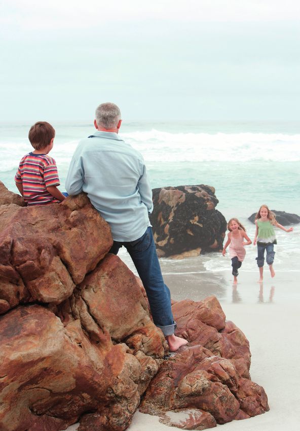
Northern Ireland’s coastline Rockpools are like natural aquariums on
the seashore. They contain a mix of life
is dramatic and diverse. The similar to that found on the shore when it
renowned Causeway Coastal is covered by the sea. However, the best
Route boasts over 60 miles rockpools are still those nearest low water,
as rockpools higher on the shore get too
of rocky headlands and warm during the time they are exposed for
sheltered bays, which offer many species to survive.
countless opportunities It is important to remember that the
to explore the fascinating seashore is a habitat, a home for dozens
habitats and wildlife calling or even hundreds of plants and animals.
Whilst rockpooling you should make every
this thin strip, where land effort to minimise your impact on this
meets sea, home. Whether habitat by following the Seashore Code
you prefer to remain (see page 5 for details).
onshore, or are eager to dive
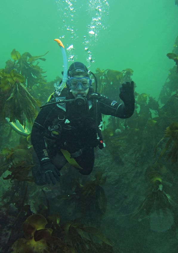
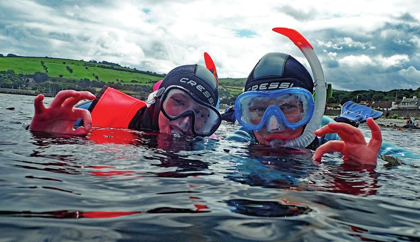
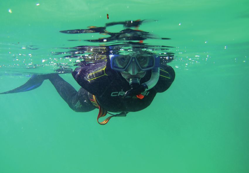
in and explore beneath the Snorkelling and Diving
waves, this guide offers a Snorkelling and diving are not just the
detailed synopsis of some of pursuits of holidaymakers visiting tropical
the finest spots to rockpool, coral reefs. Although many people do not
believe it, the cooler waters off our coast
snorkel or shore dive along abound with life and are full of colour!
the Causeway Coastal Route. Dip below the surface anywhere around
our coast and you will be amazed at the
world awaiting you. Snorkelling and diving
Rockpooling in Northern Ireland are best between
May and September, mainly because this
Rockpooling is a fantastic way to get out on is when life in our coastal waters is at its
our shores and explore the rich diversity richest. However, both activities can be
of marine flora and fauna on our coast. conducted year-round.
Anyone can do it, even if you are afraid
of entering the sea, and it is a really great The coastline between Ballygally and
way to introduce children to our marine Portstewart generally enjoys good in-water
wildlife. You can go rockpooling at any visibility and a wide variety of sites that are
time of year, you just need to wear suitable suitable for snorkelling and shore diving.
clothing for the weather. Water depths accessible from shore are
generally in the 0 – 10m range. Habitat
The sea life that we find on our shorelines types include rocky reef, sandy bottom
reflects what lies beneath the adjacent and rock walls and crevices. In some bays
seas. Often in the intertidal area (the area seagrass beds, rich in fish and marine
of shore covered at high tide but exposed invertebrates occur. There are also one
at low tide), we find the eggs and young or two wrecks accessible from the shore.
of larger marine creatures who inhabit Boat diving is also available through local
nearby waters. The area of shoreline operators (see page 13 for details).
nearest the low tide mark contains the
richest diversity of marine life because *Please note where diving is stated this
it is exposed by the tide for the shortest refers to shore-diving**
period. As you move further up the shore,
the number of species declines, because
only those species that can survive longer
periods exposed by the tide can survive.
3
Causeway Coast and Glens Heritage Trust - Rockpool & Snorkel Information Booklet - CCGHT050219.indd 3 07/03/2019 14:57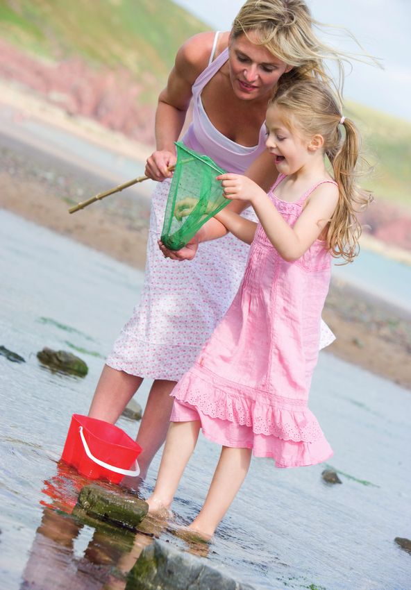
4

Causeway Coast and Glens Heritage Trust - Rockpool & Snorkel Information Booklet - CCGHT050219.indd 4   07/03/2019 14:57
The Seashore Code                                           Silence is Golden!
                                                                            •     Hauled-out seals and nesting seabirds
                Safety                                                            are easily disturbed. Do not approach
                                                                                  closer than 200m to any nesting bird
                •     Before going to the seashore, check                         or hauled-out seal whether on shore
                      the weather forecast and tides.                             or in a boat.
                •     Tell somebody where you are going                     •     Keep quiet when in the vicinity of
                      and what time you expect to be back.                        nesting birds and hauled-out seals,
                •     Dress appropriately for the weather                         as they are very prone to noise
                      and wear sturdy shoes or boots.                             disturbance.
                •     Stay away from the edge and base                      •     Keep dogs on a lead and never let
                      of cliffs as ground can give way and                        them run into areas where seabirds
                      rocks can fall.                                             are nesting or seals are hauled-out.
                •     Bring a mobile phone in case you                      •     Never allow your dog to chase birds as
                      need to call for help!                                      this causes them stress and disturbs
                                                                                  important activities such as feeding.
                Take Only Photos...                                         Beachcombers
                Leave Only Footprints                                       •     Watch out for unusual objects on
                •     Tread carefully, rocky shores can                           the beach. Occasionally discarded
                      be very slippy, look before you step                        explosives or flares may wash up, if
                      and try to avoid stepping on marine                         in doubt leave it alone and inform the
                      creatures or in rockpools.                                  coastguard (dial 999 and ask for the
                •     Don’t poke or prod soft bodied marine                       coastguard).
                      creatures (e.g. anemones) as it can kill              •     Respect     historic    wrecks     and
                      them.                                                       archaeological items. Take only
                •     If you collect shells, please make sure                     pictures and report any discoveries
                      there’s nobody still at home first!                         to Department for Communities
                                                                                  on (028) 9056 9701. Objects can
                •     If you disturb a rock or seaweed,                           also be reported through the
                      please return it carefully to the way                       Marine Antiquities Scheme https://
                      you found it. Exposed marine life                           marinefinds.org.uk/
                      quickly dries out and dies.
                                                                            •     If you find a live or dead stranded
                •     Try to observe marine life without                          whale, dolphin, porpoise, or basking
                      touching. If you must take a closer                         shark please report it immediately
                      look, gently collect the animal in a                        to the Department of Agriculture,
                      container of clean seawater. Return                         Environment and Rural Affairs
                      it to the exact spot you found it                           (DAERA) on (028) 7082 3600.
                      afterwards!
                                                                            •     If you find a seal which is ashore
                •     Litter kills marine life! Take all your                     and looks like it may be injured or
                      litter home with you.                                       malnourished, please do not touch
                •     If you see litter on the shore try to                       it or chase it back into the sea.
                      collect it and dispose of it in a bin if it                 Observe from a distance and keep
                      is safe to do so.                                           dogs and people away from it. Call
                                                                                  Exploris Aquarium on (028) 4272 8062
                                                                                  immediately for further advice and
                                                                                  assistance.
                                                                            •     Dead seals or otters can be reported to
                                                                                  DAERA by emailing marine.wildlife@
                                                                                  daera-ni.gov.uk stating the location
                                                                                  and details of the dead animal.

                                                                                                                       5

Causeway Coast and Glens Heritage Trust - Rockpool & Snorkel Information Booklet - CCGHT050219.indd 5            07/03/2019 14:57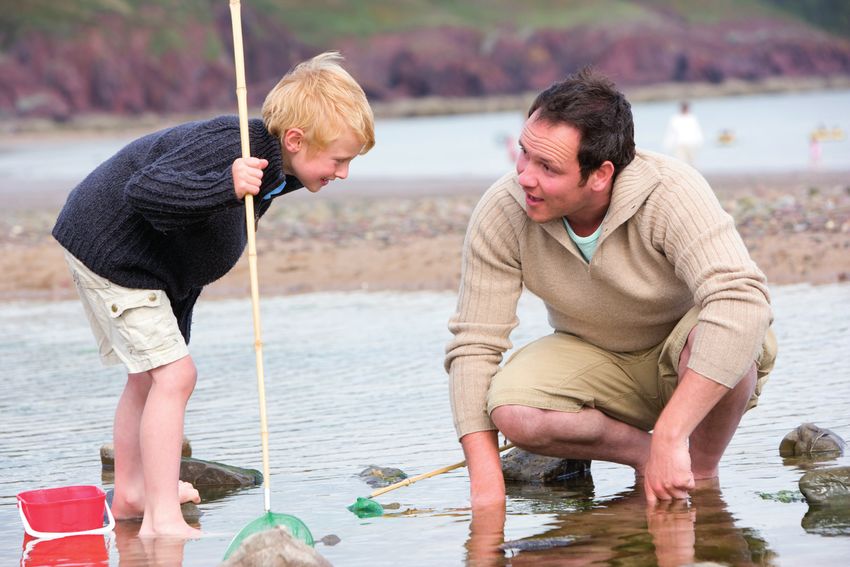
6

Causeway Coast and Glens Heritage Trust - Rockpool & Snorkel Information Booklet - CCGHT050219.indd 6   07/03/2019 14:57
Divers Code of Conduct                                      Don’t Leave a Trail
                Safety                                                      of Destruction
                                                                            •     Be dive gear aware! Secure your
                •     Dive within your limits and those of                        hoses, reels, torches and other
                      your buddy.                                                 instruments with clips.
                •     Carry an audible and visual means of                  •     Be aware of where you are anchoring
                      signalling for help.                                        or dropping shot lines. Don’t destroy
                •     Tell someone on shore where you                             the features you have come to enjoy.
                      are going and when you expect to be                         Don’t anchor unless necessary and
                      back. If on a dive boat, make a traffic                     don’t drag shot weights or anchors
                      report to the coastguard... don’t forget                    across the seabed.
                      to inform them of your safe return!
                •     Be aware of other divers in the water.                Be good neighbours
                      Boats should keep watch for bubbles                   •     Never interfere with lobster pots or
                      and give a wide berth. Look beneath                         their contents and don’t use fishing
                      you before you descend or jump in.                          gear marker buoys as mooring points
                                                                                  or shot lines.
                Take Only Photos...                                         •     Be aware of sea angling boats and
                                                                                  shore anglers, give a wide berth... the
                Leave only Bubbles                                                sea is big enough for all of us!
                •     Look with your eyes, not with your                    •     Park with consideration at dive sites.
                      fingers... touching stresses and                            Don’t block gateways, entrances or
                      injures marine animals and damages                          slipways.
                      habitats.
                •     Try not to cling to rocks to support
                      yourself as you may kill marine
                                                                            Silence is Golden
                                                                            •     Consider the neighbours and the
                      creatures which live on the rocks.                          nature of your surroundings especially
                •     Photographers... A camera is not                            in tranquil areas popular with tourists
                      a license to move, prod, or harass                          and when diving late at night or early
                      marine life. Don’t move marine                              in the morning.
                      animals from their natural habitat,                   •     Think before you start your
                      substrate or shelter.                                       compressor. Locate it away from
                •     Think twice about collecting shellfish                      houses and areas being used by
                      for the pot, removal of shellfish by                        holidaymakers. If possible locate
                      divers can leave our favourite diving                       behind a wall or vehicle to shield the
                      sites devoid of the animals we dive to                      noise.
                      see!
                •     Don’t leave litter it is unsightly and
                      kills marine creatures. Take all your
                                                                            Respect Our Wrecks!
                                                                            •     If you are visiting a shipwreck site
                      litter home with you.                                       take notice of established codes of
                •     If you come across litter while diving,                     conduct such as the Respect Our
                      collect it and bring it back to shore, if                   Wrecks (BSAC) code of practice – see
                      it is safe to do so.                                        www.bsac.com
                •     Practice good buoyancy control and
                      don’t take trainee divers to sensitive
                      sites with flora or fauna that are easily
                      damaged.
                •     Keep at least 100m from dolphins or
                      basking sharks and 200m from hauled
                      out seals and nesting seabirds.

                                                                                                                       7

Causeway Coast and Glens Heritage Trust - Rockpool & Snorkel Information Booklet - CCGHT050219.indd 7            07/03/2019 14:57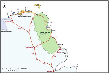
Safety
      Each of the site descriptions comes with specific safety warnings for that particular
      site. These are, of course, variable depending on tide and weather conditions
      on the day. Regardless of where you get into the water, there are safety issues
      to consider. Your snorkelling experience will be much more enjoyable in calm
      weather, so avoid snorkelling in rough seas. Local marine activity providers can
      be contacted for local knowledge, information, instruction and equipment hire.

      The main safety issues to consider are:

      Rockpooling
      •     Access – stick to easily accessible shores with safe access. Avoid shores
            where you have to scale cliffs or dangerous rocks and avoid areas which can
            be quickly cut off by the tide.

      •     Footwear – wear appropriate footwear, ideally wellingtons or boots. Flip
            flops or bare feet should be avoided as the shoreline can contain sharp
            rocks, broken bits of shells and even toe-nipping crabs!

      •     Tides – Always check the tide before you leave. Ideally, aim to start rock
            pooling two hours before low tide, so that the tide is falling when you are on
            the shore. You should leave the shore as the tide changes, this will minimise
            your risk of being caught out by a rising tide.

      Snorkelling & Diving
      •     Access – stick to shores with safe access off a beach or pier. Avoid shores
            where you have to scale dangerous or slippy rocks. Remember that while
            you are in the water, the tide may be falling, so make sure you can still get
            out of the water if the water level drops by a few metres.

      •     Hypothermia – Our seas are warmest from July until October, peaking in
            August. Average sea temperatures at this time are 14 – 16°C but in winter
            can fall as low as a chilly 6°C. A cold-water wetsuit with a minimum of 6mm
            neoprene, plus neoprene boots and hood are strongly recommended for
            snorkelling. For diving a 7mm two-piece wetsuit, a 7mm semi-dry, or a dry
            suit, plus boots, gloves and hood are required.

      •     Tides and Currents – Always check the tides, and find out about local
            currents, before you enter the water. Ideally dive or snorkel at slack water to
            minimise the chance of encountering currents. At some sites, where current
            is not an issue, it may be easiest and most rewarding to dive at high tide (or
            low tide if snorkelling).

      •     Equipment – Make sure your diving or snorkelling equipment is in good
            working order and dive gear is serviced annually. Make sure that you are
            familiar with your gear and how to use it.

     8

Causeway Coast and Glens Heritage Trust - Rockpool & Snorkel Information Booklet - CCGHT050219.indd 8   07/03/2019 14:57
• Know your ability – routes are graded, so stick to what you know you
can handle. Do not endanger yourself or your buddy by taking on a bigger
challenge than you are capable of. Before going diving, you must complete a
diving course to obtain a diving certification from a recognised certification
agency. Obtaining a recognised snorkelling certification will help you get the
most out of your snorkelling. Training is offered by many dive clubs and by
some commercial providers.
• Personal Safety – Always snorkel or dive in buddy pairs. When diving it is
best to dive with a club or reputable dive centre, and to have dive insurance
cover. Preferably, have a third person, who is not snorkelling or diving
provide shore cover to keep an eye on you while you are in the water. Always
let someone know where you are going and when you will be back and bring
a fully charged mobile phone with you.
All Activities
• Personal Safety - Always let someone know where you are going and when
you will be back, and bring a fully charged mobile phone with you.
• Emergency - Should you suffer a serious accident, find yourself in trouble, or
see others who require help, then call 999 and ask for the Coastguard.
• Weather - Be aware of weather conditions and check the forecast before you
go. Keep monitoring weather and sea conditions during your activity and be
prepared to abandon your activity if conditions deteriorate. If you are not
sure if conditions are suitable for your activity, contact local providers who
are more than happy to offer advice, as are lifeguards if near to any staffed
beaches.
9
Causeway Coast and Glens Heritage Trust - Rockpool & Snorkel Information Booklet - CCGHT050219.indd 9 07/03/2019 14:57CAUSEWAY COAST Sites 1-6 East Coast
AONB Sites 7-13 North Coast
9 8
Causeway Coast Way
10
12 11 A2 7
13
6
Coleraine
A44 5
A26 4
3
BINEVENAGH
AONB ANTRIM COAST
AND GLENS 2
AONB
1
Ballymena
Larne
A26
A8
M2
Belfast
1. Ballygally 5. Dalriada P ier
2. Glenarm 6. Cushendun Caves
3. Garron P oint 7. P ans Rock
4. Cushendall Boat Park 8. Ballintoy Harbour
10
Causeway Coast and Glens Heritage Trust - Rockpool & Snorkel Information Booklet - CCGHT050219.indd 10 07/03/2019 14:57The Coastline of the Causeway Coastal Route
This stretch of Northern Ireland’s coastline contains three Areas of Outstanding
Natural Beauty (AONBs). These AONBs are recognised as being landscapes of
national importance.
Just beyond Portstewart is the boundary of Binevenagh AONB, the coast of which
largely consists of sandy beaches and is generally unsuited to rockpooling or
shore diving. The East Coast sites included within this guide fall within the Antrim
Coast and Glens AONB, which runs from Larne to Ballycastle, and includes Rathlin
Island. A rich variety of marine habitats and species occur along the coastline
of this AONB, with the diversity determined by factors including geology, water
depth, currents, tidal range and salinity. The Causeway Coast AONB includes
30km of coastline covering some of the most beautiful and inspiring landscapes
in Northern Ireland, and in particular the Giant’s Causeway World Heritage Site.
The distinctive and rugged coastline of this AONB is characterised by beaches,
coves, sand dunes, and wonderfully contrasting basalt and limestone cliffs.
Activities along the Causeway Coastal Route are not limited to rockpooling, diving
and snorkelling; the coastline is a haven for birds, with several particularly notable
sites along its route. Rathlin Island’s western cliffs host up to 66,000 breeding
seabirds including fulmars, eiders, shags, gulls, black guillemots and everyone’s
favourite, the puffin. Within the Causeway Coast AONB there is a great diversity
of inland habitats resulting from the various natural conditions (soil type and
stability, humidity and exposure). These offer a vast array of wildflowers for the
enthusiastic botanist to study. Adrenaline junkies can also get their fix, whether
it’s through rockclimbing, bouldering, coasteering, paddleboarding, kayaking or
surfing, there’s something for everyone on the Causeway Coastal Route.
9. Dunseverick 12. Ramore Head
Harbour
13. P ortnahapple
10. P ortballintrae
11. Blue P ool, P ortrush
11
Causeway Coast and Glens Heritage Trust - Rockpool & Snorkel Information Booklet - CCGHT050219.indd 11 07/03/2019 14:57Citizen Science
Many people, once they gain confidence and familiarity with sites, decide to use
their time in the water and on the coast to help contribute to our understanding
of marine species and habitats through Citizen Science. Citizen Science utilises
the combined power of collaborative volunteer effort to collect potentially very
large data sets which researchers would not be able to achieve by themselves.
Being involved in citizen science projects is not a big jump for those who already
love to explore the shore. It usually takes some initial training in the specific
survey techniques; however, this usually requires no prior knowledge or skills.
Local providers, such as Ulster Wildlife, normally deliver training over one or
two days. In Northern Ireland, citizen science has already proven its worth by
positively influencing marine policy and conservation. The Waterfoot Marine
Conservation Zone (MCZ) was designated using data from extensive surveys
of the seagrass bed and its associated habitats and species, by citizen scientist
divers from SeaSearch Northern Ireland. These divers have been voluntarily
collecting and contributing data to long-term records since 2003.
Active citizen science projects in Northern Ireland include:
• Seasearch Northern Ireland conduct diving surveys to record
marine habitats and species in the waters around Northern Ireland.
www.seasearch.org.uk
• Irish Whale & Dolphin Group collecting casual and effort-related
sightings data for whales, dolphins, porpoises, basking sharks and turtles.
www.iwdg.ie
• Coastwatch runs annual eco-audits of litter, water quality and biodiversity
on the shoreline during September and October. www.coastwatch.org
• Shore Search is an intertidal biodiversity survey run by the Wildlife Trusts.
www.wildlifetrusts.org
• The Big Seaweed Search records seaweed distribution and
density and is run by the Natural History Museum in London.
www.bigseaweedsearch.org
• Seagrass Spotter collects seagrass records from around the UK and Ireland.
www.seagrassspotter.org
• The Big Eggcase Hunt is run by the Shark Trust and records shark and ray
egg cases. They also have a great app that allows you identify your eggcase
and submit the record. www.sharktrust.org
12
Causeway Coast and Glens Heritage Trust - Rockpool & Snorkel Information Booklet - CCGHT050219.indd 12 07/03/2019 14:57Snorkel and Dive Activity Providers
and Equipment Hire
There are a small number of marine activity providers providing snorkelling,
shore diving, gear rental and instruction in the Causeway Coast and Glens area.
Aquaholics PADI Dive Centre
14 Portmore Rd, Portstewart, BT55 7BE
Web: www.aquaholics.co.uk
Email: info@aquaholics.co.uk
Phone: 028 7083 2584
Diving | Snorkelling | Instruction | Equipment Hire | Bottle Fills | Equipment Sales
The COAST Office, P ortballintrae
The Boat House, Portballintrae Harbour, BT57 8YU
Web: Find them on Facebook @TheCoastOfficePortballintrae
Phone: 077 5438 9641
Snorkelling | Rockpooling | Instruction | Wetsuit Hire
Red Duck Diving – Scuba Training
Castlerock, BT51 4RB
Web: www.redduckdiving.co.uk
Email: redduckdiving@gmail.com
Phone: 079 2740 0723
Diving | Snorkelling | Instruction | Equipment Hire | Bottle Fills
13
Causeway Coast and Glens Heritage Trust - Rockpool & Snorkel Information Booklet - CCGHT050219.indd 13 07/03/2019 14:57Using This Guide
A symbol at the top of each page shows the activity available at each site.
Facilities are displayed on the maps
Diving using the following symbols:
Snorkelling
Parking
Rockpooling
Disabled Parking
On the maps, the recommended areas
for rockpooling are coloured blue.
Public Toilets
Rockpooling
Recommended areas for snorkelling and Wheelchair Accessible
diving are coloured by difficulty rating. Toilet
Beginner
Intermediate Tourist Information
Experienced
Cafe / Restaurant
Safety warning symbols are denoted on
the maps as follows:
Warning! – Strong Shop
Currents
Warning! – Boat Traffic
Beach
Danger! – Do Not
Snorkel or Dive in
this area Play Park
Access
14
Causeway Coast and Glens Heritage Trust - Rockpool & Snorkel Information Booklet - CCGHT050219.indd 14 07/03/2019 14:5715 Causeway Coast and Glens Heritage Trust - Rockpool & Snorkel Information Booklet - CCGHT050219.indd 15 07/03/2019 14:57
1       Ballygally

                   COUNTY                                 GRADE                              LIFEGUARD
                    Antrim                                  -                                   None

              NEAREST TOWN                           ROUTE SHAPE                          WATER DEPTH
                 Ballygally                               -                                    -

                  CURRENT                          SITE ASPECT                          BATHING WATER
                     -                           Moderate Sheltered                         Good

      Thanks to its ease of access and proximity to Larne and Belfast, Ballygally shore
      is a great ‘gateway’ site to some of the more remote sites on the Causeway
      Coastal Route. The beach is 300m long, running adjacent to Ballygally village with
      two access points at this section, as shown on the map. With a northeasterly
      aspect, it is sheltered from prevailing winds. In front of the car park the beach is
      predominantly sand, although the rockpooling site itself is within the shingle and
      rocks at the southeast end of the beach (towards Ballygally Head). Scrabbling
      amongst the rocks here is great fun, with lots to search for in terms of classic
      intertidal critters. On this shore finding critters means turning over (and
      then carefully replacing) rocks… lots of rocks! The boulders and rock can be
      treacherously slippy, so please remember to wear sturdy footwear, and navigate
      slowly and with plenty of care.

      Species of Interest
      Reef             Seaweeds | Egg Wrack; Serrated Wrack; Clawed Fork Weed; Irish
                       Moss; Dulse; Pepper Dulse; Coral Weed. Invertebrates | Snakelocks
                       Anemone; Beadlet Anemone; Chitons; Brown Crab; Shore Crab; Grey
                       Topshell; Purple Topshell; Edible Periwinkle; Flat Periwinkle; Rough
                       Periwinkle; Small Periwinkle; Dog Whelk; Limpets; Barnacles.

      Sand             Invertebrates | Common Prawn; Sand-mason Worm, Shore Crab,
                       Sand Hoppers.

     16

Causeway Coast and Glens Heritage Trust - Rockpool & Snorkel Information Booklet - CCGHT050219.indd 16   07/03/2019 14:57
Site Designations
Antrim Coast & Glens Area of Outstanding Natural Beauty (AONB).
Site Description
General: Looking out from the Ballygally shoreline, the Maidens Rocks are
visible. These uninhabited islands are a haul-out site for grey and
harbour seals, and are important sea bird colonies, especially for
the European Shag.
Rockpooling: The 300m stretch of beach adjacent to Ballygally village is
predominantly sand, but the cobbles and rock on the southern end
are the goal for the eager rockpooler to explore. From high-shore
lichens through numerous seaweed species, the curious explorer
should find barnacles, limpets, dog whelks, topshells, periwinkles
and shore crabs in the upper and middle shore. Down at the lower
shore you will find kelps, which hide elusive butterfish, shannies
and edible crabs.
Facilities: The beach is backed by Ballgally Village. There is a car park and
public toilets, shops, and hotels offering refreshments within easy
walking distance.
Getting There
By Car: From Belfast, take the M2 northbound towards Larne. Follow the
A2 (Coast Road) for a picturesque drive. Distance 28 miles (45
minute travel time).
By Public Trains operate hourly from Belfast to Larne. From Larne, bus
service 162 / 162a / 252 to Ballycastle run at intervals throughout
Transport: the day, stopping at Ballygally. See www.translink.co.uk for
timetable information.
By Bicycle: Ballygally Beach is easily accessible by bicycle or foot from the A2
Coast Road.
17
Causeway Coast and Glens Heritage Trust - Rockpool & Snorkel Information Booklet - CCGHT050219.indd 17 07/03/2019 14:57Ballygally Shore
Rock
Beach
Rockpooling
18
Causeway Coast and Glens Heritage Trust - Rockpool & Snorkel Information Booklet - CCGHT050219.indd 18 07/03/2019 14:57To Larne
A2
Coast Road
Causeway Coastal Route
19
Causeway Coast and Glens Heritage Trust - Rockpool & Snorkel Information Booklet - CCGHT050219.indd 19 07/03/2019 14:572 Glenarm
COUNTY GRADE LIFEGUARD
Antrim Beginner to Experienced None
NEAREST TOWN ROUTE SHAPE WATER DEPTH
Glenarm Looped or Linear 0 – 4 metres
CURRENT SITE ASPECT BATHING WATER
No Sheltered Not Assessed
Glenarm nestles at the foot of the first of the nine Glens of Antrim. Famed for
its forest and red squirrels, those who turn their efforts to the coast will not be
disappointed. Park in Glenarm car park across the river from the marina (which
is home to charming black guillemots) and take your pick of any of the three
activities! The rockpooling site lies at the northern end of shore, beginning just
past the ‘Coastguard Cottages’ bus stop and stretching for 250m northwards.
The north-easterly facing shore is sheltered from prevailing winds and currents
and makes an excellent alternative when the North Coast sites are blown out. On
a combination of rocky reef and sandy bottom, you can see seagrass, kelp park,
plenty of fish and crabs, and tiny bobtail squid!
Species of Interest
Reef Seaweeds | Oarweed, Cuvie, Furbelows, Dabberlocks; Sea Oak,
Serrated Wrack; Bunny-eared Beadweed; Irish Moss; Coralweed;
Dulse; Red Rags; Sea Lettuce. Invertebrates | Bryozoans; Hydroids;
Beadlet Anemone; Sandalled Anemone; Brittlestars; Barnacles;
Shore Crab; Brown Crab; Boring Sponge; Edible Periwinkle; Flat
Periwinkle; Dog Whelk; Grey Topshell; Painted Topshell; Common
Limpet; Blue-rayed Limpet; Lightbulb Seasquirt. Fish | Lesser-
spotted Dogfish; Plaice; Dragonet; Three-bearded rockling.
Sand Plants | Sea grass. Seaweeds | Sugar Kelp. Invertebrates | Brown
Shrimp; Velvet Swimming Crab; Hermit Crab; Bobtail Squid; King
Scallop; Sea Hare; Spiny Starfish; Lugworm. Fish | Plaice; Short-
spined Scorpion fish; Sand Goby; Dragonet.
Site Designations
Antrim Coast & Glens Area of Outstanding Natural Beauty (AONB).
20
Causeway Coast and Glens Heritage Trust - Rockpool & Snorkel Information Booklet - CCGHT050219.indd 20 07/03/2019 14:57Site Description
General: The village of Glenarm was established around the time of the
Normans. In the twelfth century it was granted a royal decree by
King John, making it the oldest chartered village in Ulster. This
village is bustling with character and a great base to explore the
first of the Glens. For the marine wildlife enthusiast, it offers diving,
snorkelling and rockpooling options.
Rockpooling: The rockpooling site lies at the north end of the beach. As with
Ballygally, most of the rockpooling at this site involves exploring
beneath rocks and boulders for life. Here you will find a colourful
array of seaweeds, and all the barnacles, limpets, nippy crabs and
slippy fish you could hope for.
Diving / There are two entry options, the first is down the steps from the
car park and into the sea to explore the seagrass bed that lies off
Snorkelling: the shore. The seagrass bed itself (1) starts about 100m off the
beach, so it takes a bit of a snorkel to get there! The seagrass bed
ranges from patchy to quite dense and contains a myriad of fish
and invertebrate species including plaice, pipefish, spider crabs
and stalked jellyfish. The second option is to enter the water at
the north end of the beach. Enter by the rocky outcrops in order
to experience the best of both sand and kelp covered reefs (2).
Prepare for plaice, crabs, dogfish and cute little bobtail squid in
the sand.
Facilities: There is often a mobile catering van located in the car park. Public
toilets and a play-park lie between the car park and the harbour. A
number of food outlets and a shop are available within the village.
Getting There
By Car: From Belfast bypass Larne and follow the Ballymullock Road via
Cairncastle before joining the A2 (Coast Road). Distance 31 miles
(approximately 50 minutes travel time). From Larne follow the A2
(Coast Road). Distance 12 miles (approximately 25 minutes travel
time). From Ballymena, take the A42 (Carnlough Road) through
Carnlough. Distance 18 miles (30 minutes travel time).
By Public Trains operate hourly from Belfast to Ballymena or Larne.
From Larne, bus service 162 / 162a / 252 to Ballycastle run
Transport: at intervals throughout the day, stopping at Glenarm. From
Ballymena, bus service 128 operates from Ballymena Bus Centre to
Broughshane, at intervals throughout the day, stopping at Glenarm.
See www.translink.co.uk for timetable information.
By Bicycle: National Route 93 of the National Cycle Network runs from Derry/
Londonderry to Bangor, taking the Coast Road from Ballycastle to
Larne. This route services Glenarm.
21
Causeway Coast and Glens Heritage Trust - Rockpool & Snorkel Information Booklet - CCGHT050219.indd 21 07/03/2019 14:57Glenarm Rock
Beach
Beginner
Intermed
Underwater Reef Experien
Rockpoo
2
A2
Coast Road
Causeway Coastal Route
To Carnlough
/ Ballymena Bus Stop
Straidkilly Road
22
Causeway Coast and Glens Heritage Trust - Rockpool & Snorkel Information Booklet - CCGHT050219.indd 22 07/03/2019 14:57Beginner
Intermediate
Experienced
Rockpooling
1
A2
To Belfast
/ Larne23
Causeway Coast and Glens Heritage Trust - Rockpool & Snorkel Information Booklet - CCGHT050219.indd 23 07/03/2019 14:573 Garron P oint
COUNTY GRADE LIFEGUARD
Antrim - None
NEAREST TOWN ROUTE SHAPE WATER DEPTH
Carnlough - -
CURRENT SITE ASPECT BATHING WATER
- Moderate Sheltered Not Designated
This section of coastline north of Carnlough and at the headland around the
Galboly Area of Special Scientific Interest (ASSI) is peppered with tumbled
boulders of chalk, specifically known as the Ulster White Limestone Formation.
Spectacular views across the Irish Sea are available from the upland Tower Road.
Garron Point lies directly on the beautiful Coast Road and, although compact,
this site offers all the classic intertidal rocky shore species. 200m of limestone
bedrock and shingle provides the habitat for this rockpool scramble. The beach
has an easterly aspect and is sheltered from prevailing winds. With parking
nearby this is a great site to bring more tentative explorers, allowing them a
gentle introduction to a wide variety of colourful seaweeds including fragrant
pepper dulse, grey topshells, rough periwinkles and dainty porcelain crabs.
Species of Interest
Reef Invertebrates | Shore Crab; Edible Periwinkle; Flat Periwinkle;
Rough Periwinkle; Grey Topshell; Dog Whelk; Limpets; Barnacles;
Breadcrumb Sponge.
Sand Seaweeds | Oarweed; Mermaid’s Tresses; Thongweed; Egg Wrack;
Channelled Wrack; Serrated Wrack; Spiral Wrack; Irish Moss; False
Irish Moss; Pepper Dulse; Coral Weed; Gutweed; Sea Lettuce.
Site Designations
Antrim Coast & Glens Area of Outstanding Natural Beauty (AONB).
24
Causeway Coast and Glens Heritage Trust - Rockpool & Snorkel Information Booklet - CCGHT050219.indd 24 07/03/2019 14:57Site Description
Rockpooling: Garron Point is a somewhat overlooked spot on the well-travelled
Causeway Coastal Route, and with a car park right on the shore it
is the perfect place to stretch your legs and attune your eyes to
the intertidal species on offer. 200 m of shingle and rock provide a
great opportunity to test your rockpooling prowess and find some
of your rocky shore favourites. Breadcrumb sponge, common
shrimp and shore crabs can all be found amongst the colourful
red and green seaweeds, especially lower on the shore amidst the
wracks and kelps.
Important maerl beds lie just off Garron Point. Maerl is the
‘skeleton’ of free living red seaweed, with a calcified skeleton that
grows unbelievably slowly; estimated at 1mm growth per year,
some maerl can reach up to 6000 years old! Maerl beds provide
a habitat to shellfish including cockles, and sea cucumbers. After
stormy weather you might spot some old branches of maerl
tossed on to the shore.
Facilities: With only a car park on site, Carnlough or Cushendall lie 10
minutes away to the south and north respectively, where parking,
toilet facilities, shops and food outlets can be found.
Getting There
By Car: From Belfast bypass Larne and follow the Ballymullock Road via
Cairncastle before joining the A2 (Coast Road). Distance 38 miles
(60 minutes travel time). From Larne follow the A2 (Coast Road).
Distance 17.5 miles (approximately 30 minutes travel time). From
Ballymena, take the A42 (Carnlough Road) through Carnlough.
Distance 20 miles (35 minutes travel time).
By Public Trains operate hourly from Belfast to Ballymena or Larne.
From Larne, bus service 162 / 162a / 252 to Ballycastle run at
Transport: intervals throughout the day, stopping at Garron Point. From
Ballymena, bus service 128 operates from Ballymena bus
centre to Carnlough. See www.translink.co.uk for timetable
information.
By Bicycle: National Route 93 of the National Cycle Network runs from Derry/
Londonderry to Bangor, taking the Coast Road from Ballycastle to
Larne. This route services Garron Point.
25
Causeway Coast and Glens Heritage Trust - Rockpool & Snorkel Information Booklet - CCGHT050219.indd 25 07/03/2019 14:57Garron Point
Rock
Beach
Rockpooling
To Cushendall
Co
Causeway
26
Causeway Coast and Glens Heritage Trust - Rockpool & Snorkel Information Booklet - CCGHT050219.indd 26 07/03/2019 14:57A2
Coast Road
Causeway Coastal Route To Carnlough
27
Causeway Coast and Glens Heritage Trust - Rockpool & Snorkel Information Booklet - CCGHT050219.indd 27 07/03/2019 14:574 Cushendall Boat Club
COUNTY GRADE LIFEGUARD
Antrim Intermediate to None
Experienced
NEAREST TOWN ROUTE SHAPE WATER DEPTH
Cushendall Looped 2 – 5 metres
CURRENT SITE ASPECT BATHING WATER
None Inshore Sheltered Sufficient
This site is a gem along the trail, offering ease of access for snorkelling and plenty
of rocky shore to explore. Entering off the rocks in front of the Boat Club, there
is a delightful 150m stretch of rocky outcrops with deep rockpools, gullies and
channels for the Snorkeler to explore, with a sheer drop-off on the seaward side
to a sandy bottom. Rockpoolers can venture a further 150m northwards along
the front of Cushendall Caravan Park. In westerly or northerly swells, which could
render the North Coast sites unsafe, this site should still remain sheltered and
available for use thanks to its easterly aspect. The reefs are carpeted with kelp
and a rich and beautiful diversity of seaweed species. A wide range of marine life
lives beneath the kelp. This site is busy for cruising yachts and sailing dinghies, as
well as motor boating, rowing and angling. Be aware of other water users at this
site, and if unsure use a surface marker buoy even when snorkelling.
Species of Interest
Reef Seaweeds | Furbelows; Cuvie; Sugar Kelp; Dabberlocks; Mermaid’s
Tresses; Channelled Wrack; Spiral Wrack; Serrated Wrack;
Brown Fan Weed; Sea Oak; Oyster Thief; Dulse, Bunny-eared
Beadweed; Rainbow Weed; Red Rags; Coral Weed; Sea Lettuce.
Invertebrates | Beadlet Anemone; Common Prawn; Shore Crab;
Velvet Swimming Crab; Stalked Jellyfish; Common Limpet; Dog
Whelk; Grey Topshell; Flat Periwinkle; Barnacles. Fish | Tompot
Blenny; Shanny; Leopard-spotted Goby; Short-spined Sea Scorpion;
Pollock.
Sand Plants | Sea Grass. Invertebrates | Shore Crab. Fish | Plaice; Sand
Eel.
28
Causeway Coast and Glens Heritage Trust - Rockpool & Snorkel Information Booklet - CCGHT050219.indd 28 07/03/2019 14:57Site Designations
Antrim Coast & Glens Area of Outstanding Natural Beauty (AONB).
Site Description
Rockpooling: The rocky intertidal area to the left of the pier continues for over
200 m northwards, seaward of Cushendall Caravan Park, and is
comprised entirely of bedrock with some sizeable rockpools. A
wide range of intertidal seaweed and invertebrate species can be
found here.
Snorkelling: The site is a 150m long rocky outcrop directly in front of the Boat
Club with deep gullies and channels for the Snorkeler to explore.
On the seaward side the rock drops steeply to a sandy bottom
where flatfish may be spotted, and seagrass grows in patches.
Due to the water depth, this site is not suitable for beginners.
The submerged rocky reefs covered in kelp forest and mixed
seaweeds reveal a rich abundance of marine invertebrates such
as sea urchins, crabs and anemones, and fish including Ballan and
Cuckoo wrasse. As there is frequent boat traffic in the area, use of
a surface marker buoy for snorkelers is advised.
Facilities: The shore is backed by Cushendall Boat Park where toilets are
available. The heart of Cushendall village is just over 1 km from
the car park entrance, where a number of food outlets and shops
are available.
Getting There
By Car: From Belfast/ Ballymena: Belfast is 48 miles from Cushendall
(approximately 65 minutes travel time). Take the M2 to Ballymena,
then the A43 (Cushendall Road) cross country through Martinstown
and Cargan, following signposts for Cushendall.
From Larne Bus Station, take the A2 (Old Glenarm Road/ Coast
Road) through Ballygally, Glenarm, Carnlough. Distance 25 miles
(approximately 50 minutes travel time)
By Public Trains operate hourly from Belfast to Ballymena. From
Transport: Ballymena, bus service 150 operates from Ballymena Buscentre
to Cushendun, stopping at Cushendall.
See www.translink.co.uk for timetable information.
By Bicycle: National Route 93 of the National Cycle Network runs from Derry/
Londonderry to Bangor, taking the Coast Road from Ballycastle to
Larne. This route services Cushendall.
29
Causeway Coast and Glens Heritage Trust - Rockpool & Snorkel Information Booklet - CCGHT050219.indd 29 07/03/2019 14:57Cushendall Boat Club
Cushendall Caravan Park
30 To Vi
Causeway Coast and Glens Heritage Trust - Rockpool & Snorkel Information Booklet - CCGHT050219.indd 30 07/03/2019 14:57Rock Intermediate
Beach Experienced
Underwater Reef Rockpooling
Warning Boat Traffic
Boat Club
A2
Coast Road A2
To Village Centre Causeway Coastal 31
Route
Causeway Coast and Glens Heritage Trust - Rockpool & Snorkel Information Booklet - CCGHT050219.indd 31 07/03/2019 14:575 Dalriada Pier
COUNTY GRADE LIFEGUARD
Antrim Intermediate to None
Experienced
NEAREST TOWN ROUTE SHAPE WATER DEPTH
Cushendall Looped 0 – 7 metres
CURRENT SITE ASPECT BATHING WATER
Yes current to north Sheltered Sufficient
of pier
With its name harking back to the ancient history of the northern part of County
Antrim, Dalriada Pier reflects little of the tumultuous past of the region. It is
situated at the end of quiet Dalriada Park in Cushendall. This 300m stretch of
rocky shore lies to the north of Cushendall Boat Club. This is a site for intermediate
and experienced snorkelers or divers, with a sometimes strong north to south
current running under certain conditions. Heading south towards the Boat Club,
the combination of submerged rocky reef and sand gives visitors plenty of life to
explore. Divers can head seaward to explore the rich seagrass habitat at this site.
The abundance and variety of species here is amazing, with flatfish galore and
a wide array of crab species. The adjacent kelp cloaked reef is home to wrasse,
edible urchins and common lobsters.
Species of Interest
Reef Seaweeds | Cuvie; Oarweed; Furbellows; Brown Fan Weed;
Dulse; Landlady’s Wig. Invertebrates | Beadlet Anemone; Dahlia
Anemone; Hydroids; Lightbulb Sea Squirt; Common Prawn. Fish |
Ballan Wrasse; Blue-rayed Limpet.
Sand Plants | Sea Grass. Seaweeds | Sugar Kelp; Sea Oak (Red); Sea
Beech; Beautiful Eyelash Weed; Sea Lettuce. Invertebrates | Moon
Jellyfish; Stalked Jellyfish; Brown Crab; Hermit Crab; Masked Crab;
Common Spider Crab; Long-legged Spider Crab; Velvet Swimming
Crab; Harbour Crab; Brown Shrimp; Sea Hare; Nudibranchs;
Barleycorn Sea Snail; Grey Topshell; Razor Clam; Sandmason Worm;
Lugworm. Fish | Pollock; Short-spined Sea Scorpion; Grey Gurnard;
Plaice; Flounder; Dragonet.
Site Designations
Antrim Coast & Glens Area of Outstanding Natural Beauty (AONB).
32
Causeway Coast and Glens Heritage Trust - Rockpool & Snorkel Information Booklet - CCGHT050219.indd 32 07/03/2019 14:57Site Description
Diving / There is a small pier with steps from which divers and snorkelers
can enter. Entry to the water is easiest here at high water. Be
Snorkelling: aware of boat traffic when entering from or returning to the pier.
As there may be boat traffic in the area, use of a surface marker
buoy for snorkelers and divers is advised.
The rocky headland to the north, between the Pier and the beach,
has strong tidal streams, and is also a popular spot for anglers
so if venturing this way be aware of lines and hooks. Instead, we
recommend you keep south of the pier and explore the reefs and
seagrass bed between the pier and the caravan park.
This area has kelp covered rocky reef along the shore (1), with a
band of sand and seagrass lying just offshore (2), and more kelp
park further out again (3). Exploring below the kelp will reveal a rich
abundance of marine invertebrates from vibrant dahlia anemones
to red-eyed velvet swimming crabs. Look along the stalks of the
kelp for beautiful painted topshells and colonies of star ascidians.
Continue out from shore to the southeast and you will encounter
the seagrass bed. You won’t believe the number of juvenile flatfish
and sea hares to be encountered here. There are also a wide
variety of crab species and seaweed species to be found.
Facilities: There is limited roadside parking available at the pier. The
nearest facilities, including places to eat and a shop are located
3 minutes’ walk away in Cushendall Village. Public toilets and
showers are available at Cushendall Boat Park, by the Lifeboat
Station, 0.3 miles to the south.
Getting There
By Car: From Belfast / Ballymena: Belfast is 48 miles from Cushendall
(approximately 65 minutes travel time). Take the M2 to Ballymena,
then the A43 (Cushendall Road) cross country through Martinstown
and Cargan, following signposts for Cushendall.
From Larne Bus Station, take the A2 (Old Glenarm Road/ Coast
Road) through Ballygally, Glenarm, Carnlough. Distance 25 miles
(approximately 50 minutes travel time).
Take Dalriada Avenue off the Coast Road at the north of the village,
leading to Dalriada Park. There is very limited parking available
along Dalriada Park.
By Public Trains operate hourly from Belfast to Ballymena. From
Ballymena, bus service 150 operates from Ballymena Buscentre
Transport: to Cushendun, stopping at Cushendall.
See www.translink.co.uk for timetable information.
By Bicycle: National Route 93 of the National Cycle Network runs from Derry/
Londonderry to Bangor, taking the Coast Road from Ballycastle to
Larne. This route services Cushendall.
33
Causeway Coast and Glens Heritage Trust - Rockpool & Snorkel Information Booklet - CCGHT050219.indd 33 07/03/2019 14:57Dalriada Park
1 3
To Village Centre
2
1
3
2
Cushendall
Caravan Park
34
Causeway Coast and Glens Heritage Trust - Rockpool & Snorkel Information Booklet - CCGHT050219.indd 34 07/03/2019 14:57Dalriada Pier
3
2
3
Rock Intermediate
Beach Experienced
Underwater Reef
Warning Boat Traffic Warning Strong Currents
35
Causeway Coast and Glens Heritage Trust - Rockpool & Snorkel Information Booklet - CCGHT050219.indd 35 07/03/2019 14:576 Cushendun Caves
COUNTY GRADE LIFEGUARD
Antrim - None
NEAREST TOWN ROUTE SHAPE WATER DEPTH
Cushendun - -
CURRENT SITE ASPECT BATHING WATER
- Sheltered Not Designated
Picturesque Cushendun provides the backdrop for this compact site. The 70m
stretch of rocky shore and shingle offers sheltered rockpooling and, of course,
the adventure of exploring the famous Cushendun Caves. The easterly aspect is
sheltered from prevailing winds, and a good option to check if the North Coast
is blown out. A particularly busy site for fish, rockpoolers should expect to find
shannies and pipefish here. The site is a home for all manner of starfish: Common
Sunstar, Spiny Starfish and Common Brittlestars call Cushendun home. At low
tide Beadlet Anemones can be found covering the shore. For such a compact
site, there is alot to see!
Species of Interest
Reef Seaweeds | Cuvie, Sugar Kelp; Spiralled Wrack; Egg Wrack;
Serrated Wrack; Bladder Wrack; Sea Lettuce; Gutweed; Dulse.
Invertebrates | Beadlet Anemone; Shore Crab; Edible Crab;
Common Prawn; Barnacles; Dogwhelk; Edible Periwinkle; Flat
Periwinkle, Grey Topshell; Common Limpet. Fish | Shanny; Pipefish;
Eel. d Limpet.
Site Designations
Antrim Coast & Glens Area of Outstanding Natural Beauty (AONB).
36
Causeway Coast and Glens Heritage Trust - Rockpool & Snorkel Information Booklet - CCGHT050219.indd 36 07/03/2019 14:57Site Description
General: Clough Williams-Ellis designed Cushendun village in 1912 at the
request of Ronald John McNeill, Baron Cushendun. The built
heritage of Cushendun is managed by the National Trust, retaining
its charming architecture and probably why arriving into the village
feels like stepping back in time! The rockpooling site at Cushendun
is located just at the entrance to the caves – made even more
famous by their appearance in Game of Thrones. The caves are
eroded into Devonian puddingstone, which was laid down by flash
floods when Northern Ireland was a desert environment. They
also mark the unusual entrance to Cave House, an 18th century
property built in a secluded cove that lies beyond the caves.
Rockpooling: The rockpooling site consists of boulders, rockpools and gullies,
surrounding a pebble beach. There’s lots of life to explore from
the huge variety of seaweeds to the myriad of invertebrates to be
found both in the rockpools and gullies and under the boulders
– just be sure to carefully replace the boulders after inspection!
There are also small fish such as shannies and pipefish to be found
among the boulders, close to the waters edge.
Facilities: A car park is situated across the river at the southern end of
Cushendun beach. There is a cafe, a bar and a shop in the village,
with toilet facilities within these outlets. There are public toilets
and further parking at the northern end of the beach, on the
Glendun/Torr Head Scenic Route.
Getting There
By Car: From Belfast / Ballymena: Belfast is 52 miles from Cushendun
(approximately 70 minutes travel time). Take the M2 to Ballymena,
then the A43 (Cushendall Road) cross country through Martinstown,
Cargan and Cushendall, following signposts for Cushendun.
From Larne Bus Station, take the A2 (Old Glenarm Road/ Coast
Road) through Ballygally, Glenarm, Carnlough and Cushendall.
Distance 28 miles (approximately 52 minutes travel time).
By Public Trains operate hourly from Belfast to Ballymena. From
Ballymena, bus service 150 operates from Ballymena Buscentre
Transport: to Cushendun. See www.translink.co.uk for timetable
information.
By Bicycle: National Route 93 of the National Cycle Network runs from Derry/
Londonderry to Bangor, taking the Coast Road from Ballycastle to
Larne. This route services Cushendun.
37
Causeway Coast and Glens Heritage Trust - Rockpool & Snorkel Information Booklet - CCGHT050219.indd 37 07/03/2019 14:57Cushendun Shore
Rock
Beach
Rockpooling
38
Causeway Coast and Glens Heritage Trust - Rockpool & Snorkel Information Booklet - CCGHT050219.indd 38 07/03/2019 14:5839 Causeway Coast and Glens Heritage Trust - Rockpool & Snorkel Information Booklet - CCGHT050219.indd 39 07/03/2019 14:58
7         Pans Rock

                   COUNTY                             GRADE                                  LIFEGUARD
                    Antrim                    Beginner to Experienced                         Seasonal

             NEAREST TOWN                            ROUTE SHAPE                           WATER DEPTH
               Ballycastle                             Looped                               0 – 2 metres

               CURRENT                              SITE ASPECT                         BATHING WATER
        Strong currents at north                  Moderate Exposed                         Excellent
                 point

      The town of Ballycastle serves as the gateway between the North and East Coast
      sites of this snorkel trail, and is a charming and bustling rural town. Ballycastle
      Beach itself is approximately 1.2km long and runs from the pier at Ballycastle
      Marina at the western end, to Pans Rock in the east. Pans Rock is your destination
      here. The beach and rocky outcrop have a northerly aspect, and both are
      protected from prevailing winds. Strong currents can run off the northern point
      of Pans Rock, especially on spring tides. There is a fascinating history associated
      with this site linked to salt making, with panels on site to explain more about the
      ancient and more recent history. The rocky reef is riddled with pools, outcrops
      and gullies which can be scoured on foot at low tide, or snorkelled at high tide,
      and offer a home to colourful seaweeds, invertebrates and fish.

      Species of Interest
      Reef             Seaweeds | Cuvie; Dabberlocks; Furbelows; Coral-weed; Egg Wrack;
                       Bladderwrack. Invertebrates | Beadlet Anemone; Dahlia Anemone;
                       Stalked Jellyfish; Painted Topshell; Velvet Swimming Crab; Common
                       Limpet; Blue-rayed Limpet; Barnacles.

      Sand             Seaweeds | Mermaid’s Tresses. Invertebrates | Harbour Crab,
                       Hermit Crab, Sand-mason Worm, Burrowing Anemones; Bobtail
                       Squid. Fish | Dragonets, Juvenile Flatfish, Tub Gurnard.

      Site Designations
      Designated Bathing Water, Antrim Coast & Glens Area of Outstanding Natural
      Beauty (AONB), Area of Special Scientific Interest.

     40

Causeway Coast and Glens Heritage Trust - Rockpool & Snorkel Information Booklet - CCGHT050219.indd 40     07/03/2019 14:58
Site Description
General: The most powerful tides on the Causeway Coastal Route are found
around Torr Head and Fair Head, four miles east of Ballycastle.
Here tides flow east and the rate increases as they are forced
between Ireland and Scotland, and around Rathlin Island, at
the North Channel entrance to the Irish Sea. This contributes to
inshore tidal streams, especially on spring tides, off the northern
point of Pans Rock.
Rockpooling: The rocky outcrops and reefs offer a range of intertidal species
for rockpooling, including beadlet anemones, coralweed,
bladderwrack, eggwrack, shore crabs, shrimp and shannies. Keep
your eyes peeled for the mysterious carved face in the sandstone
here (1), perhaps the work of stonemasons of old who worked on
the town’s churches.
Snorkelling: This is a site that should only be snorkelled in flat calm conditions.
Avoid the north point itself due to strong currents; there are ample
snorkelling opportunities on both sides of Pans Rock, although the
east side offers the best snorkelling experience. Shore angling is
popular at Ballycastle Beach so be aware of lines and hooks. This is
a dangerous beach with potential for dumping waves, and shelving
of the seabed leads to sudden depth. The step bridge here is built
on the remains of an old working pier so keep an eye out for old
bronze pins whilst snorkelling this site.
Facilities: The beach is backed by the town of Ballycastle. The marina to
the west offers additional car parking, with public toilets and the
town’s Tourist Information Centre. There are numerous shops,
cafes, and restaurants in the town. Pans Rock car park is located
off the Carrickmore Road at the eastern end of Ballycastle Beach.
Otherwise parking is available off North Street, a brisk 10-minute
walk from Pans Rock.
Getting There
By Car: From Coleraine (Bus Centre), take the B67 (Ballyrashane Road and
Moyarget Road) to Ballycastle, distance19.5 miles (approximately
35 minutes travel time).
From Belfast (Central Station), follow north-bound signs for
Coleraine/ Ballycastle along the M2, A26 (Lisnevenagh Road
and Crankill Road) and A44 (Drones Road). Distance 56.5 miles
(approximately 70 minutes travel time).
Follow the A2 (Carrickmore Road) to reach Pans Rock car park.
By Public Trains operate hourly from Belfast to Coleraine. The Coleraine
– Ballycastle Bus Service 172 and Causeway Rambler Service
Transport: 402 (operating during summer only) service the town and other
popular tourist destinations on the Causeway Coastal Route.
There are also options from Ballymena, see
www.translink.co.uk for timetable information.
By Bicycle: National Route 93 of the National Cycle Network runs from Derry/
Londonderry to Bangor and incorporates the Causeway Coast
Cycle Route. It leads through Ballycastle.
41
Causeway Coast and Glens Heritage Trust - Rockpool & Snorkel Information Booklet - CCGHT050219.indd 41 07/03/2019 14:58Ballycastle - Pans Rock
Rock Beginner
Beach Intermediate
Underwater Reef Experienced
Rockpooling
Warning Strong Currents
Ballycastle Marina
& Town Centre
A2
Causeway Coastal
42
Causeway Coast and Glens Heritage Trust - Rockpool & Snorkel Information Booklet - CCGHT050219.indd 42 07/03/2019 14:581
Carrickmore Road
A2
Coastal Route
43
Causeway Coast and Glens Heritage Trust - Rockpool & Snorkel Information Booklet - CCGHT050219.indd 43 07/03/2019 14:588 Ballintoy Harbour
COUNTY GRADE LIFEGUARD
Antrim Beginner to Experienced None
NEAREST TOWN ROUTE SHAPE WATER DEPTH
Ballintoy Looped or Linear 0 – 5 metres
CURRENT SITE ASPECT BATHING WATER
Strong currents around Moderate Exposed Not Designated
offshore rocks
Ballintoy Harbour is a pretty little harbour situated one mile north of the village
of Ballintoy. Famous for featuring in the Game of Thrones television series, this
beautiful site has a northeasterly aspect, so is protected from prevailing winds,
however it can be exposed to Atlantic swells. Luckily this site offers a number
of areas for diving and snorkelling, so even if one site is windy, one or more
of the other areas may still be used, however the site should only be dived or
snorkelled when there is no swell. The areas offer a mix of seabed types including
sand, rocky outcrops and submerged rocky reefs. The sand patches are known
to play host to little cuttlefish, while the reefs are carpeted with kelp. This site is
particularly good for sponges, sea anemones and nudibranchs.
Species of Interest
Reef Seaweeds | Cuvie; Dabberlocks; Furbellows; Sugar Kelp; Thongweed;
Sea Lettuce; Dulse; Bladder Wrack; Coralweed; Sea Beech; Red Rags.
Invertebrates | Edible Periwinkle; Painted Topshell; Brown Crab;
Shore Crab; Velvet Swimming Crab; Hermit Crab; Lobster; Common
Prawn; Gem Anemone; Beadlet Anemone; Dahlia Anemone; ‘Fried
Egg’ Anemone; ‘Elephant’s Hide’ Sponge; Breadcrumb Sponge;
Boring Sponge; Hydroids; Thorny Starfish. Fish | Pollock; Ballan
Wrasse; Corkwing Wrasse; Shanny; 15-Spined Stickleback.
Sand Invertebrates | Little Cuttlefish; Comb Jellies; Lion’s Mane Jellyfish;
Brown Crab; Shore Crab; Hermit Crab; Sea Hare; Violet Sea Snail; Sea
Potato. Fish | Plaice.
Site Designations
Causeway Coast Area of Outstanding Natural Beauty (AONB).
44
Causeway Coast and Glens Heritage Trust - Rockpool & Snorkel Information Booklet - CCGHT050219.indd 44 07/03/2019 14:58Site Description
General: Ballintoy Harbour is located at the end of a very small, narrow,
steep road called Harbour Road, which runs off Whitepark Road.
There is a beach located each side of the harbour, and either of
these can be used as a start point for a snorkel or dive.
Ballintoy is notable for its “raised beach”, which is associated with
changes in sea level from the last Ice Age. Further evidence of sea
level change can be seen at the harbour car park, which shows a
raised sea cave.
Diving / Ballintoy Harbour presents some fantastic underwater sites to
explore. A secluded pool (1) in the headland between the western
Snorkelling: beach and the harbour is an excellent option for the novice
Snorkeler or diver, as it is well protected and flushes out regularly.
Hug the shore, as currents can pick up with distance out, especially
on the furthest outcrops where boat cover is essential for divers.
Setting off from either beach, a combination of sand, and kelp
covered rocky outcrops present lots of marine life.
Exploring below the kelp will reveal a rich abundance of marine
invertebrates from vibrant anemones to elusive shrimps, fish and
comb jellies. There are plenty of nooks, crannies and gullies to
explore (2) and a couple of blow holes can be found in the rocky
headland at the east beach. The rocky reefs run down onto a sandy
bottom (3) and here you can find crabs full of character, juvenile
flatfish and tiny bob-tail squid! As there may be boat traffic in the
area, use of a surface marker buoy for snorkelers and divers is
advised.
Rockpooling: Just offshore of the western beach is a large area of rockpools
exposed at low tide. These are a haven for shore crab, brown crab
and hermit crabs which can be found in the rockpools, beneath
stones and amongst the seaweed. Beadlet anemones, grey
topshells, edible periwinkles, and flat periwinkles abound. Gem
anemones, sticklebacks and shannies can also be found among
the rockpools.
Facilities: A small café, car park, picnic area and access to the Causeway
Coast Way; an exhilarating 33-mile route is located at the harbour
itself whilst the village offers further visitor facilities.
Getting There
By Car: Ballintoy Harbour is 17 miles east (35 minutes travel time) from
Coleraine on the B17 (Cloyfin Road). If travelling from Ballycastle,
it is 7 miles west (20 minutes travel time) on the A2 (Whitepark
Road).
By Public An hourly train service operates from Belfast Central Station
to Coleraine. The Coleraine – Ballycastle Bus Service 172 and
Transport: Causeway Rambler Bus Service 402 (operating summer only) stop
at a number of popular Causeway Coastal Route sites including
Ballintoy. See www.translink.co.uk for timetable information.
By Bicycle: National Route 93 of the National Cycle Network runs from Derry/
Londonderry to Bangor and incorporates the Causeway Coast
Cycle Route, which runs for 23 miles from Castlerock to the Giant’s
Causeway via Coleraine. Ballintoy is a short detour off this route,
following the A2/B12 Whitepark Road.
45
Causeway Coast and Glens Heritage Trust - Rockpool & Snorkel Information Booklet - CCGHT050219.indd 45 07/03/2019 14:58You can also read