VOL11 - International Coral Reef Initiative
←
→
Page content transcription
If your browser does not render page correctly, please read the page content below
VOL

11

      SOLOMON
      ISLANDS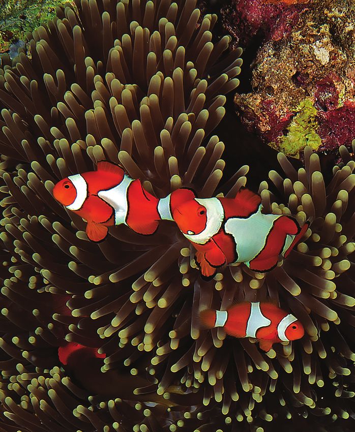
VOL

11

      SOLOMON
      ISLANDS
      GLOBAL REEF EXPEDITION FINAL REPORT

                Renée D. Carlton, Alexandra C. Dempsey, Katie Lubarsky,
                   Ivory Akao, Mohammed Faisal, and Samuel Purkis
N
KEI NWG CA
D OLE
M ODO
FNTO
I AN G A
TABLE OF CONTENTS
EXECUTIVE SUMMARY . . . . . . . . . . . . . . . . . . . . . . . . . . . . . . . . . . . . . . . . . . . . 2
1.0 INTRODUCTION . . . . . . . . . . . . . . . . . . . . . . . . . . . . . . . . . . . . . . . . . . . . . . . 6
2.0 METHODS
2.1 Site Descriptions . . . . . . . . . . . . . . . . . . . . . . . . . . . . . . . . . . . . . . . . . . . . . 12
©2020 Khaled bin Sultan Living Oceans Foundation. All Rights Reserved. 2.2 Habitat Mapping . . . . . . . . . . . . . . . . . . . . . . . . . . . . . . . . . . . . . . . . . . . . . 12
Science Without Borders® 2.2a) Satellite Imagery . . . . . . . . . . . . . . . . . . . . . . . . . . . . . . . . . . . . . . . . . . . . . . 15
2.2b) Benthic Video . . . . . . . . . . . . . . . . . . . . . . . . . . . . . . . . . . . . . . . . . . . . . . . . 15
The findings presented in this report were collected as part of the Global Reef Expedition through the support provided by His
Royal Highness Prince Khaled bin Sultan. 2.2c) Habitat Classifications . . . . . . . . . . . . . . . . . . . . . . . . . . . . . . . . . . . . . . . . . . 16
2.2d) Acoustic Water Depth Soundings . . . . . . . . . . . . . . . . . . . . . . . . . . . . . . . . 16
All research was completed under an MOU between the Ministry of Fisheries and Marine Resources and KSLOF (MFMR Ref
F/12/11 issued 20 August 2014) and under Research Permit Number RP/2014/006 issued by the Ministry of Environment, 2.3 Coral Reef Community Surveys . . . . . . . . . . . . . . . . . . . . . . . . . . . . . . . . . 18
Climate Change, Disaster Management and Meteorology on 21 August 2014. Further permissions were acquired from 2.3a) Benthic Cover Assessment . . . . . . . . . . . . . . . . . . . . . . . . . . . . . . . . . . . . . 18
the Provincial Governments in Temotu Province, Isabel Province and Western Province. This report was developed as one 2.3b) Fish Assessments . . . . . . . . . . . . . . . . . . . . . . . . . . . . . . . . . . . . . . . . . . . . . 20
component of the Global Reef Expedition: Solomon Islands research project.
3.0 RESULTS
The Khaled bin Sultan Living Oceans Foundation (KSLOF) is a nonprofit organization dedicated to providing science-based
3.1 Habitat Mapping . . . . . . . . . . . . . . . . . . . . . . . . . . . . . . . . . . . . . . . . . . . . . 24
solutions to protect and restore ocean health. KSLOF was incorporated in California as a 501(c)(3), public benefit, Private
Operating Foundation in September 2000. Since then, the Living Oceans Foundation has worked to conserve the world’s 3.2 Benthic Community Assessment . . . . . . . . . . . . . . . . . . . . . . . . . . . . . . . . . 26
oceans through research, outreach, and education. 3.2a) Western Province . . . . . . . . . . . . . . . . . . . . . . . . . . . . . . . . . . . . . . . . . . . . . . 26
www.livingoceansfoundation.org 3.2b) Isabel Province . . . . . . . . . . . . . . . . . . . . . . . . . . . . . . . . . . . . . . . . . . . . . . . 28
Khaled bin Sultan Living Oceans Foundation 3.2c) Temotu Province . . . . . . . . . . . . . . . . . . . . . . . . . . . . . . . . . . . . . . . . . . . . . . 30
7 Old Solomons Island Road, Suite 200 3.3 Fish Community Assessment . . . . . . . . . . . . . . . . . . . . . . . . . . . . . . . . . . . 32
Annapolis, MD 21401
3.3a) Species Richness of the Fish Assemblage . . . . . . . . . . . . . . . . . . . . . . . . 33
info@lof.org
3.3b) Fish Density . . . . . . . . . . . . . . . . . . . . . . . . . . . . . . . . . . . . . . . . . . . . . . . . . . 34
Chief Scientist: Dr. Samuel Purkis 3.3c) Fish Biomass . . . . . . . . . . . . . . . . . . . . . . . . . . . . . . . . . . . . . . . . . . . . . . . . . 35
Director of Science Management: Alexandra C. Dempsey 3.3d) Size Distribution of Fish . . . . . . . . . . . . . . . . . . . . . . . . . . . . . . . . . . . . . . . . 36
Marine Ecologist: Renée D. Carlton
4.0 DISCUSSION . . . . . . . . . . . . . . . . . . . . . . . . . . . . . . . . . . . . . . . . . . . . . . . . 40
Photo Credits:
5.0 CONSERVATION RECOMMENDATIONS . . . . . . . . . . . . . . . . . . . . . . . . . . . 46
Cover: Ken Marks
Pg. 4, 10, 18, 21, 31, 38, 44, 47, and 49 by Ken Marks ACKNOWLEDGMENTS . . . . . . . . . . . . . . . . . . . . . . . . . . . . . . . . . . . . . . . . . . . . 48
Pg. 22 by João Monteiro
LITERATURE CITED . . . . . . . . . . . . . . . . . . . . . . . . . . . . . . . . . . . . . . . . . . . . . . 50
Citation: Global Reef Expedition: Solomon Islands. Final Report. Carlton, R., Dempsey, A., Lubarsky, K., Akao, I., Faisal, M., and
APPENDICES . . . . . . . . . . . . . . . . . . . . . . . . . . . . . . . . . . . . . . . . . . . . . . . . . . . 52
Purkis, S. (2020) Khaled bin Sultan Living Oceans Foundation, Annapolis, MD. Vol 11.
ISBN: 978-0-9975451-6-6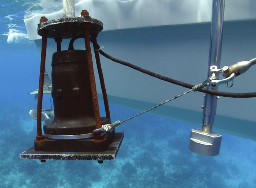
EXECUTIVE SUMMARY S
NO LOCA
EW M OLE
NDI SOLNAIN
AD S
the diversity and conditions of the reef were mapped, relatively high average live coral cover, measuring 42%
including mangroves, seagrasses, and multiple reef and 44% respectively. These were some of the highest
habitats both inside and outside of the lagoons. These percentages of live coral found within the Province and in
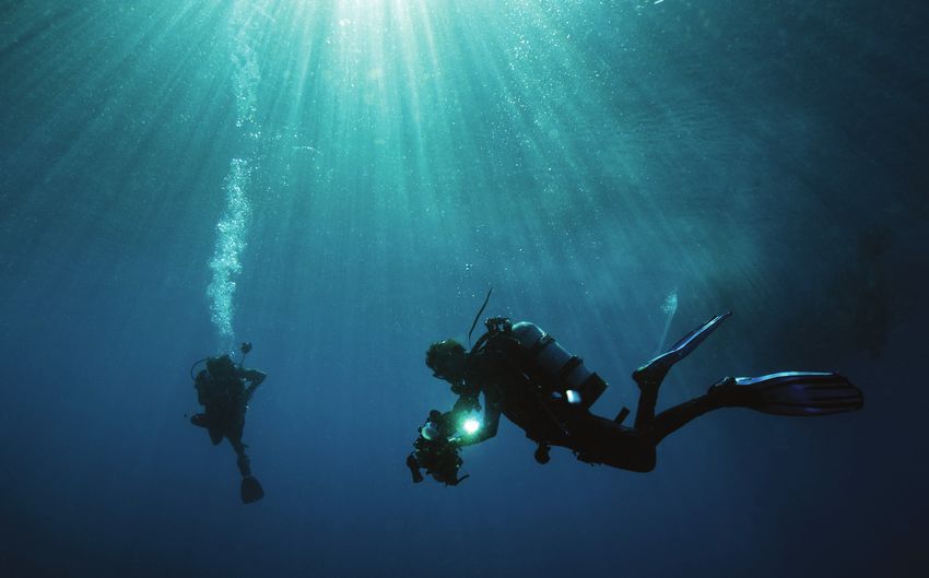
On the Global Reef Expedition—one of the largest coral reef studies in history—the
are high-resolution maps with a resolution of 2 m x 2 m. nearly all of the stations surveyed.
Khaled bin Sultan Living Oceans Foundation conducted research in the Solomon These maps are all available to view on our website at
Islands to map and characterize shallow marine habitats and assess the status of www.lof.org/maps and will be valuable to marine spatial FISH COMMUNITY ASSESSMENT
planning efforts in these areas. We encourage the public,
coral reef benthic and fish communities. Working in partnership with local officials scientists, and policymakers to consult with these maps, The fish communities in the Solomon Islands showed
and scientists from around the world, the Foundation surveyed reefs in the Western, particularly those interested in marine management, to distinct patterns across sites that likely reflected patterns
in fishing pressure across the archipelago. The fish
Isabel, and Temotu Provinces from October 26 through November 24, 2014. The better understand the areas that might require protection.
communities in the Temotu Province, where fishing
Global Reef Expedition: Solomon Islands Final Report summarizes the Foundation’s BENTHIC COVER ASSESSMENTS
pressure is likely much less, were more diverse, had the
highest fish species richness, density, and biomass. More
findings from this research mission and provides recommendations that can help
The benthic habitats of the Solomon Islands were generally populated areas, such as around Gizo, had much smaller
preserve these coral reefs for generations to come. in moderate condition with notable variability among the fish in lower trophic levels, indicating over-exploitation of
Provinces. In the Western Province, sites surveyed near nearshore fisheries. Overall, even with relatively higher
Marovo had the highest live coral cover, while areas with metrics being observed in the Temotu Province, the
the lowest live coral were found near Munda. The substrate fish communities were in dire shape, having some of
that was unoccupied by coral was instead dominated the worse metrics seen on the Global Reef Expedition,
The Khaled bin Sultan Living Oceans Foundation The Solomon Islands are found at the eastern edge of the
by crustose coralline algae (CCA) which indicates the especially when compared to nearby South Pacific
(KSLOF) was established by His Royal Highness Prince Coral Triangle, making it a valuable country to include on
invertebrate and fish communities near Munda may be nations.
Khaled bin Sultan with a mission to study and provide the GRE. In October-November 2014, KSLOF visited the
regulating macroalgal growth. Gizo also had a notably
valuable knowledge to better preserve coral reefs Western, Isabel, and Temotu Provinces of the Solomon
low live coral cover with the reefs being dominated by turf CONSERVATION RECOMMENDATIONS
around the world. To do this, KSLOF embarked on the Islands with the objectives:
algae and CCA. Nono Lagoon had slightly better live coral
Global Reef Expedition (GRE) with the goal of surveying The Solomon Islands are a treasure to the world, with
cover, though still not as high as would be expected.
coral reefs and their benthic and fish communities Map and characterize the shallow marine some of the most unique coral and fish assemblages.
on a global scale. With the help of local experts and habitats; and Isabel Province has the most protections in place because Unfortunately, it appears these habitats are in need of
a team of international scientists, KSLOF was able to of the designated Arnavon Conservation Area. KSLOF aggressive conservation efforts. Conservation of the fish
use standardized methodology to collect the most surveyed both within the conservation area around Sikopo communities should be a priority for the communities
comprehensive global coral reef data to date.
Conduct assessments and research and Kerehikapa and outside near Malakobi. The reefs that rely on them for sustenance. Regulating catch size
During the GRE, collecting data in the Coral Triangle was to understand the current status of Kerehikapa had an average of 51% live coral cover and number will help improve the overall biomass and
of Solomon Islands coral and fish which was some of the best we observed in the Solomon abundance in all trophic levels, as they are currently
important to the Foundation as this region of the world
communities. Islands. However, Sikopo had only 30% live coral which being dominated by few, small fish.
boasts some of the highest tropical marine diversity and
may be attributed to damage sustained during the tsunami
up to 76% of the world’s marine species. While in the Solomon Islands, KSLOF scientists observed
that hit the region in 2007. Malakobi had similar live coral
On the mission to the Solomon Islands, the Foundation evidence of elevated numbers of Crown-of-Thorns
cover as Sikopo and may have sustained similar damage
brought together a team of scientists, working closely Starfish (COTS), a poisonous corallivore. When an
during the tsunami, however, continued monitoring is
local officials to conduct 473 benthic surveys and 632 outbreak occurs, COTS can have detrimental effects on
recommended.
This report provides an fish surveys at 68 dive sites among the three provinces. the reef system. In other regions of the world, KSLOF has
What was found was surprising. There was high variability
assessment of coral in both the benthic and fish communities found among
Temotu Province was the most remote region surveyed
in the Solomon Islands. Within this Province, the Reef
observed, first-hand, the destruction COTS can have on a
reef where it can essentially consume and kill every coral
reefs and reef fish in the survey sites, but overall, what was most alarming was Islands had the lowest live coral cover, measuring 31%. on a reef system. It is important to educate communities
the seemingly overfished nearshore fish communities. Interestingly, there were many large patches of Halimeda on the damage these organisms can cause and develop
the Solomon Islands spp., an erect coralline algae, observed in this area, a management plan should an outbreak occur.
along with conservation HABITAT MAPPING particularly in depths deeper than 10 m. There was also
higher live coral cover observed at depths greater than 10
recommendations. In total, KSLOF mapped and characterized over 3,000
m, measuring an average of 51%. Vanikoro and Utupua
square km of the Western, Isabel, and Temotu Provinces.
are small atolls found within the Temotu Province and had
A wide variety of marine habitats that are important to
2 3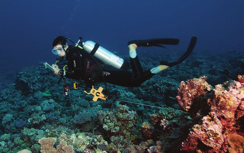
1.0
 S
 NO L OC
   EW  MAOLNE D
              I SOLNA INAD S

INTRODUCTION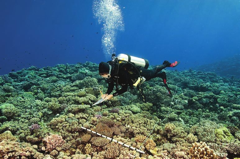
INTRODUCTION                                                                                                                                                                                                                                    S
                                                                                                                                                                                                                                                NO LOCA
                                                                                                                                                                                                                                                  EW M OLE
                                                                                                                                                                                                                                                         NDI SOLNAIN
                                                                                                                                                                                                                                                                   AD S

1.0
      The Solomon Islands are made up of numerous                     reef organisms as a form of income generation, which,          which was a relatively sustainable method of fishing and          of the fish communities than can be achieved using
      archipelagos comprised of uplifted reefal limestone and         unregulated, can have negative effects on the reef             primarily opportunistic10. Traditional forage fishing does        non-foraging strategies. However, with the introduction
      volcanic islands found within the eastern edge of the           ecosystem.                                                     not exclusively exploit one area of the reef; rather, the         of better technology, the use of more destructive
      Coral Triangle (Figure 1). The Coral Triangle boasts                                                                           fishers travel to different parts of the reef depending on        fishing methods, and an increase in both artisanal and
      some of the highest tropical marine diversity and up to         Besides the highly valuable coral reefs, the Solomon           the fishing success. This allows for fishing pressure to be       commercial fisheries, the inshore fish stocks are at risk of
      76% of the world’s marine species1,2. With coral reefs          Islands are rich in forests, metals and minerals such          more evenly distributed and for more successful recovery          depletion8.
      surrounding the nearly 1,000 islands and cays3, the             as gold, bauxite, and nickel, which are being exported
      Solomon Islands were of interest to the Khaled Bin Sultan       by multinational mining companies5. Unfortunately,
      Living Oceans Foundation (KSLOF). Despite the high              extraction of these resources have had detrimental
      marine biodiversity found here, the reefs of the Solomon        effects on the reefs through excessive sedimentation,
                                                                      nutrient runoff, and most recently an expansive oil spill
                                                                                                                                            Figure 1
      Islands are relatively understudied2. Travel among the                                                                                                        MAP OF THE SOLOMON ISLANDS EXCLUSIVE ECONOMIC ZONE OUTLINED IN RED, WITH THE

      many islands is both difficult and unreliable, hindering        due to the grounding of a cargo ship carrying mined                                           PROVINCES SURVEYED OUTLINED IN PURPLE. THE INSET MAP SHOWS THE ESTIMATED OUTLINE
                                                                                                                                                                    OF THE CORAL TRIANGLE (BLUE LINE) AS DEFINED BY THE CORAL TRIANGLE ATLAS.
      the ability of scientists to reach some of the more             bauxite6. Natural forest logging also creates excessive
      remote locations. The donated time of the M/Y Golden            sedimentation through the destabilization of hillsides
      Shadow allowed a team of international scientists to            and the removal of vast areas of tropical rainforests. In
      map and survey marine habitats within three provinces           a study by Albert et al. (2014), a recent effort to minimize
      of the Solomon Islands: the Western, Isabel, and Temotu         the impacts of deforestation led by the communities
      Provinces.                                                      around Marovo Lagoon have had a positive impact on
                                                                      the benthic and fish communities. Through the cessation
      The Khaled bin Sultan Living Oceans Foundation began            of logging and modification of catchment practices, the
      the Global Reef Expedition (GRE) with the goal of better        communities reduced the overall runoff from nearby
      understanding the status of coral reefs globally and to         logging resulting in more positive reef conditions7.
      contribute to conservation efforts of this fragile ecosystem.
      KSLOF visited the Western, Isabel, and Temotu provinces         Marine resource management in the Solomon Islands
      in October-November 2014 to undertake the objectives            is primarily led by local villages who have tenure over
      which were common to all GRE sites:                             nearshore reef access and customary entitlement to
                                                                      marine territories is managed through means of various
                                                                      cultural practices8. Simply stated, access to reefs and
            Map and characterize the shallow marine                   offshore waters is managed by the chiefs of territories
            habitats; and                                             adjacent to the area and shared marine resources are
                                                                      agreed upon by the local communities9. Traditionally,
            Conduct assessments and research to                       most inshore fisheries used the practice of foraging
            understand the current status of Solomon
            Islands coral and fish communities.

      The data collected on the research mission in the
      Solomon Islands provides important baseline information
                                                                                 The data collected on this
      about the reefs’ benthic and fish communities. The
      marine habitats of the Solomon Islands are invaluable,                     research mission provides
      particularly to the local inhabitants that rely on them for
      daily sustenance. In a study completed by CGIAR in 2012,               important information
      coral reefs of the Solomon Islands provide an average
                                                                               about benthic and fish
      of $18,000 to $75,000 SBD (Solomon Island Dollar) per
      respondent per year in direct use-value4. Of this, food              communities on coral reefs in
      from sustenance fishing was the greatest economic
      contributor with fish accounting for 23-39% of the total                the Solomon Islands.
      direct-use value in non-coral trading communities4.                                                                                             SOLOMON ISLANDS EEZ                     PROVINCE OUTLINE                     CORAL TRIANGLE

      Some communities collect, trade, and sell coral and

                                                               6                                                                                                                                         7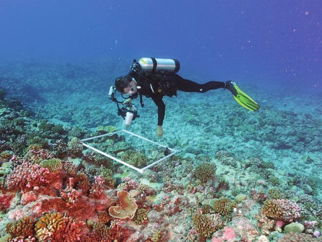
INTRODUCTION                                                                                                                                                                                                                    S
                                                                                                                                                                                                                                NO LOCA
                                                                                                                                                                                                                                  EW M OLE
                                                                                                                                                                                                                                         NDI SOLNAIN
                                                                                                                                                                                                                                                   AD S

                                                                                                                               Another network of marine conservation areas has been       conservation efforts, the marine resources of the Solomon
                                                                                                                               established around Gizo Island in the Western Province      Islands still require attention. Most of the MPAs in the

          Figure 2
                              CURRENT MARINE PROTECTED AREA (MPA) DESIGNATIONS IN THE SOLOMON ISLANDS                          through the development of the Gizo Environmental           Solomon Islands are small, in total accounting for only
                              ARE HIGHLIGHTED IN PINK. THESE AREAS ARE INTERNATIONALLY RECOGNIZED,                             Livelihood and Conservation Association (GELCA), a          0.12% of the total EEZ14. KSLOF visited some locations
                              LOCALLY MANAGED, AND HAVE VARYING MANAGEMENT REGULATIONS SPECIFIC TO
                              EACH AREA.
                                                                                                                               consortium of local representatives from villages around    near and away from a select few of these conserved
                                                                                                                               the Gizo islands. GELCA has established both permanent      areas to get a comprehensive understanding of the
                                                                                                                               marine protected areas (no-take) and multiple-use           benthic (reef bottom, including coral, algae, and sessile
                                                                                                                               marine protected areas (MPAs) called the GELCA              invertebrates) and reef fish communities. Of the sites
                                                                                                                               Conservation Protection Area. The conservation area         visited near conservation areas, KSLOF particularly
                                                                                                                               includes 10 management areas where conservation rules       focused on areas where commercial mining and logging
                                                                                                                               have been established. In November 2011, the GELCA          have not been allowed (as of the time of our visit in 2014),
                                                                                                                               released the GELCA Resource Management Plan which           particularly at sites in the Temotu province, south of the
                                                                                                                               outlines the regulations, locations, and enforcement plan   more populated provinces to the north. It is the goal of
                                                                                                                               for the GELCA MPAs13.                                       KSLOF to provide valuable baseline information about the
                                                                                                                                                                                           status of the coral reefs in the Solomon Islands, and that
                                                                                                                               Throughout the Solomon Islands, 90 internationally          through this report, effective protection and management
                                                                                                                               recognized marine conservation areas have been              can be expanded on a large scale.
                                                                                                                               designated at the time of this publication. Despite these

                                                                                                                                                                    The goal of the Khaled bin Sultan
                                                                                                                                                                      Living Oceans Foundation is to
                                                                                                                                                                  provide valuable baseline information
                                                                MPAS                                                                                             about the status of coral reefs
                                                                                                                                                                     in the Solomon Islands.
   Since the 1990s, private organizations, public agencies,         communities and government have banned: all mining;
   and NGOs have worked together to establish locally               harvesting of commercially important species such as all
   managed conservation areas in the Solomon Islands                species of turtles, pearl shell, trochus, sea cucumbers,
   to protect nearshore marine habitats from destruction            giant clams, green snails, sharks, corals, pigeons, and
   (Figure 2). One of the largest and only formally                 milkfish; logging or removal of vegetation is prohibited
   recognized Marine Protected Area (MPA) in the Solomon            except for sustenance; line fishing for reef fish except
   Islands is the Arnavon Marine Conservation Area in the           for sustenance; hunting of megapode birds except for
   Arnavon Islands, north of Santa Isabel. This conservation        seasonal harvesting of their eggs; and commercial
   area was established to protect the important hawksbill          collection of all other marine or terrestrial organisms
   sea turtle rookery and has benefited the coral ecosystem         except for sustenance12.
   within the area11. In this conservation area, the local

                                                            8                                                                                                                               9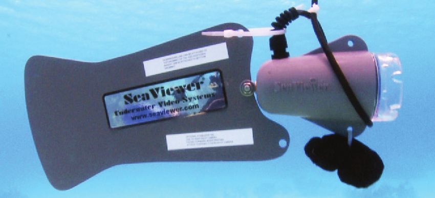
S
NO L OC
  EW  MAOLNE D
             I SOLNA INAD S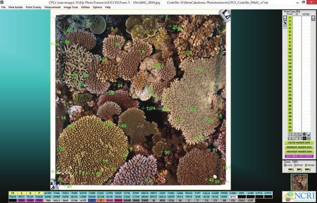
METHODS S
NO LOCA
EW M OLE
NDI SOLNAIN
AD S
2.1 SITE DESCRIPTIONS
The GRE mapped and surveyed coral reefs in three provinces of the Solomon Islands: Western, Isabel, and
2.2 HABITAT MAPPING
Using multispectral WorldView-2 satellite imagery
Temotu. A total of 68 dive sites (Figure 3) were surveyed, among which 473 benthic habitat transects and 615 (DigitalGlobe Inc., Washington D.C., USA) in
Figure 4
AREAS HIGHLIGHTED IN YELLOW ARE AREAS MAPPED BY
KSLOF. ALL MAPS CAN BE FOUND ON OUR MAP PORTAL
fish surveys were completed. combination with data obtained from aerial AT WWW.LOF.ORG/MAPS.
surveys and ground-truthing (Figure 4) by
KSLOF fellows and researchers, high-resolution
bathymetric maps and thematic habitat maps
Table 1
The dive sites were selected based on TOTAL NUMBER OF DIVE SITES AND TRANSECTS were created for shallow marine environments
COMPLETED AT EACH LOCATION IN 2014.
accessibility by boat and with the goal of found within the lagoons and forereefs (see
including all reef habitats (as defined from examples of map outputs in Figures 5a-c)15. The
NUMBER NUMBER NUMBER
the satellite images, Figure 5a). Table OF DIVE OF BENTHIC OF FISH
remote sensing data and their derivatives will be
PROVINCE LOCATION
1 shows the total number of surveys SITES TRANSECTS TRANSECTS useful not only for marine spatial planning but
conducted at each location. The extensive GIZO 6 78 72 also as a reference for future research on the
surveys were selected to include remote, Solomon Islands’ coral reefs. The generated maps
MAROVO 2 8 19
uninhabited locations that, at the time of WESTERN extend from the shoreline to approximately 25 m
MUNDA 3 43 32 water depth. Ground-truthing, which was used to
sampling, had not previously been studied
to this extent, as well as locations within NONO 7 37 67 define habitat classes, and guide interpretation
and near already designated protected of the remote sensing data (Figure 4), included
KEREHIKAPA 3 19 21
sites. The M/Y Golden Shadow and its continuous acquisition of depth soundings, drop-
ISABEL MALAKOBI 6 38 52
support vessels were graciously donated camera deployment, samples of sediment and
for use on this expedition to allow KSLOF
SIKOPO 3 20 33 hard substrates, snorkel and dive assessments,
and fine-scale photo-transect surveys. AREAS MAPPED
and invited researchers to easily gather REEF ISLANDS 15 108 122
data in some of the most understudied TINAKULA 3 12 25
regions of the Solomon Islands. TEMOTU
Figure 5a
UTUPUA 11 61 96 THESE THREE EXAMPLE MAP OUTPUTS ARE OF GIZO, SOLOMON ISLANDS. EXAMPLE OF
(A) A TRUE-COLOR SATELLITE IMAGE CAPTURED FROM THE WORLDVIEW-2 SENSOR, (B) A
VANIKORO 9 49 93 HABITAT MAP, AND (C) A SPECTRALLY-DERIVED BATHYMETRY MODEL. | SATELLITE IMAGE
WorldView-2 Satellite Imagery
Figure 3 Gizo, Solomon Islands
FISH AND BENTHIC SURVEY SITE LOCATIONS IN WESTERN, ISABEL, AND TEMOTU PROVINCES. BLUE DOTS ARE SURVEY
SITE LOCATIONS AND MARINE PROTECTED AREAS FOR THE PROVINCES SURVEYED ARE FILLED IN WITH PINK.
Western Province Isabel Province Temotu Province
SURVEY SITES MARINE PROTECTED AREAS
12 13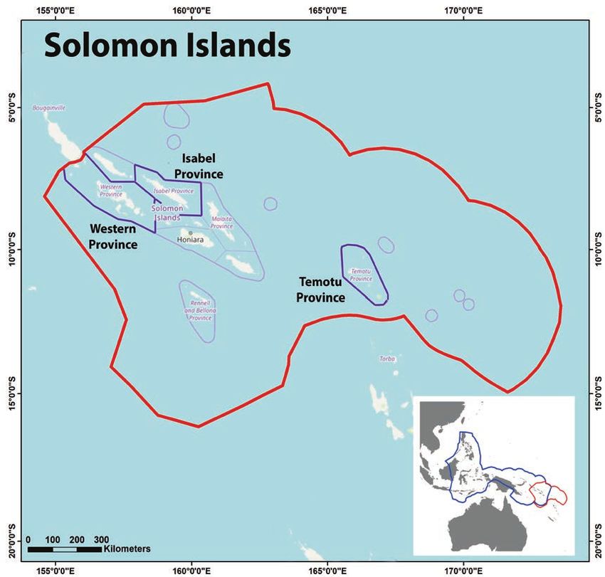
METHODS                                                                                                                                                                              S
                                                                                                                                                                                     NO LOCA
                                                                                                                                                                                       EW M OLE
                                                                                                                                                                                              NDI SOLNAIN
                                                                                                                                                                                                        AD S

  Figure 5b   HABITAT MAP WITH CLASSIFICATIONS
                                                                                 2.2
                                                      Habitat Map
                                                      Gizo, Solomon Islands
                                                                                    a SATELLITE IMAGERY
                                                                                        A total of 2,662 sq. km of DigitalGlobe Inc. WorldView-2 (8 band) satellite imagery was purchased by KSLOF
                                                                                        for the regions mapped. The satellite images had a spatial resolution of 2×2 m (each pixel covers a 4 m2 area)
                                                                                        enabling real-time navigation in the field to locate features of interest. KSLOF Fellows from Nova Southeastern

                                                                                 2.2 BENTHIC VIDEO
                                                                                        University and the University of Miami used the scenes in conjunction with a differential GPS device to
                                                                                        navigate throughout the atolls. Modelers used the imagery, combined with the ground-truthing data, to create
                                                                                        bathymetric and benthic habitat maps15.

                                                                                    b
                                                                                        An underwater tethered digital video camera, commonly termed a “drop-cam,” was used to gather video of the
                                                                                        benthic composition at each drop-cam location (Figure 6). At each station, the drop-cam was lowered from
                                                                                        the survey boat to within 0.5 m of the seafloor and video recorded for up to 60 seconds. During this time, a
                                                                                        laptop operator watched the video in real-time and guided the drop-cam operator to raise or lower the camera
                                                                                        to avoid any topography. In this manner, any damage to marine life was prevented. The video was recorded on
                                                                                        a ruggedized laptop with geo-position, time, date, boat heading, and boat speed digitally etched into the video
                                                                                        stream. Drop-cam deployment was limited to depths shallower than 40 m due to the 50 m length of the tether
                                                                                        cable.

  Figure 5c   BATHYMETRY MAP WITH DEPTHS

                                                                                            Figure 6
                                                                                                                 SEAVIEWER UNDERWATER VIDEO “DROP-CAM” USED TO RECORD BENTHIC COMPOSITION AROUND EACH ISLAND.

                                                      Image-Derived Bathymetry
                                                      Gizo, Solomon Islands

                                                 14                                                                                            15
METHODS S
NO LOCA
EW M OLE
NDI SOLNAIN
AD S
2.2 Table 2 CLASSES OF BENTHIC HABITAT USED FOR MAPPING AND AREA CALCULATIONS. THE MEASUREMENT OF EACH AREA
IS PRESENTED IN TABLE 3 FOR EACH OF THE LOCATIONS SURVEYED. KSLOF COMBINED SOME HABITATS (RIGHT
COLUMN) UNDER A BROADER CLASSIFICATION (LEFT COLUMN) FOR THE PURPOSES OF THIS REPORT.
c HABITAT CLASSIFICATIONS HAB ITAT C LAS S I FI CATI O N S
Back reef coral Back reef coral bommies
Habitat classifications of all the marine and terrestrial habitat types were determined using the satellite imagery and
Back reef coral framework
ground-truthing using benthic video surveys. The combination of all data collected was used for the development of a
habitat classification scheme and training of eCognition software to develop object-based classification models15. A total of Deep forereef slope
31 habitat types were defined for all the studied sites (Table 2). When calculating and presenting total area coverage of the
2.2 ACOUSTIC WATER DEPTH SOUNDINGS
Deep lagoonal water
different habitat classifications, multiple habitat types were sometimes combined (Table 2). For example, for back-reef coral Lagoonal coral Lagoonal Acropora framework
habitats, we combined back-reef coral bommies and back-reef coral framework to represent this broad reef environment. Lagoonal floor — coral bommies
Lagoonal fringing reefs
d
Lagoonal patch reefs
Lagoonal pinnacle reefs — branching coral dominated
Sonar soundings were gathered by KSLOF fellows along transects using a Syqwest Inc. Hydrobox, a single-beam Lagoonal pinnacle reefs — massive coral dominated
acoustic transducer operating at 50 Hz (Figure 7). Each sounding was positioned using differential GPS and the data Lagoonal substrate Back reef — pavement
were recorded on a ruggedized laptop. The soundings were used to train a satellite water-depth derivation model, Back reef — rubble dominated
which is based on the spectral attenuation of light in the water column16. The final topo-bathymetric maps have the
Back reef — sediment dominated
same spatial resolution as the satellite imagery from which they were extracted (i.e. 2 × 2 m).
Lagoonal floor — barren
Lagoonal sediment apron — sediment dominated
Lagoonal macroalgae dominated substrate Lagoonal floor — macroalgae on sediment
Figure 7 ACOUSTIC SONARS USED IN THE SURVEYS. SUB-SEABED PROFILER (LEFT) AND
Lagoonal pinnacle reefs — calcareous red-algal conglomerate
SINGLE-BEAM SONAR (RIGHT). Lagoonal sediment apron — macroalgae on sediment
Nearshore algal communities Coralline algal ridge (reef crest)
Dense macroalgae on sediment
Shallow forereef community Reef crest
Shallow forereef slope
Shallow forereef terrace
Forereef sand flats
Dense seagrass meadows
Mud flats
Reef top algal mats
Terrestrial Beach sand
Terrestrial vegetation
Unvegetated terrestrial
Mangroves
Inland waters
Urban
16 17METHODS S
NO LOCA
EW M OLE
NDI SOLNAIN
AD S
2.3
were overlaid on each photograph. A KSLOF scientist
CORAL REEF COMMUNITY SURVEYS Figure 9
A DIVER TAKES A PHOTO OF A 1 M × 1 M SQUARE QUADRAT. TEN
then defined the organism and substrate type directly PHOTOS FOR EACH TRANSECT ARE COMPLETED AT DIFFERENT
underneath the point (Figure 10). These data were then DEPTHS. BENTHIC DATA IS ALSO COLLECTED USING TRANSECT LINES
AS SHOWN IN FIGURE 8.
Living Oceans Foundation scientists and fellows on the GRE used a combination of exported into a Microsoft Excel (2013) spreadsheet and
quantitative methods, including belt transects, point intercept transects, and quadrats added to the benthic survey database for further analysis.
to assess benthic and fish communities of reefs located in the Solomon Islands. This The benthic substrate cover percentages were calculated
standardized collection methodology provides robust data that can be compared for each island as the average percentage of all transects
2.3 BENTHIC COVER ASSESSMENTS
regionally and globally. This report provides a broad discussion of trends and patterns as collected at that island, binned first by depth, then by site.
The percentage of each substrate type was calculated by
a prelude to more in-depth analysis.
dividing the total number of samples observed in each
depth on each transect by the total number of points
a
recorded, multiplied by 100. The average percentage of all
transects at each location is presented as the measure of
Cover of major functional groups and substrate type (Box 10 m transect line and record the organism and substrate each substrate type.
1) was assessed along 10 m transects using recorded type at every 10 cm mark (total 100 points per transect).
observations and/or photographic assessments. The A minimum of four transects among the five depth strata
major functional groups included: corals identified to
genus, other sessile invertebrates such as leather corals,
were completed at each dive site (Figure 8), and when
possible, surveys were completed at 25, 20, 15, 10, and 5
Box 1 CLASSIFICATION OF SUBSTRATE TYPES
RECORDED DURING BENTHIC TRANSECT
SCUBA SURVEYS.
anemones, and others identified to phylum or class, m water depths.
and six functional groups of algae. At least two KSLOF B E N T H I C H A B I TAT
surveyors used SCUBA-recorded observations to record At some locations, we conducted a photographic
SUBSTRATE TYPE
what was observed on the benthos using a point intercept assessment to supplement the point-intercept surveys.
On occasion, we were not able to complete these Live Coral
method. This technique required the surveyor to lay out a
surveys at every depth due to Dead Coral
SCUBA time limitations, so we Fused Rubble
Figure 8 supplemented this dataset with
Figure 10
A DIVER CONDUCTING A BENTHIC SURVEY. DIVER USES A 10 M TRANSECT LINE AND EXAMPLE OF A PHOTOGRAPHED QUADRAT IMPORTED INTO CPCE
RECORDS BENTHIC SUBSTRATE TYPE AND COVER EVERY 10 CM. PHOTO BY KEN MARKS. Pavement SOFTWARE, WITH RANDOMLY PLACED POINTS FOR IDENTIFICATION.
photographic assessments. FIFTY RANDOM POINTS ARE OVERLAID ON EACH PHOTO QUADRAT,
In this sampling technique, a Rubble AND SUBSTRATE TYPE AND LIVE COVER CLASSIFICATION ARE
IDENTIFIED FOR EACH POINT.
scientific diver used a 1 m × Sand/Sediment
1 m quadrat, flipping it over a
Recently Dead Coral
total of 10 times per transect
LIVE COVER
to photograph a full 1 × 10 m
photo transect (Figure 9) at each Algae
depth. As before, when possible, Macroalgae
the diver completed at least one
Crustose Coralline Algae (CCA)
survey at 20, 15, 10, and 5 m
FPO
depth at each site. In order to Erect Coralline Algae
measure the benthic community, Turf Sediment
the digital photographs were Turf
downloaded and analyzed using
Cyanobacteria
Coral Point Count with Excel
Extensions (CPCe), a software Other Invertebrates
developed by Nova Southeastern Coral (to Genus)
University’s National Coral Reef
Institute (NCRI)17. The 1 × 1 m
images were imported into the
software where 50 random points
18 19METHODS S
NO LOCA
EW M OLE
NDI SOLNAIN
AD S
To further analyze the coral and algal cover, the sum of usually important indicator species that contribute to the
the specific algae types or coral genus recorded on each health of the reef by providing such services as cropping
By analyzing the fish
transect was divided by the total number of algae or coral algal growth which otherwise would impede the settlement
observed per transect. The average of the percentages for This standardized collection of juvenile corals32,33. These fish include damselfish, communities using
each algae type is presented in (Figure 13).
provides
methodology
tangs, surgeonfish, butterflyfish, and a few small-bodied
parrotfish. Fish in trophic level 3.0-3.5 and 3.5-4.0 include
we strived
trophic levels,
To measure overall coral diversity by genus, we used
the Simpson Index of Diversity which is commonly used
robust data that can be larger-bodied herbivores, planktivores, omnivores, or to understand the
carnivores that feed on small benthic invertebrates. Fish
to characterize species diversity in a community18. This compared regionally classified in these ranges include wrasses, some species community structures
index uses the total number of individual coral colonies
of a specific genus observed per island, and the total and globally. of butterflyfish, damselfish, hogfish, goatfish, snappers,
and triggerfish. Fish in trophic level 4.0-4.5 are typically
and determine how fishing
number of genera, to provide a number to represent the
total diversity of the island community. Using this index,
considered top predators and prey on finfish of the lower pressures might be
trophic levels. These predatory fish include large wrasse,
the diversity will fall within a range of 0-1 with 0 being low grouper, hawkfish, snapper, goatfish, and sharks. The affecting the fish
diversity, and 1 being the most diverse. majority of the fish important to local fisheries are found in
trophic levels 3.5-4.0 and 4.0-4.531.
communities.
2.3
b FISH ASSESSMENTS
Reef fish surveys were conducted by KSLOF Scientists centimeters, and a and b are the species-specific
Figure 11
A SCIENTIFIC SCUBA DIVER RECORDS FISH ALONG A TRANSECT LINE. SCIENTIST
and Fellows at selected locations. The survey transects growth constants derived from the length-weight RECORDS FISH OBSERVED ALONG A 30 M × 4 M TRANSECT OVER A 10-15 MINUTE
PERIOD. PHOTO BY KEN MARKS.
covered depths between 1 to 22 m, but most of the relationships24–28. Abundance and biomass data
surveys were between 5 and 20 m depth (Figure were then converted and represented as density by
11). Transects were deployed at deep (>12m) and individuals/100m2 and biomass by kg/100m2.
shallow (3.0
S
NO L OC
EW MAOLNE D
I SOLNA INAD SRESULTS S
NO LOCA
EW M OLE
NDI SOLNAIN
AD S
3.1 HABITAT MAPPING
The Solomon Islands boasts a variety of marine habitats
that play a critical role in the diversity and condition of
The lagoonal fringing reefs accounted for 76 km2 of
the reef structure and were mapped at all of the areas
Table 3
TOTAL AREA (KM 2) OF HABITAT TYPE, BY ISLAND, CALCULATED FROM HABITAT MAPS. DASHES INDICATE NO HABITAT
TYPE FOUND AT THAT LOCATION.
T O TA L A R E A ( S Q U A R E KM )
the reefs. Habitats such as mangroves and seagrasses surveyed with the exception of the Reef Islands. Lagoonal
Reef Sikopo-
are important nursery and settlement sites for many reef fringing reefs are coral reef frameworks that fringe islands. HAB ITAT C LAS S I FI CATI O N S Gizo Malakobi Tinakula Munda Marovo Utupua Vanikoro
Islands Kerehikapa
and pelagic fish species34,35. Other mapped habitats These reefs have similar benthic community composition
Back reef coral bommies 0.23 0.00 1.00 0.01 -- 0.03 -- 0.23 --
encompassed the wave-exposed forereef habitats, as lagoonal patch reefs. Lagoonal pinnacle reefs
lagoonal habitats, mudflats and macroalgae beds that dominated by massive corals covered 60 km2 of the area Back reef coral framework 1.62 0.88 4.29 0.12 -- 1.48 0.71 2.47 3.59
all contribute to the varying community structures. The mapped. Lagoonal pinnacle reefs are typically built up by Back reef - pavement 1.97 8.94 19.30 0.69 -- 1.35 4.00 4.74 14.69
largest area mapped was Marovo lagoon which covers massive corals in the infant stages, such as Porites spp.,
Back reef - rubble dominated 3.88 6.61 20.14 0.73 -- 1.97 2.68 5.52 7.61
450 km2 (Table 3). Based on the forereef slope and size then settled upon by the smaller branching species like
of the lagoon, the rest of the areas mapped varied in size Acroporids and Pocilloporids. These reefs are typically Back reef - sediment dominated 2.07 5.59 9.94 0.24 -- 1.47 2.13 1.69 0.68
by location from 25-307 km2. found in shallower waters of the lagoon, surrounded by Deep forereef slope 4.67 20.42 8.99 7.18 0.38 0.72 1.20 3.01 6.34
sediment. Vanikoro, Utupua, and Marovo were the areas
Dense macroalgae on sediment 0.86 2.79 4.51 0.20 -- -- 2.32 -- 2.68
Reef-dominated lagoonal habitats accounted for 152 with the highest lagoonal massive dominated pinnacle
km2 total of the areas mapped in the Solomon Islands. Dense seagrass meadows 1.21 0.18 2.23 0.31 -- 0.90 0.29 1.35 0.70
and fringing reef areas mapped (Table 3). Marovo
The dominant lagoonal habitat was barren lagoonal lagoon was the only area mapped with pinnacle reefs Forereef sand flats 3.00 8.41 4.57 0.41 0.38 0.01 -- 1.59 2.23
floor accounting for 55 km2 of the total lagoonal area dominated by branching coral. This habitat is similar to the Inland waters 0.04 -- -- -- -- -- -- -- --
mapped. Given the geomorphology of the region, this is lagoonal pinnacle reefs dominated by massive coral with
unsurprising with numerous large lagoons found here. Lagoonal Acropora framework 0.02 -- -- -- -- -- -- -- --
the exception that they are developed and dominated by
Lagoons typically have a different reef community structure branching corals such as Acroporids and Pocilloporids. Lagoonal floor - barren 7.62 23.51 34.19 1.96 -- 6.44 99.12 8.42 17.01
than what is found on the forereef. In the Solomon Islands,
Lagoonal floor - coral bommies 0.12 0.06 0.64 0.00 -- 0.08 0.49 0.17 0.03
lagoonal fringing reefs and lagoonal pinnacle reefs Forereef habitats accounted for 155 km2 of the reef habitat
dominated by massive coral were the most common reef mapped in the Solomon Islands. The forereef habitats Lagoonal fringing reefs 3.20 6.03 -- 1.37 -- 0.97 32.46 11.73 20.58
habitats within the lagoons (Table 3). included deep forereef slope, shallow forereef terrace, Lagoonal patch reefs 0.21 0.29 2.12 0.07 -- 0.28 0.60 0.27 2.22
and shallow forereef slope. These three habitats generally Lagoonal pinnacle reefs -
-- -- -- -- -- -- 8.50 -- --
have a benthic community that is highly diverse and branching coral dominated
coral-dominated with a substantial macroalgae community. Lagoonal pinnacle reefs -
0.20 1.98 0.39 0.02 -- 1.46 1.92 -- --
calcareous red algal conglomerate
Deep forereef slopes have a dominant scleractinian (hard
coral) community that differs among locations with some Lagoonal pinnacle reefs -
Global Reef Expedition of the shallower areas having a combination of branching
massive coral dominated
2.89 10.61 2.72 0.24 -- 4.21 29.14 1.92 8.74
Lagoonal sediment apron -
scientists mapped 3,089 Acroporids and massive and submassive Porites macroalgae on sediment
2.60 -- 0.03 0.29 -- 0.76 0.89 -- --
colonies. Malakobi had a notably expansive forereef area Lagoonal sediment apron -
km2 of coral reefs and measuring 56 km2. sediment dominated
3.43 1.23 2.36 0.12 -- 2.96 17.66 0.92 1.37
Mangroves 2.70 1.44 1.17 1.07 -- 0.07 -- 10.13 16.33
surrounding shallow-water The marine vegetation habitats that were prevalent in
Mud flats 0.26 0.01 0.76 0.48 -- 0.20 0.03 1.83 2.19
marine habitats in the the Solomon Islands were mangroves and seagrasses.
Both habitats are important marine habitats typically Reef crest 0.38 0.72 3.41 0.21 0.14 0.22 0.09 0.75 1.71
Solomon Islands. found adjacent to coral reef communities. These habitats Shallow forereef slope 5.47 21.20 8.52 6.15 -- 1.08 1.10 3.90 6.76
were both observed in all of the areas mapped with the
Shallow forereef terrace 3.55 14.39 4.18 2.58 -- 0.83 3.20 8.56 11.59
exception of mangroves being absent from Marovo sites.
The Reef Islands had the largest area of dense seagrass, Terrestrial vegetation 32.65 6.90 24.88 1.07 5.41 9.52 240.96 61.92 175.83
covering over 2 km2. Mangroves were most prevalent in Unvegetated terrestrial 0.65 0.09 1.81 0.37 2.43 0.42 1.27 0.66 4.44
Vanikoro and Utupua. Urbanized areas 0.66 -- -- -- -- 0.76 0.10 -- --
Total 10.14 30.89 20.82 -- 0.06 6.35 0.20 0.36 0.92
24 25RESULTS S
NO LOCA
EW M OLE
NDI SOLNAIN
AD S
3.2 BENTHIC COMMUNITIES Nono Lagoon was dominated by CCA which accounted diversity index of 0.90. There was a much lower presence
for 47% (±6% S.D., n=37 transects) of the total algae of Millepora, a more “weedy” coral, in Nono Lagoon
The benthic and fish communities at 68 sites within the n=43) live coral cover (Figure 12). Bare substrate observed, with the next most dominant algae being turf which could have contributed to the higher diversity
a
Western, Isabel, and Temotu provinces were studied near Munda, meaning substrate absent of sediments, algae accounting for 29% (±8% S.D., n=37 transects) observed here because its absence may have allowed
during the KSLOF mission to the Solomon Islands. algae, live coral, or sessile invertebrates, accounted for of the total algae (Figure 13). The coral diversity in the other coral genera to grow. Gizo and Marovo had nearly
The benthic communities of the Solomon Islands were 11% (±7% S.D.) of the measurements. This was near Western province was evenly spread among common identical diversity of 0.87, however, they had very different
in unexpectedly poor condition and inconsistent in average of what was observed in all of the Solomon reef-building genera including Porites, Acropora, coral community compositions. Isopora was one of the
overall live coral cover. Given the proximity to the Coral Islands. Munda had an algal community dominated Montipora, Pocillopora, Millepora, and Turbinaria. When most abundant coral genera observed in Gizo. Marovo
Triangle, high percentages (>40%) of live coral cover36 by CCA (40% ± 4% S.D.) and turf algae (31% ± 8% analyzing the Simpson Index of Diversity, the closer the was dominated by Acropora, followed by Porites,
would be expected in the Solomon Islands, however, S.D.; Figure 13). An overabundance of macroalgae value is to 1, the more diverse the area. Having a diversity Montipora, Millepora, and Echinopora. Munda had a
overall, this was not the case for the sites surveys. might be indicative of higher nutrients or an unstable close to 1 is expected because of the region’s inclusion lower diversity index of 0.81. This area was dominated by
Additionally, there was a higher presence of erect invertebrate and fish community, however, this does in the Coral Triangle where the highest diversity in the Porites, Pachyseris, Montipora, and Acropora.
calcareous algae (primarily Halimeda spp.) at depth not appear to be the case in Munda. The dominance world is commonly found. Nono Lagoon had a high
(>15 m) which is known to reduce the successful of CCA and turf indicates the fish and invertebrate
recruitment of coral larvae to an area37. With higher community is likely contributing to the lower
wave action, the erect calcareous algae can agitate the macroalgal presence. There was, however, a higher
Figure 12
AVERAGE BENTHIC COVER (%) OF EACH ISLAND SURVEYED IN THE WESTERN PROVINCE, SOLOMON ISLANDS. THE
substrate, preventing larvae from successfully settling presence of cyanobacteria presence, accounting for SUBSTRATE TYPES ARE BARE SUBSTRATE, ALGAE, LIVE CORAL, AND INVERTEBRATES. NOTE THAT INVERTEBRATES
DO NOT INCLUDE HARD SCLERACTINIAN CORALS, AND INSTEAD INCLUDE ALL OTHER SESSILE INVERTEBRATES
and developing. Some sites had evidence of recent 3% (±4% S.D.) of the total algae observed. SUCH AS ANEMONES, SOFT CORALS, GORGONIANS, CLAMS, ETC. THESE VALUES WERE CALCULATED FROM THE
Crown-of-Thorns Starfish outbreak damage with many BENTHIC SURVEYS, AVERAGING BY DEPTH, THEN SITE. NUMBER OF TRANSECTS (N) AT EACH LOCATION: GIZO, N=78;
3.2
scars being observed on the surviving corals. The majority of the survey effort in the Western MAROVO, N=8; MUNDA, N=43; NONO LAGOON, N=37.
province was spent around the island of Gizo. Most
of the reefs around Gizo have special protections in
place (Figure 12)13 to reduce fishing pressures from
the communities. The live coral cover measured here
a WESTERN PROVINCE was 25% (± 9% S.D., n=78 transects; Figure 12). The
sites surveyed on the southeast, outer fringing reef
In the Western province, KSLOF surveyed sites near had the highest live coral cover, ranging from 30-33%. 4%
Gizo, Marovo, Munda, and Nono Lagoon. These areas Gizo’s reefs were all dominated by algae, covering 7%
had an average live coral cover ranging from 18-49% 59% (± 11% S.D.) of the total substrate. This area had
39%
(Figure 12). The sites with the highest live coral cover the lowest average percentage of CCA (31% ± 6%
50%
in the Western Province and second overall were near S.D.) with the dominant algae instead being turf (39% Gizo
Marovo measuring an average of 49% (± 7% S.D., ± 4% S.D.). The area also had the highest percentage
8%
of erect coralline algae in the province accounting for
n=8 transects) live coral. Both of the sites surveyed 6%
Marovo
at Marovo were on the exposed side of the fringing 11% (±11% S.D.) of the total algae recorded. Erect 60% 26%
coralline algae, most notably Halimeda spp. was
reef, typically where higher coral cover is observed;
Munda
no sites within the lagoon were surveyed. Marovo had commonly found throughout the Solomon Islands,
an average of 38% (± 2% S.D., n=8 transects) algae particularly at depths deeper than 15 meters. 8%
with the majority (51% ± 12% S.D.) being composed of 11%
Nono Lagoon was the last area surveyed in the Western
crustose coralline algae (Figure 13). Crustose coralline 62%
province. This area had an average overall live coral 18%
algae (CCA) is a common settlement site for coral
cover of 32% (±12 % S.D., n=37 transects; Figure 12). Nono 12%
polyps which is important for the long-term growth and
stability of the reef37,38. The sites surveyed at Marovo
The individual site averages of live coral cover ranged Lagoon 48%
8%
widely, from 20-50%. Generally, this area had the highest
were nearly absent from erect coralline algae which 33%
percentage of sessile invertebrates in the Solomon
was commonly found in the rest of the sites surveyed
Islands, measuring an average of 12% (±7% S.D., n=37
within the Solomon Islands.
transects). The dominant sessile invertebrates included
The sites with the lowest live coral cover were found leather corals, sponges, and other soft corals such as
BARE SUBSTRATE ALGAE CORAL INVERTEBRATE
near Munda. This area had an average of 18% (± 9%, Sacrophotons and Sinularia. The algal community within
26 27RESULTS S
NO LOCA
EW M OLE
NDI SOLNAIN
AD S
3.2 ISABEL PROVINCE may have affected this reef more than Kerehikapa, but
further investigation into this is suggested. Algae was
the most abundant substrate recorded, accounting for
turf with sediment. In the Malakobi region, the farthest
west sites were dominated by Halimeda spp. and turf
with sediment. They also had low relief reef structure with
b 36% (13% S.D., n=20 transects) of the benthos. The algal
community was dominated by both turf, and turf mixed
the lowest live coral cover and only small, fist-sized corals
being observed. It is possible that the tsunami may have
Isabel province’s main island is Santa Isabela, located transects) of the remaining substrate around Kerehikapa with sediment, accounting for 54% of the total algae damaged these reefs as what was observed on Sikopo.
east of the Western province. In the northwestern region and was composed predominately of CCA and turf observed, combined (Figure 13). The higher turf and turf Generally, in both areas, it was observed that the further
of the province, bordering Choiseul Province, is the algae. These algae combined accounted for 67% of the with sediment are expected given the amount of rubble south and east, and closer to the Santa Isabel, the higher
Arnavon Islands marine conservation area. KSLOF total algae measured around Kerehikapa (Figure 13). and sand found at this site. the live coral cover was observed.
surveyed around Kerehikapa and Sikopo, both found Invertebrates covered 10% (±3% S.D., 19 transects) of the
within the boundaries of the conservation area, as well substrate, leaving 7% (±6% S.D., n=19) bare. The area outside of the Arnavon Islands Marine The coral diversity in the Arnavon Islands conservation
as the area around Malakobi, which lies outside the Conservation Area, and the most northern end of Santa area ranged from 0.77-0.88. Kerehikapa had a lower
protected region. The second area surveyed within the Arnavon Islands Isabel Island, is Malakobi. Within this area, KSLOF coral diversity of 0.77, possibly due to the dominance
Marine Conservation Area was Sikopo. This cay had a surveyed sites both within and outside of the lagoon. of Acropora and Porites. These two dominant genera
Kerehikapa is the furthest south cay within the Arnavon much lower average live coral cover, measuring only Live coral cover was lower than even Sikopo, with only accounted for over 40% of the coral observed in this
Islands marine conservation area. This area had an 30% (±10% S.D., n=20 transects) when compared 26% (±12% S.D., n=38 transects; Figure 14) live coral area. The dominant genera around Sikopo were Porites
average of 51% live coral cover (± 17% S.D., n=19 to Kerehikapa. Interestingly, this site had a higher found in the benthos. It is worth noting, live coral cover and Montipora, with a notable presence of Cyphastrea.
transects) with the highest average live coral cover of all percentage of bare substrate, accounting for 29% (±10% ranged drastically from 8-45% among the sites surveyed. Although it was not a dominant genus, compared to other
areas surveyed in the Solomon Islands (Figure 14). One S.D., n=20 transects) of the total benthic substrate On average, algae dominated the substrate, covering a regions of the Solomon Islands, Sikopo had the most
site, in particular, had the highest overall with 69% (± 5% (Figure 14). The reef system around Sikopo was patchy total of 52% (±12 S.D., n=38 transects) of the substrate Cyphastrea measured. Malakobi had a higher diversity
S.D., n=8 transects) live coral cover, some of the highest with notable amounts of rubble and sand interspersed (Figure 13). The average algal cover was evenly spread of 0.88. This area was dominated by Acropora, Isopora,
observed on the entire Global Reef Expedition. Algae around the cay, at all depths, and very little reef structure among CCA, erect coralline algae, macroalgae, turf, and and Porites.
accounted for an average of 30% (±14% S.D., n=19 throughout. It is possible that the tsunami in April 2007
Figure 13 Figure 14
RELATIVE COMPOSITION (%) OF ALGAE (CRUSTOSE CORALLINE ALGAE (CCA), CYANOBACTERIA (CY), ERECT
CALCAREOUS ALGAE (E), MACROALGAE (M), TURF (T), AND TURF WITH SEDIMENT (TS) AT EACH SITE SURVEYED
IN THE SOLOMON ISLANDS. THE DATA PRESENTED IS AVERAGED ACROSS DEPTH FROM DATA COLLECTED ON
THE BENTHIC TRANSECTS AT EACH SITE. THE NUMBER (N) OF TRANSECTS AVERAGED AT EACH SITE: GIZO, N=78;
MAROVO, N=8; MUNDA, N=43; NONO LAGOON, N=37; KEREHIKAPA, N=19; MALAKOBI, N=38; SIKOPO, N=20; REEF AVERAGE BENTHIC COVER (%) OF
ISLANDS, N=108; TINAKULA, N=12; UTUPUA, N=61; VINAKORO, N=49. EACH ISLAND SURVEYED IN THE
ISABEL PROVINCE, SOLOMON 8%
100% ISLANDS. THE SUBSTRATE TYPES 13%
ARE BARE SUBSTRATE, ALGAE,
LIVE CORAL, AND INVERTEBRATES.
52%
27%
Malakobi
NOTE THAT INVERTEBRATES DO NOT
80% INCLUDE HARD SCLERACTINIAN
CORALS, AND INSTEAD INCLUDE ALL
TURF SEDIMENT
OTHER SESSILE INVERTEBRATES
PERCENT ALGAE
SUCH AS ANEMONES, SOFT CORALS,
TURF ALGAE
GORGONIANS, CLAMS, ETC. THESE
60%
MACROALGAE VALUES WERE CALCULATED FROM Sikopo
ERECT
THE BENTHIC SURVEYS, AVERAGING
BY DEPTH, THEN SITE. NUMBER OF 5%
Kerehikapa
CORALLINE TRANSECTS (N) AT EACH LOCATION:
40%
KEREHIKAPA, N=19; MALAKOBI, 11%
CYANOBACTERIA 7%
N=38; SIKOPO, N=20.
36% 29% 31%
CCA
20% BARE SUBSTRATE 51%
30%
ALGAE
CORAL
GIZO
MAROVO
MUNDA
NONO
KEREHIKAPA
MALAKOBI
SIKOPO
REEF
ISLANDS
TINAKULA
UTUPUA
VANIKORO
INVERTEBRATE
28 29RESULTS S
NO LOCA
EW M OLE
NDI SOLNAIN
AD S
3.2 TEMOTU PROVINCE Figure 16
c
PHOTOGRAPH OF THE
ACTIVE VOLCANO,
TINAKULA, IN THE
TEMOTU PROVINCE,
The Temotu Province is one of the most isolated and The Reef Islands are a conglomerate of small, uplifted SOLOMON ISLANDS. THE
difficult to reach provinces in the Solomon Islands. It is coral islands with the majority of the reef structures ERUPTION PRIMARILY
IMPACTED THE REEFS ON
the farthest southeast and receives minimal visitation being found in the lagoon, see Table 3. This area had ONLY ONE SIDE OF THE
from tourists and industry. There is a combination of an average live coral cover of 31% (±8% S.D., n=108 ISLAND.
uplifted reef islands, sand cays, and volcanic islands transects) with algae covering the majority (51% ±
found in this area, with an active volcano, Tinakula, 7% S.D., n=108 transects) of the benthos (Figure
which we surveyed. This area is one of the most 15). This area had the highest percentage of erect
understudied regions in the Solomon Islands, making it coralline algae of all the areas surveyed in the Solomon
a priority region for the GRE and where the majority of Islands, particularly abundant with Halimeda spp. that
the study time was dedicated. In the Temotu Province, accounted for 38% (±13% S.D., n=108 transects) of
KSLOF surveyed around the Reef Islands, Utupua, the total algae measured (Figure 13). Halimeda was
Vanikoro, and Tinakula. With Tinakula erupting in 2012, found at all depths, but in particularly large patches at higher algal cover. The average live coral cover at impacted half of the island. Since then, there has been
only two years prior to our survey effort, there is an depths deeper than 10 meters. At nearly all sites, there depths shallower than 10 meters was 51% (±12, n= at least one other eruption documented, so it is doubtful
essentially new reef system beginning to form around was a disparity between depths greater and less than 15 transects), 20% higher than the average for all sites. the findings of this report are still accurate. Regardless,
half of the island, making it a unique place to study and 10 meters regarding the benthic communities. There KSLOF did find evidence of COTS and removed a total at the time of the surveying effort, KSLOF completed 12
nearly incomparable to the older more developed reefs was notably higher live coral cover observed at depths of 182 individuals from the reefs indicating an active transects around the volcanic island and found it had an
in the province. shallower than 10 meters, while deeper reefs had much outbreak was occurring which could be detrimental to average of 22% (±16% S.D., n=12 transects) live coral
the reef if it had worsened since our departure. cover remaining (Figure 15). We observed many new
recruits on the large boulders that had been deposited
Vanikoro and Utupua are both small atolls found within on the side most significantly impacted by the eruption.
Figure 15 the Temotu province. Both of these sites had relatively Algae accounted for 32% (±10% S.D., n=12 transects) of
high live coral cover ranging from 42% (±8% S.D., the substrate, dominated by macroalgae and turf algae,
3% n=49 transects) to 44% (±11% S.D., n=61 transects) combined measuring 82% of the algae recorded (Figure
AVERAGE BENTHIC COVER (%) OF EACH
Reef Islands respectively, which were the highest percentages found 13). There was only 13% (±6% S.D., n=12 transects)
ISLAND SURVEYED IN THE ISABEL PROVINCE,
13%
SOLOMON ISLANDS. THE SUBSTRATE within the province and in nearly all the Solomon Islands CCA present.
TYPES ARE BARE SUBSTRATE, ALGAE, LIVE
Tinakula 52%
(Figure 15). Utupua had an average of 38% (±9% S.D.,
CORAL, AND INVERTEBRATES. NOTE THAT
31% n=61 transects) algae present, dominated by CCA. CCA The Temotu province is the most remote region of the
INVERTEBRATES DO NOT INCLUDE HARD
SCLERACTINIAN CORALS, AND INSTEAD 10% accounted for 44% (±16% S.D., n=61 transects) of the Solomon Islands and had some of the highest coral
INCLUDE ALL OTHER SESSILE INVERTEBRATES
33% algae observed, with the least amount of erect coralline diversity when compared to the other two provinces. The
SUCH AS ANEMONES, SOFT CORALS,
6%
GORGONIANS, CLAMS, ETC. THESE VALUES 35% algae for the developed reef system. Tinakula had less, diversity ranged from 0.88-0.90. Vanikoro had a diversity
WERE CALCULATED FROM THE BENTHIC
SURVEYS, AVERAGING BY DEPTH, THEN 22% 11%
but since it’s still a newly developing reef system since of 0.90 and was dominated by Acropora and Porites,
SITE. NUMBER OF TRANSECTS (N) AT EACH the eruption, it’s not considered comparable. Vanikoro although a total of 40 different genera were observed
LOCATION: REEF ISLANDS, N=108; TINAKULA,
41%
was also dominated by CCA (32% ± 17% S.D., n=49 here. This is an exceptional variety of coral observed and
N=12; UTUPUA, N=61; VINAKORO, N=49.
Utupua 42%
transects), however, there was a notable amount of erect was one of the most diverse areas observed on the entire
coralline algae, particularly Halimeda spp., accounting GRE. Despite half of the substrate being an essentially
BARE SUBSTRATE 7%
10% Vanikoro for 21% (±15% S.D., n=49 transects) of the total algae new reef, Tinakula had a diversity index of 0.90. This site
ALGAE 39% observed. had was dominated by Acropora, Montipora, Millepora,
CORAL
and Porites. The Reef Islands had a diversity of 0.89. The
44% Tinakula is an active volcano in the Temotu province that Reef Islands were dominated by Acropora and Porites.
INVERTEBRATE had a major eruption in February 2012, two and a half Utupua had a diversity of 0.88 and was dominated by
years prior to the KSLOF visit to the Solomon Islands. Acropora and Proites, combined accounting for 39% of
As seen in Figure 16, the eruption most significantly the coral measured in this area.
30 31You can also read