SACU MEMBER STATES GEOGRAPHIC AND ECONOMIC PROFILES
←
→
Page content transcription
If your browser does not render page correctly, please read the page content below
SACU MEMBER STATES GEOGRAPHIC AND ECONOMIC PROFILES

SACU MEMBER STATES GEOGRAPHIC
AND ECONOMIC PROFILES

      BOTSWANA

      ESWATINI

      LESOTHO

      NAMIBIA

      SOUTH AFRICA

                                                                                1
SACU MEMBER STATES GEOGRAPHIC AND ECONOMIC PROFILES                                                                                                                                             SACU MEMBER STATES GEOGRAPHIC AND ECONOMIC PROFILES

This Publication aims to provide a succinct overview on the geographical and economic indicators of the SACU                     VISION
Member States.
                                                                                                                                   An economic community with equitable and sustainable development, dedicated to the welfare of its people for a common
ABOUT SACU                                                                                                                         future.

    The Southern African Customs Union (SACU) is the oldest Customs Union in the world, having been established in 1910          MISSION
    between the then Union of South Africa (current Republic of South Africa) and the then British High Commission Territories
    of Basutoland (now the Kingdom of Lesotho), Bechuanaland (now the Republic of Botswana) and the Kingdom of Swaziland           Serve as an engine for regional integration and development, industrial and economic diversification, the expansion of
    (now the Kingdom of Eswatini).South-West Africa (now the Republic of Namibia) – then a colony of South Africa – was a de       intra-regional trade and investment, and global competitiveness.
    facto member of SACU at the time.
                                                                                                                                  (a) Build economic policy coherence, harmonization and convergence to meet the development needs of the region;
    The political changes following the independence of Botswana, Swaziland and Lesotho (BLS) in the 1960s necessitated a         (b) Promote sustainable economic growth and development for employment creation and poverty reduction;
    re-negotiation of the 1910 Agreement. This culminated in the conclusion of the Agreement between the BLS and South            (c) Serve as a building block of an ever-closer community amongst the peoples of Southern Africa;
    Africa in 1969. Further political and economic dispensations in the early 1990s, including Namibia’s independence in          (d) Develop common policies and strategies for areas such as Trade Facilitation’ effective customs controls and competition;
    1990, and the end of apartheid in South Africa in 1994, warranted a complete renegotiation of the 1969 Agreement.                 and
    The renegotiations culminated in a new Agreement in 2002, which sets out a broad framework for enhanced integration           (e) Develop effective, transparent and democratic institutions and processes.
    amongst the SACU Member States.
                                                                                                                                 WORK PROGRAMME
    The SACU Agreement, 2002, ushered in clear mandates, objectives, transparent and democratic institutions, and collective
    decision-making by the Member States. The following are the salient features of the SACU Agreement, 2002:                     (a) Regional Industrial Development;
                                                                                                                                  (b) Review of the Revenue Sharing Arrangement;
    (a) free movement of goods between Member States;                                                                             (c) Trade Facilitation;
    (b) common external tariff on imports from third parties;                                                                     (d) Development of SACU Institutions;
    (c) sharing of revenue from customs and excise duties; and                                                                    (e) Unified Engagement in Trade Negotiations;
    (d) harmonised customs and excise policies.                                                                                   (f) Trade in Services; and
                                                                                                                                  (g) Strengthening the Capacity of the Secretariat.

2                                                                                                                                                                                                                                                           3
SACU MEMBER STATES GEOGRAPHIC AND ECONOMIC PROFILES                                                                 SACU MEMBER STATES GEOGRAPHIC AND ECONOMIC PROFILES

                                                      REPUBLIC OF BOTSWANA
                                                      1. Location
                                                        Botswana, a landlocked country in Southern Africa, has a landscape defined by the Kalahari Desert and the Okavango
                                                        Delta, which becomes a lush animal habitat during the seasonal floods. Botswana is bordered by Namibia to the West and
                                                        North (the Caprivi Strip), Zambia and Zimbabwe to the Northeast, and South Africa to the Southeast and South.

                                                      2. History
                                                        Before its independence in 1966, Botswana was a British protectorate known as Bechuanaland. The country is named after
                                                        its dominant ethnic group, the Tswana. Since its independence the Republic of Botswana has gained international stature
                                                        as a peaceful and increasingly prosperous democratic state.

                                                      3. Economic Indicators
                                                        Botswana is the world`s largest producer of diamonds and the trade has transformed it into a middle-income nation.
                                                        Botswana is trying to reduce its economic dependence on diamonds, moving to boost local business and employment by
                                                        encouraging more value to be added to diamonds locally. Botswana protects some of Africa`s largest areas of wilderness.

                                                        It is sparsely populated, because it is dry. The Kalahari Desert, and most areas are too arid to sustain any agriculture
                                                        other than cattle. Botswana’s economy as measured by nominal GDP at market prices was estimated at R229.0 billion
                                                        in 2016 compared to R183.9 billion in 2015. Real GDP increased by 4.3 percent in 2016 compared to a contraction of 1.7
                                                        percent registered in 2015. The increase in real GDP was mainly attributed to trade, hotels & restaurants and transport
                                                        & communications industries which recorded an increase in value added of 13.5 per cent and 5.6 per cent respectively.
                                                        All other industries recorded a positive growth with the exception of mining and agriculture which declined by 3.7 and
                                                        1.0 per cent respectively. The largest industries, as measured by their nominal value added in 2016, were mining and
                                                        quarrying accounting for 19.9 per cent of GDP, followed by wholesale, retail, hotel and restaurants accounting for 18.3
                                                        per cent of GDP.

4                                                                                                                                                                             5
SACU MEMBER STATES GEOGRAPHIC AND ECONOMIC PROFILES                                                                                                      SACU MEMBER STATES GEOGRAPHIC AND ECONOMIC PROFILES

    (a) Capital City: Gaborone                                                              5. Social Indicators
    (b) Currency: Pula (BWP)                                                                  (a) Infant Mortality Rate (per 1000 live births):30
    (c) Country size: 582 000 km2                                                             (b) Life Expectancy Rate (at birth, total):69 years
    (d) Population: 2,266,857
    (e) National Day: 30 September                                                          6. International Airports
    (f) Website: www.gov.bw                                                                   (a) Sir Seretse Khama International Airport
                                                                                              (b) Kasane International Airport
Key Industries: Mining and quarrying; wholesale and retail; finance and business services     (c) Maun International Airport
                                                                                              (d) Phillip Matante International Airport

Main exports: Minerals (diamonds)                                                           7. National Flag
Main imports: Manufactured goods                                                              (a) Light blue: Symbolizes water in the form of rain and the life it sustains
Key trading partners: SACU (South Africa and Namibia); Canada; European Union; India; UAE     (b) Black band with the white edges: Symbolizes the racial harmony between the people of African and European descent
                                                                                                  and the racial diversity of the country. It also reminds of zebra, the national animal of Botswana.
4. National Holidays
    (a) 1 January: New Year’s Day
    (b) 1 May: Labour Day
    (c) 1 July: Sir Seretse Khama Day
    (d) 20 July: President’s Day
    (e) 30 September: Botswana Day
    (f) 25 December: Christmas Day
    (g) 26 December: Boxing Day

6                                                                                                                                                                                                                7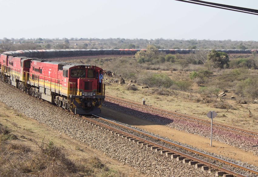
SACU MEMBER STATES GEOGRAPHIC AND ECONOMIC PROFILES                                                                    SACU MEMBER STATES GEOGRAPHIC AND ECONOMIC PROFILES

                                                      KINGDOM OF ESWATINI
                                                      1. Location
                                                        Eswatini (formerly known as Swaziland), a mountainous landlocked kingdom in Southern Africa, is bordered in the North,
                                                        West and South by the South Africa and by Mozambique in the East.

                                                      2. History
                                                        The Kingdom of Eswatini is an independent Monarchy, rich in traditions and heritage, led by King Mswati III, since 1986, as
                                                        Executive Head of State with parliament and consultation prescribing laws and Customs. Before its independence in 1968,
                                                        Eswatini was protectorate of South Africa from 1894 to 1899, but after the Boer War, in 1902, Eswatini was transferred to
                                                        British administration until it gained independence. King Mswati III renamed the country to the “Kingdom of Eswatini” in
                                                        April 2018 to mark 50 years since independence from British rule.

                                                      3. Economic Indicators
                                                        Economically, Eswatini trades mainly with South Africa, which receives almost half of Swazi exports and supplies most of
                                                        its imports. The valley of heaven “the Ezulwini Valley” in the High field of Eswatini is home to the major tourist attractions
                                                        with exceptional scenic routes. Also found in the valley is a wildlife sanctuary covering 4,500 hectares containing a wide
                                                        variety of mammals, birds, tree plants.

                                                        Eswatini’s economy as measured by nominal GDP at market prices was estimated at R54.7 billion in 2016 compared to
                                                        R51.3 billion in 2015. The economy recorded a growth of 1.4 per cent in 2016 compared to 0.4 per cent in 2015. The
                                                        growth in real GDP was mainly reflected in wholesale, retail, hotel and restaurants; and general government sectors that
                                                        recorded growth of 3.6 per cent and 8.7 per cent, respectively.

                                                        The largest industries, as measured by their nominal value added in 2016, was manufacturing accounting for 31.4 per cent
                                                        of GDP, followed by the general government accounting for 15.8 per cent of GDP.

8                                                                                                                                                                                   9
SACU MEMBER STATES GEOGRAPHIC AND ECONOMIC PROFILES                                                                                               SACU MEMBER STATES GEOGRAPHIC AND ECONOMIC PROFILES

  (a) Capital City: Mbabane                                                            (h) 25 December: Christmas Day
  (b) Currency: Emalangeni (SZL)                                                       (i) 26 December: Boxing Day
  (c) Country size: 17 364 km2                                                         (j) 28 December: Incwala Day
  (d) Population: 1,145,970
  (e) National Day: 6 September                                                      5. Social Indicators
  (f) Website: www.gov.sz                                                              (a)   Infant Mortality Rate (per 1000 live births):43
                                                                                       (b)   Life Expectancy Rate (at birth, total):59 years
Key Industries: Manufacturing; wholesale and retail; finance and business services
                                                                                     6. International Airports
                                                                                       (a) King Mswati III International Airport
                                                                                       (b) Matsapha International Airport

Main exports: Manufactured goods
Key imports: Manufactured goods
Key trading partners: SACU (South Africa); China; European Union; Kenya              7. National Flag
                                                                                       (a) Red: stands for the battles of the past
4. National Holidays                                                                   (b) Blue: stands for peace and stability
  (a) 1 January: New Year                                                              (c) Yellow: stands for the natural resources the country possesses.
  (b) 19 April: Birthday of King Mswati III                                            (d) Shield and spear: symbolism for protection of the country from enemies. The shield is black and white to show that
  (c) 25 April: National Flag Day                                                          black and white people live together peacefully in Eswatini.
  (d) 1 May: May Day
  (e) 22 July: Birthday of the late King Sobhuza
  (f) 31 August: Umhlanga Reed Dance
  (g) 6 September: Somhlolo Day (Independence Day)

10                                                                                                                                                                                                        11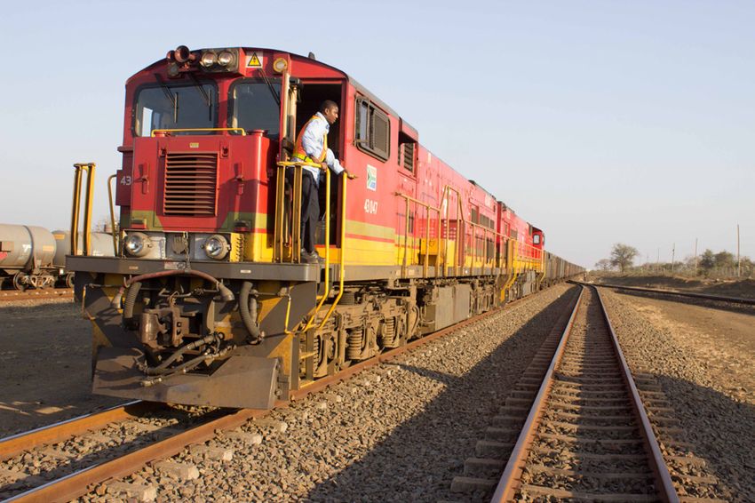
SACU MEMBER STATES GEOGRAPHIC AND ECONOMIC PROFILES SACU MEMBER STATES GEOGRAPHIC AND ECONOMIC PROFILES
KINGDOM OF LESOTHO
1.Location
The Kingdom of Lesotho, a mountainous landlocked country in Southern Africa, is an enclave, surrounded by South Africa,
bordering on three of the South Africa’s provinces, namely, KwaZulu-Natal, Free State and Eastern Cape. The Kingdom
of Lesotho is made up mostly of highlands where many of the villages can be reached only on horseback, by foot or light
aircraft.
During the winter shepherds wearing only boots and wrap-around blankets must contend with snow. While much of the
country, with spectacular canyons and thatched huts, remains untouched by modern machines, developers have laid down
roads to reach its mineral and water resources.
2. History
In 1959 Basutoland became a British Colony and was called Territory of Basutoland. Basutoland gained full independence
from Britain in 1966 and became known as Lesotho. The country is led by King Letsie III who succeeded King Moshoeshoe
II in 1996.
3. Economic Indicators
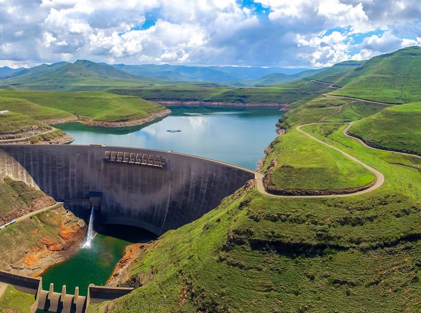
Lesotho is one of few African countries to see snow regularly. The Lesotho Highlands Water Project was completed in the
1990s to supply South Africa with fresh water. Lesotho’s nominal GDP at market prices increased to R33.7 billion in 2016
from R31.9 billion in 2015. In 2016, the economy recorded a slow growth of 2.4 per cent compared to 2.5 per cent in 2015.
The slow growth in real GDP was attributed to the performance in the general government and construction sectors.
The general government sector recorded a growth of 2.3 per cent in 2016 compared to 3.9 per cent in 2015, while the
construction sector contracted by 13.5 per cent compared to a growth of 4.8 per cent recorded in 2015. The largest
industries, as measured by their nominal value added in 2016, were general government accounting for 20.8 per cent of
GDP, followed by manufacturing accounting for 15.6 per cent of GDP.
12 13
SACU MEMBER STATES GEOGRAPHIC AND ECONOMIC PROFILES                                                                                                SACU MEMBER STATES GEOGRAPHIC AND ECONOMIC PROFILES

  (a) Capital City: Maseru                                                           5. Social Indicators
  (b) Currency: Maloti (LSL)                                                           (a) Infant Mortality Rate (per 1000 live births): 66
  (c) Country size: 30 355 km2                                                         (b) Life Expectancy Rate (at birth, total):54 years
  (d) Population: 1,941,941
  (e) National Day: 4 October                                                        6. International Airports
  (f) Website: www.gov.is                                                              (a) Moshoeshoe I International Airport

Key Industries: Manufacturing; finance and business services; wholesale and retail

                                                                                     7. National Flag
                                                                                       (a) Blue: represents the sky or rain
Main exports: Miscellaneous manufactures                                               (b) Green: represents prosperity
Main Imports: Manufactured goods                                                       (c) White: represents peace
Key trading partners: SACU (South Africa); China; Republic of China on Taiwan          (d) The Hat: (also known as mokorotlo) represents the Basotho cultural heritage

4. National Holidays
  (a) 1 January: New Year’s Day
  (b) 11 March: King Moshoeshoe’s Birthday
  (c) 1 May: Workers’ Day
  (d) 25 May: Africa Day
  (e) 17 July: King Letsie III’s Birthday
  (f) 4 October: Independence Day
  (g) 25 December: Christmas Day
  (h) 26 December: Boxing Day

14                                                                                                                                                                                                       15
SACU MEMBER STATES GEOGRAPHIC AND ECONOMIC PROFILES                                                                 SACU MEMBER STATES GEOGRAPHIC AND ECONOMIC PROFILES

                                                      REPUBLIC OF NAMIBIA
                                                      1. Location
                                                        Namibia, a sparsely populated country in Southern Africa, has a landscape distinguished by the Namib Desert along its
                                                        Atlantic Ocean coast. Namibia is bordered by Angola to the north, Zambia to the northeast, Botswana to the east, South
                                                        Africa to the southeast and south, and the Atlantic Ocean to the west. It ranges from arid in the north to desert on the
                                                        coast and in the east with the landscape varied with the desert, mountains, canyons, and savannas.

                                                      2. History
                                                        Namibia was a German colony since 1884 and used to known as German South West Africa. After the First World War,
                                                        the League of Nations mandated South Africa to administer the territory. The country has enjoyed stability since gaining
                                                        independence in 1990 after a long struggle against rule by South Africa. Namibia achieved independence in 1990 after a
                                                        bush war of almost 25 years. Inter-racial reconciliation encouraged the country`s white people to remain and they still
                                                        play a major role in farming and other economic sectors. Deserts occupy much of the country; their dunes take on shapes
                                                        and colours according to the elements.

                                                      3. Economic Indicators
                                                        The country also boasts game-rich grasslands and a semi-arid Central Plateau, large tracts of which are given over to
                                                        livestock farming. Namibia’s nominal GDP at market prices was estimated at R161.0 billion in 2016 compared to R147.6
                                                        billion in 2015. The economy recorded a slow growth of 1.1 per cent in 2016 compared to 6.0 per cent in 2015. The slow
                                                        growth in real GDP was reflected in all industries that recorded weaker growth rates with the mining and construction
                                                        sectors contracting by 5.7 per cent and 26.5 per cent, respectively. The largest industries, as measured by their nominal
                                                        value added in 2016, were general government accounting for 23.9 per cent of GDP, followed by wholesale, retail, hotel
                                                        and restaurants accounting for 13.9 per cent of GDP.

16                                                                                                                                                                            17
SACU MEMBER STATES GEOGRAPHIC AND ECONOMIC PROFILES                                                                                                     SACU MEMBER STATES GEOGRAPHIC AND ECONOMIC PROFILES

  (a) Capital City: Windhoek                                                                (i) 26 December: Day of Goodwill
  (b) Currency: Namibian Dollar (NAD)
  (c) Country size: 825 615 km2                                                           5. Social Indicators
  (d) Population: 2,368,747                                                                 (a) Infant Mortality Rate (per 1000 live births): 29
  (e) National Day: 21 March                                                                (b) Life Expectancy Rate (at birth, total):63 years
  (f) Website: www.gov.na
                                                                                          6. International Airports
Key Industries: finance and business services; wholesale & retail; Mining and quarrying     (a) Hosea Kutako International Airport
                                                                                            (b) Walvis Bay International Airport

Main exports: Manufactured goods
Main Imports: Manufactured goods                                                          7. National Flag
Key trading partners: SACU (South Africa/Botswana); European Union; China                   (a) Red: Represents Namibia’s most important resource, its people. It refers to their heroism and their determination to
                                                                                                build a future of equal opportunity for all.
4. National Holidays                                                                        (b) White: Refers to peace and unity.
  (a) 1 January: New Year                                                                   (c) Green: Symbolises vegetation and agricultural resources.
  (b) 21 March: Independence Day                                                            (d) Blue: Represents the clear Namibian sky and the Atlantic Ocean, the country’s precious water resources and rain
  (c) 30 March: Good Friday
  (d) 4 May: Cassinga Day
  (e) 25 May: Africa Day
  (f) 26 August: Heroes’ Day
  (g) 10 December: International Human Rights Day
  (h) 25 December: Christmas Day

18                                                                                                                                                                                                               19
SACU MEMBER STATES GEOGRAPHIC AND ECONOMIC PROFILES SACU MEMBER STATES GEOGRAPHIC AND ECONOMIC PROFILES
REPUBLIC OF SOUTH AFRICA
1. Location
South Africa occupies the Southern tip of Africa, with a coastline stretching more than 2,500 kilometers from the desert
border with Namibia on the Atlantic (western) coast southwards around the tip of Africa and then northeast to the border
with Mozambique on the Indian Ocean. South Africa is bordered by Zimbabwe, Mozambique, Namibia, Botswana on the
north and east and northeast by Mozambique and Swaziland and surrounds the kingdom of Lesotho.
Diversity is a key feature of South Africa, where 11 languages are recognised as official, where community leaders include
rabbis and chieftains, rugby players and returned exiles, where traditional healers ply their trade around the corner from
stockbrokers and where housing ranges from mud huts to palatial homes with swimming pools. South Africa has one of the
continent’s biggest economies, though this went into recession in May 2009 following a sharp slowdown in the mining and
manufacturing sectors.
2. History
Following the defeat of the Boers in the Anglo-Boer or South African War (1899–1902), the Union of South Africa was
created as a dominion of the British Empire. The country became a self-governing nation state within the British Empire,
in 1934 following enactment of the Status of the Union Act. The dominion came to an end in 1961 as the consequence of
a 1960 referendum, which legitimised the country becoming a sovereign state named Republic of South Africa.
From 1948–1994, South African politics were dominated by Afrikaner nationalism. Racial segregation and white minority
rule known officially as apartheid, an Afrikaans word meaning “separateness”, came into existence in 1948 (under British
rule), and become an official law of segregation when South Africa became a Republic Unions. The country gained its
independence in 1994.
3. Economic Indicators
South Africa is, along with Brazil, Russia, India, China a member of the BRICS club of emerging world economic powerhouses.
South Africa’s economy as measured by nominal GDP at market prices was estimated at R4 337 billion in 2016 compared to
R4 050 billion in 2015. The economy recorded a slow growth of 0.3 per cent in 2016 compared to 1.3 per cent in 2015. The
20 21SACU MEMBER STATES GEOGRAPHIC AND ECONOMIC PROFILES SACU MEMBER STATES GEOGRAPHIC AND ECONOMIC PROFILES
slow growth in real GDP was mainly reflected in transport & communications; financial intermediation & business services (d) 27 April: Freedom Day 7. National Flag
and mining sectors that recorded weaker growth rates. The largest industries, as measured by their nominal value added (e) 1 May: Workers’ Day (a) Red: Symbolizes bloodshed and sacrifices made in South
in 2016, were the financial intermediation and business services accounting for 18.0 per cent of GDP, followed by general (f) 16 June: Youth Day Africa’s struggle for independence
government accounting for 15.5 per cent of GDP. (g) 18 July: Nelson Mandela Day (b) White: Stands for Europeans and peace and harmony
(h) 9 August: National Women’s Day between natives and Europeans
(a) Capital City: Tshwane, (i) 24 September: Heritage Day (c) Green: Represents fertility of South African land
(b) Currency: South African Rand (ZAR) (j) 16 December: Day of Reconciliation (d) Yellow: Stands for the mineral and other natural wealth
(c) Country size: 1 219 090 km2 (k) 25 December: Christmas Day of South Africa
(d) Population: 56,521,948 (l) 26 December: Day of Goodwill (e) Black: Represents native people of South Africa
(e) National Day: 27 April (f) Blue: Stands for blue sky and endless opportunities for
(f) Website: www.gov.za 5. Social Indicators South Africans
(a) Infant Mortality Rate (per 1000 live births):29 (g) The Y: stands for the convergence of diverse elements
Key Industries: finance and business services; manufacturing; wholesale & retail (b) Life Expectancy Rate (at birth, total):64 years within South African society, taking the road ahead in
unity
6. International Airports
(a) O.R. Tambo International Airport
(b) Cape Town International Airport
(c) King Shaka International Airport
(d) Kruger Mpumalanga International Airport
(e) Pilanesberg International Airport
(f) Polokwane International Airport
Main exports: Manufactured goods (g) Lanseria International Airport
Main Imports: Machinery and transport equipment
Key trading partners: European Union; China; SACU
4. National Holidays
(a) 1 January: New Year’s Day
(b) 21 March: Human Rights Day
(c) 2 April: Family Day
22 23SACU MEMBER STATES GEOGRAPHIC AND ECONOMIC PROFILES SACU SECRETARIAT COMMUNICATIONS UNIT Private Bag 13285, Windhoek, Namibia Cnr Julius K. Nyerere & Feld Street [T] +264 61 295 8000 [F] +264 61 245 611 [E] info@sacu.int [W] www.@sacu.int 24
You can also read