SAEON Arid Lands Node Science Plan: 2016 2018 - Pula Nala - happy when it rains
←
→
Page content transcription
If your browser does not render page correctly, please read the page content below
SAEON Arid Lands Node
                          Pula Nala – happy when it rains
              Science Plan: 2016 – 2018
                                  Compiled by Joh Henschel
                                               May 2016

SAEON Arid Lands Node Science Plan 2016 - 18                 1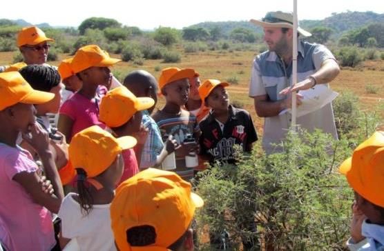
Introduction:
This document should be read in context with the initial proposal for the ALN (2006),
the SAEON Core Science Framework (2010) and the latest Arid Lands Node
Business Plan (2015). The science plan intends to provide coherence across the
ALN’s projects, guide planning of future projects and involvement of stakeholders, as
well as justify and prioritise the node’s existing and potential future projects.
Though South Africa’s vast arid lands are sparsely populated, they contribute
significantly to the South African economy, especially through agriculture (rangeland
and crops), mining, tourism and development of large-scale infrastructure for energy
generation/transmission and astronomy, which have the potential to considerably
transform the arid lands. The low and infrequent availability of water is a principal
constraint, while rising temperatures as a result of climate change in this hottest part
of South Africa pose further potential challenges for the living conditions of many
organisms and people. Land degradation exacerbates these conditions. The
geographic focus of ALN places it ideally to address these issues.
Overarching questions on ecosystem changes
What are the drivers of change across South Africa’s arid lands?
What indicators describe the changes?
What are the baseline conditions of these indicators?
What changes are detected or predicted, where and why?
What are the implications of changes?
In selecting indicator variables for the drivers of change, ecosystem structure,
processes and functioning, as well as their spatio-temporal dynamics need to be
taken into consideration. These include changes in biodiversity features, landscape
connectivity and fragmentation, eco-hydrological processes, nutrient cycling, and
geomorphological characteristics, including stability and topographic complexity.
The science themes that represent a frame for the Arid Lands Node include
grouping of several Drivers of Change identified in the SAEON Science Frame.
Climate change is an overarching driver, as is land use and management. Drivers
which may be associated are listed below.
Drivers of Change Examples of Indicator Variables in Arid Lands
Climate change Human-induced changes in climate affecting
precipitation, temperature, wind, radiation, humidity
CO2 loading CO2 increase, tree density, community composition
Other atmospheric Methane, dust
features
SAEON Arid Lands Node Science Plan 2016 - 18 2
Land use and                       Productivity, resource usage, desertification
management
Coastal environment                Geophysical changes in rivers and ocean
Coastal use                        Resource use at coast
Acid deposition                    Biogeochemical cycles and biological effects
Nutrient loading                   Biogeochemistry in soil and water esp. N & P
Pollution & poisons                Pesticides, herbicides, mining & industrial chemicals,
                                   dust
Pests                              Locusts, Karoo caterpillars, jackal, caracal
Alien organisms                    Prosopis spp., Opuntia species (cactus), various
                                   invasive grass species, aliens along roadsides and river
                                   shores
Disturbance regime                 Fire, herbivory, erosion, floods, droughts, frost, land
                                   clearing, over-grazing
Hydrological functioning           River flow, quality & seasonality, large dams, small
                                   dams, soil moisture, biotic microhydrology, endorheic
                                   pans, groundwater dynamics, usage and replenishment
Sediments                          Erosion, fluvial transport, deposition
Large infrequent events            Drought, flood, heat-wave, frost, fire, hail

Arid lands science themes: environmental changes
1.   Biome & land cover shifts
2.   Broad-scale Infrastructural Developments
3.   Large Infrequent Events
4.   Wetlands
5.   Ecosystem Restoration

Theme 1 – biome & land cover shifts

Rationale & Relevance
The boundaries and characteristics of biomes, ecosystems, biotic communities, and
habitats are predicted to shift or change as a result of global change and land use
practices. In the arid region, global change is manifested by increasing temperatures
in an already hot area, resulting in higher evaporation and drier atmosphere, and
associated steep drops in temperature on clear winter nights, with a potential for
black frost (see large infrequent events). Increased atmospheric carbon may result
in higher rates of sequestration by the soil and growth and thickening of woody
plants, including bush encroachment, in areas where trees previously occurred in
lower densities. Direct effects of increasing CO2 also include reduced water use by
plants making rainfall more effective. This could be manifested by greater
productivity for the same amount of precipitation contributing to, for example, grass

SAEON Arid Lands Node Science Plan 2016 - 18                                              3
expansion westwards. Higher temperatures and changed biological activity in the soil increases evapotranspiration, resulting in generally drier soil. The rainfall may change, and though it is as yet uncertain whether rainfall will be reduced or increase, it is thought that the distribution of rainfall across seasons may change as well as the rainfall events being shorter and more intensive, resulting in flooding and soil erosion. The result could be significant changes in soil characteristics, its biological activity and albedo. Even small changes could affect biome characteristics. Furthermore, inter-annual variability, seasonal distribution and temporal intensity of precipitation may increase. These changes may interact with changes in land use and management systems affecting land cover. Across the arid lands, these are predominantly rangeland farming practices and small protected areas (resource- intensive crop farming in some areas is part of Theme-2). Environmental changes could become manifested as shifts in biome location, creation of ‘new’ biomes, distribution changes of individual species, as well as the reorganization of the configuration and structure of biotic communities. Changes would affect biodiversity, productivity, ecosystem services and the sustainability of some current land uses and associated approaches to land management. Current and anticipated foci of effort to address this theme are expressed in the following key questions. Key Questions What are the characteristics and boundaries of the arid biomes? How do rangeland farming practices affect these biomes, and what are the mechanisms and their context, e.g. timing, intensity (grazing, trampling, defecation, toxicity, soil characteristics, nutrient cycling)? What are the observed effects of global change in each of the arid biomes, which specific drivers are involved, what is the rate of change, and are changes reversible/cyclical? Key Beneficiaries Agricultural sector Conservation sector Livelihoods & Rural Development programmes Relevant Legislation National Environmental Management Act Conservation of Agricultural Resources Act Rangeland management regulations Rural Development Northern Cape Nature Conservation Act, Western Cape Nature Conservation Ordinance, other provincial conservation legislation Potential Collaborators incl. cross-nodal GADI, NC Dept. Agriculture, WC Dept. Agriculture, DENC, CapeNature SAEON Arid Lands Node Science Plan 2016 - 18 4
SANParks, McGregor Museum, SANBI, ARC UCT, NWU, UFS, SUN, UWC, NMMU, RU, UP Approach Identify, acquire and investigate existing historic data; undertake re-surveys where possible investigate collaboration with partners undertaking long-term studies in the arid region and ensure continuation of these project (where appropriate) establish and operate long-term observation platforms ensuring continuation of long-term data collection projects and initiation of additional projects of relevance in understanding patterns and processes elucidate changes in cover and composition of biotic communities through experiments, along transects across climatic and altitudinal gradients, and over time (biome history) detect shifts in boundaries between vegetation communities, the degradation or natural recovery of communities by means of field surveys and remote sensing relate above findings to land management practices, and trends in soil moisture and temperature Current Projects Vaalbos, GADI Trials, Carnarvon Trials, Tierberg experiments Goegap, Namaqua old fields, Kgalagadi Transect Tanqua Karoo landscape units C3/C4 grass balance across altitudinal gradients Ecosystem implications for shifts in atmospheric moisture across space and time SKA land-use change and initiation of a long-term monitoring platform Theme 2 – broad-scale infrastructure developments Rationale & Relevance The previously rather little-developed arid lands of South Africa have historically received little attention on account of their low levels of development impact. They are used primarily for extensive livestock ranching which has been viewed as largely compatible with biodiversity maintenance. These areas have however recently come into the spotlight on account of the emergence of several extensive novel development threats focussed on the Karoo in particular. This includes Shale Gas development, Renewable Energy development and Uranium and other mining activity. Renewable energy generation is already undergoing rapid development across the arid zone, with as many as 92 renewable energy developments currently approved for construction or already built (as at Bid Window 4, April 2015) with around 80% of this located within the arid zone. The viability of shale gas extraction by fracking and large-scale uranium and other mining activity are also currently SAEON Arid Lands Node Science Plan 2016 - 18 5
being explored in the karoo. The world’s largest research equipment, a radio telescope spanning hundreds of kilometres, is being built at SKA. Several new high capacity transmission line corridors which traverse the Karoo are currently being designed for use over the next 20 years. Though not a novel driver, intensive cropping in the vicinity of perennial rivers in these drylands is a persistent and ever expanding impact that also results in the loss of habitat and requires large amounts of water which cannot be supplied from the local environment. Associated with all these developments are growing human settlements, which may again decline in their wake. These various developments have in common that they have infrastructure footprints, change human densities and land uses at and near the infrastructure sites, and that they have associated linear infrastructure fragmenting landscapes. These developments differ in terms of requirements of scarce resources, especially water, and the extent as well as duration of pollution and degradation they may cause. To detect the extent and understand the significance of changes across arid lands for the purposes of sustainable development, it is important to know the ecological baseline conditions before development is initiated as well as the natural dynamics of these conditions. Furthermore, analyses of subsequent changes due to developments need to take global change effects into account as well as cumulative effects that may only be apparent at the landscape scale. Key Questions What is the baseline ecological status before the onset of development? What are the actual environmental changes associated with development, and how do these compare with the predictions? What is the spatial context of these changes and how do the impacts scale up from site-specific impacts to landscape-level changes? What are the specific ecological impacts of various infrastructure developments and how can these be mitigated and the environment restored? How do the values of ecosystem services and natural capital compare with other economic aspects of these developments? How does global change interact with these development-related changes? Key Beneficiaries Industrial and mining sectors and their regulators Conservation sector Farming sector Community at large Relevant Legislation Astronomy Geographic Advantage Act 2007 No. 36 of 1998: National Water Act (NWA) SAEON Arid Lands Node Science Plan 2016 - 18 6
No. 107 of 1998: National Environmental Management Act (NEMA)
No. 10 of 1998: National Forest Act
GN No. 704 of 4 June 1999: Regulation on use of water for mining and related
activities aimed at the protection of water resources
GN No. R.385, 386 and 387 of 2006: Environmental Impact Assessment
Regulations
No. 28 of 2002. Mineral and Petroleum Resources Development Act,2002(Act
No. 28 of 2002)
MoU between Department of Science and Technology and Department of
Environmental Affairs (specifically including SAEON’s roles)
Potential Collaborators incl. cross-nodal
National & Provincial Departments – SANBI, DAFF, DENC, DEA, SANParks
Universities - UCT, UWC, SUN, NMMU, RU
NGOs – Endangered Wildlife Trust
Approach
Review existing knowledge and undertake updated data-based baseline studies
Develop appropriate monitoring techniques that can be rolled-out in areas where
development is taking place, to establish baseline conditions and monitor
changes that can be attributed to development impacts.
Provide broad-scale analyses of development trends in order to help predict
spatial patterns of likely change and identify specific species, habitats and
ecosystems vulnerable to development.
Interact with industry and stakeholders to develop best-practice and
environmental monitoring guidelines for specific development types.
Provide mitigation and avoidance recommendations as relevant to the study
areas and industries being studied.
Current Projects
Biodiversity Baseline Study and Monitoring Shale Gas Development
SAEON@SKA Environmental Research Programme
Microhydrological dynamics at different scales
Theme 3 – large infrequent events
Rationale & Relevance
South Africa’s arid lands are characterised by high environmental variability across
different spatial and temporal scales. Spatial scales can vary at the scale of
thunderclouds, 10 km diameter, to the scale of large locust outbreaks encompassing
the entire region, 1000 km across. Temporal variation can be at seasonal, annual,
decadal or centennial scales, with patterns that are irregularly cyclical or freak
SAEON Arid Lands Node Science Plan 2016 - 18 7events. The occurrence of large events is characteristically difficult to predict, though there may be underlying patterns for some (e.g. ENSO). Climatic drivers include extremes of low or high temperature, floods or long severe droughts. A novelty in the area is the occurrence of fire, which can be grouped into this category due to most of the area being historically almost fire-free. Extreme climatic events have positive or negative effects on biodiversity, population dynamics, migrations, recruitment or mortality, as well as a host of related ecosystem processes. The occurrence of such events could be critical for ecosystems and without knowledge and understanding of them it may be impossible to understand some of the observed ecosystem changes. Knowledge of the effects of extreme events such as a black frost, peak heat waves or floods and unusually prolonged severe droughts can help explain some of the changes. For others, the patterns of cycling from dormant to active, low density to high density, resident to migratory, can serve as indicators for underlying factors, or may serve as indicators when their periodicity changes. The latter would apply to periodically irruptive populations, such as ephemeral grasses, locusts, karoo caterpillars, harvester termites, springbok, hyrax, sparrow-larks and many other species. Human behaviour may change these patterns, such as the sudden cessation of long-term persecution, e.g. of jackals, locusts, or black eagles. Population periodicity would also apply to prolonged dormant systems such as endorheic pans with only brief periods of extreme activity of aquatic invertebrates and algae. Monitoring large extreme events is conducted to address the following questions. Key Questions What are the intervals, causes and consequences of large-scale periodic population irruptions or crashes? Which brief rare extreme events have extraordinarily important effects, and what causes such events? What changes are there in the probabilities or frequencies of occurrence of large infrequent events? What is the status of the effects of large infrequent events as context for short- term studies? How do different irruptions or crashes interrelate, are there causal connections? Key Beneficiaries Weather Service Agricultural sector Conservation sector Relevant Legislation NEMA Pest control regulations SAEON Arid Lands Node Science Plan 2016 - 18 8
Legislation relating to development in relation to risk of flood damage Regulations relating to agricultural subsidies Potential Collaborators incl. cross-nodal SAEON scientist (frost, heat), Egagasini (sea surface temperature and locust outbreaks) ARC, SANParks, DENC, SAWS UFS, NMMU, UCT Approach Review literature and publish reviews as appropriate Obtain available historic data, test practicalities for monitoring in future Postgraduate projects to elucidate population dynamics and plan monitoring Current Projects Frost damage Origin of locust outbreaks Springbok Trek Environmental Dynamics Theme 4 – wetlands Rationale & Relevance Water is scarce in arid lands, and the dependence of ecosystems on water is especially crucial. Next to atmospheric and soil hydrology (which features in all themes), the occurrence of surface water in perennial rivers and dams as well as groundwater associated with ephemeral drainage lines or other aquifers is essential for many ecosystem processes and human endeavours. Due to their importance, arid land rivers, especially the Orange and Vaal Rivers and their tributaries, have been extensively modified and are intensively managed and transformed systems affecting not only the water and material transport/deposition within their flood channels, but also associated riparian habitats. Ephemeral drainage lines of the karoo are often choked with aggressively invasive alien species of trees which can commandeer groundwater resources to the exclusion of native species and other consumers. Even so, available groundwater, when pumped to the surface for agricultural or industrial purposes, as is common practice, is quickly lost through evaporation, putting additional pressure on groundwater resources. Meanwhile, at the border of periurban areas, nutrient-laden effluent streams from sewerage works can transform natural landscapes by allowing non-indigenous (mesic, often alien) species to replace endemic ones. Changes in river ecosystems have far-reaching effects for arid environments, and it is therefore important to understand these systems and monitor them. SAEON Arid Lands Node Science Plan 2016 - 18 9
Ephemeral pans are the most expansive wetland features across the Northern Cape Province. Though often dry and only periodically briefly wet and therefore often inappropriately regarded as degraded systems, they are possibly among the most sensitive ecosystems in this area, potentially supporting many species of conservation significance, and probably acting as key ecosystem structures for numerous species. Despite this, the pans of the Karoo (Bushmanland) and southern Kalahari (Hakskeenpan Complex; Ghaap Plateau; Kimberley) have in the past received little attention in terms of research. By comparison, there have been some studies on the geomorphology and biodiversity of ephemeral pans in less arid regions of South Africa, which emphasize importance for improved knowledge on pans across South Africa's drylands. Key Questions What is the surface water regime over space and time, how is it changing and affecting associated biota? What are the key ecosystem sensitivities of wetlands? What are the limits of ecological reserves and their spatial configurations for wetlands? How have impoundments and associated control of water flow and sediment transport affected riparian forests and their associated fauna? How are municipality effluent streams changing ecosystems, and what are the long-term implications of such change? Key Beneficiaries Water, agricultural, conservation, industry, municipalities Relevant Legislation Water Act Orange River Mouth Management Plan Catchment Management Associations Potential Collaborators incl. cross-nodal SAEON scientist (LORRD), Elwandle (diatoms, ORM) UFS, SPU, Wits, NWU, NMMU, UCT DENC, DWS, WRC, EWT, DEA Current Projects GAME - Gariep Megatransect, Triwaters ORM - Orange River Mouth LORRD - Lower Orange River Riparian Dynamics RIHEM - River Health Monitoring Programme LEEP - Landscape Ecology of Ephemeral Pans WOES - Wolwekraal effluent stream SAEON Arid Lands Node Science Plan 2016 - 18 10
Theme 5 – restoration of natural capital Rationale & Relevance Land degradation is an increasing threat to ecosystems in arid regions, compounded by the generally slow rate of natural recovery. Anthropogenic factors which contribute to degradation relate especially to mining and other large infrastructure development and sometimes other land use practices. These include mechanical disturbance, removal of topsoil, clearing of vegetation, off-road driving, excessive stocking rates of livestock, killing of fauna or threatening their population processes, and inappropriate landscape management leading to erosion by wind or floods. Numerous factors affect ecosystems’ resilience, its degradation and recovery. The latter can sometimes occur naturally, depending on conditions. In arid regions, recovery tends to be very slow, requiring decades to centuries. Often it is necessary to assist recovery through ecological restoration, an environmental management approach aimed at returning ecosystems to target conditions in terms of their structures, processes and functioning. Monitoring is essential to track progress, but this is terminated when restoration programmes cease before target conditions have been reached. SAEON has the opportunity to continue monitoring programmes of restoration sites, or sites of natural recovery so as to improve understanding of recovery processes and to inform environmental managers and policy accordingly. Key Questions What factors and conditions affect ecosystem resilience, the nature of degradation, and the nature and rate of natural recovery of degraded ecosystems? Do initial recovery trajectories of natural capital at restored sites continue in the long-term beyond active management interventions? How does global change affect ecosystem recovery? Key Beneficiaries Farmers, mines, roads authority, protected area managers Relevant Legislation No. 107 of 1998: National Environmental Management Act (NEMA) GN No. R.385, 386 and 387 of 2006: Environmental Impact Assessment Regulations Potential Collaborators incl. cross-nodal Renukaroo, CSA, Gobabeb, SASSCAL UCT, NWU, UP Current Projects SAEON Arid Lands Node Science Plan 2016 - 18 11
Landscape Ecology of Heuweltjies – resilience of ecosystem structures,
processes and functioning
List of Acronyms
ARC Agricultural Research Council
CSA Climate System Analysis Group
DAFF Department of Agriculture, Forestry and Fisheries
DEA Department of Environmental Affairs
DENC Northern Cape Department of Environment and Nature Conservation
ENSO El Niño-Southern Oscillation
EWT Endangered Wildlife Trust
GADI Grootfontein Agricultural Development Institute
GAME Gariep Megatransect
LEEP Landscape Ecology of Ephemeral Pans
LORRD Lower Orange River Riparian Dynamics
NEMA National Environmental Management Act
NGOs Non-Government Organisations
NMMU Nelson Mandela Metropolitan University
NWA National Water Act
NWU North-West University
ORM Orange River Mouth
RIHEM River Health Monitoring Programme
RU Rhodes University
SANBI South African National Biodiversity Institute
SASSCAL Southern African Science Service Centre for Climate Change and
Adaptive Land Management
SAWS South African Weather Service
SKA Square Kilometre Array
SPU Sol Plaatjies University
SUN Stellenbosch University
UCT University of Cape Town
UFS University of the Free State
UP University of Pretoria
UWC University of the Western Cape
WOES Wolwekraal effluent stream
SAEON Arid Lands Node Science Plan 2016 - 18 12You can also read