SITE ASSESSMENT REPORT - Richmond Park Service Station Report Number: 1 Prepared for: Richmond Park Development Company (Pty) Ltd
←
→
Page content transcription
If your browser does not render page correctly, please read the page content below
SITE ASSESSMENT REPORT
                                        Richmond Park Service Station
                                                            Report Number: 1
                           Prepared for: Richmond Park Development Company
                                                                     (Pty) Ltd

                                                      DEA&DP Reference No.:
                                                 16/3/3/6/7/1/A1/18/3114/20

SLR Project No.: OG.PJ.00116
Version No: Rev 3
March 2021
Richmond Park Development Company (Pty) Ltd                                                                                 SLR Project No: 720.01109.00008
Site Assessment Report - Richmond Park Service Station                                                                                           March 2021
Filename: 720.01109.00008 RICHMOND PARK Baseline
Environmental Assessment - Baseline Assesment Report Rev1.4

             BASIS OF REPORT
                                               This document has been prepared by SLR Consulting (South Africa) Limited with reasonable skill, care and diligence, and
                                               taking account of the manpower, timescales and resources devoted to it by agreement with Richmond Park Development
                                               Company (Pty) Ltd (the Client) as part or all of the services it has been appointed by the Client to carry out. It is subject to
                                               the terms and conditions of that appointment.

                                               SLR shall not be liable for the use of or reliance on any information, advice, recommendations and opinions in this
                                               document for any purpose by any person other than the Client. Reliance may be granted to a third party only in the event
                                               that SLR and the third party have executed a reliance agreement or collateral warranty.

                                               Information reported herein may be based on the interpretation of public domain data collected by SLR, and/or
                                               information supplied by the Client and/or its other advisors and associates. These data have been accepted in good faith
                                               as being accurate and valid.

                                               The copyright and intellectual property in all drawings, reports, specifications, bills of quantities, calculations and other
                                               information set out in this report remain vested in SLR unless the terms of appointment state otherwise.

                                               This document may contain information of a specialised and/or highly technical nature and the Client is advised to seek
                                               clarification on any elements which may be unclear to it.

                                               Information, advice, recommendations and opinions in this document should only be relied upon in the context of the
                                               whole document and any documents referenced explicitly herein and should then only be used within the context of the
                                               appointment.
Richmond Park Development Company (Pty) Ltd                                                                                        SLR Project No: 720.01109.00008
Site Assessment Report - Richmond Park Service Station                                                                                                  March 2021
Filename: 720.01109.00008 RICHMOND PARK Baseline
Environmental Assessment - Baseline Assesment Report Rev1.4

SITE ASSESSMENT REPORT
Proposed Richmond Park Service Station
SLR Project No.: 720.01109.00008

Submitted by
SLR Consulting (South Africa) (Pty) Ltd

For
Richmond Park Development Company (Pty) Ltd
Atterbury
Building No. 2, Maxwell Office
Waterfall City, Jukskei View
South Africa

03 March 2021

Prepared by:                                                                                 Reviewed by:

Naledi Chere                                                                                 Brandon McGugan
Environmental Consultant                                                                     Technical Discipline Manager for the Land,
                                                                                             Quality and Remediation Group

      SLR Consulting (South Africa) (Proprietary) Limited                                                        Johannesburg Office: Physical Address: Suite 1 - Building D, Monte Circle,
                                                                                                                     178 Montecasino Boulevard, Fourways, Johannesburg, Gauteng, 2191
      Registered Address: Suite 1 - Building D, Monte Circle, 178 Montecasino Boulevard, Fourways,               Postal Address: PO Box 1596, Cramerview, 2060        Tel: +27 11 467 0945
      Johannesburg, Gauteng, 2191
      Postal Address: PO Box 1596, Cramerview, 2060, South Africa                                     Cape Town Office: Physical Address: 5th Floor, Letterstedt House, Newlands on Main,
                                                                                                              Cnr Main and Campground Roads, Newlands, Cape Town, Western Cape, 7700
      Reg. No: 2007/005517/07                                                                        Postal Address: PO Box 10145, Caledon Square, 7905              Tel: +27 21 461 1118
      Vat No: 4630242198

      Directors: R Hounsome, F Fredericks, D Junak                                                                                                                 www.slrconsulting.com
Richmond Park Development Company (Pty) Ltd                                         SLR Project No: 720.01109.00008
Site Assessment Report - Richmond Park Service Station                                                   March 2021
Filename: 720.01109.00008 RICHMOND PARK Baseline
Environmental Assessment - Baseline Assesment Report Rev1.4

DOCUMENT INFORMATION

    Title                               Site Assessment Report

    Project Manager                     Naledi Chere

    Project Manager e-mail              nchere@slrconsulting.com

    Author                              Naledi Chere

    Reviewer                            Brandon McGugan

    Approver                            Brandon McGugan

    Client                              Richmond Park Development Company (Pty) Ltd

    Comments                            The report has been compiled as per the client’s requirements.

                                        Groundwater monitoring, environmental site investigation,
    Keywords
                                        Groundwater analytical chemistry

    Deltek Number                       720.01109.00008

    Project Number                      720.01109.00008

    Report Number                       1

    Status                              Draft

    Issue Date                          March 2021

                                        720.01109.00008 RICHMOND PARK Baseline Environmental Assessment
    File Name
                                        - Baseline Assesment Report Rev1.4
Richmond Park Development Company (Pty) Ltd                                         SLR Project No: 720.01109.00008
Site Assessment Report - Richmond Park Service Station                                                   March 2021
Filename: 720.01109.00008 RICHMOND PARK Baseline
Environmental Assessment - Baseline Assesment Report Rev1.4

Executive Summary
Key aspects of the Site investigation are summarized in the table below.

  Site                   •    The Richmond Park Development Company (Pty) Ltd commissioned SLR SA to
  Description                 conduct a baseline assessment to ascertain groundwater conditions for a site
                              earmarked for the construction of a retail service station, located on ERF 38333,
                              Milnerton, Cape Town.
                         •    The topography and gradient of the Site (prior to Site development) is generally
                              flat, with a slight slope towards the west-to north west. The topography and
                              gradient of the surrounding area slopes to the west south west. Previously
                              vacant, the site has subsequently been cleared and graded as part of the bulk
                              earthworks undertaken as part of the approved Richmond Park development.
                         •    The Site is located at approximately 30m above mean sea level. According to the
                              DWAF 1:500 000 Hydrogeological Map of Cape Town 3126, the Site is underlain
                              by undifferentiated coastal deposits (unconsolidated to semi-consolidated
                              sediments including sand, calcrete, calcarenite, aeolianite, marine gravel, clay,
                              silcrete and limestone) of the Sandveld Group [P.S. Meyer, 1999].
                         •    The Site is located in an urban setting and neighbouring land uses comprise of
                              residential, commercial, and industrial properties. The Site extends over an area
                              of approximately 4 298 m2.
                         •    Nearby off-site potential contamination sources include Astron Energy Refinery
                              (located from 780 m to 1.74 km northwest), SFF tank farm (located from 195 m
                              to 1.37 km east) and Engen De Grendel Service Station (located from 350 m to
                              430 m south) of the Site.
                         •    On the 14th of October 2020, the Department of Water and Sanitation issued a
                              request for a geo-hydrogeological / groundwater assessment report the Site.
                         •    Subsequently, SLR SA conducted a baseline groundwater assessment including a
                              hydrocensus, the installation of three groundwater monitoring wells,
     Base of
                              topographical survey, and soil and groundwater laboratory analysis for a suite of
  Understanding
                              fuel related and heavy metal Contaminants of Potential Concern (COPC).
                         •    The aim of the investigation was to ascertain groundwater conditions at the Site;
                              and evaluate the potential risks associated with the establishment of a fuel retail
                              operation at the Site.
                         •    Soil and groundwater samples were collected from three newly installed
                              groundwater monitoring wells, namely MW1, MW2 and MW3.
                         •    Groundwater was encountered between 1.52 m and 1.99 m bgl.
                         •    The calculated groundwater flow direction is towards the north east, and
                              inconsistent with the topography generally towards the west.
                         •    The in-field parameters reveal pH values of 6.59 to 6.98, which are indicative of
     Results of               an acidic to neutral background. The DO values were measured from 0 mg/L to
   investigation              2.8 mg/L, which are indicative of anaerobic subsurface conditions across the Site.
                              ORP values ranged between -77 mV and -7 mV, indicating more reducing
                              conditions at MW2, located on the southern portion of the Site.
                         •    Organic compounds were not recorded above laboratory detection limits in any
                              of the collected soil and groundwater samples.
                         •    Inorganic compounds and metals were observed at concentrations below the
                              adopted Tier 1 screening levels.

                                                              i
Richmond Park Development Company (Pty) Ltd                                         SLR Project No: 720.01109.00008
Site Assessment Report - Richmond Park Service Station                                                   March 2021
Filename: 720.01109.00008 RICHMOND PARK Baseline
Environmental Assessment - Baseline Assesment Report Rev1.4

                        The current baseline data indicate that there has not been any historical impact to the
                        soil and groundwater at the Site.
                        The Site was observed to have shallow groundwater (> 2m bgl) and a calculated
                        groundwater flow direction to the north east. This increases the sensitivity of the Site
                        to future hydrocarbon vapour migration into overlying structures occupied by on-site
                        employees and off-site residents/sensitive commercial users. Furthermore, medium
                        to highly permeable subsoils have the potential for future source concentrations to
                        migrate at relatively high velocities and long distances. As there are groundwater
                        abstraction points within a 300 m radius of the Site, the proposed underground
    Overall Risk        storage of fuel at the Site introduces a potential risk to off-site groundwater users,
     Summary            should there be any future environmental releases of fuel during the operation of the
                        proposed fuel service station.
                        Based on the future scenario in which a hydrocarbon release occurs, the potential on-
                        site vapour inhalation risk is classified as medium, as the proposed office/shop
                        building will be on the eastern portion of the site, down-gradient to the fuel
                        infrastructure. The risk to groundwater users is classified as medium, as private
                        boreholes used for domestic purposes were identified south of the Site. However, the
                        calculated groundwater flow direction is to the north east; thus, the hydrocensus
                        boreholes located south of the Site are considered to be hydraulically upgradient of
                        the planned tank farm.

                                                              ii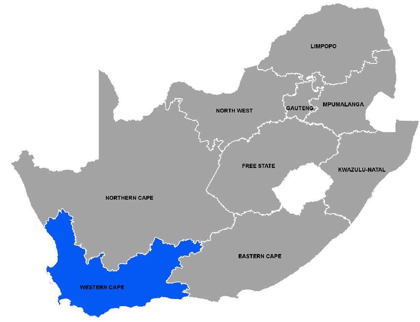
Richmond Park Development Company (Pty) Ltd                                                                                               SLR Project No: 720.01109.00008
Site Assessment Report - Richmond Park Service Station                                                                                                         March 2021
Filename: 720.01109.00008 RICHMOND PARK Baseline
Environmental Assessment - Baseline Assesment Report Rev1.4

     CONTENTS
       EXECUTIVE SUMMARY ................................................................................................................ I

               INTRODUCTION ................................................................................................................ 1
       1.1     General ........................................................................................................................................ 1
       1.2     Objectives .................................................................................................................................... 1
       1.3     Scope of Work ............................................................................................................................. 1

               DESK STUDY ..................................................................................................................... 2
       2.1     Background ................................................................................................................................. 2
       2.2     Site Overview .............................................................................................................................. 2
       2.3     Site Description ........................................................................................................................... 2

               FIELDWORK METHODOLOGY ............................................................................................ 6
       3.1     Health & Safety ........................................................................................................................... 6
       3.2     Service Clearance ........................................................................................................................ 6
       3.3     Groundwater Monitoring Well Installation and Soil Sampling ................................................. 6
       3.4     Groundwater Monitoring and Sampling ..................................................................................... 6
       3.5     Chemical Laboratory Analysis ..................................................................................................... 7
       3.6     Quality Assurance and Quality Control Program ........................................................................ 7
       3.6.1   Laboratory QA/QC Program ........................................................................................................................................ 7
       3.6.2   Field QA/QC Program .................................................................................................................................................. 7

       3.7     Regulatory Framework................................................................................................................ 8

               RESULTS OF THE INVESTIGATION ...................................................................................... 8
       4.1     Soil Investigation ......................................................................................................................... 8
       4.1.1   Drilling Locations ......................................................................................................................................................... 8
       4.1.2   Site Stratigraphy .......................................................................................................................................................... 9
       4.1.3   Soil Vapour Headspace Screening ............................................................................................................................... 9
       4.1.4   Inorganic Analytical Chemistry for Soil ..................................................................................................................... 10
       4.1.5   Metal Analytical Chemistry for Soil ........................................................................................................................... 10
       4.1.6   Organic Analytical Chemistry for Soil ........................................................................................................................ 12

       4.2     Groundwater Investigation ....................................................................................................... 14
       4.2.1   Groundwater Flow .................................................................................................................................................... 14

                                                                                        iii
Richmond Park Development Company (Pty) Ltd SLR Project No: 720.01109.00008
Site Assessment Report - Richmond Park Service Station March 2021
Filename: 720.01109.00008 RICHMOND PARK Baseline
Environmental Assessment - Baseline Assesment Report Rev1.4
4.2.2 Groundwater Monitoring Data ...................................................................................................................................... 14
4.2.3 Metal Analytical Chemistry for Groundwater ........................................................................................................... 15
4.2.4 Organic Analytical Chemistry for Groundwater ........................................................................................................ 15
4.3 Quality Assurance and Quality Control Program Results ......................................................... 17
4.3.1 Laboratory QA/QC Program ...................................................................................................................................... 17
4.3.2 Field QA/QC Program ................................................................................................................................................ 17
4.3.3 Overall QA/QC Summary ........................................................................................................................................... 17
4.4 Analytical Chemistry Results ..................................................................................................... 17
ENVIRONMENTAL EVALUATION...................................................................................... 18
5.1 Conceptual Site Model .............................................................................................................. 18
5.2 Overall Risk Summary................................................................................................................ 21
CONCLUSIONS ................................................................................................................ 21
PROPOSED CONTAMINATION RISK MITIGATION MEASURES .......................................... 22
STATEMENT OF LIMITATIONS ......................................................................................... 23
DOCUMENT REFERENCES
TABLES
Table 2-1: SITE DETAILS ........................................................................................................................ 2
Table 2-2: DESK STUDY DETAILS ........................................................................................................... 2
Table 4-1: SUMMARY OF STRATA ENCOUNTERED .............................................................................. 9
Table 4-2: SUMMARY OF SOIL FIELD OBSERVATIONS AT SAMPLING LOCATIONS ............................... 9
Table 4-3: INORGANIC ANALYTICAL CHEMISTRY FOR SOIL ................................................................10
Table 4-4: METAL ANALYTICAL CHEMISTRY FOR SOIL .......................................................................11
Table 4-5: ORGANIC ANALYTICAL CHEMISTRY FOR SOIL – HYDROCARBONS, POLYCHLORINATED
BIPHENYLS (PCB’S) AND SPECIATED PHENOLS ...............................................................13
Table 4-6: ORGANIC ANALYTICAL CHEMISTRY FOR SOIL - VOLATILE ORGANIC COMPOUNDS .........13
Table 4-7: SUMMARY OF GROUNDWATER MONITORING DATA .......................................................14
Table 4-8: SUMMARY OF GROUNDWATER IN-FIELD PARAMETERS ..................................................14
Table 4-9: METAL ANALYTICAL CHEMISTRY FOR GROUNDWATER ....................................................16
Table 4-10: ORGANIC GROUNDWATER ANALYTICAL CHEMISTRY FOR GROUNDWATER – VOCs and
HYDROCARBONS .............................................................................................................16
Table 5-1: RISK MATRIX ......................................................................................................................18
Table 5-2: RISK EVALUATION INDICATING POTENTIAL SOURCES, PATHWAYS AND RECEPTOR
LINKAGES ........................................................................................................................19
ivRichmond Park Development Company (Pty) Ltd SLR Project No: 720.01109.00008
Site Assessment Report - Richmond Park Service Station March 2021
Filename: 720.01109.00008 RICHMOND PARK Baseline
Environmental Assessment - Baseline Assesment Report Rev1.4
APPENDICES
Appendix A: Site Drawings
Appendix B: Soil Bore Logs
Appendix C: Analytical Chemistry Results
vRichmond Park Development Company (Pty) Ltd SLR Project No: 720.01109.00008
Site Assessment Report - Richmond Park Service Station March 2021
Filename: 720.01109.00008 RICHMOND PARK Baseline
Environmental Assessment - Baseline Assesment Report Rev1.4
ACRONYMS AND ABBREVIATIONS
Acronyms/Abbreviations Definition
ADO Automotive Diesel Oil
BTEXN Benzene, Toluene, Ethylbenzene, Xylenes, and Naphthalene
CSM Conceptual Site Model
DILs Dutch Intervention Levels
DRO Diesel Range Organics
DWA Department of Water Affairs (currently known as DWS)
DWS Department of Water and Sanitation
EC Electrical Conductivity
GRO Gasoline Range Organics
HASP Health and Safety Plan
H&S Health and Safety
JRA Johannesburg Roads Agency
km Kilometre
L/s Litres per Second
m Meters
m bgl Meters below ground level
MDL Method detection limit
mg/L Milligrams per litre
MNA Monitoring Natural Attenuation
MTBE Methyl Tertiary Butyl Ether
NGA National Groundwater Archive
ORP Oxidation Reduction Potential
PID Photo Ionization Detector
viRichmond Park Development Company (Pty) Ltd SLR Project No: 720.01109.00008
Site Assessment Report - Richmond Park Service Station March 2021
Filename: 720.01109.00008 RICHMOND PARK Baseline
Environmental Assessment - Baseline Assesment Report Rev1.4
Acronyms/Abbreviations Definition
ppm Parts per million
QA/QC Quality Assurance and Quality Control
RISC Risk-Integrated Software for Cleanups
RBCA Risk-Based Corrective Action
RBSL Risk-Based Screening Levels
RPD Relative Percent Difference
SANAS South African National Association of Standards
SLR SA SLR Consulting (South Africa) (Pty) Ltd
SPH Separated Phase Hydrocarbons
SSTLs Site-Specific Target Levels
SVS Soil Vapour Survey
TAME tert-Amyl methyl ether
TEA Terminal Electron Acceptor
RPDC Richmond Park Development Company (Pty) Ltd
TPH Total Petroleum Hydrocarbons
ULP Unleaded Petrol
UST Underground Storage Tank
ug/L Micrograms per litre
viiRichmond Park Development Company (Pty) Ltd SLR Project No: 720.01109.00008
Site Assessment Report - Richmond Park Service Station March 2021
Filename: 720.01109.00008 RICHMOND PARK Baseline
Environmental Assessment - Baseline Assesment Report Rev1.4
Introduction
1.1 General
SLR Consulting (South Africa) (Pty) Ltd (SLR SA) was appointed by Atterbury Property Holdings Pty Ltd, on
behalf of the Richmond Park Development Company (Pty) Ltd (“the Client”), to perform a baseline
geohydrological assessment to ascertain groundwater conditions at a site earmarked for Richmond Park
Service Station (referred in this report, as “the Site”), located on ERF 38333, Milnerton, Cape Town. The
appointment by Alexander de Beer (Atterbury Property Holdings Pty Ltd) was upon the submission of a
proposal, dated the 26th of October 2020, to undertake abovementioned scope of works at the Site.
The assessments was conducted in accordance to South African legislation, namely Sections 28 and 30 of
the National Environmental Management Act (NEMA Act No. 107 of 1998), Sections 35 to 39, 41 and 67
to 78 of the National Environmental Management Waste Act (NEMWA Act No. 59 of 2008), and the
National Water Act (Act No. 36 of 1998).
1.2 Objectives
The primary objective of the scope was to ascertain baseline groundwater conditions at the Site
earmarked for the development of the retail fuel service station, based a request issued on 14 October
2020 by the Department of Water and Sanitation (DWS) for the Site.
1.3 Scope of Work
To achieve the stated project objectives, SLR SA undertook the following work scope:
• A desktop study to assess the environmental sensitivity of the Site by collecting and evaluating
freely available topographical, geological and geohydrological information. Other available
reports, maps and databases were also evaluated;
• Compilation of a Health and Safety Plan (HASP) for the planned site works;
• Undertake a Site walkover for the visual inspection of the area proposed for the development
and selection of locations for intrusive works;
• Subsurface clearance activities in preparation for intrusive works;
• Obtaining approval from the Client for the selected groundwater monitoring well locations;
• Manual clearance, by hand augering, at the selected monitoring well locations;
• Drilling and installation of three groundwater monitoring wells;
• Field-screening of recovered spoil at 0.5m intervals for Volatile Organic Compounds (VOC)
screening using a calibrated Photo Ionisation Detector (PID);
• Logging of the recovered soils to identify zones of impact based on visual and olfactory evidence;
• Collection of one soil sample per bore at the point of highest VOC screening results (or where
there is evidence of visual/olfactory impact from petroleum hydrocarbons);
• Groundwater sampling of the newly installed groundwater monitoring wells, recording of in-field
parameters including pH, Oxidation Reduction Potential (ORP), Electrical Conductivity (EC), and
Dissolved Oxygen (DO);
• Limited walkover hydrocensus within 300m of the Site;
Page 1Richmond Park Development Company (Pty) Ltd SLR Project No: 720.01109.00008
Site Assessment Report - Richmond Park Service Station March 2021
Filename: 720.01109.00008 RICHMOND PARK Baseline
Environmental Assessment - Baseline Assesment Report Rev1.4
• Submission of all the samples to the accredited UIS Organic Laboratory, an ISO 17025 accredited
laboratory based in Gauteng Province, for hydrocarbon related analytes as well as for metals;
• Screening of the analytical results for soil against the SSV1 and SSV2 screening values as per the
requirements of Part 8, Section 37 of the NEMWA 2008;
• Screening of the analytical results for groundwater against SANS241:2015 Drinking Water
standard; and
• Preparation of an interpretative report detailing the desktop study, fieldwork activities, site
observations, maps, diagrams, sampling methodology, analytical results, and risk assessment.
Desk Study
2.1 Background
Site details are presented in Table 2-1.
Table 2-1: Site Details
Site Name Richmond Park Service Station
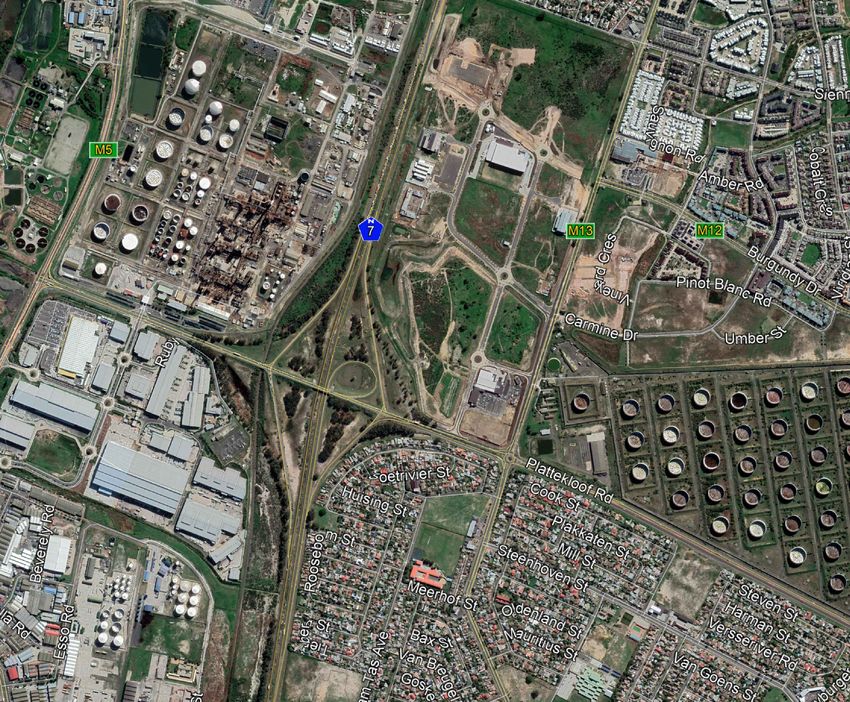
Address ERF 38333, Milnerton, Cape Town, Western Cape, South Africa
Post Code 7441 Site Co-Ords 33°50'57.35"S, 18°32'18.48"E
The Site location and surrounding land use is presented in Drawings 1 and 2 (Appendix A).
2.2 Site Overview
At present, the area proposed for the development of a fuel service station is vacant, with no fuel
infrastructure installed. The Site has been graded level but no structures have been erected at the Site at
the time of the assessment. A Site walkover was undertaken with the Site Representative (Sean McBean)
on the 10th of November 2020, and there was no visible evidence of any anthropogenic activity at the site
beyond the grading earthworks which has been completed.
2.3 Site Description
The information in Table 2-2 was derived from a desk-based review of published information.
Table 2-2: Desk Study Details
Site Land Use Current The area proposed for the construction of the service station
remains currently vacant. A shopping complex, Richmond
Corner Retail, has been developed on the adjacent property.
Proposed Site Fuel service station with an on-site shop. The area proposed for
Features this development extends over an area of approximately 4 500
m2.
Fuelling Facilities Storage Four Underground Storage Tanks (USTs) are planned for the Site.
According to design drawings, the proposed tank farm is to be
located on the southern portion of the Site. The USTs are to be
remote filled, with the proposed filler points located adjacent to
the tank farm.
Page 2Richmond Park Development Company (Pty) Ltd SLR Project No: 720.01109.00008
Site Assessment Report - Richmond Park Service Station March 2021
Filename: 720.01109.00008 RICHMOND PARK Baseline
Environmental Assessment - Baseline Assesment Report Rev1.4
Dispensing Five fuel dispensers are planned for the Site. The technical
specifications of the planned fuel dispensers are currently not
available.
Re-fuelling Five filler points are proposed for the Site, these will be located
west of the proposed tank farm.
Surrounding North Richmond Corner Retail shopping complex immediately
Land Use adjacent to the Site, followed by vacant land from 220 m
onwards.
Northeast Strategic Fuel Fund (SFF)tank farm (located from 195 m to 1.37
km east), followed by De Grende Avenue (M13), and followed by
the Burgundy Estate residential complex onwards.
East SFF tank farm (located from 195 m to 1.37 km east), followed by
De Grende Avenue (M13) and followed by vacant land onwards.
Southeast De Grendel (M13), residential properties, Bothasig Crèche
(located from 290 m to 310 m south east).
South Platterkloof Road (M14), and then high density residential
properties onwards.
Southwest Platterkloof Road (M14), high density residential properties
onwards (including Sunshine Corner Playschool and Day care
located from 200 m to 240 m south west), and vacant land
further on.
West Vacant land until the national route N7, 500m from Site.
Northwest Vacant land until commercial properties 750m from Site.
Site History Prior to 2008 Unknown, due to limited satellite imagery.
2008 to Present Historical satellite imagery identified surface water bodies from
40 m to 95 m west northwest of the Site between 2008 and
2009. These were subsequently were subsequently in-filled by
illegal dumping.
Surface water bodies were identified at 20m east and 40m west
northwest of the Site between 2009 and 2013. Between 2013
and 2016, an excavated area with grid-styled intrusion points
was identified from 50m to 80m north of the Site. Recently, the
are proposed for the development has been cleared and graded
as part of the approved Richmond Park Development.
Geography Topography The topography and gradient of the Site (prior to Site
and Gradient development) is generally flat, with a gentle slope to the north
northwest. The topography and gradient of the greater
surrounding area slopes to the west south west.
Elevation Approximately 30 m above mean sea level.
Geology Superficial Colluvium (sand and gravel).
Bedrock According to the Department of Water Affairs and Forestry
(DWAF) 1:500 000 Hydrogeological Map of Cape Town 3126, the
Page 3Richmond Park Development Company (Pty) Ltd SLR Project No: 720.01109.00008
Site Assessment Report - Richmond Park Service Station March 2021
Filename: 720.01109.00008 RICHMOND PARK Baseline
Environmental Assessment - Baseline Assesment Report Rev1.4
Site is underlain by undifferentiated coastal deposits
(unconsolidated to semi-consolidated sediments including sand,
calcrete, calcarenite, aeolianite, marine gravel, clay, silcrete and
limestone) of the Sandveld Group [P.S. Meyer, 1999].
Hydrogeology Aquifer The aquifer is classified as a Major Aquifer of most vulnerability
Classification and high susceptibility.
Aquifer Yield According to the Dept Water Affairs and Forestry (DWAF) 1:500
and Hydraulic 000 Hydrogeological Map of Cape Town 3126, the Site is
Conductivity underlain by undifferentiated coastal deposits (unconsolidated
to semi-consolidated sediments including sand, calcrete,
calcarenite, aeolianite, marine gravel, clay, silcrete and
limestone) of the Sandveld Group [P.S. Meyer, 1999].
Groundwater During the current site investigation groundwater was between
Depth and Flow 1.52 m and 1.99 m bgl.
Groundwater elevations per well location were calculated
following a topographical survey conducted by SLR SA in
November 2020. The aforementioned data was used to
interpolate groundwater elevation contours, using triangulation
with linear interpolation in Surfer (16) software; which indicated
that the groundwater flow direction on-site is north-easterly.
Groundwater Within the Site boundaries:
Abstractions No groundwater abstraction points (boreholes) were observed
during the site walkover and field investigations in November
2020.
Within 1 km radius of the Site:
Prior to mobilisation to Site, a hydro census was performed on
the 24th of November 2020, using the NGA database from the
Department of Water Affairs (DWS). No groundwater
abstraction points were located/verified through the NGA
platform within a 1km radius of the Site. However, one licensed
borehole of unknown use was identified within a 2km radius,
located approximately 1.28 km north northeast.
A limited walkover hydro census was conducted at to identify
any surrounding boreholes and to obtain relevant samples. This
included a 300m door-to-door and as well as a 1000m drive
around hydrocensus. A total of eight boreholes were identified
within a 500m radius of the proposed Site through the
hydrocensus. These boreholes are mostly located south and
south west of the Site, and predominantly used for irrigation
purposes.
Water usage on-site:
The proposed service station and surrounding properties will be
connected to the municipal water supply system.
Hydrology Surface water bodies (within 1km) were located at approximately 490m northeast,
as well as from 575 m to 725 m north northwest of the Site. Treatment ponds were
located at approximately 340 m northeast and 240 m east of the Site. No natural
Page 4Richmond Park Development Company (Pty) Ltd SLR Project No: 720.01109.00008
Site Assessment Report - Richmond Park Service Station March 2021
Filename: 720.01109.00008 RICHMOND PARK Baseline
Environmental Assessment - Baseline Assesment Report Rev1.4
surface water resources are located on or in close proximity to, the site proposed
for the development. Environmental Authorisation (EA) for the overall Richmond
Park development was obtained on 21 September 2012 (EIA Ref: E12/2/4/2-
A6/399-1009/10) (which was subsequently amended on 1 August 2013 (EIA Ref:
16/3/1/5/A5/106/1019/13)) by means of a Scoping and Environmental Impact
Assessment (EIA) process. As part of the authorisation, ERF38333 (i.e. area of
proposed development) as approved for development and has subsequently been
cleared for the establishment of building foundations.
Meteorological The average annual rainfall in Cape Town is approximately 475 mm per annum.
Data Most of the rainfall occurs during the winter months (May to August)1.
Other Nearby Underground None present.
Observations Structures
Off-Site The Strategic Fuel Fund (SFF) tank farm located within 195 m
Contamination east of the proposed site location.
Sources
The Astron Energy Refinery located from 750 m northwest of the
proposed development.
Engen De Grendel Service Station located 350 m south of the
Site.
Protected None present.
Biodiversity
Zones
Heritage and None present.
Archaeological
Sites
Sensitive Nearby sensitive environments (within 1 km of the Site); include,
Environments Sunshine Corner Playschool and Day care (located from 200 m
to 240 m south west), De Grendel/Bothasig Crèche (located from
290 m to 310 m south east), De Grendel Centre (located from
310 m to 380 m south) and Wolrad Woltemade Primary School
(located from 360 m to 575 m south southwest) of the Site.
Information The construction date of the Site is still unknown; thus, the final configuration of
Gaps underground utilities, potential preferential pathways, is unknown.
______________________
1
Source of data: CRU CL 2.0 as described in New, M., Lister, D., Hulme, M. and Makin, I., 2002. A high-resolution data set of surface climate over
global land areas. Climate Research 21, 1-25
Page 5Richmond Park Development Company (Pty) Ltd SLR Project No: 720.01109.00008
Site Assessment Report - Richmond Park Service Station March 2021
Filename: 720.01109.00008 RICHMOND PARK Baseline
Environmental Assessment - Baseline Assesment Report Rev1.4
Fieldwork Methodology
3.1 Health & Safety
Both global and SLR SA health and safety protocols were adhered to in the preparation and
implementation of the project. A comprehensive account of the SLR SA H&S methodology can be
acquired in the SLR SA standard operating procedure (SOP) 4.1.
3.2 Service Clearance
Prior to the commencement of the project, an SLR consultant conducted a site walkover with a
knowledgeable person from site management to confirm preliminary drilling locations and gather visual
clues for subsurface and overhead utilities. The client also informed SLR SA that no utility services exist
within the area of investigation. A non-intrusive utility survey was conducted using a Cable Avoidance
Tool (CAT), and final locations were confirmed. Prior to drilling, the contractor cleared the upper 2m of
soil using hand tools to ensure no utilities were present at the drilling locations.
3.3 Groundwater Monitoring Well Installation and Soil Sampling
SLR commissioned Envirovac to advance rotary percussion groundwater monitoring wells to allow for soil
sampling and the installation of monitoring wells. Three monitoring wells were advanced to depths
between 5.6 to 5.8m bgl. Each of the soil profiles was geologically logged and the borehole logs are
presented in Appendix B.
Soil screening was undertaken at selected depths (typically every 0.5m). Soil bags were field screened for
the presence of volatile vapours. Each sample bag was half-filled with soil, left for approximately 10 to
15 minutes (min), then punctured and analysed for volatile vapours. A MiniRae© Photo-Ionized Detector
(PID), calibrated against isobutylene, was used to measure the vapour concentrations. The results
reported were the maximum headspace readings attained during the analysis. Results were given in parts
per million Total Organic Vapour (ppmTOV). Representative soil samples were collected from each soil
bore, and submitted UIS laboratory for analysis.
A comprehensive breakdown of the soil sampling methodology can be acquired in SLR LQR SOP 4.8.
3.4 Groundwater Monitoring and Sampling
The newly installed groundwater monitoring wells were gauged to determine the static water level and
confirm final depth of installation using a Solinst Interface Meter.
Groundwater samples were collected using a low-flow peristaltic pump. The purpose of low-flow
sampling is to collect representative groundwater from a discrete sampling depth in the well, without
needing to excessively purge the well. This method minimises disturbance of well sediment and allows
for more accurate sampling of dissolved-phase contaminants.
Field readings such as temperature, pH, EC, ORP, and/or DO were used to determine when groundwater
pumped from the well is representative of the aquifer. Applied pump rates were between 100 ml/min
and 500 ml/min. Ideally, the water level should not drop by more than 0.1 m. If drawdown exceeds 0.1
m, the purge rate is reduced since excessive drawdown distorts natural groundwater flow and could
potentially cause migration of contaminants into a well. When sampling for petroleum hydrocarbons, the
pump inlet was inserted within the upper 1 m of the water table.
Depth to water and water quality parameters were measured in three to five-minute intervals. A sample
is collected once three consecutive readings were within an acceptable variance.
Page 6Richmond Park Development Company (Pty) Ltd SLR Project No: 720.01109.00008
Site Assessment Report - Richmond Park Service Station March 2021
Filename: 720.01109.00008 RICHMOND PARK Baseline
Environmental Assessment - Baseline Assesment Report Rev1.4
A comprehensive summary of the groundwater sampling methodology is presented in SLR SA SOP 4.4.
3.5 Chemical Laboratory Analysis
All soil and groundwater samples were sent for analysis of BTEXN, MTBE, TAME, GRO (C7-C9) and TPH
fractions (C10-C36). The samples from monitoring wells were also submitted for metals, metalloids, and
inorganics.
All samples were kept under refrigerated conditions and transported to the analytical laboratory with full
chain of custody documentation.
3.6 Quality Assurance and Quality Control Program
A quality assurance and quality control (QA/QC) program was applied to evaluate if the sampling and
analytical data were reliable based on current industry standards. The QA/QC program consisted of two
stages (noted below) with one stage completed by the laboratory and the other as part of the standard
field procedures performed by SLR SA.
3.6.1 Laboratory QA/QC Program
The soil and groundwater samples were analysed by UIS Organic Laboratory and UIS Sediba Laboratory.
The laboratory is accredited by the South African National Association of Standards (SANAS). The internal
quality procedure for batch samples includes calibrations, blanks, duplicates, and/or verification.
All time sensitive analysis is done immediately (where preservation is not possible) to preserve sample
integrity. Results are also compared between independents tests components/elements of overlap such
as the GRO ranges which can be observed in TPH ranges. All verifications are imported into control charts
for trend analysis.
Laboratory equipment is calibrated and/or verified based on a predetermined maintenance schedule.
The quality system is audited by the laboratory’s quality manager and externally by SANAS.
3.6.2 Field QA/QC Program
To verify the reproducibility of the laboratory analyses and field sampling, SLR SA collects blind duplicate
groundwater samples. One groundwater blind duplicate was collected and submitted to the laboratory
for the analysis of BTEXN, MTBE, and TAME.
Based on the results of the duplicate analysis, the relative percent difference (RPD 2) is calculated as a
measure of QA/QC. Analytical error increases near the method detection limit (MDL); therefore, the RPD
is not normally calculated unless the concentrations of both the original and duplicate samples are
greater than five times the MDL. If the RPD for a sample and its duplicate do not meet SLR’s RPD standards
for the parameters analysed, an explanation is required to qualify the difference in values.
Trip blanks were submitted to the laboratory to undergo the same analysis and calculation procedure to
ensure QA/QC protocols were maintained. One trip blank was submitted for each cooler box.
SLR SA utilises a data quality review program which incorporates both the duplicate and trip blank in
assessing the reliability of the field data.
A comprehensive account of the groundwater QA/QC program is presented in SLR SA SOP 4.4.
The laboratory groundwater analysis reports are presented in Appendix C
______________________
2
Relative percent difference (RPD) is the numerical interpretation of comparing two values with one another. It is often used as a quantitative
indicator of quality assurance and quality control for repeated measurements where the outcome is expected to be the same
Page 7Richmond Park Development Company (Pty) Ltd SLR Project No: 720.01109.00008
Site Assessment Report - Richmond Park Service Station March 2021
Filename: 720.01109.00008 RICHMOND PARK Baseline
Environmental Assessment - Baseline Assesment Report Rev1.4
3.7 Regulatory Framework
The South African Soil Screening Values (SSVs) as promulgated in the Department of Environmental
Affairs (DEA) Framework for the Management of Contaminated Land (2010) and promulgated in the
National Norms and Standards for the Remediation of Contaminated Land and Soil Quality (2014), were
used to screen the soil analytical results.
The SSVs provide two tiers for the determination of risk in order to facilitate the sensitivity of the relevant
receptor which may be subject to exposure. These are defined as:
• Soil Screening Value (SSV) 1, which represents the lowest value calculated for each parameter
from Human Health and Water Resource Protection Pathways; and
• Soil Screening Value (SSV) 2, which represents the land use specific soil value appropriate for
screening level Site assessment in cases where protection of a water resource is not an applicable
pathway for consideration.
The area surrounding the site is of mixed land use, including commercial and residential properties within
200 m of the proposed development. Therefore, both standard residential and commercial screening
levels (SSV2) have been applied.
The aquifer is considered as a water resource, as abstraction boreholes were identified within 300m of
the Site. As such, SSV1 screening values are included in the risk assessment of soil COPCs.
As the South African legislation does not account for petroleum hydrocarbon contaminants in
groundwater, various risk-based tools are utilised. Petroleum hydrocarbon (BTEXMN, TAME and TPH
fraction) concentrations in groundwater were evaluated using the Dutch Intervention Levels and
SANS241:2015 guidelines for drinking water.
The Dutch Intervention Levels are not site-specific; however, they provide a screening level above which
it is expected to be hazardous to 50% of the species in surrounding ecosystems. It is noted that these
screening values are based on toxicological testing of flora and fauna not usually found in South Africa;
however, provide a broad perspective of ecological risk for a variety of matrices (i.e. soil and water).
The Dutch Intervention Levels allow the return of contaminated land to any potential use, rather than
tailoring the level of remediation to the intended use of the land. The Intervention Value is the maximum
tolerable concentration above which remediation is required. Site concentrations (for soil or
groundwater) exceeding the Intervention Value indicate remediation is necessary.
A tiered approach is utilised in the determination of the environmental risk, as described in the American
Society for Testing of Materials (ASTM) Risk-Based Corrective Action (RBCA) guidance manual. RBCA is
defined by the ASTM as an iterative streamlining process that uses a tiered approach and site
classifications to screen and address sites based on their relative risk, taking into account site use (be it
residential or commercial/industrial), relevant sources, contamination transport pathways and receptors.
The selected screening criteria are based on the most sensitive receptor associated with the Site (i.e.
where sites are in a mix industrial and residential setting the residential RBSLs are to be used).
Results of the Investigation
4.1 Soil Investigation
4.1.1 Drilling Locations
A groundwater monitoring network comprised of three (3) groundwater monitoring wells was proposed.
The monitoring well locations were finalised on the 4th of November 2020, after consultation with a Client
Representative. The distribution of the groundwater monitoring wells across the Site is listed below,
Page 8Richmond Park Development Company (Pty) Ltd SLR Project No: 720.01109.00008
Site Assessment Report - Richmond Park Service Station March 2021
Filename: 720.01109.00008 RICHMOND PARK Baseline
Environmental Assessment - Baseline Assesment Report Rev1.4
MW1: Downgradient of the proposed forecourt area and fuel lines
MW2: Downgradient of the proposed tank farm
MW3: Upgradient well to ascertain background conditions
The three (3) groundwater monitoring wells were advanced on the 10th of November 2020 to provide
coverage around the proposed infrastructure and potentially downgradient of the new fuel storage / as
well as dispensing infrastructure. The locations of the monitoring wells are shown on Drawing 3, Appendix
A.
4.1.2 Site Stratigraphy
A generalised description subsurface geological stratigraphy observed in previous site assessments is
summarised in Table 4-1 below.
Table 4-1: Summary of Strata Encountered
Strata Description Depth (m)
Colluvium Moist, red brown, gravelly SAND. 0 to 2.1
Colluvium Moist, brown, silty SAND 2.1 to 3.1
Residual Mudrock Wet, orange brown, clay 3.1 to 5.1
Residual Mudrock Wet, grey brown, sandy SILT 5.1 to 7
4.1.3 Soil Vapour Headspace Screening
Soil screening was undertaken at selected depths (typically every 0.5 m) and the soil samples were
screened in the field both visually and using a calibrated Photo Ionisation Detector (PID). A single soil
sample was collected per monitoring well. Each sample was placed in sample glass jars within as short a
period as possible to limit atmospheric exposure, and submitted to the laboratory for analysis.
Headspace vapour concentrations were mostly not recorded in any of the sampled intervals, with the
exception of 0,2 ppmV and 0,4 ppmV measured during manual clearance at MW2, at depths of 2 and
1,5m bgl respectively. Hydrocarbon vapour concentrations for each borehole hole are presented on the
Profiling Logs. A summary of maximum headspace concentrations at sampled intervals are presented in
Table 4-2 below.
Table 4-2: Summary of Soil Field Observations at Sampling Locations
Well Date Visual and olfactory indications Sample Depth Max. field screen test
Name Of hydrocarbons (m) result (ppmTOV)1
MW1 10-11-2020 No hydrocarbon odour and no staining 1.5 0.4
MW2 10-11-2020 No hydrocarbon odour and no staining 6 0
MW3 10-11-2020 No hydrocarbon odour and no staining 6 0
1ppm TOV: parts per million Total organic Vapours measured using a PID calibrated to isobutylene
Page 9Richmond Park Development Company (Pty) Ltd SLR Project No: 720.01109.00008 Site Assessment Report - Richmond Park Service Station March 2021 Filename: 720.01109.00008 RICHMOND PARK Baseline Environmental Assessment - Baseline Assesment Report Rev1.4 4.1.4 Inorganic Analytical Chemistry for Soil The soil samples were submitted for inorganic analytical chemistry analysis, to ascertain baseline water quality conditions in comparison to the Soil Screening Values (SSV) for Anions. Commonly occurring anions are rarely encountered at concentrations that may impact on human health by direct exposure pathways, but have an important influence on soil quality from an ecological perspective. The results of inorganic determinant analysis of the soil are presented in Table 4-3 below. Table 4-3: Inorganic Analytical Chemistry for Soil Well Sample Chloride Nitrate Nitrite Sulphate Fluoride Name Name (Cl) (NO3) (NO2) (SO4) (F) MW1 SSRP01 64.62 47.78
Richmond Park Development Company (Pty) Ltd                                                                                                                          SLR Project No: 720.01109.00008
 Site Assessment Report - Richmond Park Service Station                                                                                                                                    March 2021
 Filename: 720.01109.00008 RICHMOND PARK Baseline Environmental Assessment - Baseline Assesment
 Report Rev1.4

Table 4-4: Metal Analytical Chemistry for Soil
         Well                  Sample                                               Trivalent Hexavalent                       Total
                                                 Arsenic          Cadmium                                Cobalt      Copper             Fluoride   Lead Manganese Mercury     Nickel     Vanadium        Zinc
         Name                   Name                                               Chromium Chromium                          Cyanide
         MW1                   SSRP01               1.91
Richmond Park Development Company (Pty) Ltd SLR Project No: 720.01109.00008
Site Assessment Report - Richmond Park Service Station March 2021
Filename: 720.01109.00008 RICHMOND PARK Baseline
Environmental Assessment - Baseline Assesment Report Rev1.4
The highest concentrations of metals were generally recorded at MW2. The results of the metal chemistry
presented in Table 4-4 indicate that none of the metal’s concentrations exceeded South African Soil
Screening Values SSVs for All Land Uses, Standard Residential Properties and Commercial/industrial
settings.
The metal analytical chemistry results for soil are presented in Appendix C.
4.1.6 Organic Analytical Chemistry for Soil
Three samples were collected for laboratory analysis during hand augering and prior to the installation
of the monitoring wells on 11 November 2020. The samples were submitted for laboratory analysis of
COPCs related to diesel and petrol fuel. These include monoaromatic hydrocarbons, polyaromatic
hydrocarbons, total petroleum hydrocarbons, polychlorinated biphenyl (PCB’s) and volatile organic
compounds (VOCs).The organic chemistry results were screened against the soil screening levels.
Soil laboratory analytical results for MW1, MW2 and MW3 recorded concentrations of COPCs below
the laboratory limit of reporting (LOR), indicating the absence of fuel impact in shallow soil across the
Site.
The organic chemistry results are summarised in Table 4-5 and Table 4-6 below.
Page 12Richmond Park Development Company (Pty) Ltd SLR Project No: 720.01109.00008
Site Assessment Report - Richmond Park Service Station March 2021
Filename: 720.01109.00008 RICHMOND PARK Baseline Environmental Assessment - Baseline Assesment
Report Rev1.4
Table 4-5: Organic Analytical Chemistry for Soil – Hydrocarbons, Polychlorinated Biphenyls (PCB’s) And Speciated Phenols
Well Sample Benzene Ethyl- Toluene Total Naphthalene Pyrene Benzo(a) Total PCB’s 2- 2,4,6- TPH
Name Name benzene Xylenes pyrene Chlorop Thrichlorop C7 – C9 C10 – C14 C15 – C36
henol henol
MW1 SSRP01Richmond Park Development Company (Pty) Ltd SLR Project No: 720.01109.00008
Site Assessment Report - Richmond Park Service Station March 2021
Filename: 720.01109.00008 RICHMOND PARK Baseline
Environmental Assessment - Baseline Assesment Report Rev1.4
4.2 Groundwater Investigation
4.2.1 Groundwater Flow
The elevations of the monitoring wells were surveyed relative to a common datum point (100 m amsl).
Prior to water sampling, the depth to water in each well was measured using an electronic water level
interface probe relative to a surveyed reference point. This data was used to interpolate groundwater
elevation contours using triangulation with linear interpolation (3) in Surfer (version 16), a data
visualisation and mapping software package, to create a plot of the potentiometric groundwater surface.
The calculated groundwater flow direction was inconsistent with the regional topographical slope and
direction towards the nearest river, the Diep River located 2000m west of the Site. The geology observed
during drilling activities comprised clay (residual mudrock) at shallow depths, and therefore the
groundwater flow assessment is potentially affected by the presence of perched aquifer and clay lenses.
The inferred groundwater flow direction at the site is therefore inferred to be towards the north east.
The potentiometric plot is included in Drawing 4 in Appendix A.
4.2.2 Groundwater Monitoring Data
The monitoring results indicate that groundwater is present in the monitoring wells between depths of
1.52 m and 1.99 m bgl. No Phase Separated Hydrocarbons (PSH) were found in any of the monitoring
wells. The monitoring results are presented in Table 4-7.
Table 4-7: Summary of Groundwater Monitoring Data
Monitoring Sample Depth to PSH
Date Comments
Well Name Water 1 (m) (mm)
Turbid, no petroleum hydrocarbon
MW1 GWRP01 24-Nov-2020 1.52 -
odour and no sheen
GWRP02 Turbid, no petroleum hydrocarbon
MW2 24-Nov-2020 1.75 -
(GWRPDUP) odour and no sheen
Turbid, no petroleum hydrocarbon
MW3 GWRP03 24-Nov-2020 1.99 -
odour and no sheen
1 Depth to water measured from ground level.
The in-field parameters were measured during the purging process of each monitoring well. The results
are indicative of a continuous monitoring until stabilisation of the aquifer. The in-field groundwater
parameter results are presented in Table 4-8.
The in-field equipment was calibrated prior to undertaking the Site work. No anomalies were observed
in the parameters during the purging process.
Table 4-8: Summary of Groundwater In-Field Parameters
EC ORP Temp
Monitoring Well Date DO pH
(mS/cm) (mV) (oC)
MW1 24-Nov-2020 2.80 6.98 5.37 -15 19.7
______________________
(3) With the caveat of the limitations and errors associated with Surfer ® Golden Software and the statistical interpolation method used.
Page 14Richmond Park Development Company (Pty) Ltd SLR Project No: 720.01109.00008
Site Assessment Report - Richmond Park Service Station March 2021
Filename: 720.01109.00008 RICHMOND PARK Baseline
Environmental Assessment - Baseline Assesment Report Rev1.4
EC ORP Temp
Monitoring Well Date DO pH
(mS/cm) (mV) (oC)
MW2 24-Nov-2020 0 6.59 1.43 -77 19.7
MW3 24-Nov-2020 2.80 6.98 9.08 -7 19.9
DO Dissolved Oxygen is measures in milligrams per litre (mg/l).
ORP Oxidation Reduction Potential measured in milli volts
EC Electrical Conductivity measured in millisiemens per centimetre
T Temperature measured in degrees Celsius
The in-field parameters shown in the table above reveal pH values of 6.59 to 6.98, which are indicative
of an acidic to neutral background. The DO values were measured from 0 mg/L to 2.8 mg/L, which are
indicative of anaerobic subsurface conditions across the Site. The EC values ranged between 1.43 mS/cm
and 9.08 mS/cm. The ORP values ranged between -77 mV and -7 Mv, indicating more reducing conditions
at MW2, located on the southern portion of the Site.
4.2.3 Metal Analytical Chemistry for Groundwater
Three groundwater samples were collected, from each of the newly installed wells, on the 24th of
November 2020, and submitted for laboratory analysis for metals. In the absence of a complete set of
locally legislated screening guidelines, the groundwater analytical results were compared to the South
African National Standards (SANS 241-1:2015) for drinking water and the Dutch Intervention Values.
Groundwater laboratory analytical results for MW1, MW2 and MW3 predominantly recorded
concentrations of COPCs below the laboratory limit of reporting (LOR), with an exception of traces of
copper, manganese and zinc. Thus, indicating the absence of heavy metal impacts to the shallow aquifer.
A summary of analytical data for metals is summarised in Table 4-9 below.
4.2.4 Organic Analytical Chemistry for Groundwater
The groundwater samples were submitted for laboratory analysis for fuel related COPCs. The
groundwater laboratory analytical results for MW1, MW2 and MW3 returned concentrations of COPCs
below the laboratory limit of reporting (LOR). Thus, indicating that the groundwater beneath the Site has
not been significantly impacted, and currently does not pose an unacceptable to risk sensitive ecological
receptors or to human health.
A summary of analytical data for fuel related parameters is summarised in Table 4-10 below. The
laboratory certificates are included in Appendix C.
Page 15You can also read