Space Weather & Critical Infrastructures: Findings and Outlook - Horizonte Espacio
←
→
Page content transcription
If your browser does not render page correctly, please read the page content below
Space Weather & Critical
Infrastructures: Findings and
Outlook
         An event co-organised by the European Commission’s Joint Research Centre,
                                           the Swedish Civil Contingencies Agency,
                                              the UK Met Office, with the support of
                                        the NOAA Space Weather Prediction Center

                                                 29-30 November, 2016, Ispra, Italy

          Elisabeth Krausmann, Emmelie Andersson, Mark Gibbs, William Murtagh

                                                                              2016

                                                                           EUR 28237 EN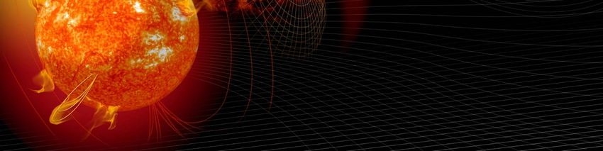
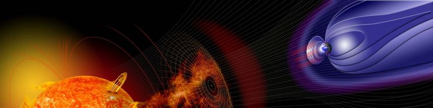
This publication is a Science for Policy report by the Joint Research Centre (JRC), the European Commission’s
science and knowledge service. It aims to provide evidence-based scientific support to the European
policymaking process. The scientific output expressed does not imply a policy position of the European
Commission. Neither the European Commission nor any person acting on behalf of the Commission is
responsible for the use that might be made of this publication.

Contact information
Name: Elisabeth Krausmann
Email: elisabeth.krausmann@ec.europa.eu

JRC Science Hub
https://ec.europa.eu/jrc

JRC104231

EUR 28237 EN

ISBN 978-92-79-63903-6        ISSN 1831-9424       doi:10.2788/152877

Luxembourg: Publications Office of the European Union, 2016

© European Union, 2016

The reuse of the document is authorised, provided the source is acknowledged and the original meaning or
message of the texts are not distorted. The European Commission shall not be held liable for any consequences
stemming from the reuse.

How to cite this report: Krausmann, E., Andersson, E., Gibbs, M., Murtagh, W., Space Weather & Critical
Infrastructures: Findings and Outlook, EUR 28237 EN, 2016, doi:10.2788/152877

All images © European Union 2016, except: Cover, Artist illustration of events on the sun changing the
conditions in Near-Earth space, Image credit: NASA

Title Space Weather & Critical Infrastructures: Findings and Outlook
Abstract
Extreme space weather has a global footprint and can affect multiple critical infrastructures at the same time.
An event of such magnitude could overwhelm a single nation’s response capacity. Further efforts in research,
and national and international coordination in preparedness and response are required.

Space Weather and Critical Infrastructures:
                               Findings and Outlook

    An event co-organised by the European Commission’s Joint Research Centre, the
               Swedish Civil Contingencies Agency and the UK Met Office
               With the support of the NOAA Space Weather Prediction Center

                            29-30 November, 2016, Ispra, Italy

                  E. Krausmann*, E. Andersson†, M. Gibbs#, W. Murtagh‡

           *European Commission, Joint Research Centre, Ispra (VA), Italy
†
Swedish Defence University (formerly at MSB - Swedish Civil Contingencies Agency),
                               Stockholm, Sweden
                                  Met Office, Exeter, UK
                                  #

           ‡
            NOAA Space Weather Prediction Center, Boulder, Colorado, USA
Contents

Acknowledgements .............................................................................................. 1
Executive summary .............................................................................................. 2
1 Introduction .................................................................................................... 3
2 Space weather today ........................................................................................ 4
3 Space weather impacts and risk reduction ........................................................... 7
   3.1 Known vulnerabilities to space weather and risk reduction ............................... 7
   3.2 National space-weather risk management and forecasting ............................... 9
4 Interdependencies and crisis response ............................................................... 12
5 Table-top exercise........................................................................................... 15
   5.1 Early warning and preparedness.................................................................. 15
   5.2 Response and recovery .............................................................................. 16
       5.2.1 Response ......................................................................................... 16
       5.2.2 Recovery .......................................................................................... 18
6 The way forward: discussion and recommendations ............................................. 19
Annexes ............................................................................................................ 22
   Annex 1. Participant list ................................................................................... 22
   Annex 2. Agenda ............................................................................................ 23
Acknowledgements
The authors wish to express their gratitude to Ms. Agnes Hegedus, Ms. Maria-Giovanna
Giuliani and Ms. Orsolya Sudar for their valuable assistance with the logistics of this
event, and to Dr. Georgios M. Karagiannis and Dr. Joaquim Fortuny-Guasch for helpful
discussions during the preparation of this report.

                                          1
Executive summary
Historical evidence shows that many critical infrastructures in space and on the ground
are vulnerable to the effects of space weather. Society relies increasingly on the services
these infrastructures provide, and the risks from extreme space weather should be
assessed to ensure adequate preparedness in industry and society.
In order to take stock of space-weather risk reduction efforts in the EU over the past five
years and to identify remaining gaps, the European Commission’s Joint Research Centre,
the Swedish Civil Contingencies Agency, and the UK Met Office, with the support of
NOAA’s Space Weather Prediction Centre, jointly organised a 2-day Summit on the
impact of extreme space weather on critical infrastructures on 29-30 November 2016 in
Ispra, Italy. The objectives of the summit were to discuss the state of play in reducing
the risks of extreme space-weather impacts on infrastructures, discuss transboundary
effects and the associated challenges for operators and emergency response, and to
provide a platform for exchange and coordination among the stakeholders.
The “Space Weather and Critical Infrastructures” Summit was attended by almost 50
representatives of European infrastructure operators, regulators, crisis-response experts,
academia, the European Space Agency, NOAA, the US Department of State, the US
Science and Technology Policy Institute, NASA and the European Commission.
The main workshop conclusions are:
• Extreme space weather has a global footprint and can affect multiple ground- and
space-based infrastructures at the same time. An event of such magnitude could
overwhelm a single nation’s response capacity.
• Some countries have recognised the threat of extreme space weather and have
included it in their strategic national risk assessment.
• There is a need to develop methodologies and tools for assessing interdependencies
between critical infrastructures.
• A multi-risk governance approach is needed to address cascading effects and the
different stakeholders that often manage the risk in isolation from each other.
• A pan-European vulnerability assessment of the power transmission grid should be
carried out to identify criticalities and the potential for transboundary effects in case
of extreme space weather.
• Infrastructure operators should assess if hidden vulnerabilities to space weather are
embedded in their systems, for example via dependencies on GNSS.
• Significant knowledge gaps in physical and impact modelling persist. These gaps
strongly affect early-warning capabilities and preparedness in industry.
• Better communication between science and industry is needed to provide relevant,
reliable and usable information to operators for decision making.
• In Europe and the USA, 24/7 space-weather forecasting capabilities are available to
support the early warning of government and industry.
• There is a need for consistency in forecasting and for coordination of forecasts from
different service providers.
• A strategic plan should be developed to define the roles of the key players in Europe.
This can include the establishment of a centralised European strategic decision-
making capability for coordinating space-weather risk mitigation and response at a
pan-European level.
• The USA has issued a National Space Weather Strategy that defines high-level
strategic goals and actions for increasing preparedness levels.
21 Introduction
Many modern critical infrastructures are vulnerable to the effects of natural hazards. Of
increasing concern is extreme space weather that can have serious impacts on ground-
based and space-borne infrastructures. Space weather occurs across national boundaries,
and crises in one country can easily spill over to neighbouring critical-infrastructure
networks. Numerous space-weather impacts to the power grid, aviation, communication,
and navigation systems have already been observed and documented. Since society
relies increasingly on the services these infrastructures provide, awareness of the space-
weather threat needs to be raised and the risks from extreme space weather should be
assessed to ensure adequate preparedness of infrastructure operators and society in
general.
Research efforts, in particular in North America and Europe, have been launched to
better understand the impact of space weather on the many different types of critical
infrastructures and to identify potential risk-reduction approaches where needed. In
addition, awareness-raising initiatives have engaged stakeholders related to power-grid
operations, aviation, financial systems, rail transport, and crisis response to increase the
resilience of critical infrastructures and society to space weather. In order to take stock
of space-weather risk reduction efforts in the EU over the past five years and to identify
remaining gaps, the European Commission’s Joint Research Centre (JRC), the Swedish
Civil Contingencies Agency (MSB), and the UK Met Office, with the contribution of the
NOAA1 Space Weather Prediction Centre (SWPC), jointly organised a 2-day summit on
the impact of extreme space weather on critical infrastructures on 29-30 November 2016
at the JRC’s Ispra site. The objectives of the summit were to discuss the state of play in
reducing the risks of extreme space-weather impacts on infrastructures, address the
problem of transboundary effects and the associated challenges for operators and
emergency response, and to provide a platform for exchange and coordination among
the stakeholders.
The “Space Weather and Critical Infrastructures” summit was attended by almost 50
representatives of European infrastructure operators, regulators, crisis-response experts,
academia, ESA2, NOAA, the US Department of State, the US Science and Technology
Policy Institute, NASA3 and the European Commission. The workshop programme and the
list of participants are provided in Annexes 1 and 2, respectively.
1
NOAA: National Oceanic and Atmospheric Administration
2
ESA: European Space Agency
3
NASA: National Aeronautics and Space Administration
32 Space weather today
Several countries have recognised the risks associated with extreme space weather and
have launched initiatives to prevent, prepare for and respond to the threat. In the first
session of the summit, six speakers from NOAA, the European Commission, Göttingen
University, ESA, the US Department of State, and the Swedish Institute of Space Physics
introduced the origin and characteristics of space weather and presented the status of
space-weather research and policy in Europe and in the USA.
Past space-weather impacts have demonstrated the vulnerability of both ground- and
space-based infrastructures to this type of hazard. In addition, space weather has a
global footprint and can therefore cause global impact, as demonstrated during the
October 2003 space-weather storms: several satellites were damaged or suffered
anomalies, numerous polar flights had to be rerouted, and there were reports of failure of
GNSS4-based positioning and power disruptions in Europe, widespread HF outage over
the African continent, and transformer damage in South Africa, as well as SatComm and
HF outages in Asia and Australia.
There are three different types of solar activity that are of concern for critical
infrastructure operations: 1) solar flares, which trigger radio blackouts very quickly and
affect radar, ground- and space-based communications, including high-frequency (HF)
communication, and the GPS network causing loss of lock; 2) solar radiation storms,
which are a threat to satellite operations, aviation and manned and robotic spaceflight;
and 3) geomagnetic storms, caused by the ejection of magnetised solar plasma (so-
called Coronal Mass Ejection or CME) which interacts with Earth’s magnetosphere,
causing impacts to satellite operations, GPS, aviation, rail transport and power-grid
operations. Of particular concern is extreme space weather, such as the Carrington storm
caused by a fast CME in 1859. A storm of such magnitude could result in major and
possibly long-term disruptions of critical-infrastructure services with significant economic
losses. It is believed that such a geomagnetic storm could overwhelm a single nation’s
response capacities. The probability of Carrington-type space-weather events is assumed
to lie between 6 and 12% within the next decade. However, for a major geomagnetic
storm to occur on Earth, the triggering CME needs to be aimed at Earth and carry a
southward magnetic field to be able to interact with the magnetosphere.
The European Union (EU) disaster risk management policy covers prevention,
preparedness and response for all types of disasters. In the EU there has been a shift
away from disaster management towards disaster risk management (DRM), with risk
assessment being seen as the very basis of DRM. The risk-assessment policy context is
the Union Civil Protection Mechanism which requires EU Member States to prepare a
National Risk Assessment (NRA) and list the priority risks the EU is facing. Six countries
(Finland, Hungary, Netherlands, Sweden, UK and Norway5) have included space weather
in their risk assessment. In addition, 20 NRAs contain critical-infrastructure loss or power
outage scenarios as priority hazards. Space weather could be considered as a trigger of
these scenarios. The Union Civil Protection Mechanism also requires Member States to
submit a risk management capability assessment by August 2018. The purpose of this
assessment is to understand the ability of Member States to address the identified
priority risks. The risk-management capability should include administrative, technical
and financial factors. Recently, the EU Disaster Risk Management Knowledge Centre has
been set up as a tool to better exploit research results, further cooperation across the
EU, and bring science and policy together. Space weather could be included in this
initiative, e.g. in terms of early warning, and to provide capacity-building support.
Europe has been active in the space sector for several decades and it has actively
contributed to space-weather research through involvement in milestone space missions,
such as SOHO, ACE and STEREO. The EU has funded over 30 research projects related to
space weather and its impacts through its 7th Framework Programme (FP7) 2007 – 2013
4
GNSS: Global Navigation Satellite System, e.g. GPS, GLONASS, GALILEO, BeiDou
5
Although Norway is not a member of the EU it participates in the EU Civil Protection Mechanism.
4and the Horizon 2020 programme for the period 2014 – 2020. An overview of these
projects is available via the European Space Weather Portal (www.spaceweather.eu). The
resources associated with these programmes have led to milestone results in space-
weather research, service developments and international collaboration. An example is
the FP7 AFFECTS (Advanced Forecast For Ensuring Communications Through Space)
project which studied impacts on the ionosphere and the effects on communication.
Through its website, the project provides event awareness by offering space-weather
services (e.g. Kp6, aurora RSS feeds), space-weather reports and alerts based on solar-
activity analysis, subscription services for flares, CMEs, and Solar Energetic Particles
(SEP), CME databases, modelling results, etc. Further EU funding is essential for the
research-to-operations path (instruments, mission development, underlying science),
including ground-based infrastructures.
The European Space Agency ESA is mandated by its member countries to protect space
and ground assets against adverse effects from space via its Space Situational
Awareness (SSA) programme. Space weather has been identified as a threat and has
recently become the largest SSA area. A cost/benefit analysis of the potential
consequences of a major space-weather event highlighted that the costs can be
significant. The analysis also clearly showed the economic benefits of using alert services.
ESA does not have its own space weather centre but it coordinates a virtual network of
expert groups in various ESA member countries that provide space-weather services. It
offers 140 products in 17 different space-weather domains. Subscription services issue
alerts depending on the interests of the user. These alerts provide information on what is
happening in space but not how the space environment will affect, e.g., spacecraft
operations. A service for power-grid operations that has become available very recently
capitalises on the results of the European EURISGIC project. It provides data on the
geomagnetic field and its change, the geoelectric field, and the geomagnetically induced
currents (GIC) in a model power grid with a simplified grid topology. 40-min GIC
forecasts are based on ground-based magnetometer data. Currently, the service covers
only Scandinavia. The future objective of the SSA space-weather segment is a system of
small missions with hosted payload to measure the space environment in low-Earth,
medium-Earth and geostationary orbits. In addition, new applications are planned to fill
gaps in current service capability. This includes benchmarking and validation of the
services provided by the Expert Service Centres, and focussed developments of services
and physics-based models.
The US Department of State plays a coordination and clearance role in international
space cooperation. In its coordination role, it leads on government-to-government
framework agreements, and in its clearance role on agency-to-agency implementing
agreements. The US National Space Policy issued in 2010 includes as goals the expansion
of international cooperation and the improvement of space-based Earth and solar
observation capabilities needed to forecast near-Earth space weather. Multiple efforts are
underway across US government agencies and internationally to increase awareness of
space-weather risks. This has much increased the coordination on the topic across US
agencies. For example, the FEMA7 Federal Interagency Response Plan will include a long-
term power-outage annex, and FERC8 has issued a rule on the development of grid
reliability standards for geomagnetic disturbances.
The National Space Weather Strategy was released by the White House in October 2015.
It defines the specific actions that US Federal agencies must undertake to prepare for
and respond to space-weather storms, as well as the timelines for completion of these
actions. The Strategy has six goals, including the improvement of assessment, modelling
and prediction of impacts on critical infrastructure, and the enabling of increased
international cooperation. This includes data sharing and research, cooperation on space-
6
The planetary index Kp provides a measure of the level of geomagnetic activity over a three-hour interval
based on magnetometer measurements. The index ranges from 0 to 9.
7
FEMA: Federal Emergency Management Agency
8
FERC: Federal Energy Regulatory Commission
5weather products and services, and a collaborative approach to extreme space-weather
preparedness. In October 2016 an Executive Order on preparing the nation for space
weather was issued by the US President. It defines the roles and responsibilities of the
various Federal government agencies in preparedness, response and recovery and their
authority to direct, suspend or control critical infrastructures before, during and after a
space-weather event.
The Roadmap prepared by COSPAR/ILWS, a joint undertaking of the Committee on
Space Research and the International Living With a Star programme, aims to protect
society’s technological infrastructure sectors by laying out a path for advancing space-
weather science. It focuses on high-priority challenges and prioritises those advances
that can be made on short, intermediate and decadal time scales. The roadmap tries to
answer fundamental questions related to processes on the Sun, the near-Earth space
environment after a solar eruption, and it aims to understand how technology and
society would be affected and could respond to the threat.
The roadmap’s highest-priority recommendations refer to research (observational,
computational, and theoretical needs), teaming (coordinated collaborative research
environment) and bridging communities (collaboration between agencies and
communities). Recommendations are separated into pathways which reflect a merged
weighting based on assessed societal impact, scientific needs, estimated feasibility, and
likelihood of near-term success. Pathways are designed to meet the differential needs of
the various user groups. For example, recommendations on observational, computational
and theoretical needs are divided into 3 pathways, which focus on 1) impacts of
GMD9/GIC on electrical systems, 2) the particle environment of (aero)space assets, and
3) pre-event forecasts of flares and solar particle events. These pathways can only be
achieved through interagency coordination and for each pathway there is a need for the
deployment of new or additional space- or ground-based instrumentation.
The key points from the first session are:
• Extreme space weather has a global footprint and can affect multiple ground- and
space-based infrastructures at the same time. An event of such magnitude could
overwhelm a single nation’s response capacity.
• The probability of an extreme Carrington-type geomagnetic storm is assumed to be
6-12% within the next decade.
• Some countries have recognised the threat of extreme space weather and have
included it in their strategic national risk assessment for better preparedness
planning.
• National and international initiatives have been launched to facilitate collaboration on
research, preparedness and response planning, and multilateral coordination in
response.
• Europe is actively contributing to space-weather research through involvement in
space missions and the funding of research projects related to space weather and its
impacts.
• The USA has issued a National Space Weather Strategy that defines high-level
strategic goals and actions for increasing preparedness levels.
9
GMD: Geomagnetic Disturbance
63 Space weather impacts and risk reduction
3.1 Known vulnerabilities to space weather and risk reduction
Many different types of critical infrastructures are known to be vulnerable to space
weather. Four speakers from the UK National Grid, SolarMetrics Consulting, JRC, and
Atkins presented the vulnerability of the power grid, aviation, GNSS, and rail to space
weather and discussed the potentially resulting problems with respect to service
disruption and cascading effects.
There is historic evidence dating back to the 1940s that power grids are vulnerable to the
impact of geomagnetic storms via the generation of GICs that enter the grid. The 1989
Quebec blackout was a wake-up call for the power industry, followed by the 2003
Halloween storm with a blackout in Sweden and damage to several transformers in South
Africa. Since high-voltage equipment is more susceptible to GIC, power transmission
systems are particularly at risk. On the other hand, GIC cannot penetrate into the
distribution network which is less vulnerable due to the higher line resistances and lower
voltages. Distribution networks might, however, suffer outages through secondary
impacts. Highly connected networks are also less vulnerable as the GIC would be spread
over more network branches. Potential GIC-related damage paths involve high-voltage
transformers (half-cycle saturation, harmonics, heating), or voltage fluctuations and line
tripping that can cause power outages. Once the power grid fails there will be ripple
effects to all sectors that rely on power, i.e. food and fuel distribution, water, transport,
industry, etc.
An assessment of the potential space-weather risks to the UK transmission grid suggests
that only Carrington-type events, assumed to have a 100-year return period, could cause
disruptions. Nevertheless, widespread transformer damage and grid collapse would be
rather unlikely. It is estimated that 20 transformers at most would be affected by
extreme space weather. Since this constitutes only about 1% of all transformers in the
UK grid, only local blackouts would be expected. National Grid relies on design (e.g. GIC-
resistant transformer design, voltages lower than 400 kV, transformer spares) and on
operational mitigation to handle the effects of geomagnetic storms. Operational
measures include return to service of items out for maintenance and switching in of all
circuits (required lead time 3-4 days), connection of all Supergrid Transformers to
distribute the GIC (lead time 2-3 days), extra reactive power support, extra staff, etc.
National Grid maintains a close relationship with the Met Office who provides them with
customised space-weather forecasts. Forecasting requirements are that operators should
receive a warning up to five days in advance of a geomagnetic storm to take all
necessary measures to protect the grid. For very fast CMEs, which take no more than 18
hours to arrive, this is currently not the case. Ideally, forecasting capabilities should be
improved to allow prediction of the likelihood and expected size of a CME 3-4 days prior
to its eruption, prediction of the CME’s magnetic orientation once launched from the Sun,
better accuracy of its arrival time at Earth, and an estimate of the geomagnetic
disturbance intensity caused by the CME.
Aviation has been subject to space-weather impacts on numerous occasions with
significant economic losses. For example, in 2005 the total cost of extra fuel used for
rerouting flights from polar routes due to space weather amounted to $186 million
(excluding costs to passengers and compensation). Space weather impacts aviation in
various ways, including through satellite navigation (GPS system availability, position
errors), avionics upsets/failures, communication loss, and additional human radiation
exposure. Aviation does not at the moment rely exclusively on GPS for navigation. For
example, in the USA the WAAS10 is based on GPS. If it is impacted by space weather, like
in October 2003, ground-based systems provide support for aircraft navigation. Since
these back-up systems are expensive to maintain and there is a trend towards reducing
10
WAAS: Wide Area Augmentation System
7redundancies to be more cost effective, there is concern that the associated risks for
navigation might not be fully appreciated.
The impacts on avionics are a problem that is not yet considered significant by airlines
although incidents where space weather is suspected have been documented (e.g.
Quantas Flight 72 in which un-commanded inputs to flight controls were reported,
causing injuries to passengers and the crew). There are several backups depending on
how flight-critical a system is. Nevertheless, flight electronics are becoming smaller as
technology progresses which increases their susceptibility to space weather. Loss of HF
communications as a primary safety-critical tool for communication is already recognised
as an issue. It is the primary communication tool in remote areas (polar regions and
oceans) which traffic management and airlines use to communicate. Together with
navigation, loss of communications is an issue that is potentially safety-relevant and can
- in the worst case - result in the closure of airspace.
It was suggested that better communication between scientists and industry is needed to
provide relevant, reliable and usable information to the aviation sector for decision
making. The information available today does not fulfil these criteria. This would enhance
awareness and understanding of the risks in the sector, and improve global emergency
response should an extreme event occur. In addition, there is a need for standardisation
of space-weather information and guidance, improved education and training, as well as
for risk and cost/benefit analysis.
GNSS is increasingly used for precise timing and positioning in a variety of applications
(e.g. eNavigation, offshore oil and gas drilling, precision farming), making them
vulnerable to space-weather impact. Recent studies recommend increased resilience of
and backups for positioning, navigation and timing services used in critical
infrastructures. The JRC investigates the vulnerability of GNSS to natural and
anthropogenic interference sources (jamming, spoofing) and their impacts on GNSS
receivers. In order to support the development of more resilient receivers, the JRC has
deployed ionospheric scintillation monitoring stations in Peru, Norway and Vietnam, as
well as two stations in Antarctica in collaboration with a European research consortium.
Scintillation events are recorded at the monitoring stations and played back at the JRC to
test standard receivers used, e.g., by aviation. This supports the development of GNSS
receivers that are less vulnerable to space-weather impact but also the preparation of
standards for enhanced receiver reliability. The JRC hosts a database of scintillation
events (intermediate frequency data) sourced from the monitoring stations during
periods of high ionospheric activity. This data is made available to the research
community for free. Future work will investigate the potential of using Formosat-
3/COSMIC data, as well as information from the International Ground Station (IGS)
network, to monitor ionospheric scintillation.
Space-weather impacts on rail have been documented in Sweden and Russia, with
disruptions to signalling as the primary effect. However, the rail industry lags behind the
power and aviation sectors with respect to awareness of and protection against space
weather. Atkins carried out an initial study to understand the vulnerability of the UK rail
network to extreme space weather and its impacts on safety and operability, under the
assumption that an event had already occurred. The study highlighted a strong
susceptibility of rail assets to space weather due to direct impacts on the infrastructure
and indirectly via its dependence on power, GNSS and radio communications. On the one
hand, GICs entering rail equipment, e.g. rolling-stock transformers or track-circuit feed
transformers, may result in transformer failure and train shut-down, or signalling
equipment producing right-side failures11. Also line current monitoring equipment may
interpret the quasi-DC GICs as incorrect train operation and shut the train down. There is
a theoretical risk that GIC induced or directly coupled into a rail may lead to wrong-side
failure which raises strong safety concerns. On the other hand, a power outage would
indirectly affect train operations, with train batteries lasting no longer than 90-120
11
Right-side failure is a condition in railway signaling that results in a safe state. Wrong-side failure causes an
unsafe state.
8minutes, signalling, and services at train stations, including lighting. In this context,
there is concern about self-evacuation and panic behaviour with passengers stranded in
trains or blocked at stations. The failure of GNSS has presently not been identified as a
safety concern. However, GPS plays a key role in maintaining timing on the GSM-R12
network, as well as in the line-side telecommunications system. GPS is also used for
Selective Door Opening to determine the location of the train on the rail network, and for
supporting the train’s propulsion system. Radio communications that use directional
antennas, such as GSM-R, would only be disrupted during sunrise and sunset. However,
their loss could be critical during emergencies. Interestingly, there is also a risk to track-
side staff during extreme space weather due to the unexpected activation of protection
system by GICs in conductors.
The Atkins study also came up with recommendations for research, forecasting and
warning, and monitoring and measuring. Most importantly, the study recommends to
close existing knowledge gaps related to single-event effects, track-circuit interference,
and GNSS dependency, while at the same time considering the potential for multiple and
simultaneous impacts. The Rail Delivery Group and Network Rail have expressed interest
in understanding how they would respond to a space-weather warning.
The main conclusions from this session are:
• Past space-weather impacts on different types of critical infrastructures (e.g. power
grid, aviation, transport, GNSS) have been documented.
• Power transmission grids have been hardened in some countries based on past
impacts. In the UK, it is believed that only Carrington-type geomagnetic storms would
be able to cause disruptions to grid operations.
• In some countries, customised models for GIC prediction and impact assessment
have been developed.
• Aviation is vulnerable to extreme space weather due to radiation exposure, loss of
communications and navigation, and impacts on avionics. These aspects are
considered safety-relevant.
• GNSS, and as a consequence the applications that depend on it, is vulnerable to
space-weather impacts. There may be GNSS dependencies embedded in systems
without infrastructure operators knowing about them.
• Space weather can affect rail either via direct impacts (e.g. GICs in transformers or
rail tracks) or indirectly through dependencies on other critical infrastructures that
are vulnerable (power, communications, navigation).
• Better communication between science and industry is needed to provide relevant,
reliable and usable information to operators for decision making.
3.2 National space-weather risk management and forecasting
Early warning and preparedness are essential for limiting the effects of space-weather
impacts. In this session four speakers from the Swedish Civil Contingencies Agency, the
UK Government Office for Science, NOAA and the UK Met Office presented examples of
national approaches to managing space-weather risks and gave an overview of available
space-weather forecasting services in the USA and the UK.
The Swedish Civil Contingencies Agency MSB is tasked with preventing and preparing for
emergencies and crises from all causes, be they natural or man-made, in collaboration
with public and private stakeholders. It has published a National Risk and Capability
Assessment (NRCA) with the aim to identify and analyse risks, vulnerabilities and
society’s capability to prevent and respond to these risks. The results of the NRCA are a
strategic basis for directing and developing the Swedish civil contingency system. In the
frame of the NRCA, solar storms were identified as a particularly serious threat and a
12
GSM-R: Global System for Mobile Communications – Railway
9scenario of extreme space weather affecting Sweden was developed. This scenario
assumed the occurrence of a Carrington-type event with major disruptions to satellite
signals and HF communications, as well as a power blackout in southern and central
Sweden due to voltage collapse. It aimed to understand the potential consequences for
the over 8 million people living in the affected area (Sweden’s total population is close to
10 million). The major challenges identified in the immediate aftermath of the space-
weather event relate to cascading effects due to the power blackout, such as shortage of
drinking water, loss of communications, impacts on transportation, fuel supply, food, and
healthcare. There is also a risk of civil unrest. Based on these observations it was
concluded that backup power is a key factor for ensuring that critical societal functions
can be maintained throughout the event. This should be supported by improved warning
systems and reliable/user-friendly forecasts and warnings. Awareness, especially within
the civil-protection community, was highlighted as essential for minimising risks, as well
as more knowledge of the event dynamics. The space-weather scenario is included in
many strategic training courses.
In the UK, the space-weather risk is owned by the Met Office while the role of the
Government Office for Science is to translate science into policy. In the frame of the
European Commission’s call for the preparation of a National Risk Assessment, the UK
also indicated space weather as one of the priority risks the country might face. Severe
space weather has been included in the UK’s National Risk Register with a relative
likelihood of occurring over the next five years between 1 in 20 and 1 in 2 and an overall
relative impact score of 3 (out of 5). There is debate if the risk is represented correctly,
and a revised NRA will be published at the end of 2016 to reflect the increased
understanding of impacts on other sectors. In this context, space weather might be
reclassified as less likely (between 1 in 200 and 1 in 20) but with a higher impact (score
4 out of 5). In support of space-weather forecasting and alerting, the Met Office
forecasting centre was developed which provides general but also tailored services to its
user groups. The Cabinet Office works with local first responders, National Grid, the rail
network and the aviation sector on a preparedness strategy for extreme space weather.
In 2015, a Strategic Defence & Security Review recognised the important place in
security of space infrastructures and their vulnerability to space weather. In the same
year, the Government Office for Science carried out a space-weather table-top exercise
with different industry sectors to raise awareness, understand how to best communicate
space-weather risks to operators and the public, and to foster dialogue about extreme
risk with high uncertainties. The next steps will follow up on the results of the table-top
exercise and address the identified gaps.
In the USA, the NOAA Space Weather Prediction Center is the official source of space-
weather alerts and warnings which go out to thousands of people and are used by
government agencies and infrastructure operators alike. In support of the alert process,
NOAA has developed space-weather scales, similar to existing hurricane or tornado
scales, which the alerts are largely based on. These scales categorise solar flares (radio
blackouts – R-scale), solar radiation storms (S-scale), and geomagnetic storms (G-
scale). For alerts of solar flares, text and graphic products are available to the users. This
includes graphics that show the areas of highest impact on HF communications on Earth
as a function of time. Only probabilistic forecasts of the conditions favourable for
triggering eruptive activity on the Sun are possible. When and where a sunspot cluster
will emerge cannot be predicted. Similarly, forecasting of the occurrence and size of a
flare is also not possible. Also for solar radiation storms, text and graphic products are
available. There is some understanding of the underlying processes and hence some
forecasting capability, but with significant limitations. For major radiations storms in
progress, high-confidence persistence forecasts can be provided with 24 hour or more
lead time. However, it is often the case that information can be given to aviation with
only very little advance notice (sometimes only minutes).
Geomagnetic-storm forecasts are divided into three phases: watch, warning and alert.
Forecasters observe and measure CMEs from the SOHO and STEREO spacecraft. A
geomagnetic storm watch is issued upon detection of an Earth-directed CME with a lead
10time of typically 1-3 days. Subsequently, the WSA-Enlil model is run to determine the
characteristics of solar winds and CMEs, and the likely arrival time of the CME at Earth.
This is a key piece of information for power-grid operators to take protective action, e.g.
delaying maintenance, switching lines back in, etc. When the CME is detected at the ACE
spacecraft about 15-45 minutes before impacting Earth, a geomagnetic storm warning is
released. At the current state of science, this is the moment when the CME’s magnetic
field orientation can be confirmed and it becomes known if a strong geomagnetic storm is
to be expected. This presents a serious limitation to modelling and consequently, to mid-
to long-range forecasting. An alert is issued when the storm is detected in the ground-
based magnetometers of the US Geological Survey. Awareness of the risks associated
with space weather is growing and there has been a steep customer increase of SWPC’s
products since the inception of the subscription service in 2005. Through this service,
and through phone alerts for certain high-profile customers, SWPC reaches out to
operators, government agencies (e.g. FEMA, FAA13) and the White House to ensure
coordinated action for preparedness and response.
The UK Met Office has created the Met Office Space Weather Operations Centre
(MOSWOC) which is fully integrated within the Met Office Operations Centre. Currently, it
is Europe’s only operational manned 24/7 forecasting capability and it provides UK-
centric advisories to support the Government, military and critical infrastructure sectors,
and it coordinates with NOAA SWPC from both an operational and strategic perspective.
Customised impact descriptions that reflect infrastructure architectures and
vulnerabilities in the UK have been added to the NOAA space-weather scales. MOSWOC
observes and provides synoptic analyses of sunspot regions, as well as space-weather
related raw data and analyses prepared by Met Office teams for the different user
groups. Technical forecasts and guidance are provided free of charge to infrastructure
operators and consist of text and graphic products (e.g. colour-coded impact matrices).
MOSWOC also offers tailored services, e.g. for terrestrial or satellite communications.
These services provide customised information to address the needs of specific
infrastructure sectors. Preparedness plans also include a protocol that will be activated in
case of a major space-weather event after discussion with the central government and
the UK Space Weather Expert Group.
The key points from this session are:
• In the frame of its national risk assessment, Sweden has identified solar storms as a
priority threat and has developed a space-weather scenario for Sweden assuming a
Carrington-type event.
• The UK has included extreme space weather in its risk register and the government
works with local responders, National Grid, and the rail and aviation sectors on a
preparedness strategy.
• In Europe and the USA, 24/7 space-weather forecasting capabilities are available to
support the early warning of government and industry.
• There is a need for consistency in forecasting, and coordination of forecasts from
different service providers is required.
• Significant knowledge gaps in physical and impact modelling persist. These gaps
strongly affect early-warning capabilities and preparedness in industry.
• Geomagnetic-storm forecasting is hampered by the limited understanding of the
CME’s magnetic field orientation, reducing warning times significantly.
13
FAA: Federal Aviation Administration
114 Interdependencies and crisis response
The potential failure of critical infrastructures during extreme space weather can lead to
cascading effects to other sectors and overwhelm national response capacities. In the
final session of the summit three speakers from the JRC, IIASA14 and the UK Government
Office for Science discussed interdependencies between critical infrastructures, the
governance of transboundary risks, and lessons learned on crisis response from a
national space-weather emergency exercise.
In the EU, the European Programme on Critical Infrastructure Protection (EPCIP) is one
of the key initiatives providing a policy background for critical-infrastructure protection.
In December 2008, the Directive 2008/114/EC on the "Identification and designation of
European Critical Infrastructures and the assessment of the need to improve their
protection" was adopted. In 2013, the European Commission published a staff working
document on a revised approach to EPCIP. In this document, the importance of resilience
and interdependencies in critical infrastructures is clearly mentioned, as well as the need
to develop the associated methodologies and tools. Accordingly, the JRC has launched a
research activity addressing these issues for different applications and levels of
granularity. Complex dynamical networks theory is applied to the modelling and criticality
assessment of interdependent critical infrastructures (e.g. energy and information
networks). Functional modelling methods are exploited to systematically represent
causes, drivers and effects of critical events on service networks. Economic impact and
disservice propagation assessment is also involved in the process, based on dynamic
inoperability input/output models. In order to support these analyses, the JRC has set up
a Geospatial Risk and Resilience Assessment Platform.
During extreme space weather there is a risk that critical-infrastructure disruptions will
cross a nation’s borders. Recent transboundary effects of power-grid outages from other
causes have already been documented. New requirements on grid architecture have
increased the vulnerability of the power grid to multiple risks (e.g. diversification of
electricity supply in different areas, deployment of renewable energy sources in zones far
from consumption centres, grids at the limit of their capacity, etc.). In light of these
findings, there is a need for multi-risk assessment but also for multi-risk governance to
address issues related to the multiplicity of incident triggers, the risks of cascading
effects, and the many different stakeholders that manage the risk often in isolation from
each other. The latter is a problem in particular for interconnected networks within the
European electricity market, where each transmission system operator is only responsible
for the operation of his own network. To avoid cascading effects, regional coordination is
necessary to assess risks and ensure the effectiveness of operational decisions and
remedial actions taken.
Multi-risk governance is subject to many challenges, including interactions between risks,
multiple hazards in interdependency, knowledge and capacity transfer, gaps between
science and implementation, institutional barriers for implementation of a multi-risk
approach, and different national or regional patterns for stakeholder coordination and
participation. Furthermore, behavioural and cognitive biases influence decision-making in
multi-hazard situations. Decision-support tools can facilitate risk governance in multi-risk
situations, however, the views of users from academia and practice (civil protection) on
their usefulness differ significantly and should be taken into consideration. A study on the
application of decision-support tools in these user communities showed that scientists
appreciate these tools for ranking and comparing risk scenarios to set risk-reduction
priorities, as well as for uncertainty characterisation and sensitivity analysis.
Stakeholders from civil protection, on the other hand, apply these tools for increasing
transparency in decision making and breaking down complex decisions into components
to support communication and training. The study further recommends the
implementation of a multi-risk approach through the creation of multi-risk platforms to
understand and communicate key risk components to communities, and the
14
IIASA: International Institute for Systems Analysis
12establishment of local multi-risk commissions to liaise between local communities and
risk-management experts. It was pointed out that a multi-risk approach cannot be
subsidiary to a single-risk approach. A recent OSCE15 handbook on the protection of
national and transnational networks from natural and man-made disasters compiles
effective risk-management concepts, tools and case studies to guide practitioners in the
field.
In case of national emergencies in the UK, the national emergency coordination group
COBRA16 convenes. COBRA meetings are chaired by the UK Prime Minister. The scientific
consensus is brought into the meeting by the Government Chief Scientific Adviser who
heads the Scientific Advisory Group on Emergencies (SAGE). Extreme space weather has
been recognised as a priority threat the UK is preparing for. To test overall preparedness
levels, SAGE organised a space-weather emergency exercise involving multiple
stakeholders in 2015. The exercise included space-weather experts, infrastructure
operators, and regulators. The scope of the exercise was limited to selected
infrastructure sectors only (power grid, aviation, rail, maritime transport) and experts
from some areas were absent (e.g. from avionics, communications, satellites).
Communications will be tested in a separate exercise.
The exercise showed that the UK National Grid is prepared well for potential space-
weather impacts and has effective emergency-management plans in place. It was noted
that the exercise was artificial in the sense that no warning lead time was given to the
operator. In a real event, the operator would monitor space-weather alerts as they
progress and would be able to put protective measures in place before the situation
became critical. The UK aviation sector was less well prepared, but it was recognised that
this sector operates in a complex international system and there are currently no
standard operating procedures in case of a major space-weather event or any
coordination of the response. Proper command structures and communication plans
would be helpful for passengers and pilots. This should include information for pilots on
the radiation levels they were exposed to during the event and if they are still cleared to
fly afterwards.
The UK rail sector takes note of space-weather alerts but is uncertain as to how to react
and turn them into decisions. Alerts would be required that specify where exactly a
problem is expected in the rail network. In addition, the rail sector is confident that
signals would fail safe (right-side failure) in case of space weather, although there is no
certainty in science to substantiate this belief. Maritime transport has good general
emergency procedures in place but it is unclear how the sector would handle space-
weather impacts, in particular if coupled with adverse weather conditions. The overall
conclusion of the emergency exercise was that for rail, aviation, and communications
there is no specific planning in the UK, however progress is being made to address this
issue. There will be follow-up workshops to the exercise that explicitly target these
sectors.
The key conclusions from this session are:
• In the EU, the European Programme on Critical Infrastructure Protection is one of the
key initiatives that provides a policy background for critical infrastructure protection.
• There are important challenges associated with interdependencies between critical
infrastructures, and there is a need to develop associated assessment methodologies
and tools.
• New requirements on grid architecture have increased the vulnerability of the power
grid to multiple risks, including space weather, and transboundary effects from recent
power outages have already been documented.
15
OSCE: Organisation for Security and Co-operation in Europe
16
COBRA: UK government emergency-response committee set up to respond to a national or regional crisis. It
is named after Cabinet Office Briefing Room A.
13• A multi-risk governance approach is needed to address issues related to the risks of
cascading effects and the many different stakeholders that manage the risk often in
isolation from each other.
• A space-weather exercise in the UK showed that National Grid is prepared well for
such an extreme event, but other infrastructure sectors may not be.
145 Table-top exercise
5.1 Early warning and preparedness
The first part of the exercise focused on understanding space-weather warning
possibilities, including how they translate into stakeholder preparedness, and the
limitations of current forecasting capabilities. The participants worked in breakout groups
on the first part of the scenario which included alerts for radio blackouts and radiation
storms on 9-11 January. They were then asked to discuss the following questions:
1. How would you expect to be alerted of a potential extreme space-weather event?
2. Which contingency plans would you expect to be in place at national level to deal with
such an event?
3. Should action to an event of this severity be coordinated across Europe or can it be
managed at national or organisation level?
In response to the first question, the groups indicated that they would expect email and
phone alerts should an extreme space-weather event occur, with follow-up phone calls.
Information could “piggy-back” also on other existing routes for information sharing, e.g.
broadcasting. Messages should be targeted to those stakeholders who can act upon the
alert, and a clear protocol is needed to define the actors responsible for providing
information, and for coordinating and initiating action. For alerts to be effective,
information on the potential consequences of an impact needs to have been
communicated to the stakeholders already prior to an event to educate them on the
effects and on how to react. This information should include an articulation of the
uncertainties associated with the issue.
The UK and the USA have contingency plans for extreme space weather (Question 2). In
particular, there are well-defined processes in place for the protection of the power
transmission grid. It was mentioned that in other countries contingency plans for general
power blackouts exist. Although they are not specific to space-weather impacts, they
could still help to mitigate the impacts of an extreme event. However, most emergency
plans for power blackouts assume that other critical infrastructures, e.g. transportation
and communications, are operational. This assumption is likely not valid during/after an
extreme geomagnetic storms. There is also a need to develop national contingency plans
for wide-range loss of communications and GNSS.
Extreme space weather could potentially impact large parts of Europe. In response to the
third question, the groups indicated that pan-European guidelines on how to address the
threat would be helpful considering that many critical infrastructures (e.g. power grid,
transportation) are interconnected across borders. However, it was pointed out that
crisis-response decisions would be taken nationally, and coordination across Europe
would not necessarily be considered a priority. It was suggested to define the areas for
which coordination at European level would provide added value and those that should be
managed on a national scale. For example, there was consensus that emergency plans
for securing water and food supplies need to held nationally.
The exercise continued with a situation update of a fast CME launched towards Earth on
13 January and arriving one day after the warning. An alert for an extreme geomagnetic
storm is issued which is classified as a Carrington-type storm. With this information, the
breakout groups were asked to discuss the following two questions:
1. Are additional observational and modelling capabilities needed to provide the
stakeholders with the information they require at this point in the scenario? If not,
what are the key gaps and priorities?
2. Which information could and should be shared with the public at this stage? Should
information be restricted to general space-weather forecasts or already include
predictions of potential impacts?
15Replying to the first question, all participant groups agreed that there are still significant
gaps in the modelling of physical phenomena and impacts that affect preparedness
levels. There was consensus that one priority need is to determine the orientation of the
magnetic field of an Earth-directed CME before it reaches L117 to extend warning lead
times for infrastructure operators. Other identified gaps relate to ionospheric forecasting
and the lack of an end-to-end Sun-Earth interaction model. On the impact side,
capabilities need to be created or improved with respect to predicting CME arrival times,
the probability and size of an impact, and the granularity of the forecasts. Customised
warning messages should be available for each country, as not all countries will be
equally affected. Since infrastructure operators require local or regional information to
prepare in the best possible way, impact maps per space-weather effect would be highly
desirable (e.g. power-grid impacts vs. geomagnetic storm magnitude across Europe). It
was pointed out that authorities would have to know when conditions have stabilised to
commence remedial action.
At this stage of the scenario, all infrastructure owners should have been made aware of
the situation (Question 2). In the UK, the government would not yet issue a warning.
Rather, the Met Office would publish awareness notices. With respect to information to
the public it was highlighted that it needs to come from the responsible authorities and
be understandable and consistent. This information should explain what is happening,
how it will impact the public, what is being done about it, how long the situation is
expected to last, and what the public should or should not do. The question was raised
what the private sector’s (e.g. aviation) responsibilities towards the public are when
government issues a space-weather warning.
5.2 Response and recovery
The second part of the table top exercise addressed the response and recovery phases. It
aimed to highlight the common challenges EU Member States might have to address in
this case (situational awareness, communication to sectors, the public, and across
borders), identify major capacity gaps at national and EU level, and discuss how industry
and government can reduce the risk of infrastructure disruptions and prepare for
mitigating their consequences.
5.2.1 Response
In a situation update, the breakout groups were informed that on 15 January, the day
after the CME impact, the resulting extreme geomagnetic storm has led to infrastructure
disruptions and cascading effects throughout Europe. The power grid is down in 45% of
the affected area, and many basic societal functions, such as water supply, heating, and
ATM services, have been disrupted. The fuel supply is limited. Mobile phones and
landlines are expected to be unusable due to capacity overloads. In the two days that
follow (16-17 January), power outages persist and several nuclear power plants run on
back-up power. Police and other emergency responders are affected by communication
and navigation disruptions. GPS positioning is unavailable across much of the globe. As a
consequence, hundreds of thousands of people in the affected area are stuck in trains.
First responders are overloaded and there is a risk of civil unrest. Against this
background the breakout groups were asked to address the following questions:
1. What are operator requirements for continued operability and constraints to respond
to such an event?
2. Which problems may appear when satellite-based services are temporarily disrupted?
3. How should the public be informed about the current situation and which information
should they be given at this stage in the scenario?
17
L1: Lagrange Point L1 is located between Earth and the Sun at a distance of about 1.5 million km from Earth.
The solar wind reaches satellites positioned at L1 about an hour before reaching Earth.
16You can also read