TERRESTRIAL POLAR RESEARCH - AT THE FEDERAL INSTITUTE FOR GEOSCIENCES AND NATURAL RESOURCES - BGR
←
→
Page content transcription
If your browser does not render page correctly, please read the page content below
TERRESTRIAL
     POLAR RESEARCH
    AT THE FEDERAL INSTITUTE FOR
GEOSCIENCES AND NATURAL RESOURCES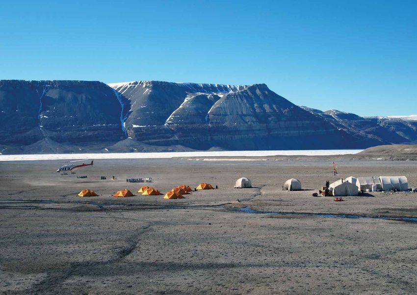
Preface 3
1 Facts in brief 4
1.1 History 4
1.2 BGR Polar Geology: Scientific expertise and sound policy guidance 6
1.3 Antarctica: Continent of Science 8
1.4 The Arctic: International cooperation across national borders 10
2 Methods: Success through diversity 12
2.1 Structural geology 12
2.2 Petrology/Geochemistry 13
2.3 Geochronology 13
2.4 Sedimentology 14
2.5 Aerogeophysics (geomagnetics) 14
2.6 Geological mapping 15
2.7 Remote sensing 15
2.8 Marine seismics 15
3 Antarctica 16
3.1 The Heart of Gondwana 18
3.2 Diverse projects with numerous partners: the BGR projects in Antarctica 20
3.3 East Antarctica: Puzzle under the ice 23
3.4 Gondwana: Life story of a major continent 25
3.5 Drilling in Antarctica: Geological findings from the depths 30
4 The Arctic 32
4.1 Key to the Earth system: 34
The continents on the perimeters of the Arctic Ocean
4.2 Exploring the landmasses around the Arctic Ocean: 36
BGR projects in the Arctic
4.3 Roller coaster climate 38
4.4 The North American continental margin - an Arctic San Andreas Fault 40
4.5 Spitsbergen: An archipelago on a journey 44
5 The National Polar Sample Archive 46
6 Logistics 48
6.1 Indispensable basis for polar research 50
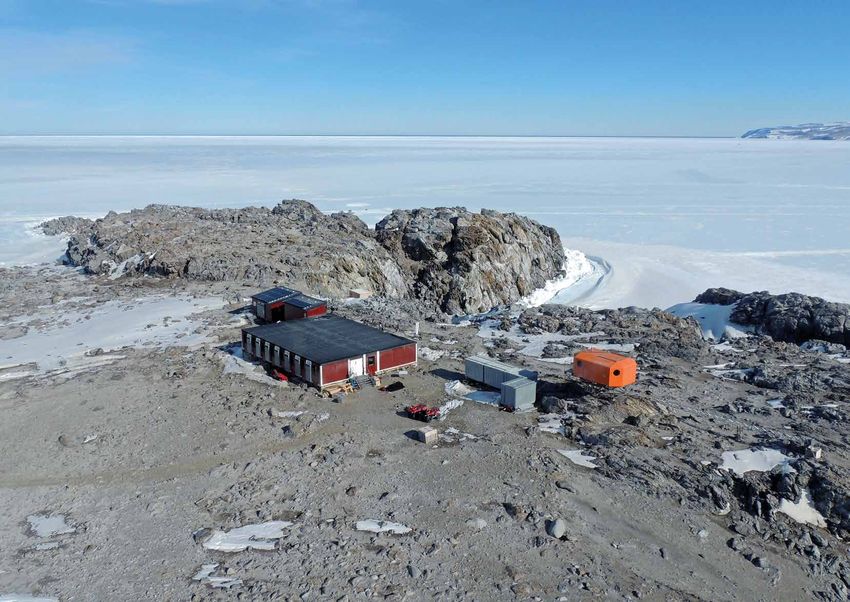
6.2 Logistics in Antarctica: 52
A research station with a small ecological footprint
6.3 Logistics in the Arctic: 55
Strong partners for research under challenging circumstances
7 Linked up at home and abroad 58
8 Glossar 60
1
PREFACE
The Federal Institute for Geosciences and Na-          at Terra Nova Bay in the Ross Sea serves as the
tural Resources (Bundesanstalt für Geowissen-          basis for its scientific research, which is carried
schaften und Rohstoffe, BGR) has been making           out in cooperation with international partners.
important contributions to research into the
Earth‘s crust in the polar regions, and thus con-      In contrast to Antarctica, the land masses of the
tributing to a better understanding of the Earth       Arctic and parts of the Arctic Ocean are sove-
system as a whole, for more than four decades.         reign territories of the neighbouring states.
The BGR cooperates with domestic and foreign           Therefore, the BGR depends on intensive co-
institutions in its geoscientific research. As a de-   operation with these respective states for its
partmental research institution, it supports the       research programmes and expeditions on land
Federal Government in furthering the develop-          and at sea. In addition, international cooperation
ment of the Antarctic Treaty System and streng-        in Arctic research is growing in importance due
thening co-determination rights in economic,           to increasing financial costs. A good example is
environmental and research policy decisions re-        the CASE programme, which has been opera-
lating to the Arctic regions.                          ting under the direction of the BGR since 1992.
                                                       A number of different partner institutions have
Research work in the polar regions is marked by        already participated in our research work on the
various political, scientific and logistical chal-     geological and plate tectonic development of the
lenges. As a common heritage of humankind,             entire Arctic region over the past decades. The
Antarctica is protected by international law, and      bilateral research cooperation between Germa-
any exploitation of resources is prohibited. Wit-      ny and Canada in which the BGR and the Geo-
hin the framework of its GANOVEX research              logical Survey of Canada (GSC) work closely to-
programme, the BGR conducts basic terrestrial          gether studying the geological structure of the
research and studies the structure, composition        Canadian Arctic, is also exemplary.
and geological development of the Antarctic con-
tinent. The BGR‘s GONDWANA summer station              More than 40 years of polar research at the
                                                       BGR – this stands both for high-level scientific
                                                       expertise and sound policy guidance as well as
                                                       close partnership and high scientific visibility in
                                                       research.

                                                       Prof. Dr. Ralph Watzel
                                                       President of the Federal Institute
                                                       for Geosciences and Natural Resources

                                                                                                             3
1 FACTS IN BRIEF
    1.1 HISTORY
          1973                                1983                                1995/1996                            2009/10
          First BGR geophysical               Construction of the Gondwana        Expansion of Antarctic research      BGR starts first high-
          research projects in the            Station at Terra Nova Bay           activities from northern Victoria    resolution aeromagnetic
          North Atlantic to explore the                                           Land (Ross Sea region) and the       survey flights in
          hydrocarbon potential of                                                Shackleton Range (Weddell Sea        northern Victoria Land
          continental margins                 1984/85                             region) to Dronning Maud Land        within the framework of
                                              With GANOVEX IV, the BGR            (GeoMAUD).                           GANOVEX X
                                              conducts the first comprehensive,
          1976                                combined geophysical and
          BGR’s first Antarctic               geological expedition to northern   1997-1999                            from 2010
          geoscientific research              Victoria Land                       Implementation of the „Cape          Expansion of CASE
          as part of US expeditions                                               Roberts Project“, an international   Programme research to
                                                                                  drilling programme in the Ross       the New Siberian Islands
                                              1987/88                             Sea, with the participation of the   (Russian Arctic) and Ellef
                                              Expansion of Antarctic              BGR                                  Ringnes Island, Yukon North
          1978                                research to the Shackleton                                               Slope and Banks Island in the
          First German marine                 Range (Weddell Sea region)                                               Canadian Arctic
          geophysical expedition in           with the GEISHA expedition          1998–2003
          Antarctic waters after World                                            Expansion of Arctic research
          War II by the BGR                                                       activities to the Polar Urals        2010/2011
                                              1988/89                             (Russia) and Ellesmere               Launch of the GEA research
                                              Expansion of the Gondwana           Island (Canada). BGR’s first         programme in cooperation
          1979                                Station to a multi-container        combined terrestrial/marine          with the AWI in Dronning
          Accession of the Federal            building                            geoscientific expedition to          Maud Land in East
          Republic of Germany to the                                              Nares Strait                         Antarctica
          Antarctic Treaty
                                              1988 & 1991
                                              First Arctic geoscientific          2002/2003                            2015–2017
          1979/1980                           research within the framework       Antarctica: Expansion                Principal phase of the renovation
          First land expedition (GANOVEX)     of an expedition of the             of work to the Lambert               and environmentally responsible,
          to northern Victoria Land,          University of Münster in            Glacier in East Antarctica           technical modernisation of
          marking the start of terrestrial    1988 and the Geoscientific          (PCMEGA)                             Gondwana Station
          polar research by the BGR           Spitsbergen Expedition SPE‘91
                                              to Spitsbergen
                                                                                  2006/07                              2017
          1980                                                                    BGR participates in the              BGR and AWI start geological
          Construction of the Lillie          1990                                ANDRILL international                and geophysical exploration
          Marleen Hut on Mount Dockery        Integration of personnel and        drilling programme in the            of potential drilling locations
          at the Lillie Glacier in northern   work priorities from the GDR’s      Ross Sea                             under the Ekström Ice Shelf
          Victoria Land                       geoscientific research in                                                (Sub-EIS-Obs)
                                              Antarctica into the BGR’s polar
                                              research                            2008/09
          1981                                                                    BGR participates in AGAP             2017
          Admission of the Federal                                                (Gamburtsev Subglacial               Most extensive terrestrial
          Republic of Germany to the          1992 & 1994                         Mountains) in the High Antarctic     geoscience expedition to date
          Round Table of Consultative         Initiation of the CASE              as part of the International Polar   since the start of BGR‘s terrestrial
          States of the Antarctic Treaty      programme on Spitsbergen and        Year 2007-09                         Arctic research to the northern
                                              North Greenland                                                          shore of Ellesmere Island, Canada
                                                                                                                       (CASE 19)

4                                                                                                                                                             5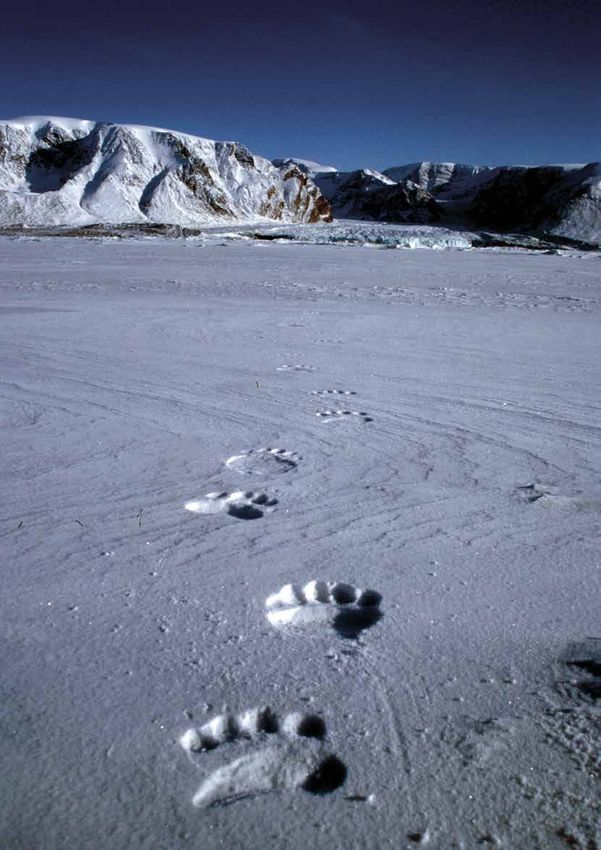
1.2 BGR POLAR GEOLOGY:
    SCIENTIFIC EXPERTISE AND
    SOUND POLICY GUIDANCE
    Germany has earned a good reputation in polar                   Research is one of the means by which Germa-           Research often depends on international net-
    research over the past 40+ years. Supported                     ny gains influence at the poles without having         working and collaboration, which is explicitly
    by elaborate programmes at both poles and                       any territorial claims there itself. Through inten-    implemented in Article 2 of the Antarctic Treaty;
    the work of hundreds of scientists, the coun-                   sive polar research in Antarctica, Germany docu-       for this reason, international partners also regu-
    try can play an influential role when the futu-                 ments its interest in the region, which, according     larly participate in polar expeditions. The BGR
    res of the Arctic and Antarctic are negotiated.                 to the Antarctic Treaty, justifies the consultative    has transferred this concept to its Arctic activi-
                                                                    status of a state. In the Arctic, a commitment         ties, thereby developing an extensive network of
    After the former German Democratic Republic                     such as this supports the attainment of observer       national and international cooperation partners
    had already joined the Antarctic Treaty in 1974,                status at the Arctic Council, which, although it       over the past decades. With this network, the
    the Federal Republic of Germany followed suit in                does not have a say in decision-making, can par-       BGR team is able to cover all aspects of research
    1979 and launched an ambitious polar research                   ticipate in discussions and provide advice. Toge-      into the complex issues that the Federal Institute
    programme. Since then, Germany has continued                    ther with the Alfred Wegener Institute Helmholtz       is working on in the polar regions. These interna-
    to expand its involvement in the Antarctic and the              Centre for Polar and Marine Research (AWI) in          tional contacts also make it possible to pool re-
                                                                                                                                                                                  View from the western margin of the Campbell Glacier towards
    Arctic and is now considered a leading research                 Bremerhaven, the German Aerospace Centre               sources and regional and international scientific      the Mt. Melbourne stratovolcano in northern Victoria Land.
    nation. Germany is one of the consultative parties              (DLR) and project funding from the German Re-          expertise and thus continue to carry out deman-
    of the Antarctic Treaty and is also an active obser-            search Foundation (DFG), the BGR represents            ding expeditions despite rising costs.
    ver in the Arctic Council in which the states and               the core of the diversified polar research com-
    indigenous peoples of the Arctic are organised. In              munity in Germany. Its research not only con-          BGR researchers are regularly drawn to the most        formation, development and disintegration of
    its „Guidelines for German Arctic Policy“ of Au-                tributes to a better understanding of the polar        scientifically fascinating and often most remote       the landmasses of Rodinia, Gondwana and Pan-
    gust 2019, the German government emphasises                     regions but also secures Germany a say in the          areas of the poles, which are difficult to reach in    gaea up to today‘s Antarctic region in the south,
    that it wishes to assume „greater responsibility                bodies that decide on the future of the Arctic or      any case. Since the Federal Republic of Germany        and the opening of the Arctic Ocean and the de-
    for the Arctic region“. In its 2011 memorandum                  Antarctic. The BGR is also mandated to advise          joined the Antarctic Treaty in 1979 and the AWI        velopment of its surrounding continents in the
    „German Commitment to the White Continent“,                     the Federal Government on matters related to           was founded in 1980, there has been a division         northern hemisphere during the disintegration
    the government had already stressed that Germa-                 geoscience and natural resources and to provide        of labour in polar research between the BGR and        of the ancient supercontinent of Laurasia. The
    ny also remains „committed to the protection of                 it with first-hand information when it wishes to       the Bremerhaven Helmholtz Centre. The Federal          corresponding research programmes, GANO-
    Antarctica in the future”.                                      take a position on relevant international issues.      Institute in Hanover uses geoscientific methods        VEX in Antarctica and CASE in the Arctic, have
                                                                                                                           to conduct its research in the Antarctic continent     been running for more than four and three de-
                                                                    The German National SCAR-IASC Committee,               and the continents around the Arctic Ocean, whi-       cades, respectively, and have contributed signifi-
    Heavy snow drift in Helliwell Hills Camp during the Antarctic
                                                                    which embodies the two International Science           le cryospheric, climatic, oceanographic and bio-       cantly to our knowledge of the geological past in
    expedition GANOVEX XI.                                          Councils, SCAR in Antarctica and IASC in the           logical research is the responsibility of the Alfred   the polar regions during this time.
                                                                    Arctic, at the national level, ensures the integ-      Wegener Institute in Bremerhaven. The BGR is
                                                                    ration of German science into the international        committed to pursuing two overarching scien-
                                                                    research agenda. BGR and AWI have the infras-          tific questions at the poles that reach far back
                                                                    tructure and logistical resources needed for re-       into the geological past and still have a major
                                                                    search in the remote and hostile polar regions;        influence on the global Earth system today: the
                                                                    they also make these resources available to re-
                                                                    searchers from universities and other instituti-
                                                                    ons. This gives these researchers the opportuni-
                                                                    ty to take part in expeditions to the polar regions.

                                                                                                                                BGR GEOSCIENTIFIC
                                                                                                                           RESEARCH SUPPORTS
                                                                                                                           GERMANY‘S POSITION
                                                                                                                           AT THE POLES.

6                                                                                                                                                                                                                                                7
1.3 ANTARCTICA:
    CONTINENT OF SCIENCE
    The territorial claims of individual nation states         rallel. Since then, scientific cooperation for the    specialist committees that draw up the relevant       There has been a national committee subor-
    are suspended in Antarctica. Cooperation is nee-           exploration of Antarctica and its role in the Earth   rules. For example, the BGR was involved in the       dinate to the DFG in Germany since 1978; this
    ded in order to conduct research in the region             system has been the guiding principle for all hu-     drafting of the PEPAT environmental protection        committee maintains contact with the interna-
    and discover its role in the Earth system. BGR             man activities at the South Pole. Forbidden acti-     protocol.                                             tional SCAR and thus anchors German Antarctic
    scientists are very active in the bodies that have         vities include military use and, since the Protocol                                                         research internationally. This task is now carried
    been created for this purpose.                             on Environmental Protection (PEPAT) entered           In contrast, the Scientific Committee on Antarc-      out by the German National SCAR-IASC Com-
                                                               into force in 1998, the mining of raw materials.      tic Research (SCAR) is a purely scientific body. It   mittee in which representatives of the most im-
    Antarctica is the only stateless continent on              Two conventions, one on the protection of An-         was founded before the conclusion of the Antarc-      portant polar research institutions, including the
    Earth. Far away from the nearest settlements, al-          tarctic seals (CCAS) and the other on the protec-     tic Treaty as a result of the International Geophy-   BGR, are represented. The committee maintains
    most completely covered with ice and therefore             tion of marine living resources (CCAMLR), for-        sical Year 1957-58 and coordinates worldwide          contact with both SCAR and its counterpart in
    absolutely inhospitable, the southern continent            malised special protections for Antarctic wildlife.   Antarctic research. SCAR is part of the Interna-      the Arctic, the IASC (International Arctic Science
    has attracted increased interest since the second          By now, 54 states have joined the Antarctic Trea-     tional Science Council whose roots go back to         Committee).
    half of the 19th century. After the race for the dis-      ty. Not all of them have ratified the environmen-     the 1930s. SCAR is made up of scientists from
    covery of the South Pole between Great Britain’s           tal protection protocol and the conservation ag-      45 nations. Germany is one of the 34 full mem-
    Scott and Norway’s Amundsen, seven states                  reements, and not all of them have the status of      bers, and its involvement includes two delegates
    gradually announced concrete territorial claims.           “consultative party”. Only such states have the       and engagement in several specialist working
    These claims have been dormant since 1959, ho-             right to vote at the treaty‘s consultative mee-       groups. Based on its observer status, the Com-
    wever, eliminating the competition for zones of            tings, which have been held since 1961, when          mittee and its members in turn act as advisers at
    influence. At the height of the Cold War, the two          decisions are made about the fate of the fifth-       the consultative meetings of the Antarctic Treaty.
    competing political blocs found the diplomatic             largest continent on Earth in terms of area and       Germany is represented in SCAR by the German
    strength to agree on the international Antarctic           the marine regions that surround it. Consultative     Research Foundation (DFG).
    Treaty despite all the opposition.                         status depends on scientific commitment, which,
                                                               according to the Antarctic Treaty, should be sub-
    The Antarctic Treaty regulates the peaceful co-            stantial enough to show interest in Antarctica.
    existence of nations on the Antarctic continent
    and in the marine regions south of the 60th pa-            Twenty-nine signatory states belong to the circ-
                                                               le of consultative states; the Federal Republic of
                                                               Germany has been a member since 1981. The
    The Sør Rondane Mountains in eastern Dronning Maud Land,
                                                               justification for this was provided by the first
    East Antarctica.                                           GANOVEX expedition to northern Victoria Land
                                                               and the geophysical survey of the Ross Sea car-
                                                               ried out by the BGR in the Antarctic summer of
                                                               1979/80, among other things. Since then, the BGR
                                                               and the AWI have established research stations
                                                               and regularly organised expeditions in which
                                                               numerous researchers from other institutes and
                                                               universities have participated, demonstrating
                                                               the Federal Republic‘s considerable research in-
                                                               terest in Antarctica. The BGR has now conducted
                                                               14 expeditions within the framework of the long-
                                                               term „GANOVEX“ research programme alone.

                                                               The annual consultative meetings of the Antarc-
                                                               tic Treaty are a forum of states. As part of the
                                                               government delegation, BGR polar scientists ad-
                                                               vise the Federal Foreign Office on all technical
                                                               issues. German scientists also sit on numerous            ANTARCTICA IS
                                                                                                                     RESERVED FOR RESEARCH.

8                                                                                                                                                                                                                               9
1.4 THE ARCTIC: INTERNATIONAL
     COOPERATION ACROSS NATIONAL BORDERS
     The Arctic mainland is encompassed by the              The Arctic Council has been a forum in which the
     territories of the bordering countries, which          Arctic states have cooperated to promote and re-
     also have extensive territorial claims to the          gulate sustainable development, environmental
                                                                                                                   Map indicating cooperation partners in the CASE programme worldwide.
     Arctic Ocean. The Arctic Council was esta-             protection and the role of indigenous peoples
     blished as an intergovernmental forum fo-              since 1966. In addition to the five states border-
     cusing on sustainable development, the in-             ing the Arctic Ocean, Iceland, Sweden and Fin-
     terests of indigenous peoples, international           land, whose territories lie partly within the Arctic   Independent of the Arctic Council, scientific or-            dition, the committee can set up task forces on
     research and environmental protection. States          but which have no coasts on the Arctic Ocean,          ganisations from the eight Arctic states foun-               specific topics. German representatives, inclu-
     without territorial claims, such as Germany,           also have a seat and a vote. In addition to the        ded the International Arctic Science Committee               ding researchers from the BGR, hold seats on all
     are also heard and have a say in the Council.          states, six umbrella organisations representing        (IASC) in 1990 to promote and coordinate sci-                permanent working groups. The National SCAR-
                                                            the indigenous peoples in the circum-Arctic re-        ence and research north of the Arctic Circle. The            IASC Committee serves as the IASC‘s interface
     Unlike Antarctica, the Arctic is anything but sta-     gion participate as permanent members. The             IASC‘s mission covers all natural science, social            to the German research community.
     te-free. At present, large parts of the central Arc-   Council‘s mandate was deliberately limited so          science and humanities disciplines and includes
     tic Ocean still belong to the high seas and are        that it would not be blocked, for example, by the      the promotion and development of the traditio-               The political importance of the Arctic has given
     thus open for research and science. The main-          strategic competition between the USA and Rus-         nal knowledge of the Arctic indigenous people.               rise to institutionalised interfaces between sci-
     lands and continental shelf areas, on the other        sia.                                                   Meanwhile, scientific organisations from 15 non-             ence and politics in Germany. The “Arctic Dia-
     hand, belong to bordering states of Russia,                                                                   Arctic states belong to the IASC, among them                 logue”, a forum for discussions between federal
     Norway, Denmark (Greenland), Canada and the            Thirteen states, thirteen governmental organi-         the German Research Foundation (DFG). The                    ministries and authorities and scientific institu-
     USA. Four of these five states have filed maps         sations and twelve non-governmental organisa-          IASC has five permanent working groups that                  tes and foundations, was launched in 2013. This
     of their zones of influence with the competent         tions are currently admitted as observers to the       cover all aspects of research in the Arctic; in ad-          forum improves the exchange of information
     UN Commission on the Limits of the Continental         Arctic Council. They are not permitted to take                                                                      between the two sectors and makes the know-
     Shelf (CLCS) and submitted applications through        part in decision-making, but they do participate                                                                    ledge generated by research and science availa-
     the United Nations Convention on the Law of            in the Council‘s six permanent and four non-per-                                                                    ble to political stakeholders. The German Arctic
     the Sea (UNCLOS), establishing their territorial       manent task forces. Germany was admitted as            Map of the United Nations Convention on the Law of the Sea
                                                                                                                                                                                Office at the AWI coordinates this platform and
     claims to the Arctic Ocean far beyond the shelf        an observer to the Arctic Council in 1998. The         (UNCLOS) in the Arctic. Modified from IBRU (2015).           also serves as an important point of contact for
     areas. A glance at the map shows that these zo-        delegation is headed by the Federal Foreign Of-                                                                     politics and industry on issues of Arctic research.
     nes overlap in places, and most of the competing       fice, but it includes numerous scientists who par-
     situations have yet to be resolved. The claims of      ticipate in the task forces on behalf of Germany.
     the five neighbouring states of the Arctic Ocean       The intensive activities of the BGR contribute to
     are largely undisputed, but the areas to which         Germany maintaining its observer status at the
     they extend have not yet been finalised. There-        Arctic Council; the BGR also advises the Federal
     fore, access to the Arctic Ocean will be limited in    Government and its ministries through regular
     the future. There is a lot at stake; the area around   participation in the Arctic dialogue of the depart-
     the North Pole is believed to be rich in resources,    ments.
     and new fishing grounds and fast shipping rou-
     tes between Europe and the Far East could open
     up as the sea ice melts.

          SCIENTIFIC COOPERATION UNITES
     INTERNATIONAL ARCTIC RESEARCH BEYOND
     THE NATIONAL BORDERS OF THE ARCTIC
     NEIGHBOURING COUNTRIES.

10                                                                                                                                                                                                                                    11
2 METHODS: SUCCESS
THROUGH DIVERSITY
Researchers from many disciplines work to-
gether to obtain a comprehensive picture
of the complex geological processes in the
polar regions. The BGR team covers a num- 2.2 PETROLOGY/GEOCHE-
ber of methods itself and seeks external
support to complement its research work. MISTRY
Thin section of a folded mica schist from Spitsbergen
consisting of biotite, muscovite and quartz. View in plane-
Geoscientific work in the polar regions is interdi- The mineralogical and geochemical composi- polarised light (left) and with crossed polarisers (right).
sciplinary and includes a variety of methods to tion of rocks is essential to understanding when
interpret and reconstruct geological processes and where they formed and what processes they
over the course of Earth‘s history. The BGR Polar underwent in their continued existence. To ob-
Geology team has expertise in the disciplines tain this information, numerous samples are ta-
BGR geologists during the CASE 20 expedition taking samples
of structural geology, petrology/geochemistry, and documenting an outcrop with Eocene sediments at Kap ken in the field; the samples are later processed
geophysics, geochronology and sedimentolo- Rigsdagen, Northeast Greenland. into thin sections or crushed into powder and/
gy. Other methods that are used in-house, fur- or mineral separates in the BGR‘s laboratories.
ther developed or adapted to the conditions at These are then analysed using various devices
the poles, include remote sensing and marine 2.1 STRUCTURAL and measurement methods such as polarisation
geophysics. In addition, the Polar Geology Unit microscopy, X-ray fluorescence analysis, X-ray
has a dense network of external cooperation GEOLOGY diffraction or mass spectrometry.
Amphibolite rock from Spitsbergen in thin section
partners at home and abroad to cover discipli- consisting of amphibole, plagioclase, garnet and chlorite.
nes such as palaeontology or methods such as Plate tectonics has been shaping the surface View in plane-polarised light (left) and with crossed
polarisers (right).
thermochronology. of the Earth for billions of years. The proces-
ses that move the tectonic plates are slow 2.3 GEOCHRONOLOGY
by human standards, but they leave clear-
ly visible traces in the rocks that have been Time is an essential aspect for reconstructing the
moved and deformed on a large scale by the movements that shape the surface of the Earth.
collision, lateral displacement and disintegra- The history of the formation of large-scale moun-
tion of continental plates. Structural geology tain ranges in the Earth‘s crust and the chronolo-
records these movements and thus facilitates gy of continental movements are revealed by the
the interpretation, understanding and recons- age of their rocks. The samples collected in the
truction of tectonic processes. To this end, the field are crushed in the BGR laboratories and mi-
researchers record structural data from pla- nerals suitable for dating, such as zircon, are se-
nar and linear elements in the field and do- parated. These are analysed by means of mass Rounded and euhedral zircon grains from a metasandstone
from northern Victoria Land.
cument indicators of their direction of move- spectrometry for certain radioactive isotopes,
ment. Another method in structural geology the decay times of which are known, in order to
is the examination of thin sections of samples deduce the age. With this information, the for-
from the deformation zones to identify the mi- mation and deformation ages of crystalline rocks
croscopic structures that were caused by the and the origin of sedimentary rocks can be de-
AN movements. termined. In addition to zircon, the mineral apa-
tite is also used by external thermochronology
INTERDISCIPLINARY laboratories to determine the cooling and uplift
history of an area using the fission-track method.
APPROACH AND Measuring the lineation of a gneiss with a geological
compass in Dronning Maud Land, East Antarctica. This can be used to reconstruct the development
of present-day landscapes in the polar regions.
METHODOLOGICAL Cathodoluminescence images of polished zircon grains from
a gneiss from Spitsbergen. Differences in brightness are
DIVERSITY MAXIMISE
caused by different uranium contents (light = low U content,
dark = high U content). The oscillatory zoning forms during
the crystallization of the zircon.
SCIENTIFIC KNOWLEDGE.
12 13
2.6 GEOLOGICAL
                                                                                                                       MAPPING
                                                                                                                       Geological mapping and the creation of geo-
                                                                                                                       logical maps represent the basic work for all
     2.4 SEDIMENTOLOGY                                                                                                 further geoscientific research. In addition,
                                                                                                                       they provide important basic data in applied
                                                         Helicopter shortly before the start of a survey flight from
     The study of sedimentary rocks provides infor-      Station Nord, Northeast Greenland.                            fields such as construction engineering or
     mation on depositional conditions of past sedi-                                                                   raw material research. They provide com-
     mentary basins. For this purpose, the rocks and                                                                   plex information on the occurrence of rock
     their sedimentary structures are examined, and                                                                    units in a region and their spatial distribu-
     their mineralogical and geochemical composi-        2.5 AEROGEOPHYSICS                                            tion. Today, geological mapping is supported
     tion and age of deposition are described. One                                                                     by modern methods such as remote sensing.
     dating method uses plant and/or animal fossils,     (GEOMAGNETICS)
     which are paleontologically identified and chro-
     nologically classified. The environmental condi-    A subfield of aerogeophysics uses magnetic                    2.7 REMOTE SENSING
     tions at the time of deposition can often be in-    properties in order to be able to track or cor-
     ferred based on their identification as well. For   relate structures or rock units even under the                The exploration of remote areas of the Earth is
     economic geology, this analysis also provides       sea or under the cover of snow and ice. These                 being increasingly supported by satellites. This
     important information regarding possible de-        properties differ according to the composi-                   technique creates opportunities to identify and
     posits of coal or oil and gas.                      tion of the rock units and can thus be recor-                 determine geological structures, rock formati-
                                                         ded with a corresponding measuring system.                    ons and possibly mineral resources from space.
                                                         A probe is flown over the survey area using                   Intensive cooperation between the Remote Sen-
                                                         a helicopter or small aircraft, which can de-                 sing Unit of the BGR or other institutions and the
                                                         tect this information under snow, ice or water                geological field work of the Polar Geology De-
                                                         using a magnetometer. It is important here to                 partment serves to refine the methods, for exam-
                                                         have good cooperation between the geolo-                      ple through the use of new types of sensors.
                                                         gists on the ground (structural geology and
                                                         petrology) and the geophysicists responsible
                                                                                                                                                                            Aerial view of Split Lake, Ellesmere Island, Canadian Arctic,
                                                         for the airborne investigations in order to cor-                                                                   with interpretation of the distribution of geological units and
                                                         relate the geomagnetic data with the data on                                                                       structures. The interpretation was done in preparation for the
                                                                                                                                                                            fieldwork of CASE 8.
                                                         the ground.

                                                                                                                       Buoys of air pulsers for seismic measurements off
                                                                                                                       Northeast Greenland.                                 2.8 MARINE SEISMICS
                                                                                                                                                                            Polar regions are not limited to continental
                                                                                                                                                                            areas. The continuation of rock units and large
                                                                                                                                                                            structures in the adjacent marine areas are also
                                                                                                                                                                            of great importance. In order to measure these
                                                                                                                                                                            structures, ship-based seismic surveys, which
                                                                                                                                                                            can detect the subsurface below sea level, are
                                                                                                                                                                            conducted in cooperation with the BGR‘s Mari-
                                                                                                                                                                            ne Seismics Unit and other institutions. Samples
                                                                                                                                                                            are also taken from the seabed and later analy-
                                                                                                                                                                            sed in the BGR laboratories.

                                                         Illustration of an aeromagnetic survey with a helicopter.
                                                         Variations in the Earth‘s magnetic field are recorded by a
                                                         magnetometer, which is towed approx. 30 m beneath the
                                                         helicopter, and in a fixed ground station. These provide
                                                         information on the magnetic properties and thus on the
                                                         composition and structure of the Earth‘s crust.
14                                                                                                                                                                                                                                            15
3 ANTARCTICA

16                  17
3.1 THE HEART OF GONDWANA
     The continent of Antarctica is a key factor in                   cation in the middle of the Southern Ocean may               changed, and finally its disintegration into the
     the Earth system. Its scientific exploration is                  seem, Antarctica, the continent itself and the               now independent components scattered across
     crucial to our understanding of the processes                    ocean area surrounding it up to 60 degrees lati-             the Earth‘s surface.
     that determine change in the global Earth and                    tude, is a key factor in the Earth system. In terms
     climate system. Its geological history also plays                of human research activities, it is also possible to         Almost 98 percent of Antarctica is covered by
     an important role in this. Therefore, the BGR is                 study processes on the southern continent that               ice. This means that direct access to the rocks
     conducting research within the frameworks of                     are no longer visible, or visible only to a lesser           is only possible in a few places; for example, in
     large-scale programmes such as GANOVEX and                       extent, elsewhere.                                           some parts of the Transantarctic Mountains and
     GEA, as well as numerous individual projects, on                                                                              where the peaks of other mountain ranges pro-
     the long period of development that Antarctica                   Deciphering the continent‘s geological history is            trude from the ice sheet as nunataks. For this
     underwent while the continents of Rodinia and                    of key importance to understanding the dynamic               reason, the BGR has relied on a combination of
     Gondwana were formed and then disintegrated.                     processes that led to the formation of modern                geological and geophysical methods since the
                                                                      Antarctica and its role in the Earth system. The-            early days of its research. All phases of its geolo-
     The continent of Antarctica has been in its iso-                 refore, in 2014, when SCAR drew up its strate-               gical history can be studied on the Antarctic con-
     lated position at the South Pole for close to 70                 gic list of the fields whose further exploration             tinent, and the BGR is investigating them with
     million years, an incredibly persistent situation                should be prioritized in the coming decades, in-             its large-scale projects GANOVEX in northern
     given the dynamics in plate tectonics. The con-                  vestigation of the geologic past was added to the            Victoria Land and GEA in Dronning Maud Land.
     tinent was once the heart of Gondwana, a posi-                   list. As with the other southern continents, the             As a cooperation partner, the BGR is also invol-
     tion it had also occupied in its predecessor, the                evolution of Antarctica over the past ca. 550 mil-           ved in international drilling projects in the Ross
     supercontinent of Rodinia. Then, one landmass                    lion years is primarily the story of Gondwana; its           Sea (ANDRILL and Cape Roberts Project) and, in
     after another broke off and drifted away, and the                formation, which began as early as the Late Pro-             cooperation with the AWI, in the Sub-EIS-Obs
     circumpolar ocean current set in, isolating An-                  terozoic, its fate as an initially isolated landmass         project. These projects has researchers inves-
     tarctica and causing temperatures to drop and                    that temporarily merged into the supercontinent              tigating the tectonic, volcanic and sedimentary
     glaciers to form. However, as isolated as its lo-                Pangaea and survived its breakup virtually un-               development as well as the glaciation history of
                                                                                                                                   Antarctica since the break-up of Gondwana.

     Large landmasses and supercontinents. a) GPlates reconstruction of Gondwana about 400 Ma ago (Matthews et al., 2016). b)
     Spectrum of detrital zircon grains (Hawkesworth et al., 2010) in comparison to the main mountain building phases, which are
     marked with red arrows (Runcorn, 1962).

                                                                                                                                   ANTARCTICA PROVIDES
                                                                                                                                   EXTRAORDINARY
                                                                                                                                   INSIGHTS INTO THE
                                                                                                                                   HISTORY OF THE EARTH.

18                                                                                                                                                                                        19
3.2 DIVERSE PROJECTS WITH
NUMEROUS PARTNERS: THE BGR
PROJECTS IN ANTARCTICA
With its long-standing research programmes tors such as tectonics, lithology, and climate. To Northern Victoria Land and the Transantarctic
and a large number of subprojects, the BGR has this end, the BGR is active in the Transantarctic Mountains bear direct and indirect witness to
been exploring Antarctica for more than 40 ye- Mountains and Dronning Maud Land. Its drilling the entirety of Antarctica’s history, from the for-
ars. The focus of the work is on East Antarctica projects target the Ross Sea and the Ekström Ice mation and passing of the Gondwana supercon-
and the Ross Sea region on the border to West Shelf. tinent to the drifting apart of the East and West
Antarctica and their development during the Antarctic continental blocks, which can be seen
course of the Earth‘s history. Northern Victoria Land in the Pacific part of An- in the formation of the Ross Sea Rift and the
tarctica has been the target of BGR research uplift of the Transantarctic Mountains during the
With its background in the fields of hard rock expeditions since the Federal Republic of Ger- Cenozoic era.
geology and geophysics, the BGR is investiga- many began conducting research in Antarctica.
ting geodynamic processes such as the forma- The area borders on the Ross Sea and includes The BGR cooperated with the Italian National
tion and disintegration of the supercontinent parts of the Transantarctic Mountains. Thus far, Antarctic Research Programme (PNRA), which
Gondwana and its precursor Rodinia, the for- fourteen expeditions have taken place there or operates the Mario Zucchelli Station adjacent to
mation of mountain belts at the margins and in in the adjacent areas of the mountain range, all the Gondwana Station, in various expeditions of
the interior of Antarctica, the development of rift under the programme name GANOVEX (Ger- the GANOVEX programme and aeromagnetic
systems and the evolution of the current land- man Antarctic NOrth Victoria Land EXpedition). campaigns within the framework of the GITARA
forms as a result of the complex interplay of fac- programme (German-ITalian Aeromagnetic Re-
search in Antarctica). The two partners are wor-
king together on a geological map of northern
Victoria Land. In 1994, the BGR participated in
Map of Antarctica with the geological and aeromagnetic working areas of the BGR since 1979. The map also shows the location the international ACRUP programme (Antarctic
of the Gondwana Station and Lillie Marleen Hut, the drill sites of the Cape Roberts Project, ANDRILL and Sub-EIS-Obs and the
location of the infrasound station IS27 operated by BGR together with AWI at Neumayer Station III as part of the Comprehensive
CRUstal Profile), which created a seismic profi-
Nuclear Test Ban Treaty. le across the West Antarctic Rift System in the
Ross Sea. Additional cooperation projects in
the Transantarctic Mountains included TAMA-
RA (TransAntarctic Mountains Aerogeophysical
Research Activities) and REVEAL/CTAM (REmote
Views and Exploration of Antarctic Lithosphere/
Central TransAntarctic Mountains) with the USA.
BGR PROJECTS IN
ALL IMPORTANT PARTS
OF ANTARCTICA.
20 213.3 EAST ANTARCTICA:
PUZZLE UNDER THE ICE
The BGR‘s second major research programme GeoMAUD (GEOscientific Expedition to Dron- Little is known about the structure or develop-
focuses on the other side of East Antarctica, in ning MAUD Land) visited some regions in cen- ment of the East Antarctic continental block.
Dronning Maud Land, which lies in the Atlan- tral Dronning Maud Land such as Dallmann- The thick ice sheet that covers it leaves few
tic and Indian Ocean sectors of Antarctica. GEA berge or Wohlthatmassiv in 1995/96. PCMEGA opportunities for geological studies. In the GEA
(Geodynamic Evolution of East Antarctica) is a (Prince Charles Mountains Expedition of Germa- research programme, the BGR therefore relies
This heavily deformed and transformed rock complex
collaborative programme with the Alfred Wege- ny and Australia), which was carried out with the on a combination of geology and geophysics to formed about 1,000-900 Ma ago along extensive island
ner Institute as co-organiser and various part- Australian Antarctic Division in the early 2000s, decipher the history and dynamics of the East arcs and is part of a newly described crustal fragment,
the TOAST (Tonian Oceanic Arc Superterrane), which was
ners from national and international Antarctic targeted the southern Prince Charles Mountains, Antarctic portion of the continent. discovered during the GEA expeditions. Person as scale.
research. The aim of the project is to study the a mountain range in the vicinity of the Lambert
evolution and structure of the East Antarctic Glacier. AGAP (Antarctica‘s GAmburtsev Provin- The glaciers of eastern Dronning Maud Land
crust and the formation of present-day Antarcti- ce) was one of the flagship projects of the 2007 glow brilliant white in the Antarctic sun. From a as the surface of the glaciers, because no geo-
ca with its isolated landmass at the Earth‘s South to 2009 International Polar Year and used various plane, the contours between the ice and a sky logical expedition has yet reached them. The
Pole. GEA builds upon a series of earlier projects geophysical methods to conduct the first explo- that becomes increasingly milky towards the GEA (Geodynamic Evolution of East Antarctica)
that have been carried out in various regions ration of the Gamburtsev Subglacial Mountains, horizon quickly blur. Craggy, sharp-edged rock research programme, which the BGR is conduc-
of East Antarctica since the 1990s. Cooperation which are completely covered by ice. spires rise from the smooth surface, indicating ting in cooperation with the Alfred Wegener Ins-
partners at that time, in addition to the AWI, in- that a mountain range is hiding beneath the ice titute in eastern Dronning Maud Land, is opening
cluded the Antarctic research programmes of The BGR was also involved in two internatio- cover. The peaks of the Sør Rondane Mountains up this undiscovered area. The goal is to clarify
several states. nal research drilling programmes in the Ross rise up to 3,400 metres in elevation, but in a few the structure and formation of the East Antarc-
Sea – the Cape Roberts Project and ANDRILL places, only the top 1,000-1,500 metres of them tic crust and to trace the continent‘s path to its
These projects targeted various mountain ran- (ANtarctic DRILLing Project). Both projects were are visible. The rest is covered by the ice masses present position. The programme relies parti-
ges in East Antarctica. GEISHA (Geological intended to clarify the tectonic, volcanic and se- of East Antarctica. cularly heavily on close cooperation between
Expedition In the SHAckleton Range) was con- dimentary development of the Ross Sea in ad- geologists and geophysicists, for only through
ducted in the southern summer of 1987/88 and dition to its glacial history. The BGR was a mem- The geoscientific view of East Antarctica is scar- this partnership of field work on the ground and
EUROSHACK (EUROpean SHACKleton Range ber of the scientific steering committee for the cely any clearer than the view from an aeropla- large-scale measurements from aircraft can we
Expedition) to the Shackleton Range at the sou- Cape Roberts boreholes. The BGR conducted the ne. Vast areas of the maps are literally as white gain insights into the continent, which is largely
thwestern edge of the Weddell Sea in 1994/95. ASAP (Aeromagnetic Surveys for the ANDRILL
Programme) aeromagnetic survey in coopera-
tion with New Zealand in order to select the AN-
View down the Priestley Glacier in northern Victoria Land
DRILL drilling sites. In cooperation with the AWI, Schematic map of the crustal provinces in East Antarctica with focus on the previously unknown crustal fragment (TOAST),
during GANOVEX XIII. the BGR is conducting the Sub-EIS-Obs (Sub- which was discovered by combined geophysical and geological investigations (modified from Ruppel et al., 2018).
Ekström Ice Shelf-Observations) project, which
uses seismic reflection profiles and the sampling
of surface sediments to study the structure and
composition of the seabed beneath the Ekström
Ice Shelf. The work is intended to establish dril-
ling locations in order to obtain core material,
which should yield additional information re-
garding the history of Gondwana’s break-up and
the rock composition in the ice-covered Antarctic
hinterland, as well as past climate changes.
22 23BENEATH THE EAST ANTARCTIC ICE SHEET
LIES A LANDMASS WITH A COMPLEX GEOLOGICAL
HISTORY.
covered by kilometre-thick ice. GEA interweaves the formation of Gondwana around 350 million 3.4 GONDWANA:
research strands that have grown out of a series years later and finally converged with them to
of international cooperation projects over the form the supercontinent Gondwana. Dating of LIFE STORY OF A
past three decades. In addition to universities, rock samples and research into the structural
other international Antarctic programmes whose geology of the Sør Rondane Mountains demon- MAJOR CONTINENT
stations can be used in the region are also invol- strated that this process took about 150 million
ved as partners. years there. The Transantarctic Mountain range is the visible This disintegration has continued for about 180
boundary between East and West Antarctica. It million years. However, Gondwana is an ancient
The five expeditions that have taken place to The geophysical survey flights with ice radar provides information not only about the more continent; its formation, existence and disinte-
date have demonstrated that East Antarctica is, and a gravimeter on board gave scientists a bet- recent part of Antarctic history, characterised by gration has been the dominant process in the
by no means, the old stable continental block it ter picture of the Earth‘s surface under the ice the large-scale West Antarctic Rift System and Earth‘s southern hemisphere over the past 500
was previously thought to be. Instead, the land- masses. For example, the coastal area between mountain uplift, but also about the many hun- million years. After all, the supercontinent las-
mass, which makes up about two-thirds of the the Sør Rondane Mountains in the west and the dreds of millions of years earlier when the land- ted for over 300 million years. For approxima-
Antarctic continent, resembles a jigsaw puzzle Yamato Mountains in the east exhibited strong masses were part of Gondwana. Expeditions of tely 150 million years, from the late Carbonife-
of individual pieces that first merged to form indications of erosion, which can be traced back the GANOVEX programme to northern Victoria rous to the Jurassic, Gondwana was part of the
present East Antarctica during the formation of to a short period of alpine glaciation shortly be- Land at the Pacific end of the mountain range supercontinent of Pangaea, and Antarctica was
Gondwana. Geophysics plays a prominent role fore the complete glaciation of Antarctica and to cover the complete period since the formation always a central part of the action, so to speak.
at GEA, as the exploration area extends into a distinct river system that had formed during of the supercontinent. The formation and disintegration of Gondwana
the high plateau of the inland East Antarctic Ice the Jurassic period shortly before and during is therefore the primary focus of GANOVEX, the
Sheet, some of whose ice is nearly 4,000 meters the disintegration of Gondwana. The mighty gla- The Transantarctic Mountains stretch for a see- Antarctic flagship programme that the BGR has
thick. Only a few rock peaks emerge here to pro- ciers that have been flowing over the region for mingly endless 3,500 kilometres across the been advancing at the South Pole for more than
vide clues regarding the geology. around 34 million years have not been able to entire continent, and their peaks mark the mor- 40 years.
remove the traces of this erosion event. phological border between East and West An-
On the GEA IV expedition, geophysicists flew the tarctica. Large sections of the mountain range
AWI research aircraft Polar 6 up to 800 kilome- are buried under glacial ice, which flows from
tres inland to trace a magnetic anomaly pattern the East Antarctic Ice Sheet over and through the
in the crust that had already been discovered mountain range to the ice shelves of West An-
during flights over the Sør Rondane Mountains tarctica. However, several four-thousand-metre
during GEA I to III. Geological fieldwork during peaks protrude from the ice, the highest being
these expeditions revealed that the anomalies Mount Kirkpatrick on the Ross Ice Shelf at 4,528
are related to rocks of a previously unknown metres. If geologists wish to explore the history
crustal fragment derived from extensive island of the continent lying over the South Pole, the
arcs from the early Neoproterozoic. Their age Transantarctic Mountains probably offer the best
was later dated at approximately 1,000 to 900 opportunity to do so, because there are few ot-
million years and thus extends into the time of her places where rocks from the deep geological
the supercontinent of Rodinia. past are so exposed. Moreover, the mountain
range is one of the two shoulders of the West
Additional aerial surveys of the adjacent ice-co- Antarctic Rift System, where West and East An-
vered terrain as part of GEA IV showed that this tarctica are breaking apart documenting what is
fragment extends up to 800 kilometres inland. probably the last act in the disintegration of the
An evaluation of the aerogeophysical measure- supercontinent of Gondwana.
ments showed that the crustal fragment has an
area of about 500,000 square kilometres, which
is roughly the size of France. This crust from
the Neoproterozoic period was apparently com- GANOVEX CAPTURES
pressed by the surrounding continents during
THE ENTIRE LIFE CYCLE OF
A SUPERCONTINENT.
24 25Geological map of northern Victoria Land, modified from the GIGAMAP series jointly published by PNRA and BGR.
In the meantime, GANOVEX has conducted 14
expeditions to explore northern Victoria Land
and the adjacent regions at the Pacific end of
the Transantarctic Mountains, an area roughly
the size of Germany. In addition to numerous
scientific publications, the results include a geo-
logical map of all of northern Victoria Land at a
scale of 1:500,000 as well as various geological,
structural geology and magnetic field maps of
sub-areas at a scale of 1:250,000. In cooperation
with the Italian National Antarctic Research Pro-
gramme, several geological map sheets have
also been published as part of the GIGAMAP
programme (German-Italian Geological Antarc-
tic MAP Programme), which will depict northern
Victoria Land and parts of southern Victoria Land
at this scale.
Rock fragment with a fossilised footprint of an early Triassic
dinosaur from a rock sequence newly discovered during
GANOVEX XI in the Helliwell Hills.
The disintegration of the Gondwana supercontinent. The researchers of the BGR and its partner in-
SA = South America, Af = Africa, M = Madagascar, l = India,
Au = Australia, An = Antarctica / Ma = million years (after
stitutions aim to gain a comprehensive picture
Walther 1998). of what has happened since the late Proterozoic
with their interdisciplinary research expeditions.
Geology provides information about the rocks
themselves, while structural geology deciphers
tectonic development. Geochronology assigns
an age to the events, so that the development
can be correlated with the history of the Earth,
and geophysics provides clues as to the extent
of the processes that were studied at individual
Today 30 Ma ago sites. Geochemistry, in turn, provides informa-
tion regarding the environmental conditions that
prevailed at different times on the Antarctic con-
tinent or Gondwana. If there is also a fossil re-
cord, palaeontology enriches this picture with in-
formation about the prevailing living conditions.
The GANOVEX programme has demonstrated
100 Ma ago 120 Ma ago that the Transantarctic Mountains offer an ex-
cellent window into the history of Gondwana.
According to current findings from the more
recent GANOVEX campaigns, its history as a
morphologically high mountain range only be-
gan around 35 million years ago, i.e. at the time
160 Ma ago 200 Ma ago
26 27when Tasmania as the last part of Australia sepa- tense volcanic eruptions occurred elsewhere, for Antarctica, except for the Antarctic Peninsula,
rated from Antarctica. The bedrock on which it is example at the Pacific margin of ancient Antarc- there is no direct evidence after this time other
built, however, is from the Ross Orogeny, which tica, which continued to be active and characte- than young volcanic rocks and deposits from the
took place at the time of Gondwana’s formation. rised by ongoing subduction. These processes most recent glaciation periods. What is certain is
This mountain range was of the same type as lasted until the Early Cretaceous, when most of that the present-day southern continents, Mada-
the present-day Andes. It was formed when the Gondwana had long since begun to disintegra- gascar and India, detached from Antarctica one
oceanic plate of the Palaeopacific was subduc- te. In northern Victoria Land, the collision of the after the other. As one of the last crustal blocks,
ted beneath the margin of the East Antarctic con- Palaeopacific plate with the East Antarctic con- Australia began to separate starting about 95
tinental plate, raising this plate margin like the tinent was superseded by large-scale extension million years before present. A system of hither-
folds of a tablecloth and forming a deep oceanic and huge lateral displacements. Results of the to unknown faults, presumably from that time,
trench. Similar to the west coast of South Ameri- GANOVEX expeditions show that an extensive was discovered during the more recent GANO-
ca, parts of the Earth’s mantle were melted, and basin formed within the Gondwana superconti- VEX expeditions; these can more plausibly ex-
the rising magma further lifted the continental nent at this margin of East Antarctica and Aus- plain the concrete separation process of the two
margin and fed several volcanoes during the tralia, during the Late Triassic at the latest, and continents. The sediments of the former vast ba-
development of the Ross Orogen. This geomor- lasted until the Early Cenozoic. The slow drifting sin of the Mesozoic and Early Cenozoic have sin-
phological feature resumes beyond East Antarc- apart of the two continental blocks and the for- ce been eroded and removed as a result of the
The remote campsite Marinella on the Mariner Glacier during
tica in what is now Australia, as both continents GANOVEX XIII/2. The “apple”, a small fiberglass hut, served mation of the West Antarctic Rift System, which intensive uplift of the Transantarctic Mountains
were immediate neighbours at the time. There, as a kitchen, office and lounge at the same time for the finally led to the rise of the present-day Trans- and were finally deposited as sediments more
geophysics team.
however, it is called the Delamerian Orogen. antarctic Mountains, ended the existence of this than ten kilometres thick in the rift basins of the
intercontinental basin relatively late, shortly be- Ross Sea.
Many detailed questions remain unanswered; Transantarctic Mountains during the course of fore the final separation of the last fragments of
for example, when the orogeny began and how its disintegration. This period spans 300 million Gondwana and the isolation of Antarctica.
long it lasted. Up to now, scientists have assu- years during which a supercontinent rose and
med that mountain building began around 530 fell, ice caps grew and disappeared again, dino- A highlight of the recent expeditions of the GA-
million years ago and lasted for approximately saurs appeared and abruptly disappeared, and NOVEX programme, were the numerous signs
fifty million years. However, results from the Gondwana itself disintegrated into its now fami- of a diverse ecosystem from the Late Triassic
more recent GANOVEX expeditions now suggest liar components in a slow process lasting more that the researchers found. They discovered the
that mountain building lasted twice as long and than 100 million years. It was also the period du- remains of a 200-million-year-old petrified forest
began correspondingly earlier, specifically 580 to ring which the Antarctic part of the superconti- in whose fossilised wood the burrows of mag-
590 million years ago. What these findings mean nent moved incrementally from a position over gots and insect droppings were still preserved.
for the tectonic models that simulate the forma- the equator towards the South Pole until, during At that time, northern Victoria Land was no lon-
tion of Gondwana remains to be seen. the more recent Cretaceous period, Antarctica fi- ger a rugged mountainous landscape, but a flat
nally arrived at its position over the South Pole, terrain over which rivers meandered and which
On one of these expeditions, intensive geophy- where it remains to this day. was covered by extensive lakes. Apparently, rep-
sical survey flights were conducted over an area tiles and probably other vertebrates also lived
of the Lanterman suture zone near the Rennick It is hardly conceivable that such a period would there because the fossilised footprint of a Trias-
Glacier. Aeromagnetic measurements with a he- be completely calm and without upheavals, and sic dinosaur was found during the expedition.
licopter yielded a high-resolution image of the current research shows that the Earth‘s crust Precise classification is difficult, but it probably Crevasses in the Campbell Glacier at Gerlache Inlet.
magnetic anomaly in this contact zone between was in fact very active during this time. In many belongs to a rather rare group that has been de-
two ancient crustal blocks. Earlier measure- cases, old fractures from the time of the Ross monstrated to have lived from the Late Permian
ments had revealed a large-scale anomaly there, mountain-building event were reactivated at la- to the Late Triassic and has been found on seve-
but this flight was now able to better define its ter times, and the mountains themselves went ral continents. The find was the first indication of
structure for a narrow area of the suture. through the usual erosional process and were their existence in northern Victoria Land.
completely eroded until a hilly river and lake
Relatively few geological traces are known from landscape determined the appearance of the Vic- Gondwana began to break apart with a series of
the time between the Ross Orogeny during the toria Land in the era of Gondwana. At the same violent volcanic eruptions 180 million years ago.
formation of Gondwana and the formation of the time, however, additional folding, rifting and in- In the Transantarctic Mountains and throughout
28 29Between 1997 and 1999, the Cape Roberts Pro- tension resulted in the subsidence of the Victoria of Gondwana 180 million years ago and conti-
ject drilled to a depth of almost 1,000 metres into Land Basin during the Oligocene. However, mas- nues into South Africa. At that time, Africa was
the seabed near Cape Roberts in the Ross Sea, sive deposits containing erosional debris from the first to break away from Antarctica, a pro-
thus obtaining an almost complete sedimenta- the Transantarctic Mountains quickly filled the cess that was accompanied by intense volcanic
tion history of West Antarctica during the peri- rift basin, and the tectonic activity of the region eruptions. The periods documented by the sedi-
Sampling with a gravity corer during the Sub-EIS-Obs II
expedition on the Ekström Ice Shelf. od from about 34 to 17 million years ago. The is also evident in these sediments; numerous na- ment deposited on this basalt will only be known
sequence obtained from a total of three bore- tural fractures can be discerned from the Neo- through the drilling, but the hope is that they will
holes extended to approximately the beginning gene into the Quaternary. close the gap in the geological record after the
of the Antarctic glaciation. A conventional dril- initial break-up of Gondwana.
3.5 DRILLING IN ling rig was erected on the sea ice, in order to Looking at the paleoclimate, the cores demon-
drill through the two-metre-thick ice and water strate that the region was surprisingly variable in
ANTARCTICA: depths of between 150 and 300 metres into the terms of climate. A core section from the bottom
subsurface. of the stratigraphic column, and another section
GEOLOGICAL FINDINGS dating from the Middle Pleistocene to the pre-
The ANDRILL project also took place in the wes- sent, document the coldest periods in the entire
FROM THE DEPTHS tern Ross Sea during 2006 and 2007 and was core. In contrast, 15.7 million years ago, during
able to obtain cores totalling 1,200 metres in the Middle Miocene, the mean air temperature
Glaciation greatly complicates the search for length at two locations between Ross Island and was +10 degrees Celsius, and the landscape was
geological traces in Antarctica. The glaciers have the mainland, reflecting the past 20 million years tundra with low-growing vegetation and fresh-
transported copious amounts of sediment into in unprecedented resolution. The core sequen- water lakes. After another colder period, warm
the shelf seas and buried the rest under ice who- ces of both drilling projects document both the conditions prevailed again during the Pliocene
se thickness can be measured in kilometres. The glaciation history of the region at the interface and Early Pleistocene, when the carbon dioxide
only way to obtain information specifically from between East and West Antarctica and the more content in the atmosphere was at times as high
the period after the advance of the glaciers is recent development of the West Antarctic Rift as it is today, but eventually tipped over into to-
through drilling projects. The BGR has been in- System. From the Late Eocene onwards, coin- day‘s icy climate, when the CO2 content drop-
volved in two major international projects and is ciding with the beginning of glaciation around ped to far below current levels. The cores also
working on a third in collaboration with the AWI. 34 million years ago, the intensive activity of the reveal the influence of the Milankovitch cycles,
system in this part is evident. The oldest sedi- in particular the eccentricity of the Earth‘s orbit
Antarctica‘s role as one of the coldest regions ments date from this time, but the rift system in around the Sun, which fluctuates in a 400,000-
on Earth has been comparatively recent. It has the Ross Sea is assumed to have already been year rhythm, on the stability of the West Antarc-
been around 34 million years, barely more than active during the Cretaceous. However, earlier tic Ice Sheet.
the blink of an eye in terms of Earth history, since sediments that could have documented the be-
the glaciers extended over most of the continent ginning of the rifting have not been found, at The BGR is currently playing a key role in the
and turned it into an inhospitable icy landscape. least at the drilling sites of the two projects. preparation of a borehole in the Ross Sea
Today, the continent is covered by continental (SWAIS-2C), with New Zealand as the primary
ice whose thickness reaches up to 4,000 metres, Nevertheless, the development of the region responsible party supported by international
but it is not as eternal as it seems. The West An- since the uplift of the Transantarctic Mountains cooperation. In addition, BGR and AWI are pus-
tarctic Ice Sheet, for example, has apparently in the Cenozoic is clearly visible. The intense ex- hing ahead with a drilling project on the opposi-
shrunk at comparatively regular intervals until it te Ekström Ice Shelf off Dronning Maud Land in
broke down completely, only to grow again to its East Antarctica. This project will involve drilling
current size. ANDRILL rig and working environment on the McMurdo Ice
through a sedimentary column similar to that
drilled through in the Ross Sea. In preparation
BOREHOLES
Shelf, Ross Sea.
The international community of researchers is for this, three campaigns have taken place so far
gaining insights into the recent past of Antarctica for the preliminary investigation of the area wit-
primarily by drilling into the layers of sediment hin the framework of the Sub-EIS-Obs project. PROVIDE INSIGHTS
on the continental shelves. The BGR has been Initial geophysical surveys have shown that the
involved in two international drilling projects. sediments on the Ekström Ice Shelf rest on a ba- INTO RECENT
salt layer called the Explora Wedge. This appa-
rently dates from the first phase of the break-up ANTARCTIC HISTORY.
30 31You can also read