The status of Red Grouse in Ireland and the effects of land use, habitat and habitat quality on their distribution - Results of the national Red ...
←
→
Page content transcription
If your browser does not render page correctly, please read the page content below
The status of Red Grouse in Ireland and
the effects of land use, habitat and habitat
        quality on their distribution.

Results of the national Red Grouse Survey 2006-2008

               Irish Wildlife Manuals No. 50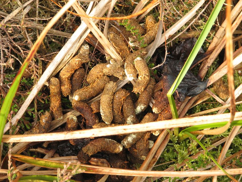
The status of Red Grouse in Ireland and the effects of land use, habitat
                 and habitat quality on their distribution.

               Results of the national Red Grouse Survey 2006-2008

        Cummins, S. 1, Bleasdale, A.2, Douglas, C., 2 Newton, S. 1, O’Halloran, J.3 & Wilson, H. J. 2

    1BirdWatch Ireland,                 2National Parks & Wildlife               3Department of Zoology,
      Unit 21, Block D,                           Service,                       Ecology & Plant Science,
 Bullford Business Campus,              Department of Environment                University College Cork,
          Kilcoole,                         Heritage and Local                       Distillery Fields,
        Co. Wicklow.                      Government (EHLG),                      North Mall, Cork City.
 www.birdwatchireland.ie                   7 Ely Place, Dublin 2.                      www.ucc.ie
                                               www.npws.ie

Citation: Cummins, S., Bleasdale, A., Douglas, C., Newton, S., O’Halloran, J. & Wilson, H.J. (2010) The
status of Red Grouse in Ireland and the effects of land use, habitat and habitat quality on their distribution.
Irish Wildlife Manuals, No. 50. National Parks and Wildlife Service, Department of the Environment,
Heritage and Local Government, Dublin, Ireland.

                          Cover photo: Adult Male Red Grouse (© Mike Brown)

                     Irish Wildlife Manual Series Editors: F. Marnell & N. Kingston
                               © National Parks and Wildlife Service 2010

                                              ISSN 1393 - 6670
Red grouse survey 2006-08

CONTENTS

EXECUTIVE S UMMARY...........................................................................................................................................................6
ABBREVIATIONS & COMMON TERMS USED ........................................................................................................................7
PARTNERSHIP .........................................................................................................................................................................9
ACKNOWLEDGEMENTS .........................................................................................................................................................9
1.0 INTRODUCTION ..............................................................................................................................................................10
    1.1 Decline in numbers and range ..........................................................................................................................10
    1.2 EU Judgment ..........................................................................................................................................................10
    1.3 Climate change ......................................................................................................................................................11
    1.4 Taxonomic status ..................................................................................................................................................11
    1.5 Previous studies ....................................................................................................................................................11
    1.6 Habitat preferences ..............................................................................................................................................11
    1.7 Territory establishment and habitat management ......................................................................................12
    1.8 Conservation value...............................................................................................................................................12
AIMS:...................................................................................................................................................................................12
2.0 METHODS .......................................................................................................................................................................13
    2.1 Sampling Range ....................................................................................................................................................13
    2.2 Preliminary reconnaissance ...............................................................................................................................17
    2.3 Regional Classification .......................................................................................................................................18
    2.4 Survey Design and Sampling Strategy ...........................................................................................................19
    2.5 Survey Units...........................................................................................................................................................19
    2.6 Survey Equipment................................................................................................................................................19
    2.7 Methods Used........................................................................................................................................................20
       2.7.1 Counts with tape-playback...............................................................................................................................20
          2.7.1.1 Tape-playback transect methodology...............................................................................................21
          2.7.1.2 Effectiveness of tape-playback............................................................................................................22
          2.7.1.3 Study Sites for the Standardised tape-playback survey................................................................22
          2.7.1.4 Survey Period for Tape-playback.......................................................................................................22
          2.7.1.5 Survey Methods.....................................................................................................................................22
       2.7.2 Counts using dogs ............................................................................................................................................22
       2.7.3 Tape-playback versus dog counts ....................................................................................................................23
       2.7.4 Casual Sightings and supplementary records database .................................................................................23
       2.7.5 Estimating species range..................................................................................................................................24
       2.7.6 Population estimates.........................................................................................................................................24
          2.7.6.1 Methods for estimation ........................................................................................................................24
          2.7.6.2 Local population estimates..................................................................................................................24
       2.7.7 Effect of elevation on patterns of distribution.................................................................................................25
       2.7.8 Landowner permission .....................................................................................................................................25
       2.7.9 Unsuitable areas ...............................................................................................................................................25
       2.7.10 Health and Safety ...........................................................................................................................................25
       2.7.11 Response rate ..................................................................................................................................................25
          2.7.11.1 Tape-playback methods .....................................................................................................................25
          2.7.11.2 Time of day ...........................................................................................................................................25
    2.8 A survey of Red Grouse (Lagopus lagopus) habitat in Ireland 2007 – 2008...........................................26

2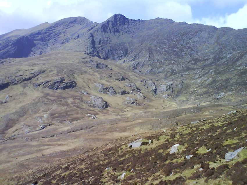
Red grouse survey 2006-08

    2.9 Data Analyses ....................................................................................................................................................... 26
       2.9.1 Statistical Software .......................................................................................................................................... 27
3.0 RESULTS ..................................................................................................................................................................... 27
    3.1 Survey outcome .................................................................................................................................................... 27
       3.1.1 Overview .......................................................................................................................................................... 27
       3.1.2 Survey coverage ............................................................................................................................................... 27
       3.1.3 Responses to tape-playback.............................................................................................................................. 27
       3.1.4 Comparison of methods: error in detection of the sexes................................................................................. 28
       3.1.5 Distribution at 10km level .............................................................................................................................. 29
       3.1.6 Distribution at 1km level ................................................................................................................................ 30
       3.1.7 Changes in species range in the last 40 years ................................................................................................ 32
    3.2 Population estimates........................................................................................................................................... 34
       3.2.1 Changes across Region Classes ....................................................................................................................... 37
       3.2.2 Changes across Habitat Classes ...................................................................................................................... 38
       3.2.3 Results of GLIMS for all sites surveyed......................................................................................................... 38
       3.2.4 Differences in the breakdown of habitats (CORINE Land Cover Data) across occupied and unoccupied
       sites............................................................................................................................................................................. 39
       3.2.5 Differences in the breakdown of habitats (CORINE Land Cover Data) within a buffer zone of 1km
       around occupied and unoccupied sites..................................................................................................................... 40
       3.2.6 Differences in elevation between occupied and unoccupied sites ................................................................. 40
    3.3 Commonage Framework Plan Study links ................................................................................................... 40
       3.3.1 Sites occupied by Red Grouse lying within Commonages assessed for grazing damage............................ 40
       3.3.2 Any relationship between grouse densities and habitats as assessed by CFPs............................................ 40
       3.3.3 Breakdown of habitat categories in a buffer zone of 1km in and around sites with and without grouse
       lying within Commonage. ........................................................................................................................................ 41
       3.3.4 Population estimates for those areas assessed by Commonage Framework Planners ................................. 43
    3.4 A survey of Red Grouse (Lagopus lagopus) habitat in Ireland 2007 – 2008.......................................... 44
       3.4.1 Effect of damage to grouse habitats on occupancy by Red Grouse ............................................................... 44
       3.4.2 RGHS Habitat Classification.......................................................................................................................... 45
       3.4.3 Habitat variables of importance ...................................................................................................................... 50
       3.4.4 Effect of percentage heather cover at sites on occupancy by Red Grouse..................................................... 50
       3.4.5 Effect of heather structure at sites on occupancy by Red Grouse................................................................. 50
       3.4.6 Land Use and Topography .............................................................................................................................. 52
       3.4.7 Important grouse habitats as identified by the RGHS .................................................................................. 52
       3.4.8 Remaining habitat variables of importance.................................................................................................... 52
    3.5 Designated Sites................................................................................................................................................... 54
       3.5.1 Sites lying within SAC.................................................................................................................................... 54
       3.5.2 Sites lying within SPA.................................................................................................................................... 54
       3.5.3 Local population estimates .............................................................................................................................. 54
    3.6 Other bird species and mammals of note...................................................................................................... 55
4.0 DISCUSSION ................................................................................................................................................................... 56
    4.1 Potential sources of bias..................................................................................................................................... 56
       4.1.1 Standardised counts using dogs and tape-playback ...................................................................................... 56
    4.2 Red Grouse population estimation ................................................................................................................. 56
       4.2.1 Regional trends ................................................................................................................................................ 57
       4.2.2 Strongholds ...................................................................................................................................................... 57
          4.2.2.1 Owenduff SPA/SAC............................................................................................................................. 57
       4.2.3 Populations on Commonages.......................................................................................................................... 58

                                                                                                                                                                                3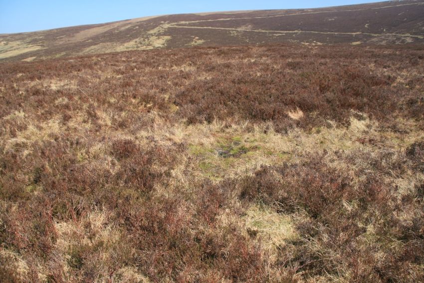
Red grouse survey 2006-08

    4.3 Influence of landscape, land use and habitats on distribution of Red Grouse ...................................58
       4.3.1 Important Habitats for Red Grouse.................................................................................................................58
       4.3.2 Habitat Quality Measures ...............................................................................................................................58
       4.3.3 Importance of heather cover .............................................................................................................................59
       4.3.4 Elevation............................................................................................................................................................59
    4.4 Areas in decline.....................................................................................................................................................59
       4.4.1 Link between populations on Commonages and damage assessments..........................................................60
       4.4.2 Causes of decline ...............................................................................................................................................60
    4.5 Limiting factors of populations in Ireland ....................................................................................................61
       4.5.1 Sedentary Nature..............................................................................................................................................61
       4.5.2 Productivity ......................................................................................................................................................61
       4.5.3 Negative impacts of commercial forestry, large-scale peat extraction and inappropriate burning practices
       .....................................................................................................................................................................................61
       4.5.4 Detrimental effects of grazing..........................................................................................................................61
       4.5.5 Predators ...........................................................................................................................................................62
       4.5.6 Shooting.............................................................................................................................................................62
       4.5.7 Climate change..................................................................................................................................................62
       4.5.8 Burning .............................................................................................................................................................63
5.0 CONCLUSIONS................................................................................................................................................................64
6.0 RECOMMENDATIONS.....................................................................................................................................................65
    6.1 Current Status of Red Grouse............................................................................................................................65
    6.2 Factors influencing Red Grouse decline.........................................................................................................65
    6.3 Planning and implementation of conservation measures .........................................................................66
       6.3.1 The importance of a Red Grouse Species Action Plan ...................................................................................66
       6.3.2 Management issues ..........................................................................................................................................67
          6.3.2.1 Low density populations in Ireland ..................................................................................................67
          6.3.2.2 Management of shooting .....................................................................................................................67
          6.3.2.3 Habitat Management ............................................................................................................................68
          6.3.2.4 Introductions of Red Grouse of British origin .................................................................................68
       6.3.3 Proposed aims of a Red Grouse Species Action Plan .....................................................................................69
       6.3.4 What is important for Red Grouse populations?............................................................................................70
          6.3.4.1 Develop Regional Plans........................................................................................................................70
       6.3.5 Current Action .................................................................................................................................................70
       6.3.6 Proposed Future Actions..................................................................................................................................70
          6.3.6.1 Important to liaise with relevant stakeholders ...............................................................................71
          6.3.6.2 Habitat recommendations ...................................................................................................................71
          6.3.6.3 Population monitoring recommendations.......................................................................................72
          6.3.6.4 Further research required ....................................................................................................................72
7.0 BIBLIOGRAPHY & RELEVANT LITERATURE .................................................................................................................73
8.0 APPENDICES ...................................................................................................................................................................77
    Appendix 1             List of current and past members of the Red Grouse Survey Project Steering Group ....77
    Appendix 2             Sites that hold or held important populations of Red Grouse ...............................................78
    Appendix 3             Unsuitable 1km2 sites dropped from the initial selection of sites.........................................81
    Appendix 4             Red Grouse recorded in SACs.........................................................................................................82
    Appendix 5             Red Grouse recorded in SPAs .........................................................................................................84
    Appendix 6             All sources of additional Red Grouse sightings data from 2000-2005 (pre-RGS period) 85

4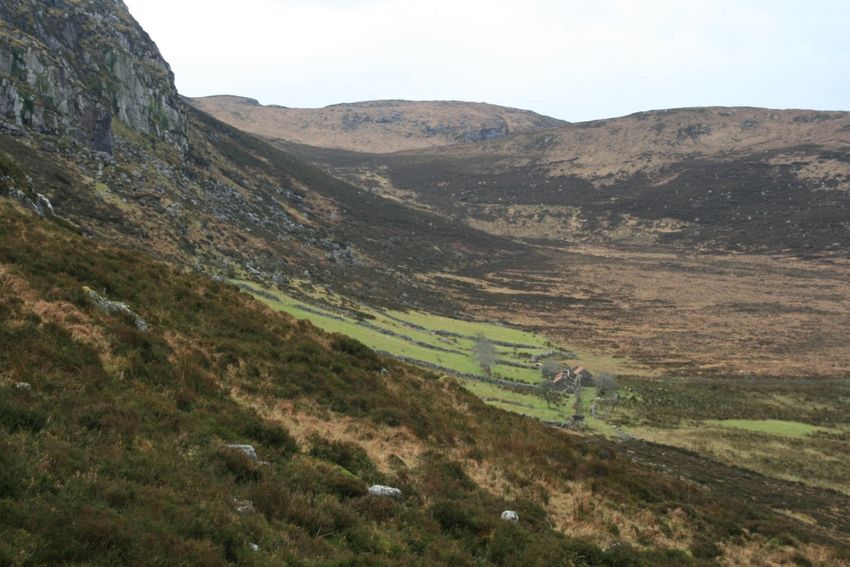
Red grouse survey 2006-08

  Appendix 7 Assessment of grazing pressures across those survey sites (N=313) where it was noted
  by observers................................................................................................................................................................. 86
  Appendix 8 List of tape-playback survey participants: Red Grouse Survey 2006-08. ............................ 87
  Appendix 9 List of participants in counts using dogs..................................................................................... 90
  Appendix 10 List of observers that submitted records to the casual sightings database....................... 92
  Appendix 11 Historical evidence of Red Grouse ‘scoticus’ introductions into Ireland......................... 95

                                                                                                                                                                      5
Red grouse survey 2006-08

EXECUTIVE S UMMARY

A baseline population estimate of Red Grouse Lagopus lagopus in the Republic of Ireland was determined
by a national survey, carried out between 2006 and 2008. A supposed 70% decline in the species range
over the past 40 years prompted its addition onto the Irish Red List of Birds of Conservation Concern in 1999
and the subsequent targeted action of a national survey.
Aim The priority of the national Red Grouse Survey is to produce an estimate of the national population
and to provide a baseline for future surveys so as to enable long-term monitoring of the species. The
intention is that this survey will demonstrate a link between habitat condition and presence of Red
Grouse, where they occur. In this way, Red Grouse can be used as a bio-indicator of the favourable
conservation status of their preferred habitats.
Methods Records of Red Grouse occupancy derived from innovative tape-playback methods, counts
using dogs and a casual sightings database of incidental records, were used to determine the species
range in the Republic of Ireland. The primary focus of the national survey was counts of territorial males
in winter and early spring, determined using tape-playback transect methodologies in a selection of
random 1km squares. Potential sites were stratified according to region and broad habitat class (CORINE
Land Cover Data) and chosen survey sites with more than 60% habitat suitability for Red Grouse were
randomly selected within these strata.
Results Densities of grouse were low (average 1.1/km2 surveyed) with much variation across habitats and
regions. The contraction in species range in the Republic of Ireland in the last 40 years was determined as
50%. The Irish population of Red Grouse was estimated at just over 4,200 birds (95% confidence limits
(nearest 100) 3,800 – 4,700), using the best available data from sites surveyed and suitability of areas not
surveyed. Regional population estimates are given along with estimates of population sizes across five
broad scale habitat classes: mountain blanket bog, upland blanket bog, lowland blanket bog, raised bog
and moors & heath.
Conclusion Red Grouse will remain on the Irish Red List as they have lost 50% of their former historical
breeding range. The national population estimate is within the limits expected from most recent literature
but highlights the decline in range, particularly in some regions. Regional estimates will be critical in
guiding future conservation efforts by highlighting areas in steepest decline. Further analyses assessing
relationships between occupancy of grouse with measures of habitat quality, including grazing damage
assessments, are also given.
Recommendations are included in this report which will hopefully form the basis for a targeted Red
Grouse Species Action Plan. These include continued monitoring of populations in key areas, making
necessary improvements in habitat quality in former and existing grouse areas and future research on
grouse ecology in Ireland. In particular current information on life history traits such as breeding success,
juvenile recruitment, natal dispersal and over-winter survival is needed to decipher whether these factors
have influenced the 50% contraction in Red Grouse historical breeding range in the Republic of Ireland
and to ascertain how likely the current population is to expand, if habitat conditions are improved.

6
Red grouse survey 2006-08

ABBREVIATIONS & COMMON TERMS USED

a.s.l.                      above sea level

Blanket bog*                blanket peat that accumulates under conditions of high rainfall and humidity, it
                            is typified by black bog rush (Schoenus nigricans), white-beaked sedge
                            (Rhyncospora alba), bog cotton (Eriophorum vaginatum) and sundew (Drosera
                            rotundifolia)

BWI                         BirdWatch Ireland

Commonage                   represents land held under common property that incorporates a system of
                            local cooperative arrangements and rules to conserve and manage the Irish
                            uplands

CFPs                        Commonage Framework Plans

EHLG                        Department of the Environment, Heritage and Local Government

EU                          European Union

GPS                         Global Positioning System

Grouse                      Red Grouse Lagopus lagopus scoticus

Heath†                      open areas with minimum cover of 25% dwarf shrubs and usually over peaty
                            soils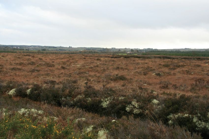
Red grouse survey 2006-08

Peatland Ф                     is an area where peat has accumulated in sites

PSG                            Project Steering Group

Raised bog‡                    accumulations of deep acid peat (3-12m in depth)

RGS                            Red Grouse Survey

RGHS                           Red Grouse Habitat Survey (Crushell & O’Callaghan, 2008)

SAC                            Special Area of Conservation - areas considered of international importance
                               whose legal basis is the EU Habitats Directive (92/43/EEC), transposed into
                               Irish law through the European Union (Natural Habitats) Regulations, 1997

SPA                            Special Protection Area - sites of international conservation importance for
                               birds whose legal basis is the EU Birds Directive (79/409/EE)

Willow Grouse                 Lagopus lagopus (although more recent nomenclature uses Lagopus lagopus scotica,
                               David & Gosselin 2002)

1km square                     1km2

* taken from A manual for the production of grazing impact assessments in upland and peatland habitats: Version 1.2. NPWS
    and Department of Agriculture and Food (unpublished).

† taken from An Illustrated Guide to British Upland Vegetation (2004) Averis, A., Averis, B., Birks, J., Horsefield, D.,
    Thompson, D. & Yeo, M. (Eds.) Joint Nature Conservation Committee.

‡ taken from A Guide to Habitats in Ireland (2000) Fossitt, J. A., The Heritage Council, Kilkenny.

Ф taken from Strategy and Action Plan for Mire and Peatland Conservation in Central Europe. Bragg, O. & Lindsay, R. (Eds.)
    (2003) Wetlands International, Wageningen, The Netherlands.

8
Red grouse survey 2006-08
PARTNERSHIP
This project was funded by the National Parks and Wildlife Service of the Department of the Environment,
Heritage and Local Government. NPWS contracted (by way of open tender) BirdWatch Ireland to project
manage the survey, which was undertaken by professional fieldworkers [botanists included], NPWS staff
and voluntary input from members of BWI, IKC and NARGC. In addition, anecdotal records were
received from a wide range of sources. Together with the NPWS and BWI Partners, other representatives
from stakeholder organisations, including the IKC and NARGC formed the Project Steering Group (PSG):
Kenny Bucke, Sue Callaghan, Peter Carvill, Damian Clarke, Barry Coad, Des Crofton, Sinéad Cummins,
James Dalton, Christy Davitt, James Dunne, Leonard Floyd, Martin Gavin, Caroline Hurley, Catherine
Keena, Jim Kelly, Helen Lawless, Liam Lysaght, Frank Macken, Sara Malone, Ben McCabe, Jack Meath,
John Muldowney, Tony Murray, Stephen Newton, Cliona O’Brien, John O’Halloran and John Wilson (for
further details see Appendix 1).
ACKNOWLEDGEMENTS
We would like to express our sincere appreciation and gratitude to all for their contribution to the
national Red Grouse Survey 2006-08.
Thanks to
• All NPWS staff that participated in the survey (Appendix 8) and provided additional sightings
data. Your expertise and assistance has been invaluable and we would like to express our
gratitude for your involvement in the survey.
• The Irish Kennel Club (IKC) and the National Association of Regional Game Councils (NARGC)
(Appendix 9) whose members turned out in force to support the survey, particularly in 2008.
• Those private landowners for providing access to surveyors.
• All who submitted records to the Casual Sightings Database over the past two years for such a
valuable contribution to the survey (Appendix 10).
• Patrick Crushell and Richard O’Callaghan who carried out ‘A Survey of Red Grouse (Lagopus
lagopus) Habitat in Ireland 2007 – 2008: an assessment of habitat condition and land-use impacts’,
for their skill, expertise and all their efforts.
• All survey volunteers (Appendix 8) and staff at BirdWatch Ireland, in particular to the field staff
(Chris Cullen, Fiona Farrell, Michalina Miklos, Tyrone Nelson, Blanaid O’Connell, Marc Shorten
and Mike Trewby) on the Red Grouse Survey that worked tirelessly for the project and whose
contribution was immense over the two field seasons. Without their perseverance and dedication,
the achievement of the survey would have been compromised.
• We are grateful to the European Environmental Agency (EEA) and the European Topic Centre on
Land Cover (ETC/LC) for providing access to the CORINE Land Cover databases and to
Ordnance Survey Ireland for the provision of Ortho 2000 (Aerial photography flown in 2000) to
assess site suitability.
9Red grouse survey 2006-08 1.0 INTRODUCTION Globally, grouse populations are represented by 18 recognised species and around 130 subspecies (Watson & Moss, 2008). In Ireland and Britain, the Red Grouse Lagopus lagopus scoticus (a sub-species of the Willow Grouse Lagopus lagopus) is endemic and it is closely associated with peatland habitats with reasonable heather cover (Lance, 1972, Watson, 1979b). Their range has been affected by many land use changes, particularly in the last 100 years (Allen et al., 2005, Davies, 2005). These changes have caused much fragmentation of grouse habitats and fractured populations that were once extensive over much of Ireland’s bogs and heaths (Sharrock, 1976). Given the estimated decline in Red Grouse extent in the Republic of Ireland (Gibbons et al., 1993), it is of concern that important areas of grouse habitat continue to be lost or damaged by activities such as peat extraction, afforestation, drainage, conversion to grassland through blanket burning, overgrazing (particularly by sheep), and development pressures associated with the erection of wind turbines, communications masts and associated infrastructures. The patchiness of much of the remaining grouse habitat in Ireland is unlikely to benefit populations and may lead to lower average densities of grouse (Watson & Moss, 2008). 1.1 Decline in numbers and range As our only native species of grouse, the Red Grouse has suffered from a serious decline in range (purported to be as high as 70% in the Republic) in the past 40 years and as a result it was added to the Irish Red List of Birds of Conservation Concern in 1999 (Newton et al., 1999), where it remains (Lynas et al., 2007). While British bags have shown long term declines in most regions (Hudson, 1992, Redpath & Thirgood, 1997), Irish bags have shown even bigger declines (Watson et al., 1993). A population of 1,000 to 5,000 breeding pairs was previously given as an all Ireland estimate (Gibbons et al., 1993). A similar study in Northern Ireland in 2004, highlighted the extent of the decline there, with a national population estimate of just 202 breeding pairs (Allen et al., 2004, Allen et al., 2005). In Britain, where grouse numbers on some moors often exceed 100 birds/km2, the relationship between predators, such as Hen Harriers Circus cyaneus, on local grouse populations has been studied in depth (Redpath, 1991, Redpath & Thirgood, 1997, Thirgood et al., 2000a, Thirgood et al., 2000b). Less is known about the effects of predators on low density populations, as in the Irish context and whether diseases such as Strongylosis (Hudson, 1986, Hudson et al., 1992) and Louping ill (Timoney, 1972) affect Irish populations to any great extent (Allen et al., 2005). 1.2 EU Judgment In June 2002, the European Court of Justice ruled (Case: EC, C-117/00) against the Irish government for its failure to fulfil its obligations under Article 3 of Council Directive 79/409/EEC of 2 April 1979 on the conservation of wild birds and Article 6(2) of Council Directive 92/43/EEC of 21 May 1992 on the conservation of natural habitats and of wild fauna and flora. The court ruling stated that ‘Ireland has thus failed to fulfil its duty to safeguard a sufficient diversity and area of habitats for the Red Grouse’ and in particular ‘Ireland has failed to take the necessary measures to prevent the blanket bog of the Owenduff- Nephin Beg Complex SPA from being damaged by overgrazing’. On January 29th 2009, the case was closed by the European Commission, who were satisfied that the Irish government had taken significant steps to address the overgrazing issue with general destocking taking place across 440,000 hectares of commonage. In key areas where recovery was not being delivered, additional restrictions were implemented through agreements with farmers, which included offwintering and further destocking of sheep. 10
Red grouse survey 2006-08

1.3 Climate change
The potential effects of climate change on Willow Grouse populations in Europe (including the sub-
species scoticus endemic to Britain and Ireland) have been examined with a predicted north westwards
shift in their breeding range by the end of this century, resulting largely in their disappearance from
Ireland with populations in Britain restricted to the most northerly parts of Scotland (Huntley et al., 2007).

1.4 Taxonomic status
The taxonomic status of the Red Grouse in Ireland has been the subject of much debate. In the past,
genetic analysis of specimens from Ireland, Britain and Scandinavia found no clear evidence to support
the classification of the Irish population as hibernicus, a distinct subspecies from its British counterpart
scoticus (Freeland et al., 2006). Indeed, the findings of this genetic research suggest that frequent
introductions of birds into Ireland from Britain in the past 100 years (Watson & O’Hare, 1979b) were
unlikely to have affected the conclusion of that study. However, a more recent study* (unpubl.) indicates
that the Irish population hibernicus is indeed genetically distinct from scoticus and that a significant
percentage of the population in Ireland is genetically bottlenecked, and in serious risk of extinction.

*The study was funded by the Native Species Conservation Committee of Dublin Zoo and Fota Wildlife Park and was
carried out by the Irish Grey Partridge Conservation Trust, University College Dublin and the University of Uppsala,
Sweden. Results of this study are due for publication in 2010.

1.5 Previous studies
Extensive research has been conducted on the Red Grouse in Britain where it is an economically viable
gamebird (Games and Wildlife Trust Review, 2008). In Ireland, most studies were carried out back in the late
1960s and 1970s by Adam Watson, P.J. O’Hare and Art Lance working mainly out of Glenamoy Research
station in north Co. Mayo (Watson & O’Hare, 1973, 1979a, 1979b, 1979c, Lance, 1976, 1978). It is widely
accepted that grouse populations in Ireland are sparsely distributed, and largely confined to wet, nutrient-
poor blanket bog (Watson & O’Hare, 1973). Densities in Britain can reach over 100 birds/km2 (Games and
Wildlife Trust Review, 2008, Hudson, et al. 2002). Populations there often experience delayed density-
dependent boom-and-bust cycles (O’Hare, 1972, Hudson et al., 2002) whereas Irish populations tend to
remain more stable with low densities of 1-6 individuals per km2 (Watson & O’Hare, 1979b, Murray &
O’Halloran, 2003, Allen, et al. 2005).

1.6 Habitat preferences
The Red Grouse is associated with specific habitat types, namely heaths, blanket bogs and raised bogs
(Cramp & Simmons, 1980). Its diet is almost exclusively ling heather (Calluna vulgaris) (Jenkins et al., 1963,
Lance & Mahon, 1974, Finnerty et al., 2007) and therefore its distribution is restricted to peatland habitats
that have heather. Historically, the Red Grouse was among the most characteristic birds of Ireland’s bogs
given its unique association with these habitats and heather where it spends its entire life cycle (Watson &
O’Hare, 1979). A recent survey of peatland birds in Ireland confirmed this association. Blanket bog
(atlantic and montane) was the first choice for Red Grouse with a weaker preference for areas with high
densities of heather cover (Bracken et al., 2008). Another recent study in Ireland found no birds on
mountain blanket bog sites with less than 25% heather cover (O’Connell, 2008) mirroring previous studies
(Lance, 1972). Grouse populations in Ireland occur at lower densities than in Britain, particularly on the
more nutrient poor western blanket bogs (Watson & O’Hare, 1973), although national abundance data
across regions or habitats has been lacking up to now.

                                                                                                            11
Red grouse survey 2006-08
1.7 Territory establishment and habitat management
Given their largely sedentary nature (Wernham et al., 2002), rarely dispersing more than 4km from natal
territories (Warren & Baines, 2007), grouse populations are susceptible to habitat losses and changes in
quality (Lance, 1978a). Males establish territories in autumn (months before the breeding season) with
territorial males calling at dawn and dusk, albeit less so in daytime particularly in the case of low density
populations (Watson & Jenkins, 1963). Flat moorland supports lower densities of grouse than hillocks as
males take larger territories where they can readily see each other (Lance, 1978b). Some studies suggest
territory size in grouse largely depends on the availability of enough plant material of adequate nutritive
value (richer in nitrogen), rather than the total amount of available heather (Savory, 1978).
1.8 Conservation value
Much of Ireland’s peatland habitat suitable for conservation has been dramatically reduced in size, with
less than a quarter remaining in relatively intact condition (Foss et al., 2001). The loss of peatland habitats
has been recognised internationally by the inclusion of blanket bog, raised bog, wet heath and dry heath
on Annex I of the EU Habitats Directive, which affords peatlands (including fen) special conservation
status. In Ireland, certain sites have been allocated special protection through their designation as Special
Areas of Conservation (SAC), Special Protection Areas (SPA) and Natural Heritage Areas (NHA).
AIMS:
• To determine the distribution and abundance of Red Grouse in the Republic of Ireland.
• To assess the relationships between Red Grouse and suitable ‘grouse habitats’ and habitat quality.
• To carry out a standardised national survey providing a reliable national population estimate of
Red Grouse.
• To establish an effective methodological base from which future monitoring can be conducted.
• To provide up to date information for addressing national grouse management issues.
12Red grouse survey 2006-08
2.0 METHODS
2.1 Sampling Range
The historical species range of Red Grouse in Ireland, prior to their decline, was taken to be the
distribution of Red Grouse as represented in the first breeding bird atlas in 1968-72 (Figure 1). This atlas
showed that Red Grouse were closely associated with ‘heather’ habitats which were widespread in
Ireland and more intact in their extent and condition in the past than now (Foss et al., 2001). The historic
species range was defined as all 10km squares in which the species had been recorded between 1968-1972.
These 10km squares are referred to as the ‘defined historical breeding range’.
Figure 1: Historical distribution of Red Grouse in the Republic based on records of occupied 10km2 from The Atlas of
Breeding Birds in Britain and Ireland (Sharrock 1976).
Using CORINE Land Cover data (EEA, 2000) as an indicator of habitat suitability, any 1km squares
identified as containing potentially suitable grouse habitat within each 10km square occupied by Red
Grouse in the Old Atlas, were selected and pooled into two strata: Region and Habitats. In total, 5,963
1km2 potential sites were identified across the country. Any 1km square with more than 60% suitable
grouse habitat was included in the potential sampling area. ArcView GIS 3.2 (ERSI, California, USA) was
used to compute landscape and habitat variables using the CORINE Land Cover Map1 (EEA, 2000).
Spatial Analyst 2.0 and Patch Analyst 3.1 extensions were used to compute the proportion of the survey
area made up of six land cover class types:
1) Upland blanket bog- CORINE Land Cover class 4.1.2.2.1 (see example in Plate 1)
1
The CORINE Land Cover Project mapped various land-cover types found throughout Europe at a scale of 1:100,000
using satellite imagery. The base data used for this project is Landsat T.M. satellite imagery.
13Red grouse survey 2006-08
2) Mountain blanket bog- CORINE Land Cover class 4.1.2.2.3 (see example in Plate 2 & Plate 4)
3) Lowland blanket bog- CORINE Land Cover class 4.1.2.2.2 (see example in Plate 3)
4) Moors and heath- CORINE Land Cover class 3.2.2 (see example in Plate 5)
5) Raised Intact bog*- CORINE Land Cover class 4.1.2.1.2
6) Raised Exploited bog *- CORINE Land Cover class 4.1.2.1.1 (see example in Plate 6)
* Due to the insufficient number of sites that were suitable for survey in areas of exploited raised bogs, the two
categories of Raised Intact Bog and Raised Exploited Bog ended up being grouped together under ‘Raised Bog’.
Each survey site was assigned to one of the six land cover classes described above. These classes were
selected out as being the most important predictors of grouse presence or absence at the landscape level.
Photo: Patrick Crushell
Plate 1: Area of upland blanket bog and dry heath mosaic (150m-300m a.s.l.) in Co. Mayo where Red Grouse were
recorded during the survey.
14Red grouse survey 2006-08
Photo: Patrick Crushell
Plate 2: Site with Red Grouse present in area of mountain blanket bog (300m a.s.l.) in Co. Donegal
Photo: Patrick Crushell
Plate 3: Lowland blanket bog site (Red grouse survey 2006-08
Photo: Sinéad Cummins
Plate 4: Mountain blanket bog site in the Macgillycuddy Reeks in Co. Kerry. Mosaic of heather, grass and exposed
rock. Red Grouse were found along the lower slopes.
Photo: Patrick Crushell
Plate 5: Wicklow survey site, where Red Grouse were recorded on the national survey, made up largely of dry and
wet heath.
16Red grouse survey 2006-08
Photo: Patrick Crushell
Plate 6: Raised bog site where Red Grouse were recorded during the Red Grouse Survey.
Previous studies suggested that the populations of Red Grouse in Ireland were low density but widely
dispersed over a large geographical area (Watson & O’Hare, 1973) and therefore stratified random
sampling would improve both precision and accuracy as it ensures proper regional and habitat coverage
(Gregory et al., 2004). Red Grouse have a clumped distribution in the Republic of Ireland, given their
distinct habitat requirements. As random sampling is much less effective when distributions are clumped;
sampling was targeted to only include potentially suitable areas for Red Grouse. In order to ensure that
the random selection process took into account possible regional variation in densities, potential grouse
squares were assigned to one of five regional categories (see Section 2.3).
2.2 Preliminary reconnaissance
The site selection process involved a number of steps:
1. ensure that any potential grouse habitat in the defined ‘historic range’ was included in selection
process
2. identify sites with potential Red Grouse habitat
3. set up randomised list of sites
4. assess site suitability using aerial photos (Ortho 2000 Data OSi)
5. final selection based on ground truthing
17Red grouse survey 2006-08
2.3 Regional Classification
Five broad regions were chosen based largely on landscape and underlying geological characteristics (see
Figure 2) and (with the exception of the Midlands Region with its raised bogs) followed the outline of
upland areas in Britain and Ireland by Averis et al. (2004). Much of the bedrock in Ireland is limestone but
with some areas of granite (e.g. Wicklow mountains) and sandstone (e.g. the far Southwest).
• Northwest Border: includes the counties Donegal, Cavan, Leitrim and Monaghan and north County
Sligo. Differing to the Midlands region in terms of habitat and geology, lying to its south, the
underlying geology is schist, gneiss or quartzite or granite with the remainder of the region made
up of carboniferous rocks. It had the second largest area of potentially suitable grouse habitat,
largely upland blanket bog but also contains areas of lowland and mountain blanket bog and heath.
• Midlands: holds the largest area of raised bogs. It was isolated from the surrounding areas of
blanket bog and put into a separate region. Its underlying geology is mainly limestone and shale.
• West Connacht: includes the western halves of counties Mayo and Galway and largely contains
lowland and upland blanket bog with some areas of mountain blanket bog and heath. Its
underlying geology is mainly schist, gneiss, quartzite or granite with some areas further east of
sandstone, shale and limestone. It had the largest area of potentially suitable habitat for Red Grouse.
• East and South: is the largest region in terms of land area although much of the region is unsuitable
in terms of habitats for grouse. It includes counties Wicklow, Carlow, Waterford, Tipperary, Laois,
Limerick and Clare and parts of Kildare, north Kerry, Offaly, northeast Cork and southeast Galway.
Suitable grouse habitat in this region is largely upland and mountain blanket bog and heath with
some patches of raised bog in Kildare, Offaly and north Kerry. The geology varies from more
granite, shale and sandstone in the east (Wicklow and Carlow) to old red sandstone in the south
(Waterford and Cork) to limestone further south and west into Tipperary and Clare.
• Southwest: includes southern parts of County Kerry and southwest County Cork. It largely made
up of Old Red Sandstone and shale and with upland and mountain blanket bog the dominant
habitat types with some areas of lowland blanket bog.
18Red grouse survey 2006-08
Figure 2: Regional classification of the Republic (Red Grouse Survey 2006-08). Areas of blanket bog, raised bog and
heath are highlighted in brown.
2.4 Survey Design and Sampling Strategy
The primary count unit was that of territorial males occupying sites in the late winter to early spring
period (December-March). At the outset, the survey design and methods took into account the sensitive
nature of these ground dwelling birds. In order to minimise disturbance, the survey period of choice was
restricted to the winter-early spring period, when male territoriality is heightened and prior to the
breeding season when pairs may be more vulnerable to disturbance given that Red Grouse are largely
single-brooded and ground nesters (Watson & Jenkins, 1963). As grouse do not disperse widely from
their natal territories, the distributions in winter and the breeding season are considered to be concurrent.
The majority of sites were visited once, with a sub sample of sites (N=64) surveyed in both field seasons.
2.5 Survey Units
The survey unit was a 1km2. Given that this survey was carried out during a period when daylight hours
are restrictive, an area of 1km2 was deemed small enough to ensure proper coverage and large enough to
detect any territorial birds.
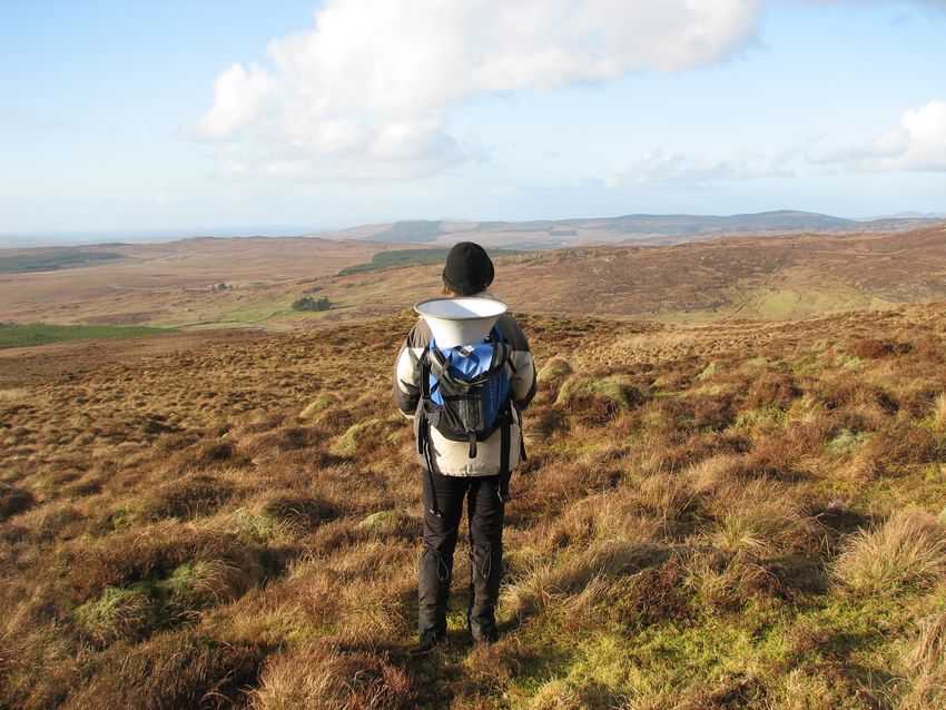
2.6 Survey Equipment
The tape-playback equipment (Plate 7) consisted of a wireless megaphone (TOA Model ER- 2230W /
2930W) connected via a 3.5mm jack lead to an mp3 player containing the grouse call. Each member of the
team was also provided with two-way radios (various models with ranges up to 1.5km) to facilitate
communication at play-points and at any other time where necessary.
19Red grouse survey 2006-08
Photo: Fiona Farrell
Plate 7: Field staff member demonstrating the correct way to carry the megaphone between play-points in the survey
square.
2.7 Methods Used
Given the extent of bog and heath habitats in Ireland, a number of methods were used in order to ensure
widespread coverage of sites. The three methods for collection of data are given below and each in turn
contributed to the overall picture of species range in the Republic of Ireland.
2.7.1 Counts with tape-playback
Songs or calls of grouse can be used to maximise counts of male grouse, particularly at lower densities
when birds are known to be less vocal (Watson & Moss, 2008). The primary count unit for this method is
the male. It relies on detection of any territorial males in the area being surveyed responding to the male
grouse call being played. Given the low densities of grouse in Ireland, this method allows for improved
detection not just of males but any incidental sightings of females and/or fresh signs of grouse presence at
a site (Plates 8 and 9).
The main assumptions of this method were that:
1) Any suitable habitat within a survey square was covered
2) All surveyors were trained via workshops with the assumption that surveyors had an equal
chance of detecting grouse and recording effort did not vary between surveyors
3) Location of fresh droppings indicated presence of a bird in the square
4) Time of day or date of survey did not influence responses by grouse to the tape
Responses were not unfavourably affected by weather conditions. Note that sites were not surveyed in
adverse weather conditions.
20Red grouse survey 2006-08
2.7.1.1 Tape-playback transect methodology.
Plate 8: Fresh caecal or ‘wet’ dropping which is emitted from the blind gut of the grouse.
Photo: Fiona Farrell
Plate 9: Example of fresh ‘dry’ Red Grouse droppings with white urine caps still visible.
21Red grouse survey 2006-08
Any birds seen/heard or any signs such as fresh droppings (Plates 8 and 9) were marked on the field maps
and recorded onto survey forms along with their locations (Grid Reference, if possible). The presence or
absence of droppings (fresh/old) and/or feathers was important as they may indicate Red Grouse presence
where no birds are actually sighted.
2.7.1.2 Effectiveness of tape-playback
• These methods are suitable for surveying areas with lower densities of grouse, as in Ireland, as
the tape-playback entices territorial males to respond to the ‘intruder’ calls thereby giving a more
accurate estimate of their density than transect methods without the tape.
• Relatively easy to use and allows for at least one 1km square to be covered by a team of two in a
winter's day.
2.7.1.3 Study Sites for the Standardised tape-playback survey
A total of 491 1km2 sites were surveyed in the periods December 1 2006 – March 31 2007 and December 1
2007 – April 7 2008. In order to assess any differences between years in numbers recorded at sites, a
random sub-sample of 64 sites was surveyed in both field seasons (December 1 2006-March 31 2007 and
December 1 2007-April 7 2008).
2.7.1.4 Survey Period for Tape-playback
The survey period for counts was restricted (Dec-Mar), in order to avoid disturbance pre-nesting which
usually occurred in late April, early May (Watson & O’Hare, 1979a). All activities regarding the use of
tape-playback were subject to regulation and carried out under licence from the National Parks and
Wildlife Service. Line transect methodologies, which are widely used in bird surveys (Bibby et al., 2000),
were adapted to incorporate the use of tape-playback with a short call of a male willow grouse played at
six predefined points within the square (along alternate transects).
2.7.1.5 Survey Methods
A pair of observers, 250m apart, walked four transects across a 1km2 at a slow steady pace in reasonable
weather conditions. Where terrain allowed, transects were walked at 125m, 375m, 625m and 875m across
the square in an east-west or north-south direction. At 250m, 500m and 750m along alternate transects,
the call of a male willow grouse was played (for no more than 30 seconds) to see whether any birds in the
area would respond. The three main types of responses were:
• Call back (assumed response of territorial males)
• Flush (bird would fly off either towards or away from the observer)
• Call back and flush (bird would call and fly off either towards or away from the observer)
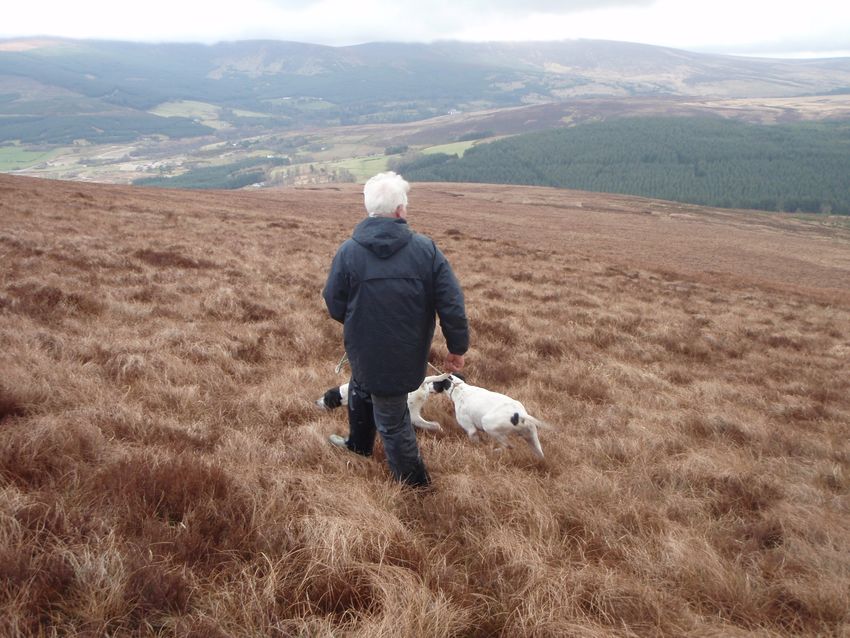
2.7.2 Counts using dogs
To ascertain how effective the tape-playback method was at detecting grouse, repeat surveys were carried
out in fifteen pre-selected areas (average area covered was 1.2 km2) in Counties Wicklow, Cork, Galway,
Tipperary, Sligo and Donegal, using dogs and the tape-playback method. Counts were usually conducted
within three days of each other. Areas counted using dogs were demarcated using observers with
handheld GPSs which subsequently allowed for these areas to be resurveyed using the tape-playback
method. The number of handlers ranged between 2-7 individuals with breeds of dogs used largely red
setters, English setters, pointers and springers.
22You can also read