Under the Big Sky e-Letter May 2021 - National Weather Service Glasgow, MT
←
→
Page content transcription
If your browser does not render page correctly, please read the page content below
Under the Big Sky
e-Letter
May 2021
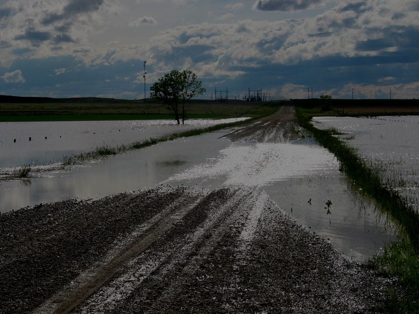
Photo Credit: Greg Forrester, Lead
Forecaster, taken on 5/14/2021
National Weather Service
Glasgow, MT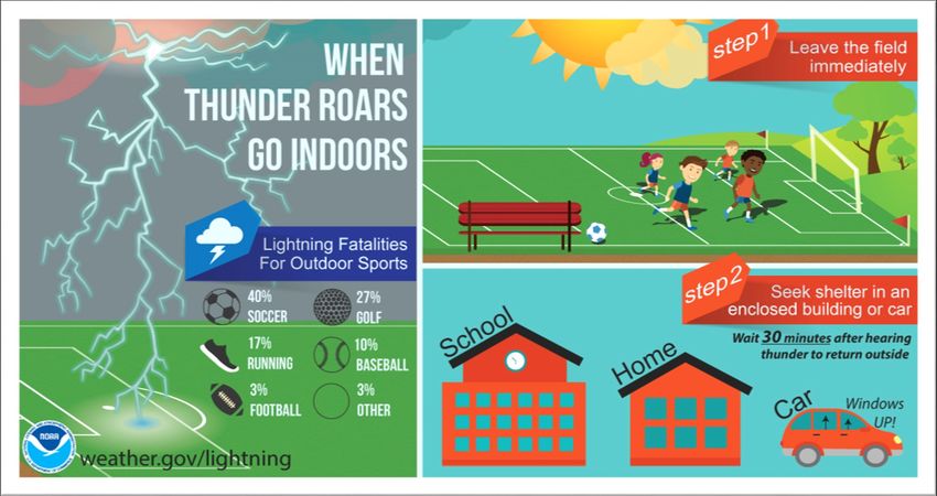
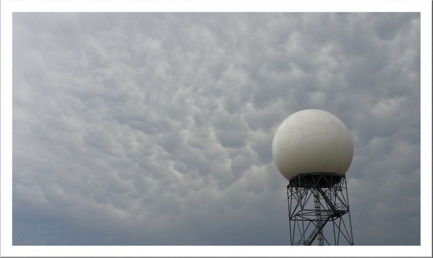
A Peak Inside: From the MIC...Page 1 Space Wx...Page 2 CoCoRaHS/30 Day Summary...Page 3 Hydro Summary...Page 4 CPC Outlook/Drought Monitor...Page 5 Climate Highlights...Page 6 Monthly COOP Precipitation...Page 7 Monthly Trivia...Page 8 Figure 1: Mammatus cloud at NWS Glasgow.
From the MIC (Meteorologist in Charge):
Severe Weather Readiness:
...Beeeeeeppppp, Beeeeeeppppp, Beeeeeppppp...The National Weather Service in Glasgow has
issued a Severe Thunderstorm Watch for Northeast Montana…
Cooler temperatures have kept severe weather at bay so far this season, but it’s knocking on our
door. There’s a few resources to help get you back into thinking about thunderstorm safety:
Quick read/graphics: NWS Weather Ready Nation Thunderstorm Safety
Short NWS Glasgow 2021 Thunderstorm Safety Videos on You Tube
NWS Online Skywarn Training Course (You’ll need to create an account, but you won’t get
spammed with tons of emails from doing so!)
Role of the Skywarn Spotter
Skywarn Spotter Convective Basics
We wish you a safe summer, but we know some of you will have to deal with severe weather. Here’s a
reminder of the reports we are looking for:
Hail (any size)
Wind gusts over 58 mph or causing damage (any speed)
Rotation in the base of the clouds
Funnel Clouds or Tornadoes
Large Dust Devils
Flooding/Flash Flooding
And, here’s how best to report to us:
Spotter Reporting Line: 800-775-5771
Email: ggw.wxreport@noaa.gov (if sending from you phone, please include your name/location
and time of event)
Facebook: https://www.facebook.com/NWSGlasgow
Twitter: @NWSGlasgow
Figure 2: Thunderstorm and lightning safety infographic.
1
By Virginia Rux, Meteorologist & Space Weather Program Lead at NWS Glasgow

         Photo Credit: NASA.

Northeast Montana is one of the few places in the entire country that has very low light pollution and it
makes this place a unique and excellent location to watch the night sky! We hope that you will join us in
Looking Up at the Big Sky! The space weather program at the National Weather Service in Glasgow, MT
is partnering with the US Army Corps of Engi-
neers at the Fort Peck Interpretive Center
and Charles M. Russell National Wildlife Ref-
uge to put together a virtual summer astrono-
my series. An introduction to the program and
the first edition has already premiered on Fa-
cebook. Our first topic was about the super-
moon and lunar eclipse on May 26th, 2021.
We will talk about relevant night sky events,
provide an educational background, and
share with you the viewing forecast and rec-
ommended locations for the best view! Check
facebook (National Weather Service Glasgow
and US Army Corps of Engineers, Omaha
District - Fort Peck Dam & Lake) for our June Photo Credit: NWS SWPC.
program and future events throughout this
summer!

                                                    2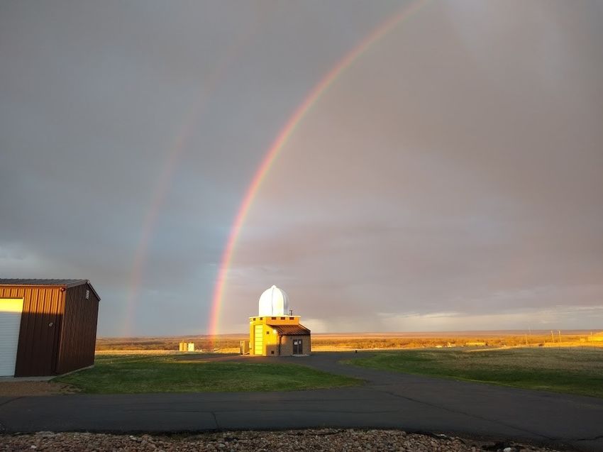
30 Day Percent of Normal Precipitation (Montana)
Join CoCoRaHS Today!
CoCoRaHS is a grassroots organization with a network
of dedicated observers who report daily precipitation
such as rain, hail, or snow from all across the country.
The data are used by
meteorologists, in-
surance adjusters,
mosquito control,
and even by those in
academia.

                                                                Figure 3: 30-day percent of normal precipitation across
Participating in the                                            Montana.

CoCoRaHS program
is a great way to make a difference in your community.           Avg. Temp Departure from Normal (Montana)
Check out the CoCoRaHS main page to learn more! We
are still accepting new observers so feel free to join
through the main CoCoRaHS website today. All you’ll
need is a ruler and a rain gage to get started!
To access some starter training, check out the recent
warm season CoCoRaHS training that was produced
by NWS Glasgow for new and interested observers. If
you are a current CoCoRaHS observer, this can be a
great refresher session!

                                                               Figure 4: 30-day temperature anomalies across Montana.

                                                               Summary: Over the last 30 days precipitation has
                                                               trended above normal for portions of North Cen-
                                                               tral Montana. However, much of eastern and
                                                               southeastern parts of the state had near or below
                                                               normal precipitation over the same period. Mean-
                                                               while, temperatures were within a couple of de-
                                                               grees of average across much of Montana.

                                                           3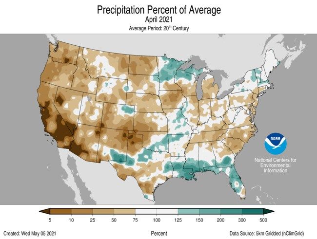
Hydrologic Summary for March 2021 by Greg Forester, Lead Forecaster at NWS Glasgow:

It was a drier and warmer than normal month for temperatures over Northeast Montana. A
few areas mainly in the southwest had near to above normal precipitation. The wet spots
were Zortman with 1.56 inches, Glasgow 46SW with 0.95 inch, and Flatwillow and Carlyle
with 0.83 inch. The dry spots were Opheim 12SE with 0.07 inch, Hoyt with 0.08 inch, and
Scobey with 0.10 inch. Glasgow received 0.43 inch which was 53 percent of normal. Tempera-
tures averaged between 3 degrees below and 2 degrees above normal across the region.
Glasgow averaged 44.4 degrees which was 0.5 degrees below normal.

The dry weather has allowed extreme drought to develop over the northeast half of the re-
gion which includes areas east of Malta, Fort Peck, and Terry. The remainder of the region is
in severe drought according to the Drought Monitor.

Stream flow on the Milk, Yellowstone, and Poplar Rivers was below normal for the entire
month. The Missouri River had near normal stream flow for the entire month.

The Fort Peck Reservoir elevation fell slightly to 2233.0 feet during the month. The reservoir
was at 78 percent of capacity and 99 percent of the mean pool.

                                               4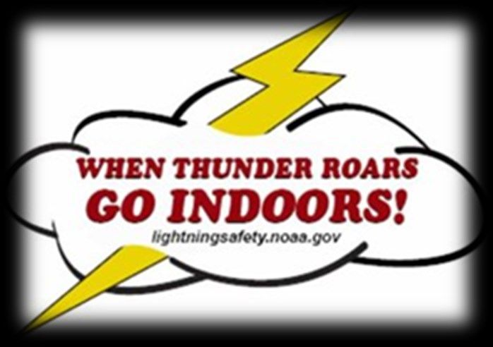
CPC Three Month Outlook:                                             U.S. Drought Monitor:
The Climate Prediction Center released an update of                  The latest U.S. Drought Monitor was released on
its three month outlook for temperature and precip-                  Thursday June 3, 2021. Much of NE Montana remains
itation for June through August back on May 20,                      under the influence of a severe to extreme drought.
2021. The outlook calls for increased odds of above                  This outlook is updated weekly. Please feel free to
normal temperatures across the state. Unfortunate-                   check out the latest here.
ly, the outlook is also suggesting a dry summer
ahead which is not good news for those with grow-
ing drought concerns. This does not mean there will
not be periods that may run cooler or wetter, but,
on the whole a warm and dry summer is expected to
result.

The latest outlook in full detail is always available
here. In addition, you can check out the Climate
Prediction Center Interactive site! You can zoom in
on our area, and navigate to see the climate outlook
for your specific location. The pie charts on the left
hand side can be particularly useful for assessing the
outlook at your specific location.

Figure 5: Climate Prediction Center three month temperature
(top) and precipitation (bottom) outlook for June 2021 through
August 2021.
                                                                         Figure 6: U.S. Drought Monitor updated June 3, 2021

                                                                 5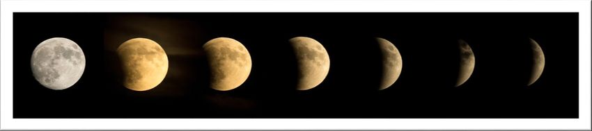
U.S. & Global Climate Highlights (April): The U.S.
& Global climate highlights for April 2021 have been re-
                                                                      Heat Safety Reminders
leased, the latest month for which data was available. A
few points for you to take home are provided below.      Summer is on the way, and that means the risk of
                                                                hot temperatures and heat-related stress. Here are
                                                                some important reminders for you to stay safe this
                                                                season.

                                                                    Figure 8: Heat Safety graphic shared on 5/16 on NWS Glasgow so-
                                                                    cial media accounts.
Figure 7: April 2021 Percent of Average Precipitation (U.S.).

U.S. Highlights for April 2021
                                                                                        Links You May Like:
1) The contiguous U.S. average temperature for April
                                                                                        May ENSO Update
   2021 was 51.9 °F, ranking within the middle warmest
   third of the climate record.                                         Atlantic Hurricane Season—A New Normal
2) The average April precipitation total for the contigu-                               Fires of the Future
   ous U.S. came in at 2.03 inches. This ranks as the
                                                                                 CO2 & Methane Rise in 2020
   14th driest April on record, and driest since 1989.

Global Highlights for April 2021

1) The 2021 global land and ocean surface tempera-
   ture was the 9th warmest on record.

2) The ocean surface temperature departure for April
   was the smallest since 2014 but the 8th highest on
   record.

3) La Niña began to weaken in April, with things pro-
   gressing toward ENSO-neutral conditions. However,
   it is still strong enough to have an effect.
                                                                6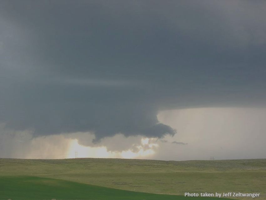
COOP Precipitation Data (*Preliminary* April 2021)

Station Precipitation    Location                  Station Precipitation     Location
   BAYM8            0.15             Baylor          MDCM8              0.42       Medicine Lake 3 SE
   BRDM8            0.26           Bredette          MLDM8              0.24              Mildred 5 N
   BTNM8              M      Brockton 17 N           MSBM8              0.32             Mosby 4 ENE
   BKNM8              M       Brockton 20 S          OPNM8              0.17             Opheim 10 N
   BKYM8            0.24 Brockway 3 WSW              OPMM8              0.07           Opheim 12 SSE
   BRSM8            0.33           Brusette           PTYM8             0.53              Plentywood
    CLLM8           0.83     Carlyle 13 NW           PTWM8              0.13         Plentywood 1 NE
   CIRM8             0.17             Circle         POGM8              0.16           Port of Morgan
  CHNM8              0.42           Cohagen           RAYM8               M Raymond Border Station
    COM8             0.30     Cohagen 22 SE           SAOM8             0.45              Saco 1 NNW
  CNTM8              0.32      Content 3 SSE          SMIM8             0.22                 St. Marie
  CULM8              0.33         Culbertson          SAVM8               M                     Savage
  DSNM8              0.36       Dodson 11 N           SCOM8             0.10             Scobey 4 NW
   FLTM8             0.83   Flatwillow 4 ENE          SDYM8             0.38                    Sidney
   FPKM8             0.29       Fort Peck PP           SIDM8            0.23                 Sidney 2S
  GLAM8              0.35    Glasgow 14 NW            TERM8             0.39                     Terry
 GGWM8               0.43      Glasgow WFO            TYNM8             0.85            Terry 21 NNW
  GGSM8              0.95    Glasgow 46 SW             VIDM8              M                  Vida 6 NE
 GNDM8              0.18     Glendive WTP            WSBM8                M                    Westby
  HRBM8                M               Harb          WTRM8              0.22              Whitewater
  HINM8             0.76     Hinsdale 4 SW            WHIM8               M         Whitewater 18 NE
  HNSM8             0.60    Hinsdale 21 SW           WBXM8              0.63               Wibaux 2 E
 HOMM8              0.18    Homestead 5 SE           WTTM8              0.34                   Winnett
  HOYM8             0.08               Hoyt          WNEM8              0.26           Winnett 6 NNE
  JORM8                M             Jordan          WNTM8              0.50            Winnett 8 ESE
  LNDM8             0.43            Lindsay           WITM8               M            Winnett 12 SW
 MLAM8              0.41              Malta           WLFM8             0.17                Wolf Point
  MLTM8             0.49         Malta 7 E            ZRTM8             1.56                  Zortman
 MTAM8              0.42        Malta 35 S

                                               7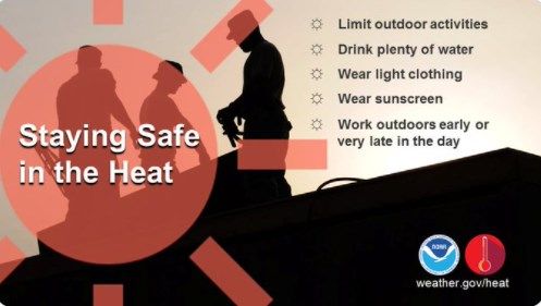
Monthly Trivia:
Last time we asked…
Convective thunderstorm season is upon us! This month we ask: What’s
the difference between a watch and a warning? We’ll share the answer to
this as well as some additional important safety information in the next
newsletter edition!

Answer: The differences between a watch and a warning , as well as safety actions you should take, are
summarized nicely in the table below.

              Figure 9: Graphical depiction of a severe weather watch vs. warning and actions you can take.

     New Question: You’ve decided to seek shelter due to a Severe Thunderstorm Warning issued for your
     area. How long after the storm has passed do you have the all clear to resume outdoor activities?
    Hint: The answer is somewhere in this newsletter!

Find us on Facebook, Twitter and YouTube! No account needed:
        Facebook.com/NWSGlasgow              Twitter.com/NWSGlasgow              YouTube.com/NWSGlasgow

                                                            8
You can also read