Walkability Plan 2013-2018 - joondalup.wa.gov.au - Green Building Council of Australia
←
→
Page content transcription
If your browser does not render page correctly, please read the page content below
Walkability Plan
2013–2018

joondalup.wa.gov.au
2 City of Joondalup Walkability Plan 2013 – 2018
City of Joondalup Walkability Plan 2013 – 2018   1

Contents
Section								 Page
Introduction                                                        4
Background                                                          4
Objectives                                                          4
Planning Context                                                    4
Related City of Joondalup Plans and Strategies                      5
Related State Government Plans and Strategies                       6
Key Walking Areas                                                   6
Audit Methodology                                                   7
Community Consultation                                              8

Key Walking Area 1 Joondalup City Centre                           14
1.1 Background                                                     14
1.2 Key Routes                                                     14
1.3 Community Feedback                                             15
1.4 Condition Audits                                               16
1.5 Recommendations                                                17

Key Walking Area 2 Suburban Shopping Precincts                     20
2.1 Background                                                     20
2.2 Key Routes                                                     20
2.3 Community Feedback                                             23
2.4 Condition Audits                                               23
2.5 Recommendations                                                25

Key Walking Area 3 Natural Bushland Areas                          27
3.1 Background                                                     27
3.2 Key Trails                                                     28
3.3 Community Feedback                                             28
3.4 Condition Audits                                               29
3.5 Recommendations                                                32

Key Walking Area 4 Yellagonga Regional Park                        35
4.1 Background                                                     35
4.2 Key Trails                                                     35
4.3 Community Feedback                                             36
4.4 Condition Audits                                               37
4.5 Recommendations                                                38
2 City of Joondalup Walkability Plan 2013 – 2018
Section Page
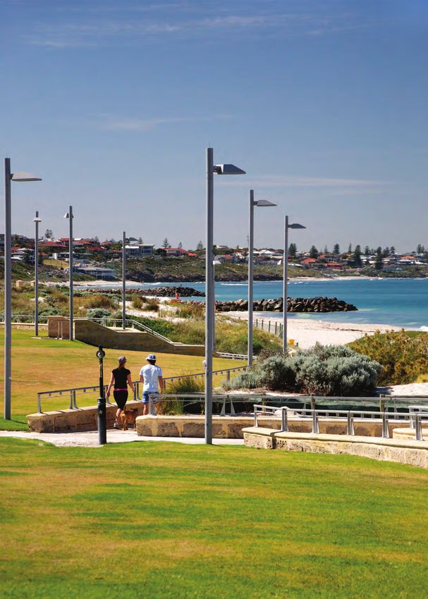
Key Walking Area 5 Sunset Coast 40
5.1 Background 40
5.2 Key Trail 40
5.3 Community Feedback 40
5.4 Condition Audit 40
5.5 Recommendations 42
Monitoring and Review 45
Appendices 47
Appendix 1 Map of Key Walking Area 1 — Joondalup City Centre 47
Appendix 2 Map of Key Walking Area 2(a) — Suburban Shopping Precincts
(Centro Warwick Shopping Centre) 48
Appendix 3 Map of Key Walking Area 2(b) — Suburban Shopping Precincts
(Westfield Whitford City Shopping Centre) 49
Appendix 4 Map of Key Walking Area 3 — Natural Bushland Areas 50
Appendix 5 Map of Key Walking Area 4 — Yellagonga Regional Park 51
Appendix 6 Map of Key Walking Area 5(a) — Sunset Coast (north) 52
Appendix 7 Map of Key Walking Area 5(b) — Sunset Coast (south) 53
Appendix 8 Recommendations 54
Appendix 9 Glossary 56
Appendix 10 References 57
City of Joondalup Walkability Plan 2013 – 2018 3
4   City of Joondalup Walkability Plan 2013 – 2018

    Introduction
    Background
    Creating environments that encourage people to choose active travel is increasingly being recognised as a way to
    foster more sustainable, healthier and safer communities. Walking and cycling are enjoyable, convenient and healthy
    modes of travel and also assist to reduce greenhouse gas emissions and improve the amenity of our local areas.
    “Walkability” is a measure of the effectiveness of community design in promoting walking and cycling as alternatives to
    driving cars to reach shopping, schools and other common destinations. The Heart Foundation of Australia, the World
    Health Organisation and other health organisations around the world advocate increasing the walkability of
    communities to promote fitness, combat obesity and enhance sustainability.
    The City’s Walkability Plan 2013–2018 is a five-year plan designed to encourage and enable safe and accessible
    environments within the City of Joondalup for all users. It presents the analysis, results and recommendations of a
    detailed audit of the City’s Key Walking Routes, Key Cycling Routes and Key Trails, and identifies how these can be
    improved. The Plan focuses on five Key Walking Areas, representing different walking and cycling contexts in the City
    of Joondalup’s urban and natural environments.
    The Walkability Plan 2013–2018 provides a strategic guide to investing in and managing walking and cycling
    infrastructure to ensure usability, appropriate signage and efficient and effective linkages. The Plan also identifies
    opportunities for enhanced community education and awareness of active recreational opportunities in the region.

    Objectives
    The objectives of the Walkability Plan 2013–2018 include the following:
    Identify opportunities to improve walkability within the Joondalup City Centre and major suburban shopping districts.
    Develop a planned and consistent approach to the establishment and maintenance of trails within natural bushland,
    wetland and coastal areas.
    Promote pathways and trails to the community and ensure they are accessible to residents and visitors.

    Planning Context
    The Walkability Plan 2013–2018 has been developed in the context of the City’s broader Integrated Planning and
    Reporting Framework. The following diagram shows the internal planning context of the Walkability Plan 2013–2018.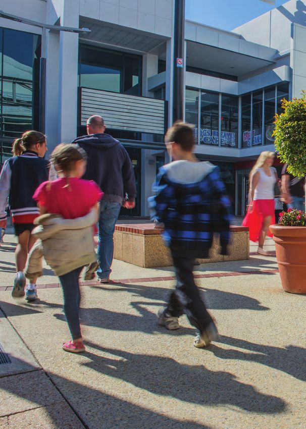
City of Joondalup Walkability Plan 2013 – 2018   5

Figure 1: City of Joondalup Internal Planning Context

                                               Joondalup 2022
                                          Strategic Community Plan
                                                 2012 – 2022

                                                                            Economic
   Governance                                        Quality                                              The
                             Financial                                      Prosperity,
      and                                             Urban                                             Natural
                           Sustainability                                  Vibrancy and
   Leadership                                      Environment                                        Environment
                                                                              Growth

                                                    Walkability
                                                       Plan
                                                    2013–2018

Related City of Joondalup Plans and Strategies
The following internal plans and strategies relate to the Walkability Plan 2013–2018:

Access and Inclusion Plan 2012–2014
The City’s Access and Inclusion Plan 2012–2014 provides for all members of the community to have equal access to
opportunities and places within the City of Joondalup. In the context of the Walkability Plan 2013–2018, it ensures that
people with disabilities, people from cultural and linguistically diverse backgrounds and people experiencing other
access and inclusion issues (for instance, the elderly or parents with prams) are able to access services, facilities,
events and public buildings, and receive information in an appropriate format.

Beach Management Plan 2011–2016
The City’s Beach Management Plan 2011–2016 represents an umbrella management framework for the conservation,
management and development of the City’s coastline. Paths and trails are covered by Key Focus Area 1 (Infrastructure)
of the Plan. Objectives of this Key Focus Area are threefold: to provide quality, low-impact infrastructure, to provide
adequate infrastructure for the needs of the region and to ensure the preservation of natural areas through effective
infrastructure design and location.

Bike Plan 2009
The overarching goal of the City’s Bike Plan 2009 is to promote cycling in the City of Joondalup and to increase the
number of cyclists using Joondalup’s bicycle network and facilities. The plan recognises the different requirements of all
types of road and path users and the different types of cyclist who have various requirements of their route
infrastructure. In addition to improving bicycle infrastructure in the City of Joondalup, the Bike Plan 2009 emphasises
the importance of signage and education to encourage, inform and assist cyclists.

Draft Joondalup City Centre Structure Plan
The Draft Joondalup City Centre Structure Plan provides a planning and design framework to facilitate the growth of
the City of Joondalup whilst ensuring an “intense mix of opportunities to live, work, play and learn with convenient
transport links to the surrounding region.” The draft Plan underscores the importance of accessibility through the
support of public transport, walking and cycling routes.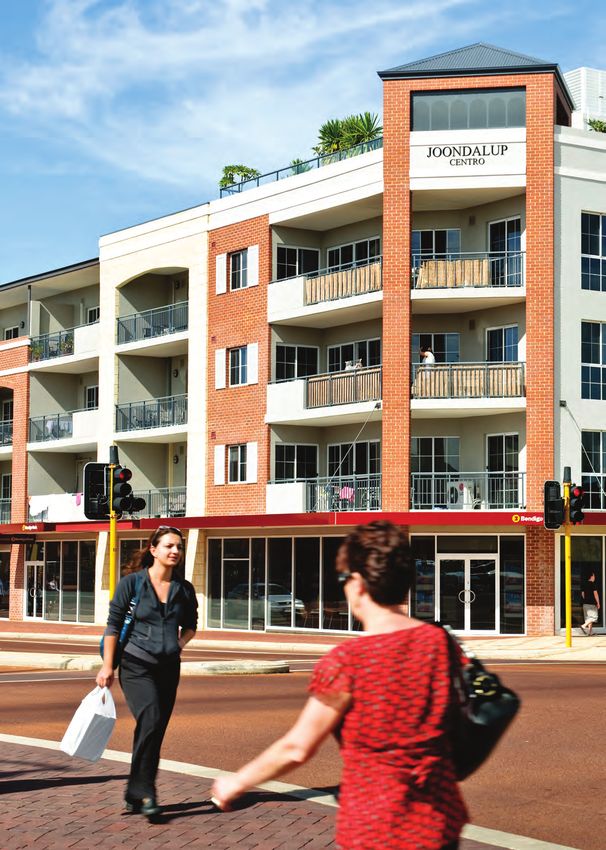
6   City of Joondalup Walkability Plan 2013 – 2018

    Related State Government Plans and Strategies
    The following external plans and strategies relate to the Walkability Plan 2013–2018:

    Directions 2031: Draft Spatial Framework for Perth and Peel
    The Department of Planning and Western Australian Planning Commissions, Directions 2031: Draft Spatial Framework
    for Perth and Peel provides a framework to guide the detailed planning and delivery of housing, infrastructure and
    services necessary to accommodate a range of growth scenarios. The draft Framework provides direction on, among
    other things, where development should be focused, what patterns of land use and transport will best support this
    development pattern, and what areas need protecting so that the region retains high quality natural environments
    and resources.

    Draft Public Transport Plan for Perth 2031
    The Department of Transport’s, Draft Public Transport Plan for Perth 2031 addresses congestion and accessibility
    issues for the growing Perth Metropolitan Area. The draft Plan identifies the main public transport infrastructure needs and
    the links required between major activity centres. Key initiatives include the introduction of light rail, the development of
    rapid transit corridors, expansion of the rail network and the introduction of additional buses and trains.

    State Planning Policy 2.8 — Bushland Policy for the Perth Metropolitan Region
    This Department of Planning’s, Bushland Policy for the Perth Metropolitan Region covers “Bush Forever” areas and
    local bushland. It provides the policy and implementation framework for bushland areas shown in the Metropolitan
    Region Scheme and supports the preparation of local bushland protection strategies by all local governments.

    Walk WA: A Walking Strategy for Western Australia 2007–2020
    Be Active WA’s, Walk WA: A Walking Strategy for Western Australia addresses the improvement of health and
    wellbeing through walking initiatives. The Strategy is a whole-of-government, whole-of-community strategy devised to
    enable a coordinated, collaborative approach to encourage all Western Australians to walk and to develop
    environments in which the decision to walk is easier.

    Draft Western Australian Bicycle Network Plan 2012–2021
    The Department of Transport’s Draft Western Australian Bicycle Network Plan 2012–2021 introduces new initiatives
    to assist in providing a safe and sustainable cycling network that connects with key activity and attraction areas.
    The draft Plan represents a progression from Austroad’s The National Cycling Strategy: Gearing up for Active and
    Sustainable Communities.

    Western Australian Trails Strategy 2009–2015
    The Department of Sport and Recreation’s, Western Australian Trails Strategy 2009–2015 outlines a strategic direction
    for the Western Australian trails sector. The Strategy considers the policies and priorities outlined by existing economic,
    environmental, health, recreational and community development documents relevant to Western Australian trails.

    Yellagonga Regional Park Management Plan 2003–2013
    The Department of Environment’s, Yellagonga Regional Park Management Plan 2003–2013 guides the protection and
    enhancement of conservation, recreation and landscape areas within Yellagonga Regional Park. The Plan provides
    statutory direction over all lands and waters of the park vested in the Conservation Commission of Western Australia
    and managed by the Department of Environment and Conservation.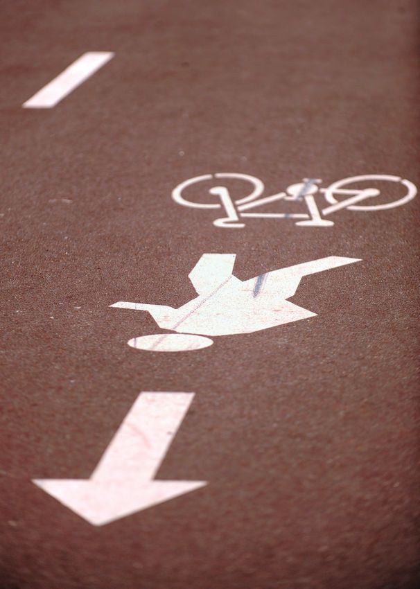
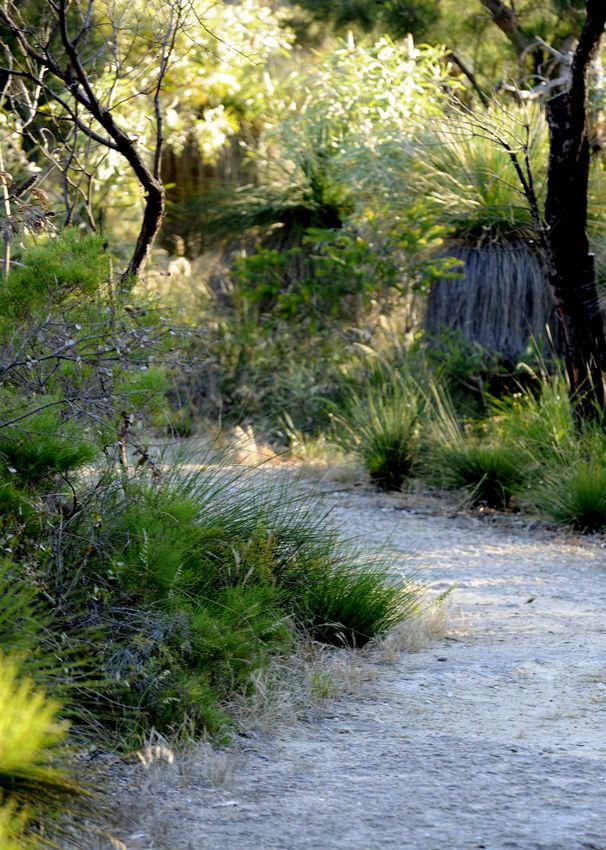
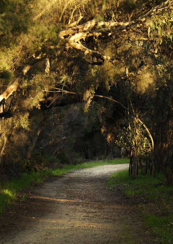
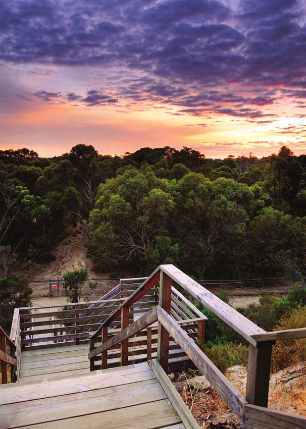
City of Joondalup Walkability Plan 2013 – 2018   7

Key Walking Areas
Five Key Walking Areas were chosen for detailed analysis which span the entire City of Joondalup region and represent
both the urban and natural context:
1. Joondalup City Centre
2. Suburban Shopping Precincts
   • Centro Warwick Shopping Centre
   • Westfield Whitford City
3. Natural Bushland Areas
   • Craigie Open Space
   • Warwick Open Space
   • Lilburne Reserve
   • Shepherds Bush Reserve
   • Hepburn Heights Bushland
4. Yellagonga Regional Park
5. Sunset Coast
Whilst these Key Walking Areas have been selected for detailed analysis of accessibility and walkability, the
recommendations provided within the Walkability Plan 2013–2018 also apply to areas that are outside of those chosen.
For each of the five Key Walking Areas, a summary of the Key Routes, community feedback, condition audit(s) and any
recommendations are provided.

Audit Methodology
The condition audits for the Walkability Plan 2013–2018 were conducted using three interdependent methods:
1. Department of Transport’s Walkability Audit Tool
2. Top Trails Western Australia assessment criteria for inclusion as a “Top Trail”
3. US Department of Transportation’s Bikeability Checklist

Walkability Audit Tool
The Key Walking Areas, Joondalup City Centre and Major Suburban Shopping Precincts; were audited using the
Department of Transport’s Walkability Audit Tool which identifies routes as Key Walking Routes and Key Cycling
Routes. The Tool was also used to supplement the audits of the Key Walking: Natural Bushland Areas, Yellagonga
Regional Park and Sunset Coast.
The Walkability Audit Tool refers to a number of design standards for pedestrian facilities produced by Austroads and
Australian Standards. In particular the Walkability Audit Tool makes reference to the Austroads Guide to Road Design
— Part 6A: Pedestrian and Cyclist Paths. The guide identifies five key attributes of an environment required to
encourage walking which state that a route should be:
1. Connected
2. Comfortable
3. Convenient
4. Convivial
5. Conspicuous
In addition, the Walkability Audit Tool identifies seven elements to be examined in each audited route. These elements
are rated as either 3 (satisfactory), 2 (unsatisfactory but acceptable), and 1 (unsatisfactory).
1. General impressions
2. Pathways
3. Crossings (of roads)
4. Street furniture and signage
5. Personal safety
6. Adjacent traffic
7. Aesthetics and amenities
8   City of Joondalup Walkability Plan 2013 – 2018

    Top Trails Western Australia Assessment Criteria
    The Key Walking Areas, Natural Bushland Areas, Yellagonga Regional Park and Sunset Coast; were audited using the
    Top Trails Western Australia assessment criteria for inclusion as a “Top Trail”.
    The Top Trails Western Australia assessment criteria stipulate that, in addition to being of a high standard and providing
    a memorable or unique experience, ideally trails must already have the following:
    1. Appropriate signage — directional trail marking (distance and “locational”).
    2. Maps, guide books and track notes, if required.
    3. Interpretative material and information, if appropriate.
    4. Management and maintenance plans.
    5. Community support (e.g. friends’ groups or local government involvement).
    6. A promotional brochure.
    7. Good information available on a website.
    Further to the assessment criteria above, Top Trails Western Australia also list the following as important aspects in the
    assessment of a “Top Trail”:
    •   Quality of the experience
    •   Point of difference
    •   Accessibility
    •   Community involvement
    •   Cultural awareness
    •   Nearby facilities and services
    •   Safety.

    Bikeability Checklist
    In addition to the use of the tools outlined above, the Key Cycling Routes of the Joondalup City Centre were audited
    using the Bikeability Checklist developed by the US Department of Transportation.
    The Bikeability Checklist includes six cycling–specific questions, including:
    1. Did you have a place to bicycle safely?
    2. How was the surface that you rode on?
    3. How were the intersections you rode through?
    4. Did drivers behave well?
    5. Was it easy for you to use your bike?
    6. What did you do to make your ride safer?

    Community Consultation
    The City conducted community consultation to inform the development of the Walkability Plan 2013–2018. The
    consultation initiatives targeted three specific groups representing both public and industry consultation: the general
    community, user groups and major stakeholders. Details of each consultation group and a summary of their responses
    are provided below.

    General Community and User Groups
    The general community was surveyed by means of a City-wide public survey and strategic on-site interview
    questionnaires. Community consultation was promoted through the following avenues:
    •  Advertising in the Joondalup Voice.
    •  Email letters with links to an electronic survey sent to members of the community (sourced through relevant
       City databases).
    • Notice on the City’s e-screens at Customer Service Centres.
    • On-site, face-to-face questionnaire interviews at Centro Warwick Shopping Centre and Westfield Whitford City
       Shopping Centre.
    Consultation with user groups involved seeking feedback from stakeholders with an interest in the Key Areas of the Plan.
City of Joondalup Walkability Plan 2013 – 2018 9
As with the general community consultation, the City-wide public survey was used. The survey was followed up by phone
discussions or face-to-face interviews. User group consultation was promoted through the following avenues:
• Initial phone call informing each group of the project.
• Cover letter mailed or emailed with links to an electronic survey or the City-wide public survey attached.
The following user groups were contacted directly for feedback:
• Action Outdoors Association
• Burns Beach Café
• Bushwalkers of Western Australia
• Duncraig Senior High School
• Easybeat Walkers
• Ern Halliday Recreation Camp
• Federation of Western Australian Bushwalkers
• Friends of Craigie Bushland
• Friends of Marmion Marine Park
• Friends of Hepburn and Pinnaroo Bushland
• Friends of Mullaloo Beach
• Friends of North Ocean Reef/Iluka Foreshore
• Friends of Warwick Bushland
• Friends of Yellagonga Regional Park
• Joondalup Community Coast Care Forum
• Marmion Angling and Aquatic Club
• Mindarie Diving Academy
• Mullaloo Surf Life Saving Club
• North Coast Triathlon Club
• Northern Districts Cycle Club
• Padbury Catholic Primary School
• Perth Mountain Bike Club
• Sacred Heart College
• Sorrento Surf Life Saving Club
• Warwick Senior High School
• Women’s Healthworks.
Commentary — City-Wide Public Surveys
Responses to background and more general questions from the City-wide survey revealed the following:
• The respondent group was equally divided between males and females. Few respondents were aged 25 years or
under and the largest sets of respondents were in the 60–69 and the 35–44 age groups. Respondents came from
almost all suburbs of Joondalup, with a strong representation from Edgewater and Joondalup.
• The pathways and trails most frequently used by the respondents are the Sunset Coast Trail, the Lake Joondalup
trails in Yellagonga Regional Park and the trails in pathways Joondalup City Centre.
• The coastal and Lake Joondalup trails are used by the respondents mainly for exercise and recreation, enjoying the
environment and dog walking; the Joondalup City Centre pathways are used mainly for accessing shopping, public
transport and services (education, medical) and some recreational walking.
• All parts of the Sunset Coast Trail are used, but the respondent group mainly uses the northern sections.
• Respondents do not use paths in areas that are a long way from where they live.
In addition to the general responses above, the survey questions on each of the Key Areas asked respondents to rank
the selected pathways or trails against a set of criteria expressed as “positive statements” (for example, “The path is in
good condition.”) The rankings ranged from 1 to 6 (“strongly agree” to “strongly disagree”). Analysis of these responses
showed that:
• For almost all of the issues (such as the quality and width of footpaths, crossings and amenities), the percentage of
positive rankings significantly outweighed the percentage of negative rankings, revealing that the walking
environment is seen in a positive way by the majority of respondents.
• Some issues frequently had more negative than positive rankings. For instance, most respondents did not agree
with the statement “I feel safe using the path at night”, whilst the statement “Cyclists and pedestrians share the
trail/path well with each other” had a lower than average positive ranking.
Respondents to the City-wide survey also had the opportunity to provide commentary on each Key Walking Area of
the Plan. These comments are briefly summarised in the Plan where each Key Walking Area is discussed in detail.10 City of Joondalup Walkability Plan 2013 – 2018
At the end of the survey, respondents were asked to provide any further comments they might have relating to
walkability. Comments varied widely and some were not particularly relevant to walkability. The most common (relevant)
comments are summarised below:
• Improve signage information on walking and public transport routes (e.g. information kiosks, mobile phone
apps, etc.).
• Improve the general amenity on pathways (e.g. shelter, seats, drinking fountains, paving, etc.).
• Improve pedestrian/cyclist safety (e.g. control cycling speed; promote the use of bells/keeping left, install centre
lines on paths etc.).
• Improve the walking environment to be more “pedestrian-friendly” (e.g. introduce separate cycle and pedestrian
paths, have wider lanes etc.)
• Promote appropriate control of dogs on paths.
• Improve pedestrian/zebra crossings.
• Improve bike parking and end-of-trip facilities.
• Improve access for people with prams and people in wheelchairs.
• Move the focus of Joondalup City Centre away from vehicle traffic and have a greater focus on pedestrians.
Commentary — On-Site Interview Questionnaires
Responses to general questions from the on-site interview questionnaires at Centro Warwick Shopping Centre and
Westfield Whitford City Shopping Centre revealed the following:
• At least 50% of respondents are women in the 50+ age group. Most shoppers come from surrounding suburbs.
• Most respondents use “active transport” (i.e. not private vehicles) to get to the shopping centres.
• Respondents who were “active transport” users frequent the shopping centres more often than car drivers. There
is a social element to their visits as well as a practical one.
• Problems noted with access to the shopping centres cover difficulties traversing busy car parks on foot, uneven
footpaths, problems walking between bus stops and difficulties crossing roads.
Industry Stakeholders
Industry stakeholders were surveyed by means the City-wide public survey through the following avenues:
• Initial phone call informing each stakeholder group of the project.
• Cover letter mailed or emailed with links to an electronic survey or the City-wide public survey attached.
The following industry stakeholders were contacted directly for feedback:
• City of Wanneroo
• Conservation Council of Western Australia
• Department of Environment and Conservation
• Department of Sport and Recreation
• Department of Transport
• Disability Services Commission
• Edith Cowan University
• Experience Perth
• Fire and Emergency Services Authority of Western Australia
• Hillarys Boat Harbour
• Joondalup Business Association
• Joondalup Health Campus
• Lakeside Joondalup Shopping City Management
• Main Roads Western Australia
• Northern Suburbs Reconciliation Group
• Public Transport Authority of Western Australia
• Quality Resort Sorrento Beach
• South West Aboriginal Land and Sea Council
• Top Trails Western Australia
• West Coast Institute
• Western Australia Police Academy.City of Joondalup Walkability Plan 2013 – 2018 11 Commentary — Industry Stakeholders Discussions were held with a substantial number of major stakeholder representatives. During these discussions the representatives were informed of the nature and broad intent of the Walkability Plan 2013–2018 and informed of the potential recommended actions that may affect them (e.g. installing “wayfinding” signage, improving road crossings and related issues in the Joondalup City Centre and natural areas). Responses were received from the following State Government stakeholders: • Department of Transport • Department of Environment and Conservation • Main Roads Western Australia • Public Transport Authority — the following local government stakeholders: • City of Wanneroo — the following Joondalup Learning Precinct stakeholders: • Edith Cowan University • West Coast Institute • Joondalup Health Campus — and the following private organisation stakeholders: • Lakeside Joondalup Shopping City In general, industry stakeholders are supportive of the need to improve walking and cycling in the City of Joondalup. The City will continue to work with these stakeholders to implement walking- and cycling-related improvements. General Recommendations Following initial research and community consultation, the following general recommendations have been developed. Additional recommendations relating to the specific Key Walking Areas of the Walkability Plan 2013–2018 are shown in the relevant sections of the Plan. A full list of recommendations is shown at Appendix 8. Recommendation 1 The City of Joondalup becomes a signatory to the International Charter for Walking. Description: The International Charter for Walking was developed by the UK-based organisation Walk21. The Charter exists to provide “a world where people choose and are able to walk as a way to travel, to be healthy and to relax, a world where authorities, organisations and individuals have recognised the value of walking, made a commitment to healthy, efficient and sustainable communities and worked together to overcome the physical, social and institutional barriers which often limit people’s choice to walk.” By becoming a signatory to the Charter, the City will be demonstrating its overall commitment to the principles of walkability. Recommendation 2 Investigate “mobile optimisation” of the City of Joondalup’s website and the use of Quick Response (QR) Codes to link to the website. Description: Low-cost, high-powered and non-intrusive technology can assist “wayfinding” and the provision of public information and education on trails and pathways. The use of QR Codes (similar to a product barcode) has become a popular method of providing directions and information to people seeking guidance in many types of environment. When used in conjunction with smart phones with a QR “app”, QR Codes have the capacity to provide a link to the City’s website. It is recommended that the City investigate the “mobile optimisation” of the City’s website and, in particular, the use of QR Codes to assist “wayfinding” in the City.
12   City of Joondalup Walkability Plan 2013 – 2018

      Recommendation 3
      Liaise with Main Roads Western Australia to investigate the feasibility of reducing speed limits within key areas
      of the City.

      Description:
      Reducing the speed limit within areas of the City that are highly utilised by pedestrians can create safer walking
      environments. Reduction of speed limits needs to consider the potential impact on traffic movement and requires
      agreement from major stakeholders including Main Roads Western Australia.

      Recommendation 4
      Develop a Walking and Cycling Counting Program.

      Description:
      Limited data is available on the level of usage of trails and pathways in the City of Joondalup. The acquisition of such
      data would be valuable for decision-making, policy development and funding applications for new road crossings
      and other improvements recommended in this Plan. Development of a Walking and Cycling Counting Program is
      recommended to determine the level of usage of trail and pathways in the City.

      Recommendation 5
      In conjunction with the Public Transport Authority, the Department of Environment and Conservation and the City of
      Wanneroo, develop a program for undertaking counts of walking and cycling traffic across the City and appropriate
      surrounding areas.

      Description:
      As noted in Recommendation 3, limited data is available on the level of usage of trails and pathways in the City of
      Joondalup. It is recommended that the City work in partnership with the Public Transport Authority, the Department
      of Environment and Conservation and the City of Wanneroo to undertake counts of walking and cycling traffic at a
      local and regional level.

      Recommendation 6
      Implement the Walking and Cycling Counting Program.

      Description:
      As noted in Recommendations 3 and 4, limited data is available on the level of usage of trails and pathways in the
      City of Joondalup. Following the development of a Walking and Cycling Counting Program, it is recommended that
      the City appropriately implement this Program through automatic “people counters” and/or utilising video capture
      technology through the City’s closed-circuit television (CCTV) system.

      Recommendation 7
      Develop a comprehensive Signage Strategy including pedestrian “wayfinding” to improve access and walkability
      within the City of Joondalup City Centre and the trails within the City’s natural areas.

      Description:
      The use of “wayfinding” signage forms an important part of the City’s Walkability Plan 2013–2018. This type of
      signage uses pedestrian and cyclist focused map based signs mounted either as free-standing doubled-sided
      panels or as single-sided panels fixed to walls or other suitable structures. In order to provide consistency in the
      style, design and content of signage it is recommended that the City develop a Signage Strategy to guide the
      development and installation on new “wayfinding” signage within the City.
City of Joondalup Walkability Plan 2013 – 2018 13
14 City of Joondalup Walkability Plan 2013 – 2018
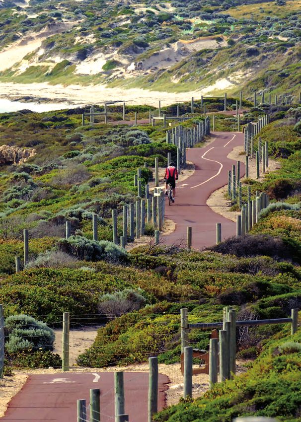
Key Walking Area 1
Joondalup City Centre
1.1 Background
The Joondalup City Centre provides employment and shopping opportunities, and continues to build upon its status
as a cultural and educational hub. Consequently, it is frequented by many visitors (residential and non-residential).
These visitors rely on the area to be pedestrian and bicycle-friendly, and need its many pathways to be connected,
safe and functional.
This Key Walking Area (shown in Appendix 1), includes a number of major destinations which include Edith Cowan
University, West Coast Institute, Western Australian Police Academy, Central Park, Joondalup Bus and Train Station,
Lakeside Joondalup Shopping City and the Joondalup Health Campus. Ideally, these destinations should be linked by
Key Walking Routes and Key Cycling Routes.
Additional major destinations planned for the Joondalup City Centre include the Joondalup Performing Arts and
Cultural Facility, a new medical facility on Shenton Avenue and Grand Boulevard and expansions to Edith Cowan
University, West Coast Institute and Lakeside Joondalup Shopping City. These developments will increase the intensity
of activity in the Joondalup City Centre, making improvements to walkability and the availability of “active transport” as
a practical choice, vital.
The Joondalup City Centre is well-served by buses and trains. Approximately 180 trains travel to and from Joondalup
Bus and Train Station each day; 15 Transperth bus routes serve the Joondalup Bus and Train Station and a free
circular Central Area Transit (CAT) bus service provides access to all key destinations. Notwithstanding, most train
services are not met by a CAT bus within 10 minutes of the train arriving, making walking to Joondalup City Centre
destinations a quicker option than waiting for the CAT bus. Most of the destinations are within a short walk or cycle
ride of the Joondalup Bus and Train Station (and each other), although long wait times at road crossings can increase
total walk times.
1.2 Key Routes
The Joondalup City Centre has a number of Key Walking Routes and Key Cycling Routes linking major destinations.
Optimising this Key Walking Area will increase the capacity of pedestrians and cyclists to access shops, services, and
cultural and educational facilities safely and efficiently.
Most of the Joondalup City Centre destinations are within a few minutes cycle of the Joondalup Bus and Train Station
(and each other) and all are within a six to12 minutes walk from the Station. The Key Walking Routes and Key Cycling
Routes and a brief description of each are listed in Table 1.2.
Table 1.2 Key Walking and Cycling Routes for the Joondalup City Centre
Route Description
Key Walking Route 1 Joondalup Bus and Train Station to Joondalup Health Campus (via Lakeside
Joondalup Shopping City)
Exit north from Joondalup Bus and Train Station; walk through Lakeside Joondalup
Shopping City to Boas Avenue; cross Grand Boulevard; use Central Walk to walk north;
and access the southern pedestrian entrance to Joondalup Health Campus.
Key Cycling Route 1 Joondalup Bus and Train Station to Joondalup Health Campus
Exit south from Joondalup Bus and Train Station; travel south to Collier Pass; turn left
(east) onto Collier Pass; ride to Grand Boulevard; turn left onto Grand Boulevard and join
the on-road bike lanes travelling north; turn right onto Boas Avenue; use Central Walk on
the left to access the southern pedestrian entrance to Joondalup Health Campus.City of Joondalup Walkability Plan 2013 – 2018 15
Route Description
Key Walking Route 2 Joondalup Bus and Train Station to Civic Area (City of Joondalup Administration
and Library) via Lakeside Joondalup Shopping City
Exit north from Joondalup Bus and Train Station; walk through Lakeside Joondalup
Shopping City to Boas Avenue; cross Grand Boulevard and Davidson Terrace to access
the Civic Area on the right-hand side of Boas Avenue.
Key Cycling Route 2 Joondalup Bus and Train Station to Civic Area (City of Joondalup Administration
and Library)
Exit south from Joondalup Bus and Train Station; travel south to Collier Pass; turn left
(east) onto Collier Pass; ride to Grand Boulevard; turn left onto Grand Boulevard and join
the on-road bike lanes travelling north; turn right onto Boas Avenue; cross Davidson
Terrace to access the Civic Area on the right-hand side of Boas Avenue.
Key Walking Route 3 Joondalup Bus and Train Station to Neil Hawkins Park (Yellagonga Regional Park)
Exit north from Joondalup Bus and Train Station; walk through Lakeside Joondalup
Shopping City to Boas Avenue; cross Grand Boulevard and cross Lakeside Drive;
continue along Boas Avenue to the very end to access Neil Hawkins Park.
Key Cycling Route 3 Joondalup Bus and Train Station to Neil Hawkins Park (Yellagonga Regional Park)
Exit south from Joondalup Bus and Train Station; travel south to Collier Pass; turn left
(east) onto Collier Pass; ride to Grand Boulevard; turn left onto Grand Boulevard and join
the on-road bike lanes travelling north; turn right onto Boas Avenue; cross Davidson
Terrace; cross Lakeside Drive; continue along Boas Avenue to the very end to access
Neil Hawkins Park.
Key Walking Route 4 Joondalup Bus and Train Station to West Coast Institute Campus
and
Exit south from Joondalup Bus and Train Station; travel south along the western path
Key Cycling Route 4
beside the bus lane on the east side of the Station to Collier Pass; cross Grand
Boulevard; continue down the path to access West Coast Institute.
Key Walking Route 5 Joondalup Bus and Train Station to Edith Cowan University Campus or Western
and Australian Police Academy
Key Cycling Route 5
Exit south from Joondalup Bus and Train Station; travel south along the western path
beside the bus lane on the east side of the Station to Collier Pass; turn left (east) onto
Collier Pass; travel along Collier Pass; turn right onto Grand Boulevard, travel south until
Kendrew Crescent; cross Kendrew Crescent; travel south-east down the path to access
Edith Cowan University. (By turning left onto Kendrew Crescent instead and travelling
east, the Western Australian Police Academy may be accessed.)
1.3 Community Feedback
From the City-wide public survey, respondents were asked to provide general comments about the Joondalup
City Centre:
• Respondents expressed the need for the installation of “wayfinding” signage, the availability of better information
and the provision of higher levels of amenity along Key Routes.
• Respondents would like a greater focus on pedestrians (e.g. a better walking environment, ease-of-access through
car parks, more road crossings, more time to cross at lights and slower traffic-speed regulations, etc.).
• Some respondents prefer separate facilities for cyclists and pedestrians.
• Respondents expressed safety and security concerns with regard to walking and cycling in the Joondalup City
Centre (e.g. night safety, speeding cyclists and dogs off the lead, etc.).16 City of Joondalup Walkability Plan 2013 – 2018
1.4 Condition Audits
Condition audits were conducted for the Key Walking Routes and Key Cycling Routes of the Joondalup City Centre
utilising the Department of Transport’s, Walkability Audit Tool. The condition audits of the Key Cycling Routes were
supplemented by the US Department of Transportation’s, Bikeability Checklist, as well as local criteria (although these
elements were not given a numerical rating). The condition audits are shown in Tables 1.4.
Table 1.4 Condition Audit for the Key Walking Routes and Key Cycling Routes of the Joondalup City Centre
(Ratings: 1 = unsatisfactory, 2 = unsatisfactory but acceptable, 3 = satisfactory)
Walkability element Rating Comment
Adjacent traffic The current speed and volume of traffic on the Key Walking Routes and Key
1
Cycling Routes are generally too high for pedestrian and cyclist safety.
Aesthetics This element takes into account litter, dumped rubbish, discarded items and
3
and amenities graffiti. There is little evidence of these problems, except in car park stairwells.
Clear sightlines There are no issues on most of the Key Walking Routes and Key Cycling Routes.
3 Intersections are open and clear and undergrowth does not obstruct cyclist’
paths.
Comfort 2 Moderately comfortable place to cycle.
Connectivity Most of the Key Walking Routes and Key Cycling Routes are short, so
connectivity issues are limited to major intersections. Some of these
N/A intersections are difficult to cross, especially those with uncontrolled slip lanes,
where neither riders nor pedestrians can safely cross to activate the crossing
button.
Crossings In order to use the Key Walking Routes and Key Cycling Routes, pedestrians
and cyclists need to cross a number of access roads for car parks and roads
1 where there are unassisted crossing facilities. They also need to cross roads at
traffic lights, including their associated slip roads which accommodate left-
turning traffic.
Information Signage for cyclists is generally poor, missing, incomplete and/or faded. In some
1 cases directions are given, but no distance or time, nor are any intermediate
destinations shown.
Pathways Pathways are flat, well-laid and usually straight. They are found on both sides of
3 nearly all streets. However, there is one pathway absent, from Collier Pass to
West Coast Institute.
Personal safety In certain parts of the Joondalup City Centre there are some safety issues at
2
night.
Signage There is little or no pedestrian “wayfinding” signage and street name signage
1
could be improved.
Smooth riding
2-3 Mostly in good condition, the exceptions being at certain crossing points.
surfaces
Space to ride Many spaces to cycle and on-road lanes are of an adequate width. They are,
N/A however, not well-marked and therefore a cause of potential confusion for the
rider. Dual-use paths are generally wide and free of obstructions.
Speed maintenance Adequate speed can be maintained by cycling of all types, although long waiting
N/A
periods for traffic lights to change can lead to impatience for riders.
Street furniture The Key Walking Routes and Key Cycling Routes are relatively short and the
3 amenity levels (water, toilets, seating etc.) were considered appropriate for short
walking and cycling trips.City of Joondalup Walkability Plan 2013 – 2018 17 1.5 Recommendations Recommendation 8 Support major Joondalup City Centre stakeholders in developing individual Travel Access Guides. Description: Travel Access Guides are hand-held or online maps that show the user the easiest ways to access a specific destination by walking, cycling and/or public transport. It is recommended that that the City support major Joondalup City Centre stakeholders (e.g. Lakeside Joondalup Shopping City, Edith Cowan University, West Coast Institute, Joondalup Health Campus, etc.) in developing individual Travel Access Guides. Recommendation 9 Install a comprehensive pedestrian wayfinding signage system in the Joondalup City Centre in accordance with the City’s overarching Signage Strategy. Description: “Wayfinding” signage in the Joondalup City Centre is sparse and does not adequately meet the needs of pedestrians and cyclists. It is recommended that a comprehensive “wayfinding” signage system be installed to assist users of the Key Walking Routes and Key Cycling Routes. Recommendation 10 Review the pathway network within the Joondalup City Centre and key surrounding nodes to target opportunities to improve useability and linkages. Description: Although the condition audits revealed that pathways within the Joondalup City Centre were comprehensive, it is recommended that a review of the pathway network be conducted to identify any “missing” pathways and the inadequate linkages. Recommendation 11 Investigate the performance of key vehicle and pedestrian intersections within the Joondalup City Centre to determine the best shared outcome. Description: Pedestrian and cyclist wait times at vehicle intersections in the Joondalup City Centre can be lengthy. It is recommended that a comprehensive investigation be conducted of the key vehicle and pedestrian intersections to determine if modifications can be made to better serve both pedestrians/cyclists and vehicles. Recommendation 12 Install tactile ground indicators at all traffic-light crossings throughout the Joondalup City Centre. Description: Tactile ground indicators are textured ground surface indicators that can be installed on pathways, stairs and train station platforms to assist blind and vision impaired pedestrians. In order to promote safer pedestrian use of traffic-light crossings, it is recommended that tactile ground indicators be installed at all traffic-light crossings throughout the Joondalup City Centre.
18   City of Joondalup Walkability Plan 2013 – 2018

      Recommendation 13
      Investigate options for developing a continuous path of travel for all entrances across the Joondalup City Centre.

      Description:
      A continuous path of travel enables pedestrians to navigate crossings safely and without inconveniences (e.g. traffic-
      light crossings). It is recommended that options for developing a continuous path of travel be investigated for major
      entrances across the Joondalup City Centre.

      Recommendation 14
      Undertake a continuous path of travel project within a major Joondalup City Centre car park to develop requirements
      for future applications

      Description:
      A continuous path of travel enables pedestrians to navigate crossings safely and without inconveniences (e.g.
      traffic-light crossings). It is recommended that the project be undertaken within a major Joondalup City Centre car
      park for a continuous path of travel that can be used as a pilot for future applications.
City of Joondalup Walkability Plan 2013 – 2018 19
20 City of Joondalup Walkability Plan 2013 – 2018
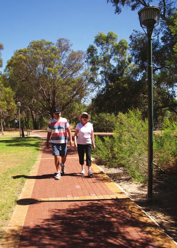
Key Walking Area 2
Suburban Shopping Precincts
2.1 Background
For this Key Walking Area, two major suburban shopping precincts in the City of Joondalup were investigated — Centro
Warwick Shopping Centre and Westfield Whitford City Shopping Centre. Centro Warwick and Westfield Whitford City
Shopping Centres are both located in the southern part of the City of Joondalup (shown in Appendices 2 and 3).
2.1.1 Centro Warwick Shopping Centre
Centro Warwick Shopping Centre is situated on the corner of Erindale Road and Beach Road in Warwick. Warwick
Bus and Train Station is a five minute walk east on Erindale Road, or one of 10 buses that travel along Beach Road
from the Station to the Shopping Centre may be caught.
2.1.2 Westfield Whitford City Shopping Centre
Westfield Whitford City Shopping Centre is situated on the corner of Whitfords Avenue and Marmion Avenue. Buses
travel from Whitford Bus and Train Station, located at the intersection of Whitfords Avenue and the Mitchell Freeway.
Buses stop directly in front of the Shopping Centre.
2.2 Key Routes
Centro Warwick and Westfield Whitford City Shopping Centres have a number of Key Routes linking public transport
hubs to the Shopping Centres. Key Routes through the broad catchment areas of the Shopping Centres were
identified and assessed. In listing the Key Routes, differentiation has not been made between Key Walking Routes and
Key Cycling Routes (although pertinent points for either are highlighted in the audit results). The Key Routes and a brief
description of each are listed in Tables 2.2(a) and 2.2(b).City of Joondalup Walkability Plan 2013 – 2018 21
Table 2.2(a) Key Routes for Centro Warwick Shopping Centre
Route Description
Key Route 1 Warwick Bus and Train Station to Centro Warwick Shopping Centre
Travel west to east along Beach Road (a main road forming the boundary between
Warwick and Hamersley (City of Stirling)). This route is an easy walk or cycle from Warwick
Bus and Train Station to the Shopping Centre along the dual-use path on the northern
side of Beach Road.
Key Route 2 Dorchester Road to Centro Warwick Shopping Centre
Approach the Shopping Centre from the north-west along a minor road through a
residential area.
Key Route 3 Ellersdale Avenue to Centro Warwick Shopping Centre
Parallel and to the north of Ellersdale Avenue, this route approaches the Shopping Centre
from the north-west along a minor road through a residential area.
Key Route 4 Erindale Road (north) to Centro Warwick Shopping Centre
Approach Centro Warwick along Erindale Road (a major road) from the north. This route
passes Warwick Open Space and Warwick Senior High School.
Key Route 5 Beach Road (east) to Centro Warwick Shopping Centre
The eastern approach of Beach Road to the Shopping Centre; it is a major road and
passes the southern boundary of Warwick Open Space.
Key Route 6 Rannoch Circle and Katrine Way to Centro Warwick Shopping Centre
Approaches from the south-east through the minor residential roads of the suburb of
Hamersley (City of Stirling) to access Beach Road (via Erindale Road or Sunart Close) and
the south-eastern corner of the Shopping Centre.
Key Route 7 Erindale Road (south) to Centro Warwick Shopping Centre
The southern approach of Erindale Road to Centro Warwick. This route meets the
Shopping Centre at the Beach Road intersection to the south-east of the Shopping
Centre.
Key Route 8 Hamersley suburb to Centro Warwick Shopping Centre
Provides access through the residential areas of Hamersley (City of Stirling) via a walkway
to the Shopping Centre. Taking the route south away from the Shopping Centre, it splits
in two across a small park and leads to residential streets.
Key Route 9 Glendale Road to Centro Warwick Shopping Centre
This route runs from Eglington Aintree Reserve at the southern end of Glendale Road
(where paths skirt the park) to Beach Road at the northern end where it leads to the
Shopping Centre.22 City of Joondalup Walkability Plan 2013 – 2018
Table 2.2(b) Key Routes for Westfield Whitford City Shopping Centre
Route Description
Key Route 1 Camberwerra Drive to Westfield Whitford City Shopping Centre
Approach the Shopping Centre from Camberwerra Drive and two nearby cul-de-sacs in
the north-east. This route provides walk and cycle access to the Shopping Centre via
paths that cross Whitfords East Park and lead to an underpass to the north of the junction
at Whitfords Avenue and Marmion Avenue.
Key Route 2 Whitfords Avenue (east) to Westfield Whitford City Shopping Centre
Follow Whitfords Avenue to the Shopping Centre from the east and use the traffic lights
at the Marmion Avenue/Whitfords Avenue intersection to access the Shopping Centre.
Key Route 3 Marmion Avenue (south) to Westfield Whitford City Shopping Centre
Approach from the south with footpaths on both sides of Marmion Avenue. An underpass
provides access from the eastern side of Marmion Avenue to Banks Avenue where there
is a choice of path gradients. The footpath leads to a crossing of Banks Avenue at a set
of traffic lights. Further south, at the Marmion Avenue/Cook Avenue intersection, there
are pedestrian crossing points over Cook Avenue.
Key Route 4 Green Road and Solander Road to Westfield Whitford City Shopping Centre
Approach from the south along Green Road and Solander Road; the roads are wide and
there is a clear view of the Shopping Centre. There are footpaths on the park side of both
roads. Between the two roads, on Banks Street, there is a roundabout, and an access
road leading to a fitness centre, Whitford Library and Whitford Senior Citizens Centre.
The roundabout has crossing places for pedestrians on all sides.
Key Route 5 Hillarys Suburb to Westfield Whitford City Shopping Centre
Follow Route through a residential area. A small number of local streets feed onto
Endeavour Drive which runs along the western side of the Shopping Centre.
Key Route 6 Whitfords Avenue (west) to Westfield Whitford City Shopping Centre
Follow Whitfords Avenue from the west to the Shopping Centre, making use of the path
set back from the road on the southern side of Whitfords Avenue.
Key Route 7 Dampier Avenue to Westfield Whitford City Shopping Centre
Approach the Shopping Centre along Dampier Avenue from the north and access the
Shopping Centre at the Whitfords Avenue/Dampier Avenue intersection.
Key Route 8 Oleander Way and Bridgewater Drive to Westfield Whitford City Shopping Centre
Follow local roads to the north of the Shopping Centre and the west of Marmion Avenue.
A walkway from Oleander Way (with a link to Bridgewater Drive) connects to the
pedestrian underpass. Bridgewater Drive is a circular road that links many of the cul-de-
sacs north of the Shopping Centre. Pedestrians along Dampier Avenue can also cut
across Whitfords West Park (at the southern end of the route) to the underpass.City of Joondalup Walkability Plan 2013 – 2018 23
2.3 Community Feedback
From the City-wide public survey and interview questionnaires administered at the Shopping Centres, respondents
were asked to provide general comments about Centro Warwick and Westfield Whitford City Shopping Centres:
• Most respondents drive to the Shopping Centres and are unaware of the walk, cycle or public transport options.
• Respondents who travel to the Shopping Centres using “active transport” methods (e.g. bus, train, etc.) visit the
Shopping Centres more frequently than car drivers.
• Respondents who travel by bus to the Shopping Centres noted problems walking between bus stops and the
Shopping Centres.
• Respondents who walk or cycle to the Shopping Centres noted difficulties in crossing roads at traffic-light
intersections, the unevenness of some footpaths and the lack of cycle parking.
• “Active transport” users are more common at Centro Warwick Shopping Centre than Westfield Whitford City.
2.4 Condition Audits
Condition audits were conducted for the Key Routes of Centro Warwick Shopping Centre and Westfield Whitford City
Shopping Centre utilising the Department of Transport’s, Walkability Audit Tool. The condition audits are shown in
Tables 2.4(a) and 2.4(b).
Table 2.4(a) Condition Audit for the Key Routes of Centro Warwick Shopping Centre
(Ratings: 1 = unsatisfactory, 2 = unsatisfactory but acceptable, 3 = satisfactory)
Walkability element Rating Comment
Adjacent traffic 2 The 60 kilometres per hour section on Beach and Erindale Road and the
complex driving environment present safety issues for pedestrians and cyclists.
Aesthetics 2 Some graffiti and rubbish was present at the time of the audit.
and amenities
Crossings 2 On Dorchester Avenue, the roundabout at the intersection with Dugdale Street
has limited crossing places. At-grade crossings on Beach Road need barriers
and driver warning signs. Erindale Road would benefit from an at-grade crossing
near the bus stops. Traffic lights at Beach Road/Erindale Road and Beach Road/
Glendale Avenue do not allow for easy crossing of the left-turn slip-lanes. Beach
Road/Glendale Avenue need pedestrian lanterns. Dorchester Avenue/Dugdale
Street and Erindale Road/Dugdale Street roundabouts have minimal or no
crossings provided.
Pathways 2 There are no footpaths on Ellersdale Road northwest of Dugdale Street. A
protruding median partially blocks the pathway on the northern side of Beach
Road near the Shopping Centre.
Personal safety 1 Residents of Bethanie Warwick Residential Village have difficulties crossing
Ellersdale Avenue, and many find the path on the return trip too steep.
Signage 1 “Wayfinding” signage is lacking in the vicinity of the Shopping Centres.
Street furniture N/A The existing is fit for purpose.24 City of Joondalup Walkability Plan 2013 – 2018
Table 2.4(b) Condition Audit for the Key Routes of Westfield Whitford City Shopping Centre
(Ratings: 1 = unsatisfactory, 2 = unsatisfactory but acceptable, 3 = satisfactory)
Walkability element Rating Comment
Adjacent traffic 2 (See comment under Personal safety above.)
Aesthetics 2 Graffiti was present in Whitfords Avenue underpass.
and amenities
Crossings 2 The traffic lights at Whitfords Avenue/Marmion Avenue and Whitfords Avenue/
Dampier Avenue do not allow for easy crossing of the left-turn slip-lanes.
Whitfords Avenue/Marmion Avenue needs pedestrian lanterns. There is no
pedestrian crossing facility over Cumberland Drive in line with the path. The
roundabout of Dampier Avenue/Alicia Street has only one pedestrian access,
across Dampier Avenue. This is a school crossing during school times but is
otherwise unhelpful for walkers. Whitfords Avenue would benefit from an at-
grade crossing near the bus stops.
Pathways 1 Access to an underpass on Marmion Avenue from the east side, north of Banks
Avenue, is steep. From Hillarys in the south-west, there are no walk-through
laneways for walkers to take a shortcut to the Shopping Centre. Access to the
Shopping Centre is limited to a small number of local streets which feed onto
Endeavour Drive. Walkers along Dampier Avenue can cut across Whitfords West
Park to the underpass, but there is no paved route to follow.
Personal safety 2 The 60 kilometres per hour section on Whitfords Avenue and the complex
driving environment present safety issues for pedestrians and cyclists.
Signage 1 Wayfinding signage is lacking in the vicinity of the Shopping Centre.
Street furniture 2 Whitfords Avenue underpass is prone to flooding.City of Joondalup Walkability Plan 2013 – 2018 25 2.5 Recommendations Recommendation 15 Investigate methods and costs of flood-proofing through a functionality assessment of underpasses throughout the City. Description: As most Suburban Shopping Precincts lie between one or more major roads, underpasses are an important way for shoppers to access the Precincts. It is recommended that an investigation be undertaken into methods and costs of flood-proofing underpasses to ensure greater useability for pedestrians. Recommendation 16 The City of Joondalup supports Centro Warwick Shopping Centre and Westfield Whitford City Shopping Centre to improve the availability of walking and cycling information to assist visitors to the Shopping Centres. Description: A lack of wayfinding signage and information can discourage visitors to major shopping precincts from walking or cycling. It is recommended that the City support Centro Warwick Shopping Centre and Westfield Whitford City Shopping Centre to improve the availability of walking and cycling information to assist visitors. Recommendation 17 Review the pathway network associated with key nodes outside of the Joondalup City Centre to target opportunities to improve useability and linkages. Description: It is recommended that a review be undertaken into the pathway network of key nodes outside of the Joondalup City Centre to target opportunities for improvement. Recommendation 18 Undertake a study to assess pedestrian access and road crossability to determine the best shared outcome for key nodes throughout the City. Description: Vehicular infrastructure, such as traffic-light intersections and major roads can provide an impediment to pedestrians and cyclists accessing Major Shopping Precincts. It is recommended that a study be undertaken of key nodes throughout the City to assess pedestrian access through and across roads to determine the best shared outcome for both pedestrians/cyclists and vehicles. Recommendation 19 Undertake a study to determine options for improving pedestrian crossings at controlled intersections located adjacent to shopping centres. Description: Pedestrian and cyclist wait times at vehicle intersections can be lengthy and can deter shoppers from accessing major suburban shopping precincts by these methods. It is recommended that a comprehensive study be undertaken to determine options for improving pedestrian crossings at controlled intersections located adjacent to shopping centres.
You can also read