White Paper Reaching 1 cm (0.4 in) drone survey accuracy - Wingtra
←
→
Page content transcription
If your browser does not render page correctly, please read the page content below

White Paper
    Reaching 1 cm (0.4 in) drone survey accuracy

                                                                           Latest tests in USA and Switzerland prove that the VTOL
      3x higher absolute accuracy with                                     WingtraOne drone repeatably reaches the best-in-class
      WingtraOne                                                           1 cm (0.4 in) absolute accuracy. In optimal conditions
                                                                           even subcentimeter accuracy is possible. This is 3x higher
                                                                           accuracy than what other fixed wing drones can achieve.

      WingtraOne PPK – 1 cm (0.4 in) 1
                                                                           This white paper discusses how the WingtraOne defines a
                                                                           new level of accuracy and presents sample data of over 20
                                                                           flights. It outlines the key factors influencing accuracy and
      Other fixed wing drones with a 20 MP camera – 3 cm (1.2 in)   2
                                                                           explains how you can achieve 1 cm (0.4 in) absolute drone
                                                                           survey accuracy in your next mapping project.

1
    Horizontal RMS error measured over 23 test flights in USA and Switzerland, Summer 2018. RMS error has a standard deviation of 0.4 cm
    (0.16 in) over all flights.
2
    Best possible results of other market leading drones with a 20 megapixel camera according to the manufacturer’s technical specifications.

wingtra.com
W I N GT R A W H I T E PA P E R

                                Content

                                Why VTOL equals better accuracy                                                            2

                                Accuracy tests in US and Switzerland                                                      3

                                Influencing factors                                                                       6

                                How you can achieve 1 cm (0.4 in) absolute drone
                                survey accuracy in your next mapping project                                               7

                                Appendix                                                                                10

Orthomosaic map of the ETH Zurich facility where WingtraOne reached its best absolute horizontal accuracy result — 0.7 cm (0.3 in). Switzerland, 2018.

                                                                                                                                                               1
W I N GT R A W H I T E PA P E R

Why VTOL equals better accuracy

VTOL carries better cameras                                             Higher resolution results in better accuracy
                                                                        and more reliable map generation
As a vertical take-off and landing drone, WingtraOne
is able to fly in the air as far and stable as a fixed wing             High resolution images taken by a 42 MP camera work
aircraft. Take-off and landing are smooth even on gravel                especially well when reconstructing maps of grass fields,
because a VTOL plane can hover like a multicopter. That                 sand, forests or similar homogenous patterns. When using
ensures not only the safety of the drone and its operator               a drone with a lower resolution sensor, it happens very
but also of the onboard high-end camera.                                often that map generation fails.

In the fixed wing world, this is not the case. The heavier              Similar to that, high density of pixels greatly affects the
the sensor, the heavier the drone, resulting in an increased            accuracy. During the post processing, the coordinates are
impact energy during a belly landing. Therefore, most fixed             defined for each pixel on the map. Thus, the more pixels
wing drones are equipped with 20 MP or lower resolution                 there are, the more accurate the final map or 3D model is.
cameras since high end cameras are too heavy and would                  For example, if you fly with a GSD of 3 cm/px (1.2 in/px),
in addition require a catapult for take-off.                            3 cm (1.2 in) is also the best possible accuracy. In contrast,
                                                                        WingtraOne with the Sony RX1RII offers GSDs as low as
The VTOL WingtraOne‘s flagship camera is the 42 MP full                 0.7 cm/px (0.3 in/px) that also allows reaching subcenti-
frame Sony RX1RII. Such a camera takes high resolution                  meter level absolute accuracy.
images where the number of total pixels is more than
                                                                        Other 20 MP camera                   Sony RX1RII 42 MP camera
double than with a usual 20 MP camera.
                                                                                                             (with a WingtraOne drone)

            Durability during take-off and landing
                     on a difficult terrain

                                                                        Both accuracy and ground sampling distance (GSD) of the map
                                                                        highly depend on the resolution of the pictures the drone collects.
              Each landing is safe even on gravel
                                                                        The better the resolution, the more pixels are in the image. That leads
                       over many landings
                                                                        to better GSD and higher accuracy.

                                                                        PPK = increased accuracy without the use
                                                                        of GCPs

                                                                        WingtraOne PPK drone has a built-in PPK GNSS antenna
          Drone deteriorates with each landing and                      from Septentrio. It ensures best in class image geotag
              risks to be broken on rocky terrain                       correction after the flight. Thus the ground control points —
                                                                        GCPs — are not needed for accurate map reconstruction.
                                                                        They can be used as checkpoints to verify the accuracy
Smooth vertical landing guarantees not only the safety of the           of the project. This greatly reduces the time spent in the
drone but also of its onboard high-end sensor. Belly landing drones
                                                                        field as up to 30 GCPs would otherwise be needed. For
are unable to carry sensors of similar quality due to the increase in
                                                                        projects needing accuracy assessments, 3 checkpoints
weight and harder skid landings.
                                                                        would be recommended when working with the WingtraOne.

                                                                                                                                                        2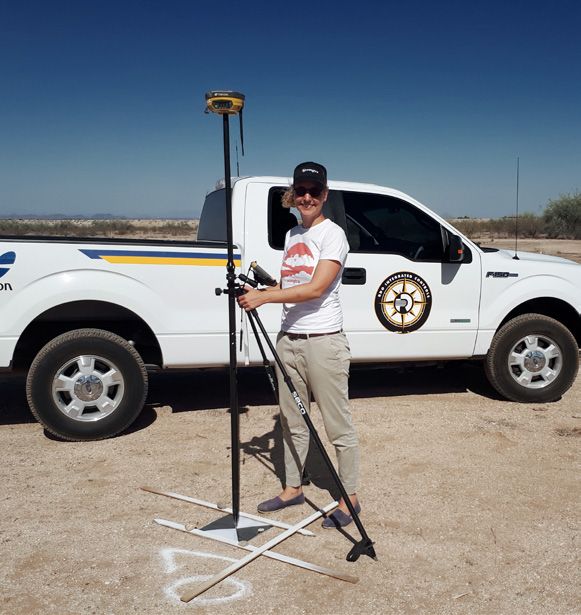
W I N GT R A W H I T E PA P E R

Accuracy tests in USA and Switzerland

Down to subcentimeter level accuracy                          ETH Zurich, Switzerland

No high coverage drone to date has ever been capable of       The ETH Zurich Honggerberg facility provided two unique
reaching subcentimeter level accuracy, and many experts       setups that were perfect for Wingtra‘s project:
were skeptical about these WingtraOne claims. Thus,
in order to verify them, Wingtra partnered with RDO           1. There was a continuously measuring GNSS station
Integrated Controls, one of the largest Topcon dealers and      that is part of the highly accurate Swiss national CORS
the largest Wingtra distributor in the US. In Switzerland,      network (swipos). It provided optimal correction data
Wingtra worked with ETH Zurich, one of the top science          for the PPK geotagging and allowed absolute position
universities in the world (Top universities, 2018).             determination at the centimeter level via GPS and
                                                                GLONASS.
To prove the 1 cm (0.4 in) accuracy claim, Wingtra nee-       2. The ongoing research in the field housed a high preci-
ded a measurement setup capable of measuring accu-              sion fixed point network that guaranteed 2 mm (0.08 in)
racies even below that. But as every surveyor will know,        horizontal and 4 mm (0.12 in) vertical absolute accuracy
it is just not that simple to get a global position with an     (Januth, Guillaume, 2018)!
accuracy in the millimeter range. The usual measurement
methods using a GNSS receiver in RTK mode are not             In this setting, the Wingtra team conducted 14 flights
precise enough. So how could Wingtra overcome this            62 m (203 ft) above home with a GSD of 0.7 cm (0.3 in). The
challenge?                                                    collected images and the raw measurements of the
                                                              onboard dual-frequency GNSS receiver were automa-
                                                              tically saved to the camera SD card after each flight.
                                                              Additionally   to   the   flight   data,   the    raw      GNSS
  i                                                           measurements of the continuously operating reference
       Test setup ETH Zurich, Switzerland                     station (CORS) at ETH were used to geotag the images in
       + 14 flights                                           WingtraHub on a centimeter level accuracy.
       + PPK correction using Swipos CORS network
       + Area: 7 ha (17.3 ac)                                 Because of the high precision fixed point network provided
       + Altitude above takeoff: 62-78 m (203-256 ft)         by ETH Zurich, the 14 projects could be compared to the
       + GSD: 0.8-1.0 cm (0.3-0.4 in)                         checkpoints at the accuracy of 2 mm (0.08 in). The ETH net-
       + Overlap: 80% | 80%                                   work was used to assess the difference to the point cloud,
       + 5 checkpoints                                        generated within Pix4Dmapper. On average over the 14
       + Checkpoint accuracy (horz/vert): 2/4 mm              flights, the root mean square (RMS) error of the checkpoints
           (0.08/0.16 in)                                     was 0.7 cm (0.3 in) horizontally and 2.6 cm (1 in) vertically
                                                              (values taken from a Pix4D quality report).

                                                                          SWIPOS station

       The fixed point network at ETH Zurich

  Honggerberg is so precise ( 2 mm / 0.08 in)

  that it is even sensitive to the movements

        of tectonic plates. Therefore they are

      established in a reference frame that is

      fixed to the European tectonic plate to                                                                                          3

             compensate for the movements.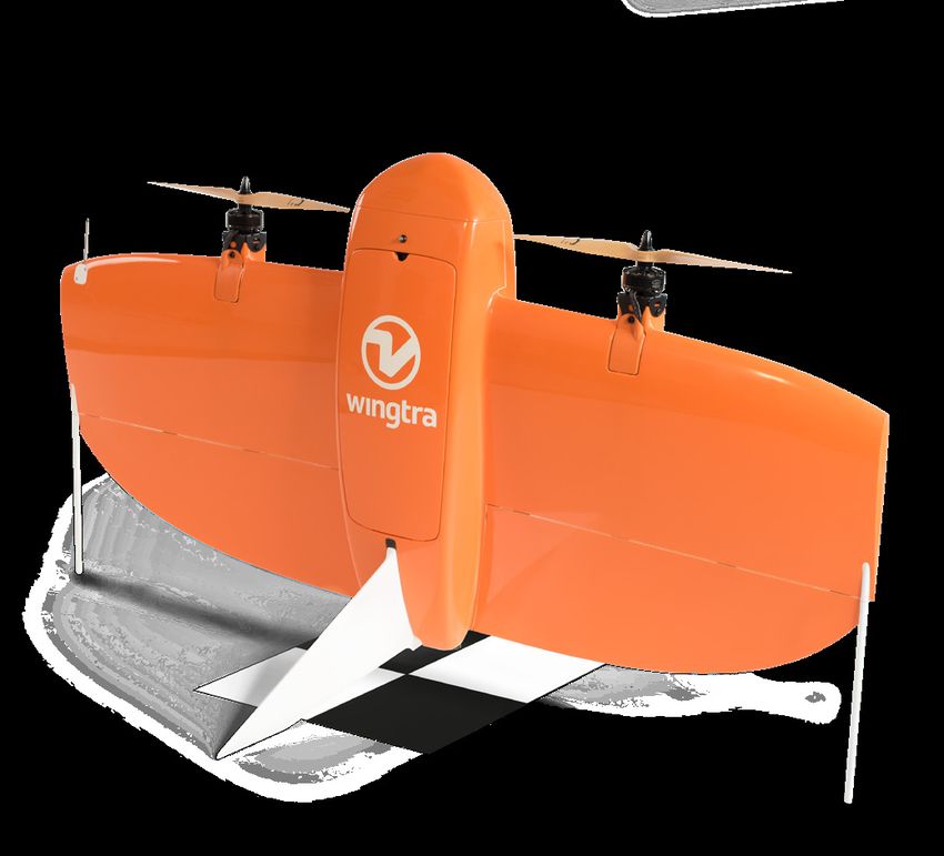
W I N GT R A W H I T E PA P E R

Phoenix, USA

In Phoenix, Arizona, Wingtra and RDO teams lacked
the high tech infrastructure available at ETH Zurich.
Therefore, an individual base station and highly accurate
checkpoints had to be installed manually.

Due to the sparse CORS network a HiPer V GNSS antenna
from Topcon was set out as the base station. It was
left on the field to log GNSS coordinates for more than
3 hours. The logged coordinates of the newly established
base station were later corrected using the US online
positioning user service OPUS, which ensures subcenti-
meter level accuracy (Ngs.noaa, 2018).

Another HiPer V GNSS antenna was used as an RTK
rover to establish 9 photogrammetric targets as check-
points. Their accuracy was measured in RTK mode using            A Topcon HiPer V GNSS antenna was used in the Arizona desert, enabling a

correction data from the local base station. These targets       centimeter accuracy comparison when testing the WingtraOne.

were used as checkpoints to evaluate centimeter level
accuracy of the maps generated by the Wingtra team.

In these circumstances, the images collected with the              i
WingtraOne were geotagged in the standard GNSS                         Test setup Phoenix, USA
coordinate system WGS84, using WingtraHub. Data was                    + 9 flights
post processed with Pix4Dmapper to create a point cloud.               + PPK with own base station
The same point cloud is the basis to create orthophotos or             + Area: 17 ha (42 ac)
digital surface models (DSM).                                          + Altitude above takeoff: 62 m (203 ac)
                                                                       + GSD: 0.8 cm (0.3 in)
On average over the 9 flights, the root mean square (RMS)              + Overlap: 80% | 80%
error of the checkpoints was 1 cm (0.4 in) horizontally and            + 9 checkpoints
2.5 cm (1.0 in) vertically. The value was taken from the Pix4D         + RTK accuracy
quality report generated for the point cloud.

     RDO Integrated

  Controls sells and

   supports positio-

  ning and surveying

    equipment from

     manufacturers

      including John

 Deere, Vermeer, and

    Topcon. With 78

locations across the

 United States, RDO

      is the biggest

        WingtraOne

   distributor on the                                                                                                                        4

        West Coast.
W I N GT R A W H I T E PA P E R

Results

+ Tests at ETH Zurich, Switzerland and Phoenix, Arizona                                         Number of         Horizontal        Vertical
     showcased that in optimal conditions, the WingtraOne                                       flights in        RMS error         RMS error
     drone consistently achieved an accuracy of 1 cm                                            dataset

     (0.4 in) and below. The very small standard deviation                    ETH Zurich        14                0.7 cm            2.6 cm
     value of 0.6 cm (0.2 in) shows that the high accuracy is                                                     (0.3 in)          (1.0 in)
     repeatable in every flight.
                                                                              Phoenix,          9                 1.0 cm            2.5 cm
                                                                              Arizona                             (0.4 in)          (1.0 in)
+ The millimeter-precision setup at ETH Zurich revealed
                                                                             Horizontal and vertical RMS (root mean square) values
     the best horizontal absolute accuracy result, which was
                                                                             illustrating absolute accuracy achieved with WingtraOne when
     0.7 cm (0.3 in).
                                                                             processing the aerial images without using GCPs. Detailed
                                                                             results can be found in the appendix.
+ The resulting horizontal and vertical RMS errors were as
     expected. These numbers lie within the general rule of
     thumb for accuracies in photogrammetry of horizontally
     1x GSD and vertically 2-3x GSD.

Such results have never been achieved with a high cover-
age fixed wing drone as to the best of our knowledge.

      3x higher absolute accuracy with WingtraOne

      Best accuracy achieved with the WingtraOne — 0.7 cm (0.3 in) 3

Table 1: Horizontal
   Accuracy    resultand vertical
                      with        RMS (root mean
                           the WingtraOne          square)
                                            in optimal     values illustrating
                                                       conditions  — 1 cm (0.4absolute
                                                                               in) 4   accuracy achieved with WingtraOne at ETH Zurich,
Switzerland and Phoenix, Arizona. Detailed results can be found on the appendix.

      Accuracy achieved with other fixed wing drones with 20 MP camera — 3 cm (1.2 in) 5

WingtraOne PPK with a Sony RX1RII sensor proved to repeatedly reach 1 cm (0.4 in) absolute accuracy in good conditions. The best
showcased result in optimal conditions was 0.7 cm (0.3 in). Based on the data of other drone providers, the result that other fixed wing drones
with 20 MP cameras reach in optimal conditions is 3 cm (1.2 in) in absolute accuracy.

3
    Horizontal RMS error over 14 test flights at ETH Zurich in Summer 2018. RMS error has a standard deviation of 0.5 cm (0.2 in) over all
    14 flights
4
    Horizontal RMS error over 9 test flights as measured in Phoenix in Summer 2018. RMS error has a standard deviation of 1 cm (0.4 in)
    over all 9 flights.
5
    Best possible results of other market leading drones with a 20 megapixel camera according to their manufacturer’s technical
    specifications.

                                                                                                                                                             5
W I N GT R A W H I T E PA P E R
Influencing factors
Distance to a static base station The accuracy of checkpoints
What happens when the conditions are not optimal? While mapping with the WingtraOne PPK, GCPs are not
Different scenarios showcased that with intervening needed to achieve high accuracy results. Instead the same
factors such as a long baseline —
being far away from a photogrammetric targets usually used for establishing
base station, the absolute accuracy might vary. As a rule GCPs are used as checkpoints to evaluate the achieved
of thumb — every 10 km (6.2 mi) in distance adds 1 cm accuracy of the drone.
(0.4 in) to the RMS error. Vertical accuracy suffers greater
effect than horizontal accuracy. In Wingtra‘s case, these checkpoints have to have a
subcentimeter accuracy. It is a very complicated task to
In case of a vertical baseline of more than 500 m (1640 ft), accurately measure checkpoints at this level, so how to
horizontal accuracy also becomes notably worse. achieve that? First of all, good photogrammetric targets
are needed. The marks should be fixed so that they do not
move from the time you measure them, until the flights are
The closer the base station, finished. They need to be placed on an open area to ensure
the better the accuracy that they are visible on as many images as possible. The
1 cm > 1 cm > 2 cm
marks should have high contrasting colors and a clearly
accuracy accuracy accuracy
defined center point.
If you have a highly accurate reference point close by
10 km (< 5 km (3 mi)), the checkpoints can be measured using a
tachymeter or through a differential GNSS measurement
20 km system (real-time or post processing). If no reference can
be established, long-term static GNSS measurements are
30 km
needed.
Absolute accuracy results decrease gradually when moving away
from the static base station. Rule of thumb — every 10 km (6.2 mi)
add 1 cm (0.4 in) to the accuracy
CORS Station Baseline Baseline RMS error RMS error
(swipos) (horizontal) (vertical) horizontal vertical
RMS errors of check points of an
ETH2 0 km 20 m 0.8 cm 2.6 cm
exemplary flight at ETH after geotagging
FRI3 33 km 112 m 0.9 cm 8.3 cm images with different base stations as
reference are compared to the horizontal
SCHA 38 km 24 m 1.6 cm 9.2 cm
and vertical distance between base
FALE 86 km 729 m 7.6 cm 11.8 cm station and flight area.
ZIM2 99 km 339 m 4.6 cm 12.2 cm
DAV2 121 km 1030 m 8.7 cm 13.0 cm
6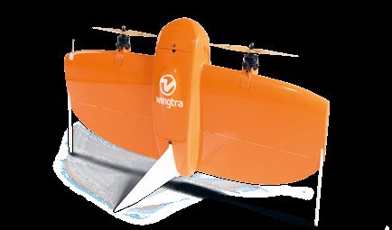
W I N GT R A W H I T E PA P E R

How you can achieve 1 cm (0.4 in) absolute drone
survey accuracy in your next mapping project
1. Use WingtraOne PPK drone with a Sony RX1RII payload                4. Always use a high quality survey grade base station
WingtraOne PPK is the only broad coverage drone to date               When setting up a new base station on an unknown point
to have achieved subcentimeter (0.4 in) absolute accuracy             let the GNSS receiver log the GPS data for a couple of
results.                                                              hours, or even better, overnight. Logging GPS data for lon-
                                                                      ger periods will help ensure higher accuracy results.

                                                                                                                  3 h+

                                                                      When establishing a new base station, log GPS data for at least a

                                                                      couple of hours

2. Be aware of the distance to a base station
The achievable absolute accuracy depends on the                       Note that if a new base station is established on a known
correction data derived from the static base station                  point, the results depend on how accurately the point was
logging. The closer a base station is to the flight location,         measured before.
the better the corresponding correction data will be to the
onboard GNSS logging of the WingtraOne.                               Important! Don‘t forget to check minimum base station
                                                                      requirements, which are:
When using a continuously measuring GNSS station,
make sure it is close enough. The accuracy results will               + Possibility of continuous logging with logging interval
reduce gradually the further you are from the station. Rule             of 15s or faster (1s is recommended for the highest
of thumb — every 10 km (6.2 mi) adds 1 cm (0.4 in) to the               accuracy)
RMS error.                                                            + Logging at least two frequencies L1 and L2.
                                                                      + Receiving Constellations GPS + GLONASS (optional for
In case the GNSS station is further away, use your own                  high precision).
base station.
                                                                             L1 & L2
3. Be aware of elevation influence                                           GPS, GLONASS
A long baseline most of all affects the vertical accuracy. In
the case of a height difference between base station and              Your base station should log both L1 and L2 frequencies and receive

surveying area of more than 500 m (1640 ft), accuracy                 data from GPS and GLONASS

becomes significantly worse. Take that into consideration
when planning your projects.
                                  > 1 cm (0.4 in)

            1 cm (0.4 in)
                                          500 m
 0m

In case of more than 500 m (1640 ft) elevation difference, accuracy
will be worse

                                                                                                                                                     7
W I N GT R A W H I T E PA P E R
5. Establish checkpoints to prove the accuracy to your 6. Be careful with different coordinate systems
customer
WingtraOne images can be geotagged in any earth-
centered, earth-fixed coordinate system such as WGS84.
When a local projected coordinate system is desired as an
output, the transformation can be performed either in the
postprocessing toolchain or externally using a conversion
tool suitable for the desired coordinate system. Be awa-
re that the final results in local coordinate systems are
only as good as the provided conversion tools to the local
To ensure bulletproof accuracy evaluation, make sure that your coordinate system.
checkpoints are measured precisely
Y
When measuring your checkpoints, make sure to use
an RTK or PPK GPS receiver. Common products include
Trimble or Leica brands. Using any device other than an
RTK or PPK GPS receiver will compromise the accuracy.
X
Remember to place the tip of your GPS receiver directly on
the center of the control point marker. Make sure to cali-
brate your GPS receiver to be level with the ground. Follow
Z
the instructions on the system provided by the measure-
ment device manufacturer. Use a tripod to make sure the
receiver is stable and does not move during the measure-
Earth-centered, Earth-fixed coordinate system
ment process.
Transformation might
introduce errors
Y
Y
X
X
Z
Projected coordinate system
Transforming final results from one coordinate system to another
might introduce some errors. Be aware that the final results in local
coordinate systems are only as good as the provided conversion
tools.
8W I N GT R A W H I T E PA P E R
Stay in the clear and avoid obstacles that could obstruct the GNSS signals
add. 7. Environmental obstacles might block the GNSS satellite signal to your GNSS receiver. Such interference would have a negative impact
on your accuracy results. Be aware of that when planning your projects in valleys, canyons or next to tall buildings.
7. Avoid environmental obstacles
The GNSS satellite signals can be blocked by large
obstacles such as tall buildings, mountains or trees.
Therefore when using GNSS as a surveying method, care-
fully choose locations where the surrounding environment
does not shelter your receiver from the satellite signals.
8. Contact us
If you have any questions about planning your next
project, contact Wingtra team on support@wingtra.com
and we will make sure to help you out!
9W I N GT R A W H I T E PA P E R
Appendix
Table 1: Results of an exemplary flight at ETH Zurich, Switzerland (flight5). Error of checkpoints relative to the point cloud processed in Pix4D
without using GCPs.
Checkpoints Error X Error Y Error Z
Checkpoint 1 0.0 cm -0.1 cm 1.4 cm
Checkpoint 2 -0.4 cm -0.5 cm -2.0 cm
Checkpoint 3 -0.6 cm -1.0 cm -2.2 cm
Checkpoint 4 0.0 cm 0.7 cm -3.2 cm
Checkpoint 5 -0.6 cm -0.5 cm -3.5 cm
Mean -0.31 cm -0.28 cm -1.90 cm
Sigma 0.27 cm 0.57 cm 1.74 cm
RMS 0.41 cm 0.64 cm 2.58 cm
RMS horizontal/vertical 0.76 cm 2.58 cm
Table 2: Comparison of point cloud to check points. Average over all 14 flights at ETH Zurich, Switzerland.
Average of 14 flights X Y Z
Mean 0.26 cm 0.50 cm -2.09 cm
Standard deviation 0.24 cm 0.31 cm 1.50 cm
RMS 0.36 cm 0.63 cm 2.68 cm
RMS XY/Z 0.73 cm 2.68 cm
10W I N GT R A W H I T E PA P E R
Table 3: Results of an exemplary flight in Phoenix, US (flight 7). Error of checkpoints relative to the point cloud processed in Pix4D without using
GCPs.
Checkpoints Error X Error Y Error Z
Checkpoint 1 0.0 cm -0.9 cm 2.7 cm
Checkpoint 2 1.0 cm -0.4 cm 2.6 cm
Checkpoint 3 1.6 cm 1.1 cm 1.6 cm
Checkpoint 4 -0.6 cm 1.0 cm 2.3 cm
Checkpoint 5 -0.7 cm 0.6 cm 2.2 cm
Checkpoint 6 0.5 cm 0.1 cm 1.2 cm
Checkpoint 7 0.4 cm 1.0 cm 2.3 cm
Checkpoint 8 -0.8 cm 0.7 cm 1.0 cm
Checkpoint 9 0.7 cm -0.4 cm 3.1 cm
Mean 0.23 cm 0.31 cm 2.09 cm
Sigma 0.77 cm 0.68 cm 0.65 cm
RMS 0.80 cm 0.75 cm 2.19 cm
RMS XY / Z 1.10 cm 2.19 cm
Table 4: Comparison of point cloud to check points. Average over all 9 flights in Phoenix, US.
Average of 14 flights X Y Z
Mean 0.22 cm 0.23 cm 2.16 cm
Standard deviation 0.68 cm 0.61 cm 1.07 cm
RMS 0.74 cm 0.68 cm 2.45 cm
RMS XY/Z 1.02 cm 2.45 cm
11You can also read