YALLOCK-BULLUK MARINE AND COASTAL PARK DRAFT ACCESS AND INFRASTRUCTURE PLAN - Version C_March 23 2021 - Parks Victoria
←
→
Page content transcription
If your browser does not render page correctly, please read the page content below
YALLOCK-BULLUK
MARINE AND COASTAL PARK
       DRAFT ACCESS AND
   INFRASTRUCTURE PLAN

                   Version C_March 23 2021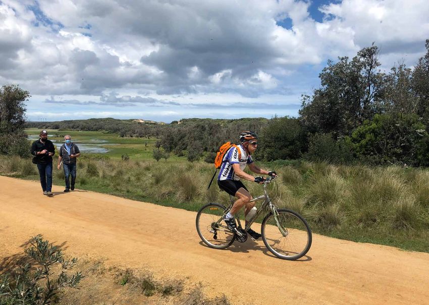
Hassell
                     61 Little Collins Street
                     Melbourne VIC
                     Australia 3000
                     hassellstudio.com
                     @hassell_studio

Prepared For

2   Yallock-Bulluk Marine and Coastal Park Access and Infrastructure Plan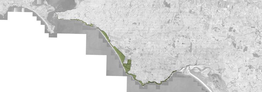
TABLE OF CONTENTS

Table of Contents                            3    Chapter 3 - Draft Access and Infrastructure 47
Acknowledgements                             5    Plan
Welcome to Country                           6    Park infrastructure and Services            48
Connecting with Country                      7    Park Experience                             50
Chapter 1 - Setting the Scene                9    San Remo                                    52
Introduction                                 10   Kilcunda                                    54
Purpose                                      14   Powlett River                               56
The creation of a new park                   16   Wonthaggi West                              58
Project Vision                               18   Wonthaggi South                             60
AIP Objectives                               19   Harmers Haven                               62
Stakeholder Engagement                       20   Cape Paterson                               64
Chapter 2 - Design Strategies                25   Bunurong Coastal Drive                      66
Caring For Country - Culture and Heritage    28   Inverloch                                   68
The Strata of Time                           30   Wonthaggi to Inverloch Inland Route         70
Caring For Country - Environment             32   Chapter 4 - Draft Access Infrastructure     73
Understanding Coastal and Marine Processes   34   Park Infrastructure Supporting Facilities   74
Access to Country - Loops and Journeys       36   Car Park Upgrade Shack Bay                  76
Trail Network                                37   Car Park Upgrade The Caves                  77
Journey Options                              38   Along the way - Trail Nodes                 78
Access to Experience                         40   Park Infrastructure Kit of Parts            90
Park Supporting Services                     42   Park Infrastructure Trail Design            80
Accessibility and Track Grading              44   Bunurong Coastal Drive Trail Options        82
                                                  Appendix 1 - Supporting Studies             85
                                                  Trail Grading Analysis                      86
                                                  Appendix 2 - Benchmarks and Precedents 93
                                                  Three Capes Track                           94
                                                  Copper Coast Geopark                        95
                                                  Park Infrastructure Precedents              96

                                                                                                   Yallock-Bulluk Marine and Coastal Park Access and Infrastructure Plan   3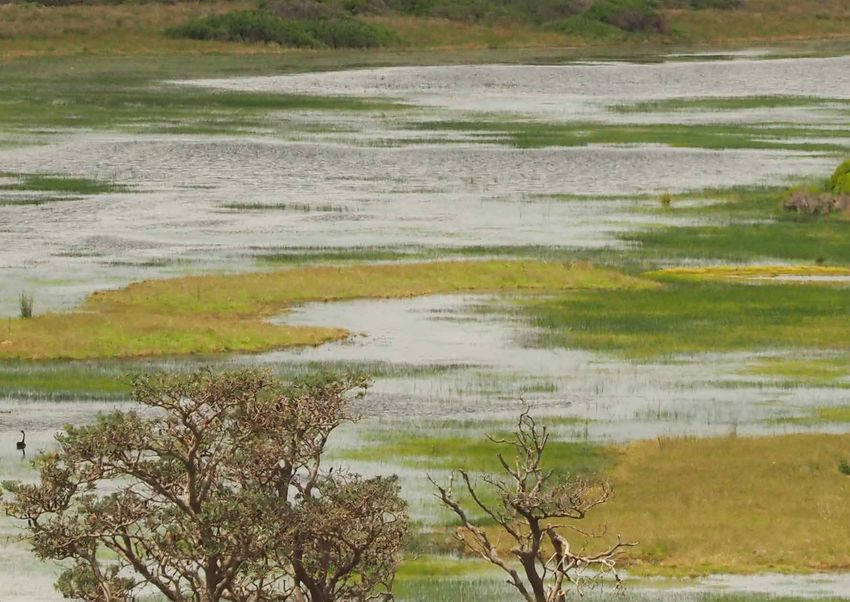
4 Yallock-Bulluk Marine and Coastal Park Access and Infrastructure Plan
Acknowledgement to Country

We pay our respects and acknowledge Bunurong ancestors, Bunurong
elders, the Bunurong community and to our community who call
Bunurong Country their home. Our land and waters are our home, it is
our cultural landscape that we work towards protecting and preserving
for our next generation and for all people on Bunurong Country to value
and appreciate. It is a landscape that we connect with our ancestors and
nurture our spirits.

                              Yallock-Bulluk Marine and Coastal Park Access and Infrastructure Plan   5
WELCOME TO COUNTRY
                                                                            Respects are given.
                                                                              Welcomes are made.
                                                                                To those now passed in earth they
                                                                                  lay.
                                                                                    Step gently upon these graves
                                                                                       and the spirits shall guide you,
                                                                                        They will keep you safe,
                                                                                       You will travel across land to
                                                                                    Where waves are made.
                                                                                   Where feasts were once eaten
                                                                                 Where old middens lay.
                                                                               This sacred place in which our past
                                                                             remains.                         Poem by
                                                                                                              Darrel Gibbs
                                                                                                              The illiterate poet.

6   Yallock-Bulluk Marine and Coastal Park Access and Infrastructure Plan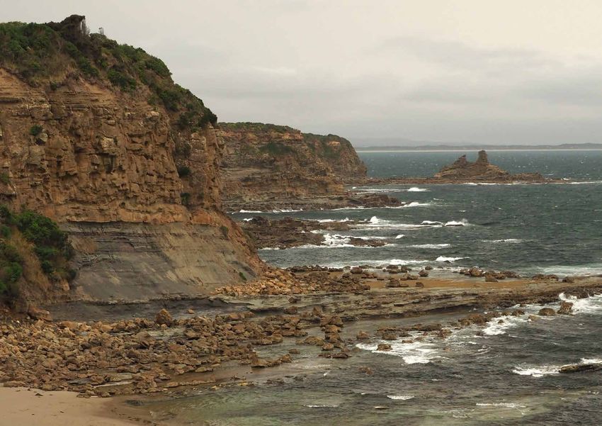
CONNECTING WITH COUNTRY

Country is living, constantly changing, and evolving.
Country is not only the actual physical land, soil or rock,
                                                              Traveling the Coast                                      The YBAIP enables connection to the cultural and
                                                                                                                       natural values of the park by:
that can be stepped upon. Country rather describes
the connection between all living and material entities       Travel routes, thousands of years in use, connect the    ‒ Providing access to information through signage
that together form the landscape, including biological,       various ceremonial places, living places and sacred      ‒ Providing access to information through
geomorphological, hydraulic, and even climatic systems        places along the Bass Coast. Weaving between ocean         interpretation and inclusion of narratives into
and processes.                                                break - even beyond over land now submerged, along         built form, such as lookouts, shelters, rest stops
It includes the person that visits, walks, rides or lives     waterways and rivers, and across wetlands teeming          [trailheads and trail nodes] and furniture.
here.                                                         with life. Through sand, forest and scrub.               ‒ Respecting and engaging with the values that
Country describes a tight and symbiotic relationship          When traveling, groups consisting of elders and young,     Bunurong people share with the broader
between human and landscape, one that is respectful,          would use resting times and locations to spin a yarn,      community.
loving and responsible. This relationship goes both           tell a story, teach some knowledge.
ways.                                                         Today, when taking those routes, ‘yarning circles
Country is culture.                                           and places’ along the various routes could provide

                                                                                                                                                                                                                      sky
Bunurong people have developed a deep                         opportunities to engage with nature, oneself or fellow
understanding of, and a caring relationship to Country        walkers.
- and invite non-aboriginal visitors to engage with this
relationship and to join becoming a fellow custodian of
the land.
The Yallock-Bulluk Marine and Coastal Park Access and
Infrastructure Plan [YBAIP] can explore how a deeper
connection between land and visitor can be achieved,
through the creation of awareness and understanding,
                                                                                                                                                        Earth
through the development of opportunities of active
engagement.
The Bunurong Land Council Aboriginal Corporation

                                                                                                                       Sea
are working actively with Parks Victoria and DELWP
to establish shared roles and responsibilities in
management and curation of the park.

                                                                                                                                                                              Yallock-Bulluk Marine and Coastal Park Access and Infrastructure Plan   7
8 Yallock-Bulluk Marine and Coastal Park Access and Infrastructure Plan
CHAPTER 1
SETTING THE SCENE

        Yallock-Bulluk Marine and Coastal Park Access and Infrastructure Plan   9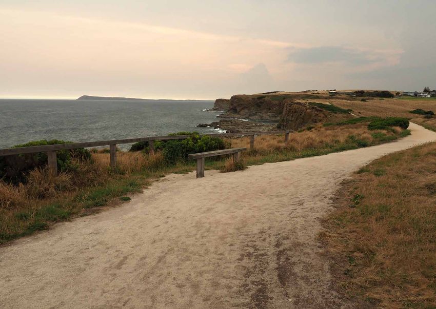
INTRODUCTION

The Bass Coast is located                                         The Site                                                   The Setting
a 90 minute drive from                                            Dramatic cliffs give way to sandy beaches and, at low
                                                                  tide, rock shelves expose a diverse intertidal marine
                                                                                                                             For many thousands of years the Bass Coast has been
                                                                                                                             home to the Bunurong people. Rich hunting grounds
Melbourne and offers                                              scape of pools, seagrass beds and an abundance of
                                                                  marine life.
                                                                                                                             along the coast, in the water, and on land supported
                                                                                                                             settlements such as the large village near San Remo,
some of Victoria’s most                                           Lookouts at coastal formations such as the iconic Eagles   recorded in 1826 as a settlement of 50 to 100 huts.

visited and internationally                                       Nest rock stack provide extensive views along the
                                                                  dramatic Bass Strait coastline, and offer opportunities
                                                                                                                             Large shell middens and the many sacred sites, places
                                                                                                                             and artefacts along the coast are powerful reminders
recognised tourism                                                for wildlife watching. Whales can be seen close to the
                                                                  coastline on their annual migrations during winter and
                                                                                                                             of a human history within these landscapes.
                                                                                                                             With its unique natural reserves and extensive fertile
destinations, including                                           early spring.
                                                                  The rugged cliffs and headlands that were formed
                                                                                                                             agricultural land the Bass Coast shire area is recognised
                                                                                                                             as a unique place of environmental significance where
Phillip Island and its                                            around 95 million years ago are famous for the rich        a tranquil lifestyle is paired with strong economic
Penguin Parade. The                                               inclusion of fossil finds of national significance.
                                                                  The coastal headlands form a dramatic backdrop for
                                                                                                                             growth based on tourism, agriculture, manufacturing,
                                                                                                                             and residential development. Bass Coast Shire aspires
coast continues east with                                         water based recreational activities such as surfing,
                                                                  kayaking, fishing and boating that occur along the
                                                                                                                             [Bass Coast Shire Council Strategic Hierarchy 2016] to
                                                                                                                             be recognised as:
another natural highlight,                                        protected bays. The townships like San Remo, Kilcunda,
                                                                                                                             ‒ A celebration of natural assets;
the inspiring wilderness of                                       Cape Paterson and Inverloch are popular destinations
                                                                  during the summer months.                                  ‒ A window on the history of Victoria;

the Wilsons Promontory                                            The land is covered with a fragile layer of sensitive
                                                                  vegetation, hardy enough to withstand the raw coastal
                                                                                                                             ‒ A village in a technology world; and
                                                                                                                             ‒ A food bowl for Victoria.
National Park with South                                          processes, yet vulnerable to human impacts, and
                                                                  changing climatic conditions. Many of the present flora
                                                                                                                             The Yallock-Bulluk Marine and Coastal Park has other
Gippsland on its doorstep.                                        and fauna communities are listed as endangered and
                                                                                                                             associated active government work that is relevant to
                                                                                                                             the overall planning. This planning may continue to
                                                                  vulnerable.                                                be influenced by and responsive to these associated
                                                                                                                             projects and include the Distinctive Area Landscape
                                                                                                                             work, new school location, Cape to Cape Resilience
                                                                                                                             Project (Inverloch Regional and Strategic Partnership)
                                                                                                                             for coastal processes at Inverloch, and future road
                                                                                                                             changes.’

10   Yallock-Bulluk Marine and Coastal Park Access and Infrastructure Plan
Melbourne Yarra Ranges National
Park
Pakenham
Longford
M1 Prin
Geelong cess Hig
Frankston hway
M 420 Trafalgar
Port Phillip Bay
Tarra-Bulga
Queenscliff
National Park
Western Port Bay
French Island Nyora
Hastings
M
Hig 440
hw Gip
ay psl
an
d
Phillip Island
Cowes Leongatha
B460
San Remo
REGIONAL ACCESS MAP Anderson
Major Road Connection Wonthaggi
Inverloch
Road Connection Cape Paterson
Legend
Ferry Route REGIONAL ACCESS MAP
Regional Access Major Road Connection REGIONAL ACCESS MAP
V/Line
The Bass Coast Coachfrom Phillip
stretches Road Connection
Major Road Connection
Island in the west to Andersons Inlet Route
Ferry
Existing
and Inverloch to theRail
east.Trail
It is located
V/Line Coach
Road Connection
Wilsons Promontory Ferry Route
approximately 100km from Melbourne Existing Rail Trail
Proposed Rail Trail Proposed Rail Trail National Park V/Line Coach
and is well connected via the South
GippslandProject
FreewaySite
and Bass Highway.Project Site
Tidal River
Existing Rail Trail
Public transport connects Melbourne Coach Destinations Proposed Rail Trail
Coach Destinations
with all townships including Cowes, Coach Stops on Site
Project Site
National Parks
San Remo, Kilcunda, Wonthaggi and Coach Destinations
Inverloch.Coach Stops on Site Coach Stops on Site
0 10 20 30 40km
National Parks National Parks
Yallock-Bulluk Marine and Coastal Park Access and Infrastructure Plan 11The Project The Brief The project will resolve:
As part of the $105.6 million ‘Victoria’s Great Outdoors’ The access and infrastructure plan [AIP] will design a ‒ Trail alignment;
initiative, the Victorian Government is creating the complete walking and cycling trail connecting the 40km ‒ Trail interface with townships and the establishment
Yallock-Bulluk Marine and Coastal Park [YBMCP]. It will of coastal landscapes between San Remo and Inverloch of trailheads including carparking and amenities;
combine existing parks and reserves along 40km of and providing improved visitor amenities to better
coast from San Remo to Inverloch. ‒ Trail infrastructure such as resting, viewing and
engage with attractions along the coast. access to attractions including the detailed
The Yallock-Bulluk Marine and Coastal Park is created The AIP focuses on the trail and associated visitor
under the National Parks Act to improve environmental development of bridges, boardwalks, beach access,
experience infrastructure. It is the first step toward seating and viewing points;
protection along the sensitive coast and is set to establishing a marine and coastal park that will:
protect and enhance the land and waterscapes along ‒ Delivery and maintenance strategies; and
the coastline between San Remo and Inverloch, ‒ Reposition the existing and proposed experiences ‒ Construction budget estimates to support the
to improve access to these landscapes, providing into an attractive destination; delivery on ground.
opportunities for all ability users and visitors to engage ‒ Diversify the number and type of visitors attracted to The project further identifies additional opportunities
with the natural and cultural values, stories and visit the coast; for linkages, destinations and improvements to existing
features of the coast. ‒ Provide a diverse range of experiences for visitors to assets, which are beyond the extent and scope of the
The park’s name honours the Yallock-Bulluk Clan of the enjoy; YBAIP.
Bunurong People whose Country spans across the park
areas. Yallock translates to ‘river’ and Bulluk to ‘swamp’ ‒ Curate the experiences into a cohesive regional
- a reference to the landscape characteristics of the offering that supports the Bass Coast visitor
region. economy;
Whilst the park’s proposed boundaries are based ‒ Invite visitors to spend more time and extend each
on consolidating individual reserves and parks, it is stay in the region and by effect - increase the visitor
expected that further land acquisition over time in spend to support direct and indirect benefits.
strategic locations will assist in achieving the vision for A second focus of the plan is to understand how the
the park. park may evolve over time through the influences and
The core objective of the project is to invite a wide relationships with its adjacencies.
variety of different visitors to spend time in the region, The new park will both influence and be influenced by
enjoy its produce and experiences and contribute to a range of dynamic factors and variables that include
the local economies. In exchange, the new park status the natural changes that shape the coast; the way
is better placed in protecting the very natural and that the local villages and towns interface with the
cultural values that visitors come to enjoy. park; and the evolution of existing and creation of
new services and businesses that will grow around the
experiences that are created.
12 Yallock-Bulluk Marine and Coastal Park Access and Infrastructure PlanThe George Bass Coastal Walk is popular amongst
walkers
Yallock-Bulluk Marine and Coastal Park Access and Infrastructure Plan 13PURPOSE
promote travel [like trail running events or exhibitions].
In recent years Gippsland has undergone significant structural changes to sector investment and diminished innovation in
the diversification and modernisation of the visitor Demand drivers act as anchors for other tourism
its economy. These changes have resulted in profound flow-on effects to experience sector. investment including in accommodation, hospitality,
the region including significant negative impacts to employment and the Gippsland is a truly spectacular and unique part of retail and other attractions that cannot attract visitors
to travel in isolation. The clustering of activities and
region’s communities. Victoria, with a diverse landscape characterised by
mountains and valleys, bays and beaches that are attractions and the development of tourism routes are
supported by a rich network of touring routes. vital components of effective tourism development.
Unlocking the potential of these destinations and
Caring For Country ‒ Wonthaggi Heathland Nature Conservation Reserve; experiences into a cohesive offering presents a great Unique Offer
‒ Punchbowl Coastal Reserve; and opportunity to make this part of Victoria a year-round The YBAIP and its associated trail network offers unique
Human habitation and custodianship of the coastal draw card for domestic and international visitors, and
and marine landscapes has occurred over millennia. ‒ Parts of San Remo, Kilcunda and Cape Paterson opportunities compared to other trail experiences
Foreshore reserves. just a short drive from Melbourne. across Australia. Typically walking trails in Australia
This continues today. The recognised Traditional
Owners of this Country and Sea Country, the Bunurong, are located wholly within national parks and far from
have managed the lands, and the water, in a deep The consolidation of these reserves and parks into a Bushfires and COVID 19 towns. The proposed trail will deliberately link through
relationship and understanding of its flora, fauna, single marine and coastal park allows better protection The devastating bushfires of the summer 2019-2020 the towns and rural settings of the area to provide
landforms and water bodies. of their environmental values, including threatened season had substantial impact on life in regional a unique and engaging experience. Nature will be
Traditional Owners are represented as key project ecologies and habitat such as Coast Banksia Woodland. Victoria, not only destroying invaluable habitat celebrated, as well as the history and culture of the
partners through the Bunurong Land Council Aboriginal The protection of environmental values extends onto and natural systems, but also destroying lives and area’s communities and agricultural landscapes.
Corporation [BLCAC]. the extensive intertidal rock platforms, such as Twin businesses, mostly depending on income generated Visitors can immerse themselves in nature but also
This project bears the opportunity to strengthen the Reefs, which are rare along the Victorian coast. The through tourism. stop in the region for high-quality accommodation,
close relationship of Indigenous communities to their range of species and biological communities, their The COVID 19 pandemic has highlighted the shopping, connected experiences [such as historic
lands, securing and growing roles and responsibilities, relatively undisturbed condition and the occurrence of importance of locally available open space and sites, cellar doors or markets], and hospitality. For the
as well as economic opportunities for the indigenous less common habitat types makes both the intertidal recreational opportunities. Whilst it is not yet fully communities of the Bass Coast, this means that existing
community. This role may extend to shared land and subtidal areas highly valuable as a natural understood what implication the pandemic will have and new businesses are capturing a more significant
management services, opportunities to arrange resource. on international travel and tourism in Australia, it is share of tourist expenditure.
cultural events and ceremonies, and sharing knowledge Through carefully curated improvement of access and certain that local and regional demand for nature The proposed trail will offer a new type of experience
with the broader local and visiting communities. amenities within the park, a balance can be achieved based recreation will increase in the interim. in the Victorian market. This will ensure that the trail
between the protection, and in fact, increase of will complement and enhance Victoria’s offer and
Environmental Protection environmental value of the project area whilst at the Visitor Economy create new demand.
same time catering for the increased visitation demand Critically, the trail will be accessible to all income
The new park will create a connected ecological and changing visitor uses. The proposed trail and its associated infrastructure can groups, ages and fitness levels through the multitude
corridor between San Remo and Inverloch by add significant value to the region and Victoria. of entry and exit points. People can have a luxury
The trail can leverage existing natural and cultural
amalgamating the following parks and reserves under
schedule 3 of the National Parks Act:
Contextual assets to attract tourists in search of new, authentic
experience with high-quality accommodation and
excellent food and wine, or camp and bring their own
As the region’s traditional industries provided strong experiences. Visitors that come to experience the park supplies for a budget option. The target market for
‒ Bunurong Marine Park; employment and underpinned the economy for much are likely to expand their activities into townships and the trail is therefore vast, due to the ‘choose your own
‒ Bunurong Coastal Reserve; of the 20th century, the visitor economy received little surrounding tourism offer. adventure’ experience on offer.
‒ Kilcunda-Harmers Haven Coastal Reserve; investment or attention during this period. The trail can act as a demand driver. Demand drivers
The resultant lack of public investment in the visitor can create and encourage visitation to a destination
economy was compounded by waning private and are ‘must-see’ attractions or host activities that
14 Yallock-Bulluk Marine and Coastal Park Access and Infrastructure PlanBenefits Retail Community based
The trail and its associated attractions can attract Landcare Programs
There are many benefits to the trail. The trail will seek further investment from the private and public sector,
Bunurong Cultural
to: Food and Beverages Events and Ceremonies
and can increase visitation to Bass Coast matching
‒ Enhance the visitor experience; that of Victoria into the future. This could result in an
estimated increase of day visitors by the year 2035 Shuttle Services and
‒ Protect and conserve natural and cultural heritage Transport
by an additional 232,000 visitors per annum, and
values; Local Produce
overnight stays may increase by 400,000, boosting local
‒ Increase visitation across the year (into shoulder and economy. The predicted growth equates to an increase Bike Rentals
off-peak times); of 12.7 and 12 per cent respectively.
‒ Encourage more people to visit the outdoors and be
active; The project aims to establish narratives and Accommodation Fossil Tours
‒ Encourage flow-on private investment through the experiences around the cultural, natural, heritage
demand for accommodation, food and beverages, and geological values of the region. This strategy
and retail; can assist to link to broader initiatives by various
‒ Deepen, broaden and amplify the brand profile of agencies including local and state government bodies. Historical Tours Temporary Arts
the region; As a result, a holistically curated visitor experience Events
within the Bass Coast region could be established and
‒ Provide new recreational opportunities for the local
assist in the establishment of a geopark, which as a
population;
globally established tourism offer blurs the boundaries Cultural Events and Re-Vegetation
‒ Generate employment pathways for younger between park, farmland and urban spaces in creating a Markets Programs
residents; coherent, branded visitor experience.
‒ Allow for the development of a network of Running and Cycling
Events School and
attractions and commercial partnerships; and Education Camps
‒ Through the above, ultimately to connect people Geo-Caching
back to Country, re-establishing the links of
awareness, care and responsibility.
The number of people visiting the region, along with
the length of time spent per visit, can increase because
of the development of the trail and its positioning as
an iconic visitor attraction for the Bass Coast.
Similar trails around Australia attract around 50,000-
60,000 visits each year. The trail network may expect
similar visitation in the medium term (3-10 years after
development). In addition, 27 per cent of the Latrobe-
Gippsland population are interested in bushwalking
and would also use the trail network. Economic Spin-off opportunities of the YBAIP
One of the core elements of the trail is its contribution The trail and its associated infrastructure provide opportunities for the public and private sector to
as an anchor and stimulus for the broader tourism offer connect with the park and its users. The above shows some of these connection options.
in Bass Coast, growing regional visitation in total.
Yallock-Bulluk Marine and Coastal Park Access and Infrastructure Plan 15THE CREATION OF A NEW
PARK
way h
Bass Hig
Phillip Is
land Roa
d
The Yallock-Bulluk Marine and Coastal Park is created by the
amalgamation of various existing coastal parks and reserves,
managed currently by state or local governments. Some
other sections of Crown land are currently managed by
committees of management.
Land acquisition of private land in strategic locations for the
park over time is considered to enhance connectivity of the
various reserves and trail network.
Wonthaggi Heathland Nature
Conservation Reserve
Kilcunda Kilcunda - Harmers Haven
San Remo Foreshore Punchbowl Foreshore Coastal Reserve
Reserve Coastal Reserve Reserve
Legend
YBMCP Extents
Existing Parks and Reserve Boundaries
1 2 3 4 5 km
16 Yallock-Bulluk Marine and Coastal Park Access and Infrastructure PlanBass Highway
Bunurong Coastal Reserve
Road
Cape Paterson
Coastal Reserve
k
-Kongwa
Inverloch Foreshore
Reserve
Inverloch
Bass Hig
hway
d
Berrys Roa
Ca
pe
Pa
ter
so
n
Yallock-Bulluk Marine and Coastal Park Access and Infrastructure Plan 17PROJECT VISION
Vision Design Response
The trail and associated infrastructure through the
To create a unique, site responsive visitor Yallock-Bulluk Marine and Coastal Park will be
experience through the design of a quality trail recognised as a centerpiece of the new marine
and associated infrastructure that will highlight and and coastal park and a wonderful multi-day
accentuate the coastal environment and significant route for visitors to the Bass Coast. The trail
natural features and cultural values of the site. invites people to slow down and connect with
the coast's rich natural and cultural landscapes
Parks Victoria Design Brief 2019 and to engage visitors in a rewarding regional
experience focused in and around the local
villages and towns.
18 Yallock-Bulluk Marine and Coastal Park Access and Infrastructure PlanYBAIP OBJECTIVES
The following five objectives inform the translation of the brief to the
design process and have been identified as:
Culture and Experiences Environment Access and Operations
heritage movement and
management
‒ Design and plan for a park
‒ Conserve and recognise culturally ‒ Raise the profile and positioning ‒ Conserve, protect, repair and ‒ Optimise accessibility of the trail
boundary that may change over
significant sites of Aboriginal and of the experience with the trail enhance the park's natural values. by connecting it to the broader
time with the park boundary being
European heritage. as the center piece of the visitor ‒ Connect and link the park's coastal road network and public transport
augmented.
‒ Through design reflect the experience. and marine natural systems to options.
‒ Leverage the trail's proximity and
knowledge systems, values and ‒ Connect the trail to the existing amplify and leverage a broader ‒ Improve connections of townships
relationship to each town for
beliefs of the Traditional Owners to visitor experience network of trails, environmental improvement with the park through better
supporting services, management
enrich the visitor experience. services and products to support a program. linking pathways and defining
and operational needs.
‒ Through the AIP and associated range of links, loops and journeys. ‒ Consider the trail's setting as one borders.
‒ Develop the rural and coastal land
services - create new opportunities ‒ Design to enable the network of part of an integrated landscape and ‒ Provide defined entry points into
relationship to leverage benefits
for the Bunurong people for experiences to evolve, expand and environmental system. the park [trailheads].
and services for the park and
cultural, social and economic grow over time. ‒ Enable the engagement of landcare ‒ Enable growing visitor numbers townships.
benefits. ‒ Curate an intuitive and immersive groups and other not for profit to engage with the park and its
‒ Implement the access and
‒ Harness local pride and productivity interpretative and education organisations to connect to the attractions.
infrastructure plan in a phased,
to connect the trail experience to experience along the trail through a park. ‒ Create and build on a series of trail managed and sustainable way that
its regional surrounding offer. variety of communication channels. ‒ Explain the coast’s significance and network connections establishing enables it to evolve.
‒ Consider the characteristics of the ‒ Take a whole of landscape enable people to engage with its loops and choices for trails of
‒ Design for the long-term and
park that may elevate its attraction approach. values. various lengths and difficulties.
consider capital expenditure
to local and broader communities. ‒ Promote the hinterland’s farming ‒ Provide access to the natural ‒ Enhance access for all abilities to with ongoing maintenance and
heritage, scenic values, landscape, values of the land, both the living key attractions of the park. operations costs.
ecologies and cultural landscape. environments and the geological ‒ Identify trails through the trail ‒ Develop a clear identity and
‒ Appreciate each town’s nature, foundations. grading system to communicate marketing strategy for the park and
character and identity through ‒ Design for visitation which level of challenge to visitors. its attractions.
authentic local experiences. mitigates impacts on the parks’ ‒ Develop a comprehensive signage ‒ Collaborate with partners and
ecology and cultural values. and wayfinding strategy to engage with stakeholders regarding
improve on access to information connected tourism experiences.
in the park.
Yallock-Bulluk Marine and Coastal Park Access and Infrastructure Plan 19STAKEHOLDER ENGAGEMENT
The access and infrastructure plan is informed by The comments have been grouped according to Access and movement Key Findings
stakeholder
“exploring with and
my dogcommunity
on leash” engagement, alongside a
Trail features
the five themes of project objectives: Access and This theme addresses the actual infrastructure that is
range
- survey ofrespondent
technical studies. Movement; Experiences; Culture and Heritage; The key findings from phase one of community
Survey respondents gave feedback on the important provided in the park to enable the experiences, such as consultation were:
The
Otherfirst phasesuch
recreation of community
as horse riding,consultation
paragliding was Environment;
heldof a trail through
features Operations and Management.
the multiple-choice car parking, walking trails, township connections etc.
inand running was
between mentioned
8 May and by 28some
Juneparticipants.
2020. Participantsquestion: ‘What featuresThese summarise
are important as follow:
in a trail?’.
contributed
“Hang gliding through surveysurfing
and paragliding responses
and walking shown in Figure 5, these responses largely
to theAsEngage Information sharing ‒ A trail that respects the natural environment and
access” - survey respondent aligned with the qualitative answers about what
Operations and Management: showcases the beauty of the coastline between San
Victoria platform, online community information Culture and Heritage:
respondents would like to see and do on the trail.
Sharing information and signage emerged as a
Multi-day experiences were mentioned by some theme in response to being asked about This
whattheme focuses on all issues around management Remo and Inverloch;
sessions and an online workshop. AdditionalThe
participants, including those who are interested in
feedback This theme
most popular response is focusing
was for clear directionalon all cultural and
participants heritage
would like to see and do on the trail.
was sought through There was a further question about what and maintenance
values in including needs to clean and ‒ The importance of protecting local environmental
overnight hiking, campingaand targeted survey
an experience thatfor young
signage (69%) followed by lookouts (65%) and
both Aboriginal and colonial and can they
leadaretomost
strategies
promotesbetween
people overnight stays
10-31in nearby beach
towns. Altogether, almost
July 2020.
access (64%). The ‘other’ comments tended the area maintain assets such as toilets.
interested in learning about. and Aboriginal cultural values;
to express
to mention specific facilities such asthese
toilets, stories
or and narratives
As shown inin the 10,
Figure park.
there was a very strong
Some
800 participants
people commented through
participated that they dosurveys,
not wish community
specific recreational activities. appetite to learn more about environmental (82%), ‒ Provision of facilities such as toilets, drinking water,
Facilities along the trail
to have camping along the trail, or that having and Aboriginal cultural heritage values The (74%).summary break-down to the right outlines key Winter
information
campsites would sessions
need to be and theregulated.
closely online workshop. This Experiences: access to car parking and seating along the trail is
When asked the ways to share stories messages
with the that were reported during the process.
feedback related to facilities alongalong
thethe trail and important; Survey
“Walk and be in solitude. Be able to camp This theme attempts to group community, signage
all activities and(79%) was the most popular
Participants
features of it,with
way, or nearby sharing information,
hike in only campsites andand sharing the trail.
drive response, followed by information boards (63%) and could also contact the Parks Victoria Survey respondents
‒ Managing gave
use along thefeedback about the
trail is needed so that it encoura
in campsites.” – survey respondent
possible visitor experiences in downloadablethe park, from guidedwalking
walks (54%). There engagement
was some team through email or telephone to have facilities they think are important along the trail. As
For a full copy of the consultation report, please visit does not feel busy, and manages different user most fre
to para gliding birdwatching to photographing.
support for other ways of sharing information such
a say. Several organizations and some individuals made shown in Figure 8, over three quarters of
Ideas mentioned by fewer than five per cent of
www.engage.vic.gov.au/yallock-bulluk. as website information (46%), interactive apps groups; along th
respondents are not included in the above (36%). There was relatively low supportsubmissions
for to inform the AIP. participants chose toilets as important along the trail. respond
Insummary
developing the AIP,ofthese
for efficiency comments,
reporting. The ideas ideas and Environment: educational play areas (17%) and guided walks ‒ Thefacilities
Other trails should be fit-for
that were highlypurpose
regarded trails and
included
concerns
raised are arealsovaluable
often coveredandininform design directions and
the remainder (22%). long as
This theme consolidates all issues and opportunities functional
access year-round
to drinking withcar
water and good drainage,
parking. Thereand
was
of the report, and include: safety, provision
the recommendations of further testing and on-site of
Young people were also asked about what they are walking connections to towns; and
appetite for seating, picnic tables, campsites and Some re
facilities, beach access, mountain biking,
studies. related to the living, and material eco systems, this is
access for all abilities and connections to interested in learning about along the trail. As with universal
‒ There access
should be(almost
good one third of respondents
information and signs and man
nearby towns.
all flora and fauna, geology andthecoastal landscapes.
broader survey, the environment (called ‘nature’
trail cou
in the youth survey) ranked highest (61%), followed valued these facilities).
provided along the trail
by beaches and historic heritage.
What features are important in a trail? What values are you most interested in learning about in this area? What facilities are most needed “Tracks
80% 90%
82%
in the park? Hiking in
69% 76% many pe
70% 68% 80% 80%
64% 74% degrade
70%
70%
60% 63% 60% 54% “I cur
62% 49%
50% 60% 50%
50% 46%
48% 37%
46%
50%
40% 31% 31% 32%
20% 24%
50% 30%
40% 38% Some re
40% 20% 11% (i.e. allo
40%
30% 27% 10% enabling
30% 0% help enc
20%
15%
20%
“Winter
hiking a
10%
10% - survey
4%
0%
0%
other access to interpretive points of solitude places to sit loop walks beach lookouts clear
shelter information interest access directional
other post-colonial archaeological geological palaeontological Aboriginal environmental inco
heritage (dinosaurs and cultural heritage
signage fossils) cyc
Figure 5: survey respondent views on important features on a trail (n=794) Figure 10: Survey responses on which values participants are interested in learning more about (n=794)
20 Yallock-Bulluk Marine and Coastal Park Access and Infrastructure Plan
12 Victoria's Great Outdoors Figure 8: survey responses regarding facilities along the trail OvernigCulture & Experiences Environment Access and Operations &
heritage movement management
‒ There is interest to learn about the ‒ There is interest in trails for hiking ‒ There is interest to learn more ‒ There is a desire for trail access to
Aboriginal cultural heritage of the and walking, as well as some other about environmental values along beaches, and trails that go along
area through storytelling along the recreational uses. the trail. them. – Provision of facilities such as
trail. ‒ The trail should showcase the ‒ There was strong aspiration for the ‒ Day walks are the preferred toilets, drinking water, access to
‒ Protecting places of cultural natural beauty of the area and trail to provide opportunities to experience for the trail. car parking and seating along the
significance along and near the trail provide the opportunity for good appreciate and enjoy nature and ‒ Connecting in to local townships is trail is important.
is considered important. lookouts with diverse views. views. considered important, particularly – Maintaining the trail through
‒ Working together with Bunurong is ‒ Loops walks that finish where they ‒ Environmental values such as for walkers and cyclists. winter months, and designing
a priority. start and that connect well to local nesting areas for birds, sensitive ‒ There should be good information for wet conditions was a
towns are desired. dunes and vegetation need to be and signs provided along the trail. common treatment suggested
‒ Clear signage, lookouts and beach considered and protected. to encourage all-seasons access
‒ The use of the trail needs to be
access were considered the most along the trail.
managed so that it does not feel
important features of the trail. busy, and manages different user – There was a strong desire for
‒ Signage is considered important. groups. engagement and being kept
It should help people find the way, informed as the plans progress.
and also give information about the
environment, cultural heritage and
paleontological history.
‒ There is some appetite for camping,
though consideration of existing
offering and environmental values
should be given.
“Bush, spots to sit watch the “I love the natural environment “preserving as much “Well signed, accessed walking “Short loop walks to interesting
ocean, birds or just immerse and hope this will not develop or environmental diversity as paths. Facts and points of sites would be helpful with
oneself if the beauty of nature.” – interfere with the natural beauty possible. Information for visitors interest. A walk is always better information boards. Also, access
survey response to ‘what would of the region...Creating some of the importance of protecting with information and history of paths to the beach where
you like to see and do on the trail? boardwalks to reduce damage to the fragile costal environment.” the area passing through.” appropriate. Access to toilet
different parts of walking tracks facilities are important too.”
to create less walker impact.”
Above in speach bubble: survey response to ‘what
would you like to see and do on the trail?’
Yallock-Bulluk Marine and Coastal Park Access and Infrastructure Plan 21STAKEHOLDER ENGAGEMENT
Program and Engagement
The AIP is being delivered through a four stage process
as outlined below.
Of these, stages 1 - 3 are forming the scope of this
report.
Early Stages Stage 1 Stage 2 Stage 3 Stage 4
2019 JUNE - August 2020 SEPTEMBER 20 - MAY 2021 MAY - AUGUST 2021 LATE 2021
Engagement ‒ The engagement was conducted ‒ Online survey with 794 participants ‒ Feedback on Draft YBAIP ‒ Launch of final YBAIP ‒ Progress and deliver final YBAIP
in June and July of 2019 and ‒ Three online community
included: information sessions with 58
– A roundtable event participants
– Five open house sessions ‒ Online workshop with 30
– Meetings with partners and participants
stakeholders. ‒ Youth Survey with 98 participants
‒ School workshop with six
participants
Design/ Delivery ‒ Site analysis ‒ Strategies ‒ Concept development ‒ Construction documentation
‒ Constraints and opportunities ‒ Design concepts ‒ Detail design development ‒ Construction tender
‒ Draft concepts ‒ Staging and implementation ‒ Construction
22 Yallock-Bulluk Marine and Coastal Park Access and Infrastructure PlanWalkers and cyclists sharing the rail trail. Yallock-Bulluk Marine and Coastal Park Access and Infrastructure Plan 23
24 Yallock-Bulluk Marine and Coastal Park Access and Infrastructure Plan
CHAPTER 2
DESIGN STRATEGIES

    A wide range of background reports including geospatial references has
    been reviewed as part of the site and project understanding to assess issues
    and opportunities related to site processes and facts such as vehicular
    movement and access around the area, environmental and cultural values,
    geomorphological and hydraulic influences, the wider planning and economic
    context in which the trail will develop. The following presents a graphic
    summary of the key findings that will inform the further trail design.

                             Yallock-Bulluk Marine and Coastal Park Access and Infrastructure Plan   25
Experience a trail journey through the layers of time,
discovering imprints of life vanished 100 million years ago,
nurturing soul and body with local produce and
a relaxed local lifestyle,
whilst learning about the industrial past, modern pastimes, and
deep connections to a Country born by sea and water.
26 Yallock-Bulluk Marine and Coastal Park Access and Infrastructure PlanYallock-Bulluk Marine and Coastal Park Access and Infrastructure Plan 27
CARING FOR COUNTRY
CULTURE AND HERITAGE
Aboriginal Values- Tangible Aboriginal Values- Intangible European
The YBMCP features a large number of known The landscape of the YBMCP is also overlayed with Key Sites The colonisation of the Bass Coast by Europeans and
Aboriginal heritage sites containing stone artefact a rich tapestry of intangible indigenous themes and other cultures over the past 200 years has dramatically
Key sites have been identified spatially within the park
scatters, shell middens and Aboriginal Ancestral stories. This project seeks to express this knowledge to altered the endemic natural landscape. Routes by
that allow for concrete interpretation of narratives
Remains [burials]. The BLCAC has expressed its desire the broader community through the design expression explorers and surveyors are marked along roads and
or cultural values that are embedded within the
to manage these sites in collaboration with Parks of trail infrastructure and interpretation. highways. Shipwrecks along the coast tell the story of
landscape.
Victoria. Working alongside the BLCAC, the following narratives dramatic sea-faring along the stormy coast.
The YBAIP may deliver on a few of these opportunities
Through work undertaken during the first project have been highlighted as significant to the area. But most visible are the remnants of a short but
however, ongoing projects can further develop a
stage, known sites have been mapped and the possible important phase of coal mining that occurred between
relationship of contemporary expression of Aboriginal
impact of works undertaken through the YBAIP 1909 and 1968.
values and highlight the significance of specific sites
identified. Mining was undertaken since the first discovery of coal
Possible design responses have been identified where Trailhead and landscapes.
on the Bass Coast in Wonthaggi, Kilcunda, San Remo
trail or park facilities are in close vicinity to these sites. A Welcome to Country experience. Griffith Point and Cape Paterson. The State Coal Mine operates
A gateway and threshold can be created that can today as a museum managed by Parks Victoria. The
1. Through detailed site surveys, confirm existing reference a smoking ceremony and its effect to create At the western tip of the San Remo foreshore the West Area, along its Haulage Line and Mullock Heap
known sites of cultural sensitivity and identify a transitional experience guiding from one reality or relationship between mainland and Phillip Island further west, offers land that strategically can connect
additional areas of sensitive impacted by project. realm to another. When traversing a trailhead, the park and the dominant Cape Woolamai becomes highly Wonthaggi to the coast, via the opportunity of
2. Develop Cultural Heritage Management Plan user should be made aware and be sensitive to being legible where the fast flushing tides can be a interpreting, displaying and highlighting the industrial,
[CHMP]. immersed in a place of significance. dramatic experience to observe. The island has been and topographic features that were left behind once
3. Minimise impact on sites in close proximity to the an important place to the Bunurong as a place for the mines closed.
trail through design strategies including. ceremonies and food collection. As a by-product of the mining activities, the Powlett
– Elevate trail via boardwalks. Trail Node River railway line was established in 1910, connecting
Wonthaggi
– Identify sensitive sites through information and Places along the journey. Wonthaggi with Nyora. The trestle bridge over Bourne
interpretation. The trail nodes are deisgned to stop, sit down and The word ‘Wonthaggi’ translates into ‘home’ and Creek in Kilcunda highlights the scenic location of this
become both open to the surrounds, and reflective of references the significance of the place as a ceremonial line, which was closed in 1978 and converted to a
– Where possible, ensure trail alignment avoids
the experience. These places enable a deeper dialogue meeting ground for the Bunurong and neighbouring bridging link in the Bass Coast Rail Trail.
sensitive sites [Micro siting of works].
with oneself, or within groups. They can reference the clans.
idea of ‘yarning circles’, or traditional places of rest, The YBAIP promotes the interpretation of European
where stories were told and connection to Country Eagles Nest cultural heritage through design references at key
lived through story telling. Eagles Nest refers very directly to Bunjil, the creator, sites and the conversion of the West Area into a
who inhabited this place because of its great vistas post industrial parkland offering access to history,
along the coast, both west towards Cape Woolamai sightseeing, art and the possible cultural activities.
and east towards the Wilsons Promontory. A future opportunity for the trail would be the
development of a holistic interpretation strategy that
curates access to information along the whole coast in
coordination with stakeholders.
28 Yallock-Bulluk Marine and Coastal Park Access and Infrastructure PlanSan Remo Mitchell Coal
The map to the right shows the key areas of cultural Mine Kilcunda
Powlett River
interest. Mouth
These include publicly known Aboriginal cultural
sites. Further, the labeled ‘key sites’ of Foots Lookout, Wonthaggi West Area
Mining
Wonthaggi West Area and Eagles Nest are shown.
European heritage sites have been identified where
mining activities are still visible in the landscape, such Wonthaggi Central
as the Kilcunda West area, Wonthaggi Mullock Heap Area Mining
and the West Area, as well as the State Coal Mine in
close vicinity to the project area.
Shipwrecks such as the Artisan and the Amazon are still
visible [at times] on the beach and rock shelf.
It is noted that the area presents a plethora of
Aboriginal Cultural sites such as middens [living
grounds], burial sites and other sites of significance.
The database of these sites is constantly updated.
Projects such as the YBAIP will require further
archaeological investigation to ensure that it will not
interfere with or damage additional sites that are
unknown to date.
The YBAIP is engaging with the Bunurong Land Amazon Shipwreck
Council Aboriginal Corporation to curate possible
access to sites of cultural significance to enrich the Legend:
coastal experience through stories, information and
interpretation. YBMCP extents
Aboriginal heritage key
Site [cultural value] Eagles Nest
Mining heritage
site
Shipwreck site
Opportunity for dinosaur
interpretation Artisan n
shipwreck 1 5
1 5km
Yallock-Bulluk Marine and Coastal Park Access and Infrastructure Plan 29THE STRATA OF TIME
Access to Experience
The Bass Coast and its new Yallock-Bulluk Marine and
Coastal Park are significant landscapes on many levels. 1
Archaeological finds prove human occupation for many
thousands of years supported by the many registered
sites of middens, stone artefacts, burial sites and
known stories.
Fertile soils are supporting a healthy agriculture and a
3
growing number of permanent and holiday residents
within an environment that is rich in diverse ecologies
and habitats.
The underlying bedrock itself is famous and of national 6
significance for its important fossil content. In addition,
7
the bedrock has supported an important period of
Victoria’s own production of coal. 2
By way of providing physical access to places that are 4
offering insight into the many stories and histories
of the place, the trail enables a satisfying process of
learning and engaging.
Next to the sheer physical access to sites of significance
in regards to their natural, cultural, or geological values 5
they display, the project can create the background
for information, interpretation and education
opportunities. The design approach to the trail and
the supporting visitor experience infrastructure is to
provide a range of channels for visitors to interpret and
engage in the coast and its many stories.
Multiple media may be utilised to display the
information, such as signage, digital media, art or
sculptural elements, and temporary installations such
as events, exhibitions and festivals.
1 The Natural Strata - coastal and marine flora and fauna of the Bass Coast
The YBAIP provides the foundation for information
2 The Colonial Strata - coastal and maritime European stories and histories
and interpretation strategies to improve access to
3 The Deep Time Strata - ancient connections to Country
knowledge, stories and narratives that make this
4 The Coal Seam - geology and industry
landscape unique.
5 The Fossil Strata - traces of ancient life forms
An example of how these layers of time can engage 6 The Sea Strata - the soft dynamics with hard impacts
with the park and its infrastructure, is the ‘Dinosaur 7 The Gondwana Strata - tectonics that shaped a landscape
Trail’ initiative by Bass Coast Shire Council.
30 Yallock-Bulluk Marine and Coastal Park Access and Infrastructure PlanYallock-Bulluk Marine and Coastal Park Access and Infrastructure Plan 31
CARING FOR COUNTRY
ENVIRONMENT
The YBMCP covers a diverse region of ecosystems and                 In order to protect and enhance these fragile                 Interpretation and Education
Ecological Vegetation Classifications (EVCs), some of               environments, it is proposed that a range of actions are
these are classified as endangered or vulnerable, such              implemented in the trail design and construction. They        Broadening understanding of the sensitive ecologies
as Coast Banksia Woodland, Coastal Tussock Grassland                are:                                                          of the park helps to grow appreciation for the
or the Swamp Scrub.                                                                                                               regional landscape and its coast as one integrated
The park is home to some endangered animals, such                    ‒ Complete targeted site surveys to determine the            environmental system. Educating the public about it
as the Hooded Plover, the Swamp Antechinus and the                     presence and condition of native vegetation, and           can help explain the coast’s significance and enable
Southern Brown Bandicoot to just name a few of the                     to assess suitable habitats for endangered flora and       visitors to engage with the park’s values.
land based fauna present.                                              fauna;                                                     The YBAIP can support park, cultural and
There are multiple waterways that release large water                ‒ Where possible, utilise existing trails and goat tracks,   environmental awareness through information and
catchments into the ocean, and thus potentially                        reducing the need to cut new trails;                       signage across the park.
harming through the carriage of pollutants to the                    ‒ Minimise the impact on environmentally sensitive                                                                  Wetlands near Powlett River
marine and coastal ecosystems.                                         sites and habitats through the use of micro siting;
Many of the ecosystems in the park are established on                ‒ Ensure minimum trail widths are designed to reduce
soft sand which is prone to erosion once vegetation                    the impact on surrounding vegetation;
cover is removed and wind and water can access the                   ‒ Elevate sections of trail over sensitive flora, fauna
exposed and vulnerable soft sand.                                      and water systems using boardwalks; and
Expansive wetland systems showcase a vast variety of
migratory birds that depend on feeding and nesting                   ‒ Environmental planting to disturbed areas.
grounds.
                                                                    Protecting the waterways
The YBAIP proposes to modify the existing trail                     Even though most of the park is at the downstream
network to promote better access to the features and                end of waterways, the YBAIP can still contribute
attractions of the park. Existing tracks may be stabilised          to the quality of any run-off from its hard surfaces
to minimise erosion, other tracks may be widened to                 and minimise the carriage of sediments in run-off,                                                                   Coastal Tussock Grassland,
allow for better amenity for park users.                            often caused through poor trail design, steep and                                                                             Kilcunda
The plan carefully balances benefits for park users                 uncontrolled drainage channels and through the cause
versus impact on environmental values in the park to                of erosion by depleted vegetation.
create a visitor experience that heightens the value of             The plan initiatives propose to:
the landscape and improves it.
                                                                     ‒ Filter and cleanse all surface run-off from upgraded
                                                                       car parks;
                                                                     ‒ Manage velocities of run-off through the detailed
                                                                       design of water channels;
                                                                     ‒ Install water detention initiatives where possible;
                                                                     ‒ Minimise impact on waterways and drainage flows
                                                                       by elevating tracks where required.

                                                                                                                                                                                             Banksia Woodland

32     Yallock-Bulluk Marine and Coastal Park Access and Infrastructure Plan
Trails and Ecologies
The YBMCP is comprised of a wide variety of diverse
ecosystems, some of which are classified as vulnerable
or endangered. The park provides habitat to many rare
animal species.
The map to the right highlights some of the sensitive
ecosystems.
The YBAIP will upgrade some existing tracks and 1 2 3 4 5 6 7
cut very short sections of new tracks to improve on
access to attractions in the park. Trail design has been
undertaken to minimise impact on the ecosystems.
9 10 11
Wetland and dune
Legend boardwalk
Hooded Plover YBMCP extents
Orchid Areas of ecological
sensitivity
Southern Brown Revegetation
Bandicoot opportunities
Swamp Antechinus
Existing trail
Growling Grass Frog no change
Existing trail
Strzelecki Gum using roads
River Swamp Beach walking 12 13
Reopen track to
Wallaby Grass Cutlers Beach West
8
Upgrades to existing trail
Dwarf Galaxias surface and width Improve dune
Improve all beach Harmers Haven trails in Cape
New trail access firebreak trail Paterson
900mm wide
New trail 1 5km
1800mm wide
Yallock-Bulluk Marine and Coastal Park Access and Infrastructure Plan 33UNDERSTANDING COASTAL AND
MARINE PROCESSES
The landscape of the Yallock-Bulluk Marine and Coastal
Park is diverse in typologies, ranging from high cliff
There are several options to access information on
water levels:
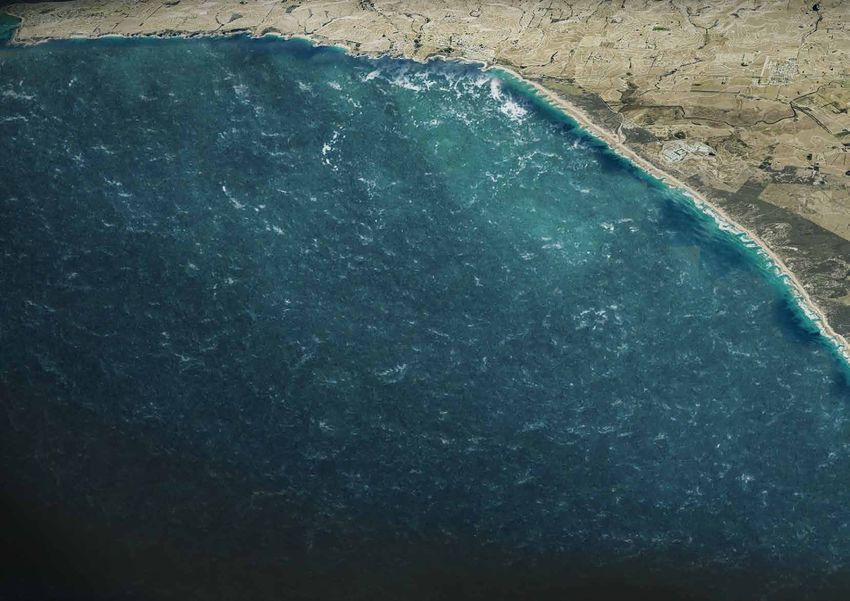
Coastal Erosion
tops of elevated sedimentary rock to elevated ancient Erosion of sandy coastlines is linked to sea levels and
sand dunes that are cut by rivers and waterways and ‒ Walkers are asked to self inform using weather apps increased storm surges.
long sandy beaches with some low rock shelves. The or data from relevant websites; Along the YBMCP coastline, in particular the beaches
relentless energy of the Southern Ocean constantly ‒ A specific app for mobile phones may be developed of Kilcunda and Inverloch have a record of increased
pulses against all these land forms and continues to as part of the overall YBMCP experience. The app coastal erosion.
change these, either through slow and almost invisible could provide access to weather and tidal data. This Various engineering solutions are available to manage
processes but also often in dramatic and abrupt app potentially can extend to recommend walking the destructive nature of sea surges, some of these are
changes, expressed through cliff collapses and land times and become a tool to design an appropriate already applied along the Inverloch beach and include
slides and beach and dune erosion. experience; sand bags and rock armour.
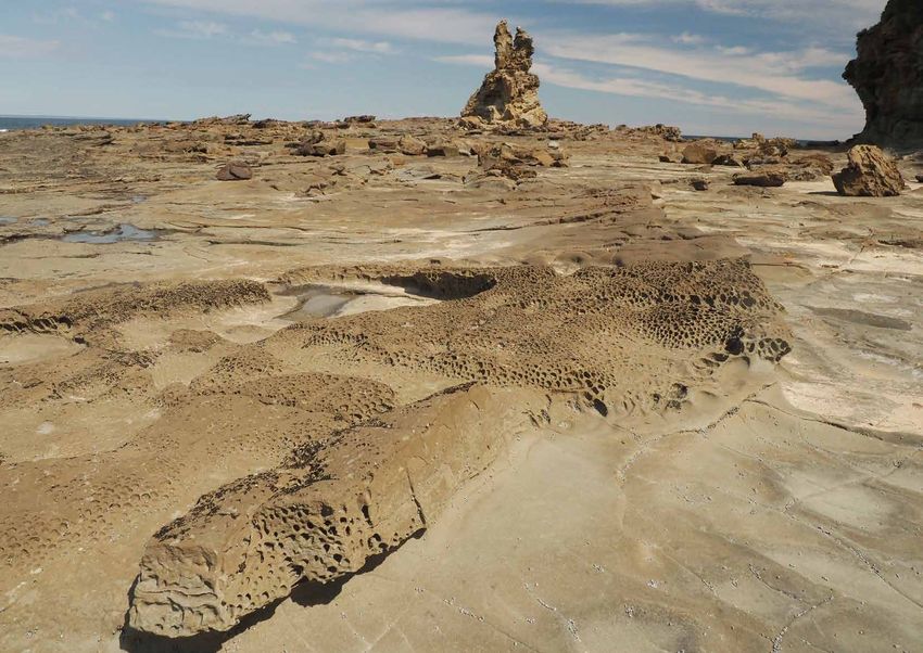
A different force that informs and alters the landscape ‒ A dynamic onsite warning system that could provide In addition, beach-replenishment, which describes the Sea Cave at The Arches,
is the water that flows down rivers and waterways. A digital information directly on beaches [co-located activity of recharging beaches by moving sand, may be Kilcunda
pluvial flood event can be very visible in the riparian with beach nodes for example] that informs on feasible to mitigate or delay the destructive impact on
corridor of the Powlett River, where downstreaming accessibility. assets.
rainwater builds up over time and creates vast The Inverloch Regional and Strategic Partnership is
The sea water level is likely to increase over time and
temporary wetlands, supporting a rich diversity of currently undertaking a Coastal Hazard Assessment
access to beach walking may decrease accordingly. The
ecologies. Parks Victoria is actively managing this which may inform and recommend best responses to
impact of sea level on access to beaches will need to
ecosystem by carefully coordinating the opening of the the risk of beach and coastal erosion.
be monitored.
river mouth and releasing the freshwater build up.
In order to maximise the possible visitor experience by Cliff and Ground Stability
bringing visitors as close to the water edge as possible,
the YBAIP will need to consider the risks caused by the
Inundation The relatively soft structure of the various sedimentary
rock material that make up the elevated sections of
natural processes and understand impacts on locations Pluvial flooding occurs when rain events over upstream
coastline is prone to erosion processes that are caused
of lookout structures, pathways and other assets. catchments increase the volume of stormwater
by wind and sea water impact. Sea caves, such as the Typical sandy beach near
flushing down the waterways. These pluvial events
collapsed cave at Punchbowl and the existing caves Harmers Haven
can sometimes occur relatively abruptly. The flood
further east at the Caves site, are expressions of this
Sea Level and Tidal Events plain of the Powlett river is already being shaped and
influenced by water building up behind the sandbank
force.
Tidal fluctuation with sea level changes between high When locating viewing platforms close to cliffs, the
that most of the time closes the river mouth. Any
and low tides ranging around 3m at times result in siting will need to consider the likelihood of cliff
structural elements that are placed into the flood zone
sections of beach being inaccessible at high tides. collapse. Geotechnical analysis of key locations
of waterways need to be designed so that they are less
These locations are mostly around Harmers Haven. identified through this stage of the YBAIP will help
impacted by flood waters. The boardwalks and viewing
to place viewing structures as close to the optimum
platforms proposed for the Wetland Walk between
Between non-passable sections of beach at high tides, experience as possible, yet at maximum safety for the
Kilcunda and Powlett River will need to be elevated
hikers could potentially be trapped. To mitigate this risk visitor.
well above the maximum anticipated water level or,
it is important that all hikers choosing to walk along A special feature of the rock strata of the coast is the
alternatively, when levels are low to minimise visual
beaches have easy access to tidal charts and plan their presence of coal and the resulting locations of mine
impact of these structures, a certain timeframe of
hiking accordingly. shafts to harvest the coal. These mine shafts bear the
inundation of these structures in peak flood events will
risk of collapsing and their locations and stability will
need to be factored into the experience.
need to be assessed in more detail. Cliff face near Eagles Nest
34 Yallock-Bulluk Marine and Coastal Park Access and Infrastructure PlanYou can also read