Auckland Regional Land Transport Plan 2018-2028
←
→
Page content transcription
If your browser does not render page correctly, please read the page content below
Auckland
Regional Land
Transport Plan
2018–2028

Auckland Regional Land Transport Plan 2018–2028

2   Introduction

Auckland Regional Land Transport Plan 2018–2028

Introduction
from the
Chair
For the first time, through the       The key issues that we, along with our partners the Auckland Council,
Auckland Transport Alignment          Government (through the Transport Agency) and KiwiRail, identified have also
Project (ATAP) the priorities of      been validated by substantially all submitters.
Auckland and the Government           ATAP is not just another plan that will gather dust on a shelf, it has money firmly
are absolutely aligned and more       behind it and this RLTP demonstrates that we are getting on with delivering.
importantly funded. Consequently,     The joined-up thinking that ATAP represents is critical, because Northland and
this Regional Land Transport          the rest of the North Island can only connect through Auckland. On a national
Programme (RLTP) outlines             scale, for New Zealand to thrive, Auckland must thrive.
an exciting and very ambitious
programme of work for Auckland.       The pace and scale at which Auckland is growing, and the associated
                                      challenges, have been well documented. These growth-related challenges
The RLTP is a statutory document      require urgent and flexible services and solutions for the travelling public.
required under legislation. But
it is much more important than        Our relatively new Chief Executive, Shane Ellison, has a clear brief from the
that, it is our ‘contract’ with the   Board to transform the culture of Auckland Transport (AT) and to deliver
ratepayers and taxpayers to           results in several key areas.
contribute to the development         Reliable, frequent and affordable public transport must continue to be a
of an economically, socially,         focus. New electric trains will be added to our existing fleet by early 2020,
culturally and environmentally        and important local improvements such as bus priority lanes made this year
successful Auckland.                  to ensure more people move through congested roading networks more
Many thousands of individuals         frequently. There will be an ongoing and enhanced emphasis on active
and organisations, including Local    transport, which we still strongly believe is a highly credible (and reliable and
Boards who represent their wider      affordable) modal option.
communities, took the time and        Every detail of the network is being worked on, including traffic signals, to
effort to review our draft plan       enable smoother flows – as an example over 200 intersections are being
and make formal submissions.          reviewed this year alone.
It was both pleasing and              But it’s not only about hard infrastructure such as roads, vehicles, buses, trains
encouraging that the vast majority    and ferries. People are at the heart of everything we do and tragically, every day
of those submitters backed the        someone is killed or seriously injured on our transport network – this must stop!
general direction of the plan.
                                      Recently the AT Board commissioned an independent, expert review into road
                                      safety in Auckland. This hard-hitting report produced 45 recommendations, all
         Do you think we have         of which we have adopted without question. However, we cannot achieve our
12,000      correctly identified      road safety ambitions and objectives by ourselves, we will need the support of
                                      many agencies and importantly that of each and every Aucklander.
           the most important
                                      This emphasis on safety as the top priority is reflected throughout this RLTP
          transport challenges        and along with the rest of the AT Board, I cannot stress enough how important
             facing Auckland?         this element of our work programme will be going forward.
   yes
                                      Finally, I take this opportunity to once again thank and acknowledge all our key
                                      partners and stakeholders – working together Aucklanders will see the sort of
             no
                                      transformational change that they not only need but deserve.
                      other

                                      Dr Lester Levy, CNZM
                                      Chair, Auckland Transport

                                                                                                                   Introduction   3
Auckland Regional Land Transport Plan 2018–2028

    Table of
    contents
    Introduction from the Chair3

    01.
    Our vision                                                   6

    02.
    Feedback from consultation                                   7

    03.
    Purpose and scope of the Regional Land Transport Plan       12

    04.
    Auckland’s challenges                                       16

    05.
    Addressing Auckland’s challenges                            30

    06.
    Maintaining and renewing existing assets                    46

    07.
    Inter-regional priorities                                   48

    08.
    Measuring outcomes                                          49

    09.
    Funding and expenditure                                     50

    Appendices
    Appendix 1      Auckland Transport Capital Programme        54
    Appendix 2       NZ Transport Agency Investment Programme   70
    Appendix 3       Rail Infrastructure Capital Programme      76
    Appendix 4       Department of Conservation Programme       78
    Appendix 5       Significance Policy                        80
    Appendix 6       Glossary                                   82

4   Contents
Auckland Regional Land Transport Plan 2018–2028

                                      Contents    5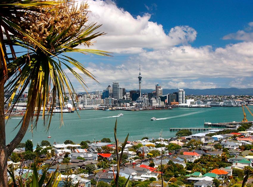
Auckland Regional Land Transport Plan 2018–2028

    01.
    Our
    vision
    Auckland is New Zealand’s largest city and home to almost 1.7 million people.
    Its population has grown strongly over the past few years, and over the 10 years
    of this Regional Land Transport Plan (RLTP) Auckland is expected to grow by
    a further 300,000 people.

    Growth brings opportunities to improve prosperity and         The programme set out in this RLTP will enable the
    wellbeing through the greater diversity of social, cultural   delivery of a safe, reliable and accessible transport
    and economic opportunities that a larger population           system that supports and shapes Auckland’s
    provides. However, rapid population growth has brought        development. It will encourage the move away from
    challenges, including increased congestion, reduced           single-occupant vehicles as the dominant mode of travel,
    accessibility, increased deaths and serious injuries on       enabling public transport, walking and cycling to play a
    the road network, and increasing negative impacts on          significant role in the transport system.
    the environment.
                                                                  It will lead Auckland towards being a city where there is
    The refresh of ATAP has provided the opportunity for          growth without increased congestion, where it is easy to
    Auckland to make a major step forward in addressing           access employment and services, where it is safe to drive,
    these challenges. Through ATAP, the Government                walk and cycle, where there are genuine travel choices,
    and Auckland Council agreed on a transformative and           and where the negative impacts of the transport system
    visionary plan for Auckland, supported by a $28 billion       on people and the environment are minimised.
    package of transport investment over the next 10 years.
    The 10-year programme set out in this RLTP is built on
    this agreed investment package. It provides for significant
    improvements to be made in public transport, including
    rapid transit, walking and cycling, network initiatives to
    help to address congestion, and support for greenfield
    and urban redevelopment. It also provides for a major
    focus on improving safety on Auckland’s road network.

6   Our Vision
Auckland Regional Land Transport Plan 2018–2028

02.
Feedback
from consultation
Introduction
This section summarises the feedback received through submissions on the draft RLTP.

Consultation
Public consultation on the draft RLTP ran from Tuesday 1 May 2018 to Monday 14 May 2018. The consultation process
was aligned with Auckland Council’s consultation on the proposed Regional Fuel Tax (RFT). Auckland Council also
undertook initial consultation on a proposed new Development Contributions policy.

Feedback was sought on the draft RLTP as follows:            The following consultation responses were received
• Have we correctly identified the                           on the proposed RFT and the draft RLTP:
  challenges facing Auckland?                                • 18,091 submissions were received, including
• Have we allocated the available funding                      17,930 submissions from individuals and 161 from
  to the highest priorities?                                   organisations or companies.

• Have we excluded any projects or                           • Over 60 people attended public drop-in events held
  activities from the proposed transport                       in Takapuna on Monday 7 May 2018, in Manurewa on
  programme that should be included?                           Tuesday 8 May 2018, and in two sessions on Saturday
                                                               12 May 2018 in New Lynn and Grey Lynn.
                                                             • Four organisations took the opportunity to present
                                                               their views at the regional stakeholder event on Friday
                                                               11 May 2018.
                                                             Six iwi elected to present to a formal hui on Tuesday 15
                                                             May 2018, led by the Governing Body with members of
                                                             the Regional Transport Committee (RTC) in attendance.
                                                             The Auckland Council Mana Whenua Kaitiaki Forum (a
                                                             leadership-governance forum) as a whole also provided
                                                             a submission, though elected not to present. In total, 13
                                                             of the 19 members of the Kaitiaki Forum submitted, as
                                                             well as the Forum itself.
                                                             All 21 Local Boards adopted resolutions giving feedback
                                                             on the draft RLTP, with most boards also appending
                                                             detailed feedback. Twenty Local Boards presented
                                                             feedback on the draft RLTP in person to representatives
                                                             of the RTC on Monday 7 May 2018.

                                                                                                   Feedback from Consultation    7
Auckland Regional Land Transport Plan 2018–2028

    02. Feedback from consultation cont.

    Feedback from individuals and organisations

    Submitters were asked for their
    feedback on the specific challenges
    identified in the RLTP, which were:
    • Safety
    • Congestion
    • Decreases in accessibility
                                                                     Do you think we have correctly identified the most
    • Impact on the environment                                      important transport challenges facing Auckland?
    • Supporting growth in the region.
                                                               Yes                                                           10,535
    The majority of submitters
    agreed with the draft RLTP’s
    statement of transport challenges,
    as shown in the figure right.                              No                   2,941
    Submitters who answered No
    were prompted to say what
    other transport challenges they                         Other
                                                                           993
    considered should be included.                       comments
    Most submitters used this
    opportunity to emphasise the
    importance of one of the challenges                              0      2,000      4,000    6,000      8,000    10,000      12,000
    already raised, or to give a specific
    example of a project or activity
    they felt was important, as distinct
    from raising a new high-level issue.

    There were some new high-level issues raised, though only a handful of submitters mentioned each of these:
    • Value for money, including the broader costs and benefits of investing (or not investing).
    • Affordability, both of public transport and of vehicle travel, for low-income households. This was of particular concern
      to those on the urban fringe who consider themselves to be most affected by the RFT.
    • Disruption/ future challenges, including autonomous vehicles, climate change, and new technology.
    • Health, in its broadest sense including inactivity, air quality impacts and social isolation.
    A clear majority of submitters felt that the draft RLTP had identified the key challenges correctly. Some submitters used
    the comments section to emphasise the need to “get on with it”.

8   Feedback from Consultation
Auckland Regional Land Transport Plan 2018–2028

                                                                               Please indicate how important the following areas are to you
The draft RLTP consultation also
                                                              Public Transport
sought feedback on the level
of support for specific areas of                        Network Optimisation
focus, to inform the prioritisation
of funding. Overall, there was a                                         Safety
high level of support (over 80%)
for investment in the areas listed                                 Grolth Area
in the draft RLTP, as shown in
                                                                  Environment
the figure right. The exception
to this was walking and cycling,
                                                       Corridor Improvements
with 34 percent of submitters
saying that walking and cycling                              Walking & Cycling
were “less important” to them.
                                                                                  0%         20%        40%           60%          80%         100%

                                                                                  Very important      Moderately important          Less important

Submitters were also asked if there were any projects or activities they thought should be included. These responses
show a clear preference for emphasis on public transport improvements, as shown in the figure below.

                                                                             Please indicate activities and projects that should be included
       Public transport improvements - improve existing services, park
            and ride, improve/extend heavy rail, light rail, bus and ferry

                    Corridor improvements - upgrades to existing road,
                     extended or upgraded motorways, seal extensions

                                           Additional Walking & Cycling
                                              projects (mainly cycling)

                                                      Additional support
                                                        for growth areas

                                                              Additional
                                                          Safety projects

                                                    Additional Network
                                                   Optimisation projects

                                                            Additional
                                                   Environment projects

                                                                         0%         1,000    2,000   3,000    4,000    5,000       6,000     7,000

                                                                                                                            Feedback from Consultation   9
Auckland Regional Land Transport Plan 2018–2028

     02. Feedback from consultation cont.

     Iwi feedback
     Accessibility                                                  Safety
     Iwi submissions consistently reflected a broad                 All iwi emphasised the importance of improving
     definition of accessibility, with many specifically            safety, with some noting that the burden of road
     linking accessibility to affordability.                        trauma falls disproportionately on Māori communities.
                                                                    Iwi were keen to build on the Māori road safety
     “If iwi/whānau can’t afford petrol they can’t always
                                                                    partnerships already underway, and to expand this
     attend manaaki manuhiri, pōhiri, tangihanga.”
                                                                    area of work in future. The safety of state highways
     Improved access to public transport was seen as                was a concern alongside the safety of local roads.
     unlocking a range of benefits including better access
     to education and economic opportunities, however
                                                                    Impact on the environment
     most marae are located away from public transport              Tiaki taiao or nurturing the environment was
     links. The cost of public transport fares is also a barrier,   another key concern, with iwi supporting the
     with some iwi requesting that discounts be available           initiatives underway to be more energy efficient
     for Māori and/or for low-income groups generally.              and to promote electric vehicles, but requesting
                                                                    that AT do more to reduce pollution and litter
                                                                    from roads entering natural waterways.

10   Feedback from Consultation
Auckland Regional Land Transport Plan 2018–2028
Local Board feedback
Transport challenges Priorities
Local Boards were overwhelmingly in support of Key points about funding priorities made by multiple Local
the transport challenges identified, with all but Boards included:
four Local Board submissions specifically agreeing
with the vision and direction, and on the identified
Safety
challenges. Several Local Boards commented Safety was identified as a high priority for funding. Local
on the alignment with Local Board Plans. Board feedback was consistent with the emphasis on high-
risk road upgrades, speed management and monitoring.
Safety
Safety was identified as the major concern. Every
Public transport
Local Board commented on the need to improve Local Boards agreed that public transport is a priority, and
road safety, and five Local Boards specifically each made suggestions for public transport expansions/
commended the proposed Vision Zero approach. improvements in their areas. Local Boards were especially
keen to help improve access to the Rapid Transit Network,
Congestion
through a combination of walking and cycling links,
Eighteen of the Local Boards specifically feeder services, park-and-ride and land use integration.
mentioned congestion, often in the context of
a specific project to reduce local congestion.
Walking and cycling
Local Boards were all in favour of the emphasis on walking
Decreases in accessibility
and cycling, and in particular for a connected, safe, off-road
Only five Local Boards mentioned accessibility network. The role of Local Boards in local placemaking was
specifically, although support for accessibility emphasised, as was the need to work together to achieve
was reflected in all Local Board feedback. this. Local Boards were optimistic about the opportunities
to work with AT to deliver better local connections, and saw
Local Boards in low income areas were passionate
this as an opportunity to invest the increased Local Board
about affordability, and the need for the RLTP
Improvements Fund to achieve good transport outcomes.
to benefit low income communities:
“Most of our families live tough and we are literally Supporting growth areas
bracing ourselves for the implications of the Local Boards emphasised the sheer scale and speed of
looming RFT to hit our pockets! It is important growth, and the need to think differently, because new
therefore that public transport is cheaper and challenges cannot be met by old thinking. All of the Local
easier to access.” (Mangere-Otahuhu) Boards except Great Barrier saw themselves as “growth
areas” with the need to support intensification being at least
Impact on the environment
as significant a challenge as support for greenfield growth.
Local Boards supported the inclusion of “impact
on the environment” on the list of challenges. Environment
Several Local Boards noted that the environment priority
Supporting growth in the region
was aligned with the priorities in Local Board Plans. One
All 21 Local Boards emphasised the importance of Local Board submitted that environmental sustainability
supporting growth in their areas. Urban Local Boards should cover the whole programme – how we do things,
emphasised that intensification is as important as rather than a separate budget area.
greenfield growth, with Waitematā pointing out
that it is the fastest-growing Local Board area. Network optimisation and corridor improvements
Local Boards generally supported corridor improvements
and network optimisation, and were generally more focused
on regional issues than individual submitters, with many
expressing support for improvements not in their areas.
Feedback from Consultation 11Auckland Regional Land Transport Plan 2018–2028
03.
Purpose and scope of the
Regional Land Transport Plan
Purpose of the Regional Land
Transport Plan (RLTP)
An RLTP sets out the region’s land transport objectives, The RTC is required to complete a review of the RLTP
priorities and measures for at least 10 years. It must during the six months prior to the end of the third year of
be prepared every six years in accordance with the the Plan, to ensure that the Plan is relevant, aligned with
Land Transport Management Act 2003 (LTMA) and the strategic context, and that it gives effect to the GPS.
include a 10-year programme of activities to support Public consultation is required if the RLTP is revised.
the achievement of these objectives. It includes the
The RTC (which comprises the AT Board and a
land transport activities of Auckland Transport (AT), the
representative of the Transport Agency) decided
New Zealand Transport Agency (the Transport Agency),
that, given Auckland’s rapid growth and the change
KiwiRail and other agencies.
in government priorities, a full revision of the RLTP
The RLTP must contribute to the purpose of the LTMA was warranted.
that seeks an effective, efficient and safe land transport
system in the public interest. It is also required to be
consistent with the Government Policy Statement on Strategic context
Land Transport (GPS). It must take into account a range Key planning documents and other information that
of other matters, including likely funding from any source have guided the preparation of this RLTP are briefly
and any relevant national and regional policy statements. described below.
All publicly funded land transport activities in Auckland Government Policy Statement on Land
are contained in the RLTP, including:
Transport (GPS)
• Transport planning and investment in improvements
The purpose of the GPS is to guide investment in
for customers
land transport over the next 10 years by providing a
• The road network, including state highways longer-term strategic view, and by setting out where
• Road safety activities delivered in partnership by AT, the Government intends to focus its resources.
the Transport Agency, and the New Zealand Police The Government’s revised draft GPS 2018 identified
• Public transport (bus, rail and ferry) services the four strategic priorities for 2018-28:
• Improvements to bus stops, rail stations and ferry • Safety
wharves, and the creation of transport interchanges
• Access
and park-and-ride facilities
• Environment
• Footpaths and cycleways
• Management and improvement of rail track • Value for money.
infrastructure by KiwiRail and City Rail Link Safety and access are the two key strategic priorities
Limited (CRLL) for the Government and these are supported by the
• Parking provision and enforcement activities priorities of environment and value for money.
• Travel demand management.
12 Purpose and Scope of the Regional Land Transport PlanAuckland Regional Land Transport Plan 2018–2028
Each strategic priority has a number of objectives: The Auckland Plan
• Safety: a land transport system that is a safe system The Auckland Plan is a long-term strategy for
free of death and serious injury managing Auckland’s growth and development
• Access: a land transport system that: over the next 30 years, which brings together social,
economic environmental and cultural objectives.
°° provides increased access to economic and social
opportunities Auckland Council undertook a refresh of the Auckland
Plan and consulted on the revised draft plan in
°° enables transport choice and access conjunction with the Long-term Plan 2018-28.
°° is resilient The Auckland Plan identifies the three
• Environment: a land transport system that reduces major challenges facing Auckland:
the adverse effects on the climate, local environment • Population growth and its implications
and public health
• Sharing prosperity with all Aucklanders
• Value for money: a land transport system that
delivers the right infrastructure to the right level at the • Reducing environmental degradation.
best cost. To address these challenges, the Auckland Plan
The draft GPS also includes themes to assist is structured around six integrated outcomes
understanding of how to deliver effectively that are spatially reflected in a development
on priorities. These themes are: strategy. The six outcomes are:
• A mode neutral approach to transport planning and • Belonging and participation
investment decisions • Māori Identity and wellbeing
• Incorporating technology and innovation into the • Homes and places
design and delivery of land transport investment
• Transport and access
• Integrating land use and transport planning
• Environment and cultural heritage
and delivery.
• Opportunity and prosperity.
The draft GPS 2018 signals that a second stage GPS is
likely to be required to fully realise the Government’s Transport contributes to achieving all six
direction for land transport. This is expected to outcomes, with the strongest links to Transport
address a range of matters, including how funding and access. The Auckland Plan strategic directions
for rail and coastal shipping might be incorporated and focus areas for the Transport and access
into the GPS framework, the development of a new outcome are set out in the table below.
road safety strategy, investigating interventions
to improve the affordability of public transport,
and any future recommendations and targets
produced by the Climate Change Commission.
Purpose and Scope of the Regional Land Transport Plan 13Auckland Regional Land Transport Plan 2018–2028
03. Purpose and scope of the Regional Land Transport Plan cont.
Auckland Plan – Transport and access outcome The ATAP Report provides advice on recommended
investment priorities for 2018-28 to reflect the
Aucklanders will be more easily able to get to where
Government and Auckland Council’s shared direction for
they want to go, and will have choices about how they
transport in Auckland. The ATAP report recommended a
get around.
package of investments (the ATAP Package) to provide
direction to the RLTP and the National Land Transport
Directions Plan (NLTP), and other statutory documents.
Better connect people, places, goods and services The ATAP Package contains around $28 billion of
Increase genuine travel choices for a healthy, investment in Auckland’s transport system over the
vibrant and equitable Auckland next decade. This is based on planned and assumed
funding, including an expected increase of $4.6 billion on
Maximise safety and environmental protection
previous funding plans from the following sources:
• An additional $2.8 billion from the National Land
Focus Areas Transport Fund (NLTF)
Make better use of existing Better integrate land use • $1.5 billion from the proposed RFT scheme
transport networks and transport decisions
• $360 million from Crown Infrastructure Partners.
Target new transport Move to a safe transport
investment to the most network, free from death The ATAP Package seeks to balance transformational
significant challenges and serious injury change while also addressing the critical transport
challenges that Auckland currently faces. The key
Maximise the benefits from Develop a sustainable and
transport technology resilient transport system outcomes expected from the ATAP package include:
Make walking, cycling and public transport • Supporting substantial growth in key rapid transit
preferred choices for many more Aucklanders corridors, to enhance capacity and the potential for
housing growth
Auckland Transport Alignment Project (ATAP) • Initial support to enable greenfield development
where around 30 per cent of Auckland’s growth is
The impact of Auckland’s growth on the transport expected to occur
system was the subject of detailed examination through
• Support for an increase in public transport and
ATAP in 2016. This process involved central and local
cycling mode share, with flow on benefits for health,
government working together to identify an aligned
safety, the environment and congestion
strategic approach for the development of Auckland’s
transport system. • Improved access as a result of more congestion free
alternatives for travel and changes in land use enabled
The Minister of Transport and the Mayor of Auckland
by rapid transit investment
agreed in late 2017 to reconvene ATAP to refresh its
recommendations to give effect to the Government’s • A 60 per cent reduction in deaths and serious injuries
intention for its transport priorities to shape Auckland’s on Auckland’s transport network, from 813 in 2017 to
urban form and development. This includes placing no more than 325 by 2027
greater weight on the Government’s priorities and • Improved environmental outcomes through the
developing a transport system for Auckland that provision of lower carbon alternatives for travel and
provides safe, reliable and sustainable access. This by encouraging less single-occupant travel.
means that transport:
In addition to the ATAP Transport Package, the
• Easily connects people, goods and services to where report also identifies further priority investments that
they need to go should be progressed as funding becomes available.
• Provides high quality and affordable travel choices for Further bus priority investments are recommended
people of all ages and abilities as the highest priority for additional funding. More
• Seeks to eliminate harm to people and the environment investment for walking and cycling, a more extensive
network optimisation programme, increased funding
• Supports and shapes Auckland’s growth for greenfield growth, and further rail network
• Creates a prosperous, vibrant and inclusive city. upgrades are noted as important for Auckland.
14 Purpose and Scope of the Regional Land Transport PlanAuckland Regional Land Transport Plan 2018–2028
National Energy and Conservation • Infrastructure and property. We will continue to work
Strategy 2017-22 with mana whenua on land use issues and in the
design and construction of facilities and infrastructure
The National Energy and Conservation Strategy is
prepared by the Energy Efficiency and Conservation • Natural environment. We have a large impact
Authority. Its goal is to guide and promote an energy on the environment. We will work with mana
productive and low emissions economy. The current whenua to minimise adverse impacts and to
strategy was put in place in 2017 and has three preserve and enhance the natural environment.
priority areas: These strategic priorities are consistent with other
• Renewable and efficient use of process heat strategic planning priorities and are incorporated into
the resources and programme for the next 10 years.
• Efficient and low emissions transport
• Innovative and efficient use of electricity. Auckland Transport
The target for efficient and low emissions transport in Māori Responsiveness Plan
the strategy is for electric vehicles to make up two per
Auckland Transport’s commitment to meeting its
cent of the vehicle fleet by the end of 2021.
legal and relationship responsibilities, and how AT
will be responsive to Māori, are set out in its Māori
Māori outcomes Responsiveness Plan. The Plan focuses on three areas:
Māori outcomes in this RLTP are guided by • Empowering AT to respond more effectively to
the key directions and focus areas identified in Māori through strong, committed and coordinated
the revised Auckland Plan. The key direction leadership, by enhancing the capability and capacity
areas for Māori Identity and Wellbeing are: of our people and processes to respond more
effectively to Māori
• Advance Māori wellbeing
• Ensuring AT has the right relationships and processes
• Promote Māori success, innovation
in place to enable partnership with mana whenua and
and enterprise
effective participation in decision-making, including
• Recognise and provide for meaningful, timely and inclusive engagement at all
Te Tiriti o Waitangi outcomes levels
• Showcase Auckland’s Māori identity and • Developing AT’s current and future role in
vibrant Māori culture. contributing to and delivering positive outcomes for
and with Māori. This involves integrating activities and
The mana whenua groups who comprise the majority
operations across outcomes and connecting Māori
of Auckland’s iwi have agreed five strategic pou for
communities to opportunities in support of their
Māori aspirations. These have direct relevance for
development needs and aspirations.
transport in Auckland:
AT ensures that its transport partners in Auckland are
• Cultural identity. We will work to preserve and
fully aware of AT’s legal and relationship responsibilities
enhance the unique cultural identity of Māori and its
under the AT Māori Responsiveness Plan.
place at the forefront of New Zealand’s way of life.
• Economic wellbeing. Opportunities will be
sought to provide economic development
for Māori businesses and people consistent
with procurement requirements.
• Leadership and influence. We will continue to
work with mana whenua to recognise their role
under the Treaty of Waitangi for kawanatanga
Purpose and Scope of the Regional Land Transport Plan 15Auckland Regional Land Transport Plan 2018–2028
04.
Auckland’s
challenges
Introduction Auckland’s annual population growth (2007-2017)
50,000 1,700,000
Auckland has experienced rapid
growth in recent years, which has 1,600,000
40,000
impacted on travel demand and
1,500,000
Auckland’s transport system. This
growth has led to Auckland facing 30,000
1,400,000
significant challenges. This section
1,300,000
describes the key challenges to 20,000
be addressed over the 10 years of 1,200,000
this RLTP. 10,000
1,100,000
Overview 1,000,000
2007 2008 2009 2010 2011 2012 2013 2014 2015 2016 2017
Auckland is the largest urban
Annual growth (LHS) Total population (RHS)
area in New Zealand, and home
to almost 1.7 million people. Over Based on data from Statistics NZ, Subnational population estimates: June 2017
the past few years, the rate of
population growth has increased
substantially, from around 17,000
people each year from 2006 to
2013 to over 40,000 since 2015,
making Auckland the fastest- Annual population estimates at 30 June
growing major city in Australasia.
3,000
Over the next 25 years, Auckland’s High projection
2,500
population is expected to increase Medium projection
by more than the rest of New 2,000 Low projection
Zealand’s population growth Estimated residential population
combined, to reach 2.3 million by 1,500
2043.1 Over the 10 years of this
1,000
RLTP, Auckland is expected to grow 1998 2003 2008 2013 2018 2023 2028 2033 2038 2043
by an additional 300,000 people.
Based on data from Statistics NZ, Estimated resident population: June 2017
Statistics NZ, Subnational population projections: February 2017
1
Medium projection, Statistics NZ February 2017.
16 Auckland’s challengesAuckland Regional Land Transport Plan 2018–2028
Auckland annual net migration
40,000
35,000
30,000
25,000
A significant proportion of the
20,000 growth in Auckland’s population
is due to migration, with Auckland
15,000
experiencing high rates of in-
10,000 migration since 2013. Annual net
5,000 migration rose from just over 5,000
in 2013 to approximately 36,500
0
in the year to June 2017, dipping
Mar13 Sep13 Mar14 Sep14 Mar15 Sep15 Mar16 Sep16 Mar17 Sep17 Mar18
slightly to 34,500 in the year to
Stats NZ International Travel and Migration - information releases: latest March 2018 March 2018.
Alongside population growth,
there has been a strong upward
Auckland 12 month average new car registrations trend in new car registrations in
11,000
Auckland. Registrations increased
from just over 6,000 vehicles in
10,000 2013 to almost 11,000 in the year
to September 2017, falling slightly
9,000
to around 10,500 in the year to
8,000
March 2018.
Rapid population growth, lower
7,000
fuel prices, a buoyant economy
6,000 and increases in car ownership
have led to substantial growth in
5,000 travel demand. Vehicle kilometres
travelled have increased strongly
0
4,000
Mar10 Mar11 Mar12 Mar13 Mar14 Mar15 Mar16 Mar17 Mar18 over the past four years, up from
12.6 billion kilometres in the year to
NZ Transport Agency Vehicle Registration Centre
June 2013 to 14.2 billion kilometres
in the year to June 2016.
Auckland annual vkt (billions of kilometres) This growth provides opportunities
to improve the prosperity and
15.0
wellbeing of all New Zealanders,
14.5 through the greater diversity of
social, cultural and economic
14
opportunities that a larger
13.5 population provides. However,
these benefits will only be
13 realised if new opportunities can
12.5 be accessed safely, sustainably,
conveniently and affordably.
12
11.5
11
Jun09 Jun10 Jun11 Jun12 Jun13 Jun14 Jun15 Jun16
Ministry of Transport Transport Volume: November 2017
Auckland’s challenges 17Auckland Regional Land Transport Plan 2018–2028
04. Auckland’s challenges cont.
Safety
Safety is one of the components of the transport Contributing factors to the recent increase in
system that can significantly drift into failure if road Auckland road trauma include speed, failure to give-
design, vehicle safety, education, regulation and way at intersections, inattention on urban arterials,
enforcement do not keep pace with constantly loss of control on rural roads, driving under the
changing and complex travel patterns. Improving influence of alcohol or drugs, non-use of restraints,
road safety is one of the key strategies for unlocking and distraction. Some communities are over-
increased public and active transport in urban represented in road trauma including young drivers
environments, as well as generating significant health, and passengers, older road users, and Māori. For
access and environmental benefits. example, Māori made up 10 percent of the Auckland
While deaths and serious injuries steadily reduced over population in 2017 but were involved in an estimated
the last thirty years to a record low in 2012, Auckland 15 percent of the DSI in the region.
has experienced substantial increases in both deaths Vulnerable road user trauma (pedestrians,
and serious injuries in recent years. There were 64 motorcyclists and cyclists) makes up a significant
road deaths and 749 serious injuries (DSI) in Auckland proportion of all Auckland road trauma (47% in 2015).
in 2017, with a social cost estimated at $1.3 billion, a Vulnerable road user crash numbers have continued
level of road trauma that was last seen in 1996. to grow while vehicle crash numbers have increased
Rates of road trauma per head of population and sharply. This will continue to be one of the region’s key
per vehicle kilometre travelled are also increasing, safety challenges over the next 10 years.
suggesting that there are other underlying factors Increasingly unsafe aspects of the transport system
generating worsening road safety outcomes. When can limit the range of realistic travel options, through
compared to similar low-density Australasian cities, both perceived and real safety concerns, discouraging
Auckland is a poor performer. Compared to the rest walking, cycling and reducing opportunities for
of New Zealand, Auckland has experienced a 70 healthy active lifestyles. Real benefits can be gained
percent increase in DSI since 2014, while the rest of in the next 10 years from providing quality integrated
the country experienced a 30 percent increase. land use, safe access to and from public transport,
This recent poor performance includes a significant safe infrastructure and speeds for active modes, and
increase in vulnerable road user trauma (particularly ensuring that private vehicle trips are as safe as they
pedestrians and motorcyclists) as more diverse travel can be.
choices are made in urban environments, and these
changing travel patterns occur on a complex road
network with reduced margins for error. The major
part (70%) of Auckland road trauma occurs on urban
roads. Additionally, Auckland’s housing growth in
rural areas has generated increased travel by new
drivers on unforgiving high-speed rural roads and
state highways.
18 Auckland’s ChallengesAuckland Regional Land Transport Plan 2018–2028
Auckland road deaths & serious injuries (DSI) 2007 to 2017 Congestion
900 Demand for travel is exceeding
800 capacity on many parts of the
700 transport network.
600 While some level of congestion is
500 the by-product of a successful and
growing city, the performance of
400
many parts of Auckland’s transport
300 network has deteriorated rapidly
200 over the past few years. In 2014,
100 19 percent of the region’s arterial
road network was congested
0
2007 2008 2009 2010 2011 2012 2013 2014 2015 2016 2017 during the morning peak compared
with 24 percent in 2017 – a 25
Fatal Serious percent reduction in arterial road
Source: NZ Transport Agency Crash Analysis System network performance over three
years. Congestion is increasingly
spreading into inter-peak times,
Auckland road deaths & serious injuries by mode 2013 to 2017
negatively affecting the commercial
900
and freight movements that occur
800 during this period.
700 Analysis undertaken as part of
600 the current investigation into the
500 feasibility of introducing congestion
pricing in Auckland indicates that
400
road network performance will
300
continue to decline, even with
200 major investment in transport
100 infrastructure and services.2 The
0
analysis indicates that by 2046:
2013 2014 2015 2016 2017
• The proportion of car travel in
People in vehicles People on motorbikes People on bikes People walking severe congestion is projected
to increase by 29 percent in the
morning and afternoon peaks
and by 38 percent in the
Access inter-peak
Population growth and the increase in travel demand have placed significant • Severe congestion on the
pressure on Auckland’s transport system, leading to congestion, increased freight network during both
travel times, impacts on the movement of people and goods, and reduced the morning peak and inter-
accessibility to employment, education and other activities. peak is projected to increase
by 50 percent.
2
The Congestion Question Phase I report 2018.
Auckland’s challenges 19Auckland Regional Land Transport Plan 2018–2028
04. Auckland’s challenges cont.
Auckland Regional Freight Network
Freight Regional Freight Network Warkworth/Puhoi Silverdale /
Dairy Flat
Increased travel times and poor
reliability have a particularly severe 0 0.5 1 0 1 2
impact on the freight industry
Kilometres Kilometres
and the efficient movement of
goods and services. Auckland
has a nationally significant freight Great Barrier Island Waiheke Island
logistics function in the production 0 5
Kilometres
10 0 1
Kilometres
2
and distribution of freight to
the rest of New Zealand, and
internationally. Travel delays and
poor reliability create substantial
costs to businesses that are
ultimately borne by all Aucklanders.
Analysis undertaken for the Ministry
of Transport indicates that in 2012
63.25 million tonnes of freight
was moved within, to, from and
through Auckland. The bulk of
that movement (87%) was carried
by road. Internal distribution and
service trips make up the major
portion of commercial travel within
Auckland, with freight moved
initially within Auckland before it
is sent to its destination. Within
Auckland, freight moves primarily Legend
on the state highways, motorways, Level 1A
Level 1A (Proposed)
Railway
Motorway
and arterial road network. Level 1B
Level 2
Arterial
Major Road
However, in industrial areas, freight Level 3
movements make up a substantial International Gateway
Major Freight Generating and Attracting Areas
proportion of travel on local roads as Minor Freight Generating and Attracting Areas
they provide access to warehouses Future Freight Generating Areas
and distribution centres.
Freight in Auckland is expected to The key challenge will be to limit the growth in congestion on the freight
grow substantially over the next network, particularly in the inter-peak, and to improve the efficiency of
30 years, with total freight carried connections to major freight hubs. Catering for freight movements through
projected to increase from 63.25 currently rural areas experiencing housing development and growth will also
million tonnes to 108.63 million need to be addressed to avoid slower travel times and safety issues.
tonnes by 2046, an increase of The figures on the next pages illustrate the extent of congestion on the
72 percent.3 Freight kilometres Auckland road network during the morning and afternoon peak periods, and
travelled are projected to increase the inter-peak, during March 2018. The maps show the actual median speed
by 53 percent over the same on each road link compared with the posted speed limit on that link.4 Service
period, with freight kilometres levels D to F, shown as red, dark red and black in the figures below represent
travelled within Auckland congested conditions.
projected to rise by 85 percent.
4
Arterial road level of service is measured by median speed as a percentage of the posted speed limit
and is categorised as follows: A is 90 percent and greater, B is 70 percent to 90 percent, C is 50 percent
3
National Freight Demand Study 2014. to 70 percent, D is 40 percent to 50 percent, E is 30 percent to 40 percent, F is less than 30 percent.
20 Auckland’s ChallengesAuckland Regional Land Transport Plan 2018–2028
Morning Peak Congestion Map March 2018
±
LEGEND
Snitch Traffic AM Level of Service
A
B
LOS related to median
speed as proportion of C
posted speed limit D
E
F
No Data 0 1.5 3 6
km
Source: Auckland Transport
Source: Auckland Transport
Auckland’s challenges 21Auckland Regional Land Transport Plan 2018–2028
Inter-peak Congestion Map March 2018
±
LEGEND
Snitch Traffic AM Level of Service
A
B
LOS related to median
speed as proportion of C
posted speed limit D
E
F
No Data 0 1.5 3 6
km
Source: Auckland Transport
Source: Auckland Transport
22 Auckland’s ChallengesAuckland Regional Land Transport Plan 2018–2028
Afternoon Peak Congestion Map March 2018
±
LEGEND
Snitch Traffic AM Level of Service
A
B
LOS related to median
speed as proportion of C
posted speed limit D
E
F
No Data 0 1.5 3 6
km
Source: Auckland Transport
Source: Auckland Transport
Auckland’s challenges 23Auckland Regional Land Transport Plan 2018–2028
04. Auckland’s challenges cont.
Accessibility
Increased congestion has resulted in longer travel illustrate where the numbers of jobs accessible increases
times and reduced travel time reliability, making it more between 2013 and 2026, and the areas in red illustrate
difficult to reach employment, education, healthcare, where the numbers of jobs accessible decrease over
shopping, services, recreation and other activities. Easy the same period. The darker the colour, the greater the
access to jobs and education is crucial to boosting increase or decrease in the number of jobs accessible.
Auckland’s economic productivity and prosperity, as well
The figure illustrating the change in access by car shows
as improving the quality of life for Aucklanders generally.
the decline in accessibility to employment from the
The figures below illustrate forecast changes in access to west, south and some parts of the North Shore over the
employment 2013-2026, based on analysis undertaken period 2013-2026. The west and south contain some of
as part of the original ATAP project.5 The figures illustrate the poorest communities in Auckland. Given this and
the change in the number of jobs accessible by car within the expected growth in these areas, focused effort is
30 minutes and public transport within 45 minutes in required to improve access for these parts of Auckland.
the morning peak. The analysis assumes a base level of Appropriate provision of business land in greenfield
investment in transport infrastructure. The areas in green areas is also needed to reduce the need to travel.
Change in number of jobs accessible 2013-2026 (AM Peak)
Less than -150000
-150000 to -100000
-100000 to -50000
-50000 to -25000
-25000 to 0
0 to 25000
25000 to 50000
50000 to 100000
More than 100000
Car 30 minutes PT 45 minutes
ATAP (CEE4) Baseline projections
5
Auckland Transport Alignment Project 2016.
24 Auckland’s ChallengesAuckland Regional Land Transport Plan 2018–2028
Annual patronage by mode
100
The availability of public transport
90
is also a key factor influencing
80
accessibility. Extending public
70
transport coverage and service
60
frequency will play a key part
Million
50
in improving accessibility and
40
increasing public transport
30
mode share.
20
There has been considerable 10
success in recent years in increasing 0
public transport uptake in Auckland. 2010 2011 2012 2013 2014 2015 2016 2017
Annual public transport boardings Bus Rail Ferry
have increased by 31 percent, from Auckland Transport Annual Patronage: December 2017
69.7 million in the year to December
2013 to 91.1 million in the year to
December 2017. Rail has been a big Annual growth rate (total patronage and the RTN network)
component of that growth, with 30%
boardings increasing by over 92 25%
percent since 2013, on the back of 20%
initiatives such as a new fleet of 15%
electric trains. Bus patronage has
10%
also increased, by 20 percent from
5%
53.9 million in the year to December
2013 to 64.6 million in the year to 0%
December 2017, with the rollout -5%
Dec 2011 Dec 2012 Dec 2013 Dec 2014 Dec 2015 Dec 2016 Dec 2017
of the New Network, integrated
ticketing and new fare structure. Total annual growth RTN annual growth
Auckland Transport Annual Patronage: December 2017
Growth in public transport patronage has been Nearly half of peak time trips are under six kilometres, a
significantly higher on the rapid transit network (RTN) distance that can be travelled in 25 minutes by bicycle.
where public transport runs in its own right of way, Over half of Aucklanders live within a 15-minute ride of
unaffected by congestion. The RTN currently comprises Auckland’s RTN. While there has been an increase in
the Auckland rail network and the Northern Busway, and investment in the cycle network in recent years, only
growth on the RTN totalled 12.7 percent in the year to a small proportion of the protected cycle network is in
December 2017 compared with 7.4 percent for the public place. This network has however delivered significant
transport network as a whole. increases in trips by bicycle, for example Upper Queen
Walking and cycling can also play a greater role in Street, where several protected routes meet, has seen a
meeting Auckland’s transport needs. As with public 406 percent increase since 2013.
transport, urban development patterns and the lack of Walking accounts for 14 percent of journeys taken in
investment in safe walking and cycling facilities has not Auckland and AT’s research indicates there is significant
encouraged the use of active modes. potential for more. The quality of the pedestrian
A very small proportion of people in Auckland have environment is the key barrier to increasing the number
access to a completed part of the cycle network to take of walking trips, particularly the lack of safe, direct routes
them safely and comfortably to their destinations. As for walking. Around Auckland 51 percent of pedestrian
a result, just 1.2 percent of people ride to work and just DSI occurs away from a formal crossing point. There is
three percent cycle to school. The lack of connectivity clear potential to encourage walking for short journeys
in the network means that cycling does not currently for people who live close to the city centre, nearby
play the significant role it could play in moving people. public transport stations, for school journeys and trips
Auckland is not receiving the significant health, social and to local centres, supported by safe places to cross, and
environmental benefits that a connected network of safe accessible and connected walking routes.
cycleways would provide.
Auckland’s challenges 25Auckland Regional Land Transport Plan 2018–2028
04. Auckland’s challenges cont.
Environment Growth
Auckland’s transport network forms a large part of the region’s public space. Accommodating Auckland’s
Where the balance between movement and place is tilted towards moving rapid population growth requires
vehicles, the network can create a number of unwanted impacts on people accelerating the construction of
and communities. housing and business development.
Opening up rural land for
These impacts include noise and air pollution that can affect visual amenity,
development, and facilitating
sense of community, and reduce physical connections between key local
redevelopment of existing urban
destinations and within communities. As transport corridors become more
areas to higher densities, is frequently
congested, it becomes increasingly difficult to manage the balance between
dependent upon the provision of new
movement and place, and to create attractive and welcoming public spaces.
transport infrastructure and services.
This is particularly the case in the city centre, and where major arterial routes
pass through local and regional centres. Historical development patterns At current rates of population growth
and legacy practices have also resulted in significant disparity in tree cover in and household occupancy, Auckland
different parts of the region, including within the road corridor. will likely require another 320,000
dwellings to be built by 2050.6 Two
Transport also has significant impacts on surrounding ecosystems.
thirds are expected to be built in
These include:
existing urban areas, and the rest in
• contributing to the contamination of waterways through run-off areas that are currently rural.
• flooding and stormwater overflow due to infrastructure being unable to Significant investment is required
cope with extreme weather events to enable and support growth
in the region. The Unitary Plan
• visual and noise pollution
identifies around 15,000 hectares
• loss of green space of rural land for future urbanisation
• disruption to ecosystems with the construction of new transport to accommodate around 135,000
infrastructure dwellings. This will require new
transport, water and wastewater
• soil and groundwater contamination. infrastructure in targeted growth
At the local level, runoff from the transport network contributes to the areas. While this infrastructure will
pollution of waterways while the construction of new transport infrastructure be partly provided by developers,
has the potential to generate environmental, cultural and social impacts that it will require significant public
need to be appropriately mitigated. sector investment. The map below
illustrates the scale and location of
Particulates and other vehicle emissions compromise air quality and harm key areas of proposed development
the health of Aucklanders. Unattractive environments for walking and cycling in the Auckland region over the next
contribute to lower levels of physical activity and a wide variety of associated 30 years.
health problems, including obesity and diabetes.
Managing the transport impacts
Transport is Auckland’s largest contributor to greenhouse gas emissions at of both private and public sector
40 percent, which is much higher than the 18 percent national average, the development will also be a major
majority of which comes from road transport. This in turn contributes to the challenge over the next decade.
global challenge of climate change. Reducing greenhouse gas emissions While integrated planning of new
from the transport system is fundamental to meeting regional, national and development can assist in reducing
international commitments to mitigate the impact of climate change. travel demand, the direct impacts of
Addressing greenhouse gas targets represents a significant challenge and accommodating demand generated
opportunity with the growth anticipated within Auckland. The Government by new developments, and those
will be undertaking engagement on the Zero Carbon Bill in 2018. Auckland arising from the provision of transport
Council will also be updating Low Carbon Auckland in 2018. infrastructure, will be significant.
6
Auckland Plan 2050.
26 Auckland’s ChallengesAuckland Regional Land Transport Plan 2018–2028
Development
Sequencing - Years 1-30 Map 28
Strategy
Hatfields
Motorway
Beach
Strategic Arterial Road
Upper
-
Orewa Rural Urban Boundary (RUB)
Rural
Existing Urban Area
Wainui
East Node Years 1 - 30
Years 1 - 3
Dairy Future Urban Area 2018*
Silverdale
West Flat
East
Development Area 2018-2021
Dairy Future Urban Area 2018-2022*
Flat Years 4 - 10
Helensville
Development Area 2021-2028
Albany Future Urban Area from 2022*
Village Future Urban Area 2023-2027*
Riverhead Years 11 - 30
Huapai
Development Area 2028-2048
Sunnynook
Future Urban Area 2028-2032*
Kumeu- Takapuna
Whenuapai Future Urban Area 2033-2037*
Northcote Future Urban Area 2043-2047*
* Refer to the Future Urban Land Supply
Westgate Birkenhead Strategy (2017) as Auckland Council's policy
Red for the sequencing and timing of future
Hills -
Te Atatu urban areas.
Peninsula
-
Te Atatu Newton Glen
South Morningside Innes
Henderson Glendene Mt Albert Dominion Greenlane
Avondale St Lukes Road Ellerslie -
Corridor Tamaki
Sunnyvale Kelston Highland Maraetai
Mt Roskill Park
Sylvia
New Three Park Pakuranga
Glen Kings
Eden Lynn
-
Onehunga
- - Whitford
Otahuhu -
Otara
-
Mangere
Papatoetoe
-
Oruarangi Puhinui
Clevedon
Takanini
Manurewa
Clendon
Papakura
Hingaia
Warkworth
Opaheke
Karaka / Drury
North Drury
Warkworth Clarks
West
North Beach
Kingseat
Paerata
Glenbrook
Beach
Warkworth
South Pukekohe
0 5 10 Note: The best way to view the data presented here,
km is by using the interactive map on the Auckland Council website.
It has different layers that become visible at different zoom levels
Auckland’s challenges 27Auckland Regional Land Transport Plan 2018–2028
04. Auckland’s challenges cont.
Value for money
A major challenge in Auckland is to
ensure ratepayers and taxpayers
receive value for money in the Capital goods price index all construction, indexed at June 2009
delivery of transport services and
1,300 10%
infrastructure in an environment
9%
where there are significant growth
8%
pressures, rapid increases in 1,200
7%
property, land and construction 6%
costs, and an increasing 1,300 5%
number of parties delivering 5%
transport infrastructure. 3%
1,200
2%
Added to this are the difficulties of
1%
building infrastructure in already
900 0%
developed areas, such as the Jun 09 Jun 10 Jun 11 Jun 12 Jun 13 Jun 14 Jun 15 Jun 16 Jun 17
city centre, and the increasing
complexity of the infrastructure Index, CGPI all constructions Population (LHS) GGPI annual % increases (RHS)
required. Such examples include Stats NZ Price indexes for the construction industry: September 2017
the Waterview Tunnel, which
opened in mid-2017, and the City
Rail Link (CRL), which is currently
under construction.
Construction costs have increased significantly since 2011, with particularly
strong growth since 2014. The figure above illustrates the national trend
in construction costs since 2009, with particularly strong upward growth
evident since 2014.
The increasing number of parties involved in the delivery of transport
infrastructure also creates the challenge of ensuring that transport investment
is made in the most cost-effective way. The need to clearly define roles,
responsibilities, interface arrangements and agree risk allocation can add
time, cost and complexity to the planning, funding and delivery of transport
projects and services.
Several parties have been established to deliver transport infrastructure over
the past two years, including the City Rail Link Limited (CRLL) to deliver the
CRL, and Crown Infrastructure Partners to assist in the delivery of roading
infrastructure to support housing development. There is potential for
additional agencies to be established during the period of this RLTP.
28 Auckland’s ChallengesYou can also read