Regional Pedestrian Policy Plan - Mid-America Regional Council Transportation Department - Mid-America Regional ...
←
→
Page content transcription
If your browser does not render page correctly, please read the page content below
Regional Pedestrian
        Policy Plan
        Mid-America Regional Council
          Transportation Department

                       Approved May 2018
Table of Contents
              Introduction............................................................................................................................................ 3
              Plan Organization.................................................................................................................................. 4
              Plan Goals................................................................................................................................................ 5
                  Analysis of MARC Activities............................................................................................................................................ 5
              Strategies................................................................................................................................................. 7
                  Regional Strategies............................................................................................................................................................. 8

                  Local Strategies.................................................................................................................................................................... 9
              Conclusions............................................................................................................................................. 11
              Plan Implementation............................................................................................................................. 11
              Appendices............................................................................................................................................. 12

                  A. Regional Assessment................................................................................................................................................... 13

                         i. MARC Plans................................................................................................................................................................ 12

                         ii. MARC Programming Process............................................................................................................................. 13

                         iii. Complete Streets Policy...................................................................................................................................... 14

                         iv. Active Transportation Program........................................................................................................................ 14

                         v. Air Quality Program............................................................................................................................................... 17

                         vi. Communities for All Ages.................................................................................................................................. 17

                         vii. Geographic Information Systems................................................................................................................... 18

                         viii. Climate Resilience Strategy............................................................................................................................. 18

                         ix. Planning Sustainable Places Program........................................................................................................... 18

                         x. Regional Economy................................................................................................................................................. 19

                         xi. Safety Planning Program.................................................................................................................................... 19

                         xii. Traffic Operations Program.............................................................................................................................. 20

                         xiii. Transit Planning Program................................................................................................................................. 21

                  B. Local Government Assessment................................................................................................................................ 22

                  C. Local Government Pedestrian Inventory Survey Responses......................................................................... 26

                  D. Plan Development Process......................................................................................................................................... 44

       Funding from United States Department of Transportation (USDOT), administered by the Kansas
       Department of Transportation (KDOT) and the Missouri Department of Transportation (MoDOT), in
       part funded the preparation of this report. The opinions, findings and conclusions expressed in this
       publication are those of the authors and not necessarily those of USDOT, KDOT and MoDOT.

2   Mid-America Regional Council
INTRODUCTION
Increasingly, communities are focusing on the benefits of quality of life that walkable areas provide. Safe, convenient
and inviting pedestrian spaces provide communities with health, environmental and socioeconomic benefits, in
addition to increased transportation options and long-term stability. Most people are pedestrians at some point
during the day, even if just to walk from a parked car to the entrance of a workplace.

Walkability is a measure of how friendly an area’s infrastructure and other amenities are to pedestrians. It is
multifaceted and requires regional and local collaboration. The ability to walk or travel in a wheelchair has a profound
effect on our lives — from access to employment and educational opportunities to the quality of the air we breathe,
our ability to integrate exercise into our day, our economic vitality,
and the safety of vulnerable transportation users, such as children and
the elderly. Yet there is a tendency to under value pedestrian systems         Plan Vision
and even avoid pedestrian issues due to the challenges in balancing
transportation modes.                                                          The RPPP envisions a Kansas
                                                                              City region where pedestrians
Although walkability is generally thought of in terms of sidewalks,
                                                                              can get to where they need
crosswalks and other facilities in specific locations, there is also a
regional need to focus investments strategically where pedestrian             to go in a pleasant and safe
mobility demand is greatest, such as in activity centers, dense mixed-        environment.
use development, transit corridors, schools and parks.
                                                                              Pedestrian facilities:
Land use, the built environment, and transportation networks all play
an important role in making pedestrian trips viable. Walking (and              • Are well maintained.
biking) can extend the ability of transit riders to get there they need to
                                                                               • Offer excellent access to
go. Short distances translate to walkable trips, making these trips easy
and attractive to pedestrians. Optimal conditions for a pedestrian trip
                                                                                 transit, jobs, goods and
include a mix of land uses, spaced for efficiency, supported by streets          services, education and
and intersections designed with priority for pedestrians first, followed         recreational opportunities.
by cyclists, transit users and finally automobile users.
                                                                               • Are integral to the region’s
On behalf of the Kansas City metro, MARC developed this Regional                 economic vitality and public
Pedestrian Policy Plan (RPPP) to improve walkability. The RPPP seeks             health.
to:
    »» Integrate and coordinate MARC plans, policies and programs that
       have pedestrian elements.
    »» Identify both strengths and areas of needed improvement.
Additionally, the plan identifies goals and strategies at the regional and local levels based on assessments conducted
during a two-year period.

MARC has a role in facilitating pedestrian considerations as the Kansas City region’s Metropolitan Planning
Organization (MPO) under Federal requirement 23 U.S.C.USC 134 (h). Additionally, MARC seeks to serve as a regional
forum to help local governments solve pedestrian challenges that are common to all.

                                                                                      Regional Pedestrian Policy Plan   3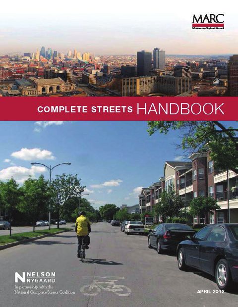
PLAN ORGANIZATION
This document is intended to aid decision-makers at the regional and local levels. The plan itself is organized to
address regional and local assessments in summary fashion with detailed discussion in subsequent appendices.
The RPPP provides:
Self-assessment of regional work
»» Identifies what we do well
»» Identifies areas of needed improvement
Peer MPO best practice review
Assessment of local government work
»» Identifies what we do well
»» Identifies areas of needed improvement
Regional and local strategy recommendations to advance a common vision and set of goals.
In Appendix A: Regional Assessment, the RPPP analyzes MARC plans, policies and program initiatives through a
pedestrian lens. Many of MARC’s initiatives go beyond federal requirements, advancing pedestrian issues and serving
MARC’s diverse communities.
In 2017, MARC staff conducted a peer review to evaluate how other MPOs have addressed pedestrian issues from
a regional planning perspective. To initiate the peer review process, MARC staff reviewed the Federal Highway
Administration’s (FHWA) Metropolitan Pedestrian and Bicycle Handbook published in February 2017, which provides
practical examples of pedestrian and bicycle transportation planning activities. MARC supplemented this report with
additional research to help inform the development of goals and recommended strategies. Links to best practices
from peer MPOs are provided throughout the RPPP.
The Local Government Assessment in Appendix B provides information about municipal plans, policies and
programs. MARC conducted a Local Government Pedestrian Inventory (LGPI) in mid-2016. The inventory contained
a four-part survey designed to address intradepartmental pedestrian issues. Responses totaled 82 from 34
municipalities throughout the MARC region. Some communities responded to all four surveys while others only
responded in part. Detailed responses to the survey are provided in Appendix C.
Highlight from the LGPI include:
»» Pedestrian and bicycle issues are addressed by many communities through an established interdepartmental
meeting process. However, bicycle and pedestrian issues are not a priority for some governments.
»» More than 85 percent of respondents provide a wide variety of marketing and public education efforts that
support pedestrian friendly events.
»» Half of communities reported adoption of a Complete Streets Policy but, only one in three reported
adoption of ordinances to support complete streets.
»» The role of law enforcement agencies is vital to keep roadways safe for pedestrians.
The creation of a walkable region requires collaborative efforts from state and local authorities, as local efforts have
a cumulative effect on the region as a whole. MARC supports local efforts to become Walk Friendly Communities
(WFCs). This national program recognizes communities that show commitment to improving walkability and
pedestrian safety with a comprehensive set of programs, plans and policies.
Appendix D: Plan Development Process offers details on the development of this plan, led by MARC’s Bicycle and
Pedestrian Policy Committee (BPAC). Phase 1 began in January 2016 with a local pedestrian government inventory
to gather plans, policies and programs at the local level. MARC staff conducted an in-depth review of MARC plans,
policies and programs during Phase 2. During Phase 3, staff produced the report and gathered feedback. BPAC also
led an ongoing stakeholder engagement process throughout all phases.
4 Mid-America Regional Council
PLAN GOALS
The Regional Pedestrian Policy Plan seeks to encourage and facilitate the ability of people across the Kansas City
region to walk (or operate a wheelchair) for transportation and recreation. To this end, the goals of the RPPP are to:
Increase the safety of pedestrians
Increase and improve the quality of pedestrian facilities
(sidewalks, crosswalks, ramps, etc.)
Target areas of high need and density of pedestrians
Educate the public on the benefit of walking as a mode of transportation
Analysis of MARC Activities
MARC has crosscutting plans, policies, programs and committees that focus on and elevate pedestrian issues. The
following discussion summarizes how each goal is currently addressed through MARC activities. The Regional
Assessment contained in Appendix A provides a more detailed discussion.
Goal 1: Increase the safety of pedestrians
The safety of pedestrians is a priority for MARC across its initiatives and activities. Transportation Outlook 2040
(TO2040), the Metropolitan Transportation Plan for the region, includes the improved safety and security of
transportation users in its 10 policy framework goals. Additionally, the Active Transportation chapter of TO 2040
includes several strategies that encourage pedestrian safety, such as the creation of quality facilities and support
for local Safe Routes to Schools programs.
MARC also carries out activities that are largely devoted to pedestrian safety. Destination Safe is a coalition of
federal, regional, state and local agencies coordinated by MARC that seeks to improve transportation safety
(including pedestrian safety) across 13 counties. Safety Ambassadors, developed in 2007 by MARC and partner
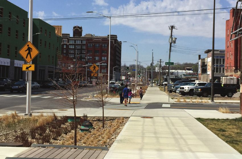
organizations, is a program that provides consistency in youth pedestrian and bicycling safety education across
the region. This program complements Safe Routes to Schools, an initiative implemented across the country to
help children safely get to and from school on foot and bike. Finally, MARC promotes the national Walk Friendly
Communities program, which recognizes local governments for efforts to improve walkability and pedestrian
safety.
MARC issues a call for Destination Safe projects annually. These projects are funded through a combination
of Missouri state funds allocated to the Missouri Department of Transportation (MoDOT) Kansas City District
through the Missouri Coalition for Roadway Safety (MCRS). Nine Missouri counties compete for funding to
support enforcement- and education-based programs. MARC has four Kansas counties that compete for
National Highway Traffic Safety Administration (NHTSA) funding awarded through the Kansas Department of
Transportation (KDOT).
On behalf of the Destination Safe Coalition, MARC coordinates a regional safety awareness campaign.
Coordinated media buys, such as Facebook promoted posts and radio drive time messages, serve the regional
population and result in a seamless Destination Safe campaign with funding from both Kansas and Missouri
authorities. Pedestrian safety messages are concentrated during strategic periods of the year, such as back to
school and Halloween.
Regional Pedestrian Policy Plan 5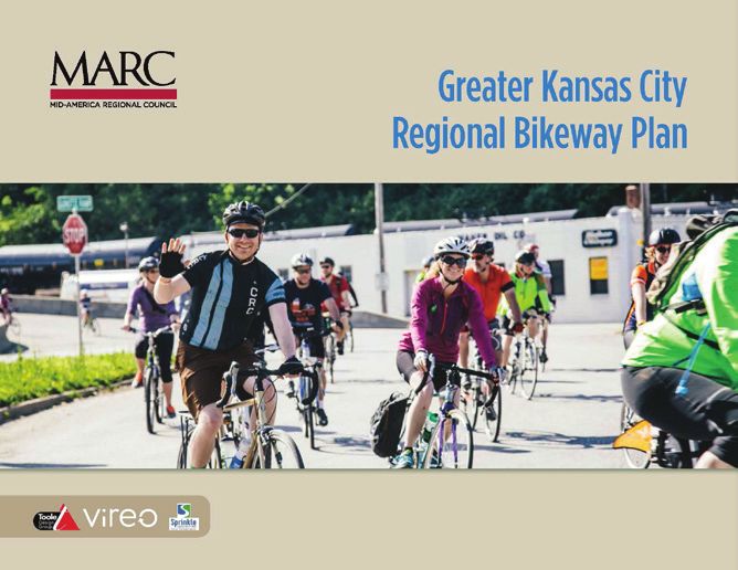
MARC works with Destination Safe partners to develop and adopt the Kansas City Transportation Safety
    Blueprint: Together Toward Zero 2018-2022. The Blueprint promotes the Vision Zero movement that promotes
    pedestrian safety through crash prevention and mitigation. These two strategies are important in reducing the
    frequency and severity of pedestrian serious injuries and fatalities. Engineering, education, enforcement and
    emergency response are safety disciplines that, when combined, provide proven safety benefits to pedestrians.
    Slowing traffic increases reaction time and reduces the force of crashes. Cutting down on conflict points at
    intersections and separation of modes along roadways reduces risk. In order to increase the safety of pedestrians,
    MARC and its partners work together to identify opportunities and areas of need. MARC staff engage in research
    and analysis that pertains to pedestrian safety including analyzing pedestrian crash data and performing
    pedestrian road safety audits.

    Goal 2: Increase and improve the quality of pedestrian facilities
    In order for pedestrians to move safely, they need extensive and well-maintained sidewalks, crosswalks and
    other infrastructure. TO 2040 includes strategies to support Complete Streets — roadways designed for safe
    and convenient travel by users of all ages and abilities. Furthermore, MARC adopted a regional complete streets
    policy in 2012 (updated in 2015) and encourages local governments to use this policy as a template to create and
    adopt policies of their own. Twelve local governments have adopted Complete Streets policies.

    Although MARC does not build or own pedestrian (or other) infrastructure, as the MPO, MARC receives federal
    funding that it then distributes via a competitive process to local entities for an array of projects, including those
    that are principally or partially pedestrian in nature. The Active Transportation chapter of TO2040 includes a
    strategy to promote Complete Streets through the selection of local projects for funding.

    For each source of funding, MARC coordinates both Missouri and Kansas selection committees made up of
    local government staff and others who review applications and score projects. Surface Transportation Program
    (STP) funds can be used for the construction of pedestrian facilities, thereby advancing the Federal Highway
    Administration’s (FHA) goal of increasing modal choice. Transportation Alternatives Program (TAP) funds can
    also be used to build pedestrian facilities, thereby expanding travel choice and enhancing the transportation
    experience. Congestion Mitigation Air Quality (CMAQ) funds can be used for projects that improve air quality,
    including pedestrian projects since walking produces zero emissions.

    Another way to build or improve pedestrian facilities is for local governments to engage developers and
    businesses to help provide new and improved pedestrian infrastructure. Many cities and counties already require
    developers to provide new or repair existing sidewalks that abut their property. While this creates needed
    facilities, it sometimes leads to sidewalks that abruptly end at the property line, leaving pedestrians stranded.
    Communities could require developers to pay pedestrian impact fees, related to the expected pedestrian demand
    of their development. These funds could then be used to build or fix sidewalks, create crosswalks and purchase
    needed signals in specified areas.

    Goal 3: Target areas of high need with high density of pedestrians
    Transit stops, mobility hubs, schools, parks and other high activity places should be targeted for pedestrian
    investments. As discussed under Goal 2, MARC distributes funding that can be used to build pedestrian facilities.
    During the scoring process, projects receive more points if they are located in activity centers — places that
    are more dense, have a mix of uses and are pedestrian-friendly. Projects also receive points if they include a
    pedestrian component and if they are located in environmental justice communities — locations where the need
    for better infrastructure is typically higher.

    MARC’s recent review of projects funding through federal programs revealed that about one-third of investments
    go towards non-motorized modes of travel. While this share of investment is good, closer analysis reveals that the
    majority of these investments were outside of target areas where they would have had the greatest benefit.

    Goal 4: Raise public awareness of the benefit of walking as a mode of transportation
    MARC engages in several activities that provide education on the benefits of walking. In 2002, MARC introduced
    Explore KC, a regional campaign to promote local trips by foot and bicycle. Over the years, Explore KC and
    MARC have collaborated with a number of local partners on a variety of community-based events. Each year, the
    Explore KC program continues to encourage residents, workers and visitors to bike and walk to make the most
    of the region’s growing network of trails, parks and other resources. MARC budgets an average of forty thousand
    CMAQ dollars annually toward the Explore KC regional campaigns. The program encourages safety, as well as
    the health benefits of physical activity and increased exercise. Its ultimate goal is to help people improve their

6    Mid-America Regional Council
personal well-being through active transportation.

   MARC gathers information from local governments to publish the Greater Kansas City Regional Trails & Bikeway
   Map on a biannual basis. The map is printed as well as published through a mobile web app.

   Most of MARC’s efforts are designed to increase the share of people walking for everyday trip purposes. While
   education is important, other factors such as socioeconomics, transit service and land use play important roles in
   creating demand while improving the likelihood of pedestrian trips.

   Additional information about MARC plans, policies and programs that address pedestrian issues is explained in
   the Regional Assessment.

STRATEGIES
The RPPP is intended to elevate the awareness of pedestrian challenges related to the plan goals. Additionally,
strategies target investments and efforts to maximize pedestrian benefits. Strategies are organized into three
categories: policy, technical and best practices at both regional and local levels.

Policy level strategies are intended to aid decision makers at the regional level during the planning and programming
process, and at the local level in the development of plans and zoning regulations. Technical strategies identify
actions where additional analytical work, such as collection of sidewalk data and GIS mapping, is needed to
understand current conditions and identify needs. Best practices strategies are a collection of actions that have
proven to be effective in a variety of communities. Many strategies are crosscutting, addressing more than one goal.

The regional strategies are for MARC and its partners, while the local strategies are for local governments. Regional
strategies are meant be guide future discussions during the update of programming review criteria but not supplant
them. The local strategies are meant to serve as a “menu of options” for local governments, recognizing that the
capacity of staff and the need for pedestrian initiatives and actions varies across the Kansas City metro area.

Adoption of these strategies will help focus investments on locations where they will have the greatest benefit.
Regional plans, policies and programs should facilitate planning and coordination among local jurisdictions and
transit providers. They should help guide prioritization of investments where they will have the greatest opportunity
to maximize limited regional resources. At the same time, local best practices should also prioritize investments of
limited resources to maximize opportunity.

The following chart lists the regional and local strategies and which goals they address.

                                                                                      Regional Pedestrian Policy Plan   7
REGIONAL STRATEGIES
Goals             Policy Strategies

                   1. Concentrate investments
                   During the programming of funds, prioritize sidewalks and other elements of robust pedestrian
                   networks within a quarter-mile of intense and walkable activity centers, mobility hubs, fast
                   and frequent transit corridors, elementary schools and neighborhood parks. Concentrating
                   investments results in facility construction and improvement where the demand is greatest,
                   maximizing benefits.
                   2. Address barriers
                   Prioritize pedestrian system improvements to address regional barriers on major river crossings,
                   freeways, railroads and links within a quarter-mile of bridge ends. By improving these critical
                   linkages, pedestrians will be better able to access all parts of the region.
                   3. Increase resources
                   Increase amount of resources directed towards sidewalk improvements in activity centers,
                   mobility hubs, transit corridors, schools and parks.

Goals             Technical Strategies
                   1. Walk Friendly Community assistance
                   Provide assistance to local jurisdictions working to achieve Walk Friendly Community
                   designation.
                   2. Walk to School events
                   Promote and expand participation in Walk to School events.
                   3. Regional Counting Program
                   Expand the Regional Counting Program to local governments setting up non-
                   motorized counting through loan of equipment, the development of standardized data
                   collection methodologies, and sharing of data.
                   4. Professional training
                   Continue to provide professional training to planners, engineers and others through
                   free monthly webinars.
                   5. GIS data schema
                   Develop regional sidewalk schema for data collection within a quarter-mile of activity
                   centers, mobility hubs, transit corridors, schools and parks.
                      a. Develop gap analysis.

                      b. Explore adaptation of MARC Walk Score using sidewalk data.

                      c. Perform pedestrian crash analysis of these high-need areas.

                   6. Bridge inventory
                   Update regional level bridge pedestrian inventory.
                   7. Pedestrian signal timing
                   Integrate pedestrian considerations into the next Operation Green Light Strategic Plan
                   by developing model context-sensitive pedestrian signal timing best practices.
                   8. Pedestrian Road Safety audits
                   Facilitate future training opportunities for the development of Pedestrian Road Safety
                   audit.
                   9. Revise project scoring
                   Revise scoring scale in STP/TAP/5310 Programs to elevate pedestrian system and/or
                   operational improvements.

        SAFETY             QUALITY FACILITIES            TARGET AREAS OF NEED                 PUBLIC EDUCATION

8   Mid-America Regional Council
REGIONAL STRATEGIES
Goals            Best Practice Strategies

                 1. Sidewalk clearinghouse
                  Create regional sidewalk clearinghouse from local generated datasets.

LOCAL STRATEGIES

Goals            Policy Strategies
                 1. Pedestrian Master Plan
                 Develop Pedestrian Master Plans with ADA Title II Transition Plan for public right-of-
                 ways.
                 2. Include sidewalks in CIP
                 Consider creating a sidewalk construction and replacement prioritization plan that
                 places projects in the multi-year CIP For example, a line item in a local government’s
                 program could be used to budget funding to replace sidewalks, address ADA
                 compliance, and expand sidewalks where there are gaps.
                 3. Prioritize improvements
                 Prioritize sidewalk improvement within a half-mile of activity centers, mobility hubs,
                 transit corridors, schools and parks. For example, a Pedestrian Master Plan could be
                 used to identify high priority areas or needs based on location, need and condition of
                 pedestrian infrastructure.
                 4. Planning and zoning
                 Adopt plans and zoning provisions (such as mandating the construction of sidewalks
                 on both sides of the street in redeveloped and new areas) to ensure pedestrian
                 connectivity.
Goals            Technical Strategies
                 1. Counting program
                 Develop an active transportation traffic counting program to monitor and evaluate
                 trends.
                 2. Infrastructure inventory
                 Complete a citywide pedestrian infrastructure inventory.
                    a. Collect local data on sidewalk location, width and condition

                    b. Develop inventories of crosswalks, curb ramps and signals.

                    c. Map areas where pedestrian infrastructure is publicly or privately maintained.

                 3. Roadway design standards
                 Adopt functional class design standards for roadways that require 6-foot sidewalks (5-
                 foot minimum) on:
                   • Both sides of arterials roadways.
                   • On one side of collectors roadways.
                   • On one side of locals roadways.

        SAFETY          QUALITY FACILITIES          TARGET AREAS OF NEED               PUBLIC EDUCATION

                                                                             Regional Pedestrian Policy Plan   9
LOCAL STRATEGIES

Goals              Best Practice Strategies

                    1. Citizen advisory committee
                    Establish a local government citizen advisory committee to address pedestrian city
                    wide issues.
                    2. Walk-friendly assessment
                    Complete a Walk Friendly Communities Assessment Tool application to institutionalize
                    the pedestrian mode into local plans, policies and programs.
                    3. Complete Streets Policy
                    Adopt a Complete Streets Policy to include considerations of all users and all modes in
                    roadway improvement projects.
                    4. Traffic calming
                    Adopt a Traffic Calming Policy to include considerations of roadway design that slows
                    vehicle speeds to improve safety and comfort for all users
                    5. Financing plan
                    Develop a financing implementation plan for pedestrian improvements.
                    6. Residential sidewalk policy
                    Develop residential sidewalk construction policies, with fair and practical financing
                    programs for construction and replacement of residential sidewalks.
                    7. Engage business
                    Engage developers and businesses to help provide new and improved pedestrian
                    infrastructure.
                    8. Education and outreach
                    Engage advocacy organizations at the local and regional level for support and
                    coordination of education and outreach programs. Develop a pedestrian education
                    outreach program that supports safe and active communities.
                    9. Enforcement
                    Provide routine enforcement of traffic laws to protect pedestrians in activity center
                    and school zones.

         SAFETY             QUALITY FACILITIES         TARGET AREAS OF NEED              PUBLIC EDUCATION

10   Mid-America Regional Council
CONCLUSIONS
MARC’s pedestrian planning activities integrate into all core MPO functions. MARC’s MPO regional activities
incorporate pedestrian considerations during development of the RTP and project programming process. In addition,
related stand alone programs that address environment, land use and transit planning also integrate pedestrian
issues either explicitly or implicitly through crosscutting plans, policies and programs that related to pedestrian
planning and community walkability in general.
The TO2040 Active Transportation Chapter addresses pedestrian issues as they relate to other sectors. For example,
a regional role of MARC is to elevate the importance of pedestrian considerations in all bridges crossings of major
rivers and highway systems to eliminate barriers and connect pedestrian facilities across city, county and state lines.
MARC identifies the need for data collection to further the planning and programming process. For example, MARC
has made progress towards a regional count program and has built new partnerships with local governments.
Extensive local sidewalk datasets have been acquired but gaps still exist to create a shared regional dataset. MARC’s
Active Transportation program has made progress towards addressing pedestrian challenges and strategies;
however, progress is incremental and will require sustained efforts over the years to come. For example, efforts by
local municipalities to attain WFC designation has proven more difficult than anticipated.
The MARC Unified Planning Work Program (UPWP) provides an annual opportunity to advance regional services
and work products needed to address pedestrian issues. The UPWP is a list of all of the transportation projects that
MARC, as the region’s MPO, plans to advance. Every year, active transportation initiatives and projects, including
those that relate to pedestrian safety and facilities are included.
The MARC Programming Process addresses pedestrian projects by incorporating selection criteria that supports
complete streets across funding sources and programming committees. Planning committees are also given
opportunity to provide input into the selection process. The programming process demonstrates strong ties between
the RTP and the TIP. MARC has an ongoing process in place to review and enhance selection criteria. This allows
MARC to strengthen the links between regional goals and investments.
Local government plans, policies and programs often create support for walk friendly communities. MARC can help
to coordinate local efforts by providing broad technical support for communities committed to the Walk Friendly
Communities (WFC) national model. This national program provides ample technical support at all levels including
planning, engineering, education, enforcement and evaluation of best practices. The WFC application process
provides an assessment tool local government are encouraged to follow.
PLAN IMPLEMENTATION
Implementation of the strategies identified in this plan will require ongoing oversight. MARC will use the RPPP to
help shape the development of future plans, policies and programs and will evaluate project selection criteria used
for funding decisions.
During the development of the 2050 Regional Transportation Plan update, MARC will reevaluate regional
performance measures and determine how to track pedestrian investments. This will help determine the extent to
which pedestrian investment are effectively targeted to the areas identified in the RPPP’s policy strategies.
Every year, MARC Active Transportation staff will include the regional pedestrian strategies in the UPWP to provide
staff with a series of tasks.
To support the implementation of local strategies, MARC will continue to offer technical support and resources.
MARC will also request inventories of sidewalks, curb ramps, crosswalks and other related pedestrian datasets from
local communities, and combine them in a regional database. Other areas where MARC staff will offer technical
support to communities includes the Walk Friendly Communities Assessment Tool, Regional Counting Program,
Explore KC and the efforts of Destination Safe to address pedestrian safety.
Regional Pedestrian Policy Plan 11APPENDIX A: REGIONAL ASSESSMENT
Pedestrian issues are crosscutting and integrated across MARC plans, policies and programs. Recommendations to
improve MARC’s efforts are incorporated in this assessment.
MARC PLANS
MARC Regional Plan for Sustainable Development
In 2009, the MARC Board of Directors adopted a regional vision for a more vibrant,
connected and green region. Viewing the policy framework through a pedestrian lens
helps to elevate the importance of walkable communities.
Walkable communities are vibrant. Walkable communities reduce the cost of
transportation. They create a sense of place through streetscapes that are inviting
to pedestrians. Vibrant communities maximize a mix of residential, civic, commercial
and open spaces through a built environment that uses both vertical and horizontal
space. Vibrant places are inclusive, providing a mix of housing options for all ages
and socioeconomic backgrounds.
Walkable communities are connected. Walkable communities provides streets
that accommodate all roadway users. The idea of providing routine pedestrian
accommodations has gained acceptance in most circles. Pedestrian sidewalks, crossings and treatment at
intersections are especially important to ensure that walking is both inviting and safe. Pedestrians are at higher
risk of serious injury and death when traffic is speed increases. Compounding the risk like include issues like
distracted driving and drugged driving.
Walkable communities are green. Walkable communities require less energy to move people and reduce the
need for other forms of transportation. As people rely less on motorized transportation, fuel consumption will
decrease and air quality will improve. Walkable streets are “green” in other ways too: streets redesigned with
more space allocated for trees and native vegetation create stormwater treatment areas. Trees provide shade,
reducing ambient heat islands associated with asphalt surfaces. Reducing impervious surfaces alleviates the
need for larger stormwater systems and allows for natural systems to better treat runoff pollutants.
Transportation Outlook 2040
Transportation Outlook 2040 (TO2040) was
adopted in June of 2015 and serves as the Regional
Transportation Plan (RTP) for the Kansas City region.
This plan directs the transportation decision-making
process to achieve regional goals. TO2040 serves
as a blueprint for the management of the region’s
transportation system through the year 2040. It
describes the current and evolving surface transportation needs of the metropolitan area and broadly categorizes
transportation investments ranging from road and transit improvements to projects that enhance bike, pedestrian
and freight movement.
Chapter 6 of the plan, titled Active Transportation, discusses pedestrian and bicycle needs and strategies. The
creation of the RPPP fulfills one of the strategies identified in this chapter by creating a framework for regional
pedestrian strategies. Other strategies include:
»» Provide assistance to communities to gain Walk Friendly Community recognition.
»» Encourage the development of local complete streets policies.
»» Facilitate pedestrian counts by loaning automated counting equipment to communities.
Unified Planning Work Program (UPWP)
The Unified Planning Work Program (UPWP), a required product under federal metropolitan planning regulations,
promotes a unified regional approach to transportation planning in order to achieve regional goals and objectives.
The UPWP performs three distinct functions: (1) it describes the transportation planning activities that MARC and
other agencies propose to undertake each year to address regional issues and priorities; (2) it serves to document
12 Mid-America Regional Councilthe proposed expenditures of federal, state and local funds in support of applications for various planning grants;
and (3) it provides a management tool for MARC and the funding agencies in scheduling major transportation
planning activities, milestones and products.
The MARC UPWP has long documented resources for active transportation planning that supports the development
of innovative solutions to address regional transportation challenges. Current and ongoing efforts in the UPWP focus
on:
»» Development, maintenance and implementation of regional planning strategies of the Active Transportation
Chapter of Transportation Outlook 2040.
»» Foster increased regional bicycle and pedestrian travel as a share of all trips.
»» Facilitate transportation policies that integrate active transportation solutions with community development
needs in the region.
»» Support engineering best practices, public education and traffic enforcement to improve safety of pedestrians
and bicyclists.
»» Support efforts that address and advance active transportation data collection.
»» Encourage advancement of technical analysis tools that address active transportation planning and
programming needs.
»» Provide active transportation planning support across related MARC initiatives and programs and to local
governments working to address pedestrian and bicycling needs.
Transportation Improvement Plan (TIP)
As the designated MPO, MARC maintains the Transportation Improvement Program (TIP)
for the area within the Metropolitan Planning Boundary, consisting of Cass, Clay, Jackson,
Platte counties, and a small portion of Lafayette County in Missouri and the entirety of
Johnson, Leavenworth, Miami and Wyandotte counties in Kansas.
Under federal law, two requirements ensure pedestrian investments as part of multimodal
transportation system. The TIP must cover all modes of travel and be consistent with the
approved metropolitan transportation plan, among other requirements.
The TIP provides project descriptions. Pedestrian accommodations are described as part
of a roadway or intersection project. This is the standard rather than the exception.
Public Participation Plan (PPP)
The Public Participation Plan (PPP) is a federally-mandated MPO product that outlines
public participation procedures for engaging the public and stakeholders in MPO
planning and programming activities, which at a minimum, includes the Metropolitan
Transportation Plan, Unified Planning Work Program, the Transportation Improvement
Program as well as the Public Participation Plan itself. MARC’s public participation
processes must include consultation with transportation stakeholders as outlined in the
FAST-Act. MARC’s PPP identifies ways to engage stakeholders early and throughout the
planning process. This includes engaging with representatives of pedestrians. As part
of the procedures outlined in the PPP, the plan cites this requirement and calls out as a
primary strategy within the consultation process, that staff should engage members of
MARC committees, including the Bicycle and Pedestrian Advisory Committee (BPAC).
MARC PROGRAMMING PROCESS
One of MARC’s fundamental roles as MPO is to provide a forum and facilitate processes for cooperative decision-
making regarding the use of federal transportation dollars for projects and programs in the Kansas City area.
MARC typically issues a call for project every two-years. MARC programs these funds using competitive application
processes governed by various MARC committees. The committees consider policy guidance from the Total
Transportation Policy Committee (TTPC), project evaluation scores, advisory priorities and commentary from MARC
modal planning committees, public input, and other relevant information to develop funding recommendations
for TTPC and the Air Quality Forum, as appropriate. The MARC Bicycle Pedestrian Advisory Committee (BPAC) is
the modal planning assigned with the task of developing advisory priorities and commentary. The MARC Active
Regional Pedestrian Policy Plan 13Transportation Programming Committee (ATPC) is assigned with the task of
making funding recommendations to TTPC for all projects submitted under PEER MPO EXAMPLE
the Transportation Alternatives Program (TAP) and Congestion Mitigation Air-
Quality (CMAQ) sub-allocated programs. Many more pedestrian investments Nashville’s MPO commits
are made using Surface Transportation Program (STP) sub-allocated funds
15 percent of its
that are typically part of larger roadway, intersection or bridge project.
annual STP funding to
The Kansas and Missouri Surface Transportation Priorities Committees are
assigned with the task of making funding recommendations to TTPC for all standalone pedestrian
projects submitted under STP. and bicycle projects.
While this might not
MARC programming committees adopt project selection criteria are
be the proportion that
reflective of the goals established by the RTP and are updated periodically to
improve ties between long-range planning and the programming of federal makes sense for the
transportation funds. Kansas City area, the
region could decide
Recently, MARC review the past two funding cycles. Does our project
to set aside a specific
selection process select projects according to our policy goals? This analysis
amount for pedestrian
grouped investments into three categories: bicycle/pedestrian, transit and
other. Bicycle/pedestrian investments using STP funds regionally represented and bicycle projects.
29 percent of funds for federal fiscal years 2017-2018. Bicycle/pedestrian
investments regionally increased to 33 percent for 2019-2020. While, MARC
programming process results in significant pedestrian investments, it is vital that
these investments are located strategically. For this reason, this plan recommends pedestrian investments within
activity centers serving transit corridors and mobility hubs, schools and parks. As stated in TO2040: Strategically
placed bicycle and pedestrian investments could significantly increase non-motorized trips and help meet active
transportation needs of residents. (TO 2040 p 6.7)
A full list of MARC Transportation Committees is available online. The role or purpose of each committee is provided.
COMPLETE STREETS POLICY
Complete streets are streets, highways and bridges that are routinely planned, designed,
operated and maintained with the consideration of the needs and safety of all travelers
along and across the entire public right of way. This includes people of all ages and
abilities who are walking; driving vehicles such as cars, trucks, motorcycles, or buses;
bicycling; using transit or mobility aids; and freight shippers.
In March 2013, the MARC Board of Directors approved a Complete Streets Policy
in support of the region’s vision for a safe, balanced, multimodal and equitable
transportation system. The policy also calls for a transportation system that is
coordinated with land-use planning, protective of the environment and that guides and
informs MARC’s planning and programming work.
The Complete Streets Handbook serves as a guide and reference for local communities
that wish to implement complete streets facilities and supportive policies. The handbook
offers guidance to communities that are at different stages of complete streets policy
and/or facility implementation. It was developed with numerous audiences in mind, including policymakers, elected
officials, planners, engineers, residents, leaders and organizations. The document is meant to help communities
take complete streets policies or implementation to a higher level. The handbook is also intended to help readers
understand the basics and identify resources that provide more detail on complete streets-related topics.
MARC worked with a consultant in the fall of 2011 to create the handbook. An update is planned for 2017.
ACTIVE TRANSPORTATION PROGRAM
Kansas City Regional Bikeway Plan
Adopted January 2015 by the MARC Board of Directors, the Kansas City Regional Bikeway Plan is a standalone
bicycle plan. While its focus is on bicycling, it promotes pedestrians in a number of ways.
It sets forth a regional vision expanding active transportation choices over a 2,000 mile Regional Bikeway network.
14 Mid-America Regional CouncilThe plan promotes a complete streets approach so that when right of way is
upgraded or resurfaced, facilities for bicyclists are included, a concept first
promoted through MetroGreen. The Regional Bikeway Network also connects
regional activity centers through expanded transportation choice and provides
better access to the transit corridors and the expanding transits system.
Moreover, the plan recommends contemporary design guidelines that identify
pedestrian planning and design best practices. The plan also recognizes the
need to build upon regional trail investments serving pedestrians (as well
as bicyclists) to connect gaps between built systems. It addresses the need
to mitigate major regional barriers, including rivers and highways. The plan
provides an inventory of bridges across major highways and evaluates their current level of accommodation for
pedestrians. The inventory addresses planning and the overall tracking of conditions over time.
Association of Pedestrian and Bicycle Professionals Webinars
MARC host monthly webinars produced by the Association of Pedestrian and Bicycle Professionals (APBP).
Webinars are offered free to anyone on the third Wednesday of each month typically from 2-3 p.m. Because space
is limited, registration is required. Typical attendance exceeds fifteen. All APBP
webinars are AICP CM and each webinar is worth 1.0 credit.
Webinars are geared toward planners, engineers and advocates. These webinars
provide relevant and state of the art training in rapidly changing fields related to
pedestrian and bicycle professionals. For example, this program offers training
and resources on subjects including complete street design, shared and separated
off-street paths, performance measures, pedestrian and bicycle automated count
technology, facility maintenance and management, designing for active transportation in suburban contexts, crash
safety analysis, traffic operations analysis, ADA compliance, innovative intersection design and operation, local, state
and federal funding sources, and more.
MARC periodically evaluates the program using surveys. In most cases, the quality of the webinars meet or exceed
expectations. MARC believes this program provides a valuable educational resource and serves to raise awareness
solution driven strategies to advance pedestrian and cycling issues.
Walk Friendly Communities
The Active Transportation Chapter of TO 2040 identifies and promotes Walk Friendly
Communities (WFC), a national program that recognizes communities that show
commitment to improving walkability and pedestrian safety with a comprehensive set of
programs, plans and policies. The program awards Bronze, Silver, Gold and Platinum levels
of recognition.
MARC promotes WFC as a regional strategy to advance pedestrian issues at the local level.
MARC discovered two MPOs that also have adopted WFC as a regional strategy. The Santa Fe
Metropolitan Pedestrian Master Plan
MARC hosted a two-day regional workshop in June of 2015 with facilitators from the University of North Carolina,
Pedestrian Bicycle Information Center (PBIC), the administrators of the Walk Friendly Communities program.
Combined, the WFC events drew 98 participants, representing 31 cities and 12 counties across two states. The vast
geographic representation and diverse backgrounds of the audience demonstrated to MARC that local governments
seek to become more walk-friendly.
MARC continues to provide technical assistance to communities in the region to apply for walk-friendly recognition.
Communities that commit to complete the WFC application process have found there are many benefits associated
with this effort, including enhanced communication between city/county departments and the identification of
strengths and areas where improvement is needed.
Furthermore, MARC has used promotion of WFC to integrate pedestrian planning and its Communities for All Ages
community recognition program by explicitly including it as one of the factors considered.
Part II The Local Government Assessment builds on WFC program as model approach for communities in the
Regional Pedestrian Policy Plan 15Greater Kansas City area to improve pedestrian conditions and safety. In May of 2015, the PBIC designated the city
of Lee’s Summit Silver Walk Friendly Community.
For additional information about the WFC program visit walkfriendly.org. A copy of the Community Assessment Tool
(pdf) provides in depth information about the application process and rationale behind the survey questions.
Explore KC – Walk to School Campaign
Since 2002, MARC has annually promoted International Walk To School Day.
MARC has developed enduring partnerships with BikeWalkKC, KC Healthy
Kids, Safe Kids Johnson County, Safe Kids Metro KC and numerous local
governments to increase the number of elementary schools participating in
the event.
MARC funds social media, radio, print and digital ads to promote Walk (and
Bike) to School Day. A website www.walktoschoolkc.com allows schools to
register and provides resources designed for schools and families. A national
website www.walkbiketoschool.org provides additional resources and tracks participation across the United States.
In 2016, 94 elementary schools in the Greater Kansas City area registered to participate. This represents 26 percent
of area schools compared with a national participation rate of five percent.
Ultimately, the goal is to transition schools from a one-day event to ongoing programs, like Walking Wednesdays or
every day walking school buses. Moreover, year round biking and walking programs are associated with Safe Routes
to School (SRTS) programs.
Regional Counting Program
As part of its Unified Planning Work Program (UPWP), MARC conducts a Regional Counting Program and assists
local governments with setting up local programs to conduct manual and automatic bicycle and pedestrian counts
through the loan of counting equipment and training. This includes analyzing bicycle/pedestrian volume data once it
has been collected. The Regional Counting program:
»» Increases data collection and builds baseline data on biking and walking.
»» Provides assistance, support and outreach to local partners and member communities.
»» Supports bicycle/pedestrian amenities in transportation projects, the implementation of Complete Streets and
creating quality places.
Counts also help to establish baselines to measure changes in pedestrian and bicyclist trips. MARC continues to
develop better methodologies for data collection to improve the accuracy and reliability of data.
For inquires about the MARC Regional County Program contact Kaitlyn Service at kservice@marc.org.
Greater Kansas City Regional Trails & Bikeways Map
MARC collects information from local governments regarding TOTAL BIKEWAY MILES MAPPED
the location of trails and bikeways to develop a regional map.
Year On-road Off-road Combined
The first edition of the map was published in 2004 and since
then there have been six iterations. Miles of on-road bikeways miles miles
and off-road trails have grown substantially. 2008 265 416 681
Collection of data, and map production is a collaborative effort 2010 343 472 815
across departments involving Transportation and Environment,
Research Services GIS and Public Affairs. 2013 459 555 1014
2015 602 701 1303
PEER MPO EXAMPLE
The San Francisco County Transportation Authority developed a GIS-based smart phone app
called CycleTracks, which other MPOs can use. The app allows bicyclists to report issues with
bike facilities and verify assumptions about bike networks. A similar app could be created,
allowing pedestrians to report broken or missing sidewalks or places where other facility
improvements are needed.
16 Mid-America Regional CouncilMARC has distributed the map widely across the region. In addition, the map is available through a web app that can
be assessed by computer, tablet or smartphone.
MARC is currently working to collect data for the next map publication in 2018.
AIR QUALITY PROGRAM
Kansas City Regional Air Quality Educational Program
When the Clean Air Action Plan (part of MARC’s Regional Air Quality Educational Program) was updated in 2011
it emphasized the need for a more robust and well-maintained pedestrian network .
The program promotes pedestrian-centered goals that decrease ozone forming gases
by increasing walking and other related activities. In fact, the goals outlined in the
plan support MARC’s Complete Streets Program and its work of integrating pedestrian
infrastructure into all streets where pedestrians are allowed.
MARC’s Complete Street Policy states, “By supporting more transportation choices and
services, Complete Streets help limit disparities. Complete Streets accommodate more
than just vehicular travel, and help make sure that corridor users and area residents are
not overburdened by the noise, air and water pollution generated by motor vehicles.” Ten
cities and three counties across the bistate area have adopted Complete Street policies.
This accounts for over 60% of MARC’s region and features sidewalk updates, new walkways, bike lanes and more.
Another way we supported air quality and pedestrian involvement was with one of our Quinton’s Clean Air-Venture
commercials. In this commercial, we showed Quinton, our air pollution fighting bird, encouraging people to bike or
walk instead of drive. We also urge pedestrians to go outside and exercise. This includes safety and the need for
policies that reinforce such safeties, along with reducing emissions by exercising outside instead of traveling to a
gym, etc.
COMMUNITIES FOR ALL AGES
KC Communities for All Ages created a toolkit are designed to help local government officials consider measures to
improve the quality of life and opportunities for healthy living for older
adult residents in metropolitan Kansas City’s older suburbs. The First
Suburbs Coalition, a Mid-America Regional Council (MARC)-supported
organization of 19 older suburban communities on both sides of the
state line, uses this toolkit as a resource to ensure that the needs of
an increasingly diverse population are met. The toolkit addresses a
variety of factors involved in creating communities for all ages including
transportation, and more specifically, walkability.
To promote efforts at the local level, a Communities for All Ages recognition program was developed. The program
includes a tiered approach to community investment and effort. A community can earn one of three levels of
recognition representing the extent of its work: Bronze (Awareness), Silver (Assessment) or Gold (Implementation).
Recognition for each level requires a community to complete a set of actions, several of which push for improved
and expanded pedestrian facilities The actions do not necessarily require a great financial commitment, but do
require time and effort from elected officials and staff, as well as citizen engagement. In most cases, the actions can
be included in already-existing processes and programs.
One action that communities can take to earn points is to consider applying for WFC designation (see previous
section on this topic).
Regional Pedestrian Policy Plan 17You can also read