Courtown and Riverchapel Local Area Plan 2015 -2021 - Appendix 1 Strategic Environmental Assessment Screening Report - Wexford County ...
←
→
Page content transcription
If your browser does not render page correctly, please read the page content below
Courtown and Riverchapel Local Area Plan
              2015 -2021

Appendix 1

Strategic Environmental Assessment
Screening Report
Draft Courtown and Riverchapel
Local Area Plan 2014-2020
Appendix 1
Strategic Environmental Assessment
Screening Report and Determination as to whether or not
the implementation of the Draft Courtown and Riverchapel
Local Area Plan 2014-2020 would be likely to have
significant effects on the environment
April 2014Part 1 Determination as to whether or not the implementation of the Draft Courtown and Riverchapel Local Area Plan 2014-2020 would be likely to have significant effects on the environment
Legislative Requirements
In accordance with Article 14A of the Planning and Development (Strategic
Environmental Assessment) Regulations 2004 (as amended), Wexford County
Council are required to consider whether or not the implementation of the Draft
Courtown and Riverchapel Local Area Plan 2014-2020 would be likely to have
significant effects on the environment, taking account of the criteria outlined in
Schedule 2A of those regulations and any submissions or observations received
from prescribed Environmental Authorities.

Consultation with Environmental Authorities
In March 2014, a screening report was prepared and was sent to the prescribed
Environmental Authorities. The screening report is contained in Part 2 of this
document. A four week statutory consultation period took place during which time the
Environmental Authorities could make submissions or observations in relation to
whether or not implementation of the Local Area Plan would be likely to have
significant effects on the environment. Two submissions were received and are
summarised below.

Department of Communications, Energy and Natural Resources
The submission includes a letter from the Geological Survey of Ireland (GSI)
detailing the mapping/databases available on their website. The GSI request that the
Council contact them should they identify a Geological Heritage Site within the study
area and to furnish them with a copy of reports detailing any site investigations
carried out.

Environmental Protection Agency (EPA)
   •   It is noted that the SEA screening report describes the key objectives and
       policies in the County Development Plan which protect environmental
       sensitivities and vulnerabilities and which will govern the development of the
       Plan area.
   •   It is noted that no additional lands are proposed to be zoned in the Plan.
       Consideration should however, be given to clarifying whether proposals for
de-zoning/re-zoning/phasing of lands or strategic land reservation are
proposed.
• With regard to the old landfill site located within the Plan area, the EPA
acknowledges that the EPA Code of Practice: Environmental Risk
Assessment for Unregulated Waste Disposal Sites (April 2007) will be taken
into consideration and that the zoning for the lands in question are to be ‘most
appropriate to the potential sensitivities.’ It is also noted that the Plan includes
a commitment requiring that an appropriate risk assessment is carried out for
any development on that site.
• In addition, given that the former landfill site lands are identified as being at
significant risk of flooding (Flood Zone A), it should be ensured that the
zoning/development of lands is appropriate to the level of flood risk (Flood
Risk Zone A) identified, in accordance with the Planning System and Flood
Risk Management - Guidelines for Planning Authorities (OPW/DEHLG, 2009).
• In relation to the proposals in the Plan for possible coastal protection works,
coastal walkways, upgrade of wastewater infrastructure etc., it should be
ensured that the requirements of the SEA, EIA, Habitats, Water Framework
and Floods Directives in particular are taken into account.
• The submission includes a reminder to Wexford County Council of the
requirements to screen any future proposed amendments to the Plan and to
comply with the requirements of Article 6 of the Habitats Directive in relation
to appropriate assessment. Reference is also made to updated SEA
Regulations and Circulars.
The issues raised in the EPA’s submission have been addressed and incorporated
into the Draft Local Area Plan, where relevant. In addition, it is noted that:
• A Stage 2 Strategic Flood Risk Assessment (SFRA) has been undertaken to
inform the Draft Plan and the recommendations included in this document
have been integrated into the Draft Plan.
• Appropriate Assessment Screening has been carried out in accordance with
the Habitats Directive and it has found that the Plan will not have a significant
effect on the Natura 2000 network and a Stage 2 Appropriate Assessment is
not required.Determination In accordance with Article 14A(5) of the Planning and Development (Strategic Environmental Assessment) Regulations 2004 (as amended), having taken account of the relevant criteria set out in Schedule 2A and the submissions and observations received from the Environmental Authorities, the Planning Authority has determined that the Draft Courtown and Riverchapel Local Area Plan 2014-2020 would not be likely to have significant effects on the environment. Therefore an Environmental Report is not required to be prepared with the Plan.
Part 2

Strategic Environmental Assessment
        Screening Report
Table of Contents 1.0 Statutory Requirements .................................................................................... 3 1.1 Introduction....................................................................................................... 3 1.2 Statutory Consultation ...................................................................................... 3 2.0 Description of Plan ........................................................................................... 5 2.1 Description of Lands ......................................................................................... 5 2.2 Purpose of LAP ................................................................................................ 5 2.3 Content of LAP ................................................................................................. 5 3.0 Assessment of the environmental effects of the Plan ....................................... 7 4.0 Conclusion...................................................................................................... 22
Preface
In accordance with Article 14A(4) of the Planning and Development (Strategic
Environmental Assessment) Regulations 2004 (as amended), notice was given on
the 22nd August 2013 that Wexford County Council intended to prepare a Local Area
Plan for Courtown and Riverchapel. A Screening Report, which considered the
environmental effects of implementing the plan having regard to Schedule 2A of the
Regulations, was submitted on that date to the environmental authorities for their
consideration.

Since the submission of the original screening report and completion of that
consultation period, some new issues have arisen. The Screening Report has been
updated to reflect these issues. The key issues which arose were:
   •   the presence of an old landfill
   •   the requirement to strengthen the councils objectives with regard to coastal
       protection and include statement signalling that the Councils intent to carryout
       maintenance of the existing coastal protection works and potentially beach
       replenishing in the long term
   •   the desirability of including additional tourism-product and marine-leisure
       development objectives, including the possibility of the development of a
       marina

The revised Screening report is hereunder submitted to the environmental authorities
for their consideration.

                                                                                      2
1.0 Statutory Requirements
1.1 Introduction
In accordance with Section 18 of the Planning and Development Act 2000, as
amended, Wexford County Council intends to prepare a new Local Area Plan (LAP)
for Courtown and Riverchapel. The LAP will set out the planning policies for the area
and will guide its physical, environmental and social development in a sustainable
manner for the next six years, or for an extended period as provided under Section
19(1)(d) of the Planning and Development Act 2000 (as amended).
The EU Strategic Environmental Assessment Directive (2001/42/EC), otherwise
referred to as the SEA Directive, requires all member states to systematically
evaluate the likely significant effects on the environment of implementing a plan or
programme prior to its adoption. The Directive was transposed in Ireland through the
Planning and Development (Strategic Environmental Assessment) Regulations 2004
(as amended). These regulations require SEA to be carried out in respect of an LAP
where the population or target population of the area is 5,000 persons or more,
where the area covered by the plan is more than 50 square kilometres or where the
plan is for a town and its environs. In all other cases, SEA must be carried out where
it is considered that the plan would be likely to have significant effects on the
environment. This is determined through a screening process.
In accordance with the Regulations, where the Planning Authority, following this
process, has not made a determination as to whether the implementation of an LAP
would be likely to have significant effects on the environment, it shall give notice to
the prescribed environmental authorities and indicate that submissions or
observations may be made in relation to whether or not implementation of the LAP
would be likely to have significant effects on the environment.
1.2 Statutory Consultation
The Planning Authority is required to consult with the following prescribed
Environmental Authorities:
Environmental Protection Agency
3 Minister for the Environment, Community and Local Government
Where it appears to the planning authority that the plan might have significant
effects on fisheries or the marine environment, the Minister for Agriculture,
Food and the Marine and the Minister for Communications, Energy and
Natural Resources
Where it appears to the planning authority that the plan might have significant
effects in relation to the architectural or archaeological heritage or to nature
conservation, the Minister for Arts, Heritage and the Gaeltacht
Any adjoining planning authority whose area is contiguous to the area of the
planning authority preparing the plan.
A copy of this screening report will be forwarded to each of these authorities and
they will have a period of not less than four weeks to make submissions or
observations in relation to whether or not the implementation of the Local Area Plan
would be likely to have significant effects on the environment.
42.0 Description of Plan
2.1 Description of Lands
Courtown and Riverchapel are located in the northeast of County Wexford,
approximately 6km east of Gorey; 16km south of Arklow and 35km northeast of
Wexford Town. The R742 Regional Road passes through the centre of the plan
area. The area is a popular tourist destination, and the current land uses reflect this
fact. The area offers to visitors the use of its vast and rich natural amenities in the
form of extensive woodlands, blue flag bathing beaches and coastal walkways, while
family activity and entertainment facilities offer alternative recreation opportunities.
There are a large number of holiday homes in the area.
2.2 Purpose of LAP
It is an objective of the County Development Plan to prepare an LAP for Courtown
and Riverchapel. The purpose of the LAP is to set out a community led strategy for
the proper planning and sustainable development of the area. This strategy will
facilitate the planned, integrated and sustainable development of the area so that
growth can take place in a co-ordinated manner, while protecting and preserving the
area’s character, heritage and amenity and making a positive contribution to people’s
quality of life.
2.3 Content of LAP
It is not envisaged that any additional lands will be zoned for residential development
from what was included in the Courtown and Riverchapel LAP 2002 (now expired).
However, the Plan will seek to consolidate the existing urban settlement and will
facilitate appropriate infill development subject to normal planning and environmental
criteria. The Plan will facilitate the appropriate expansion of retail development
sufficient to meet local needs and will support tourism development. In particular, the
redevelopment of brownfield sites in the village centre will be encouraged. New
community facilities to meet the needs of the existing and future population will also
be facilitated.
The plan will also promote the integrated and sustainable development of the
tourism product and infrastructure of the area. This will include objectives relating to
5recreation and marine leisure activities. The plan will also contain objectives for the
development of environmentally sensitive coastal protection works.
There are no new roads proposed in the area. However, the development and
upgrading of footpaths will be a key objective of the Plan. The Council will promote
the use of alternative modes of transport to the private car.
The Plan will include objectives for the protection of the environment including water
quality and protection of the natural and built heritage. The Plan will be screened for
Appropriate Assessment in accordance with the Habitats Directive, to ensure that its
implementation will not adversely affect the integrity of any Natura 2000 sites. It is
not anticipated that a Stage 2 Appropriate Assessment will be required. A Strategic
Flood Risk Assessment will also be carried out in conjunction with the preparation of
the Plan and every effort will be made to ensure that the zoning of land is compatible
with the flooding guidelines.
It should be noted that the Wexford County Development Plan 2013-2020,
which was subject to Strategic Environmental Assessment and Appropriate
Assessment Screening, is the overarching plan for the area. The objectives of
the LAP will be consistent with the objectives contained in the County
Development Plan.
63.0 Assessment of the environmental effects of the Plan
In deciding whether the proposed LAP is likely to have significant environmental
effects, it must be assessed against a set of criteria listed in Annex II of the SEA
Directive/Schedule 2A of the Planning and Development (Strategic Environmental
Assessment) Regulations 2004. This assessment has been carried out and is
summarised below.
3.1 THE CHARACTERISTICS OF THE PLAN HAVING REGARD IN
PARTICULAR TO:
3.1.1 The degree to which the plan sets a framework for projects and other
activities, either with regard to the location, nature, size and operating
conditions, or by allocating resources;
The purpose of this plan is to provide a development framework for Courtown and
Riverchapel. This framework will include the zoning of land for the use solely or
primarily of particular areas for particular purposes. These uses include
residential, commercial, tourism, recreation (as open space or otherwise),
education, childcare and community. It will give a general indication on the
preferred urban structure and layout for the area with reference to public open
space, urban design, access roads and infrastructural requirements and will set
the framework for planning applications and other developments.
Individual proposals for development will be subject to detailed assessment at the
planning application stage and will be subject to compliance with normal planning
and environmental criteria and EU Directives.
The plan will include objectives to support the development of certain
infrastructural projects. Such projects may include:
• Upgrading of water and wastewater infrastructure
• Provision of footpaths and cycle lanes
• Maintenance/upgrading of the coastal path
• Coastal protection works
7There are already a number of objectives in the County Development Plan which
support these works including the following:
Objective WW02
To provide, subject to funding, adequate wastewater facilities to serve the
existing and future needs of populations in the towns and villages identified in
the Settlement Hierarchy subject to complying with the provisions and
objectives of the EU Water Framework Directive, relevant River Basin
Management Plan, relevant Pollution Reduction Programmes for Shellfish
Waters, Urban Waste Water Treatment Directive and the Habitats Directive.
Objective WW03
a) To facilitate the provision and improvement of adequate wastewater
services in order to serve the existing and future needs of the populations
of towns, villages and settlements as identified in the settlement hierarchy
and Core Strategy and as determined by the Water Services Assessment
of Needs and as finances permit and in accordance with the Water
Framework Directive 2000 and the EU Urban Wastewater Directive and
Habitats Directive;
b) To develop, where necessary, and in line with the Core Strategy and
Settlement Strategy, additional capacity of existing treatment plants to
meet the requirements of future development proposals;
c) To ensure that all foul water generated is collected and discharged after
treatment in a safe and sustainable manner, having regard to the
standards and requirements set out in EU and national legislation.
Objective T10
To encourage walking and cycling by all sections of the community through:
Promoting walking and cycling as sustainable transport modes and
healthy recreation activities throughout the county;
• Promoting cycling and pedestrian friendly development layouts, provide
facilities at public transport nodes, towns and villages, plan for and make
provision for the integration of cyclist and pedestrian needs when
8considering new development proposals;
• Promoting cycling and walking facilities as integral to the provision of
vehicular traffic facilities;
• Requiring the provision of drop kerbs at all junctions and central island
refuges to facilitate ease of access for elderly and mobility restricted
people;
• Requiring that proposed developments are sited and designed in a manner
which facilitates and encourages safe walking and cycling;
• Supporting the installation of infrastructure measures (for example
new/wider pavements, road crossings and cycle parking facilities),
retrofitted if necessary, which facilitates and encourages safe walking and
cycling;
• Supporting the preparation of walking and cycling audits for the
settlements in the county;
• Ensuring that the needs of walkers and cyclists are given thorough
consideration in all planning documents, including town development
plans, local area plans, village design statements and public realm plans
produced by or in conjunction with the Council;
• Ensuring that the needs of walkers and cyclists are given full consideration
in proposals to maintain and upgrade public roads, in undertaking traffic
calming and proposals to maintain or change local speed limits in all town,
village and rural locations.
Objective RS22
To promote the development and use of the Wexford Coastal Pathway (Slí
Charman) as a recreation and tourist facility, subject to compliance with
Articles 6 and Article 10 of the Habitats Directive.
Objective RS23
To provide and maintain new/improved coastal access points, right-of-ways and
the improvement and upgrading of the Coastal Pathway, subject to compliance
with Articles 6 and Article 10 of the Habitats Directive.
9Objective CZM03
To consider the carrying out of environmentally sensitive coastal protection works
where necessary subject to the works being appropriately designed and where it
is demonstrated that the works would not exacerbate existing problems of coastal
erosion or result in altered patterns of erosion, deposition or flooding elsewhere
along the coast to the detriment of other properties, important habitats, coastal
features or Natura 2000 sites.
The objectives in the LAP will be consistent with the objectives in the County
Development Plan. The quantum of development will be carefully considered by
reference to the core strategy in the County Development Plan 2013-2019. The
location of particular land use zonings within the plan area will ensure that uses
do not inappropriately impact on each other and that they maximise on
environmentally sustainable land use patterns
3.1.2 The degree to which the plan influences other plans, including those
in a hierarchy.
The hierarchy of land use plans on which this LAP is based is the National Spatial
Strategy 2002-2020, the Regional Planning Guidelines for the South-East Region
2010-2022 and the County Wexford Development Plan 2013-2020. The County
Development Plan is the ‘parent’ plan and the LAP must be consistent with its
objectives. There are no plans beneath the LAP. Courtown and Riverchapel are
within the administrative boundary of Wexford County Council and do not border
any other Council’s administrative boundary. As such the LAP will not influence
other plans.
3.1.3 The relevance of the plan for the integration of environmental
considerations, in particular with a view to promoting sustainable
development.
The LAP is being prepared under the Planning and Development Act 2000 (as
amended) and must therefore be in accordance with the proper planning and
sustainable development of the area. Accordingly, all policies and objectives in
the LAP will be informed by the principles of sustainable development.
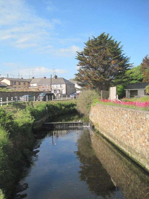
103.1.4 Environmental problems relevant to the plan.
Water Framework Directive
The Water Framework Directive (WFD) requires Member States to manage all of
their waters and ensure that they achieve at least 'good status’ by 2015. EPA
maps show that groundwater status in and adjacent to the plan area is good.
Surface water status at Courtown North Beach Bathing Area and the
Owenavorragh River is also good. However, surface water quality in the
Breanogue River is identified as poor.1 WFD status is shown to be poor for both
the Owenavorragh and Breanogue rivers and these rivers are identified as being
at risk of not achieving good water quality status by 2015.
Wastewater
The Courtown Waste Water Treatment Plant (WWTP) was commissioned in
2002. It treats all flows from the Courtown drainage scheme area and also treats
part of the Gorey wastewater load. The plant has a design capacity of 12,000
P.E. The plant provides secondary treatment and discharges to sea by a long
outfall pipe. Two main pumping stations are located at Gorey WWTP and
Courtown Harbour.
The Gorey WWTP is currently at capacity but provides secondary treatment for
5,000 P.E. Gorey WWTP discharges to the Banogue River which in turn
discharges to the Owenavorragh River which discharges to the sea through
Courtown Harbour. Excess waste water from Gorey is pumped to Courtown
WWTP.
An upgrade to the Courtown WWTP is to commence shortly and is expected to
be completed by the end of 2015. The upgrade will provide for 35,000 P.E. with
20,000 P.E. allocated to Gorey and 15,000 P.E. allocated to Courtown. The
Gorey WWTP will be converted to storm water storage once the Courtown
WWTP is complete and all waste water from Gorey town will be pumped to the
Courtown WWTP.
1 th
http://gis.epa.ie/Envision/ [accessed 15 August 2013]
11The upgrading of the drainage scheme in Courtown will lead to the general
improvement of the water quality in the streams in the drainage scheme. A
reduction in nutrient levels is to be expected with an overall improvement in the
aesthetic quality of the waterways in the environs of Courtown.2
Drinking Water
Courtown has experienced some difficulties with drinking water supply, especially
during the summer months. Water is currently treated at the Barnadown Water
Treatment Plant (WTP) which serves south Gorey and Courtown (north Gorey is
served by the Creagh WTP). The Barnadown WTP provides capacity/loading for
2,000 PE to 5,000 PE during the summer months. New mains have been laid in
Gorey and Courtown which has improved water supply.
A new Water Treatment Plant (WTP) and water storage reservoir are proposed at
Ballyminaun Hill to the south of Gorey Town. It is anticipated that the new WTP
will be completed mid 2016, subject to approval by Irish Water. Eight new
boreholes will supply water to the new WTP at Ballyminaun Hill. Six of these
boreholes have already been brought into production and the additional wells are
expected to be brought into production once the new WTP is complete.
Six of these boreholes have already been brought into production and this has
significantly improved water supply in the area. The two additional wells
(treatment required for high manganese) are expected to be brought into
production once the new WTP is complete.
Bathing Water
Identified bathing waters are monitored, assessed and managed under the
requirements of the 2008 Bathing Water Quality Regulations. Courtown North
Beach was designated as a Bathing Water in 1992. The bathing area is
approximately 0.5 km long and the bathing water is approximately 0.1 km2 in
2
Courtown Drainage Scheme Environmental Impact Statement, Appendix No. 4 Flora, Fauna and
Water Quality Study
12area. The Owenavorragh River drains into the bathing area to the north and by
canal through Courtown harbour to the south.
Courtown North Beach is a blue flag beach and is identified as having good
quality bathing water.3 The Bathing Water Profile for Courtown North Beach
(March 2011) identifies Courtown WWTP, Gorey WWTP and the Owenavorragh
River as potential pressures on the bathing area but indicates that all three
pressures do not pose any significant risk.
Flooding
The OPW flood maps identify one recurring flood point at Riverchapel
(www.floodmaps.ie). The report for the recurring flood point states that the
estimated return period is greater than 20 years.
The OPW has also carried out a Preliminary Flood Risk Assessment as part of
the CFRAM (Cathcment Flood Risk Assessment and Management) Study. This
identified a risk of flooding along the coast and the Breanoge river bank.
A Strategic Flood Risk Assessment (SFRA) will be carried out in tandem with the
LAP in accordance with The Planning System and Flood Risk Management:
Guidelines for Planning Authorities (DoEHLG & OPW, 2009). The sequential and
justification tests will be applied to land use zoning and site-specific flood risk
assessments will be required for development proposals, where relevant. It is
noted that an old landfill is located within an area subject to flooding (Flood Zone
A). This will be addressed by a suitable land use zoning and objectives in the
LAP.
Landfill
A site within the plan area, measuring approximately 0.85 hectares, was formerly
used as a quarry and was subsequently used as a landfill site from 1965 to 1975.
The site is also located in Flood Zone A.
3 th
Splash - the National Bathing Water Information website for identified waters [accessed 13 August
2013]
13The site is not classed as a historic unlicenced waste disposal site under the
Waste Management (Certification of Historic Unlicensed Waste Disposal and
Recovery Activity) Regulations 2008. However, it is considered that appropriate
risk assessment would be required prior to any development taking place on the
site. Where likely significant environmental impacts are identified, suitable
remediation measures would be required to be put in place to the satisfaction of
the local authority.
The EPA Code of Practice: Environmental Risk Assessment for Unregulated
Waste Disposal Sites (April 2007), page 3, states:
“Landfill sites operated and closed prior to 1977 are outside the general scope of
this document as the Waste Framework Directive only came into force in July
1977. However, if landfill sites operated prior to 1977 are identified during the
application of the Identification Methodology and it is considered that they may
pose a risk to the environment or human health then the risk screening process
should be applied in line with the precautionary principle and in the interest of
environmental protection.
This methodology shall be used in conjunction with other guidance documents
published by the Agency on various aspects of landfilling, including those listed in
Chapter 9. The EPA landfill manual series includes guidance on site
investigations, monitoring, and restoration and after care as well as providing
details on specific risks from landfill gas and leachate.”
In the application of the precautionary principle therefore the planning authority
will include an appropriate objective with regard to the assessment of this site
prior to consent being given for development. The planning authority will also
ensure that the zoning is the most appropriate to the potential sensitivities.
14Designated Sites
There are two pNHAs in/adjacent to the plan area. Courtown Dunes and Glen
pNHA (site code 000757) is a large area of mixed woodland situated immediately
north of Courtown (at the northern end of the plan area). It consists mostly of
mixed woodland along the Owenavarragh River and a dune ridge which is largely
wooded. Ardamine Wood pNHA (site code 001733) is situated on the east coast
approximately 3km south of Courtown (southern end of the plan area). The site
consists of a woodland area with associated scrub and heath that slopes down to
clay sea cliffs and bedrock shores.4
The nearest Natura 2000 sites to Courtown include the Kilpatrick Sandhills SAC
located approximately 10km along the coast to the north; the Cahore Polders and
Dunes SAC and the Cahore Marshes SPA, located approximately 10km along
the coast to the south; and the Slaney River Valley located approximately 10km
inland to the west.
Protection of designated sites is high priority. The LAP will include objectives for
the protection of these sites and also for the management of features of the
landscape which are important for the migration, dispersal and genetic exchange
of wild species. The Plan will also be screened for Appropriate Assessment in
accordance with the Habitats Directive, to ensure that its implementation will not
adversely affect the integrity of any Natura 2000 sites. It is not anticipated that a
Stage 2 Appropriate Assessment will be required.
Archaeology
There are four Recorded Monuments in the plan area: a latin Cross at Ballintray
(WX012:006), a church site (WX012-009) and motte and bailey (WX012-010) at
Ardamine and a promontory fort (WX012-012) at Glen (Richards). The plan will
include objectives to ensure that new development does not negatively impact on
these sites.
4
Site Synopses for Courtown Dunes and Glen and Ardamine Wood
15There are a number of structures in the plan area which are included on the
Record of Protected Structures contained in the Wexford County Development
Plan 2013-2019. Appropriate objectives are included in the County Development
Plan for the protection of these structures and similar objectives will be included
in the LAP.
Coastal Erosion
Courtown North Beach has extensive coastal protection works all along the
boundary between the dunes/woodland and the beach itself. To the south of
Courtown Harbour, a number of landowners have placed rock armory along the
boundaries of their property.
The Irish Coastal Protection Strategy Study Phase II shows predicted future
erosion on the east coast for the years 2030 and 2050.5 The study identifies low
confidence rates for erosion predications in localised areas where coastal
protection works are in place. This includes Courtown (at the northern end of the
plan boundary) and Pollshone (at the southern end of the plan boundary). In
between these areas, Ardamine is identified as one of ten primary areas of
potential significant coastal erosion hazard. This area is identified as having high
confidence (i.e. between 70% and 85% confidence in the erosion extent shown).
The plan will include a statement of the Council’s intent and an objective to
carryout maintenance works on some existing coastal defence works. There is
also reference to maintenance dredging of the harbour area and the potential, in
the long term that the council will erect four break waters at Courtown beach to
facilitate beach replenishing. Any such developments will be required to be
subject to detailed environmental assessment and will be required to comply with
the relevant EU and national legislation when such plans are developed to an
appropriate stage. Such development will also be required to be in accordance
with Objective CZM03 of the County Development Plan 2013-2019. The plan will
5
The erosion maps have been produced for existing conditions only and do not currently include for
projected future changes in climate such as sea level rise, increased storm frequency or associated
variations in erosion rates. Neither do they include for variations in erosion rates due to planned
coastal protection or dredging works or other potential changes of a geological nature.
16include an objective to consider planning applications for coastal defense works
by others. Such works will be required to be carried out in accordance with
objective CZM03 of the Wexford County Development Plan 2013-2019 and a
similarly worded objective will be included in the plan. The Wexford County
Development Plan 2013-2019 was subject to SEA and Appropriate Assessment
screening.
Traffic
Courtown sometimes experiences traffic congestion, but this is generally limited
to bank holiday weekends and hot weather spells. In general there are no issues
with traffic flow and there are no current proposals for new roads in the area.
There are some concerns around pedestrian safety and the Plan will include
appropriate objectives for the development of footpaths, in particular between
Courtown and Riverchapel. An objective to encourage the creation of a
continuous path along the entire coastline of the plan area will also be
considered, subject to the proper planning and sustainable development of the
area (including compliance with EU Directives) and subject to available funding.
3.1.5 The relevance of the plan for the implementation of European Union
legislation on the environment (e.g. plans linked to waste management or
water protection).
Issues in relation to EU legislation on the environment are addressed in the
Wexford County Development Plan 2013-2019 which is the overarching plan for
the area. The LAP will be consistent with the objectives of the County
Development Plan and will include appropriate objectives to comply with EU
legislation. Particular regard will be had to EU Directives on habitats, water
quality, flooding, waste management, SEA and EIA. Regard will also be had to
the Joint Waste Management Plan for the South-East region 2006-20116 or any
subsequent updated version of this document, and the South Eastern River Basin
Management Plan (2009-2015). These plans seek to implement EU Directives on
waste management and water quality.
6
This Plan has been extended until a new plan is in place in early 2014
173.2 CHARACTERISTICS OF THE EFFECTS AND OF THE AREA LIKELY
TO BE AFFECTED, HAVING REGARD, IN PARTICULAR, TO:
3.2.1 The probability, duration, frequency and reversibility of the effects.
Water quality
It is not envisaged that the implementation of the Plan will have any negative
impacts on water quality. The upgrade to the WWTP will have positive impacts for
water quality and all new development will be subject to appropriate infrastructure
being in place.
Water supply
The Council will work with the water utilities provider to ensure the maintenance
of a sufficient water supply that will meet the development needs of the plan area
and minimise wastage in the water supply network by implementing water
conservation measures. This will have positive effects for water supply in the area
for the duration of the plan.
Wastewater treatment and disposal
The upgrade to the Courtown WWTP will ensure a sufficient supply to meet
demand during the lifetime of the plan.
Flooding
The implementation of the Plan will not exacerbate flood risk in the area. An
SFRA will be carried out in tandem with the Plan and the sequential approach
and justification test for land use zoning shall apply. Site-specific flood risk
assessment will be required for proposed developments, where relevant, and the
Council will seek to ensure that all proposed drainage systems are consistent
with Sustainable Urban Drainage Systems (SuDS).
Traffic generation
The Plan will include objectives to promote alternative modes of transport to the
private car and will facilitate the development and upgrading of footpaths and
cycle lanes. It is not considered that implementation of the Plan will result in such
18additional traffic so as to impact negatively on the environment.
Waste generation/collection
The Council aims to address the issue of waste through the continued promotion
of waste education, re-use and recycling and the regulation of private contractors.
It is envisaged that this will have positive long term effects on the environment.
Loss of hedgerows and trees
The preparation of the Plan will include the carrying out of a habitats survey and
identification of Article 10 corridors. Appropriate objectives will be included in the
Plan to manage these features in accordance with the requirements of the
Habitats Directive and to retain such features in the design of new developments
insofar as is possible.
Heritage
The Wexford County Development Plan 2013-2019 includes appropriate
objectives for the protection of the natural and built heritage and similar objectives
will be included in the LAP.
3.2.2 The cumulative nature of the effects
In terms of strategic plans and programmes, the LAP will have positive
cumulative effects as it will seek to implement regional objectives in relation to
waste management and water protection at the local level.
Flood control policy will seek to ensure that all proposed drainage systems are
consistent with Sustainable Urban Drainage Systems (SuDS). This will have
positive cumulative effects in terms of reducing surface water run-off and flood
risk in the plan area.
Objectives to provide community facilities and high quality open spaces as well
as the promotion of public transport and improved linkages in the area will also
have positive cumulative impacts on human health.
19Positive cumulative impacts on cultural heritage will be provided through the
protection of monuments and structures of intrinsic interest. These are just some
of the examples of positive cumulative impacts on the environment which are
envisaged through the implementation of the LAP.
Appropriate Assessment screening will be carried out in accordance with the
Habitats Directive as part of the LAP process and this will consider cumulative or
in-combination impacts on Natura 2000 sites.
3.2.3 The transboundary nature of the effects.
There will not be any significant transboundary effects on the environment from
implementing the plan.
3.2.4 The risks to human health or the environment (e.g. due to accidents).
No risks to human health or the environment due to accidents have been
identified. There are no designated SEVESO sites within the plan area. The
upgrading of the WTP and WWTP will have a positive effect on water quality and
therefore on the likelihood of any risks to the environment and human health.
The plan will encourage more sustainable land use patterns and encourage
sustainable transport options and as such will improve air quality.
3.2.5 The magnitude and spatial extent of the effects (geographical area
and size of population likely to be affected).
The Census 2011 results show the population of Courtown and Riverchapel to be
2,857 persons. However, the census boundary does not follow the plan
boundary, with the latter having a larger area to include a caravan park at
Middletown and a number of housing estates at Pollshone. The population for the
plan area has therefore been estimated at 2,977 persons.
Courtown and Riverchapel is identified as a District Town in the Wexford County
Development Plan 2013-2019. It is stated in the County Development Plan that
growth in these areas should be more limited and that new development should
seek to consolidate the existing settlements.
20The Core Strategy contained in the County Development Plan allows for an
increase of 5.6% in population in Courtown and Riverchapel during the period
2013-2019. It is not envisaged that the plan boundary will be extended from what
was included in the 2002 Plan (now expired) and no additional lands will be
zoned for residential development. The focus will be on consolidating the existing
urban structure through infill development, redevelopment of brownfield sites and
completion of unfinished housing estates, subject to normal planning and
environmental criteria. The Council will also seek to reduce the vacancy rate in
the area (though second homes will be accommodated in accordance with the
objectives of the County Development Plan).
3.2.6 The value, and vulnerability of the area likely to be affected due to:
(a) special natural characteristics or cultural heritage;
The County Development Plan is the overarching plan for the area and contains
appropriate objectives for the protection of the natural and built heritage. Similar
objectives will be included in the LAP. As such, there will be no likely significant
impact on cultural heritage as a result of implementing the plan. Any planning
applications in relation to a Recorded Monument, Protected Structure or
proposals which could have a significant impact on a designated site will be
referred to the relevant prescribed authorities and will be individually assessed for
their impacts on cultural heritage. All plans and projects will be subject to
Appropriate Assessment screening in accordance with the Habitats Directive, to
ensure that they would not affect the integrity of a Natura 2000 site.
(b) exceeded environmental quality standards or limit values;
It is not expected that any environmental quality standards will be exceeded or
that the value of vulnerable areas limited as a result of implementing the Plan.
The environmental objectives to be contained in the LAP will seek to reduce the
overall impact of future developments on existing habitats and species and
environmentally sensitive locations.
21(c) intensive land use
The Plan will seek to consolidate the existing urban settlement through
appropriate infill development and redevelopment of brownfield sites. This may
result in some intensification of land use in the village centre. However, is not
expected that the intensification of land uses in the plan area will be such that
vulnerable areas will be significantly affected. All new residential development will
be required to be in accordance with Planning Guidelines on Sustainable
Residential Development in Urban Areas (DEHLG, December 2008).
3.2.7 The effects on areas or landscapes which have a recognised
national, European Union or international protection status.
The implementation of the Plan will not have significant environmental effects on
landscapes which have a recognised national, EU or international protection
status. Appropriate objectives are included in the Wexford County Development
Plan 2013-2019 for the protection of these sites and similar objectives will be
included in the LAP. The Plan will be subject to Appropriate Assessment
screening in accordance with the Habitats Directive. It is not anticipated that a
Stage 2 Appropriate Assessment will be required.
4.0 Conclusion
The Planning Authority has considered whether the implementation of the Courtown
and Riverchapel LAP 2014-2020 would be likely to have significant effects on the
environment, taking account of relevant criteria set out in Schedule 2A of the
Planning and Development (Strategic Environmental Assessment) Regulations 2004
(as amended). It is not anticipated that implementation of the Plan will have likely
significant effects on the environment.
22Strategic Environmental Assessment
Screening of the Proposed Alterations to the
Draft Courtown and Riverchapel Local Area
Plan 2014-2020
November 2014Table of Contents 1.0 Background ................................................................................................. 1 2.0 Proposed Alterations ................................................................................... 2 3.0 Assessment of the environmental effects of the Proposed Alterations........ 5 4.0 Conclusion ................................................................................................ 10
1.0    Background
The Draft Courtown and Riverchapel Local Area Plan 2014-2020 was prepared in
accordance with the Planning and Development Act 2000 (as amended) and was
screened for Strategic Environmental Assessment in accordance with the
Planning and Development (Strategic Environmental Assessment) Regulations
2004 (as amended). Following consultation with Environmental Authorities, it was
determined that the Draft Local Area Plan (LAP) would not be likely to have
significant effects on the environment and a full SEA was therefore not required
to be carried out.

The Draft LAP was subsequently made by Wexford County Council and was
placed on public display for a period of six weeks in accordance with the
requirements of the Planning and Development Act 2000 (as amended).
Following this consultation period Wexford County Council decided to make a
number of material alterations to the Draft LAP. These alterations are
summarised in Section 2 of this Report.

The Proposed Alterations to the Draft LAP have been screened for SEA in
accordance with Section 20(3)(f) of the Planning and Development Act 2000 (as
amended). The results of this screening process are documented in this report.

The Proposed Alterations will be placed on public display for a period of four
weeks during which time written submissions/observations may be made to the
planning authority. Written submissions/observations relating to the Proposed
Alterations will be taken into consideration and the Draft LAP will be adopted with
or without the Proposed Alterations.

Article 14G of the Planning and Development (Strategic Environmental
Assessment) Regulations 2004 (as amended), provides that information on the
likely significant effects on the environment of implementing the proposed
alterations will also be available for inspection and that a submission or

                                                                                   1
observation in relation to such information made to the planning authority within
the stated period will also be taken into consideration before the making of any
alteration.
2.0 Proposed Alterations
The Proposed alterations include a number of minor amendments and
clarifications to the Draft Plan. The material alterations include the following:
• Amendment to Objective TE08 to move the indicative location of the
proposed WC/shower block so that it is outside of the pNHA.
• Amendment to Objective AM05 to include the development of cycling
paths in tandem with the new pedestrian routes subject to suitability and
the necessary financial resources being available.
• Amendment to the Natural Heritage Section to highlight and strengthen
the importance of riparian buffer zones. A minimum of 5-10m riparian
buffer zone will be required and up to 50m in certain cases. The following
additional objectives are also proposed:
NH06 To only consider proposals for culverting/piping of streams and
watercourses where these works are deemed absolutely necessary and
appropriate. Inland Fisheries Ireland (IFI), National Parks and Wildlife
(NPWS) and the Office of Public Works (OPW) will be consulted, where
appropriate.
NH07 To have regard to the ‘Planning for Watercourses in the Urban
Environment Guidelines’ (Shannon Regional Fisheries Board) when
considering development proposals in the vicinity of rivers and streams
within and adjoining the plan area.
2• Inclusion of an additional section on invasive non-native species and two
new objectives as follows:
NH08 To promote best practice in the control of invasive species and
support measures for the prevention and/or eradication of invasive species
as appropriate and as opportunities and resources allow.
NH09 To raise awareness in relation to invasive species, including making
landowners and developers aware of best practice guidance in relation to
the control of invasive species and encouraging them to adhere to same
and, to ensure, in so far as possible, that proposals for development do
not lead to the spread of invasive species.
• Amendment to Flood Risk Management Section to reflect the changes
proposed in the following two bullet points. Objective F03 is amended as
follows:
To ensure that screening for flood risk is carried out for all development
proposals in accordance with the Planning System and Flood Risk
Management-Guidelines for Planning Authorities (DEHLG and OPW,
2009), as amended by Circular PL2/2014 and any other future update to
the Guidelines.
Planning applications for development proposals within, or incorporating
areas at moderate (Flood Zone B) to high (Flood Zone A) risk of flooding
will be required to be accompanied by a site specific and appropriately
detailed flood risk assessment. In Flood Zone C the need for an
appropriately detailed site specific flood risk assessment will be assessed
based on a number of factors including, inter alia, the proximity to Flood
Zone A or B, the topography of the subject lands and adjoining lands and
the nature and vulnerability of the development proposal.
3The required site-specific flood risk assessment shall be carried out by a
suitable qualified and indemnified professional and in accordance with the
requirements of the Planning System and Flood Risk Management
Guidelines for Planning Authorities (Department of Environment, Heritage
and Local Government and Office of Public Works, 2009), as amended by
Circular PL2/2014 and any other future update to the Guidelines.
• Replacement of Appendix 3 Strategic Flood Risk Assessment with a
revised Strategic Flood Assessment. The revised assessment comprises a
Stage 2 Flood Risk Assessment prepared by JBA Consulting on behalf of
the Council. The Stage 2 assessment focused on modelling all of the
watercourses in and adjoining the plan area (the modelling was carried out
at a more detailed level than the previous flood map datasets used by the
Local Authority). The resulting flood zone maps were verified through site
walkovers and consultations with Engineers from the Local Authority. The
verified flood zone maps were then used to inform land use zoning
throughout the plan area and necessary policy responses.
• Amendment of land use zoning of all areas within Flood Zone A and B
(both developed and greenfield sites) to ‘Leisure and Amenity’ (water
compatible leisure and amenity uses). This amendment is a result of the
revised flood modelling and Circular Letter PL2/2014 dated 13th August
2014 which amends the Flooding Guidelines and states that planning
authorities should, when reviewing development plans, consider if an
existing land use zoning of a vulnerable use is still the appropriate zoning
for the area.
• Amendment of land use zoning at Seamount (approx. 1.05 ha.) from
‘Community and Education’ to ‘Holiday Caravan / Mobile Home Park’.
4The Proposed Alterations seek to strengthen the Draft LAP and ensure the
overall proper planning and sustainable development of the area during the
lifetime of the Plan.
3.0 Assessment of the environmental effects of the Proposed
Alterations
In deciding whether the Proposed Alterations are likely to have significant
environmental effects, they must be assessed against a set of criteria listed in
Annex II of the SEA Directive/Schedule 2A of the Planning and Development
(Strategic Environmental Assessment) Regulations 2004 (as amended). This
assessment has been carried out and is summarised below.
3.1 THE CHARACTERISTICS OF THE PLAN HAVING REGARD IN
PARTICULAR TO:
3.1.1 The degree to which the plan sets a framework for projects and other
activities, either with regard to the location, nature, size and operating
conditions, or by allocating resources;
The purpose of the LAP is to provide a development framework for Courtown and
Riverchapel. This framework will include the zoning of land for the use solely or
primarily of particular areas for particular purposes. It will give a general indication
on the preferred urban structure and layout for the area with reference to public
open space, urban design, access roads and infrastructural requirements and will
set the framework for planning applications and other developments.
The Proposed Alterations to the Draft LAP will not significantly affect the
proposed development framework. The location, nature, size and operating
conditions of activities may be affected through the proposed revisions to land
use zoning i.e. water compatible developments in areas zoned as Leisure and
Amenity. However, this will have a positive impact by reducing the risk of flooding
to people, property and the environment.
5Individual proposals for development will be subject to detailed assessment at the
planning application stage and will be subject to compliance with normal planning
and environmental criteria and EU Directives.
3.1.2 The degree to which the plan influences other plans, including those
in a hierarchy.
The hierarchy of land use plans on which this LAP is based is the National Spatial
Strategy 2002-2020, the Regional Planning Guidelines for the South-East Region
2010-2022 and the County Wexford Development Plan 2013-2019. The County
Development Plan is the ‘parent’ plan and the LAP must be consistent with its
objectives.
3.1.3 The relevance of the plan for the integration of environmental
considerations, in particular with a view to promoting sustainable
development.
The LAP is being prepared under the Planning and Development Act 2000 (as
amended) and must therefore be in accordance with the proper planning and
sustainable development of the area. Accordingly, all policies and objectives in
the LAP have been informed by the principles of sustainable development.
The Proposed Alterations to the Draft LAP seek to strengthen the principles of
sustainable development through:
• Promotion of cycling through the development of cycling paths in tandem
with the new pedestrian routes, where suitable.
• Protection of riparian zones through the requirement for minimum buffer
zones of 5-10m and up to 50m in certain cases, depending on the width of
the river and the nature of the site.
• Prevention and/or eradication of invasive non-native species which are a
threat to local biodiversity.
• Verification of flood maps and appropriate policy responses to
prevent/reduce flood risk to people, property and the environment.
63.1.4 Environmental problems relevant to the plan.
The SEA Screening Report for the Draft LAP highlighted a number of
environmental problems relevant to the plan area including water quality
(including water supply, wastewater treatment infrastructure and bathing water),
flooding, pre-1977 landfill, coastal erosion and traffic flow. Appropriate objectives
have been included in the Draft LAP to address these issues. The Proposed
Alterations do not present any additional environmental problems relevant to the
plan area. The issue of flooding is further addressed through the verification of
flood maps and the appropriate policy responses.
3.1.5 The relevance of the plan for the implementation of European Union
legislation on the environment (e.g. plans linked to waste management or
water protection).
Issues in relation to EU legislation on the environment are addressed in the
Wexford County Development Plan 2013-2019 which is the overarching plan for
the area. The Draft LAP and the Proposed Alterations are consistent with the
objectives of the County Development Plan and appropriate objectives are
included to comply with EU legislation, in particular in relation to habitats, water
quality, flooding, waste management, SEA and EIA.
3.2 CHARACTERISTICS OF THE EFFECTS AND OF THE AREA LIKELY
TO BE AFFECTED, HAVING REGARD, IN PARTICULAR, TO:
3.2.1 The probability, duration, frequency and reversibility of the effects.
The effects of the Proposed Alterations will be to increase local biodiversity value,
reduce the risk of flooding to people, property and the environment and to
promote alternative modes of transport to the private car. This will result in
positive, long term impacts on biodiversity, water and human health.
3.2.2 The cumulative nature of the effects
The Proposed Alterations will have positive cumulative effects on water quality,
7biodiversity and human health. For example, reduced flood risk, taken together
with the planned upgrade to the Courtown Wastewater Treatment Plant, will have
positive cumulative impacts on surface water quality, which in turn will have
positive impacts on biodiversity. Control and/or eradication of invasive non-native
species, taken together with objectives in the Draft Plan to protect important
ecological corridors and stepping stones, will also have positive impacts on local
biodiversity. Similarly, the development of cycling paths in tandem with the new
pedestrian routes will have positive impacts on human health, and also on air
quality through a reduction in car journeys within the plan area.
3.2.3 The transboundary nature of the effects.
There will not be any significant transboundary effects on the environment from
implementing the Draft LAP/Proposed Alterations.
3.2.4 The risks to human health or the environment (e.g. due to accidents).
No risks to human health or the environment due to accidents have been
identified.
3.2.5 The magnitude and spatial extent of the effects (geographical area
and size of population likely to be affected).
The geographical area and size of population affected by the Draft Plan are not
amended as a result of the Proposed Alterations.
3.2.6 The value, and vulnerability of the area likely to be affected due to:
Special natural characteristics or cultural heritage
The Draft LAP includes appropriate objectives for the protection of the natural
and built heritage. The Proposed Alterations also include four new objectives in
relation to natural heritage (Objectives NH06 – NH09) which will further ensure
that the special natural characteristics of the plan area are protected.
8You can also read