2020-21 30-Year Plan for Greater Adelaide - 2017 Update Report Card - The 30-Year Plan for ...
←
→
Page content transcription
If your browser does not render page correctly, please read the page content below
2020-21

30-Year Plan for Greater Adelaide – 2017 Update
Report Card
The 30-Year Plan for Greater Adelaide - 2017 update (the Plan) states that the State Planning
Commission (the Commission) will monitor the implementation of the Plan and provide an annual
Report Card on the progress of the actions and targets. The scope of the Report Card is to measure
progress against six high level strategic targets that reinforce the outcomes of the Plan to deliver a
more compact urban form, and to manage growth within the existing urban footprint by monitoring
how our city grows. The six targets are a key tool in determining whether the policies and actions
outlined in the Plan have been effective in delivering the new urban form.

Each target was reviewed in 2020, using the best available data and methods, to provide an update
on progress against the 2015 baseline values set in the Plan. Three of the targets have been
measured using reliable and consistent data to provide a direct comparison against the baseline. The
remaining targets have data inputs that could not be directly compared against the baseline, or
showed potential for improved reporting efficiencies through alternative measures, and were identified
as requiring review.

Both Target 3 (getting active) and Target 4 (walkable neighbourhoods) were not measured in 2020
because the only data available is from the 2016 Census. Given the age of this data, it was
determined the August 2021 Census will provide more timely and relevant data for assessment of
these targets. A review of these targets will take place as part of the 30-Year Plan update,
commencing in 2022.

Target 5 (a green liveable city) has seen significant improvements to the data capture and monitoring
method since the baseline was established. These improvements have resulted from a partnership
between the Government of South Australia (DEW and DPTI) and 18 local governments to measure
tree canopy cover 1 across metropolitan Adelaide using Light Detection and Ranging (LiDAR) data.
LiDAR data is now recognised as a more accurate and robust method for measuring tree canopy
extent and change over time. As a result of this change in method, it is not possible to currently
measure progress against the baseline in the Plan.

1
    https://data.environment.sa.gov.au/Climate/Data-Systems/Urban-Heat-Mapping/Pages/default.aspx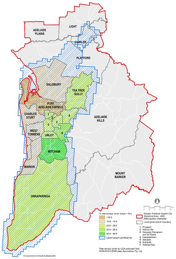
Target 1 - Containing our urban footprint and protecting our resources
The Plan aims to progressively change Adelaide’s urban form by containing the outward growth of
the metropolitan area and avoiding consumption of highly productive agricultural and horticultural
land on the urban fringe.

Target 1.1 - 85% of all new housing in Metropolitan Adelaide will be built in established urban
areas by 2045.

Target 1.2 - 90% of all new housing in the Outer Greater Adelaide 2 will be built in established
townships and designated urban development areas by 2045.

How is this target measured?
The target is measured using annual dwelling count data prepared by the Attorney-General’s
Department (AGD). New dwellings are attributed to infill, fringe or township locations within
Metropolitan Adelaide 3, as shown in Map 1.

Current Status
                                                Target Achieved

                                                   On Track

                                                   Some progress

                                                Requires Review

                                                       Target 1.1              Target 1.2
    Baseline 2015                                          76%                      88%
    Status 2020                                            82%                      91%
    Target 2045                                            85%                      90%

Assessment
This target is on track. However, ongoing monitoring is required to capture the most recent urban infill
and greenfield development trends.

2   ‘Outer Greater Adelaide’ covers the area outside of the GACC, but within the Greater Adelaide Planning Region (GAPR) shown on Map 1
3 ’Metropolitan Adelaide’ relates to the extent of the Greater Adelaide Capital City (GACC) statistical area, defined by the Australian Bureau
of Statistics (ABS) and shown on Map 1

                                                                      2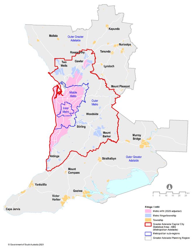
Map1 – Metro infill vs metro fringe/township

                                               3
Target 2 - More ways to get around
The Plan seeks to provide more housing options in locations that are well serviced by frequent public
transport, aiming to grow public transport use in Adelaide.

Target - 60% of all new housing in Metropolitan Adelaide is built within close proximity to current
and proposed fixed line (rail/tram/O-Bahn) and high frequency bus routes by 2045.

How is this target measured?
This target is measured using annual dwelling count data prepared by AGD. New dwellings are
attributed to the defined public transport catchments and then calculated as a proportion of the total
dwellings built in Metropolitan Adelaide (urban area). Any additions to the public transport network
that meet the high frequency criteria of this target will be added and included in the analysis.

Current Status

                                   Target Achieved

                                     On Track

                                     Some Progress

                                   Requires Review

 Baseline 2015                                       41%
 Status 2020                                         47%
 Target 2045                                         60%

Assessment
This target is on track. Future monitoring will ensure continued progress towards the target and
identify areas for improvement.

                                                     4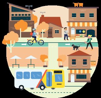
Target 3 - Getting active
The plan aims to encourage people to travel to work by active transport modes, including walking,
cycling and public transport use. This will result in increased capacity and reduced congestion in the
transport network; reduced environmental impacts; improved public health; reduced healthcare costs;
and improved community wellbeing and social cohesion.

Target - Increase the share of work trips made by active transport modes by residents of Inner,
Middle and Outer Adelaide by 30% by 2045.

How is this target measured?
At this time, only the 5 yearly census data is available. Additional data sources will need to be
explored to allow reporting against this target.

Current Status
                                         Target Achieved

                                           On Track

                                           Some Progress

                                         Requires Review

                                Metro Adelaide          Inner     Middle        Outer
 Baseline 2015                       14.1%              24%        14.4%        9.1%
 Target 2045                         18.3%              31.2%      18.7%        11.8%

Assessment
This ambitious target involves a change in travel behaviour, as well as changes in development
patterns and infrastructure planning. As a result, it is expected that it will take time to deliver real
measurable change. In addition, the data required to accurately review against the baseline is only
delivered once every 5 years through the Australian Bureau of Statistics (ABS) Census. Given the
age of the 2016 Census data, it is not possible to provide an accurate state of play in relation to this
target.

It is also worth noting that the Census only captures the journey to work on a single day in each 5-
year period. Therefore extraordinary events like rail closures, extreme weather and COVID-19 can
limit the effectiveness of this data for reliably measuring change. It is recommended that while the
2021 Census data (released in mid-2022) would provide the best opportunity for an accurate status
update using the same data input methods, a review of this target is required.

The Plan review will consider the availability of alternative data sources to enable more frequent
status updates. Investigation into methods that may capture a broader range of trips (work, school,
shopping and leisure) will also ensure a more comprehensive assessment of travel behaviours. The
review may suggest a new baseline be established from 2022.

                                                    5
Target 4 - Walkable neighbourhoods
A ‘walkable neighbourhood’ is where the daily needs of most residents can be met within a short trip
of where they live or work. It provides close access by foot, bike or public transport to jobs, shopping,
learning, open space, recreation and other amenities and services. Such neighbourhoods have
extensive economic, social, health and environmental benefits.

Target - Increase the percentage of residents living in walkable neighbourhoods in Inner, Middle
and Outer Metropolitan Adelaide by 25% by 2045.

How is this target measured?
This target measures walking distance to public open space, primary schools, public transport and
shops. Population data at the ABS mesh block level (approximately 30 to 60 households) are
overlaid with walking networks to estimate the population within each walkability category.

Current Status

                                       Target Achieved

                                         On Track

                                         Some Progress

                                       Requires Review

                                 Inner        Middle          Outer
 Baseline 2015                   73%            53%            30%
 Target 2045                     90%            66%            36%

Assessment
This target has been identified as requiring review because the data needed to accurately measure
performance against the baseline is only delivered once every 5 years through the ABS Census. The
current baseline for this target is based on the 2011 census, and the next available data for
measuring this target is from the 2016 census. Given the age of the data, it is not possible to provide
an accurate state of play in relation to this target.

It is therefore recommended that while the 2021 Census data (expected to be released in mid-2022)
would provide the best opportunity for an accurate status update for this target using the same data
input methods, a review of this target is required.

The Plan review will consider the availability of alternative data sources to enable more frequent
status updates. Effective monitoring of this target also requires the input criteria be reviewed and
updated to reflect changes in land use (parks, schools, transport and shops) over time. Consideration
may also be given for refining the criteria to ensure relevance of this target into the future. The review
may suggest a new baseline be established from 2022.

                                                    6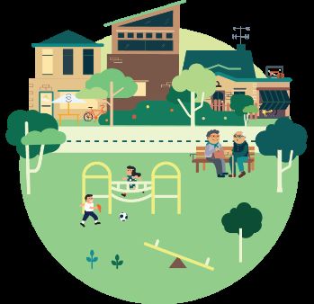
Target 5 - A green liveable city
Urban tree cover, is known to provide multiple economic, biophysical and social benefits. Regular
monitoring of urban tree cover allows for identification of areas with vegetation loss or low vegetation
cover and can ensure that urban infill areas maintain appropriate levels of urban greenery.
Target - For council areas with less than 30% tree canopy cover currently, cover should be
increased by 20% by 2045.
Target - For council areas with more than 30% tree canopy cover currently, this should be
maintained to ensure no net loss by 2045.
How is this target measured?
The target will be measured using software consistently applied to local council areas across the
Adelaide metropolitan area. It is recognised that councils currently have varying amounts of tree
canopy cover. Therefore, the target has been split into two parts, with one for councils with less than
30% tree canopy cover and a separate target for those with greater than 30% tree canopy cover.
Current Status
Target Achieved
On Track
Some Progress
Requires Review
Baseline 2020 (LiDAR method – Trees > 3m, excluding Adelaide Hills) 23.4% average
Target 2045 (LiDAR method– Trees > 3m, excluding Adelaide Hills) 26.7% average
Assessment
Since the release of the Plan in 2017, this target has seen significant progress in terms of an
enhanced data capture and analysis method. This progress has resulted from a partnership between
the Government of South Australia (DEW and DPTI) and 18 local governments to measure tree
canopy cover across metropolitan Adelaide using Light Detection and Ranging (LiDAR) data. The
outcomes of a 2018/2019 study have demonstrated the effectiveness of LiDAR data as a more
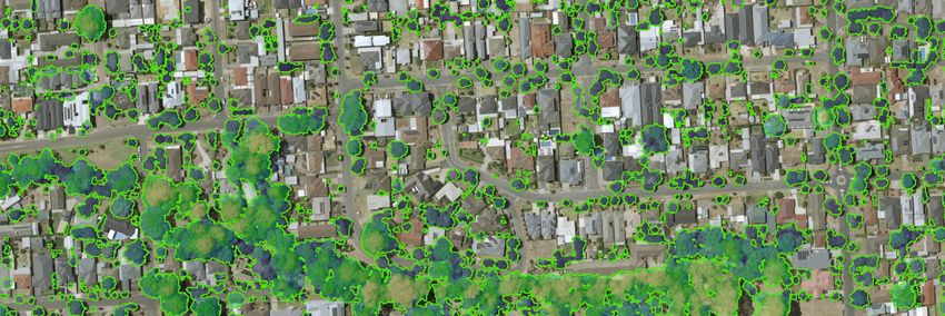
accurate and robust method for measuring tree canopy extent and change over time (see image
below). As a result of this change in method, it is not currently possible to measure progress against
the baseline in the Plan.
7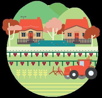
Image: Extract from Urban Heat and Tree Mapping of Adelaide Metropolitan Area (https://data.environment.sa.gov.au/Climate/Data-
Systems/Urban-Heat-Mapping/Pages/default.aspx)

The table below outlines the differences between the LiDAR method and that used to set the 2015
baseline (i-Tree method) in the 30-Year Plan. It demonstrates why these methods cannot be
compared directly, and therefore why an accurate measure of change is not currently possible.

                                       Key variations between i-Tree and LiDAR methods

    i-Tree method                                                     LiDAR method

    •    Measures trees and shrubs.                                   •   Measures tree canopy only (trees greater than 3m).

    •    Random sample technique applied to LGA.                      •   Accurate and complete measurement of all trees.

    •    Covered 19 LGAs including Adelaide Hills which had           •   Captured for most metropolitan LGAs. Adelaide Hills,
         the highest canopy cover (>50%) of all LGAs in the               Playford and Gawler LGAs were only partially
         study area. Measurements were provided for each                  captured by LiDAR. These LGAs could therefore not
         LGA. An average of the 19 LGAs is shown for the                  be calculated and were excluded from the 2020
         baseline.                                                        calculation.

The 2018/2019 LiDAR data capture has been used to map tree canopy cover by LGA as displayed in
Map 2. The benefits of this data to provide a more accurate and repetitive method for monitoring
change over time has led to the recommendation that this data be used to establish a new baseline
for the 2020 report card. In June 2022, updated LiDAR data will be available to provide the first like-
for-like comparison of tree canopy change.

In addition to the improved measurement method, there are recent policy changes that will facilitate
successful achievement of this target in the longer term. These include:

•       The Planning and Design Code now incorporates an Urban Tree Canopy Overlay, with the
        dersired outcome being to ensure that new residential development preserves and enhances
        urban tree canopy through the planting of new trees and retention of existing mature trees.

•       The Urban Tree Canopy Off-set Scheme facilitates tree planting and the enhancement of tree
        canopy in metropolitan Adelaide.

                                                                  8
Map 2 – Tree canopy cover across metropolitan Adelaide, LiDAR 2018/2019

                                            9
Target 6 - Greater housing choice
Historically, the predominant form of housing built in Adelaide has been detached dwellings on large
allotments. The Plan seeks to facilitate the supply of a diverse and well-designed range of housing
types to cater for all ages and lifestyles.
Target - Increase housing diversity by 25% to meet changing household needs by 2045. The
baseline indicates that 25% of dwellings built between 2010 and 2014 were not “detached”. A 25%
increase in diversity aims to see this rise to 32%.
How is this target measured?
This target will be measured using annual dwelling count data prepared by AGD to track the number
of dwellings built by type. It will use a rolling five-year average to calculate the ratio of detached to
non-detached dwellings.
Current Status
Target Achieved
On Track
Some Progress
Requires Review
Non-detached:Detached
Baseline 2015 25:75
Status 2020 33:67
Target 2045 32:68
Assessment
This target is on track. While the latest data indicates that this target has been achieved, further
monitoring is required to ensure a diverse range of housing is developed in the future.
10Summary
The following three targets are on track to be delivered and will continue to be monitored:
• Target 1 - containing our urban footprint and protecting our resources
• Target 2 - more ways to get around
• Target 6 - greater housing choice
The three remaining targets contain strategies that are important to monitor, however the measures
developed in the 30-Year Plan require review:
• Target 3 - getting active
• Target 4 - walkable neighbourhoods
• Target 5 - a green liveable city
11You can also read