2020 Master Plan - Perth Airport
←
→
Page content transcription
If your browser does not render page correctly, please read the page content below
Master Plan
2020
APRIL 2020
112

Section 6:
Ground
Transport
Plan

Ground transport planning
is critical to the continued
growth of Perth Airport and
ensuring there is easy access
for people coming to and
going from the airport.

           PERTH AIRPORT MASTER PLAN 2020   113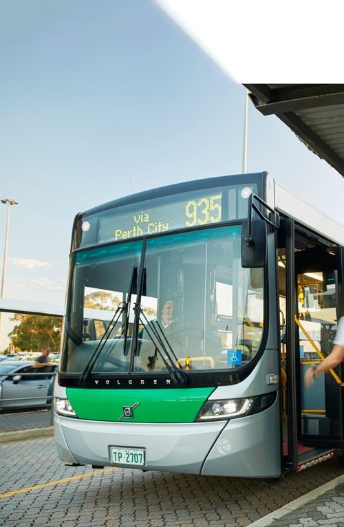
Section 6: Ground Transport Plan

6.1 Introduction                                                       Perth Airport works with State and Local Governments including
                                                                       Main Roads and the PTA to ensure that the changing demands
Ground transport planning is critical to the efficient operation of
                                                                       of Perth Airport operations are reflected in strategic network
Perth Airport. The journey to and from the airport often creates
                                                                       modelling and planning. Perth Airport also ensures that
the first and last impression for people visiting Western Australia
                                                                       developments within the airport estate consider the surrounding
and Perth Airport is working closely with State and Local
                                                                       State and local infrastructure capacity. This engagement will
Governments to ensure road infrastructure provides easy access
                                                                       continue to ensure both the internal and external ground
for all customers.
                                                                       transport networks cater sufficiently to meet demand.
The development and implementation of the Ground Transport
Plan is based on a core principle of seeking to provide multiple
options and streamline the efficiency and customer experience          6.2 State Planning
for people coming to and going from the airport. This is achieved      The State Government is both the regulator and operator of
through integrated planning and adopting a collaborative               public transport services, including bus and rail for the Perth
approach with the State and Local Governments to ensure that           metropolitan area, including that servicing Perth Airport.
the road, rail, shared path, and public transport networks are         Furthermore, the State Government is the regulator for taxi,
developed and operated to provide a suitable level of service.         rideshare and other commercial vehicle operations which service
                                                                       Perth Airport, in addition to its role setting the policy framework
The Ground Transport Plan is focused on the developments
                                                                       to determine mode share targets for the Perth metropolitan
which will occur in the next five year period as well as considering
                                                                       transport network.
the future requirements over the twenty-year planning horizon of
this Master Plan 2020.                                                 Perth Airport is committed to working with State and Local
                                                                       Governments in achieving targets for sustainable transport
The key factors informing the Ground Transport Plan and access
                                                                       options and mode share. Perth Airport will undertake this
to Perth Airport are:
                                                                       collaboration through co-ordination of projects located at the
• the modes of transport used and how they will change over time,
                                                                       airport estate boundary, where appropriate.
• meeting the demands of forecast passenger numbers,
• the consolidation of all commercial air services into Airport        State and Local Governments are responsible for the road
  Central by 2025,                                                     network that surrounds and provides access to Perth Airport.
• integration of the Forrestfield-Airport Link rail project into the   The Ground Transport Plan considers and incorporates the key
  transport network,                                                   State Government land use and transport strategies which
• the anticipated level of commercial development and                  directly impact Perth Airport.
  associated employment on the airport estate,
                                                                       Figure 6-1 shows the location of Perth Airport in the context of
• the growth in traffic on the roads surrounding Perth Airport
                                                                       metropolitan transport.
  generated by activities unrelated to Perth Airport,
• continuing to reduce the convergence of passenger and
                                                                       6.2.1 Perth and Peel @ 3.5 Million – The
  freight vehicle traffic,
                                                                       Transport Network
• integration of the airport’s ground transport network into the
  wider local and state-wide networks, and                             Perth and Peel @ 3.5 Million - The Transport Network (2018)
• providing a safe, secure and sustainable ground transport            was prepared by the State Department of Transport with the
  network.                                                             intent of guiding the long-term planning of transport
                                                                       infrastructure for the Perth metropolitan region. The Transport
The key stakeholders involved in the development of the Ground         Network provides a framework to develop an efficient transport
Transport Plan include:                                                network catering for Perth ’s population as it approaches 3.5
• the State Government Department of Transport, which sets             million people and beyond.
  policy and strategic direction for transport throughout
  Western Australia,                                                   This Master Plan 2020 is consistent with the intent of the
• the State Government Department of Planning, Lands and               Transport Network framework, in providing capacity to support
  Heritage, which develops planning policies related to land use       the ongoing growth of Perth’s population and subsequent
  and the transport network,                                           required transport infrastructure.
• the Public Transport Authority (PTA), which manages and
  operates public transport within Perth and the regions,              6.2.2 State Planning Policy 5.4 Road and Rail
• METRONET, which is made up of key government agencies                Transport Noise and Freight Considerations in
  including Department of Transport, PTA, Department of                Land Use Planning
  Planning, Lands and Heritage, Department of Communities,             The State Planning Policy 5.4 Road and Rail Transport Noise and
  LandCorp and Metropolitan Redevelopment Authority,                   Freight Considerations in Land Use Planning (2019) (SPP 5.4)
• Main Roads Western Australia (Main Roads), which is                  identifies primary freight roads and rail routes within the Perth
  responsible for planning, construction and management of the         metropolitan area, with the objective of promoting a system in
  major State roads to the airport,                                    which sustainable land use and transport are mutually
• Local Governments, which are responsible for the planning,           compatible. The policy delineates both Tonkin Highway and
  construction and management of local and regional roads              Great Eastern Highway as Primary Freight Routes and identifies
  adjacent to and connecting to Perth Airport,                         CBH Forrestfield, adjacent to Perth Airport, as an intermodal
• Perth Airport, which is responsible for the planning and             (rail to road) facility.
  construction of roads within the airport estate, and
• the Commonwealth Minister for Infrastructure, Transport and
  Regional Development, who is responsible for the approval of
  the Ground Transport Plan, as part of this Master Plan 2020, as
  well as the approval of any subsequent major development plans
  required prior to the construction of road network projects.

114
Section 6: Ground Transport Plan
Local government
area boundaries
Primary Roads
Freight Rail RAAF Base
Pearce
Freight Terminals
Passenger Railway and Stations
Existing
Future
Major Industry
– Welshpool
– Hazelmere 25km
– Forrestfield
– Canning Vale
– Maddington
– Spearwood
– Latitude 32
Specialised Activity Centre
– University of WA/QEII
– Curtin University
– Bentley Technology
– Murdoch University
Activity Centre Fu
– Perth CBD tu
re
E nk
ast
– Fremantle
i
ay L
W
– Morley
hw
ann
ig
– Midland Gnangara
ero
lH
Dr
na
– Cannington
o Lin
at
io
– Garden City nN
wi
k
ar
th
D
15km
r
Pe
Hepburn Ave
10km
Reid Hwy
Morley Dr
Midland
Morley
5km
Gr
e a t Easter n Hwy
Bayswater Hazelmere
M
h
itc
Rd y
ford Hw
Guild
ell
rn
te
Fw
as
tE
y
ea
Gr
To
nk
in
Forrestfield
Hw
Perth
y
Terminal
w
y
Perth Airport
Roe H
CBD
Forrestfield
O
rr
on
g
y
Rd
Hw
Kewdale
wy
h
Kewdale
ac
Le Port Shuttle
y
aF
Hw
an
ing
Alb
n
Welshpool
nn
Kwi
University
a
yH
Ca
n
w
of WA er Kewdale Interstate
Riv
y
an Freight Terminal
Sw
Curtin We
lsh
p ool Rd East
University
Ton
Cannington
kin
Hw
ning H w y wy
Can hH
y
ac
Booragoon Le
Maddington
Leach Hwy y
e Hw
Ro
Fremantle Al
ba
South St Canning
ny
C a nnin g Rd
South St
Hw
Vale
y
Kwinana Fwy
Murdoch
University
H wy
Roe
Sto ck Rd
Jandakot
Airport
Ra
nd
or
y
Spearwood
w
f
d
H
in
Rd
nk
To
Beelia r Dr
r o ok
t on Hw y
B
Armadale
Albany H
wy
Latitude
32
Figure 6-1 Perth Airport in the context of metropolitan transport
Source: Perth Airport
PERTH AIRPORT MASTER PLAN 2020 115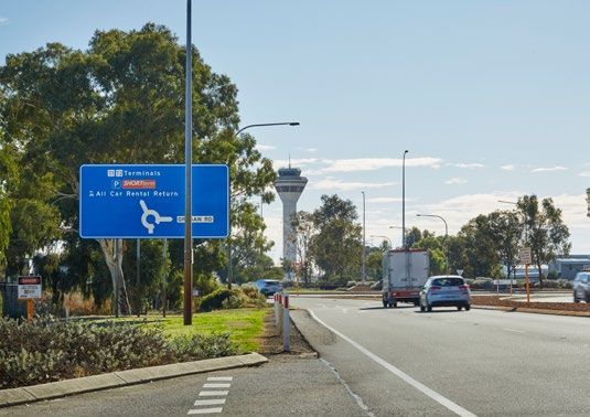
Section 6: Ground Transport Plan

6.2.3 Western Australian Regional Freight                                6.3.1 Gateway WA
Network Plan                                                             Access to Perth Airport was significantly improved with the April
The Western Australian Regional Freight Network Plan                     2016 completion of the $1 billion Gateway WA project, at the
(WARFNP) identifies that the growing inner-metropolitan,                 time Western Australia’s largest-ever road project.
Kewdale, Forrestfield, Perth Airport and Kwinana areas support
                                                                         The Commonwealth Government provided $676 million and the
Western Australia’s freight activities, and that these areas will
                                                                         State contributed $310 million to fund the development, with
continue to represent convergence points for both metropolitan
                                                                         Perth Airport supporting the project through the contribution of
and regional freight and logistics activities. This Plan identified
                                                                         30 hectares of land, a financial contribution, and the construction
the need for the State Government to deliver the Gateway WA
                                                                         of roadworks valued at $35 million within the estate. Gateway WA
project to ensure growth in regional traffic does not constrain the
                                                                         improved the safety and efficiency of one of the State’s most
freight performance of the Kewdale and Forrestfield intermodal
                                                                         important freight transport corridors, and included:
terminals, Perth Airport and adjacent industrial precincts.
                                                                         • upgrading Tonkin Highway between Great Eastern Highway
                                                                           and Roe Highway to six lanes,
6.2.4 Westport: Port and Environs Strategy
                                                                         • a major freeway-to-freeway interchange at Tonkin Highway
The Westport: Port and Environs Strategy is currently being                and Leach Highway,
developed by the Department of Transport to provide guidance             • upgrading Tonkin Highway and Roe Highway interchange to a
to the State Government on the planning, development and                   partial freeway-to-freeway interchange,
growth of the Port of Fremantle and Port of Bunbury, and also            • a new interchange at the Tonkin Highway, Horrie Miller Drive
the required rail and road networks that contribute to the                 and Kewdale Road intersection,
handling of the growing trade task.                                      • a new interchange at the Leach Highway and Abernethy Road
The Strategy is focused on delivering a sustainable and globally           intersection,
responsive long-term supply chain strategy to optimise freight,          • upgrading Leach Highway between Orrong Road and Tonkin
trade and logistics needs from Fremantle and Kwinana to                    Highway to an expressway standard and associated upgrades
Bunbury. It is anticipated that strategy implementation will begin         to local roads and intersections in the Kewdale area,
within the timeframe of this Master Plan 2020.                           • Airport Drive constructed by Perth Airport as new passenger

                                                                                                                                               H
                                                                           access to the Airport Central Precinct,
The Airport, neighbouring rail freight facilities and the availability   • a new interchange at Boud Avenue leading to T3 and T4
of land supported by the surrounding major road freight network            (known as the Dunreath interchange), and
have led to the area being an attractive location for transport          • an extension to the principal shared cycling and pedestrian
dependent businesses, making the area an important part of the             path network along Tonkin Highway and Leach Highway.
State’s freight and logistics supply chain.
The potential for a future intermodal development within the             6.3.2 Road Network Hierarchy
airport estate would contribute to future container rail activity to     The road network in Western Australia is categorised by a
the port(s). This supports the State Government’s target of rail         functional hierarchy that represents the role that the road is
accounting for a 20 per cent mode share for freight movements            intended to perform. The hierarchy is determined by a range of
in WA.                                                                   criteria, including location, degree of connectivity, predominant
                                                                         road use, indicative traffic volume, and recommended
6.2.5 Eastern Metropolitan Regional Council                              operating speed.
Regional Integrated Transport Strategy Action Plan
                                                                         Perth Airport is well served by the metropolitan primary main
The Eastern Metropolitan Regional Council (EMRC) Regional                road network, connecting the airport with the Perth CBD and the
Integrated Transport Strategy (RITS) Action Plan forms part of           major metropolitan areas. The Primary Distributor roads
the land use and transport planning for the eastern region of the        surrounding the airport are managed by Main Roads WA.
Perth metropolitan area. It translates the high-level, whole of          Lower-order roads (Distributor A, Distributor B, Local Distributor
metropolitan area land use and transport planning undertaken             and Access roads) feeding into the primary road network are
by the State Government and applies it to the regional network.          managed by the three Local Government authorities (cities of
This includes roads that directly integrate with and impact the          Belmont, Swan and Kalamunda) that adjoin the estate. The road
Perth Airport estate.                                                    hierarchy relevant to Perth Airport includes:
                                                                         • Primary Distributor: Tonkin Highway, Great Eastern Highway,
                                                                           Great Eastern Highway Bypass and Roe Highway, which
6.3 Current Road Network                                                   provide for major traffic movement and carry large volumes of
In addition to Perth Airport funded projects within the estate,            generally fast moving traffic,
both the State and Commonwealth Governments have                         • Distributor A: urban area roads in built up areas that carry
contributed significantly to fund infrastructure supporting the            traffic between industrial, commercial and residential areas
transformation of Perth Airport in recent years, including                 and generally connect to Primary Distributor roads,
improving road access to the airport to support the consolidation        • Distributor B: similar to Distributor A roads, but with reduced
of all commercial air services to the Airport Central Precinct.            capacity due to flow restrictions (often older roads with a
                                                                           traffic demand in excess of that originally intended),
                                                                         • Local Distributor: roads that link Distributor roads (A and B) to
                                                                           access roads, and
                                                                         • Access Roads: provide access to properties with amenity,
                                                                           safety and aesthetic aspects having priority over the vehicle
                                                                           movement function.
                                                                         Figure 6-2 shows the road hierarchy network surrounding
                                                                         the estate.

116
Section 6: Ground Transport Plan
Ja
cks
o
n
St
West Rd
Bassendean South Guildford
Cr
Stirling
Reid
St St
Co
ig
Ha
Rd
ls
e
Pd
to
all
un
ay
Hazelmere
terh
Rd
lw
i
Ra
Wa
Bark
er Rd
Great Eastern Hwy Bypass
Kalam
unda
Rd
Rd
dy
ar
H
Ka
d Rd
ta
nn
lan
in
g
St
Mid
Airport
North
e
Av
Ascot an
a
ng
Bu
Ad
ela
ide
wy 21 St
nH
er
st
tE
a Fa Cr
g
ea un in
Gr tle irl
ro St
yA
24
ve
ve
e yA
Brea r l
)
5m
Airport m
X4
St
63
West 21
n d
4(
co
2
Se
6/
reath Dr
0
AY Munday Rd
W m
UN Swamp oo
SR en
Dun
S itt
C RO W
Ep
Rd
so
y
rn
m
Hw
bu
Av
d
ew
e
in
il R Be
nk
N r
Rd
Cy rle
To
on
W
nt
y
a
St
06
H
ar
m)
de
y
X 45
Rd
St
an
44m
rb
Rd
Du
n ey
1 (34
y Rd
Ed
High Wycombe
rbird Lad
03/2
St
e
er
id
WAY
lv
Suga
Be
St
k
ic
RUN
er
ed
Fr
MAIN
St
Airport
am
Maida Vale Rd
nh
io
Pr
Central
de
Sy
e
Av
Dr
er
nd
Miller
a
ex
Al
Horrie
St
on
Rd
gt
er
in
Paltr iln
rp
y
idge M
in Hw
O
Rd
Hudswell Rd
Tonk
as Rd
03
D u nd
A
be
rn
St
et
ht
hy
rig
t
lS
Rd
W
rie
Cloverdale
ab
G
Airpor
t Dr
thy Rd
Airport
Be
rk
sh
Aberne
South
ire
Be
lg
Rd
ra
vi
a
St
Hawtin Rd
Dubs Cl
St
w
Ke
wy
hH
ac
Le
Ac
to
n
Av
St
e
s
at
Kewdale
O
Rd
le To
da n kin
w
e
Ke
Av
Hw
y
a
Forrestfield
i lle
nv
ai
t
tS
ug
en
Bo
id
es
Be
Pr
rk
sh
ire
Terminals
Rd
y
Hw
Abernethy
Rd
e
Ro
Current Airside Fence
St
re
lit
zi
Airport Boundary
a
Av
D
e
St
aw
ks
so
ic
n
Primary Distributor
H
Av
Rd
e
St es
ra m
ol
ba H
Pil Distributor A
Cy
O
Sh
rr
p
effi
on
re
d
lR
s
g
el
al
s
Distributor B
Rd
d
Rd
m Hale Rd
Rd
Ku
D
Coburg St
W
Rd
Sussex
ow
es
Re
d
t
yn
St
Local Distributor
Anderson
o
ld
s
Rd
Cumberla
Access Roads
Rd
Sh
effi
H
t
ar
nd Rd
el
lS
tfi
el
d
0 500 1,000
e
Rd
w
ld
Rd Do
Ea
Rd
Welsh c
sia
st
po M METRES
ol Rd nk
Ba Rd
Ju
b
hn
ile
Jo
e
St
Rd
Rd
n
ol
nc
Wim
Li
t
rS
brid
a
lsp
Fe
ge
Figure 6-2 Main Roads WA road hierarchy
Rd
Source: Aurecon
Sh
effi
el
d
Rd
Rd
is
w
Le
PERTH AIRPORT MASTER PLAN 2020 117
Section 6: Ground Transport Plan
West Rd
Bassendean South Guildford
Rd
Re
all
id
St
h
ter
Hazelmere
Wa
Barke
r Rd
Great Eastern Hwy Bypass
Kala
mun
da Rd
Talb
ot R
d
d
Yag
yR
ineC
llop
l
d
ton R
ay
Co
W Brin
ac sm
ead
Ap
New
Rd
Ascot Rd Airport
e e
Av
Secondary Re
d cliff
an
a North Lew
ng is Rd
access Bu
to airport
wy
r nH
te
E as Fa Cr
un g
at lin
re tle ir
G ro St
yA
ve
Redcliffe ve
Station e yA
Brea r l
St
Airport
d
co
n Snook Rd
West
Rd
Se
ler
reath Dr
Mil
High St Munday
e
Av Swamp
ud
Dun
Bo
y
Hw
kin n
To
Primary
access
to airport Airport Central
Station
y Rd
High Wycombe
rbird Lad
Rd
Suga
ck
Affle
Ep
Grogan Rd Eas
so
Airport t
m
Av
Maida Vale Rd
e
Central
Local
access to
er Dr
airport
tt Rd
ie Mill
Abbo
Forrestfield
Horr
St
H
Station
ar
on
de
gt
y
in
Rd
Paltr
rp
y
id ge R
in Hw
O
d Hudswell Rd
Tonk
Cloverdale
Primary
t
lS
rie
access
ab
G
to airport
Airpor
t Dr
thy Rd
Pe
Airport
ar
Searl
lR
e Rd
d
Aberne
South
Dubs Cl
Rd
Dundas
Reid Rd
Terminals
Cr
St
Tarlton
w
Ke
Current Airside Fence
wy
Fa
wc
hH
ett
C r
ac
Le
Airport Boundary
Secondary Airport Roads
access
to airport Non Airport Roads
Be
Rd
rk
and Highways
sh
le
da
ire
To
w n
Rd
kin
Ke Hw
y
Railway
Forrestfield Airport
Link Railway
Forrestfield
Abernethy
Rd
0 500 1,000
y
Hw
e
Ro
METRES
D
aw
so
n
Av
e
Figure 6-3 Existing road network within and around Perth Airport
Source: Perth Airport
118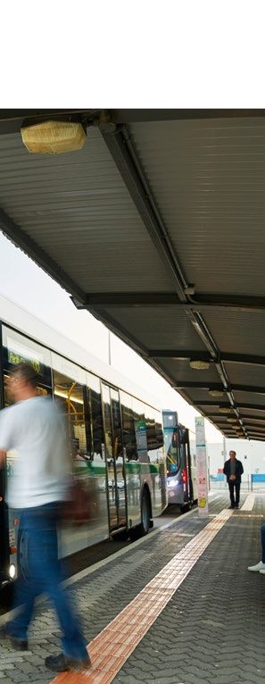
Section 6: Ground Transport Plan

6.3.3 Access to Perth Airport                                          Access to T3 and T4 is via the Tonkin Highway and Dunreath
The close proximity of Perth Airport to the CBD enables good           Drive grade separated intersection which opened in 2015 as part
off-peak access via the arterial road network. During morning          of the Gateway WA project. Central Avenue was extended from
and evening peak periods, the road network surrounding Perth           the airport boundary to a new roundabout constructed on
Airport facilitates significant volumes of commuter traffic. The       Dunreath Drive to provide improved connections to the local
peak periods for passengers using the Perth Airport passenger          road network. Brearley Avenue, the previous access road from
terminals currently differs to the traditional metropolitan            Great Eastern Highway to the terminals, was permanently closed
commuter peak periods, reducing the impact of the airport              in early 2017 to allow the construction of the Forrestfield-Airport
traffic on the surrounding road network capacity at peak times.        Link’s Redcliffe Station.

As shown in Figure 6-3, the main access to the passenger               Dunreath Drive will continue to be the main access to the Airport
terminals within the Airport Central Precinct is through the grade     West Precinct after the relocation of Qantas operations to
separated Tonkin Highway, Leach Highway and Airport Drive              Airport Central by 2025, with Fauntleroy Avenue continuing to
intersection.                                                          supply secondary access and Second Street (Stanton Road)
                                                                       providing local access.
Constructed by Perth Airport, Airport Drive is the designated
primary access to Airport Central and all road signs direct traffic    Access to the General Aviation (GA) Area is provided by
for T1 and T2 onto this route. It has been designed and land           Fauntleroy Avenue, from Great Eastern Highway.
safeguarded to allow future upgrade to provide a three-lane dual       The primary road network within and surrounding the estate also
carriageway access to the airport terminals.                           forms part of the metropolitan freight network for over-size
The secondary access point into the Airport Central Precinct is        Restricted Access Vehicles (RAV). There are RAV 4 (27.5 metre
the Tonkin Highway, Horrie Miller Drive and Kewdale Road               B-Double, comprising a towing vehicle and two semitrailers) and
intersection. This intersection was upgraded as part of the            RAV 6 (36.5 metre double road train 87.5 tonnes) routes on the
Gateway WA works to a grade separated single point intersection,       estate and RAV 7 (36.5 metre double road train 107.5 tonnes) on
controlled by a set of traffic signals providing access to Airport     Tonkin Highway and Abernethy Road providing heavy vehicle
South and Kewdale industrial areas. Traffic for T1 and T2 is not       access to the estate. There is a turning restriction at the
directed along this route as it is intended primarily for commercial   intersection of Abernethy Road and Grogan Road for all RAV
vehicle access. Traffic between the Perth CBD and the airport is       vehicles, with right turns not being permitted either from
directed onto the Great Eastern and Tonkin Highways, while traffic     Abernethy Road into Grogan Road or from Grogan Road into
from the east on the primary road network is directed to use the       Abernethy Road.
Roe, Reid and Tonkin Highways.
Grogan Road historically connected to the surrounding local
road network before Abernethy Road was constructed; the road
was closed in 1987 following the construction of T1, preventing
its use for through traffic until it was reopened in 2005. Grogan
Road is currently used by local traffic either accessing T1 and T2,
businesses on the estate, or as a through route to access the
primary road network south and west of the estate. In fact,
Grogan Road traffic surveys have determined that this through
traffic constitutes a significant portion of overall traffic during
commuter peak hours (westbound in the morning peak and
eastbound in the afternoon peak), confirming that Grogan Road
is being used by non-airport related traffic as a through-route.

                                                                                              PERTH AIRPORT MASTER PLAN 2020          119
Section 6: Ground Transport Plan

6.4 Public Transport                                                                      6.4.2 Network Context
                                                                                          The Perth urban rail network is based on a ‘hub-and-spoke’ model
6.4.1 Rail
                                                                                          focused on the Perth Central station, located in the CBD, as the
The $1.86 billion Forrestfield-Airport Link is an 8.5 kilometre                           hub which radiates with five separate passenger rail services.
underground extension of the Perth rail network from Bayswater
to Forrestfield, of which 3.8 kilometres is located within the Perth                      The connection of Perth Airport to the remainder of the
Airport estate. The project is jointly funded by the State                                metropolitan rail network will offer passengers and employees
Government ($1.37 billion) and the Commonwealth Government                                who work on the estate an alternative means of accessing the
($490 million) and is being delivered by the State Government.                            airport. Current planning is for trains to run every ten minutes
The rail link, shown in Figure 6-4, will form an integral component                       during peak times, providing passengers with an 18 minute
of Perth’s long-term public transport network to meet existing                            journey time between Airport Central Station and the CBD at the
and future public transport demand. Works on the Forrestfield-                            same fare payment rates as the rest of the Metropolitan rail
Airport Link project commenced in October 2016 and are                                    network. Perth Airport will continue to work with the Public
expected to be completed by 2021.                                                         Transport Authority and the nearby Local Governments to ensure
                                                                                          the stations are well connected to other modes of transport.
As part of the Forrestfield-Airport Link project, a rail station
(Airport Central Station) is being constructed adjacent to the Air                        6.4.3 METRONET
Traffic Control tower within the Airport Central precinct.
                                                                                          The Forrestfield-Airport Link is the first stage of the State
Passengers will access T1 and T2 via a 280 metre long elevated
                                                                                          Government’s METRONET project, a $3.6 billion passenger rail
‘Skybridge’ walkway that is currently being constructed by Perth
                                                                                          project comprising approximately 72 kilometres of new
Airport. The new terminal, to be constructed for the relocation of
                                                                                          passenger rail and up to 18 new stations, as shown in Figure 6-5.
Qantas operations to Airport Central by 2025, will also connect
to the Airport Central Station.                                                           METRONET is the largest single investment in public transport
                                                                                          that Perth has seen and is a catalyst to convert over 5,000
The Forrestfield-Airport Link also provides two additional train
                                                                                          hectares of land around new stations into desirable places for
stations outside the estate at Redcliffe (Redcliffe Station) and
                                                                                          investment in housing, jobs and services for growing communities.
High Wycombe (Forrestfield Station).
                                                                                          Perth Airport supports the State Government’s investment in
The route provides a commuter rail service from Forrestfield that
                                                                                          METRONET to increase the public transport connection to the
connects to Bayswater station on the existing Midland line and
                                                                                          airport. Perth Airport will seek to improve connectivity from the
ultimately to the Perth CBD. The link runs underground from
                                                                                          Airport Central Station and Redcliffe Station to businesses on the
Forrestfield to the underground stations at Airport Central and
                                                                                          estate not served by the Public Transport Authority bus service.
Redcliffe before emerging on the western side of the river. As the
demand for pick-up, drop-off and parking proximate to terminals                           6.4.3.1 Redcliffe Station
in the Airport Central Precinct increases, Perth Airport will look
                                                                                          Redcliffe Station is located on State-controlled land, adjacent to
at encouraging the use of rail access to diversify the modes by
                                                                                          the airport estate. This rail station will include a public transport
which Airport Central is accessed and increase the use of more
                                                                                          interchange that provides links to local bus services and will
sustainable transport methods.
                                                                                          focus on general metropolitan commuter passenger demand.

                                                                                                             South Guidford
                                                              Bassendean
                                            Ashfield
                                                                                                                                                     Hazelmere

                    Bayswater

                                                                           Redcliffe Station

                                   Ascot

                                                  Redfliffe

                                                                                                                Airport Central Station

         Maylands
                                                                                                                                             High Wycombe

                                  Belmont

                                                                                                                                                Forrestfield Station

            Rivervale
                                                       Cloverdale

                                                                                                                              Forrestfield
                                                                                                                                                                   Maida Vale
      Lathlain                  Kewdale
                                                                                                                                                          0        500     1,000

                                                                                                                                                                  METRES

Figure 6-4 Forrestfield-Airport Rail Link
Source: Perth Airport

120
Section 6: Ground Transport Plan
Figure 6-5 Planned METRONET rail network
Source: METRONET
PERTH AIRPORT MASTER PLAN 2020 121Section 6: Ground Transport Plan
Queens Rd
Pinezone Playground
Park
r
South
Pickering
e
Park
Riv
Ashfield
Res
Max Hunt
Guildford Waterhall
Park
Res
Ashfield
West Coast
Model Rally
Club Gary Blanch
Moojebing Park
Ron Courtney
an
Res Sandy Beach
Island Res
Sw
Garvey
Park
C
Shir ity o
e o fS
f K wan
ala
mu
Frank Treen
nda
Albert
Jordan
Park
Memorial
Park Perth Airport
Claughton
Res
Ayres
Bushland
4
93 0
5
93 0
4
5
Ollie
d
40 DOMESTIC
Worrell
Res
T 935 TERMINALS
Selby Park 40 Emms
Res
High
Wycombe
Village
935 C C
ity ity
of of S
Redcliffe T Be w
l m an Viv Robinson
Park
W
on
t
Newburn
Aquanita Lakeside
Park Smythe Nursing Pine
Lake Home The Village Tree Res
Park Progress
Lakeside Library Res
Ascot Close Lodge Gibson INTERNATIONAL
Park TERMINALS
Retirement
Village
Peter
Brightwater Annus
Care Andell Park Range
Group Park
e
as
Epsom View
Ch
Avenue Park
T
alk
W
Fleming
iew
Res
a
tic
rkv
enary
us
Pa
M
rk
John Scott
s MacLarty Res
Redcliffe
Park Park
Belvidere Morgan
Shopping Park
Centre Redcliffe Park
Belmont Community CHC
Centre
T
284 935
998 999
Alfred
Res
Monier
Park Epsom
Park
CHC
Signal Hill
High Wycombe
5
Harmen
93
Park
4
CHC Middleton
28
Rosedale Park
Park
Miles
Park
28 Hoskin
4
Park
93 293
Faulkner Pol
Park Belmont Youth &
5 Family Centre
CHC
2 St Ives Museum Library
Belgravia St
38 86 2
Faulkner Park Arts & Shopping McLarty
Retirement Craft Centre Park
0 87
Estate Centre
Belmont
93 Senior Citizens
Cloverdale
5 Centre
Belmont Forum
Belmont
District
Belmont
T
Village
Forster
38 286 287
Wicca
Res
Park
Community
288 298 380 Hall P. H. Dod
Res
935 998 999
da
Willow
t
Belm on
Lake Treave St
am un
Park Park
Belmont
Oval
T
of Kal
C ity of
T
Shir e
Tomato Dawson
Lake Abernethy Park
Park
Tomato
Lake Peachey
Res Park
Noble Organic
Association
of WA
Park
Carlisle
Res High Frequency Bus Routes, Pioneer
Park
Other Bus Routes
Nance
T
Park
Kewdale
High Frequency Bus Routes
Dept of
Culture & the Arts
(Joobaitch House) 298 Other Bus Routes C ity of Belm
ont Fo
C ity of C an
ning
T Bus Terminus CHC
Local Authority Boundary
0 500 1,000
METRES Welshpool G.R.
Morrison
Oval
Connaught
Street
Res
Figure 6-6 Bus routes on and around the airport Reid
Oval
Source: Transperth Hartfield Park
CHC
Lansing CHC
Park
122 Hartfield
Country ClubSection 6: Ground Transport Plan
The associated bus interchange will significantly improve the Longer term, underground walkways may also be considered for
catchment for public transport serving the area. The station is pedestrian access between the Airport Central Station and the
located less than 900m from T3 and T4 and will be connected by new terminal to provide a grade separated access for rail
a footpath. After 2025, when all regular passenger transport passengers, as well as linking future commercial developments
services consolidate in the Central Terminal precinct, the station within the Precinct.
will primarily serve the needs of local residents and the Airport
The rail link will provide an alternative to the current road-based
West retail and business park users.
access to the airport. Perth Airport will work with the Public
In line with State Government and METRONET planning, the Transport Authority to improve services to the airport and to
land in Airport West in the vicinity of the rail station will be seamlessly link the Airport Central Station with the surrounding
developed along transit-oriented development principles to facilities and nearby employment.
provide a range of jobs and services.
6.4.3.3 Forrestfield Station
Perth Airport will continue to work with the Public Transport
Forrestfield Station is located on State controlled land,
Authority, METRONET and Main Roads WA to ensure and
approximately 500m east of the estate boundary. The station
improve connection to the station by various modes to nearby
will be a major transport interchange, with a park and ride facility
attractions and employment.
with approximately 2,500 parking bays and a public transport
6.4.3.2 Airport Central Station interchange, with links to local bus services.
The Airport Central station is located in the core of the Airport 6.4.3.4 Bus Services
Central Precinct and provides connectivity to the existing T1 and
As shown in Figure 6-6, Airport Central is currently served by a
High
Wycombe
T2 forecourts and the future new terminal.
Transperth public bus service that connects Perth Airport to the
With the future consolidation of terminals to the Airport Central Perth CBD. Route 380 operates through the suburb of Belmont
Precinct by 2025, the Airport Central Station will provide access and along Airport Drive to service T1 and T2. The journey time is
for the majority of all regular passenger transport aviation approximately 45 minutes between the airport and the Perth
services into and out of Perth. Integrating the rail station into the CBD. Upon completion of the Forrestfield-Airport Link this
terminal and forecourt areas will provide an effective ground service is likely to become obsolete. Perth Airport will continue to
transport system and a high-quality passenger and visitor work with the Public Transport Authority to reallocate these
Peter
Hegney
experience. Construction is nearing completion on Skybridge, a resources to better service those suburbs that are not served by
Park
280-metre elevated walkway connecting the Airport Central the Midland line and Forrestfield-Airport Link.
station to the terminal forecourts. In future, the Skybridge will
While the ultimate services and routes are still to be finalised by
also be able to provide elevated walkway links to the new
the Public Transport Authority, Redcliffe Station and Forrestfield
terminal and the proposed future hotel (subject to demand
Station will incorporate bus interchanges to facilitate improved
and approval).
public transport connection to the airport from the surrounding
suburbs. Perth Airport will continue to work with the PTA to
confirm new and amended Transperth bus routes to and from
the Airport Estate.
T
Library
Pol
orrestfield
Forum
PERTH AIRPORT MASTER PLAN 2020 123Section 6: Ground Transport Plan
6.5 On Airport Traffic Measures may include the provision of new infrastructure such
as paths, shelters and end-of-trip facilities for cyclists and
The Ground Transport Plan caters for all activities on the estate
pedestrians, as well as improved access to public transport.
including:
Perth Airport will work with all relevant stakeholders to ensure a
• passengers,
diverse range of transport infrastructure is available.
• employees,
• commercial development, and
6.5.1 Emerging Technologies
• freight.
Planning for the short and long-term needs to consider
Almost 70 per cent of traffic on the estate is directly related to emerging technologies that are disrupting the more traditional
aviation activities, and the predominant mode of access to and ground transport options, in addition to the Forrestfield-Airport
from Perth Airport is road-based transport, both public and Link that will provide an alternative mode choice for accessing
(primarily) private. Although the opening of the Forrestfield- the airport from 2021.
Airport Link in 2021 and subsequent reallocation of bus services
will have a significant impact on travel choice and behaviour to The introduction of rideshare services has already seen changes
and from the airport, road-based transport is expected to remain in mode share, as more passengers choose to be dropped off on
the predominant mode for the next five years and throughout the the forecourt as opposed to parking in the short or long term car
planning period of this Master Plan 2020. Mode shares will parks. It is anticipated that this rate of change will increase.
change as the use of automated vehicles, ridesharing and Automated vehicles are expected to have an even greater
Mobility as a Service (the shift away from personally-owned impact. Fleet or privately-owned autonomous vehicles will be
modes of transportation and towards mobility solutions that are able to drive themselves to and from the airport, reducing
consumed as a service) becomes widespread. demand for airport car parks but increasing the need for
The 2015 mode split and projected change in passenger travel drop-off and pick-up facilities located close to the terminals.
modes to and from Perth Airport for 2025 and 2045 are shown The timing and scope of the developments and initiatives
in Figure 6-7. outlined in this ground transport plan are therefore flexible and
State and Local Governments are planning for and identifying will be determined by the close monitoring of ground transport
opportunities to balance the transport mode share, which is trends and mode shares as they emerge.
currently dominated by car-based private vehicles in the Perth Emerging technologies can also represent opportunities to
metropolitan area, towards more sustainable alternatives improve ground transport and access to the airport. These are
through initiatives including: discussed in more detail in the following sections.
• investing in new infrastructure and services in road, rail and
public transport,
• encouraging travel demand management for employees and
contractors around key activity centres, and
• the provision of additional public transport options for both
aviation passengers, and employees and contractors at
Perth Airport.
2015 2025 2045
2.6% 1.8%
6.2% 4% 1.8%
4.5% 10%
8%
5.6%
5.1%
19%
18% 63% 58.2% 45.8%
16.6%
4%
13.1%
2055
Private Car
16%
2% Taxi / Commercial Vehicles
Car Rental / Valet
37%
Ride Share
Transperth Bus
32%
Transperth Train
10%
Inter-Terminal Transfer
3%
Figure 6-7 2015 and projected passenger travel modes to and from the airport
Source: Aurecon
124Section 6: Ground Transport Plan
6.5.1.1 Smart Traffic Management 6.5.1.3 Automated Vehicles
In the short-term, additional smart traffic management Automation of vehicles is to emerge as a viable option within the
measures are proposed to optimise the existing ground next five years and will most likely be widely adopted within the
transport network. Harnessing the power of technology 20-year planning horizon of this Master Plan 2020. By removing
dramatically changes how Perth Airport operates and optimises the driver, rideshare services may become significantly cheaper,
transport networks. Rapid changes in how data can be collected resulting in an increase in the proportion of passengers
and analysed in real time, will enable network operators to make accessing the airport this way. This would result in an increase in
informed operational decisions to improve network efficiency, demand for pick-up and drop-off facilities.
safety and customer experience. Implementation of smart traffic
Similarly, as private ownership of automated vehicles increases,
management technology assists in managing transport
the proportion of customers choosing to use pick-up and
networks under normal conditions, during periods of heavy
drop-off facilities and have their vehicle drive itself to and from
congestion and when managing planned or unplanned incidents.
their residence or nearby remote parking facility would increase.
There are opportunities for Perth Airport to implement smart This remote parking may include Perth Airport car parks.
traffic management to further optimise the use of the road
Although the development of MMTI facilities (including
network and parking infrastructure, improving travel time for
multi-storey car parks) represents an opportunity to increase the
commuters and delaying the requirement for significant capital
capacity of pick-up and drop-off facilities, Perth Airport will
expenditure. The project opportunities of particular interest are:
continue to monitor ground transport mode share and will
• Foundation infrastructure –vehicle detector stations on each
consider demand management to ensure all ground transport
lane of the main access roads and key locations, which
modes are operating as efficiently as possible.
provide real-time information of traffic volumes and issues on
the network. The fibre optic backbone would link back to The automation of logistics delivery vehicles is also anticipated.
Perth Airport operations centre, with associated control Automated vehicles may rely on or have their operation
systems to monitor and display the information (see Variable enhanced by their ability to communicate with other vehicles,
Message Signs). Additional CCTV coverage would also be infrastructure and transport management systems and mobile
considered to allow visual validation of congestion or other devices. Further, automated vehicles may be facilitated by
issues on the network, high-resolution digital mapping of the areas they operate in.
• Variable Message Signs (VMS) – digital signage is a practical Perth Airport will consider the technology required to facilitate
example of smart traffic management that can improve this communication or other requirements of vehicle automation.
customer experience and manage congestion. VMS allows
Automated vehicles are also likely to be used in place of the
airport operational staff to dynamically control messaging to
bus services currently used for long term car park and terminal
road users to manage the traffic in a way that optimises traffic
transfers landside and for remote stand passenger transfer
flow for a range of different conditions at the airport. Variable
airside. Additionally, many of the airside vehicles servicing
messaging on the airport road network and on the Perth
aircraft, such as cargo dollies and aircraft tugs could be
Airport mobile app will be aligned with relevant Main Roads
automated.
standards and guidelines as below.
• Smart parking sensors and/or use of existing CCTV can be 6.5.1.4 Drone Technology
used for pick-up and drop-off or in car parks, with end-to-end
The use of drones is currently regulated by the Civil Aviation
navigation to guide drivers to an available bay and smart
Safety Authority (CASA) under the Civil Aviation Safety
matching between car size and bays. This concept can be
Regulations 1998. These Regulations state that drones cannot
extended to the use of ground positioning systems (GPS) to
be used within 5.5 kilometres of Perth Airport which precludes
guide automated vehicles towards vacant spaces in car parks
any freight, logistics or even passenger transfer operators from
and on forecourts.
using drone technology at the airport. As such, there are no plans
Standards and guidelines for smart traffic management have at this stage to dedicate any infrastructure for drone operations
already been developed by Main Roads for the external road within this Ground Transport Plan.
network. Smart traffic management at Perth Airport will be
Many companies are investigating drone technology for use in the
aligned with these standards to ensure a seamless journey for
long-term, particularly those in the freight forwarding and logistics
those travelling to and from the airport.
industry. As drone technology matures to make their operation
6.5.1.2 Rideshare Services safer and more regular it is possible that the Regulations may be
amended to facilitate their use around controlled aerodromes.
Since the introduction of Uber to Perth in 2014 and Ola in 2018,
This may present opportunities to operate drone-based, freight
the proportion of people choosing to park their car at the
forwarding or passenger pick-up and drop-off to increase
airport has declined as passengers increasingly choose to use
efficiency and diversify mode share. As many controlled
rideshare services.
aerodromes fulfil a significant freight forwarding and logistics
The decline in demand for parking at Perth Airport and the function, Perth Airport will investigate drone use should the
corresponding rise in demand for drop-off and pick-up facilities regulatory environment around drone technology evolve.
will be closely monitored by Perth Airport to ensure that
As the technology evolves, Perth Airport will continue to work
necessary infrastructure is available to accommodate these
with CASA and relevant stakeholders to ensure the ongoing safe
and other new rideshare services.
operations of the airport and to explore future drone operations.
PERTH AIRPORT MASTER PLAN 2020 125Section 6: Ground Transport Plan
West Rd
Bassendean South Guildford
Rd
Re
all
id
St
h
ter
Hazelmere
Wa
Barke
r Rd
Great Eastern Hwy Bypass
Kala
mun
da Rd
Talb
ot R
d
d
yR
Yag
llop
ineC
l
d
Co
ton R
ay
W
ac
Ap
New
Brin
sm
ead
e
Airport Rd
Av
Ascot e
Rd
ga
na North Lew
cliff n is Ad
d Bu Rd ela
Re ide
St
wy
r nH
te
as Cr
tE g
ea Fa
irlin
Gr un St
tle
ro
yA
ve
Redcliffe ve
Station e yA
Brea r l
St
Airport
d
co
n Snook Rd
West
Rd
Se
ler
reath Dr
Mil
High St Munday
e
Av Swamp
ud
Dun
Bo
y
Hw
kin n
To
Airport Central
Station
y Rd
High Wycombe
rbird Lad
Rd ck
Affle
Suga
Ep
so
Airport Grogan Rd Eas
m
t
Av
Maida Vale Rd
e
Central
er Dr
tt Rd
ie Mill
Abbo
Forrestfield
Horr
St
H
Station
ar
on
de
gt
y
in
Rd
rp
y
in Hw
O
Paltr
id ge R Hudswell Rd
d
Tonk
t
lS
rie
ab
G
Cloverdale
Airpor
t Dr
thy Rd
Airport
Pe
Searl
ar
e Rd
lR
Terminals
Aberne
South
d
Current Airside Fence
Dubs Cl Airport Roads
Reid Rd
Non Airport Roads
Cr
St
Tarlton
and Highways
w
Ke
wy
Fa
wc
hH
ett
C r Railway
ac
Le
Be
Forrestfield Airport
rk
Rd
sh
ire
Dundas
Link Railway
Rd
Proposed Footpaths
Rd
dal
e
To Proposed Airport Roads
w nkin
Ke Hw
y Forrestfield
Proposed MRWA Roads
Proposed Rail Spur
Proposed New Runway
Abernethy
Rd
0 500 1,000
y
Hw
e
Ro
METRES
D
aw
so
n
Av
e
Figure 6-8 Proposed five year ground transport plan concept for Airport Central
(Road layout to be confirmed during MDP development)
Source: Perth Airport
126Section 6: Ground Transport Plan
6.6 Airport Central Precinct
The primary access to the Airport Central Precinct for terminal-related traffic is via Airport Drive, with freight traffic using
Horrie Miller Drive.
Airport Drive is the primary traffic route to T1 and T2 and ultimately to all terminals following relocation of Qantas operations to the
Airport Central Precinct by 2025. It is currently constructed as a dual carriageway with two lanes in each direction and designed to be
widened to three lanes as traffic volumes increase in the future. Major intersections on Airport Drive are currently roundabout
controlled, as this facilitates turning movements and ensures the free flow of traffic to the terminals. The increased traffic volumes
expected with the relocation of Qantas operations to Airport Central will require the upgrade of these intersections, with the ultimate
configuration requiring grade separation.
With the relocation of Qantas operations into this precinct and the forecast growth in passenger numbers, vehicle traffic volumes will
experience a step change in demand by 2025. Terminal-related traffic in Airport Central is projected to increase from 30,000 vehicles
per day in 2018 to almost 50,000 vehicles per day in 2025, and to 90,000 vehicles per day by 2045. The majority of the increase will be
passenger related traffic concentrated on Airport Drive.
Total Traffic
Million Passengers Airport Drive Horrie Miller Drive Terminal-Related Traffic
Year per Annum (Vehicles per day per direction) (Vehicles per day) (Vehicles per day)
2018 8.2 30,000 13,500 30,000
2025 16.6 48,500 32,800 47,800
2035 24.1 64,000 42,200 65,300
2045 32.1 96,900 42,300 90,200
Table 6-1 Predicted terminal-related vehicle traffic using Airport Drive and Horrie Miller Drive
Source: Aurecon
To avoid congestion and ensure free flow to terminals within With the rise of rideshare services and the mainstream adoption
Airport Central at consolidation, the intersection of Airport Drive of automated vehicles, the future demand for drop-off and
with Sugarbird Lady Road will be upgraded. As shown in Figure pick-up services close to the terminals is expected to increase.
6-8, within the next five years, traffic signals are planned to be Extra drop-off and pick-up capacity can be achieved through the
installed on the roundabout. In the longer term, further re-purposing of the MMTIs. When demand requires, the MMTIs
improvement will be needed to signalise or grade separate the could provide separation of drop-off and pick-up facilities on
remaining intersections on Airport Drive as required, dependent different floor levels. Future demand may also be managed
on the observed trends in demand. through premium drop-off and pick-up facilities close to the
terminals and a free service that operates from a satellite
Perth Airport is committed to collaboration with Main Roads
location, most likely in the southern portion of Airport Central or
following consolidation, to monitor increase in demands on the
Airport South. This satellite area would be connected to the
Gateway WA network, including key interchanges. The joint
terminals, Airport Central Station, car parks and businesses by a
Perth Airport / Main Roads Gateway WA Development
transit system.
Agreement identified the trigger mechanism to be used to inform
any modifications or upgrades to the network to ensure they are Perth Airport will continue to work with the State Department
delivered when needed and agreed responsibility for funding. of Transport to ensure suitably located facilities are provided for
all vehicles.
In the longer term there are also opportunities to achieve
significant overall traffic capacity increase by using Airport and The timing of these developments will be informed by the close
Horrie Miller Drives as a one-way loop, with inbound passenger monitoring of traffic levels on main access routes to the airport
traffic using Airport Drive and outbound traffic using Horrie as well as demand for pick-up and drop-off facilities.
Miller Drive and a new connecting road back to Airport Drive. In
this scenario an additional road would be constructed as a 6.6.1 Automated Mass Transit
freight route to ensure the segregation of passenger and freight To ensure reasonable levels of service for those passengers
traffic is maintained. choosing to be picked up and dropped off at the future free
satellite locations, Perth Airport will investigate the use of
The consolidation and the integration of all domestic and
Automated Mass Transit systems such as automated buses,
international terminals within Airport Central will require
trackless trams and automated people movers to connect this
relocation of pick-up and drop-off facilities away from the
location with the terminals and long-term car parks. Such a
terminal forecourt road and into the car parks. To provide the
system could eventually replace the buses transporting
required car parking and pick-up and drop-off facilities, two
passengers and visitors between the various car parks and
MMTIs are planned to be constructed to support the terminal
terminals.
consolidation. The MMTIs will include multi-storey car parks
and facilities for drop-off and pick-up as well as all other ground This system could also serve to connect Airport Central Station to
transport modes, such as car rental, buses and small charter the many businesses in other parts of the estate, particularly
vehicles. As demand increases, non-essential facilities will be those in the southern portion of Airport Central and Airport South.
moved out of the car parks to locations more remote from the
terminals.
PERTH AIRPORT MASTER PLAN 2020 127Section 6: Ground Transport Plan
West Rd
Bassendean South Guildford
Rd
Re
all
id
St
h
ter
Hazelmere
Wa
Barke
r Rd
Great Eastern Hwy Bypass
Kala
mun
da Rd
Talb
ot R
d
d
yR
Yag
llop
ineC
l
d
Co
ton R
ay
W
a c
Ap
New
Brin
sm
ead
Airport Rd
North
e
Rd Av
Ascot d cliff
e
ng
an
a Lew
is Rd Ad
ela
Re Bu ide
St
wy
r nH
te
as Cr
tE g
ea Fa
irlin
Gr un St
tle
ro
yA
ve
Redcliffe
e
Station Av
Brearle y
St
Airport
d
co
n Snook Rd
West
Rd
Se
ler
reath Dr
Mil
High St Munday
e
Av Swamp
ud
Dun
Bo
y
Hw
kin n
To
Airport Central
Station
y Rd
High Wycombe
rbird Lad
Rd ck
Affle
Suga
Ep
so
Airport Grogan Rd Eas
m
t
Av
Maida Vale Rd
e
Central
er Dr
tt Rd
ie Mill
Abbo
Forrestfield
Horr
St
H
Station
ar
on
de
gt
y
in
Rd
rp
y
in Hw
O
Paltr
id ge R Hudswell Rd
d
Tonk
t
lS
rie
ab
G
Cloverdale
Airpor
t Dr
thy Rd
Airport
Pe
Searl
ar
e Rd
lR
Terminals
Aberne
South
d
Current Airside Fence
Dubs Cl Airport Roads
Reid Rd
Non Airport Roads
Cr
St
Tarlton
and Highways
w
Ke
wy
Fa
wc
hH
ett
C r Railway
ac
Le
Be
Forrestfield Airport
rk
Rd
sh
ire
Dundas
Link Railway
Rd
Proposed Footpaths
Rd
dal
e
To Proposed Airport Roads
w nkin
Ke Hw
y Forrestfield
Proposed MRWA Roads
Proposed Rail Spur
Proposed New Runway
Abernethy
Rd
0 500 1,000
y
Hw
e
Ro
METRES
D
aw
so
n
Av
e
Figure 6-9 Proposed five year ground transport plan concept for Airport West
(Road layout to be confirmed during MDP development)
Source: Perth Airport
128Section 6: Ground Transport Plan
6.7 Airport West Precinct The Direct Factory Outlet (DFO) and Costco in Airport West are
the first steps towards the development of this precinct into a
The construction of Gateway WA in 2016 has dramatically
retail and business park post-consolidation. To reduce the
changed the way Airport West is accessed. Where previously the
impact on terminal traffic of the DFO commercial development,
main access was via Brearley Avenue off Great Eastern Highway,
temporary traffic management was implemented on opening
this road was closed in 2017 to make way for Redcliffe Station.
days as well as other high use sale-days. These measures will be
The Tonkin-Dunreath interchange is now the primary access to
maintained in the coming years.
the precinct with secondary access from Fauntleroy Avenue via
Great Eastern Highway. To accommodate the terminal traffic Development Area 6 (DA6) is located in Redcliffe and includes
that previously used Brearley Avenue, Perth Airport constructed land within the City of Belmont and the Perth Airport estate. It is
three new roundabouts on Dunreath Drive at Fauntleroy Avenue, bounded by Tonkin Highway, Great Eastern Highway, Coolgardie
Snook Road and Boud Avenue, with this becoming the new route Avenue, Redcliffe Road, Fauntleroy Avenue and the Airfield
leading to T3 and T4. Precinct. DA6 has been identified as a significant redevelopment
area and has been investigated for development by the City of
The concept for the ground transport network over the next five
Belmont since 2003. With the construction of the Forrestfield-
years within the Airport West Precinct is shown in Figure 6-9
Airport Link, strategic planning is progressing to maximise the
(road layout to be confirmed during MDP development).
access benefits of Redcliffe Station. Perth Airport will continue
Currently the Airport West road network is focused on through- to collaborate with the City of Belmont, the PTA and
traffic to facilitate access to T3, T4 and the GA Area. METRONET to ensure good connection between the public
transport node at Redcliffe Station, the residential community in
The ground transport plan for Airport West will evolve as land
DA6 and any proposed developments in the area.
use changes in this precinct. The consolidation of all commercial
air services to Airport Central will occur by 2025, and the closure In addition to Perth Airport, METRONET and City of Belmont
of T3 and T4 will greatly decrease demand on the road network plans for this precinct and surrounding areas, Main Roads has
and car parking facilities within the precinct. The modes of undertaken a planning review for the portion of Great Eastern
transport required will change as priorities for ground transport Highway to the northwest of this precinct; between Tonkin
shift from ensuring passenger access to T3 and T4 to becoming Highway and the Great Eastern Highway Bypass. Consolidation
a transit-oriented development that meets the needs of the GA represents an opportunity to engage with all of these
Area and the future business and retail park that is planned. At stakeholders to ensure overall ground transport and land use
this time, the road network will be assessed to identify planning is undertaken harmoniously.
opportunities for repurposing roads and improve amenity in the
precinct. For instance, Brearley Avenue may not require four
lanes when it no longer facilitates terminal access and two of the
lanes could be converted into a linear park retaining the existing
spine of established trees in the median strip. Similarly, the
roundabouts on Dunreath Drive may be replaced by traffic
signals to reflect the changing needs of those accessing the
precinct and improve connectivity to the GA Area, nearby
businesses, residences and public transport.
PERTH AIRPORT MASTER PLAN 2020 129Section 6: Ground Transport Plan
6.8 Airport North Precinct An important consideration for ground transport infrastructure
for this precinct is the proximate location of the residential areas
The Airport North Precinct is currently being developed to
of Hazelmere and High Wycombe, and in particular, access to
provide industrial and mixed-use businesses. It is serviced by
future developments.
Kalamunda and Abernethy Roads, both of which form part of the
metropolitan regional road freight network. The extension of Bungana Avenue to form a new intersection
with Kalamunda Road, will provide access to the Airport North
The portion of land to the south and west of Kalamunda Road,
Precinct as well as improve the traffic flow in the GA Area and
within the Airport North Precinct, will be developed as an
reduce demand on Fauntleroy Avenue and its intersection with
industrial, freight and logistics area. Perth Airport will be
Great Eastern Highway within Airport West. The attractiveness
progressing developments in this area within the next five years
of this route to provide an alternative through-route for non-
as outlined in Section 5 (subject to approval).
airport traffic is recognised and will be factored into the ultimate
Three access points off Kalamunda Road are planned, with the design and road layout. This access point will be complemented
locations to be determined as a part of a broader project by two additional access points off Kalamunda Road that will be
re-aligning Kalamunda Road. required for the long-term development of the precinct.
Perth Airport has worked with the State Department of The Midland Freight Rail line currently runs along the eastern
Planning, Lands and Heritage, Main Roads, the City of Swan and boundary of the estate and provides the opportunity for a future
the City of Kalamunda, as well as the Metropolitan Cemeteries private rail access spur for the direct delivery of freight by rail into
Board, to establish a road layout plan that meets the needs of all the eastern portion of Airport North. While Master Plan 2014
stakeholders. This is important to limit the exposure of the identified that the future aviation fuel facility was likely to be
nearby residential communities of Hazelmere and High located within the southern aviation support precinct, further
Wycombe to through-traffic. The plan shown in Figure 6-10 is a planning is progressing on an alternate potential site in Airport
starting point for a possible future layout, which will be confirmed North. The potential rail spur is an opportunity to diversify the
through the MDP process. The layout shown broadly services modes by which fuel is delivered, further improving the resilience
the interests of each of the key stakeholders, including: in the fuel supply system to the airport. Although the existing
• Main Roads, to facilitate a high wide load corridor to service pipeline will remain the primary source of fuel for the airport, a
heavy industrial businesses on Great Eastern Highway, fuel facility in Airport North that can be serviced by road and rail
• the Cities of Swan and Kalamunda, to facilitate local via the intermodal facility would ensure redundancy in the
businesses and to segregate industrial traffic from their nearby delivery of this vital commodity. Planning for a potential rail spur
residential areas, will include consultation with the PTA and Arc Infrastructure who
• the Metropolitan Cemeteries Board, to remove the bisection of are the current lessee for operating the WA freight network. The
South Guildford Cemetery, and final decision on the preferred location for the future aviation fuel
• Perth Airport, to facilitate RAV7 traffic to service the industrial, facility is anticipated in late 2019.
freight and logistics developments planned in Airport North.
Other than the planned access arrangements outlined above and
Perth Airport will continue to work with all stakeholders to as endorsed by the Local Government and Main Roads, there will
develop and evolve the road network options in this area to be no additional direct lot access onto Kalamunda or Abernethy
achieve a mutually beneficial outcome. Roads, which are designated as Other Regional Roads in the
Metropolitan Region Scheme, without prior approval.
Perth Airport will also continue to support the role of Adelaide
Street (as identified in the State Government’s Hazelmere In the longer term, as Airport North develops, road access will be
Enterprise Area Structure Plan) to provide a separation provided to the GA Area.
function between future industrial and existing residential/
rural-residential areas, subject to an appropriate arrangement
being reached.
Access to the Airport North precinct will be further improved by
the planned Lloyd Street southbound extension from Midland by
the City of Swan which will intersect with the Great Eastern
Highway Bypass at Abernethy Road to ultimately form a
diamond interchange in line with current State Government
planning. Main Roads is also currently undertaking a detailed
road planning study to determine the ultimate layout for Great
Eastern Highway Bypass between Great Eastern Highway in
South Guildford and Roe Highway in Hazelmere. This concept
includes a raised interchange at Kalamunda Road, with Great
Eastern Highway Bypass travelling above Kalamunda Road.
Perth Airport is continuing to work closely with Main Roads to
ensure that the intersection does not constrain the proposed
extension to the main runway.
130You can also read