8 Green Infrastructure and Biodiversity - Dún Laoghaire ...
←
→
Page content transcription
If your browser does not render page correctly, please read the page content below

8
Green
Infrastructure
and
Biodiversity

Flowers Fernhill Park

dlrcoco | County Development Plan 2022-2028 | Draft Plan

                                                            Fernhill Park, Stepaside

154
Chapter   8     Green Infrastructure and Biodiversity

8.1 Introduction
The Dún Laoghaire-Rathdown County Development             M   Increasing awareness among all sections
Plan (CDP), has adopted the principle of sustainable          of the population of the importance of the
development within the Green Infrastructure (GI)              County’s green infrastructure, landscape, and
Chapter, and identifies GI as a key strategic asset for       biodiversity, which can aid the eco-systems
the County, and one which can aid in the creation             services approach address the challenge of
of a climate resilient County, as set out in the              climate change.
overarching vision and County Strategic Outcomes          M   Ensure full integration of environmental
in Chapter 1.                                                 considerations into other Development Plan
                                                              policies.
This Chapter includes policies for the protection,
creation, and management of this resource in an
                                                          M   Ensuring that the forthcoming County’s Wildlife
integrated manner by focusing on key themes                   Corridor Plan and the forthcoming Biodiversity
within GI such as: landscape and the coast; access;           Plan are implemented and that succession plans
biodiversity; and parks. In addition, the integration         are put in place at the appropriate time.
of the emerging Ecosystem Services Approach (ESA),        M   Recognising the interconnecting elements of
will be promoted and encouraged. ESA is a strategy            GI and the importance of the distribution of
for the integrated management of land, water and              landscape, and recreational assets (parks and
living resources that promotes conservation and               open spaces) across the County, to provide an
sustainable use in an equitable way. This will also be        inclusive and accessible County.
included in the forthcoming Biodiversity Plan for the     M   The need to update the existing ‘Green
County.                                                       Infrastructure Strategy’ for the County during
                                                              the lifetime of the Plan.
The strategic vision of the Plan in relation to GI,       M   Recognising the challenges of climate change
Landscape, and Biodiversity recognises the following
                                                              and its impact on GI and, biodiversity and the
key issues:
                                                              availability of ESA to address this challenge.
                                                          M   Ensuring full compliance with the requirements
                                                              of the Habitats Directive.

 View of County from Dublin Mountains

                                                                                                                      155
dlrcoco | County Development Plan 2022-2028 | Draft Plan

           8.2 National and Regional Planning Context
           The policies and objectives set out in this Chapter       8.2.2     egional Spatial and Economic
                                                                              R
           fully align with national and regional planning policy             Strategy
           in the form of the National Planning Framework
           (NPF) and the Regional Spatial and Economic               The RSES seeks to protect and enhance the unique
           Strategy (RSES) for the Eastern and Midlands              identity and character of places and to facilitate
           Region. Both documents seek to protect and                improvements to human wellbeing and the quality
           enhance the unique identity, and character of             of life that comes from the interaction of people
           places, and to facilitate improvements to human           and their environment. The RSES also contains a
           wellbeing, and the quality of life that comes from        number of Regional Policy Objectives (RPOs), which
           the interaction of people and their environment.          could be included under the broad heading of Green
                                                                     Infrastructure and Biodiversity (including landscape,
           8.2.1        National Planning Framework                  access, open space and recreation).
           The NPF highlights the relevance of open space and        The NPF and RSES outcomes, and policy objectives,
           recreation to enhance our amenities, landscape,           outlined above have been taken into account, and
           heritage, and healthy living. It also emphasises that     form the basis for a number of the specific Policy
           open space and recreational facilities are key to         Objectives set out in this Chapter.
           the delivery of sustainable communities. The NPF
           includes the following National Policy Objectives         This Chapter is divided into the following Sections:
           (NPOs), which relate directly to the issue of green
           infrastructure, open space, and recreation:               M   Green Infrastructure;
                                                                     M   Landscape;
           M      NPO26: Support the objectives of public            M   The Coast;
                  health policy including Healthy Ireland and
                  the National Physical Activity Plan, though
                                                                     M   Access and the Mountains;
                  integrating such policies, where appropriate and   M   Biodiversity.
                  at the applicable scale, with planning policy.
           M      NPO62: Identify and strengthen the value of
                  greenbelts and green spaces at a regional and
                  city scale, to enable enhanced connectivity to
                  wider strategic networks, prevent coalescence
                  of settlements and to allow for the long-term
                  strategic expansion of urban areas.

               Killiney Beach

156
Chapter   8     Green Infrastructure and Biodiversity

  Flowers Fernhill, Park

8.3 Green Infrastructure
Green Infrastructure (GI) can be broadly defined           can be achieved with regard to sustainable
as a strategically planned network of high quality         transport, provision of open space, sustainable
natural and semi-natural areas with other                  management of water, protection and
environmental features, which is designed and              enhancement of biodiversity.
managed to deliver a wide range of ecosystem
services and protect biodiversity in both rural and      The GI approach for the County, also guides
urban settings (consistent with Section 7.7 of the       and assists in developing a County-wide green
RSES).                                                   infrastructure network to ensure the conservation
                                                         and enhancement of biodiversity and ecosystems,
GI serves a wide variety of important functions          including the protection of European Sites.
including but not limited to; provision of habitat,
increased biodiversity, provision of ecological          GI includes our stocks of natural assets and the
corridors, climate change adaptation and mitigation,     ecosystems services they provide to us, which if
water treatment, water retention, local amenity          planned for in the same way as other services, can
provision, air quality improvement, cultural and         provide long term benefits in a County such as DLR.
heritage preservation, provision of a mentally           For example, our parks and open space promote
restorative environment and flood mitigation.            health and well-being, providing recreational
                                                         facilities and enjoyment for our communities
At the local authority scale, GI offers an opportunity   and for our visitors to DLR. GI is also a crucial
to develop integrated strategies around economic         component in building resilient communities,
development, urban placemaking and rural policy.         capable of adapting to the consequences of climate
Linking strategic natural assets with cultural and       change with trees, woodlands and wetlands,
heritage assets further enhances the opportunities       providing carbon capture and slowing water flows
for GI strategies to drive recreation and tourism        while improving air quality. GI also enhances
benefits.                                                opportunities for tourism, and encourages new
                                                         businesses to invest, helping the economy of the
  8.3.1 Policy Objective GIB1: Green                     County.
  Infrastructure Strategy
  It is a Policy Objective to continue to                It is the Council’s intention to review and update
  implement, and update, the DLR Green                   the existing Green Infrastructure Strategy for the
  Infrastructure (GI) Strategy, to protect               County in consultation will all key stakeholders and
  existing green infrastructure and encourage            with the public during the lifetime of the County
  and facilitate, in consultation with relevant          Development Plan, 2022- 2028. The Strategy will
  stakeholders, the development, design and              identify key green infrastructure aims, with support
  management of high quality natural and                 from the forthcoming DLR County Wildlife Corridor
  semi-natural areas. This recognises the                Plan, 2021, and objectives for the County taking
  ecosystems approach and the synergies that             account of the main Policy Objectives identified in
                                                         the County Development Plan.

                                                                                                                      157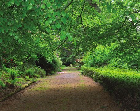
dlrcoco | County Development Plan 2022-2028 | Draft Plan

           8.4 Landscape
           The landscape, and biodiversity of DLR represent        The Planning and Development (Amendment)
           some of the most important intrinsic assets             Act, 2010 defines landscape as per Article 1 of the
           of the County. Indeed, to a great degree they           European Landscape Convention (ELC) (2000) “an
           actually define the County. The extensive network       area, as perceived by people, whose character is the
           of public parks and open spaces in the County,          result of the action and interaction of natural and/or
           provide important areas for passive and active          human factors”.
           recreation, as well as key spaces for eco-systems
           and enhancement of biodiversity. The County is          The ELC definition introduced the concept of
           framed by its coastal and upland landscapes, and        landscape as a dynamic system, not just confined
           the diverse range of landscape character areas          to the countryside; but including urban, peri-urban
           ‘Between the Mountains and the Sea’, testify to         and rural areas, and encompassing land, inland
           the variety of landscapes in what is the smallest       waters, coastal and marine areas. Landscape policy
           administrative County in Ireland.                       deals with every-day and degraded landscapes, as
                                                                   well as those that are considered to be exceptional.
           All these assets are integral to the County’s image     The new definition in law recognises the importance
           and add greatly to the quality of life for both         of all landscapes, not just exceptional landscapes, as
           residents and visitors alike. They set the physical     having a crucial bearing on our quality of life and as
           context to the daily experiences of those who           deserving attention in policy.
           live, work, and visit DLR. The landscape, cultural
           heritage and biodiversity of the County also            The Local Government (Planning and Development)
           represent valuable economic assets. The effective       Act 2000 (Part II, S10 (e) and 1st Schedule, Part IV
           management of these assets is integral to the future    (7) requires every planning authority to include
           successful development of the County.                   objectives in their Development Plan for the
                                                                   “preservation of the character of the landscape
           By promoting greater levels of information,             where, and to the extent that…the proper planning
           communication, and imaginative design, however,         and sustainable development of the area requires
           conflicts can be minimised, and it should be possible   it, including the preservation of views and prospects
           for DLR to continue to grow in vitality whilst          and the amenities of places and features of natural
           retaining its very distinct characteristics.            beauty or interest.”

             8.4.1 Policy Objective GIB2: Landscape               The Council will take a proactive approach to the
                                                                   landscape with policies that seek to conserve, and
                   Character Areas
                                                                   enhance strongly distinctive, and specific landscape
             It is a Policy Objective to continue to protect,      elements of significance that are intrinsically
             manage and plan to conserve, maintain                 important or contribute to the general amenity
             or enhance the distinctive characteristics            of the County, and that underpin the broader
             of the County’s landscapes, townscapes                landscape character of areas.
             and seascapes in accordance with the
             recommended strategies as originally outlined         The updating of the County Landscape Character
             in the Landscape Character Assessment                 Assessment, and the County Development Plan is
             (2002 and since updated), in accordance               informed by existing European, national, regional,
             with the ‘Draft Guidelines for Landscape              and local planning documents and policies.
             and Landscape Assessment’ (2000) as issued
             by the Department of Environment and                  Landscape assets are non-renewable resources
             Local Government, in accordance with the              that the Council will seek to protect. The existing
             European Landscape Convention (Florence               Landscape Character Assessment is included as
             Convention) and in accordance with ‘A                 Appendix 9 of this Draft CDP.
             National Landscape Strategy for Ireland –
             2015-2025’. The Council shall implement                 8.4.2 Policy Objective GIB3: Seascape
             any relevant recommendations contained in               It is a Policy Objective to carry out a Local
             the Department of Arts, Heritage, and the               Seascape Assessment in accordance with any
             Gaeltacht’s National Landscape Strategy for             relevant recommendations or methodologies
             Ireland, 2015 - 2025.                                   contained in the Irish Marine Institute’s
                                                                     National Seascape Character Assessment and
                                                                     the Department of Culture, Heritage and the
                                                                     Gaeltacht’s ‘National Landscape Strategy for
                                                                     Ireland, 2015 – 2025’.

158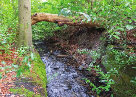
Chapter   8     Green Infrastructure and Biodiversity

  Seascape Dún Laoghaire Coast

Seascape Character Assessment is an extension              Within these areas, the presumption will be
of Landscape Character Assessment and, with                generally to resist any development not directly
17km of coastline, Seascape is a crucial element           related to the area’s amenity potential, or its
of the County’s history, identity, and culture. It is      existing use for agriculture, mountain, or hill
recognised that a Seascape Assessment for coastal          farming.
parts of the County should be carried out, as there
is a need to identify and describe seascapes in                8.4.4 Policy Objective GIB5: Historic
order to recognise the character, and key visual                     Landscape Character Areas
attributes of different parts of the coast/sea, and
                                                               In assessing development proposals and in the
to understand and manage the natural and other
                                                               preparation of plans, it is a Policy Objective
factors that lead to seascape character change.
                                                               to have regard to the recommendations and
                                                               findings of the Historic Landscape Character
  8.4.3 Policy Objective GIB4: High Amenity                   Assessments (HLCA), already undertaken
        Zones                                                  for a number of the urban-rural fringe areas
  It is Policy Objective to conserve and enhance               of the County most likely to come under
  existing High Amenity Zones and to seek to                   development pressure.
  manage these and other areas to absorb
  further recreational uses and activity without           A HCLA is a detailed holistic study of the historical
  damaging their unique character.                         development and environmental significance of
                                                           an area. The HLCA offers a dynamic perspective
The County Development Plan maps indicate                  of the total landscape, thereby contributing to
areas that are zoned as High Amenity areas. These          the management, and promotion of sustainable
areas consist of landscapes of special value where         development within that area. Five HLCAs have
inappropriate development, would contribute to a           been carried out in the County to date:
significant diminution of the landscape setting of
the County.                                                M     Barnacullia;
                                                           M     Kiltiernan;
These areas include the Glencullen Valley,                 M     Glencullen;
Glendoo Valley and Kilmashogue Valley. The                 M     Ballycorus – Rathmichael; and
areas immediately adjacent to the High Amenity             M     Old Connaught.
areas are, likewise, also sensitive landscapes.
Development in these areas proximate, may affect
directly or indirectly the quality, and integrity of the
adjoining High Amenity areas.

                                                                                                                         159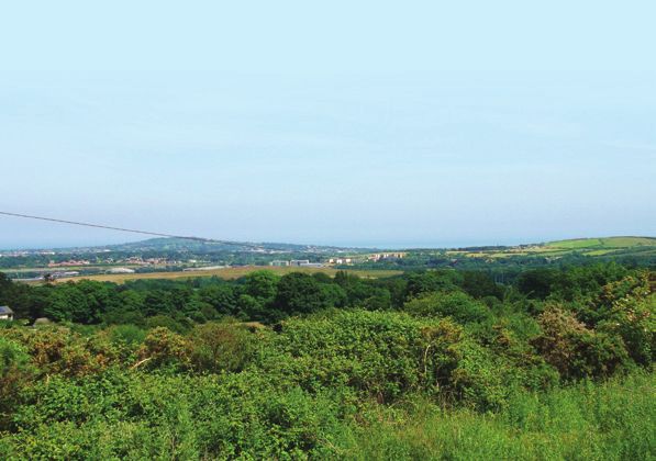
dlrcoco | County Development Plan 2022-2028 | Draft Plan

                                                                           It is also recognised that visual linkages between
             8.4.5 Policy Objective GIB6: Views and                       landmarks, landscape features and views exist. The
                   Prospects                                               Council will also take into account any Views and
             It is a Policy Objective to preserve, protect                 Prospects of adjoining Counties–Wicklow, Dublin
             and encourage the enjoyment of views and                      City and South Dublin, when assessing planning
             prospects of special amenity value or special                 applications for development proximate to the
             interests, and to prevent development, which                  mutual County boundaries.
             would block or otherwise interfere with Views
             and/or Prospects.                                             In evaluating planning applications for development
                                                                           in the foreground of identified Views and/or
                                                                           Prospects, consideration will be given to the effect
           DLR contains many sites and vantage points from
                                                                           such development may have on the View and/or
           which scenic views over areas of great natural
                                                                           Prospect.
           beauty, local landmarks, historic landscapes,
           adjoining Counties, and the City of Dublin may be               Where possible, DLR will seek to improve and
           obtained. In addition, the County also contains                 retain the viewing potential of existing views and/or
           important prospects i.e. prominent landscapes or                prospects.
           areas of special amenity value, or special interest
           which are widely visible from the surrounding area.             Roads or other public areas from which there is
           Specific Views and Prospects for protection have                a View and/or Prospect worthy of protection are
           been identified in the Plan and are considered when             graphically shown on the suite of Development Plan
           assessing planning applications.                                Maps.

           Table 8.1:    Prospects to be Preserved
            Prospects to be Preserved
            Dublin City and Bay from Deerpark, Mount Merrion
            Carrickgollogan from Ballybrack (e.g. Church Road and Churchview Road)
            Carrickgollogan from Bray Road (Shankill to Bray area)
            Carrickgollogan from Ballyman Road
            Carrickgollogan from the Enniskerry Road (south of Kiltiernan Village)
            The Scalp from Ballyman Road and part of the Enniskerry Road
            Three Rock Mountain and Two Rock Mountain from the Enniskerry Road (Sandyford-Kiltiernan area) and
            Sandyford Village
            Three Rock Mountain and Two Rock Mountain from the Ballybrack Road
            Three Rock Mountain and Kilmashogue Mountain from Marlay Park
            Tibradden Mountain and Kilmashogue Mountain from Kilmashogue Lane
            Glencullen Mountain and Valley from the Ballybrack Road
            Glendoo Mountain from the Ballybrack Road
            Dalkey Hill from Ulverton Road, Station Road and the East Pier
            Killiney Hill from Vico Road, Station Road and the East Pier

          Additional Views and Prospects may be considered throughout the lifetime of the Plan.

           Views of Stepaside

160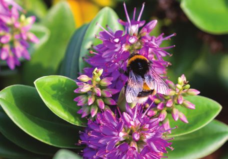
Chapter     8     Green Infrastructure and Biodiversity

8.5 The Coast
The Coast is a feature iconic of the County. It is      of progressing towards the adoption of a National
used for a wide variety of purposes - amenity,          Marine Plan, which is required under EU Directive
recreational activities, commercial, sporting, and      2014/89/EU, to be in place by 2021.
economic. It represents areas of high landscape
quality, natural heritage, and amenity value.           Part V of the Planning and Development
                                                        (Amendment) Act 2018 transposes the Directive
The 17km coastline of DLR is diverse - varying          into primary legislation. It is important to note
from rocky headlands with a variety of inlets, long     that Section 68 states that Part V, “shall not apply
established historical harbours, and high-quality       to those parts of the nearshore areas to which a
beaches. The retention of the Blue Flag status at       Development Plan, a Local Area Plan, the NPF, a
Seapoint and Killiney Bay is an objective for the       RSES, a guidance on a directive under Part 11 of the
duration of the County Development Plan and             principle Act applies”.
beyond. The Coast is also an important economic
resource - particularly for the fishing, aquaculture,   The draft NMPF also references the Marine
leisure, and tourism industries.                        Planning and Development Management Bill, which
                                                        introduces a “single development management
The Coast is home to a variety of important habitats    process for the maritime area for activities and
and species. This is reflected in the number of         development to be administrated by An Bord
designated sites of National and International          Pleanála and Local Authorities, as appropriate”.
importance along its length, including South Dublin
Bay, Booterstown Marsh, and the Dalkey Coastal          The Council supports in principle the provision of
Zone.                                                   a small pier/jetty at Shankill Beach and to promote
                                                        its use as a health and well being amenity for water
It is important that the coastal zone is managed and    based and recreational purposes. Proposals for such
developed in a way which protects and enhances          development shall be accompanied by Screening
its natural heritage and landscape. The impacts of      for AA and, as necessary, an AA Natura Impact
climate change also need to be considered.              Statement and EIAR Screening and Environmental
                                                        Assessments as appropriate.
  8.5.1 Policy Objective GIB7: National
                                                        A general scheme of the Bill was approved by the
        Marine Planning Framework (NMPF)
                                                        Government in December 2019. The role of the
  It is a Policy Objective to support the policies      Local Authority in this respect will crystallise as the
  and objectives as appropriate and relevant            legislation is finalised.
  of the forthcoming National Marine Planning
  Framework (NMPF), with respect to the
                                                          8.5.2 Policy Objective GIB8: Coastline
  conservation, management, and protection for
  a sustainable future for the marine area.                     Parks and Harbours
                                                          It is a Policy Objective to continue to upgrade
The Government have produced a consultation               recreational and tourism-related amenities
draft NMPF, which sets out a vision, objectives,          in the public parks and harbours along the
and policies to aid draft decision making in the          coastline, including improved accessibility by
marine area. It is an important component piece           the general public.

 Dublin Bay

                                                                                                                       161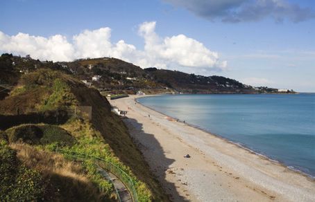
dlrcoco | County Development Plan 2022-2028 | Draft Plan

           There are a number of public parks and smaller          in 124 Countries. The biosphere designation does
           incidental urban spaces along the coastline             not add or detract from the regulatory framework
           including Blackrock Park, the Peoples Park,             already in place for the Bay, but is designed to
           Newtownsmith, Killiney and Shanganagh. The              assist stakeholders in finding sustainable solutions
           Council will continue to develop the amenity            to the management of the Bay, which ensure good
           potential of these parks, and ensure continued          outcomes for both people and nature.
           public access to harbour areas. It is an Objective of
           this Council to maintain the Coal Harbour area, and     The biosphere is managed by the Dublin Bay
           the East and West Piers of Dún Laoghaire Harbour        Biosphere Partnership which includes Fingal County
           as publicly accessible facilities.                      Council, Dublin City Council, DLR County Council,
                                                                   Dublin Port Company and the National Parks and
             8.5.3 Policy Objective GIB9: Beaches                 Wildlife Service of the Department of the Arts,
                                                                   Heritage and the Gaeltacht.
             It is a Policy Objective to promote the use of
             certain beaches for amenity and recreational          The Partnership is working to promote the
             use, and to continue to develop the County’s          protection of habitats and species, to support
             beaches in co-operation with local and                education, and research within the site, and to
             environmental interest groups.                        support a sustainable economy for people living,
                                                                   and working in the area in accordance with the
           Whilst the DLR beaches team maintain a number           Habitats Directive. The Partnership works with
           of locations across the county, there are five (5)      local community groups and Non-Government
           designated bathing areas as follows:                    Organisations (NGOs). A number of NGOs are valued
                                                                   members of the Biosphere Conservation Working
           Table 8.2:   Bathing Areas in the County                Group.
            Name of Bathing Area
            Seapoint
                                                                     8.5.5 Policy Objective GIB11: Coastal Area
                                                                           Feasibility Study
            Sandycove Harbour and Beach
                                                                     It is a Policy Objective to explore undertaking
            40 Foot Swimming Area                                    a comprehensive feasibility study on the
            White Rock Beach                                         recreational potential along the coastal area of
            Killiney Beach                                           the County, which comprehensively addresses
                                                                     recreational impact - including visitor numbers,
                                                                     mapping and surveying of sensitive habitats
             8.5.4 Policy Objective GIB10: Dublin Bay               and species and identification of significant
                   Biosphere                                         threats on European sites - and which would
                                                                     allow an assessment of any future proposals,
             It is a Policy Objective to participate, support        alone or in combination, to assess impact
             and contribute to the management of the                 on the coastal and marine zone within and
             biosphere, along with its partners and to aim           adjacent to the County boundary. The Council
             to raise awareness and education to people              will explore the possibility of carrying out
             living, working and using the biosphere,                this study with adjoining and/or coastal Local
             through an Education Strategy. In furtherance           Authorities and/or other agencies.
             of this Policy Objective, DLR have contributed
             to the development of an Environmental Code
             of Practice for those working in the Biosphere,
             and all partners carry out conservation actions
             including gathering biodiversity data, and
             monitoring within the biosphere.

           Biosphere reserves are places where nature
           and people connect. They are areas which are
           internationally recognised for their biological
           diversity, yet also actively managed to promote a
           positive relationship between people and nature.

           The Dublin Bay Biosphere is a special designation
           awarded by the United Nations Educational,
           Scientific, and Cultural organisation (UNESCO). It is
           part of a global network of 701 biosphere reserves

162
Chapter 8 Green Infrastructure and Biodiversity
8.6 Access and the Mountains
The County has extensive possibilities for possible, the Dublin Mountain Partnership’s efforts
recreational use between parks, natural routes, to reroute the Dublin Mountains Way off public
beaches, and the hills/mountains. Traditionally, roads and to provide/improve access to publicly
the recreational use of the Dublin Mountains owned land in the upland area.
would have been primarily for activities such as
walking, road cycling, dog exercising and picnicking, The Dublin Mountains Area also contains significant
which capitalised upon the scenic qualities of the archaeology, particularly in the form of passage
mountains and the panoramic vistas over Dublin. graves, portal tombs and wedge tombs among
Today there is a much wider range of recreational other features, which add to the overall recreational
pursuits taking place in the mountains including component of the Dublin Mountains Asset.
mountain biking, orienteering, mountain running.
8.6.3 P
olicy Objective GIB14: Public
A number of polices are contained within this Rights-of-Way
Section of the Chapter to protect and enhance
It is a Policy Objective to:
the mountains, including their use for access and
i. Preserve, protect, promote, and improve for
recreation.
the common good all existing public rights-
of-way which contribute to general amenity.
8.6.1 Policy Objective GIB12: Access to
Natural Heritage ii. Extend or enhance existing rights-of-way
It is a Policy Objective to promote, protect and either by agreement with landowners or
enhance sustainable and appropriate access using compulsory powers in the interest of
to the natural heritage of the County, where ensuring access to amenities, including the
practicable, in a balanced way while protecting coast, upland areas, riverbanks, heritage
the natural heritage of the County. sites and National Monuments.
iii. Prohibit development and keep free from
obstruction existing rights-of-way, and to
take legal action if necessary, to prevent any
8.6.2 Policy Objective GIB13: Dublin
attempt to close them off.
Mountains Strategic Plan
It is a Policy Objective to support the vision iv. Prohibit development which would
and objectives of the Dublin Mountains prejudice public access to existing rights-
Partnership Strategic Plan (2020- 2025), of-way, unless the level of amenity is
including the continued sustainable maintained by the right of way, footpath, or
management, development and enhancement bridleway being diverted by the minimum
of the Dublin Mountains Way and its rerouting practical distance and the route continues
off public roads, wherever possible. to be segregated from vehicular traffic.
v. Consider favourably planning applications
In 2006 the Dublin Mountains Initiative (DMI) was which include proposals to improve the
formed - to represent the views of recreational condition and appearance of existing rights-
users of the Dublin Mountains and to foster the of-way.
development of a management plan for the area.
The Dublin Mountains Partnership (DMP) was The Council will continue to use its powers under
established in 2008, to improve the recreation the Planning Acts to preserve and maintain existing
potential of the public lands in the Dublin rights-of-way, and to promote their greater use in
Mountains. The DMP Partners include Coillte, the amenity areas. In addition, the Council may seek
National Parks and Wildlife Service, DLR County to incorporate the creation of pedestrian ways as a
Council, South Dublin County Council, Dublin City condition of a planning permission to link amenities,
Council and the DMI. facilities, and points of interest.
The Partnership was also established to oversee the Rights-of-way will be displayed on the County
preparation of the Dublin Mountains Partnership Development Plan Maps, where possible, and the
Strategic Plan. The flagship project of the DMP is the Council is committed to ensuring that access by
42.6km National Way marked trail, which crosses the public to amenity areas is retained. It is an
the mountains from Shankill to Tallaght. objective of the Council to secure the retention of
those established public rights-of-way as set out in
In order to enhance the enjoyment and safety of Appendix 12.
walkers, the Planning Authority will facilitate, where
163dlrcoco | County Development Plan 2022-2028 | Draft Plan
Routes through Fernhill, Stepaside
164Chapter 8 Green Infrastructure and Biodiversity
Mountain Partnership in improving the recreational
8.6.4 Policy Objective GIB15: Recreation experience for users of the Dublin Mountains.
Access Routes
It is a Policy Objective to preserve all 8.6.5 Policy Objective GIB16: National
Recreation Access Routes, which contribute to Park
general amenity. It is a Policy Objective to promote and to
co-operate in the extension of the Wicklow
The current Plan identifies Recreation Access Mountains National Park.
Routes (RARs) within the lands under the control of
Coillte. Coillte Teoranta, the State Forestry Board, The Wicklow Mountains National Park was
was established to manage the public forest built established by the Government in 1991, and
up since the commencement of State planting originally covered an area of 3,700 hectares. This
and is the largest provider of forest recreation area has been expanded to over 20,000 hectares,
in Ireland. Coillte’s commitment to recreation and it is envisaged that the Park will continue to
and nature is underpinned by its membership of grow as new lands are acquired. The primary aim
the Dublin Mountain Partnership, and its recent of the Park is the conservation of local biodiversity
‘Coillte Nature’ alternative, which is dedicated to and landscape. A very small portion of the Park falls
addressing the biodiversity and climate change within the jurisdiction of Dún Laoghaire-Rathdown.
crises via reconfiguration with native woodlands,
and restoration of biodiversity areas.
8.6.6 Policy Objective GIB17: Trails, Hiking
It is an objective of the Council to support the and Walking Routes
sustainable management of recreation in the Dublin It is Policy Objective to promote the
Mountains. As members of the Dublin Mountains development of Regional and local networks
Partnership, which comprises representatives from of hiking and walking routes/trails. These
a wide range of partner organisations, the Council should be waymarked/signposted and listed,
will continue to support the role of the Dublin where feasible and appropriate.
The forthcoming Heritage Plan (completion
2021), informs the Council’s policies regarding
the protection, and management of and access to
heritage in the County. The County Development
Plan (CDP) will have full regard to the new County
Heritage Plan, during the lifetime of the CDP,
and will also continue its commitment to the
development of hiking and walking trails in the
County.
Implementation of this policy may involve the
development of walks designed around cultural
and historic personalities and events, coastal and
sea-based routes, and long-distance hiking trails in
the Dublin Mountains. The Council will co-operate
with relevant agencies and groups, e.g. the Dublin
Mountains Partnership and Biosphere Partnership,
local groups, and landowners as appropriate, with
a view to increasing such routes - particularly
in upland areas. This will include consultation
with adjoining Local Authorities with a view to
promoting routes extending beyond the County
administrative boundary.
Steps to encourage such routes may include public
transport connectivity, safe cycling routes, secure
parking, publication of maps, and the provision of
other appropriate facilities for users of such routes.
Where possible and appropriate established hiking
and walking routes will be signposted. (Refer also
to Section 2.2.7.5, Policy ST8). That all in use public
Walking Route through Dublin Mountains rights of way including those over private lands be
suitably signposted.
165dlrcoco | County Development Plan 2022-2028 | Draft Plan
Bee and Flowers Marlay Park
8.7 Biodiversity
8.7.1 Introduction species visit our gardens such as urban foxes,
badgers and hedgehogs, and not forgetting all our
The natural heritage of DLR includes our flora,
wonderful flora including many rare species.
fauna, geology, and the landscape that surrounds
us. In simple terms biodiversity includes all the The condition of these natural habitats and species,
variety of life on Earth. It is the diversity of nature, affects how they can provide ecosystem services,
of our habitats, plants, and animals (including us), including providing us with resilience to climate
and their interconnections with each other. We change. It affects the quality of life of the residents
are a part of nature and everything in nature is and visitors to the County and is important in
connected. Biodiversity forms part of the overall supporting local businesses such as tourism
Green Infrastructure of the County. and recreation, highlighting the importance of
protecting, and enhancing our natural habitats and
The Council will aim to protect and enhance
species.
biodiversity and landscape and will strive to
ensure the protection of environments and
habitats (consistent with RPO 7.15 of the RSES). 8.7.1.1 Policy Objective GIB18: Protection
DLR, stretching from the coastal strip along South of Natural Heritage and the
Dublin Bay to the uplands of the Dublin Mountains, Environment
contains a wealth of diverse natural habitats and It is a Policy Objective to protect and conserve
species. the environment including, in particular, the
natural heritage of the County and to conserve
These include our marine and coastal environments, and manage Nationally and Internationally
our hedgerows, rivers, streams, wetlands, important and EU designated sites - such as
woodlands and areas of upland grassland, heath, Special Protection Areas (SPAs), Special Areas
fen, and bog. Various species can be found across of Conservations (SACs), proposed Natural
the County in all of these habitats, from our Heritage Areas (pNHAs) and Ramsar sites
protected harbour porpoise, our seals and birds in (wetlands) - as well as non-designated areas
our marine and coastal areas to our red squirrels of high nature conservation value known as
in Killiney Hill, bats roosting and foraging across locally important areas which also serve as
the County, terns, swallows and swifts that fill our ‘Stepping Stones’ for the purposes of Article 10
summer skies, to our watercourses and wetland of the Habitats Directive.
with otter, newts and frogs. The less shy of our
166Chapter 8 Green Infrastructure and Biodiversity
Red Squirrel, Killiney Hill
167dlrcoco | County Development Plan 2022-2028 | Draft Plan
Implementation of this Policy Objective will involve, M Promotion of the Integrated Biodiversity Impact
inter alia: Assessment (IBIA) approach - a methodological
framework for biodiversity impact assessment
M Protection of existing woodlands, trees and that integrates SEA/EIA requirements with AA.
hedgerows which are of amenity or biodiversity M Continuing as partners of the UNESCO Dublin
value and/or contribute to landscape character, Bay Biosphere and to support the agreed plans
including those listed under Tree Protection and actions of the partnership.
Orders (TPOs) and ensure that proper provision
is made for their protection and management.
M Continuing to actively support the aims and
objectives of the All Ireland Pollinator Plan 2020
M Designation of High Amenity zones. - 2025 by encouraging measures to protect
M Identification of Views and Prospects of special and increase the population of bees and other
amenity value or special interest. pollinating insects in DLR.
M Mapping of existing public rights-of-way and M Implementing any relevant recommendations
other strategic access routes. contained in the Department of Arts, Heritage,
M Protection of sites of geological and and the Gaeltacht’s National Peatland Strategy
geomorphological importance. 2015.
M Protection of a Special Protection Areas (SPA),
Special Areas of Conservations (SACs), and 8.7.1.2 Policy Objective GIB19: Habitats
proposed Natural Heritage Areas (pNHAs). Directive
M Maintaining the ecological character and It is a Policy Objective to ensure the protection
sustainable use of our wetlands that are of natural heritage and biodiversity, including
considered of International Importance. DLRs European Sites that form part of the Natura
Ramsar site is the Sandymount Strand/Tolka 2000 network, in accordance with relevant
Estuary No. 832. EU Environmental Directives and applicable
M Protection of existing access (including National Legislation, Policies, Plans and
established rights-of-way) to such sites, where Guidelines.
feasible, and the promotion of public access
where it does not exist at present – but subject Implementation of the above policy will be in
to ensuring and maintaining the highest accordance with the following and any updated/
environmental standards. superseding documents:
M Development and protection of the DLR M EU Directives, including the Habitats Directive
Ecological Network (Refer to Appendix 10).
(92/43/EEC), as amended, the Birds Directive
M Identification and protection of non-designated (2009/147/EC), the Environmental Liability
sites of local and high nature conservation Directive (2004/35/EC), the Environmental
value, and the management of features of the Impact Assessment Directive 2011/92/EU, as
landscape which are of major importance for amended by 2014/52/EC), as amended, the
wild fauna and flora in accordance with Article Water Framework Directive (2000/60/EC)
10 of the Habitats Directive. and the Strategic Environmental Assessment
M Maintenance and, as appropriate, achievement Directive (2001/42/EC).
of ‘favourable conservation status’ of habitats M National legislation, including the Wildlife
and species within SACs and SPAs as per the Acts 1976 and 2010, as amended, the
requirements and obligations of the Habitats European Union (Planning and Development)
Directive Council Directive 92/43/EEC and the (Environmental Impact Assessment) Regulations
Birds Directive 2009/147/EC. 2018, the European Union (Water Policy)
M Undertake field studies and map invasive alien Regulations 2003, as amended, the Planning
species throughout the County in line with the and Development Act, 2000, as amended, the
forthcoming DLR Invasive Species Plan. European Communities (Birds and Natural
M Working with local communities, groups, Habitats) Regulations 2011 (SI No. 477 of
landowners, National Parks and Wildlife Service 2011), as amended, the European Communities
(NPWS) and other relevant parties to identify, (Environmental Liability) Regulations 2008, as
protect, manage and, where appropriate, amended, and the Flora Protection Order 2015.
enhance and promote understanding of sites of M National policy guidelines, including the
local biodiversity value. Landscape and Landscape Assessment Draft
M Protection of the ecological integrity of Guidelines 2000, the Environmental Impact
proposed Natural Heritage Areas (pNHAs), Assessment Sub-Threshold Development
Natural Heritage Areas (NHAs), Statutory Nature Guidelines 2003, Strategic Environmental
Reserves, Refuges for Fauna and Annex 1 Assessment Guidelines 2004, Flood Risk
Habitats. Management Guidelines 2009, Guidelines
168Chapter 8 Green Infrastructure and Biodiversity
on the Information to be contained in M To collect biodiversity information on the
Environmental Impact Assessment Reports County and assess our ecosystem services.
2017, and the Appropriate Assessment M To raise public awareness of biodiversity,
Guidance 2010. ecosystems, and ecosystem services, and to
M Catchment and Water Resource Management coordinate existing and new initiatives.
Plans, including the National River Basin District M To improve resilience of biodiversity to climate
Management Plan 2018-2021. change and, thereby, improve human resilience
M Biodiversity Plans and guidelines, including the to climate change.
forthcoming DLR County Biodiversity Action M To provide a basis for monitoring the success of
Plan 2021-2026, the National Biodiversity biodiversity conservation at an International,
Action Plan 2017-2021, and the EU Biodiversity National, and local level.
Strategy 2030.
M Ireland’s Environment 2016 (EPA), and to make The implementation of the current DLR County
provision, where appropriate, to address the Biodiversity Action Plan has resulted in the
report’s goals and challenges. completion of a number of projects/studies that
have increased the overall level of knowledge,
8.7.1.3 Policy Objective GIB20: Biodiversity awareness and understanding of the biodiversity
of the County. These projects/studies are listed in
Plan
Appendix 3, and have been used to produce the DLR
It is a Policy Objective to support the Ecological Network Map (Refer to Supplementary
provisions of the forthcoming DLR County Map B1). The Ecological Network Map visually
Biodiversity Action Plan, 2021 – 2026. demonstrates the ecological network that currently
exists across the County. The Council will undertake
The DLR County Biodiversity Action Plan has been necessary ecological surveys, and update the
written with the EU Biodiversity Strategy 2030, and habitat and species mapping for the County.
the National Biodiversity Action Plan 2017-2021,
in mind along with other plans and policies. As 8.7.1.4 Policy Objective GIB21: Designated
outlined in the National Biodiversity Action Plan, Sites
2017-2021, Ireland’s Vision for Biodiversity is “that
biodiversity and ecosystems in Ireland are conserved It is a Policy Objective to protect and preserve
and restored, delivering benefits essential for all areas designated as proposed Natural Heritage
sectors of society and that Ireland contributes Areas, Special Areas of Conservation, and
to efforts to halt the loss of biodiversity and the Special Protection Areas. It is Council policy to
degradation of ecosystems in the EU and globally”. promote the maintenance and as appropriate,
delivery of ‘favourable’ conservation status of
The EU Biodiversity Strategy for 2030 announced in habitats and species within these areas.
May 2020, is a comprehensive, ambitious, long-
term plan for protecting nature and reversing the There are a range of sites in the County that are
degradation of ecosystems. It aims to put Europe’s designated under National and EU legislation.
biodiversity on a path to recovery by 2030, with The National Parks and Wildlife Service (NPWS)
benefits for people, the climate, and the planet. designates Special Protection Areas (SPAs), and
A core part of the European Green Deal, the EU Special Areas of Conservation (SACs), under the EC
Biodiversity Strategy will also support a green Birds and Habitats Directives, respectively.
recovery following the current pandemic.
Internationally Protected Areas:
The forthcoming DLR County Biodiversity Action There are a number of areas designated in DLR
Plan, 2021 – 2026, aims to incorporate the aims to conserve habitats and species of European
of these EU and National Biodiversity plans into importance pursuant to the EU Habitats and Birds
objectives and actions. This will be reflected in the Directives The National Parks and Wildlife Service
primary features of the forthcoming DLR County (NPWS) designates Special Protection Areas (SPAs),
Biodiversity Action Plan, which will aim: and Special Areas of Conservation (SACs), under the
EC Birds and Habitats Directives respectively.
M To translate International, European, and Irish
policies and obligations into effective local SPAs are designated for wild birds listed on Annex
action on the ground. I of the EC Birds Directive. SACs are designated for
M To provide a framework for the conservation of habitats listed on Annex I, and for species listed on
biodiversity of International, National, and local Annex II, of the EC Habitats Directive. SPAs and SACs
importance. form part of a European network of designated sites
called European sites.
169dlrcoco | County Development Plan 2022-2028 | Draft Plan
The Council is also committed to avoiding pollution activities. The Council will normally only grant
or deterioration of important bird habitats outside permission where it is clearly demonstrated that
SPAs (as per Article 4(4) of the Birds Directive). a proposal will have no significant adverse impact
In line with the requirements of Article 3 of the on the habitats, and species of interest in the
Habitats Directive, the Council will endeavour to designated area, and its ecological integrity.
improve the ecological coherence of European sites
by maintaining, and where appropriate, developing, All designated sites in the County are shown on the
further features of the landscape, which are of Development Plan Maps, and are set out in Table
importance for wild fauna and flora. 8.3 below.
The Council shall endeavour to engage with the Table 8.3: Designated Sites in DLR
National Parks and Wildlife Service to ensure Site no Site name SPA pNHA SAC
Integrated Management Plans are prepared for
all European sites, and ensure that plans are fully 00210 South Dublin 3 3
integrated with all land use and water management Bay SAC
plans in the County. It is the intention that such 004024 South Dublin 3
plans are practical, achievable and sustainable Bay and River
and have regard to all relevant ecological, cultural, Tolka Estuary
social and economic considerations and with special SPA (includes
regard to local communities. Booterstown
Marsh)
Appropriate Assessment (AA), Article 6 of the
Habitats Directive requires that the impacts of any 004172 Dalkey Islands 3 3
plans or projects likely to affect European sites are SPA
assessed by the Planning Authority. In accordance 001205 Booterstown 3 3
with ‘Appropriate Assessment of Plans and projects Marsh pNHA
in Ireland, Guidance for Planning Authorities’, any
001206 Dalkey Coastal 3
plan or project that has the potential to impact
Zone and
on European sites must undergo the Appropriate
Killiney Hill
Assessment (AA) process (Refer to Section 12.1.2.2
pNHA
of the Plan).
001753 Fitzsimons 3
Beyond the Appropriate Assessment part of the Wood pNHA
process, if adverse impacts remain even after 001211 Loughlinstown 3
mitigation measures have been considered, Woods pNHA
then alternatives may be examined or in the
absence of any alternatives, there is the final 001207 Dingle Glen 3
stage of the process, where a proponent may pNHA
request permission for Imperative Reasons of 001202 Ballybetagh 3
Over-Riding Public Interest (IROPI), subject to the Bog pNHA
strict requirements of Article 6(4) of the Habitats
000713 Ballyman Glen 3 3
Directive.
SAC
Nationally Protected Areas: 00725 Knocksink 3 3
Under the Wildlife (Amendment) Act, 2000 Woods SAC
proposed Natural Heritage Areas (pNHAs) have (also a Nature
been designated to conserve species and habitats Reserve)
of national importance. This includes some of 002122 Wicklow 3 3
our few remaining native woodlands such as Mountains
Fitzsimons Woods, and Loughlinstown Woods, along SAC
with wetland sites such as Ballybetagh Bog, and
003000 Rockabill to 3
important coastal areas such as the Dalkey Coastal
Dalkey Islands
Zone, and Killiney Hill. There is also a Statutory
SAC
Nature Reserve at Knocksink Woods, that straddles
the border of DLR and Wicklow. Note: SPA -Special Protection Area (Birds), pNHA -
Proposed Natural Heritage Area, SAC - Special Area
These areas, established under the Wildlife Act,
of Conservation.
are areas where nature conservation is the primary
objective and takes precedence over all other
170Chapter 8 Green Infrastructure and Biodiversity
The biodiversity of DLR is not just contained
8.7.1.5 Policy Objective GIB22: Non- within specifically Designated Areas but is found
Designated Areas of Biodiversity throughout the County. Many areas that do not have
Importance formal protection under legislation still possess a
It is a Policy Objective to protect and promote level of natural heritage importance, which needs to
the conservation of biodiversity in areas be recognised and protected, where possible. These
of natural heritage importance outside areas include woodlands, wetlands, semi- natural
Designated Areas and to ensure that notable grasslands, hedgerows, trees, rivers, streams,
sites, habitats and features of biodiversity private gardens, and other urban green spaces.
importance - including species protected Other areas of important biodiversity in DLR can
under the Wildlife Acts 1976 and 2000, the include graveyards, cemeteries and the green spaces
Birds Directive 1979, the Habitats Directive associated with institutional lands.
1992, Flora (Protection) Order, 2015, Annex
I habitats, local important areas, wildlife The Council recognise the importance of these areas
corridors and rare species - are adequately as buffer zones, and ‘linkages’, between formally
protected. Ecological assessments will be designated ecological sites. A number of surveys
carried out for all developments in areas of non-designated sites have been carried out
that support, or have potential to support, since 2010. Sites which have been assessed and
features of biodiversity importance or rare and identified as making an important contribution to
protected species and appropriate mitigation/ the biodiversity resource of DLR at the National,
avoidance measures will be implemented. County, and local level have been incorporated in
In implementing this policy, regard shall be the DLR Ecological Network, and are detailed in
had to the Ecological Network, including the Supplementary Map B1. It is envisaged that the
forthcoming DLR Wildlife Corridor Plan, and forthcoming wildlife corridors will also be depicted
the recommendations and objectives of the in Supplementary Map B1.
Green City Guidelines (2008) and ‘Ecological
The Council will ensure that the impact of new
Guidance Notes for Local Authorities and
developments on biodiversity is minimized and will
Developers’ (Dún Laoghaire-Rathdown Version
seek to include measures for the enhancement
2014).
Fernhill Park
171dlrcoco | County Development Plan 2022-2028 | Draft Plan
Wild flowers at Marlay
of biodiversity in all proposals for large urban resilience to climate change, both for biodiversity
developments. The ‘Green City Guidelines’ prepared and for our communities, providing many
by UCD Urban Institute Ireland, Fingal County immediate benefits to society and the economy.
Council and DLR County Council provides general
guidance and advice on how best to retain, and Regard should be had to Article 10 of the Habitats
enhance biodiversity in new medium-to- high Directive, which references ecological areas that
density urban developments. link European sites. Many habitats of conservation
concern - particularly designated sites - are ‘linked’
In accordance with Article 4(4) of the Birds to the surrounding landscape by natural and
Directive, the Council will endeavour to ensure the man-made features, such as water courses (rivers,
avoidance of pollution or deterioration of important streams, canals, and drainage ditches), hedgerows,
bird habitats outside formally designated SPAs. treelines, roads and railways. It is important that
areas of conservation concern are not considered in
The Council will also continue to support swift isolation. The linkages between buffer zones around
species and other important bird species through such areas must also be protected, to ensure the
the encouragement of the provision of swift nest continued migration of species and genetic diversity
boxes in develpoment(s), with advice from Swift throughout the wider County.
Conservation Ireland.
Issues related to connectivity, including maintaining
The four Dublin Local Authorities have also and establishing connections between protected
published ‘Ecological Guidance for Local Authorities areas, play an integral role in land-use planning.
and Developers’, which aims to provide both The County Development Plan seeks to improve the
developers and Local Authority staff with concise overall ecological template in DLR, by enhancing
factual information on the best approach to deal connectivity between small fragmented areas and
with certain specific ecological issues. remedying gaps in the connectivity both within
wildlife corridors, and also between important
8.7.1.6 Policy Objective GIB23: County- areas.
Wide Ecological Network
National and local studies undertaken through the
It is a Policy Objective to protect the Ecological
implementation of the DLR Biodiversity Plan, have
Network which will be integrated into the
allowed for ongoing assessments of the current
updated Green Infrastructure Strategy and
status and nature conservation value of notable
will align with the DLR County Biodiversity
sites, habitats and species in the County. The
Action Plan. Creating this network throughout
information collected to date (by way of ecological
the County will also improve the ecological
surveys) has been used to inform the development
coherence of the Natura 2000 network in
and updating of the Ecological Network for the
accordance with Article 10 of the Habitats
County. The forthcoming Wildlife Corridor Plan will
Directive. The network will also include non-
also inform the Ecological Network.
designated sites.
The specific habitats identified include treelines,
The Council supports and recognises the importance hedgerows, scrub and woodland, watercourses,
of wildlife corridors, green infrastructure, and and semi-natural areas such as mixed broadleaved
green initiatives. The Council also recognises the woodland, coastal habitats, which are mapped and
important role many of the wildlife corridors and are shown on The Ecological Network Map (Refer to
biodiversity areas play in relation to improving Supplementary Map B1). A number of other specific
172Chapter 8 Green Infrastructure and Biodiversity
Stream in Marlay Park
Policies throughout the Plan are aimed at affording
further protection of these features (refer also to 8.7.1.7 Policy Objective GIB24: Rivers and
Policy Objective LHB25 and Policy LHB24 below). Waterways
It is a Policy Objective to maintain and protect
The DLR Ecological Network includes: the natural character and ecological value of
the river and stream corridors in the County
M Designated sites (SACs, SPAs, and pNHAs);
and where possible to enhance existing
M Non-designated sites of high nature channels and to encourage diversity of habitat
conservation value and locally important areas and nature-based solutions that incorporate
(such as non-designated sites of National/ biodiversity features. It is also policy (subject
County importance supporting Annex I habitats, to the sensitivity of the riverside habitat), to
Annex II species, rare and protected flora and provide public access to riparian corridors,
high quality semi-natural habitats important at to promote improved passive recreational
the County and local level); activities.
M Non-designated sites of local conservation
value (public parks, smaller local woodlands This objective aims to protect rivers, streams and
etc.); other watercourses and maintain them in an open
M Forthcoming Wildlife Corridors that include state capable of providing suitable habitat for fauna
our rivers and streams and associated habitats, and flora, including fish. Existing County flood plain
hedgerows, pollinator areas and coastal management policy seeks to limit development
habitats. in identified floodplains, and to preserve riparian
corridors. Development proposals in riparian
It is further recognised that the maintenance and corridors will be considered providing, where
development of the Ecological Network will play practicable, they:
a future role in climate change adaptation. An
Ecological Network throughout the County linked M Dedicate a minimum of 10m each side of the
to, and with adjoining land areas, will allow for water’s edge for amenity and biodiversity and
species migration which will inevitably take place up to 30m for areas where the ecosystem
over time as a climate change adaptation process. functioning of the catchment requires it, (where
practicable).
173You can also read