A BASELINE ASSESSMENT - LEARNING AREA " The Burren " (Ireland) - HNV-Link
←
→
Page content transcription
If your browser does not render page correctly, please read the page content below
A thematic network on High Value Farming
Learning, INnovation & Knowledge

                   LEARNING AREA « The Burren »
                            (Ireland)

                A BASELINE ASSESSMENT

Authors:
Caroline Sullivan, James Moran and Brendan Dunford
Date: July 2017

         This project has received funding from the European Union Horizon 2020 research
         and innovations program under Grant Agreement No. 696391
                                                                                           1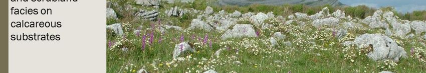
The Burren is the most extensive glaciated karst landscape in Western Europe and comprises two primary
landscape units: the Burren uplands to the west (often 2-300m above sea level) and what are sometimes
referred to as the ’Gort lowlands’ (
The limestone is composed of the calcium-rich skeletal remains of marine organisms (e.g. sea-lilies,
ammonites, urchins, corals, brachiopods) that populated the warm, shallow sea that lay over the region
during the Carboniferous period. These were eventually compressed by their own weight and that of the
sea above, and subsequently elevated to reveal the massive, fossil-rich beds that we see today.
This limestone was formed 340m years ago and has been shaped by a range of forces – tectonic, glacial,
‘solutional’ and human – to create a very unique geological heritage.
The limestone bedrock is important for farming as it offers a ‘dry lie’ for outwintering cattle, almost like an
underfloor heating system!
The geological heritage of the Burren has been recognised by its award of UNESCO Geopark Status (along
with the adjacent Cliffs of Moher).

                                                                                                             3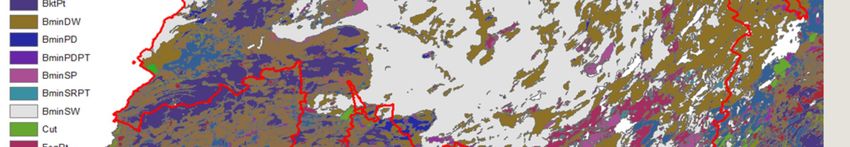
The maximum height of the limestone hills in the Burren is 330m. Many of the hills
plateau at 150m.

The Burren Uplands lie in County Clare and are the most widely known and visited part of the
Burren. They are particularly rich in archaeological sites, having always been attractive to farmers
due to their light, fertile, free draining soils. They also contain some of the best pasture and
meadow habitats, the conservation of which is a high priority. A series of terraced hills separate the
Burren uplands from the Gort lowlands to the east.
These areas provide the habitats for the celebrated Burren flora and rough winter grazing for livestock. The
intervening valleys and a low-lying coastal strip of glacial drift are more species poor and are often used for more
intensive farming practices.

                                                                                                                  4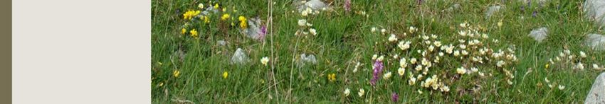
This low-lying limestone plain is a ‘covered karst’ and is characterised by thin layers of fertile soil with
outcroppings of limestone pavement and an extensive system of calcareous lakes and fens of high
conservation importance. This includes the most extensive area of naturally functioning turloughs in
Ireland. Grazing levels are lower in the Burren lowlands as there is more outcropping rock and less soil
cover on much of the area. One of the main conservation priorities in the Burren lowlands is to prevent
eutrophication of the wetland habitats.

Typical wetland habitats include calcareous fens, oligotrophic lakes, petrifying springs and seasonal lakes known as
turloughs.

The Burren lowlands also contains important grasslands and heaths. Unlike the upland grasslands, these are not
always used
for winter grazing.

                                                                                                                  5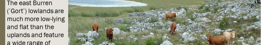
The unavailability of water in summertime in this free-draining landscape where most of the water flows
underground, forced farmers to adopt a system of winter grazing which in turn shapes the biodiversity and
cultural traditions of the Burren.

The River Fergus which lies to the south of the Burren drains a considerable part of the Burren plateau to
the north and northwest of the river and much of the lowland areas. The catchments north of the Burren
plateau drain mainly through submarine outlets in the sea at Galway Bay (Deegan, 2016). The western
Burren catchment drains largely into the Atlantic Ocean. Unusually for a karst landscape, there are surface
waters in the Burren uplands. To the southeast of the plateau are numerous lakes, for example Loughs
Inchiquin and Bunny. These occupy shallow hollows in the limestone and are hydrologically connected to
the groundwater body of the lowlands (Drew, 1990). There are also two surface rivers: the Caher River and
the Aille River (Drew 1990). Geomorphology and hydrology are intimately linked in a karst landscape and
the hydrology of the low Burren is particularly distinctive and complex due to extensive karstification. There
is extensive groundwater-surface water interaction in this area and the turloughs in the Burren lowlands
appear to be hydrologically linked. There is also groundwater-sea water interaction and the water level of
turloughs close to the sea can vary according to the tide (Deegan, 2016).

                                                                                                             6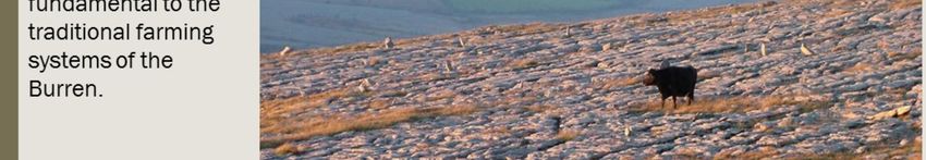
The most common soil type in the area is Rendzina – a young, dark, calcimorphic soil which supports a typical
Burren flora and is really only suitable for rough (winter) grazing.

Brown earth soils dominate the more fertile valley and coastal areas, lending themselves to more intensive tillage
and dairy farming systems.

                                                                                                                7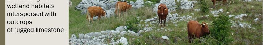
The high rainfall levels in the Burren flush nutrients from the thin rendzina soils, while summer
droughts on can lead to desiccation of soils and vegetation. Thus the Burren can represent a very
stressful growing environment for many plants, offering a competitive advantage to more compact,
stress tolerant plants such as the herbs for which the Burren is famous. Indirectly, the geology and
climate impact on biodiversity through agricultural practices such as winter grazing – farmer’s
response to the hydrological limitations of the landscape (poor summer water), exploiting the
geological (the winter warmth of the limestone) and climatic (mild winters) conditions.

                                                                                                  8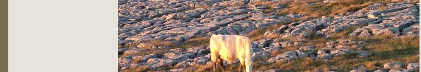
Habitats include:
•    Semi-natural dry grasslands and scrubland facies on calcareous substrates
     (Festuco Brometalia)(*important orchid sites) (6210)
•    Alpine and Boreal heaths (4060)
•    Juniperus communis formations on heaths or calcareous grasslands (5130)
•    Lowland hay meadows (6510)
•    Limestone pavement (8240)
•    Turloughs (3180)
•    Calcareous fens (7210)
•    Petrifying springs (7220)

Other important habitats include Atlantic Hazel woodland (the extent of which is increasing in the
area as grazing pressure decreases). Hazel woodland contains a rich ground flora and provides
extensive habitat for many different fungi and lichens, some of which are extremely rare (Deegan,
2016).

                                                                                                9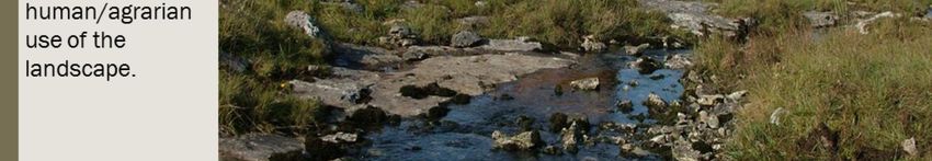
Over 30,000 ha of the Burren have been designated as Special Areas of Conservation
under the Habitats and Species Directive (92/43/EEC), while an additional area of almost
2,000 ha is designated as Special Protection Area. These designations were introduced in the late 1990s to
encourage biodiversity conservation and environment protection. These policies
resulted in a mitigation of some of the negative impacts of agriculture on the
environment – including land reclamation and over-intensification which were
significant issues in the 1980s and 1990s.
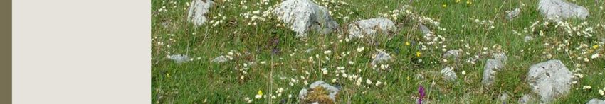
10The Burren is a very important site for semi-natural grasslands on calcareous substrates. Wet and neutral
grasslands are common elsewhere in Ireland but no other area can rival the Burren for concentration or species-
richness of calcareous grasslands. The image above shows a grassland near the coastal upland pf Black Head.
Harebell (Campanula rotundifolia), Ox-eye Daisy (Leucanthemum vulgare), Devils-bits Scabious (Succia pratensis),
Red Clover (Trifolium pratense), Crested Dogstail (Cynosurus cristatus), Blue Moorgrass (Sesleria caerulea), Sweet
vernal grass (Anthoxanthum odoratum), Eyebright (Euphrasia sp.) and Tormentil (Potentilla erecta) are all visible.
11Ireland has the largest area of limestone pavement in the EU and is common throughout the Burren. While it does
occur elsewhere in Ireland, notably small areas around Lough Corrib and on the Aran Islands, the most extensive
limestone pavement occurs in the Burren. Limestone pavements are both geologically and biologically important
resources. The structure of limestone pavement consists typically of blocks of rock, known as clints, separated by
fissures, or grikes. There is considerable variation with some areas consisting of massive blocks of smooth, relatively
un-weathered pavement with well-developed grikes to areas where the grikes are very narrow and shallow. Finely
fractured pavements or shattered pavements, where grikes are almost absent, also occur. The rock surface is
almost devoid of overlying soils (considerably less than 50% cover) except sometimes for patches of shallow skeletal
soils, although more extensive areas of deeper soil occasionally occur
12The Burren is an important area for turloughs. Again, they do occur elsewhere in Ireland but they occur in high
densities here. Turloughs are groundwater-dependent wetlands that occur in limestone depressions mainly in the
karst landscape of the west of Ireland (Sheehy Skeffington et al. 2006). The hydrological regime of turloughs is
linked to precipitation, which may result in flooding at any time of the year during high rainfall events, although
flooding generally occurs between October and April (Coxon 1987). Turloughs are traditionally important summer
grazing pastures and the substrate and grazing management are also important factors in determining species
distribution (Goodwillie 2003).
13Limestone pavement (8240) provides a dry, warm habitat for out wintering cattle, while turloughs (3180) and
springs (7220) provide them with a calcium rich water supply.
Cattle rely on the species rich grassland forage provided by the Burren’s grasslands and heaths (6210 & 4060) with
hay from medows (6510) providing supplementry feeding for stock in bad weather and for sick animals.
In spite of the importance of these priority habitats for agriculture, much of the area is not considered ‘utliizable’ for
grazing and thus not eligible for Basic Payment Scheme funding. In a survey of 200 Burren farms in 2016, on
average only 60% of the area was BPS eligible.
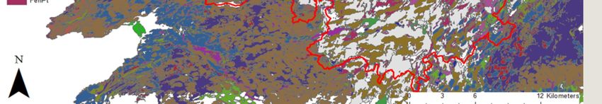
14Here is an example of a Burren farm with all habitats mapped as part of the IDEAL-HNV project.
A typical non-Burren farm is presented in the inset for contrast.
Note the complex mosaics of semi-natural habitats on the Burren farm and the more homogenous improved
agricultural grassland areas.
Mosaics of hazel scrub, dry calcareous and neutral grassland, dry calcareous heath and exposed calcareous rock
with patches of mature woodland are common on these farms. The improved agricultural grassland areas are
essential for the functioning of these farms, providing grazing for summer and additional fodder for winter.
15A total of 23 of Ireland’s 27 orchid species and regional specialities such as the Alpine Gentiana verna, the Arctic
Dryas octopetala and the Mediterranean Neotinea maculata whose main British and Irish populations occur in the
Burren.
Other relatively common species such as Campanula rotundifolia, Antennaria diocia, Galium verum and Geranium
sanguineum are said to ‘flourish so much more exuberantly in the Burren than elsewhere in Ireland’ (Webb and
Scannell, 1983).
16Indeed, the Burren is recognised as one of the best surviving areas for bumblebees in Ireland (Santorum and Breen,
2005) and is home to at least half of the 570 macro-moths recorded in Ireland and 30 of Ireland’s 34 butterfly
species. Over 60 species of snail are found in the Burren, as are most of Ireland’s native bat species.
17Ireland’s only native reptile, the common lizard (Zootoca vivipara) and the introduced slow worm (Anguis fragilis)
occur in the area. Ireland’s only native frog (Rana temporaria), is also very common in the region
18Farmland birds such as Yellowhammer (Emberiza citrinella), Common Cuckoo (Cuculus canorus),
Red-billed Chough (Pyrrhocorax pyrrhocorax), Eurasian Skylark (Alauda arvensis) and Common
Linnet (Carduelis cannabina) are declining and becoming increasing localised in many parts of
Europe. However they can still be found in suitable habitats in the extensive, farmed landscape of
the Burren.
Several birds of prey may also be found in the Burren, in particular the Peregrine Falcon (Falco
peregrinus).
The persistence of such nationally and internationally notable biodiversity in this area is intrinsically
linked to farming. There is a long and rich tradition of farming in the area. From an agricultural
perspective, the Burren is primarily renowned as the land of the ‘dry lie’ - owing to its capacity for
the extensive outwintering of ‘store’ cattle, or ‘outliers’, which to this day raise a premium in
markets due to their general health and ability to thrive when subsequently removed to finishing
grass (Dunford, 2001, 2016).
19These towns rely to a lesser or greater degree on tourism, being easily accessible and with
reasonably good levels of services still available. Most of these towns grew strongly over the course
of the ill-fated economic boom known as the ‘Celtic Tiger’ but some – such as Gort – suffered
hugely during the subsequent recession.
The inland Burren in contrast is very rural and with very poor infrastructure (roads, signage,
broadband, mobile phone signal) and contains a few small villages – running west to east these
are Fanore, Carron, Boston and Tubber. In general, these smaller ‘agricultural’ villages and their
associated townlands continue to suffer from steady population decline and the withdrawal of
services (post offices, shops, church) and decline in school enrolments and social outlets.
Traditionally the economy of the Burren, as with the rest of rural Ireland, has been dominated by
agriculture. In the last few decades however the market has changed substantially with the
development of other industries such as tourism and technology. Many Burren families have at
least one member working off-farm. Many of these work in Galway, Ennis, Limerick and Shannon
where some large biotech, transport and IT companies are based, as well as major hospitals and
universities. Most such work is within one hour’s commute from the Burren, and while such
workers continue to reside in the Burren they may not interact and utilise local facilities e.g shops,
schools etc which, partly as a result, continue to decline. This off-farm work usually provides a
reliable source of good income for a fixed work day, so the associated farm business has to be
restructured to become more efficient to facilitate this off-farm job, which has a big impact on how
the land is managed and which in turn has a big impact on the landscape itself.
20The main change from 1991 would appear to be the increasing age profile of Burren farmers with a substantial loss
of younger farmers (under 44) to the older cohorts, but very low levels of young farmer recruitment. This mirrors the
National trend of an ageing farmer population. Turnover of land is very low in the Burren, and it is common for those
inheriting land to retain the land while either farming it as a part-time occupation or renting it to other farmers.
Increasingly, Burren farmers are working part- or full-time off the farm, further reducing the labour available.
21Almost 80% of Burren’s UAA was grassland that was used for pasture, hay or silage, and nearly 11% of the
area was used for rough grazing. Farmland occupies almost 85% of the Learning Area.
22Such ‘ineligible’ areas are shown above – areas with scrub (l) and exposed limestone (r). However, these marginal,
extensively managed agricultural areas are among the most significant from a natural - and cultural - perspective.
23Cattle are the dominant livestock in the region. The numbers of dairy cows fell by over 40% between 1991 and
2010. There were also falls in the number of sheep in the region (c.65%). Suckler cow-based beef systems are
the dominant farm enterprise in the region, a change driven primarily by EU agricultural policy, most notably, the
'Suckler Cow Premium'. The extent of dairy and sheep farming in the region is, as a result of this and other
factors, increasingly limited. The traditional system of grazing older beef cattle, along with some sheep and
goats on the uplands is no longer widely practiced. Farmers concentrate on the production of high quality
weanling (under one year) cattle due to the demand for these for export market. Breeds have also changed;
formerly Shorthorns and Herefords were dominant, while today continental breeds are becoming increasingly
popular, especially Charolais, Limousine, and Simmental, again due to their marketability. The nutritional and
husbandry requirements of these animals is much higher than that of the native breeds, and so supplementary
feedstuffs and housing are often necessary for their care.
24Rocky winterage areas may have a carrying capacity as low as 0.1LU/ha while stronger winterages would suport
0.56LU/ha.
Middling winterages such as that shown here would have a carrying capacity of 0.28LU/ha.
Stocking rates in the Burren remain relatively low compared the national rates. They were estimated at an average of
0.65LU/ha (Dunford, 2001) an increase on previous figures and reflective of the more intensive management of the
productive lowland areas – fertiliser and slurry inputs have enabled higher levels of production on these areas.
Upland areas in contrast have seen a reduction in stocking levels, or in some cases, increased levels of
supplementary feeding of silage – in either case, grazing levels continue to decline as a result.
25This is a low-cost farming system that requires no housing nor large amounts of feedstuff but does require a higher
labour input due to the inaccessible nature of the winterage lands.
This system is possible due to a combination of factors:
• Mild marine-temperate climate
• Long growing season
• Heat retention capacity of the limestone rock
• Well-drained permeable limestone pavements
For many generations, farmers have prized the ‘dry lie’ of the Burren as a place for storing cattle over winter. The
warmth of the limestone, as well as the calcium-rich water and herb-rich diet, produced beef and lamb of superior
quality described as far back as 1681 as ‘much sweeter [than any land in this kingdom] by reason of the sweet
herbs intermixed and distributed everywhere’.
26Without grazers, plants such as blue moor-grass (Sesleria caerulea) , purple moor grass (Molinia caerulea) and
heather (Erica sp. and Calluna sp.) would begin to dominate, out-competing smaller herbs for which the Burren is
famous.
Over time shrubs such as hazel (Corylus avellana) and blackthorn (Prunus spinosa) would spread over the
landscape, smothering the grasslands and any monuments they might contain.
Cattle tracks would close up, further restricting access and movement and making herding more difficult.
Removing scrub is very costly and difficult, and maintaining a suitable grazing regime is the most cost effective way
of avoiding, or at least delaying, scrub encroachment.
2728
Grazing by livestock is the key to the conservation of the biodiversity and landscape of the Burren. Too little
grazing, or too much - particularly in summertime or with heavy feeding - can badly damage the Burren
habitats. Getting the grazing balance right requires skill, experience and time, but also ongoing work by the
farmer such as maintaining walls, providing clean fresh water for livestock and improving access. Only by
grazing a winterage well will the farmer make the most of the available forage, thereby reducing feeding
and housing costs while also maintaining animal health and keeping the winterage in prime condition for
future grazing.

                                                                                                             29
The most popular marketplace among Burren farmers for trading livestock is Kilfenora mart in the south Burren, and
also Ennis andGort marts. Many marts have recently introduced night-time sales to cater for the large number of
part-time farmers in the area. Another significant aspect of modern farming practices in the Burren is the high level
of mechanisation and external input involved. These efficiency-driven changes have led to the more intensive use of
accessible 'lowland' areas of the farm, with fertiliser use and silage harvesting facilitating greater production levels
on these areas. As a consequence of this, many upland areas have become disused, with silage and/or 'slatted'
animal housing being used for overwintering animals instead.
This contributed to a steady loss in plant species diversity, and indeed cultural heritage, on some holdings. Similar to
other HNV areas, over half of all Burren farmers have a source of off-farm income. Many farmers are increasingly
disenchanted with the relatively long hours, poor holidays and limited income available, and are electing to leave the
land, at least on a part-time basis. With them goes a vast store of management knowledge and experience, a
multigenerational link with the land, and a loss in the cultural and natural diversity of these farms.
3031
The density and diversity of monument and settlement types spanning from the Neolithic to modern times is
staggering.
There are thousands of hectares of intact ancient agricultural landscape in the Burren, from the Neolithic and Early
Bronze Age, particularly in the uplands

These archaeological landscapes include ancient field systems and associated settlements, boundary walls and
enclosures which often occur in tandem with monuments such as megalithic tombs and cairns. The most numerous
megalithic tombs in the Burren are the wedge tombs from the Late Neolithic – Early Bronze Age. The densest
concentration of wedge tombs in Ireland can be found in the Burren on Roughan Hill, an intact 150 ha ancient
landscape (Deegan, 2016). Other dominant built features include the ubiquitous drystone field walls from prehistoric
and more recent eras, numerous ancient settlements including approximately 500 ringforts from the Early Christian
Period, including the magnificent triumvallate (three walled) Cahercummaun and the chevaux-de-frise (an ancient
defensive structure composed of upright stones) ringed Ballykingvarga and hundreds of abandoned pre-famine
villages (Deegan, 2016). The density of monuments and settlement landscapes indicate the intensity of landuse and
settlement over the course of the Burren’s history. These ancient landscapes of intensive settlement are in stark
contrast to the unpopulated areas of winter pasture in the uplands today.

                                                                                                                 32
Many others – including the characteristic single stone wall – date from more recent times, in particular the past
200 years. These walls perform important agricultural functions enclosing parcels or forming characterstic shelter
walls (T-shaped structure to protect the animals from prevailing winds). They also mark townland boundaries. Many
of these stone structures have fallen into disrepair due to the high labour required for their maintenance
Farming activity in the Burren has been moulded by the very individual limitations and strengths of the unique
landscape, as is reflected in the evolution of practices such as winterage, herding and physical features such as
rainwater troughs and shelter walls to name but a few. However, the agricultural tradition that contributed to the
creation and maintenance of such features, and is reflected in them, is seriously threatened by changes in
agriculture which have served to render many of these traditions functionally and economically obsolete. In much
the same sense as some species-rich grasslands have been reclaimed and/or fertilised to produce uniform swards,
so too has much of the diversity in farming activity succumbed to the increasing specialisation and intensification in
the agricultural sector threatening the HNV of the landscape.
33UNESCO Global Geoparks are single, unified geographical areas where sites and landscapes of international
geological significance are managed with a holistic concept of protection, education and sustainable development. A
UNESCO Global Geopark uses its geological heritage, in connection with all other aspects of the area’s natural and
cultural heritage, to enhance awareness and understanding of key issues facing society (UNESCO, 2017).
The EDPA is a prestigious international award granted since 1965 by the Committee of Ministers of the Council of
Europe. It recognises natural and semi-natural areas and landscapes of exceptional European importance for the
preservation of biological, geological and landscape diversity and which are managed in an exemplary way (Council
of Europe, 2017).
34In terms of telling the story of the Burren over time, we have an exceptionally well preserved prehistoric record in
stone, supplemented by a strong written record including the Annals of the Four Masters which recorded information
from as far back as the early Christian Period, and including the superb record of Hely Dutton and his Agricultural
Census of County Clare in 1808. These written records tell a fascinating story, from the Mediaval Period when the
Burren contained vast sheep walks owned by the landed classes, to the unspeakable tragedy of the Famine when
the land and its people were laid bare.
There are a number of significant time periods in the history of the Burren, each of which influenced the landscape
we see today. Times of exploit were often followed by lulls which allowed the natural resources to recover. The
development of farming was one of the most significant events, particularly in the Bronze Age which saw a significant
reduction in woodland cover in the region. This was followed by a period of recovery during the Iron Age lull. Similarly,
the early 1800’s resulted in an increased pressure on the landscape with the Famine in the 1840’s forcing the
exploitation of any available natural resource to feed desperate people. This was also followed by a lull which
allowed the landscape to recover and resulted in more sustainable agriculture for a time.
From the early 20th century until Ireland’s accession into the then European Economic Community (EEC) in 1973
advancements in agricultural technologies had a major influence on the region from the advent of the use of
fertilisers to the increased mechanisation of farming systems. These advancements largely took place unchecked by
national policies.
From 1973 onwards, the policies of the EEC influenced Irish farmer’s decisions both nationally and in the Burren
region. The increased exposure to the international marketplace and continuing advances in farmland technology all
impacted farming practices in the area with much intensification and modernisation taking place. During this period,
the designation of Natura 2000 sites and the advent of agri-environment schemes precipitated an unfavourable
situation in the Burren region that was positively addressed through applied research initiatives that took place from
2004 onwards.
35During the early Neolithic, farming activity was of a small scale and transient nature characterised by sporadic
clearances, followed by abandonment and subsequent regeneration of the woody vegetation.
Farming developed significantly during the late Neolithic and early Bronze Age, when a phase of more structured,
and settled agricultural activity seems to have developed.
The presence of over seventy-five wedge tombs (almost 20% of the national total), and the high number of farm
settlements (incl. stone walls) from this period in the Burren indicate a prospering agricultural-based economy.
Pollen records from the Neolithic-Bronze Age show an increase in the presence of grassland species at the expense
of species typical of wooded habitats – a reflection of increased farming activity. Parts of the Burren at this time
were quite intensively farmed. However, during what is known as the ‘Iron Age Lull’ (up to 500AD) this trend
reversed, possibly as a result of a climactic downturn, and forest cover recovered significantly.
36Huge number of circular enclosures known as Ring Forts were built during this time (6-900AD) by farming
communities. This may reflect innovations in dairying such as butter and cheese production, allowing communities
to store food year-round and improve nutritional levels, thereby releasing the human resources needed to build
these massive structures. The increased value of the milk cow would also have warranted the construction of these
forts to protect cattle from raiding parties. Cattle became the currency across Ireland at this time. Land was valued
on the basis of the number of cows it supported. The number of cattle one owned was a measure of one’s standing
in society. Fines, rents, tributes and gifts were paid in cattle (Kelly, 1997). Tributes of beef cattle, cows, sheep, pigs
and cloaks were paid to the kings of Ireland from the tribes of the Burren.
37Written records from this time highlight the frequency of raids into the Burren, and the generous
spoil secured - consisting mainly of herds of cattle and flocks of sheep. Warfare – particularly in the
mid 17th century - and disease also impacted on society and farming.
Tower houses were built from the 14th to the mid-17th century by Anglo-Irish noblemen and Gaelic
lord, soften featuring walled yards or ‘bawns’ employed ‘for fear of theft, and on account of the
ravages of wolves which had grown much in numbers while the wars engaged the attention of the
people’ (Ua Cróinín and Breen, 1996)
Towards the end of the 17th century, ‘huge flocks of sheep numbering from 5,000 to 20,000 were
commonly owned by the planters’, while the stock of the peasantry was limited to ‘generally a cow
or two, some goats and six or eight small Irish sheep which they clip twice a year’ (O’Donovan,
1940).
38In the Barony of the Burren 35 categories of land type were described, which in turn were broken
down into 121 grades of different value. Under ‘pasture’ for instance, there are fourteen different
classes, such as ‘Dwarfwood pasture’ and ‘Rockie pasture’. These classes are further
differentiated into 69 subdivisions based on profitability, such as ‘Rockie pasture 1/3 profit’,
‘Rockie pasture 1/8 profit’, etc. This shows the variation in habitats, and most likely farming
activity, across the Burren at this time, prior to the redistribution of land to the settlers, a
redistribution that was to last until the early 1900s, 250 years later.
A record by a traveller named Dineley, describes the Burren in 1681: ‘it consists of one entire rock
with here and there a little surface of earth, which raises earlier beef and mutton, though they
allow no hay, than any land in this kingdom, and much sweeter by reason of the sweet herbs
intermixed and distributed everywhere.’
39Dutton describes the tenant farmers: ‘A few farmers near towns hire their cows to their tenants,
whose wives retail the milk; farmers generally have from four to eight; scarcely a cottier without a
cow, some two, besides their succession’.
He also describes ‘the limestone crags of Burrin ... are, with some exceptions, devoted to the
rearing of young cattle and sheep, and some so very rocky that four acres could not feed a sheep’.
He notes that it is the ‘custom of many graziers … to permit the grass to remain for feeding store
cattle or sheep in winter, and frequently for the purpose of turning in cattle until their fattening
round is ready, which in backward springs is of great value … very high prices are often paid …’
40Mitchell (1982) claims that around the time of the Famine ‘every usable scrap of land was being
turned over by spade, and no combustible material was left undisturbed’. Old stems of mountain
avens, sods of earth and cow dung were common fuels in the Burren reflecting the absence of
scrub at the time, as it had all been exhausted for fuel and as forage for goats.
However, in the fifty years following the Famine (1854-1904), the numbers of cattle and sheep in
Ireland almost doubled, as the collapse in population facilitated the consolidation of the highly
fragmented small holdings of pre-Famine times. Various land Acts in the late 19th century helped
give some security of tenure to tenants. The Congested Districts Board was established in 1891
with the goal of creating holdings sufficient to support families in the poorest areas of the north-
west and west of Ireland. They amalgamated and restructured many holdings.
By March 1919 the Congested Districts Board had resold around 585,000 acres (of some 23,000
holdings) in its area of operation, and together with the Land Commissioners and Estates
Commissioners had sold 9.3 million acres of land (285,000 holdings). From the 1860s to 1915,
most of the increase in livestock occurred with cattle, with numbers increasing from 3.5 million to
4.5 million (Huttman, 1972). Land reform finally gave Irish farmers control over the land they had
been farming for many years previously.
41Goat farming was an important source of additional income: the ‘milk kid’ – a goat kid reared on
mothers milk – was a popular local delicacy up until the 1970s when most goat farming ceased.
Shorthorn cattle – first introduced in 1860 – were the dominant breed, considered excellent ‘dual
purpose’ animals, good milkers and good beef cattle. In the 1960 census, 99% of cows kept were
Shorthorn – though Angus and Hereford breeds were soon to grow increasingly popular.
The tradition of ‘herding’ whereby farmers with land in the Burren but living elsewhere employed
local men to herd their livestock continued, with such herdsmen being granted a ‘freedom’ in
exchange for their services. Such ‘freedoms’ included the free grazing for a defined number of the
herder’s own stock on the owners holding.
42During the decades following Ireland’s accession to the EEC in 1973, the relationship between
Burren farmers and their landscape changed in a way that was unprecedented in terms of its
speed, scale and impact. This was encouraged by a range of factors including the Common
Agricultural Policy (CAP), which offered grant aids and subsidies designed to improve the lot of the
Irish farmer, while also ensuring food security for the consumer.
Major changes were enabled by new agricultural technologies—cattle breeds, heavy machinery and
agrochemicals—as well as technical support from farm advisors. Up to this time Ireland had one of
the lowest levels of application of artificial fertilisers in Europe (O'Sullivan, 1968; Potter, 1997).
Since the early 1970s, agriculture-related activities have led to habitat loss and change in Ireland.
These activities include ploughing, reseeding, arterial and field drainage, commonage division, land
reclamation, the substitution of silage-making for hay-making, increased use of fertilisers and
increased nutrient inputs through supplementary feeding of increased stock numbers (Hickie et al.,
1999; Feehan, 2003). The Irish Farmers Journal even reported on an experiment to fertilise parts
of the Burren via helicopter. All of this raised real concerns of nutrient leaching to oligotrophic
lakes, turloughs and groundwater. Reclamation, increased fertiliser and slurry usage all resulted in
a substantial increase in production. There was also an increase in the use of silage as
supplementary feedstuff, produced in the lowlands but often fed-out on upland grasslands
(‘winterages’).
43By 1986 arterial and field drainage schemes had funded ‘improvement’ of lands covering nearly
one third of Ireland including areas of high scientific interest. For many farmers, these were
welcome developments.
A 2001 study estimated that stocking levels in the Burren increased from 0.38LU/ha in 1970 to
0.66LU/ha in 2000, a 72.8 per cent jump over 30 years (Dunford, 2001).
Changes in Marketing and Dairy production also occurred.
The environmental impact of changing practices was very significant; extensive areas of rough
grazing were ‘reclaimed’ and improved, silage production increased significantly (facilitated by
higher nutrient inputs which impacted on local wetlands) and increasingly displaced the tradition of
out wintering cattle on the hills.
44While every farm in the Burren is unique, and equally so the management changes and challenges
on each farm, in general the changes in farming and landscape over the past 4 decades is
summarized in this slide of a ‘typical’ Burren farm. Increasing focus on lowland grasslands
(fertilisers, slurry, machinery, silage, housing) may result in environmental damage such as reduced
water quality while contributing to the undergrazing of species-rich uplands and the encroachment
of scrub on these areas.
4546
The wholesale lack of consultation caused a lot of upset throughout the country. A report by the Consultative
Committee on the Heritage of the Burren (2000) found that farmers were ‘bewildered and some angered by the lack
of proper consultation before their lands were lumbered with SAC categorisation.’
Land designated as a Natura 2000 site would not receive planning permission for building a house or developing a
wind farm for example. This had an impact on some farmers. With so much of the Burren region designated as
Special Area of Conservation, farmers in the area felt at a disadvantage compared with non-designated areas.

The designation of SACs was not greeted positively by farmers, for a number of reasons. In most cases, farmers in
Ireland were officially notified of the SAC designation through the post, receiving a list of activities on their land that
would henceforth require ministerial consent. The wholesale lack of consultation caused a lot of upset throughout
the country. A report by the Consultative Committee on the Heritage of the Burren (2000) found that farmers were
‘bewildered and some angered by the lack of proper consultation before their lands were lumbered with SAC
categorisation.’ O’Rourke (2003) described the ‘strong criticism’ by local farmers of the ‘top down autocratic
approach’ with ‘no prior consultation with the landowners’ and plans ‘designed solely on “the best scientific
grounds”’. The study goes on to say that ‘Burren landowners frequently complained about their inability to contest
the designation, because it can only be done on “scientific grounds”—which they feel puts them at a distinct
disadvantage.’ It is further noted that ‘given the history of the land struggle in County Clare and throughout Ireland,
the imposition of legally binding restrictions on how landowners use their land is naturally quite emotive, even if they
are once more given some financial compensation.’

                                                                                                                        47
By 2007, almost 40% of the farmed land in Ireland was covered by REPS including most of the
Burren. REPS was a single, national, prescription-based scheme with no accounting for regional
variation.
While Burren farmers welcomed the income provided by REPS and its impact in ‘tidying up’ the
area, they were unhappy with rules which limited their freedom to farm the and as they saw it.
Severe restrictions on grazing periods and feeding systems were introduced which, farmers felt,
didn’t sufficiently accommodate the unique circumstances of the Burren. From an environmental
perspective, REPS didn’t significantly address key concerns around pollution or undergrazing.
48The public’s perception of the role of farming in the Burren had also grown very negative. Farmers
themselves were feeling very embattled and disrespected. Against this backdrop, the Burren Irish
Farmers Association (IFA) was established. These were farmers from nine local parish branches of
the IFA who disagreed with the perceived inappropriateness of the REPS guidelines in the Burren.
Consequently, the Burren IFA group negotiated the ‘Conditions for the Conservation of the Burren to
be applied under REPS’ in 1995. This included a number of important concessions that made it
possible, and more attractive, for Burren farmers to enrol in the scheme. This early success,
including the group’s ability to negotiate at high levels with public officials, instilled confidence and
belief in the group and its potential.
4950
This research incorporated ecology, sociology and agriculture (both theoretical and applied)
identified the key environmental challenges such as the limitations of existing management
approaches, and also suggested some potential solutions.
In addition, a survey of local farmers was carried out to identify existing, and likely future, trends in
Burren farming, to explore attitudes to the land and its management (with a particular focus on
existing agri-environment schemes) and to identify issues that encouraged (or discouraged)
farmers to engage with such programmes.
Importantly, it also helped to reframe the relationship between farming and the Burren in a much
more positive light and identified areas of common ground for local and regional stakeholders.

                                                                                                      51
The findings were also used to set up a website ‘Burrenbeo’ (the living Burren) which told the
broader world about the importance of farming to the biodiversity and landscape of the Burren.
Burrenbeo also began a number of local school and community educational initiatives which
invested in farmers as Burren custodians. Burrenbeo Trust is now a major national ENGO focussing
on ‘connecting people with their place and its care’.
Following this, a successful application was made in 2003 for funding from the EU LIFE Nature
fund (a fund dedicated to the sustainable management of SACs across Europe) for €2.23m. The
National Parks and Wildlife Service (NPWS), Teagasc (the Irish agricultural advisory body) and the
Burren Irish Farmers Association (IFA) participated as co-funders and key stakeholders. The
project’s objective was to develop a blueprint for the sustainable agricultural management of the
Annex I habitats of the Burren.
Its approach was simple; to implement a range of management interventions across a selection of
working farms in the Burren and to monitor the agricultural, economic and environmental impact of
these interventions. To achieve this an ambitious programme, with a range of project actions, was
developed. These included implementing best-known management practices on 2,000ha of the
Burren.
52The project worked on 20 pilot farms. On these farms, key management challenges were identified
and potential solutions (mainly proposed by farmers) were tested and costed.
Key achievements of the project included the development of new cattle feeding systems, livestock
watering facilities and scrub removal techniques
The final output of the project was a blueprint for the sustainable agricultural management of the
Burren which included a range of actions, their impact and cost.
53By 2018, an estimated 450 Burren farmers will partake in the Burren programme, covering 90% of
the target area (Annex I habitat).
The BP is a ‘Hybrid’ AES whereby farmers are paid for project actions (on a co-funded basis) and
also for project impact/results. The latter innovation, whereby fields are given an annual
environmental health score which determines the payment for that field, has proven very impactful
and attests to the success of the approach.
54This future include:
Social: an ageing farming population with very few young farmers resulting in a loss of
management knowledge and skill and insufficient labour to carry out required conservation
actions.
Economic: Farming remains an unviable occupation for most farmers, even with additional funding
provided by the Burren Programme. Farmers currently gain very little from tourism or added value
gained from livestock sales.
Environmental: Notwithstanding the impact of the Burren programme, scrub continues to encroach
onto the Burren’s grasslands while on lowland areas there is continued, often damaging
intensification (reclamation, nutrient input).
5556
57
At a series of Burren Farmer Training Sessions in October 2016, 200 Burren farmers were asked to
list 5 words to describe farming in the Burren today. Then they were asked to choose 5 words that
would represent their vision for farming in 20 years time. These responses are aggregated into the
word clouds above. The word sustainable for the future is noteworthy and is also reflected in terms
such as profitable/rewarding (economic), community/young farmers (social) and no encroaching
scrub (environmental).

                                                                                                58
This vision was developed in collaboration with local farm leaders, while also drawing upon three
previous studies: The Burren Charter, The Burren Farm Family Survey and Feedback from BFCP
Training. It will be presented for discussion by a wider group of stakeholders at the HNV Innovation
Seminar.
5960
All these barriers, altogether, call for innovative ways to overcome the difficulties. Life Burren
project has shown how to overcome them.

                                                                                               61
62
63
64
65
66
You can also read


