A Short History of Cartography and Meteorology - Chris Little, IT Fellow, Met Office Chair OGC Meteorology and Oceanography Domain WG 2020-09-28
←
→
Page content transcription
If your browser does not render page correctly, please read the page content below
A Short History of Cartography
and Meteorology
Chris Little, IT Fellow, Met Office
Chair OGC Meteorology and Oceanography Domain WG
2020-09-28

Talk Outline

Some History
Where Are We Now (± some years)
Thoughts on the Future (provocative?)
Questions & Answers (discussion?)

© Crown copyright Met Office

© Crown copyright Met Office
Meteor + Logos - Μετεωρολογικά

© Crown copyright Met Office
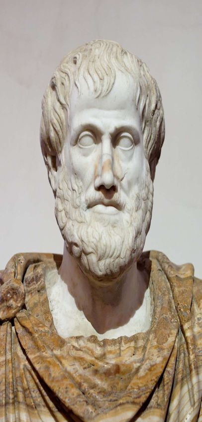
Aristotle’s 3/5
climatic zones
12th-century
manuscript of
Macrobius's
Commentarii in
Somnium Scipionis
ca. 1150.
Copenhagen, Det
Kongelige Bibliotek
Al-Masudi 947CE The Meadows of Gold and Mines of Gems ( مروج الذهب ومعادن الجواهر,Muruj adh-dhahab wa ma'adin al- jawhar)

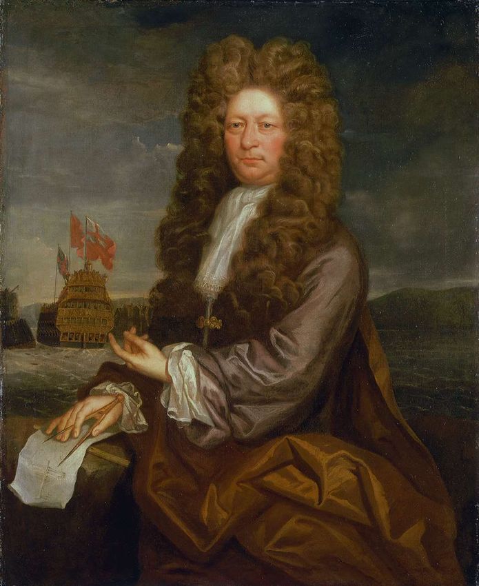
Halley’s Trade Wind Map 1656
© Crown copyright Met Office
© Crown copyright Met Office
Beaufort’s Weather Code
                               1820-1825 version

                               b.   Blue sky
                               c.   Clear, transparent atmosphere
                               ci. Cirrus clouds
                               cl. Cloudy
                               cu. Cumulus clouds
                               d.   Mist (damp air)
                               Dk Dark weather but atmosphere clear
                               f.   Foggy
                               f:   Dense Fog
                               g.   Gloomy weather
                               h.   Haze
                               m. Mist in valley
                               p.   Passing cloud
© Crown copyright Met Office   r.   Rain
1831 Beaufort Wind Force Scale
0 Calm
1 Light Air Or just sufficient to give steerage way
2 Light Breeze Or that in which a man-of-war with all sail set, and
clean full would go in smooth water from.1 to 2 knots
3 Gentle Breeze 3 to 4 knots
4 Moderate Breeze 5 to 6 knots
5 Fresh Breeze Or that to which a well-conditioned man-of-war could
just carry in chase, full and by. Royals, etc
6 Strong Breeze Single-reefed topsails and top-gallant sail
7 Moderate Gale Double reefed topsails, jib, etc
8 Fresh Gale Treble-reefed topsails etc
9 Strong Gale Close-reefed topsails and courses
10 Whole Gale Or that with which she could scarcely bear close-
reefed main-topsail and reefed fore-sail
11 Storm Or that which would reduce her to storm staysails
12 Hurricane Or that which no canvas could withstand
© Crown copyright Met Office© Crown copyright Met Office
Voyage of HMS Beagle

© Crown copyright Met Office
© Crown copyright Met Office
© Crown copyright Met Office
© Crown copyright Met Office
© Crown copyright Met Office
© Crown copyright Met Office
© Crown copyright Met Office
© Crown copyright Met Office
coined the term
                               'anticycl

© Crown copyright Met Office
© Crown copyright Met Office
©
C
r
o
w
n
c
o
p
y
r
i
g
h
t
M
e
t
O
f
f
i
c
e

    How Meteorology works
     Where are we now?    now
    How
© Crown copyright Met Office
The Primitive Equations of
                               Meteorology – p, T, (u, v) and q
                                      Ideal Gas Law (Equation of State)

                                      First Law of Thermodynamics

                                      Hydrostatic Law

                                      Newton’s Second Law of Motion

                                      Conservation of Mass Applied to the
                                      Atmosphere (Equation of Continuity )

© Crown copyright Met Office
© Crown copyright Met Office
State of the Art computer

© Crown copyright Met Office
© Crown copyright Met Office
Quasi-Geostrophic Vorticity
Equation

Baroclinic Instability Theory
© Crown copyright Met Office
© Crown copyright Met Office
©
C

    • ENIAC 24 hour forecast grid
r
o
w
n
c
o
p
y
r
i
g
h
t
M
e
t
O
f
f
i
c
e
Computers Used for Weather and Climate Prediction
1.E+16
IBM Power7
1.E+15
IBM Power6
1.E+14
Peak performance (FLOPS)
1.E+13
Cray T3E NEC SX-8
1.E+12
1.E+11
NEC SX-6
1.E+10
Cray C90
ETA-10 Cray Y-MP
1.E+09
1.E+08
Cyber 205
1.E+07
IBM 360/195
1.E+06
1.E+05
KDF-9
1.E+04
Mercury
1.E+03
1.E+02 Leo
1.E+01
1950 1960 1970 1980 1990 2000 2010 2020
Year of First UseImproving accuracy: Pmsl
RMS surface pressure error over the NE Atlantic
© Crown copyright Met Office© Crown copyright Met Office
© Crown copyright Met Office
Meteorology meets GIS
                          1980s: GIS not feasible
                          1990s: Niche GIS use for specific products for limited customers
                          2000s: Nicer niche products and prettier backgrounds
                          2007: Regular Met Conference: recommended GIS workshop
                          2008-2009: Workshop on GIS/OGC Standards in Meteorology:
                                  • Recommended OGC involvement and establish Met DWG
                                  • Proposed work: WMS interoperability for Nat. Met. Services
                                  • MoU between OGC & WMO and IOC/WMO JCOMM
                                  • Covers meteorology, climatology, hydrology, oceanography
                                  • OGC Met Ocean Domain WG established
                          2009-2013: Three more Workshops, ~ 10 NMS joined OGC
                                  • Work extended to conceptual modelling, WCS
                          2014-2018 OGC and W3C: SDWBP, Time, CRS, graphics, etc
                          2018-2020 Weather on the Web (WotW) APIs
                              -> OGC API – Environmental Data Retrieval (EDR)
© 2010 Open Geospatial Consortium, Inc.
Where are we now? Thoughts on Future Possibilities
Meteorology has a history of
     inventing/tailoring technologies
☒ Operating Systems
☒ Programming Languages
☒ Telecoms Protocols
☒ Telecom computers (message switching)
? Data Formats
☑ Visualisations
                       GIS domain!
☑ Semantics
Challenges for Mapping in Meteorology
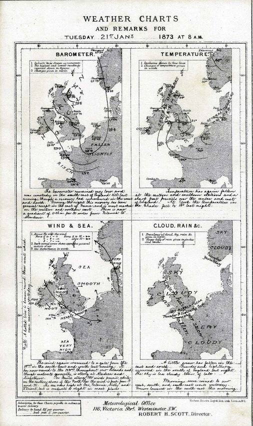
Long history of interoperability at human/paper level
Significant ‘Objects’, features of interest
Not Mbytes or GB, but TB and PetaBytes of data daily
Spatial & Temporal, 2D, 3D, 4+D, constantly changing
• Multiple Time attributes
• Irregular time intervals
• Timescales: hours,.., seasons,.., centuries, + & -
Vertical coordinates
• Cross-sections, height-time diagrams, T/φs, etc
‘Regular’ grids are not always regular
Continual change of coordinate systems & projecting
• Eulerian versus Lagrangian viewpoints
Ensembles: probabilistic distributions
© 2010 Open Geospatial Consortium, Inc.Technology Trends NWP resolutions from 500km -> 1km -> 0.3km -> ? More blending of our data with customers/users: • Met, Ocean, Hydro, Space, Ecology, Earth Systems Likely evolution / interactions • WMO Formats -> general Scientific Formats (netCDF, Zarr, ..) • -> Geospatial standards ? • Visualisations -> general graphics tech (SVG, OpenGL, …) • -> Geospatial standards (SLD/SE?)
2D Maps & Layers ‘broken’

                    2D Maps and Layers - cartography
                    3D or 4D data breaks ‘Layers’ paradigm
                           • Suppose data have 10 levels x 10 times: ->
                           • 100 layers – choose from a menu?
                    But
                           • 100 levels, 100 times, 100 ensembles: ->
                           • 1 000 000 layers?
                           • X 100s of parameters of interest

© Crown copyright Met Office
Geospatial is Changing
Other 3D activities in OGC:
• CDB simulation
• Gaming
• UxVs
• Underground
• CityGML
• 3D Portrayal
None of these based on traditional 2D cartography
Start from 3/4D assumption
• Lots of 3D support in h/w (GPUs)
• Derive 2D by restriction of 3/4D work
• Could support other visualisations: cross sections
(“vertical maps”), graphs
Generic containers, managed APIs, RESTful
Moving away from Schemas to ‘schema-less’
Copyright © 2018 Open Geospatial ConsortiumFuture possibilities?
• 5 years: No specialized meteorological visualization software, all done
in generic geospatial software with meteorological style sheets?
• 10 years: No specialized geospatial software, all done in ‘browsers’?
• Real 3D displays when?
• Virtual Reality/Augmented Reality/Head-Up Displays make 3D easier?
Consequential suggestions:
0. Make Z & T ‘first class CRS citizens’
1. Codify and expose meteorological styles
2. Expose meteorological symbols and their semantics
• Try to put into Unicode
3. Move away from existing rigid layout of WMO symbols/semantics of
artificial 10x10 structure imposed by telegraphic codes
4. ‘Abstract’ symbols powerful. C.f. SigWx chartQuestions & Answers
WMO Present Weather Symbols
© Crown copyright Met Office
Ensemble of many forecasts

© Crown copyright Met Office
© Crown copyright Met Office
Summary - Forecasting
                           Big Data getting bigger despite electricity costs
                           Forecasts need supercomputers, not ‘cloud computing’
                           Meteo and Ocean forecasts too big & volatile to move
                               • Global enterprise involving all 193 countries.

                           “Moving data costs, calculations are free”
                               1. Move apps to the data, but how?
                                  • Merging authoritative & unreliable info
                                  • Need federated security architecture
                               2. Defining ‘Convenience APIs’
                                  • Get just the data needed for the application
                                  • Use scalable Web architectural style ‘RESTful’

© Crown copyright Met Office
                                  • Cache retrieved API data with URI for re-use
Summary - Data
Cross-domain information becoming the norm, BUT
domain specific (big) data formats here to stay:
• (NetCDF, HDF, GRIB, BUFR, FITS, BAM, VCF, GF3, …)
• Binary, efficient, optimised
• Established eco-systems of access software & tools
• Established domain expertise, controlled vocabularies
Generic data formats have no traction, BUT
Web friendly transfer formats for browsers and apps
• (CSV, JSON, XML)
• More verbose – small amounts OK
© Crown copyright Met OfficeSummary - Metadata
Metadata should be cross-domain for discovery
• Metadata fixed format/containers a good start
• Only for discovery, not usage and management
• Metadata is open-ended, not in containers/catalogues/portals
Controlled Vocabularies -> Taxonomies -> Ontologies
Semantic Web / Web 2.0
• Highly scalable
• Highly flexible
Resolvable registries of controlled vocabularies
happening
Conceptual models can be stored as ontologies
Ontologies allow valid machine reasoning
Semantic formats much too verbose for most data
Copyright © 2017 Open Geospatial ConsortiumYou can also read