Air Quality Sensors AAPCA Fall Membership Meeting - New Tools For Air Quality Evaluation: The Association of Air Pollution Control ...
←
→
Page content transcription
If your browser does not render page correctly, please read the page content below
New Tools For Air Quality Evaluation:
        Air Quality Sensors
           AAPCA Fall Membership Meeting
             Monday, August 26th, 2019

                  Andrea L. Clements, Ph.D.
         U.S. EPA Office of Research and Development
                  clements.andrea@epa.gov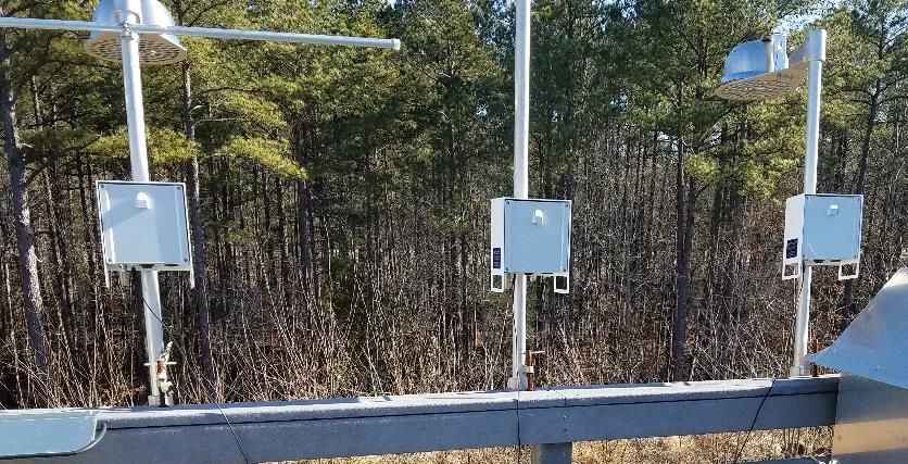
Background
• Technological advances have made it
  possible to measure air quality with
  smaller, more portable sensors at
  lower-cost and in more locations
  while simultaneously engaging new
  players.

• Data is more complex with
  implications for data storage,
  processing, and data correction before
  it’s useful for research applications.
Motivation
• Rapid expansion in the use of sensors
  creates a growing need to understand
  the data being produced so that
  agencies are better able to respond.
   • As an example, there are more than 6000
     publicly reporting PurpleAir sensors
     worldwide                                        Regulatory Monitors
   • Outnumber the regulatory monitors
• In some cases, this data is out-competing
  AirNow for Air Quality information                  Roughly 10-fold more
   • People sometimes believe data they collect       monitoring locations, filling
                                                      this geographic area
     themselves over data provided by government
   • Data is geographically closer and perceived to
     be more representative of local exposure
                                                       Low-Cost Sensors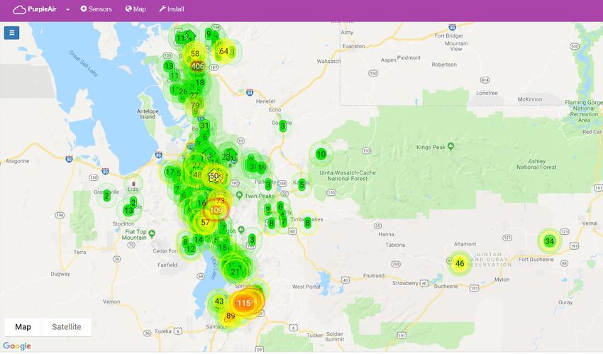
EPA Research
SPEAR (Sensor Performance, Evaluation and Application Research) Program
• Project Goals
   • Discover, evaluate, develop, apply and communicate new & emerging air quality
     sensor technologies to meet a wide range of stakeholder needs (general public to
     regulatory officials)
• Research Questions
   • What are the capabilities of emerging technologies and their potential to meet current
     & future air quality monitoring needs?
   • How can EPA best support sensor developers and the user community?
   • What other data and technologies are needed to help understand and interpret sensor
     data?
   • How can EPA apply the knowledge gained to issues of concern to EPA and their
     clients/partners/stakeholders?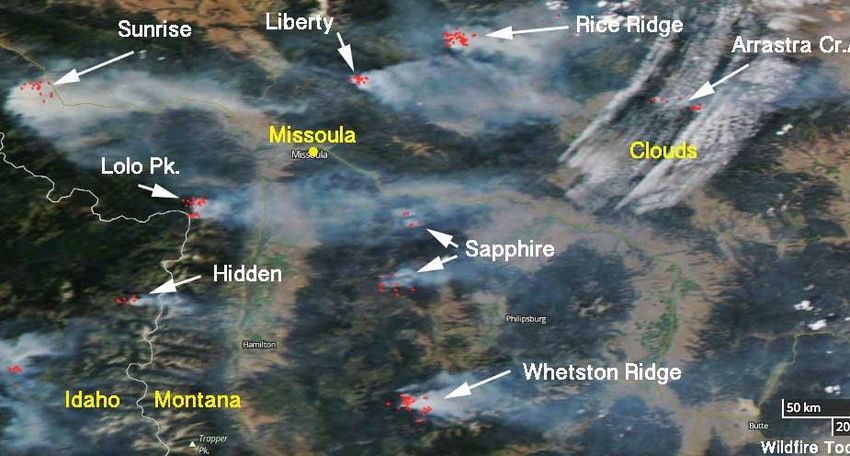
Ambient

                               RTP Evaluations
                                                                Project Lead: Andrea Clements
   • Continued effort to evaluate new sensors
     coming to market
          • Focus on criteria pollutants but also considering
            other pollutants (e.g., VOCs, HAPs)
          • Especially interested in products likely to be
            widely adopted and/or new technologies
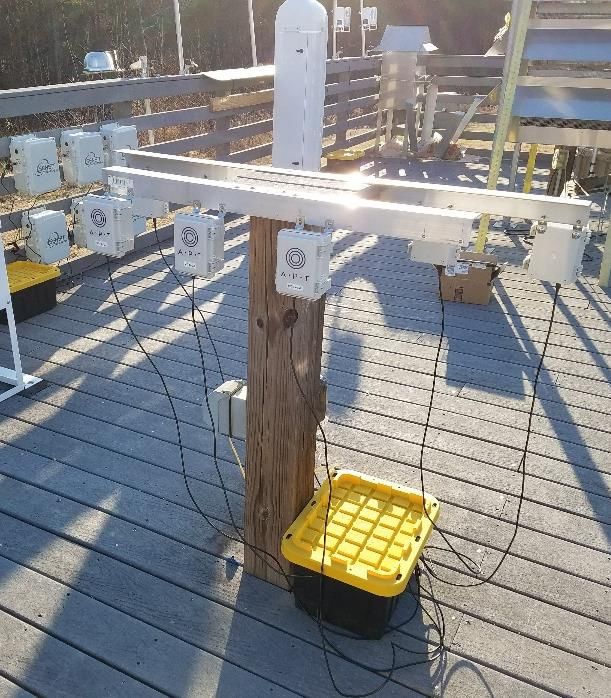
   • Select sensors are collocated at the AIRS
     research site in RTP, NC for 30 days or more
          • Tested in triplicate to understand sensor
            variability
          • Data compared to nearby regulatory instruments
            (FRM/FEM) and meteorological measurements to
            evaluate performance
   • Results communicated through the Air Sensor
     Toolbox (https://www.epa.gov/air-sensor-toolbox)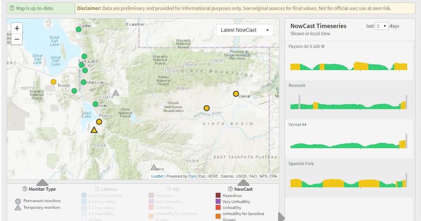
Ambient, Long-Term

                                                  Long-term performance project (LTPP)
                                                                                                         Project Lead: Andrea Clements
     Study Design:
     • Leverage partnerships
       with air monitoring
       agencies to test sensor in                                                                          AQY - Aeroqual
       a variety of locations for                                                                                                    PurpleAir
       an extended period
     • 7 air monitoring stations                                          Sites across the US
       across the US - NC, GA,
       DE, AZ, CO, OK, WI                                                                                  ARISense -
                                                                                                       Aerodyne Research           Ramp -SenSit
     • 1-year of measurements
       beginning in July 2019                                 • 6 air sensors
     • Similar reference                                      • Some PM only, some
       monitors across sites                                    multipollutant
     Image sources: http://www.aerodyne.com/products/arisense, https://www.purpleair.com/,
                                                                                                            Maxima -                 Clarity Node -
     https://www.aeroqual.com/product/aqy-micro-air-quality-station, https://clarity.io/solution   Applied Particle Technology   Clarity Movement Co.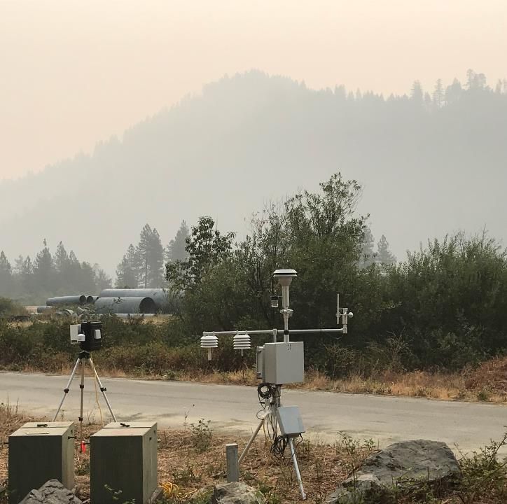
Ambient, Long-Term, Crowdsource

                                  LTPP - US Performance PurpleAir
     Design:
     • Leverage projects already underway                       Collocation sites
       by air monitoring agencies                               in 10 states - AK,
     • 12 partner air monitoring agencies                       AZ, FL, GA, OK,
       and ~50 collocated Purple Air sensors                    VT, NC, CA, WI, IA
       across the US

     Objectives:
     • Draw broader conclusions about the
       performance of Purple Air sensors
         • Different climates
         • Extreme events
     • Explore methods of Quality Assuring
       (QA) and adjusting data from
       distributed sensors                         Partners from 10 states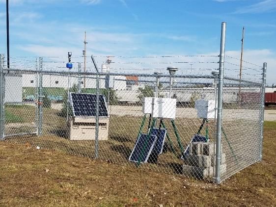
Preliminary results

                      LTPP - US Performance PurpleAir
                                                                                   1-hr comparisons across 3 sites

Preliminary PurpleAir findings
• Good precision between sensors as
  similar slopes are observed for

                                                   PurpleAir PM2.5 cf_1 (µg m-3)
  replicate sensors at same site.
• Accuracy is variable - field
  collocation is essential as
  relationships in different parts of the
  country vary
   • Slope ~2.1 Atlanta
   • Slope ~1.7 in RTP
   • Slope ~1.2 Phoenix               Red line=
                                      linear
                                      regression                                       T640x PM2.5 (µg m-3)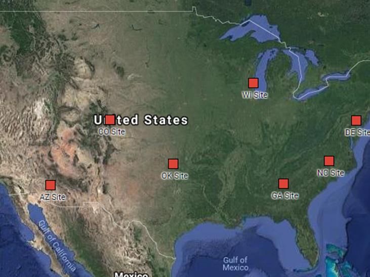
Extreme Events                                                                                        Preliminary results

                            PM sensors for wildfire smoke
                                                                            Project Lead: Amara Holder
   Evaluated low to mid-cost PM2.5 sensors to augment ambient
   monitoring networks during wildfire smoke events:
   • PurpleAir PAII-SD (PM1, PM2.5, PM10)
   • Aeroqual AQY (PM2.5, O3, NO2)
   • SenSevere RAMP (PM2.5, CO, CO2)

                                             Fire/Measurement Location                 Sensors       Reference
                                            EPA ambient monitoring site (RTP, NC)    AQY, PA, RAMP      T640
                                               Natchez Fire (Happy Camp, CA)            AQY, PA        E-BAM
                                            Bald Mt – Pole Creek Fire (Price , UT)      AQY, PA      E-SAMPLER
                                                 Alder Fire (Springville, CA)           RAMP            BAM
                                                       (Pinehurst, CA)               AQY, PA, RAMP      BAM
                                                     (Camp Nelson, CA)                  RAMP           E-BAM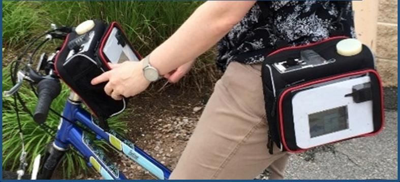
Preliminary results

                        PM sensors for wildfire smoke
                                                                                      Natchez Fire
• All PM sensors were highly correlated (R2 > 0.8) with reference
  instruments at elevated PM concentrations
• PM sensors generally reported 1.5 – 2X higher than EBAMs at
  elevated concentrations, but were in better agreement at lower
  concentrations
                                                                    PM Sensor
• Correction for RH and T improve comparison
                                                                                      BAM
                                                                                      Reference
Indoor/Outdoor, Extreme Events Preliminary results
Wildfire Smoke Translational Science
Research Questions Science Leads:
• What interventions are effective for reducing wildland fire Wayne Casio
smoke exposures and risks?
• How is public health impacted by different levels and durations Gayle Hagler
of exposures? Amara Holder
• What science is available to support recommendations for
communities to develop clean air spaces in larger buildings?
• How effective are portable air cleaners (PACs) during smoke
events?
• Are people in community clean air spaces or who have PACs in
their homes reducing their exposure/risks to PM2.5?
Project Design
• Two 2019 field campaigns – Missoula, MT & Hoopa Valley, CA
with indoor/outdoor measurements and outdoor mapping
• Laboratory testing with portable air cleanersNetwork
Phoenix P-TAQ (Nov. 2018 – Mar. 2020)
Project Lead: Sue Kimbrough
Phase 1 – Pilot (Nov. 2018 - May 2019)
• Study PurpleAir performance in unique, arid environment
• Low humidity, high temperature, and high PM10 concentrations
• Evaluate sensor performance against collocated reference monitors
• Sensor degradation, reproducibility, and local correction factor
Phase 2 – (May 2019-Mar. 2020)
• Is PurpleAir suitable to supplement monitor network?
• Calibration of non-collocated PurpleAir sensors
• Optimal density and use of PurpleAir sensorsPreliminary results
P-TAQ Pilot (Nov. 2018 – Apr. 2019)
• Hourly PurpleAir PM2.5 data correlates much better than PM10
• PurpleAir over-estimates PM2.5, underestimates PM10
PM2.5 PM10
Sensor
R2 Regression R2 Regression
PurpleAir 1 0.88 y = 1.2x – 0.5 0.52 y = 0.6x – 0.8
PurpleAir 2 0.88 y = 1.3x - 0.5 0.52 y = 0.6x - 0.7
PurpleAir 3 0.89 y = 1.2x - 0.8 0.54 y = 0.6x – 1.4
Slope = 1Preliminary results
P-TAQ Pilot (Nov. 2018 – Apr. 2019)
• Hourly PurpleAir PM2.5 data correlates much better than PM10
• PurpleAir over-estimates PM2.5, underestimates PM10
• PM10 simply scales the PM2.5 concentration – not a reliable measurement
• PM2.5-10 events are not detected by PurpleAir
The PurpleAir
sensors tested
appear to be
R2 ≤ 0.1
unreliable for
PM10Community Near Source
KC-TRAQS (Oct. 2017 – Nov. 2018)
Kansas City TRansportation and local-scale Air Quality
Project Lead: Sue Kimbrough
Study (KC-TRAQS)
• Research Questions
• What is the spatial and temporal extent of local air pollution sources in and around
the Argentine (KS) neighborhood?
• Can the impact of local air pollution sources on the Argentine and surrounding
neighborhoods’ air quality be identified and quantified?
• Approach
• A complementary citizen science program using personal sensors and computer
modeling tools as a comparison to the field study data;
• A field study using stationary monitors and mobile measurements to collect black
carbon (BC) and PM2.5 data to characterize the impact of local air pollution sources.
• A mobile monitoring campaign using an instrumented electric vehicle and a support
vehicle to collect BC, ultrafine particulate (UFP), and nitrogen dioxide (NO2).
• A screening model to assess spatial/temporal coverage of measurement sites.KC-TRAQS (Oct. 2017 – Nov. 2018)
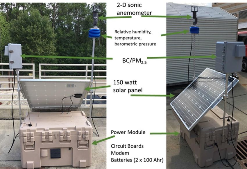
• Sensor Technologies
• Custom built P-Pod measuring BC (AethLabs
MA350) and PM2.5 (Alphasense OPC-N2), WS/WD,
T, RH, and P
• Custom built AirMapper measuring PM2.5
(Alphasense OPC-N2), CO2, GPS, accelerometer,
noise, T, and RH
• Commercially available sensors including PurpleAir
and Aeroqual AQYBefore/After Mitigation
Roadside Vegetation Project
• Collaboration between ORD and EPA Regions (5, 9)
Project Lead:
• Collecting air quality, meteorology, and noise (Detroit only) measurements Rich Baldauf
before and after roadside vegetation planting
• Assessing benefits for air quality and water runoff control
• Approach
• Research-grade mobile and fixed monitoring data for UFP, BC, NO2, CO2
• Portable BC and NO2 sensors
• Meteorology at multiple heights and locations
Data explored on RETIGO
“Bird house” Portable Air Quality Sampler (PAQS) epa.gov/retigoSupplemental Monitoring
Regional Sensor Loan Program
• Collaboration between ORD and EPA Regions (1, 2, 3, 5, 8) Project Lead:
Andrea Clements
• Procurement of 20 multipollutant sensor devices (AriSense), 7 with solar
panels for off-grid application
• Measurements: CO, NO, NO2, O3, CO2, PM, solar intensity, noise, wind
speed, and wind direction
• Initial sensor performance evaluation work at EPA’s RTP site then
sensors to be provided to Regions on a rotating basis for targeted
projects with local partners
• Applications under consideration include
• Wintertime PM in mountain valleys
• Educational outreach with students
• Measuring near transportation sourcesPersonal Exposure/Behavior Modification
Library Sensor Loan Program
• Collaboration between ORD and EPA Region 9 Project Lead:
Andrea Clements
• Procurement of 30 low-cost PM sensors (APT) with clip and connectivity for
mobile or stationary applications
• Development of train-the-trainer materials, lessons plans, quick start guide,
and a resource list to support the library use and loan
• Approach
• Library trainers will be given training on air quality and use of sensors
• Trainers will train additional library staff and conduct outreach programs
within their respective library branches
• Sensors will be loaned to interested community members (e.g., teachers,
school groups, community groups, private citizens)
• Materials will be made publicly available and lessons-learned will be
summarized to support future efforts to expand the program to other localesExternal Collaborations
• Current Agreements
• Cooperative Research and Development Agreement (CRADA) with
Aeroqual involving evaluation and application of sensor systems in
select field studies
• CRADA with Aclima involving collaboration on evaluation of ambient
mobile monitoring data using higher-end instruments and/or low-cost
sensors
• Agreements Under Discussion
• Material Transfer Agreement (MTA) with PurpleAir supporting the
exchange of air quality sensor data (current and historical)
• Potential work EPA may pursue
• Research on quality assurance methods for PA data
• If methods produce data of sufficient quality, EPA may explore the use of the
data in research studies and applications
• Model evaluation
• Data fusion
• Data visualization
• Development of research and informational applicationsEPA Grantee Sensor Work
1. Carnegie Mellon University - Democratization of Measurement and
Modeling Tools for Community Action on Air Quality, and Improved Spatial
Resolution of Air Pollutant Concentrations – Pittsburgh, Pennsylvania
2. Kansas State University/University of Memphis - Shared Air/Shared
Action (SA2): Community Empowerment through Low-cost Air Pollution
Monitoring – Chicago, Illinois
3. Massachusetts Institute of Technology - The Hawaii Island Volcanic Smog
Sensor Network (HI-Vog): Tracking Air Quality and Community
Engagement near a Major Emissions Hotspot – Hawai’i Island, Hawaii
4. Research Triangle Institute - Monitoring the Air in Our Community:
Engaging Citizens in Research – Globeville, Elyria Swansea (GES),
Denver, Colorado
5. South Coast Air Quality Management District - Engage, Educate, and
Empower California Communities on the Use and Applications of “Low-
cost” Air Monitoring Sensors – North, Central, and South California
6. University of Washington - Putting Next Generation Sensors and Scientists
in Practice to Reduce Wood Smoke in a Highly Impacted, Multicultural
Rural Setting (NextGenSS) – Yakima Valley, WashingtonAcknowledgments
Thanks to all contributors:
• EPA eval: A. Clements, T. Conner, S. Reece, M. Srivastava, J. Rice, R. Williams
• LTPP: A. Clements, K. Barkjohn, I. VonWald, C. Johnson, Maricopa County AQD, Wisconsin DNR, Colorado DPHE, Oklahoma
DEQ, Delaware DNR, Georgia DNR, Iowa DNR, San Luis Obispo Country APCD, EPA R4, Sarasota County Government,
Quapaw Nation, Vermont DEC, Alaska DEC, Forsyth County OEAP, Mojave Desert AQMD, Antelope Valley AQMD
• PM Sensors for wildfire: A. Holder, B. Mitchell, A. Mebust, D. Vallano, L. Maghran, K. Stewart, R. Elleman, M. McGown
• Wildfire Translational Science: S. Katz, G. Robarge, W. Cascio, G. Hagler, A. Holder, B. Hassett-Sipple, C. Bagdikian, G.
Davison, A. Brown, Missoula City-County Health Department, Climate Smart Missoula, University of Montana, Hoopa Valley
Reservation
• P-TAQ: S. Kimbrough, A. Clements, B. Davis, H. Patel, I. Domsky, R. Pope, I. VonWald, K. Barkjohn, J. Benforado, J. Schaefer,
M. Kurpius, R. Evans, G. Hagler, Maricopa County AQD
• KC-TRAQS: S. Kimbrough, S. Krabbe, R. Baldauf, R. Duvall, M. Hays, P. Barfield, B. Mitchell, B. Wright, R. Snow, J. Faircloth,
C. Bailey, C. Croghan, T. Barzyk, V. Isakov, G. Hagler, M. Davis, M. Brown, C. Brown, A. Shields, A. Bhesania, A. Algoe-Eakin, A.
Hawkins, N. Feinberg, P. Deshmukh, T. McArthur
• Vegetation: R. Baldauf
• Regional Loan: A. Clements, B. Judge, R. Graham, C. Gross-Davis, M. Fuoco, J. Richard, C. Johnson
• Library Loan: A. Clements, R. Duvall, B. Hubbell, A. Kaufman, R. Freed, E. Canteenwala, K. Davidson, P. Pathak, D. Vallano
• Aeroqual CRADA: R. Duvall, G. Henshaw
• Aclima CRADA: S. Kaushik, A. Whitehill, M. Small, D. Vallano, C. Tucker, S. Caspersen, M. Lunden, B. LaFranchi, A. Singh, C.
Blanchard
• PurpleAir MTA: G. Hagler, A. Clements
• STAR Grants: R. Callan
Disclaimer: Although this abstract was reviewed by EPA and approved for publication, it may not necessarily reflect official
Agency policy. Mention of trade names or commercial products does not constitute endorsement or recommendation for use.You can also read


