APPENDIX K Public Information Centre Number 1 - City of ...
←
→
Page content transcription
If your browser does not render page correctly, please read the page content below

APPENDIX K Public Information Centre Number 1

NOTICE OF PUBLIC INFORMATION CENTRE NO. 1
     CONLIN ROAD EAST, FROM SIMCOE ST. N. TO TOWNLINE RD. N.
            CLASS ENVIRONMENTAL ASSESSMENT STUDY
The Study
In response to growing traffic volumes
related to proposed development, the
Corporation of the City of Oshawa is
undertaking     a     Class    Environmental
Assessment (Class EA) Study, and has
retained      AMEC        Environment       &
Infrastructure to investigate the need for
improvements to Conlin Road East, from
Simcoe Street North to Townline Road
North. In order to best address operational
deficiencies and the need for additional
east-west traffic capacity, a number of
alternatives are being examined as part of
the study including operational improvements, cycling and pedestrian facilities and the overall
effect of improvements on the social, cultural and natural environments.
The Process
The study is being conducted in compliance with the Schedule C requirements of the
Municipal Engineers Association "Municipal Class Environmental Assessment," which was
approved under the Ontario Environmental Assessment Act. A key component of the study
is consultation with interested stakeholders (public, landowners and agencies). Two Public
Information Centres (PICs) will be held to provide interested parties with an opportunity to
review and discuss issues related to the project. The first PIC is to be held as follows:
                    Wednesday, October 2, 2013 from 6:30 p.m. to 8:30 p.m.
                       Maxwell Heights Secondary School – Cafeteria
                           1100 Coldstream Drive, Oshawa, ON
The first PIC will provide an overview of existing conditions, present initial analysis and seek
input on the planning alternatives being considered, concerns, requirements, and specific
issues.
Following the PIC, the material presented at the meeting will be posted on the City of
Oshawa’s website (noted below). If you require accessibility accommodations for this
meeting, contact project managers prior to PIC.
Public Comments Invited
Should you have any questions or concerns, or wish to be added to the study mailing list,
please contact the City of Oshawa, Engineering Services or the Consultant Project Manager
at:
Mr. Kevin Wilson, Project Manager        Mr. David Sinke, Consultant Project Manager
City of Oshawa, 50 Centre St. S.         AMEC Environment and Infrastructure
Oshawa, ON L1H 3Z7                       3215 North Service Road, Burlington, ON L7N 3G2
Phone: 905-436-3311 x 2462               Phone: 905-335-2353
Toll Free: 1-800-667-4292                Toll Free: 1-866-751-2353
Fax: 905-436-5694                        Fax: 905-335-1414
Email: kwilson@oshawa.ca                 Email: david.sinke@amec.com
Please also see the City’s web site at www.oshawa.ca for details related to scheduled project
events.
Information will be collected in accordance with the Freedom of Information and Protection of
Privacy Act. With the exception of personal information, all comments will become part of the
public record.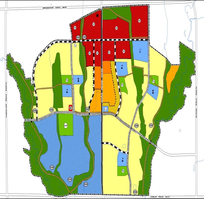
Welcome
                              to
                Public Information Centre No. 1
     For Conlin Road East from East of Simcoe Street North
                       To Townline Road North
       Municipal Class Environmental Assessment Study
                         October 2, 2013
    Please “sign in” so we can keep you updated on this study.

       Please review the display materials and discuss your
            questions and ideas with the Study Team.

                               Conlin Road East from East of Simcoe Street North to Townline Road North
1            October 2, 2013              Municipal Class Environmental Assessment Study
Study Area

        The Study Area extends along Conlin Road East,
    from East of Simcoe Street North to Townline Road North.
                           Conlin Road East from East of Simcoe Street North to Townline Road North
2        October 2, 2013              Municipal Class Environmental Assessment Study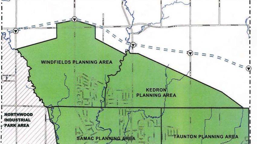
Study Background

                      • Conlin Road East is a key arterial “Type B” road
                        in the City of Oshawa Official Plan (OP) and the
                        Durham Regional Official Plan (DROP), under
                        the jurisdiction of City of Oshawa.
                      • Sustained existing and planned future urban
                        growth has triggered the need for a Schedule C
                        Municipal Class Environmental Assessment
                        (Class EA) Study to assess the need for
                        transportation improvements.
                      • The DROP plans for the ultimate linkage of
                        Conlin Road as a ‘Type B’ Arterial Road serving
                        the entire Durham Region, including on-road
                        bicycle lanes and neighbourhood connections for
                        walking and cycling trails. Conlin Road East is
                        part of the Region’s Official Cycling Network.

                       Conlin Road East from East of Simcoe Street North to Townline Road North
3   October 2, 2013               Municipal Class Environmental Assessment Study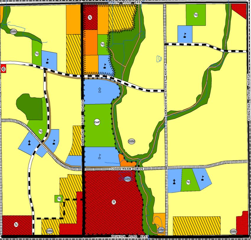
Study Background

    Study Purpose
     • To identify long term improvements for the horizon year of 2031 and
       beyond, to meet the anticipated travel needs along the corridor.

    Study Objectives
     • To consider, evaluate and document improvement alternatives for
       Conlin Road East, taking into account natural environment, technical
       and socio-economic factors.
     • Consulting with stakeholders to identify and resolve or mitigate
       issues of concern.
     • To meet the requirements of the Municipal Class Environmental
       Assessment process to permit the City of Oshawa to proceed with
       detail design and construction.

                                  Conlin Road East from East of Simcoe Street North to Townline Road North
4               October 2, 2013              Municipal Class Environmental Assessment Study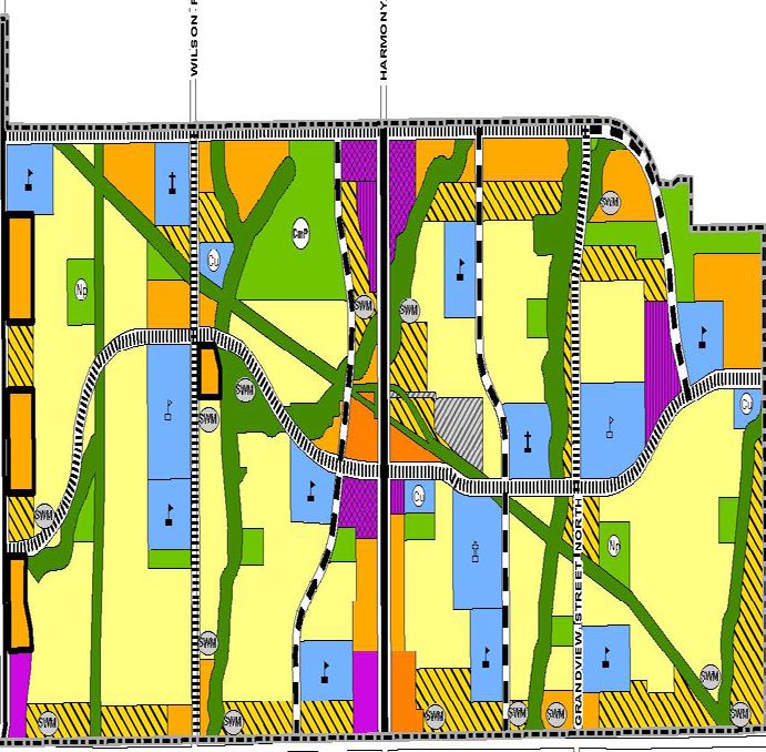
Municipal Class EA Process

    • Many projects related to municipal water supply, sewers and
      transportation systems that are similar in nature are carried out
      routinely, and have predictable and mitigable environmental effects, are
      investigated according to the Municipal Engineers Association
      "Municipal Class Environmental Assessment” (2011).

    • The Municipal Class Environmental Assessment (Class EA) process
      categorizes proposed municipal projects according to their anticipated
      environmental impact, and requires increasingly stringent review
      requirements as the magnitude of the anticipated environmental impact
      increases.

    • This project will be conducted in compliance with Schedule C of the
      Municipal Engineers Association "Municipal Class Environmental
      Assessment” (2011).

                                  Conlin Road East from East of Simcoe Street North to Townline Road North
5               October 2, 2013              Municipal Class Environmental Assessment Study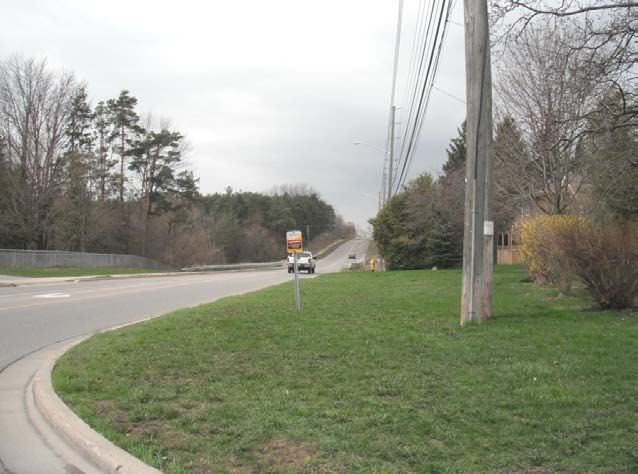
Municipal Class EA Process

                                                                        Phase 3
          Phase 1                     Phase 2
                                                                  Alternative Design                 Phase 4
           Identify                  Alternative                                                                                   Phase 5
                                                                       Concepts                    Environmental
        and Describe                  Planning                                                                                  Implementation
                                                                   For the Preferred               Study Report
       the Problem(s)                Solutions
                                                                       Solution

                                • Identify reasonable            • Identify alternative          • Compile an                 • Proceed to construction
                                  alternative planning             designs to implement            Environmental Study          of the project.
                                  solutions.                       the preferred solution.         Report (ESR).              • Monitor environmental
                                • Evaluate the alternative       • Inventory natural,            • Place ESR on public          provisions and
                                  solutions, taking into           social/cultural and             record for review for 30     commitments.
                                  consideration                    economic environments.          days.
                                  environmental and              • Identify the impact of the
                                  technical factors.               alternative designs after     • Notify the public and
                                • Identify a preferred             mitigation.                     government agencies of
     We                           solution to the                • Evaluate alternative            completion of the ESR
                                                                                                   and of the Part II Order
                                  problem(s).                      designs.
    Are                                                          • Identify a preferred            provision in the EA Act.
                                                                   design.
    Here

                                     Agency and                      Agency and
                                     Stakeholder                     Stakeholder
                                     Consultation                    Consultation

      Problem Statement           Preferred Solution                Preferred Design                       ESR

                                                Conlin Road East from East of Simcoe Street North to Townline Road North
6                         October 2, 2013                  Municipal Class Environmental Assessment Study
Technical Studies

    Investigations in the following fields of study
    will be completed as part of the Class EA:
    • Traffic
    • Stage 1 Archaeology
    • Built Heritage Property and Cultural Heritage
      Landscape
    • Drainage & Hydrology / Storm Water Management
    • Fisheries / Aquatic Habitat
    • Terrestrial Ecology
    • Geomorphology
    • Geotechnical / Pavement
    • Landscape Design
    • Structural
    • Traffic Noise

                                 Conlin Road East from East of Simcoe Street North to Townline Road North
7              October 2, 2013              Municipal Class Environmental Assessment Study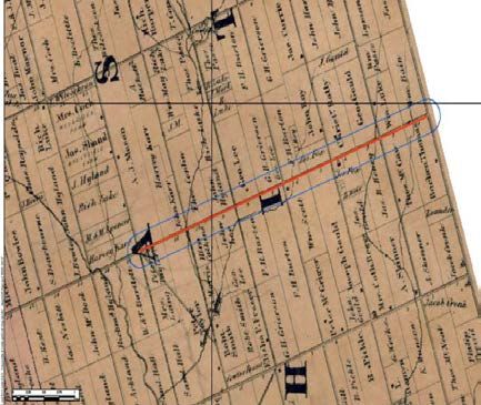
Land Use

                                                                                                                                  Study Area

                 Conlin Road East

                                                                                                               Grandview Road N

                                                                                                                                               Townline Road N
                                                                                       Harmony Road N
                                                             Wilson Road N
                                       Ritson Road N

    The City of Oshawa Official Plan designates lands within the study area as
    primarily Residential, Open Space, Recreation and areas of Industrial and
    Commercial use. Two Local Central Areas are located within the study limits.

                                    Conlin Road East from East of Simcoe Street North to Townline Road North
8                 October 2, 2013              Municipal Class Environmental Assessment Study
Secondary Planning Areas
Simcoe Street North
Study Area
Townline Road North
DRAFT
Conlin Road East
Conlin Road, between Simcoe Street and Townline Road North borders on four Part II /
Secondary Planning Areas: Windfields, Kedron, Samac and Taunton. The Part II / Secondary
Plans build on the Official Plan's policies and regulations and include detailed land use
designations and policies that serve as a guide for development or redevelopment of an area of
the City.
Conlin Road East from East of Simcoe Street North to Townline Road North
9 October 2, 2013 Municipal Class Environmental Assessment StudySecondary Planning Areas
Windfields Planning Area Draft Kedron Planning Area
Conlin Road East from East of Simcoe Street North to Townline Road North
10 October 2, 2013 Municipal Class Environmental Assessment StudySecondary Planning Areas
Samac Planning Area Taunton Planning Area
Conlin Road East from East of Simcoe Street North to Townline Road North
11 October 2, 2013 Municipal Class Environmental Assessment StudyExisting Conditions
Designated Natural Areas
• There are no significant natural areas within the study area (Ministry of Natural Resources
(MNR) 2013). However, the Oshawa Creek Watershed Management Plan indicates that the
Iroquois Beach Area of Natural Scientific Interest (ANSI) encompasses the west half of the
study area. This zone has been identified by Central Lake Ontario Conservation Authority
(CLOCA) as being of moderate sensitivity based on several different criteria including
significant terrain, forests, wildlife and fisheries.
Aquatic Habitat
• Approximately 60% of the study area is located within the Oshawa Creek watershed and 40%
is within the Harmony Creek watershed. There are six drainage feature crossings within the
study area; two drainage features have been buried and four (high sensitivity) provide direct
fish habitat.
• The watercourses flow through and are directly associated with the Provincially Significant
Wetlands (PSWs).
Ecological Land Classification (ELC)
• Approximately 82% of the study area includes agricultural fields, existing roadways, and
developed lands in the form of residential, commercial and institutional buildings.
• There are natural areas and five forested areas, however, the majority of existing terrestrial
vegetated features are influenced by exotic species.
Conlin Road East from East of Simcoe Street North to Townline Road North
12 October 2, 2013 Municipal Class Environmental Assessment StudyExisting Conditions
Aquatic and Terrestrial Biology
• Barn Swallow (listed as Threatened by COSEWIC and SARO) was
observed by AMEC at five breeding bird point count survey locations as
well as one incidental record. An additional bird species listed as
Threatened by COSEWIC and SARO, Eastern Meadowlark, was
observed at two breeding bird point count locations.
• Avian Species at Risk (SAR), Bobolink and Whip-poor-will, are recorded
by MNR within the study area.
• The significant wildlife habitat and corridors within the study area are
primarily found near the west end and are largely coniferous plantations.
• One provincially rare tree species, Honey Locust, was recorded by
AMEC near the west end of the study area.
• Ministry of Natural Resources (MNR) and CLOCA reports that there are
no current records of any aquatic SAR in close proximity to, or within, the
study area.
Conlin Road East from East of Simcoe Street North to Townline Road North
13 October 2, 2013 Municipal Class Environmental Assessment StudyExisting Conditions
Natural Environment
C# Watercourse Crossing
Conlin Road East from East of Simcoe Street North to Townline Road North
14 October 2, 2013 Municipal Class Environmental Assessment StudyExisting Conditions
Archaeological Assessment
• The Stage 1 background research indicates that 59% (11.30 hectares) of
the study area exhibits archaeological potential with approximately 41%
(7.90 hectares) have had archaeological potential removed due to existing
roadways, driveways, residential homes, underground utilities
disturbances, and current construction.
• A Stage 2 Archaeological Assessment prior to development-related
disturbance is warranted. The Stage 2 Archeological Assessment will be
completed at a later date.
Built Heritage and Cultural Landscape
• There are ten cultural heritage resources of
varying significance within the study area,
identified either through previous studies or
through the current study.
Conlin Road East from East of Simcoe Street North to Townline Road North
15 October 2, 2013 Municipal Class Environmental Assessment StudyExisting Conditions
Drainage Features
• Drainage features C1 and C3 are buried (storm sewers).
• Crossings C2 and C4 are located on the east branch of the East Oshawa Creek and a tributary
of the East Oshawa Creek.
• The east tributaries of the project area (Crossing C5 and C6) are both tributaries of the
Grandview subwatershed of Harmony Creek.
• All culverts have capacity for the Regulatory Storm.
• There are three existing Stormwater Management (SWM) Facilities north of Conlin Road East.
‒ 2 SWM facilities are removed from Conlin Road East right-of-way and do not receive drainage from the roadway.
‒ A third SWM facility (in proximity to C1) may receive drainage from Conlin Road East (TBD).
Summary of Existing Crossings
Drainage Area
Structure No. Creek Structure Location Size/ Type
(ha)
C1 East Oshawa Crk Tributary (sewered) West of Bridle Road NA 450 mm sewer +/-
C2 East Oshawa Crk east Branch East of Bridle Road and west of Avalon Street 3871.08 12 m by 8 m Bridge (+/-)
East Oshawa Crk Tributary
C3 (Tributary 1) At Ritson Road North 132.84 1650 mm diameter storm sewer
(sewered)
Twin 3.33 m by 1.2 m Box
C3 NEW East Oshawa (New Culvert) East of Ritson Road North 122.32
Culverts
C4 East Oshawa Crk Tributary East of Wilson Road North 237.29 3.6 m by 3 m Closed Box Culvert
C5 Harmony Creek West of Grandview Road North 203.6 8.0 m by 1.7 m Open Box Culvert
East of Grandview Street North and west of Townline 7.32.m by 1.65 m Open Box
C6 Harmony Creek 432.40
Road North Culvert
Conlin Road East from East of Simcoe Street North to Townline Road North
16 October 2, 2013 Municipal Class Environmental Assessment StudyExisting Conditions
Transportation
• Conlin Road East is a two-lane arterial road
serving east / west traffic flows.
• Intersections within the study area are
beginning to exhibit capacity issues.
• The existing roadway is a mix of urban and
rural cross sections.
• The posted speed of Conlin Road East is 50
kph.
• Conlin Road East is identified as a local
secondary cycling route in the Regional Cycling
Plan.
Conlin Road East from East of Simcoe Street North to Townline Road North
17 October 2, 2013 Municipal Class Environmental Assessment StudyTraffic Study Overview
Current Level of Delay in 2013 (Peak Hours)
Conlin Rd. East
Harmony Rd N
Townline Rd N
Ritson Rd N
Wilson Rd N
Grandview St N
Projected Level of Delay in 2021 (Peak Hours) With no improvements
Conlin Rd. East
Harmony Rd N
Townline Rd N
Ritson Rd N
Wilson Rd N
Grandview St N
Legend Represents congested Represents more unstable Represents stable traffic
conditions with slow flows where small increases in flow conditions with modest
operating speeds, high volume can reduce operating reduction in operating
delays, and extensive speeds and increase delays speeds and minimal delays
queues at intersections and queues at intersections at intersections
Conlin Road East from East of Simcoe Street North to Townline Road North
18 October 2, 2013 Municipal Class Environmental Assessment StudyProblem Statement
Based on the review of existing and future conditions, as well as
preliminary consultation with stakeholders, the following problems/
opportunities have been identified:
• Existing and future traffic congestion;
• Roadway geometrics to meet or exceed City design standards for an arterial road
and address traffic safety and operational deficiencies;
• Lack of consistent pedestrian and cyclists facilities;
• Intersection operations;
• Pavement condition;
• Watercourse crossings to address structural conditions, hydraulics and fish/animal
passage needs;
• Phased construction for interim horizon to meet the needs of Highway 407
opening;
• Need for future transit facilities, and
• Accommodation for future municipal services and utilities within the ultimate right-
of-way.
Conlin Road East from East of Simcoe Street North to Townline Road North
19 October 2, 2013 Municipal Class Environmental Assessment StudyAlternative Planning Solutions
1) Do Nothing
• Make no improvements to the corridor
• Continue regular maintenance
2) Limit Development
• Restrict future development in the area
3) Travel Demand Management Initiatives / Improve Transit Services / Active Transit
• Encourage and support change in travel behaviour to reduce peak travel demand
• Improve existing public transit service to address capacity requirements
4) Improve Other Roadways
• Add capacity and divert traffic to adjacent parallel roads
5) Localized Intersection & Operational Improvements
6) Widen Road
• Addition of through traffic lanes to accommodate increased traffic along the corridor
Conlin Road East from East of Simcoe Street North to Townline Road North
20 October 2, 2013 Municipal Class Environmental Assessment StudyPreliminary Assessment of Short Listed
Planning Alternatives
Alternative 1 Alternative 2 Alternative 3 Alternative 4 Alternative 5 Alternative 6
Evaluation Criteria
Do Nothing Limit Development Travel Demand Management Improve other roadways Intersection Improvements Widen Road
Transportation / Technical Least Preferred Least Preferred Partially Preferred Partially Preferred Partially Preferred Most Preferred
Corridor Capacity and Level of Service •With increase in traffic volumes and no •Potential to limit increase in traffic •Potential to limit increase in traffic •Potential to limit increase in traffic •Potential to improve traffic movement due •Improves corridor capacity and reduces
expansion of existing facilities, the road will congestion by limiting growth in trip making congestion by promoting alternative modes congestion by promoting traffic shift to to intersection improvements, however, mid- delay and queuing
be unable to meet future traffic demands, of travel adjacent roadways block roadway would not have sufficient
causing longer delays capacity to meet future demand
Safety •Increase in traffic volumes with no •Increase in traffic volumes with no •Increase in traffic volumes and pedestrian / •Increase in traffic volumes with no •Opportunity to improve safety at •Opportunity to improve safety due to
expansion of the corridor will increase the expansion of the corridor will increase the cyclist movement with no expansion of the expansion of the corridor will increase the intersections reduction in congestion and other
potential for collisions potential for collisions corridor will increase the potential for potential for collisions improvements
collisions
Addresses Problem Statement •Does not address problem statement •Does not address problem statement •Partially addresses problem statement •Partially addresses problem statement •Partially addresses problem statement •Addresses problem statement
Accommodation for Pedestrian and Cyclists •Does not improve access for pedestrian / •Does not improve access for pedestrian / •Encourages active transportation •Does not improve access for pedestrian / •Improvement for pedestrian / cyclist •Improvement for pedestrian / cyclist routes
cyclists cyclists •Requires improvement to road cross cyclists movement at intersections
section
Structural Impacts • No impacts •No impacts •No impacts •Impacts to existing structures on adjacent •Impacts to existing structures at •Some impacts to existing structures along
roadways intersections in the study area the corridor
Stormwater Management Impacts •Will not meet assumptions for stormwater •Will not meet assumptions for stormwater •Will not meet assumptions for stormwater •Will not meet assumptions for stormwater •Will not meet assumptions for stormwater •Will meet assumptions for stormwater
management proposed for development management proposed for development management proposed for development management proposed for development management proposed for development management proposed for development
Socio-Economic Partially Preferred Least Preferred Partially Preferred Partially Preferred Partially Preferred Partially Preferred
Noise Impacts •With increase in traffic volumes and no •A reduction in predicted traffic volumes •A reduction in predicted traffic volumes •Potential increase of noise on other roads •Minor reduction due to decrease in •Potential increase in noise due to increased
expansion of existing facilities, congestion, would be achieved, however, background would be achieved, however, background •Reduction of noise due to diversion of traffic congestion at intersections traffic volumes
and in turn noise, will increase traffic would still increase, and in turn noise, traffic would still increase, and in turn noise, to adjacent roadways •Opportunity to include additional noise
will increase will increase mitigation if required
Archaeological / Cultural Heritage •No impacts •No impacts •No impacts •Potential impacts to archaeological and •Potential impacts to archaeological and •Potential impacts to archaeological and
Resources built heritage resources on other roads built heritage where widening would occur built heritage resources
Neighbourhood Traffic Infiltration •Future capacity issues will not be •Potential for reduction of predicted traffic •Potential for reduction of predicted traffic •Potential for reduction of predicted traffic •Potential for reduction of traffic infiltration •Potential for reduction of neighbourhood
addressed, causing an increase in volumes which may reduce neighbourhood volumes which may reduce neighbourhood volumes which may reduce neighbourhood due to improvements in vehicular movement traffic infiltration
congestion and Neighbourhood Traffic traffic infiltration traffic infiltration traffic infiltration at intersections
Infiltration
Compliance with City’s official and •Does not comply with the City’s planning •Does not comply with the City’s planning •Complies with the City’s planning •Partially complies with City’s planning •Partially complies with City’s planning •Complies with City’s planning documents
Secondary Policies documents documents documents by supporting alternative modes documents documents
of travel
Aesthetics and Streetscape •No potential to improve aesthetics and •No potential to improve aesthetics and •No potential to improve aesthetics and •No potential to improve aesthetics and •Potential to improve aesthetics and •Opportunity to improve aesthetics and
streetscaping streetscaping streetscaping streetscaping streetscaping at intersections streetscaping
Air Quality •With increase in traffic volumes and no •Marginal improvement to future air quality •Marginal improvement to future air quality •Marginal improvement to future air quality •Marginal improvement to future air quality •Marginal improvement to future air quality
expansion of existing facilities, congestion condition due to reduction in predicted traffic condition due to reduction in predicted traffic condition due to reduction in predicted traffic condition due to reduction of congestion at condition due to reduction in congestion
will increase and in turn air quality will volume volume volume intersections
decrease
Natural Environment Partially Preferred Most Preferred Most Preferred Least Preferred Partially Preferred Partially Preferred
Impacts on Provincially Significant • No impacts •No impacts •No impacts •Potential impacts on other roads • No impacts • No impacts
Wetlands, Areas of Natural or Scientific
Interest, or Environmentally Sensitive Areas
Wildlife, Vegetation, Aquatic Species and • No impacts •No impacts •No impacts •Potential impacts on other roads •Minor impacts to terrestrial, aquatic, and •Minor impacts to terrestrial, aquatic, and
Habitat vegetation can be mitigated with established vegetation can be mitigated with established
practices and guidelines practices and guidelines
Costs Most Preferred More Preferred Partially Preferred Least Preferred Partially Preferred Partially Preferred
Utility Relocation • Utility relocation would not be required •Utility relocation would not be required •Utility relocation would not be required •Utility relocation would be required along •Utility relocation would be required at •Utility relocation would be required along
other roadways intersection the corridor
Capital Costs • No capital costs • No capital costs • Moderate capital cost increase would be • High capital cost to improve adjacent • Moderate capital costs due to •High Capital Costs
• Lost Opportunity Cost required to advance program initiatives and roadways improvements to intersections and
improve related infrastructure signalized traffic lights
Vehicle Operation and Maintenance Costs • Increase in operational and maintenance •Increase in operational and maintenance •Marginal increase in operational and •Increase in operational and maintenance •Mitigates vehicle operation costs due to •Potential reduction in operational and
costs associated with increase in traffic costs associated with increase in traffic maintenance costs associated with increase costs associated with increase in traffic reduced congestion maintenance costs due to improvements
in traffic •Minor increase to road maintenance cost
due to increase in traffic
Property Acquisition Costs • No property acquisition costs • No property acquisition costs • No property acquisition costs • Potential property acquisition costs on • Potential property acquisition costs at • Potential property acquisition cost
other roadways intersection
Comments •Does not accommodate proposed •Limiting development would reduce traffic •TDM can contribute to reduced traffic •Widening adjacent roadways could help •Intersection improvements would only •Widening provides the additional capacity
development within the study area, however, proposed demands with minor improvements to accommodate the expected growth, partially fully address existing and future required and fully addresses problem
•Does not address the problem statement scale of development is required to meet corridor to facilitate modal transportation however, would not address increase due to traffic concerns statement.
provincial mandate for growth in City shift proposed development immediately adjacent
•However, TDM cannot address the problem
alone
Conlin Road East from East of Simcoe Street North to Townline Road North
21
21 Recommendation October 2, 2013
Carried forward for comparison purposes
only
Not carried forward for further
consideration
Carried forward as part of the
Municipal Class
recommendedEnvironmental
solution
Not carried forward for further
Assessment
considerationStudy
Carried forward as part of the
recommended solution
Carried forward as part of the
recommended solutionPreliminary Preferred Solution
The preliminary preferred solution includes a combination of the following
alternative solutions:
• Widen Conlin Road East
• Intersection Improvements
• Travel Demand Management / Improve Transit Services
The preliminary preferred solution will consider pedestrian and cycling
facilities including sidewalks, bicycle lanes and accessibility
considerations.
Conlin Road East from East of Simcoe Street North to Townline Road North
22 October 2, 2013 Municipal Class Environmental Assessment StudyNext Steps
• Receive public comments by October 16, 2013;
• Review and confirm preferred planning alternatives and assessment in
light of comments received from the public and agencies to date, and
confirm or modify alternative;
• Complete environmental inventory;
• Develop alternative design concepts;
• Complete detailed impact analysis;
• Develop proposals for mitigation of negative effects;
• Technical meeting No. 2 with agencies and stakeholders;
• PIC No. 2, and
• Prepare and file Environmental Study Report.
Conlin Road East from East of Simcoe Street North to Townline Road North
23 October 2, 2013 Municipal Class Environmental Assessment StudyHow to Provide Your Comments
• Complete a comment sheet
• By Mail Mr. Kevin Wilson, P. Eng.
Project Manager
Mr. David Sinke, P. Eng.
Consultant Project Manager
City of Oshawa AMEC Environment & Infrastructure
• By Phone 50 Centre Street South 3215 North Service Road
Oshawa, Ontario L1H 3Z7 Burlington, ON L7N 3G2
• By Fax Phone: 905-436-3311 x 2462 Phone: 905-335-2353
Toll Free: 1-800-667-4292 Toll Free: 1-866-751-2353
• By e-mail Fax: 905-436-5694
Email: kwilson@oshawa.ca
Fax: 905-335-1414
Email: david.sinke@amec.com
Please submit comments no later than
October 16, 2013
Thank you for your participation!
Conlin Road East from East of Simcoe Street North to Townline Road North
24 October 2, 2013 Municipal Class Environmental Assessment StudySummary of Public Information Centre
Tuesday, October 08, 2013
Our File: TP112021-12
Subject: Conlin Road East, from Simcoe St. N. to Townline RD. N.
Municipal Class Environmental Assessment Study
Public Information Centre No. 1
Date: Wednesday October 2, 2013
Time: 6:30 p.m. to 8:30 p.m.
Location: Maxwell Heights Secondary School – Cafeteria, 1100 Coldstream Drive, Oshawa
In Attendance:
Kevin Wilson ................................................... City of Oshawa
Melissa McCabe ............................................. City of Oshawa
Denny Boskovski ............................................. City of Oshawa
David Sinke ................... AMEC Environment & Infrastructure
Felix Wong .................... AMEC Environment & Infrastructure
MATTERS DISCUSSED
1. Public Information Centre (PIC) No .1 for the above project was held on Wednesday
October 2, 2013 from 6:30 p.m. to 8:30 p.m. at the Maxwell Heights Secondary School –
Cafeteria, 1100 Coldstream Drive, Oshawa. Notification of the PIC was sent to
stakeholders, local residents, agencies and municipal staff by mail and email. Notices were
placed in Oshawa This Week on September 18, 2013 and Oshawa Express on September
25, 2013. Information regarding the PIC was also advertised on the City of Oshawa project
website.
2. The PIC was hosted by representatives from the City of Oshawa along with the consulting
team from AMEC Environment & Infrastructure. The PIC took an Open House format
including display boards and maps detailing the progress of the project.
3. Display boards were prepared to summarize the following:
Welcome;
Study Area;
Study Background;
Study Purpose;
Study Objectives
Municipal Class EA Process;
Technical Studies;
Land Use;
Secondary Planning Areas;
Existing Conditions:
o Designated Natural Areas
o Aquatic Habitat
o Ecological Land Classification (ELC)
o Aquatic and Terrestrial Biology
o Natural Environment
AMEC Environment and Infrastructure,
A division of AMEC Americas Limited
3215 North Service Road
Burlington, Ontario
Canada L7N 3G2
Tel (905) 335-2353
Fax (905) 335-1414 1MATTERS DISCUSSED
o Archaeological Assessment
o Built Heritage and Cultural Landscape
o Drainage Features
o Transportation
Traffic Study Overview;
Problem Statement;
Alternative Planning Solutions;
Preliminary Assessment of Short Listed Planning Alternatives;
Preliminary Preferred Solution;
Next Steps, and
How to Provide Your Comments.
4. An Existing Conditions drawing with existing land uses was presented.
5. Display boards and mapping were located along the perimeter of the room. Participants
browsed the display boards and discussed issues with project team members. Specific
issues and concerns were raised and discussed amongst the visitors and project team staff.
These questions and concerns were either addressed by the project team through
clarification, conveyed onto a comment form or deferred to further investigation. The PIC
had 21 attendees signing the registry.
6. Comment Forms were provided to promote the opportunity of providing input/comments by
members of the public and the agencies. They were encouraged to provide feedback on the
project by submitting their comments on site, via mail, fax, website or email. All comments
were requested to be returned by October 16, 2013. There have been 2 comment sheets
received to date. The display boards were placed on the City of Oshawa website.
Minutes prepared by:
AMEC ENVIRONMENT AND INFRASTRUCTURE,
a division of AMEC Americas Limited
Per: Danny Stone
Environmental Planner
cc: All Present
DmS
\\Brl-Fs1\Project\Work\TP113039\Corr\PIC\PIC1\13-10-02 PIC1 Summary.DocCHIPPEWAS OF GEORGINA ISLAND
R.R#2 P.O. BOX N-13 SUTION WEST
ONTARIO LOE 1RO
Phone: (705} 437-1337
Fax: (705} 437-4597
GEORGINA
ISLAND
October 30, 2013
Re: Conlin Road East, From Simcoe St. N. to Townline RD. N. Class Environmental Assessment Study
To whom it may Concern;
This letter is to thank you and to acknowledge the information sent. We wish to be kept informed
regarding the project and would like to remain on the study contact list. If any other First Nation has any
concerns we stand behind them fully.
Sincerely,
~~
Sheri Taylor
Community Consultation Worker
Chippewas of Georgina Island First Nation
sheri.taylor@georginaisland.com
WWW.GEORGINAISLAND.COMFrom: Tracy Manko To: Kevin Wilson Date: October-04-13 12:26:44 Please don't make Conlin Rd. E. any more dangerous than it already is. Have you looked at any othere roads like Winchester? They already have the lights in there to control volumes of traffic. How bout Britanica? They all ready have a bridge in the works. We are having trouble with the speeding traffic now and we all find to hard to get out our driveways now. There are mostly senior s living on this part of Conlin and as we age it gets harder and harder to get into and out of the driveways. We not only have the students, buses and construction traffic some of us have to deal with the flow of traffic comlmg and going from camp samac. If I remember correctly the simcoe gates for camp samac were closed because of the traffic on simcoe st. Will they close the gates on conlin road if it gets widened? We have tryed for years to get the traffic slowed down on conlin but the BUSES , TRUCKS AND CARS are still flying down this road.. How will one get across 4 lanes of speeding traffic which we have to cross to get access to the sidewalk if we want to get up to simcoe st. There already been one person hit at one of the side streets trying to get across. Then there are the side streets, avalon and manor. There are no sidewalks on these streets and the cars turning on to them are flying to get off conlin rd inbetween the speeding on coming traffic. I invite you to come up here and I can show you what all I am talking about. Maybe the city could concearn itself with the safety of the people in this neighbour hood as it stands right now before they add to the ongoing problems. I really think winchester rd. should also be looked at as an alternative route. There are fewer homes that would be impacted. Thank you for taking the time to read this email and if you would like to talk more to me I would love to hear from you. Tracy Manko 905 576 5734. Better yet come on up 316 Conlin Rd. E. Thanks again.
From: Kevin Wilson [mailto:KWilson@oshawa.ca]
Sent: October-07-13 8:16 AM
To: mosesr@distributel.net
Cc: Wong, Felix KY
Subject: RE: Conlin Road East construction

Mary

Thank you for your email and you will be added to our mailing list.

At this point in the study we are still determining the proper solution. So it is too early to comment on
the timing of any improvements. As the study evolves, we will be in a better position to respond to your
question.

Thanks

Kevin Wilson
Project Manager
City of Oshawa

From: mosesr@distributel.net [mailto:mosesr@distributel.net]
Sent: Friday, October 04, 2013 9:25 AM
To: Kevin Wilson
Subject: Conlin Road East construction

May I please be put on your list to receive information regarding the Conlin Road East construction. I
was unable to attend the public meeting.

What year is the construction between Simcoe and Ritson proposed to take place.

Mary
From: Kevin Wilson [mailto:KWilson@oshawa.ca]
Sent: October-08-13 1:52 PM
To: gerry.gibbs37@yahoo.ca
Cc: Wong, Felix KY
Subject: Conlin Rd. Public meeting

Mr. Gibbs

As per our conversation, please find attached a copy of the display material presented at our public
meeting Oct 2. The information will soon be available on our website at the following address:

http://www.oshawa.ca/study/Conlin_Rd_E.asp

I have also attached a comment sheet should you wish to send in any comments.

Thanks

Kevin Wilson | Project Manager| City of Oshawa
905 436-3311 x 2462 | 1-800-667-4292 | TTY 905-436-5627
kwilson@oshawa.ca | www.oshawa.ca
-----Original Message-----
From: Kevin Wilson
Sent: Tuesday, November 05, 2013 8:09 AM
To: 'Steh, John'
Cc: Nana And Ati; dale.dionne@ghd.com; Lynn Collins
(Lynn.Collins@ghd.com)
Subject: RE: Assessment study Conlin road

Mr. Steh

You name has been added to our study stakeholder list and you will be
informed of study progress. Please see our website for information
presented at the public meeting.

http://www.oshawa.ca/study/Conlin_Rd_E.asp

Thanks

Kevin Wilson | Project Manager| City of Oshawa
905 436-3311 x 2462 | 1-800-667-4292 | TTY 905-436-5627
kwilson@oshawa.ca | www.oshawa.ca

-----Original Message-----
From: Steh, John [mailto:john.steh@yrdsb.edu.on.ca]
Sent: Sunday, November 03, 2013 1:27 PM
To: Kevin Wilson
Cc: Nana And Ati
Subject: Assessment study Conlin road

Please add my name to the study mailing list. Unfortunately I was
unable to attend the meeting on October 2.   Thx

John Steh
1001swiss heights
Oshawa , on

Owner of 2045 grandview St N
Oshawa

Sent from my iPhone
From: Stephen Vrantsidis
Sent: Thursday, April 10, 2014 2:16 PM
To: Kevin Wilson
Subject: RE: Fields of Conlin - Progress Update

Thank you Kevin.

Have a nice day,
Stephen Vrantsidis | Wellness & Information Coordinator
Oshawa Senior Citizens Centres | T: 905-576-6712 ext. 2847
svrantsidis@oshawa.ca | www.oscc.ca

From: Kevin Wilson
Sent: Thursday, April 10, 2014 1:16 PM
To: Doug Duffy; Stephen Vrantsidis
Cc: Wong, Felix KY (Felix.ky.Wong@amec.com)
Subject: RE: Fields of Conlin - Progress Update

Mr. Vrantsidis

We are currently conducting a Class Environmental Assessment of Conlin Rd. between Simcoe St. and
Townline Rd. At this point in the study we are determining the staging of improvements on Conlin Rd.
and preparing a preliminary design. We will be holding a Public Meeting in the near future to obtain
public input into the proposed solution.

I will add your name to the study stakeholder list so that you can be notified of the next public meeting.

Further information can be found on our website at:
http://www.oshawa.ca/study/Conlin_Rd_E.asp

thanks
Kevin Wilson | Project Manager| City of Oshawa
905 436-3311 x 2462 | 1-800-667-4292 | TTY 905-436-5627
kwilson@oshawa.ca | www.oshawa.ca

From: Doug Duffy
Sent: Thursday, April 10, 2014 11:45 AM
To: Stephen Vrantsidis
Cc: Kevin Wilson
Subject: RE: Fields of Conlin - Progress Update

There is currently a public process in place called an Environmental assessment for
Conlin Road from Simcoe Street to Townline Road to assess a proposal to expand this
length of public highway for a multitude of reasons which are all part of the public
process. Undoubtedly there will be expansion of the roadway. Further information on
the status of this process can be discussed with Project Engineer, Kevin Wilson. By
copy of this e-mail to Kevin I will keep him advised of your question and aware that you
may contact him for further information.

D.W.(Doug) Duffy C.E.T. | Development Engineering Manager | City of Oshawa
905-436-3311 ext. 2276 | 1-800-667-4292 | TTY 905-436-5627
dduffy@oshawa.ca | www.oshawa.ca

From: Stephen Vrantsidis
Sent: Thursday, April 10, 2014 10:54 AM
To: Doug Duffy
Subject: RE: Fields of Conlin - Progress Update

Hello Doug,

Have there been discussions to expand Conlin Road to four lanes? We were visiting the neighborhood
last night and some of the residents said they heard rumors it was going to be done in the near future.
We are most interested in the section of Conlin that runs between Wilson and Harmony.

Thanks again for the information. We are leaning towards backing out of this particular lot, but wanted
to gather all of the facts first.

Best Regards,
Stephen Vrantsidis | Wellness & Information Coordinator
Oshawa Senior Citizens Centres | T: 905-576-6712 ext. 2847
svrantsidis@oshawa.ca | www.oscc.ca

From: Doug Duffy
Sent: Monday, March 31, 2014 3:05 PM
To: Stephen Vrantsidis
Subject: RE: Fields of Conlin - Progress Update

We now have approved engineering and the developer FKT Co-Tenancy has been
granted what we call preservicing approval to move forward with the deep servicing and
road construction. Building permits will not be available until the servicing is complete
and the subdivision agreement is registered with the developer which is currently in
process. However, that will all take place in the not too distant future.

Should you wish to view the detailed plans that will form part of the City agreement such
as lot grading or the Utility Co-ordination plans which provides you driveway location
and its relationship to all the urban boulevard clutter, you can just let me now some
dates and times that you would like to come in I can see what we can do for you.

D.W.(Doug) Duffy C.E.T. | Development Engineering Manager | City of Oshawa
905-436-3311 ext. 2276 | 1-800-667-4292 | TTY 905-436-5627
dduffy@oshawa.ca | www.oshawa.ca

From: Stephen Vrantsidis
Sent: Monday, March 31, 2014 2:20 PM
To: Doug Duffy
Subject: Fields of Conlin - Progress Update

Hello Doug,

I hope you have been doing better than the Leafs. At your convenience, can you please share any details
you have on the Fields of Conlin development. To refresh your memory, a bank of lots (69-76) offered by
Greycrest Homes are on hold and I was curious what progress has been made. From what we
understood, the developer did not get approval due to their plans (grading and how the water travels).

The last rumor I heard was that not all of the lots could be built on, that a portion of it may be used for a
small pond or green space.

My wife and I are not locked into any deals, we have been monitoring the site. So feel free to be brutally
honest with any feedback.

Best Regards,
Stephen Vrantsidis | Wellness & Information Coordinator
Oshawa Senior Citizens Centres | T: 905-576-6712 ext. 2834 | F: 905-576-0848
svrantsidis@oshawa.ca | www.oscc.ca
You can also read


