Australia Pacific LNG Project - Volume 5: Attachment Attachment 26: Flooding, Drainage and Stormwater Management - LNG Facility
←
→
Page content transcription
If your browser does not render page correctly, please read the page content below
Australia Pacific LNG Project
Volume 5: Attachment
Attachment 26: Flooding, Drainage and Stormwater
Management – LNG Facility
Volume 5: Attachment
Attachment 26: Flooding, Drainage and Stormwater Management – LNG Facility

           Disclaimer

           This report has been prepared on behalf of and for the exclusive use of Australia
           Pacific LNG Pty Limited, and is subject to and issued in accordance with the
           agreement between Australia Pacific LNG Pty Limited and WorleyParsons
           Services Pty Ltd. WorleyParsons Services Pty Ltd accepts no liability or
           responsibility whatsoever for it in respect of any use of or reliance upon this report
           by any third party.

           Copying this report without the permission of Australia Pacific LNG Pty Limited or
           WorleyParsons is not permitted.

Australia Pacific LNG Project EIS                  Page ii                                      March 2010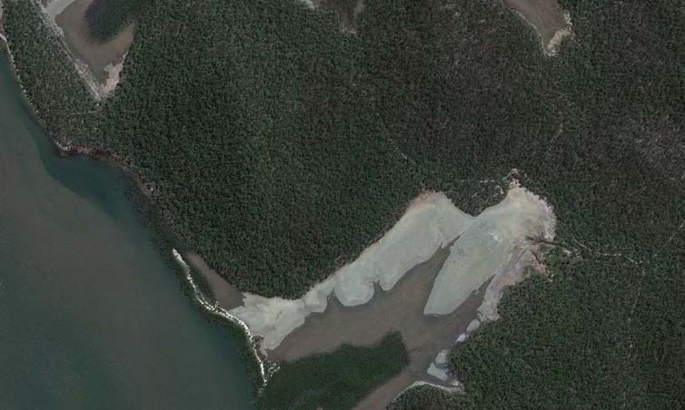
Volume 5: Attachment
Attachment 26: Flooding, Drainage and Stormwater Management – LNG Facility

Executive Summary
This report describes the investigation of surface waters issues for the proposed Liquefied Natural
Gas (LNG) facility to be constructed by Australia Pacific LNG Pty Ltd (the Proponent) at Laird Point, on
Curtis Island, Queensland. The investigations undertaken to assess the water quantity and quality
impacts of the LNG facility included the following:

   x Assessment of catchment, catchment hydrology, storm run-off flows and flood extents for
     existing conditions.

   x Assessment of waterways and water bodies within the LNG facility site area.

   x Water demand and source water for the LNG facility.

   x Potential impacts of the proposed development

   x Proposed mitigation measures and surface water quality management and monitoring
     requirements.

The investigations were undertaken to address section 3.4.1 of the Terms of Reference for the
Project’s EIS that relate to surface water environment, namely:

   x Existing surface drainage and flows.

   x Flooding.

   x Water quality.

   x Surface water management.

   x Stormwater management

The methodology adopted for the investigations included the following:

   x Description of the environmental values of the surface waterways on the site of the proposed
     LNG facility.

   x Identification of potential impacts on surface water quality, quantity, drainage patterns and
     sediment movement.

   x Formulation of management and monitoring strategies to ensure mitigation of potential impacts.

The site of the proposed LNG facility is traversed by a ephemeral creek system having three
tributaries and flowing across an extensive area of tidal flats to an outlet through mangroves that
drains a catchment that comprises timbered hills and valleys and tidal flats extending over an area of
284ha.

No recorded water quality and surface waterways information was available for the site and limited
information was able to be obtained during site inspections due to the absence of flow in the creek
system.

The extent of potential inundation of the LNG facility site has been determined using hydrologic and
hydraulic modelling techniques. The modelling results indicated that existing flooding is generally
confined to a 60m to 180m width along the main creek and the tributary branches across the site and
spreads out over the broad tidal flats that extend to the creek entrance.

Additionally, the flats are subject to occasional tidal inundation during higher spring tides, with the
maximum level for tidal inundation corresponding to Highest Astronomical Tide (HAT) level

Australia Pacific LNG Project EIS                 Page iii                                      March 2010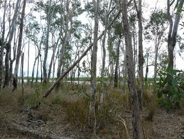
Volume 5: Attachment
Attachment 26: Flooding, Drainage and Stormwater Management – LNG Facility

(2.562mAHD). The maximum water levels for ocean inundation of the tidal flats are expected to occur
in major ocean storm surge events, which may exceed HAT level.

The Laird Point site is located on the landward side of Curtis Island, approximately 12km from the
ocean and is considered to be well protected from tsunamis, with the tsunami hazard generally
considered to be low.

It is proposed that a portion of the tidal flats be filled to 6mAHD and runoff from the hills above the
LNG facility site will be diverted around the of the site and discharged to Port Curtis to ensure that
LNG facility will not be adversely impacted by floods and tidal fluctuations.

The site is not located within any area covered by a water resource plan, land and water management
plan or declared wild river area.

The environmental values of the surface waterways were derived from values identified in the EPP
(Water) and Queensland Water Quality Guidelines and relevant environmental values for the Port
Curtis region.

The primary source of water for the LNG facility during the construction period, as well as the
operation period, is expected be desalinated seawater, with supplementary supply from stormwater
runoff stored in the hydro-test pond and sediment basin. A water balance has been undertaken to
assess the yield that can be supplied from stormwater runoff from the LNG facility.

Surface runoff from the site will be collected and conveyed to sediment ponds via vegetated swales,
which will include rock check dams to reduce velocity and facilitate sediment deposition during the
construction and operation phases of the LNG facility.

Potentially contaminated stormwater runoff containing fuels, oils or chemicals from the plant process
areas will be collected and directed to a coalescing plate interceptor (CPI) treatment process and
disposed by irrigation with the sewage effluent in order to prevent fuels and chemicals being
discharged to Port Curtis in stormwater runoff.

A stormwater management plan (Section 7) has been prepared that outlines objectives, key pollutant
risks, management actions, monitoring requirements, corrective actions and responsibilities for the
construction and operation periods of the LNG facility. The stormwater management plan will be
incorporated into the Environmental Management Plan (EMPlan) for the LNG facility.

Australia Pacific LNG Project EIS                 Page iv                                       March 2010

Volume 5: Attachment
Attachment 26: Flooding, Drainage and Stormwater Management – LNG Facility

Contents

1.         Introduction ............................................................................................................................... 1

2.         Project description..................................................................................................................... 5

3.         Existing conditions .................................................................................................................... 6

     3.1   Catchment characteristics......................................................................................................... 6

     3.2   Streamflow ................................................................................................................................ 8

     3.3   Stormwater flows....................................................................................................................... 9

     3.4   Existing Conditions Flood Extent ............................................................................................ 11

     3.5   Ocean inundation .................................................................................................................... 13

     3.6   Existing water quality .............................................................................................................. 15

4.         Water quality ........................................................................................................................... 19

     4.1   Water Quality Guidelines ........................................................................................................ 19

     4.2   Environmental Values ............................................................................................................. 19

     4.3   Receiving Environment Monitoring Program .......................................................................... 20

5.         Proposed water management................................................................................................. 21

     5.1   Construction ............................................................................................................................ 21

     5.2   Operations............................................................................................................................... 22

     5.3   Water balance ......................................................................................................................... 24

6.         Stormwater management........................................................................................................ 25

     6.1   Proposed drainage strategy.................................................................................................... 25

     6.2   Stormwater flows..................................................................................................................... 28

     6.3   Bypass channels ..................................................................................................................... 29

     6.4   Climate extremes .................................................................................................................... 30

     6.5   Stormwater quality management ............................................................................................ 31

           6.5.1       Water Quality Objectives............................................................................................ 31

           6.5.2       Construction period .................................................................................................... 32

           6.5.3       Operation period......................................................................................................... 32

     6.6   Stormwater quality modelling .................................................................................................. 33

     6.7   Water quality monitoring ......................................................................................................... 35

7.         Stormwater management plan................................................................................................ 36

     7.1   Objectives ............................................................................................................................... 36

     7.2   Construction period ................................................................................................................. 36

Australia Pacific LNG Project EIS                                    Page v                                                            March 2010
Volume 5: Attachment
Attachment 26: Flooding, Drainage and Stormwater Management – LNG Facility

     7.3     Operation period ..................................................................................................................... 37

     7.4     Monitoring and maintenance................................................................................................... 37

             7.4.1       Monitoring................................................................................................................... 37

             7.4.2       Maintenance............................................................................................................... 38

     7.5     Responsibility .......................................................................................................................... 38

     7.6     Reporting................................................................................................................................. 39

     7.7     Corrective actions ................................................................................................................... 39

8.           Conclusions and Recommendations ...................................................................................... 40

9.           References.............................................................................................................................. 41

Figures
Figure 3.1 Site LocationRainfall and evaporation data .......................................................................... 7

Figure 3.2 Catchments and RAFTS model - existing........................................................................... 10

Figure 3.3 100 Years ARI flood extent - existing.................................................................................. 12

Figure 3.4 Extent of tidal inundation..................................................................................................... 14

Figure 3.5 Laird Point waterways and photo locations......................................................................... 18

Figure 6.1 Bulk earthworks................................................................................................................... 26

Figure 6.2 Proposed drainage.............................................................................................................. 27

Figure 6.3 Conceptual design of diversion channel outlets.................................................................. 30

Tables
Table 1.1 Terms of reference and response locations........................................................................... 1

Table 3.1 Climate data at Radar Hill (Source: Bureau of Meteorology Climate Averages) ................... 8

Table 3.2 RAFTS model peak flows at downstream extent of the site .................................................. 9

Table 3.3 Rational Method peak flows - existing.................................................................................. 11

Table 3.4 Gladstone tidal plane data.................................................................................................... 13

Table 3.5 Water quality results from Laird Point farm dam, 16 June 2009 .......................................... 15

Table 4.1 EPP Water Environmental Values........................................................................................ 19

Table 5.1 Estimated total water demand for construction .................................................................... 21

Table 5.2 Projected water demand (kL/hr) ........................................................................................... 22

Table 5.3 Predicted sewage treatment plant effluent quality ............................................................... 23

Table 5.4 Water balance results........................................................................................................... 24

Table 6.1 Post-development peak flows 100 years ARI ...................................................................... 28

Australia Pacific LNG Project EIS                                      Page vi                                                          March 2010
Volume 5: Attachment
Attachment 26: Flooding, Drainage and Stormwater Management – LNG Facility

Table 6.2 Ecosystem Health Guidelines (from Storey et al., 2007) ..................................................... 31

Table 6.3 MUSIC Model Parameters ................................................................................................... 34

Table 6.4 Predicted stormwater quality ................................................................................................ 34

Table 7.1 Typical contaminants in run-off from construction sites ....................................................... 36

Table 7.2 Monitoring program .............................................................................................................. 37

Table 7.3 Stormwater maintenance schedule ...................................................................................... 38

Table 9.1 Soil Parameters: (Ref: BCC Guidelines) .............................................................................. 60

Table 9.2 Runoff Quality: (Ref: BCC Guidelines)................................................................................. 60

Appendices
Appendix A          Design Rainfall Data, Curtis Island

Appendix B          RAFTS Model Results Summary

Appendix C          HEC-RAS Model Results

Appendix D          Site Inspections

Appendix E          MUSIC Model Input Data

Australia Pacific LNG Project EIS                                 Page vii                                                    March 2010

Volume 5: Attachment
Attachment 26: Flooding, Drainage and Stormwater Management – LNG Facility

1.          Introduction
This report describes the investigations of the existing surface water environment and potential
impacts from the proposed Liquefied Natural Gas (LNG) facility to be constructed by Australia Pacific
LNG Pty Ltd (the Proponent) at Laird Point, on Curtis Island, Queensland. The investigations included:

     x An assessment of waterways and water bodies within the LNG facility site area including
       determining the existing hydrologic and water quality conditions..

     x A summary of the LNG facility’s water demand and potential sources of supply.

     x A review of potential impacts of the proposed development.

     x Potential mitigation measures for stormwater flow and quality management during both the
       construction and operational phases of the LNG facility.

     x Surface water quality management and monitoring requirements.

The investigations were undertaken to address section 3.4.1 of the Terms of Reference for the
Project’s EIS that relate to surface water environment. The Terms of Reference and the locations of
the responses are summarised within Table 1.1.

Subsequent to the above investigations, a stormwater management plan was prepared that outlines
objectives, key pollutant risks, management actions, monitoring requirements, corrective actions and
responsibilities for the construction and operation phases of the LNG facility (Section 7 of this report).
Table 1.1 Terms of reference and response locations

                                         Terms of Reference                                            Response

Description of environmental values

The EIS should describe the environmental values of the surface waterways of the affected area in
terms of:

     x   Values identified in the EPP (Water) and Australian and New Zealand Environment and
         Conservation Council, State of the Environment Reporting Taskforce 2000 (ANZECC 2000)
                                                                                                       Section 3
     x   Sustainability, including both quality and quantity

     x   Physical integrity, fluvial processes and morphology of watercourses, including riparian
         zone vegetation and form

any water resource plans, land and water management plans, declared or proposed wild river
areas relevant to the affected catchment.

A description should be given of the surface watercourses and their quality and quantity in the area   Section 3
affected by the project with an outline of the significance of these waters to the river catchment
system in which they occur.

Details provided should include a description of existing surface drainage patterns and existing       Section 3
and historical flow regimes in major streams and wetlands and a description of present and
potential water uses downstream of the areas affected by the project.

Australia Pacific LNG Project EIS                        Page 1                                        March 2010
Volume 5: Attachment
Attachment 26: Flooding, Drainage and Stormwater Management – LNG Facility

                                       Terms of Reference                                                 Response

Details should be provided on the likelihood of flooding, history of flooding (including extent, levels    Section 3
and frequency). Flood studies should include a range of annual exceedance probabilities for
affected waterways, based on observed data if available, or use appropriate modelling techniques
and conservative assumptions if there are no suitable observations. The flood modelling should
include local flooding due to short duration events from contributing catchments on site, as well as
larger scale regional flooding including waterways downstream.

The EIS should provide a description, with photographic evidence where appropriate, of the                Appendix D
geomorphic condition of any watercourses likely to be affected by project works and operations.
The results of this description should form the basis for the planning and subsequent monitoring of
rehabilitation of the affected watercourses.

An assessment is required of existing water quality in surface waters and wetlands likely to be            Section 4
affected by the proposal. The basis for this assessment should be a monitoring program, with
sampling stations located upstream and downstream of the project areas. The water quality
monitoring should capture seasonal variations or variations with flow where applicable. A relevant
range of physical, chemical and biological parameters should be measured to provide a baseline
for affected creek or wetland systems.

Potential impacts and mitigation measures                                                                  Section 6

The water management systems for all project elements should be described, addressing surface
water quality, quantity, drainage patterns and sediment movements.

The beneficial (environmental, production and recreational) use of nearby surface water should be          Section 6
discussed. An analysis of potential impacts on affected creeks should be carried out. This analysis
should identify any likely inundation and duration, as this may affect emergency vehicle access.

Monitoring programs should be described which will assess the effectiveness of management                  Section 7
strategies for protecting water quality during the construction, operation and decommissioning of
the project. Monitoring programs should also be designed to evaluate changes in the physical
integrity and geomorphic processes associated with changed flow regimes in affected water
courses.

Where on-site storage of water sourced from waste water treatment plants is proposed, the EIS              Section 5
should detail how this water would be managed to ensure environmental harm is avoided. The EIS
should also describe the design features of any such storages to effectively contain saline water
and other harmful constituents.

Key water management strategy objectives include:                                                          Section 6

   x   Maintenance of sufficient quantity and quality of surface waters to protect existing beneficial
       downstream uses of those waters (including maintenance of in-stream biota)

   x   Maintenance or replication of the existing geomorphic conditions of local watercourses

   x   Minimisation of impacts on flooding levels and frequencies both upstream and downstream
       of the project.

Australia Pacific LNG Project EIS                       Page 2                                            March 2010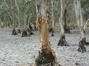
Volume 5: Attachment
Attachment 26: Flooding, Drainage and Stormwater Management – LNG Facility

                                       Terms of Reference                                              Response

The EIS should include a risk assessment for uncontrolled emissions to water due to system or           Section 6
catastrophic failure, implications of such emissions for human health and natural ecosystems, and
strategies to prevent, minimise and contain impacts.

The EIS should describe the proposed project component stormwater drainage systems and the              Section 6
proposed disposal arrangements, including any off-site services and downstream impacts.

Where dams, weirs, or ponds are proposed, the EIS should investigate the effects of predictable         Section 6
climatic extremes (droughts, floods) upon the structural integrity of the containing walls, and the
quality of water contained, and flows and quality of water discharged.

A dam failure impact assessment should be carried out for any proposed dams that, due to their          Section 6
size, trigger the need for such an assessment under the Water Act 2000. Any dams that are likely
to be referrable under the Water Act 2000 should be noted and emergency response procedures
incorporated into the project's environmental management plan (EMP).

The need, or otherwise, for licensing of any dams (including referable dams) or creek diversions,       Section 5
under the Water Act 2000 or the Fisheries Act 1994 or the construction or raising of any waterway
barrier works under the Fisheries Act 1994 should be discussed. The process for water allocation
and water discharge should be established in consultation with DERM. Consideration should also
be given to any water allocation and management plans.

The environmental values of the surface waters potentially affected by the project should be            Section 4
identified in accordance with the EPP (Water). Surface water quality objectives should be
determined after consideration of the Australian and New Zealand Guidelines for Fresh and Marine
Water Quality.

Risks to farmland from potentially contaminated surface water flow, particularly during flood events       Not
should be assessed.                                                                                     Applicable

Options for flood mitigation and the effectiveness of mitigation measures should be discussed with      Section 6
particular reference to sediment, salinity and other emissions of a hazardous or toxic nature to
human health, flora or fauna.

Waste management

Stormwater management should also address:                                                               Section 6

   x   Nominated stormwater discharge points and discharge criteria

   x   Design criteria, diversions, volume and capacity of any retention ponds, process tanks or
       bunded areas, as well as those reasonable and practicable measures proposed to prevent
       the likely release of contaminated stormwater to any drain or waters

   x   Potential impacts during extreme rainfall events

   x   Information on the collection, treatment and disposal of contaminated stormwater runoff
       from plant and associated materials handling facilities

   x   details of expected contaminants (e.g. chemical composition, particulates, metals, effluent
       temperature and pH) in controlled discharges of proposed wastewater and stormwater

Australia Pacific LNG Project EIS                      Page 3                                          March 2010
Volume 5: Attachment
Attachment 26: Flooding, Drainage and Stormwater Management – LNG Facility
Terms of Reference Response
management systems
x Impacts of discharges on potential receiving waters, particularly effects on the downstream
environment of stormwater releases (i.e. water – salt balance)
x An outline the expected disposal strategies, where solid or liquid wastes are to be disposed
of off-site.
Australia Pacific LNG Project EIS Page 4 March 2010Volume 5: Attachment
Attachment 26: Flooding, Drainage and Stormwater Management – LNG Facility
2. Project description
The Project’s LNG facility is proposed to be developed in stages to a maximum ultimate capacity of
approximately 18 million tonnes per annum (Mtpa) of LNG. It is expected that the ultimate
configuration of the LNG facility will comprise up to four LNG trains, each producing up to 4.5 Mtpa of
LNG. To produce 4.5 MTPA of LNG, each train will require approximately 270 Petajoules (PJ) of Coal
Seam Gas (CSG) per annum which is roughly equivalent to 11 million m3 of LNG per annum. The
LNG facility is expected to operate 24 hours per day, seven days a week.
It is anticipated that the LNG facility will consist of the following major components:
x LNG trains for processing incoming gas to LNG
x LNG and LPG storage tanks
x Process gas wet and dry ground flares
x Wastewater treatment
x Desalination plant
x Plant infrastructure
x Loading jetties to transfer LNG to ships for export to market and receive shipments of LPG
x A Material Off-loading Facility (MOF) for the transfer of building materials and heavy equipment
to the LNG facility site
x Ferry terminal
x Construction workforce accommodation, offices and related facilities.
The LNG facility site area is located on Curtis Island within the Curtis Island Industry Precinct of the
Gladstone State Development Area (GSDA) and the adjacent areas of Port Curtis. Curtis Island is
approximately 10km north of Gladstone on the central Queensland coast.
The facility site is described as Lot 3 on SP225924 and is situated within the mid-west corner of Curtis
Island adjacent to Laird Point. The site is bound by Graham Creek to the north and Targinie Passage
to the west. The location is referred to as Laird Point. The LNG facility site will cover approximately
270 hectares (ha), which includes approximately 39ha of tidal flats that are to be reclaimed for LNG
facility infrastructure and the MOF. The LNG facility footprint covers approximately 156ha or 58% of
the LNG facility site area.
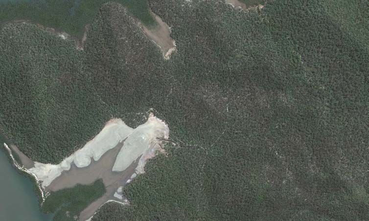
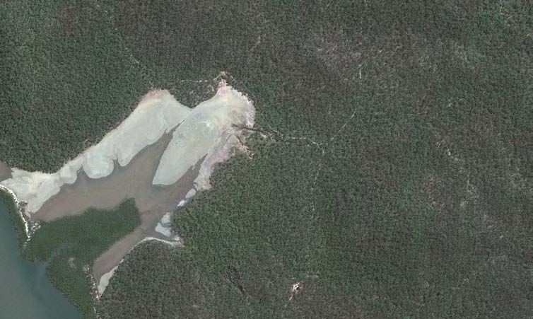
Australia Pacific LNG Project EIS Page 5 March 2010Volume 5: Attachment Attachment 26: Flooding, Drainage and Stormwater Management – LNG Facility 3. Existing conditions 3.1 Catchment characteristics The proposed LNG facility site is located on the west coast of Curtis Island, approximately 1km south of Laird Point and Graham Creek, as shown on Figure 3.1. The site is traversed by an ephemeral creek system having three tributaries and flowing across an extensive area of tidal flats and through mangroves to an outlet into Port Curtis approximately 1.3km south of Laird Point. The local creek catchment covers the LNG facility site and extends to the south-east, covering a total area of 284ha. The central and upper reaches of the catchment comprise steeply graded (up to 30% slope) timbered hills and valleys, while the lower catchment comprises approximately 50ha of grassed tidal flats and mangroves at the creek entrance. Natural ground levels on the site range from approximately 1.5mAHD within the intertidal area to 62mAHD towards the south-east corner. The soils on the site and in the catchment are gravelly sandy loams on the hillsides, having dispersive nature and a medium runoff potential. Initial site investigations indicated the presence of actual Acid Sulphate Soils (ASS) and potential acid sulphate soils (PASS) on the site. The assessment of the soils on the site is presented in Volume 4, Chapter 5 of this EIS. Reconnaissance surveys of the site were carried out in order to obtain some qualitative assessment of the condition of the natural drainage on site. During these surveys, a natural melaleuca wetland and a small farm dam were located on the site. Both features are degraded and were considered to posses few environmental values, due to the lack of diversity and habitat present, as well as the damage made by cattle and horses. The dam was supplied by groundwater from a nearby bore as catchment runoff into the dam is insufficient to provide a continuous supply. The aquatic ecology and habitat values of the waterways throughout the site are explained in detail in Volume 4, Chapter 9 of the EIS. The site has been used previously for cattle grazing and runoff quality is expected to be similar to that for low intensity grazing. Contamination of runoff is considered unlikely as no disused cattle dip or other potential sources of contamination were found on the LNG facility site. The site is no longer used for cattle grazing, however wild horses roam over the site. Australia Pacific LNG Project EIS Page 6 March 2010
313000 314000 315000 316000 317000 Gladstone
Gladstone
(
(
7374000 LEGEND
QLD
QLD
QLD
QLD
Drainage lines NT
NT
NT
NT
Area
Area of
of (Monto
( Monto
7374000
Interest
Interest
Interest
Interest
Site boundary
SA
SA
SA
SA
NSW
NSW
Conceptual facility layout NSW
NSW
Taroom
Taroom
(
(
Injune
Injune (
(
The
Gympie
Gympie((
Narr
eek
Graham Cr Roma
Roma (
(
7373000
sow
(Surat
( Surat (Dalby
( Dalby
Laird Point
Toowoomba
Toowoomba (
(
7373000
7372000
7372000
Proposed LNG facility
site
Loading berth This map incorporates data which is:
7371000
© Commonwealth of Australia (Geoscience Australia) 2009. The Commonwealth gives no warranty regarding the accuracy,
option 2a completeness, currency or suitability for any particular purpose.
© WorleyParsons Services Pty Ltd
While every care is taken to ensure the accuracy of this data, WorleyParsons makes no representations or warranties about its accuracy, reliability,
completeness or suitability for any particular purpose and disclaims all responsibility and all liability (including without limitation liability in negligence) for all
expenses, losses, damages (including indirect or consequential damage) and costs which might be incurred as a result of the data being inaccurate or
incomplete in any way and for any reason.
7371000
Satellite imagery captured by GeoEye-1 on 24 March 2009
Option 1b proposed marine structures extracted from Bechtel CAD drawing 25509-100-K0-K01-00001.dgn supplied by client on 15/09/2009.
North Passage Option 2a proposed marine structures extracted from Bechtel CAD drawing 25509-100-K0-K01-00002.dgn supplied by client on 11/09/2009.
Conceptual Site Plan 25509-100-P1-000-10005.dgn supplied by client 24/07/2009
Island
0 17/02/2010 Issued for use JC DH KLH RB
7370000
Loading berth
Rev Date Revision Description ORIG CHK ENG APPD
option 1b
7370000
AUSTRALIA PACIFIC LNG PTY LIMITED
0 0.5 1km
SCALE - 1 : 20,000 (at A3)
Map Grid of Australia Zone 56
Geocentric Datum of Australia 94
Port Curtis AUSTRALIA PACIFIC LNG PROJECT
Figure 3.1 Site Location
313000 314000 315000 316000 317000
Project No: 301001-00752 Figure: 00752-00-EN-DAL-0094 Rev: 0
Compiled by BRISBANE INFRASTRUCTURE GIS SECTION K:\CONOCOPHILLIPS\301001-00752\GIS\Maps\00752-00-EN-DAL-0094-Rev0(Site_Location_TR).worVolume 5: Attachment
Attachment 26: Flooding, Drainage and Stormwater Management – LNG Facility
The nearest long-term rainfall gauges to the site are located in Gladstone, where the long-term mean
annual rainfall is 965mm based on the composite Gladstone rainfall data for the period 1872 to 2009
for the Post Office and Radar Hill stations.
The monthly average rainfall, evaporation and temperature data for the Radar Hill station for the
period 1957 to 2009 are summarised in Table 3.1.
Table 3.1 Climate data at Radar Hill (Source: Bureau of Meteorology Climate Averages)
Month Jan Feb Mar Apr May Jun Jul Aug Sep Oct Nov Dec Total
year
Rainfall 143.4 143.4 82.6 46.4 59.6 38.9 34.4 31.2 26.2 61.3 73.2 128.8 869.7
(mm)
Days rain 4 4 2 1 1 1 1 1 1 2 2 3 23
10mm
Potential 195 165 164 132 105 90 96 109 132 170 183 195 1736
Evaporation
(mm)
Temperature 22.5- 22.4- 21.5- 19.6- 17.0- 14.3- 13.4- 14.3- 16.4- 18.7- 20.5- 21.9- 18.5-
(°C) 31.2 30.9 30.2 28.4 25.7 23.2 22.8 24.1 26.5 28.4 29.9 31.0 27.7
The climate data exhibits high seasonality with the highest rainfall occurring between December and
February, during which period approximately 48% of the annual rainfall occurs. The higher
evaporation begins in October and extends through to March, reflecting the higher temperatures
during those months.
The average annual rainfall recorded at the Radar Hill station is approximately 10% less than the long-
term average annual rainfall obtained for the period 1872-2009 using the composite records for the
Post Office and Radar Hill gauges. The lower annual rainfall reflects the influence of the prolonged
drought from the mid 1990s to 2008 when rainfall was 25% less than for the preceding 120 years.
3.2 Streamflow
There are no known streamflow records for the drainage lines within the site or other watercourses on
Curtis Island.
The nearest DERM streamflow gauging stations to Curtis Island are located at Castlehope on the
Calliope River, approximately 20km south-west of Gladstone and at Old Station on Raglan Creek,
approximately 45km west of Gladstone. The mean annual depths of runoff at the two stations are
117mm and 89mm respectively and are equivalent to approximately 10-14% of the average annual
rainfall for the catchments.
The catchment and rainfall characteristics for the gauged catchments are similar to those on Curtis
Island. Therefore, the average depth of runoff on Curtis Island is estimated to be approximately
140mm, based on a volumetric runoff factor of 15% and the long-term average rainfall, yielding an
estimated volume of runoff from the local creek catchment at the site of approximately 400ML/yr.
Based on the rainfall data presented in Table 3.1, runoff would be effectively concentrated to the
period between December and March, with negligible stream flow during the remaining months.
Australia Pacific LNG Project EIS Page 8 March 2010Volume 5: Attachment
Attachment 26: Flooding, Drainage and Stormwater Management – LNG Facility
3.3 Stormwater flows
Storm runoff hydrographs were calculated at the catchment outlet (downstream extent of the site) and
a number of locations within the LNG facility site using the RAFTS hydrologic model. RAFTS is a non-
linear run-off routing model that calculates run-off hydrographs from excess rainfall for rural and urban
catchments ranging in area from less than 1ha to over 1000km2.
The RAFTS model comprised nine sub-areas covering the site and the upstream areas. The
delineation of the sub-areas was based on topography and the natural drainage layout. The RAFTS
model layout is presented on Figure 3.2.
Design rainfall intensity-frequency-duration data was determined for the Curtis Island locality in
accordance with Australian Rainfall and Runoff (AR&R 2001). The design rainfall intensity-frequency-
duration (IFD) data is presented in Appendix A.
An initial loss of 25mm and continuing loss of 2.5mm/hour were adopted for the RAFTS model. The
adopted rainfall losses were based on the volumetric run-off co-efficients for a typical single storm for
soils having a moderate to high infiltration capacity, similar to the soils on the site.
The RAFTS model produced peak flows for a critical storm duration of 120 minutes for the 100 and 50
years ARI events and for a critical storm duration of 180 minutes for the lesser design storm events.
The longer critical storm duration for the lesser events reflects the influence of initial loss on excess
rainfall and resultant run-off. This effect is particularly evident in the 1 and 2 Year ARI events, where
the adopted initial loss represents 40-50% of the rainfall in the critical duration design storm events.
The peak flows at the downstream extent of the site are listed in Table 3.2 and a summary of peak
flows for the model sub-areas are listed in Appendix B.
Table 3.2 RAFTS model peak flows at downstream extent of the site
Average Recurrence Peak flow (m3/s)
Interval (yrs)
100 47.4
50 42.2
20 34.4
10 27.4
5 22.4
2 14.5
1 9.0
Australia Pacific LNG Project EIS Page 9 March 2010314000 315000 316000 317000
LOCALITY MAP
eek
Graham Cr
7373000
7373000
7373000
7373000
Laird Point
7372000
7372000
F4 L12
L12 F2
F2
LL55 F2
F2
D2
D2
LL44
LL66 D1
D1
7372000
F4
F4
7372000
LL77 F3
F3 F1
F1
D
DLL11
F3
LL88
F5 F1
F1
D4
D4
00 LL L3
L3 E3
E3
99
LL11
LL22
F5
F5 E4
E4
LL11
11 E3
E3 E2
E2
Loading berth E4 L1
E1
E2
E2
option 2a
7371000
7371000
E1
E1
This map incorporates data which is:
© WorleyParsons Services Pty Ltd
While every care is taken to ensure the accuracy of this data, WorleyParsons makes no representations or warranties about its accuracy, reliability,
completeness or suitability for any particular purpose and disclaims all responsibility and all liability (including without limitation liability in negligence) for all
7371000
7371000
expenses, losses, damages (including indirect or consequential damage) and costs which might be incurred as a result of the data being inaccurate or
incomplete in any way and for any reason.
LNG facility site Satellite imagery captured by GeoEye-1 on 24 March 2009
Option 1b proposed marine structures extracted from Bechtel CAD drawing 25509-100-K0-K01-00001.dgn supplied by client on 15/09/2009.
Option 2a proposed marine structures extracted from Bechtel CAD drawing 25509-100-K0-K01-00002.dgn supplied by client on 11/09/2009.
North Passage Conceptual Site Plan 25509-100-P1-000-10005.dgn supplied by client 24/07/2009
Island Contours supplied by Fredriksen Maclean and Associates Consulting Surveyors 28 October 2009
LEGEND
0 14/01/2010 Issued for use JC DH KLH
D 14/01/2010 Re-issued for squad check JC DH KLH
RAFTS node
7370000
Rev Date Revision Description ORIG CHK ENG APPD
7370000
Catchment boundary
HEC RAS stream
Loading berth
7370000
7370000
RAFTS link
option 1b 5m contours AUSTRALIA PACIFIC LNG PTY LIMITED
0 250 500m Site boundary
SCALE - 1 : 16,000 (at A3)
Map Grid of Australia Zone 56
Geocentric Datum of Australia 94
Limit of LNG facility
AUSTRALIA PACIFIC LNG PROJECT
Figure 3.2 Catchments and
314000 315000 316000 317000 RAFTS Model - Existing
Project No: 301001-00752 Figure: 00752-00-EN-DAL-0031 Rev: 0
Compiled by BRISBANE INFRASTRUCTURE GIS SECTION K:\CONOCOPHILLIPS\301001-00752\GIS\Maps\00752-00-EN-DAL-0031-Rev0(Catchment_Rafts_Model_Exist_TR).worVolume 5: Attachment
Attachment 26: Flooding, Drainage and Stormwater Management – LNG Facility
Peak flows for design storm events were also estimated for existing catchment conditions using the
Rational Method in order to validate the RAFTS modelling. The time of concentration for the
catchment was estimated to be 90 minutes, as per the Bransbury-Williams formula for rural
catchments.
The Rational Method peak flow estimates for design storm events having an Average Recurrence
Interval (ARI) for up to 100 years are presented in Table 3.3.
Table 3.3 Rational Method peak flows - existing
Average Recurrence Peak flow (m3/s)
Interval (yrs)
100 51.5
50 43.3
20 33.5
10 27.2
5 22.9
2 16.0
1 11.7
The peak flows predicted by the RAFTS model are comparable to the peak flow estimates obtained
from the Rational Method for moderate and major design storm events. As stated above, the adopted
initial loss has a significant influence for the minor storm events, resulting in marginally lower peak
flows for those events than the Rational Method estimates for the 1 and 2 Year ARI design storms.
The principal purpose of the RAFTS modelling was to determine peak flows at selected locations
along the natural drainage network for input to the hydraulic model to estimate the extent of inundation
in the 100 years ARI design event, as discussed below.
3.4 Existing Conditions Flood Extent
The approximate extent of inundation of the proposed site in the 100 years ARI design event was
determined using a HEC-RAS hydraulic model, with peak flows obtained from the RAFTS hydrologic
model.
HEC-RAS is a one-dimensional hydraulic model that was developed at the Hydrologic Engineering
Center by the US Army Corps of Engineers. The model is designed to perform one-dimensional
hydraulic calculations for natural and constructed channel networks. The model can simulate
branched networks and hydraulic structures, including weirs, bridges and culverts.
The HEC-RAS model of the study area included the main creek and two tributary branches, with peak
flows input for seven reaches. The cross-sections for the model were extracted from the contour
survey information for the site. The cross-section locations are depicted in Figure 3.3.
A tail-water level at 1.64mAHD, corresponding to Mean High Water Springs (MHWS) at the Gladstone
Port gauge was adopted for the HEC-RAS model. The natural ground level at the lowest portion of the
site adjacent to the mangroves at the mouth of Graham Creek is approximately 150mm below MHWS
level.
The approximate extent of inundation in the 100 years ARI design storm event is plotted in Figure 3.3
and peak flood levels are summarised in Appendix A.
Australia Pacific LNG Project EIS Page 11 March 2010315000 315500 316000 316500
LOCALITY MAP
7372500
7372500
7372000
7372000
X
XS
XS
SA
XS
XSA4
XSA7
X
XS
A1133
X
XSA
SA
A1122
A4
A7
SA33
A66
SA
A1111
AA11
XS
XSA10
XSA10
X
XSA
XXSS
X
SA
XS
XSA9
S
S
SA
7372000
XS
7372000
XXSS
A
X
A88
XS
X
A9
SA
AA11
A1144
XXSS
22
BB11
55
AA11
XXSS
XXSS
66
AA11
77
1111
BB
XXSS
1100
XXSS
BB
AA11
XXSS
88
XXSS
BB99
AA11
XXSS
XXSS
7371500
99
7371500
CC55 66
BB88
AA22
XXSS
CC44
CC
XXSS
XXSS
11
XXSS
AA2200
BB77
XXSS
CC33
XXSS
BB66
XXSS
7371500
7371500
XXSS
B55
CC22
SB
XXSS
XS
X
B44
BB33
XSSB
C11
XXSS
C
B22
X
XXSS
SB
BB11
XS
XXSS
X
This map incorporates data which is:
© WorleyParsons Services Pty Ltd
While every care is taken to ensure the accuracy of this data, WorleyParsons makes no representations or warranties about its accuracy, reliability,
completeness or suitability for any particular purpose and disclaims all responsibility and all liability (including without limitation liability in negligence) for all
expenses, losses, damages (including indirect or consequential damage) and costs which might be incurred as a result of the data being inaccurate or
incomplete in any way and for any reason.
Satellite imagery captured by GeoEye-1 on 24 March 2009
7371000
7371000
Conceptual Site Plan 25509-100-P1-000-10005.dgn supplied by client 24/07/2009
Contours supplied by Fredriksen Maclean and Associates Consulting Surveyors 28 October 2009
7371000
7371000
0 14/01/2010 Issued for use JC DH KLH
LEGEND E 14/01/2010 Re-issued for client review JC DH KLH
Rev Date Revision Description ORIG CHK ENG APPD
Flood extent
HEC-RAS cross section
HEC-RAS stream
5m contours AUSTRALIA PACIFIC LNG PTY LIMITED
7370500
7370500
0 125 250m Site boundary
SCALE - 1 : 8,000 (at A3)
Map Grid of Australia Zone 56
Limit of LNG facility
AUSTRALIA PACIFIC LNG PROJECT
7370500
7370500
Geocentric Datum of Australia 1994 Figure 3.3 100 Years ARI
315000 315500 316000 316500 Flood Extent - Existing
Project No: 301001-00752 Figure: 00752-00-EN-DAL-0032 Rev: 0
Compiled by BRISBANE INFRASTRUCTURE GIS SECTION K:\CONOCOPHILLIPS\301001-00752\GIS\Maps\00752-00-EN-DAL-0032-Rev0(HecRas_CrossSections_Q100_TR).worVolume 5: Attachment
Attachment 26: Flooding, Drainage and Stormwater Management – LNG Facility
The HEC-RAS modelling results indicate that floodwaters are generally confined to a 60-180m width
along the main creek and the tributary branches across the site. The floodwaters spread out over the
broad tidal flats that extend to the creek entrance.
The extent of inundation in the 100 years ARI design storm event for existing conditions covers a
significant proportion of the proposed LNG facility site. The LNG facility site is to be filled and runoff
from external areas is to be diverted around the LNG facility as discussed in Section 6.1.
3.5 Ocean inundation
The proposed LNG facility site extends onto tidal flats within an area of approximately 24ha between
the mangroves at the mouth of the creek to near the bases of the hills. The flats are subject to
occasional tidal inundation during higher spring tides. The maximum level for tidal inundation
corresponds to Highest Astronomical Tide (HAT) level and is 2.562mAHD. This is approximately 1m
higher than the lowest portion of the site and adjacent to the mangroves at the mouth of Graham
Creek.
The location of the HAT level contour on the site is plotted on the survey plan for the reclamation area
presented on. The extent of the proposed reclamation areas for the LNG facility and MOF are also
shown on Table 3.4. The reclamation areas are to be filled to 6.0mAHD as discussed in Section 6.1.
The tidal plane data for Gladstone is listed in Table 3.4. This data was adopted for defining the tidal
water level data for the Laird Point site.
Table 3.4 Gladstone tidal plane data
Tidal plane Height above LAT (m) Level (mAHD)
Highest Astronomical Tide (HAT) 4.83 2.562
Mean High Water Springs (MHWS) 3.96 1.692
Mean High Water Neaps (MHWN) 3.11 0.842
Mean Sea Level (MSL) 2.34 0.072
Australian Height Datum (AHD) 2.268 0.000
Mean Low Water Neaps (MLWN) 1.57 -0.698
Mean Low Water Springs (MLWS) 0.72 -1.548
Lowest Astronomical Tide (LAT) 0.00 -2.268
Source: Maritime Safety Queensland, 2009
The estimated 100 years ARI storm tide water level at Gladstone (Harper 1998) is 0.8m above HAT
level, resulting in a maximum inundation level at 3.362mAHD.
The tsunami hazard along the Queensland east coast is generally considered to be low (WLA 2009).
In general, sites exposed to the ocean are most vulnerable to tsunami hazard. The Laird Point site is
located on the landward side of Curtis Island, approximately 12km from the ocean and is considered
to be well protected from tsunamis.
Therefore, the maximum water levels for ocean inundation of the tidal flats are expected to occur in
major ocean storm surge events.
Australia Pacific LNG Project EIS Page 13 March 2010314000
314000 314500
314500 315000
315000 315500
315500 Gladstone
Gladstone
(
(
LEGEND
Drainage line
QLD
QLD
QLD
QLD
NT
NT
NT
NT
7372500
7372500
Site boundary Area
Area of
of (Monto
Interest
Interest
( Monto
Interest
Interest
H.A.T. contour R.L. 2.562m AHD
SA
SA
SA
SA
NSW
NSW
NSW
NSW
Reclamation area Taroom
Taroom
7372500
7372500
(
(
Mangroves
Injune
Injune (
(
Gympie
Gympie((
Roma
Roma (
(
(Surat
( Surat (Dalby
( Dalby
Toowoomba
Toowoomba (
(
7372000
7372000
7372000
7372000
Reclamation area for LNG facility
24.35ha
Reclamation area for MOF
15.09ha
7371500
7371500
This map incorporates data which is:
© Commonwealth of Australia (Geoscience Australia) 2009. The Commonwealth gives no warranty regarding the accuracy,
completeness, currency or suitability for any particular purpose.
© WorleyParsons Services Pty Ltd
7371500
7371500
While every care is taken to ensure the accuracy of this data, WorleyParsons makes no representations or warranties about its accuracy, reliability,
completeness or suitability for any particular purpose and disclaims all responsibility and all liability (including without limitation liability in negligence) for all
expenses, losses, damages (including indirect or consequential damage) and costs which might be incurred as a result of the data being inaccurate or
incomplete in any way and for any reason.
Satellite imagery captured by GeoEye-1 on 24 March 2009
Conceptual Site Plan 25509-100-P1-000-10005.dgn supplied by client 24/07/2009
HAT, Reclamation and Mangrove Areas extracted from 3751-1-01A,02B,03A_091028.dwg supplied by client 28/10/2009
Proposed LNG facility
site
0 17/02/2010 Issued for use JC DH KLH RB
7371000
7371000
Rev Date Revision Description ORIG CHK ENG APPD
North Passage
Island
7371000
7371000
AUSTRALIA PACIFIC LNG PTY LIMITED
0 200 400m
SCALE - 1 : 8,000 (at A3)
Map Grid of Australia Zone 56
Geocentric Datum of Australia 94
AUSTRALIA PACIFIC LNG PROJECT
Figure 3.4 Extent of Tidal Inundation
314000
314000 314500
314500 315000
315000 315500
315500
Project No: 301001-00752 Figure: 00752-00-EN-DAL-0091 Rev: 0
Compiled by BRISBANE INFRASTRUCTURE GIS SECTION K:\CONOCOPHILLIPS\301001-00752\GIS\Maps\00752-00-EN-DAL-0091-Rev0(HAT_Extent_TR).worVolume 5: Attachment
Attachment 26: Flooding, Drainage and Stormwater Management – LNG Facility
3.6 Existing water quality
No information is available from DERM databases with regard to water quality and condition of the
natural drainage lines for the Laird Point study area. Two reconnaissance surveys of the site were
carried out in order to obtain some qualitative assessment of the condition of the natural drainage on
site. A small farm dam was located on the site during the first site visit. The dam was supplied by
groundwater from a nearby bore as runoff into the dam was insufficient to provide a continuous
supply. The dam and nearby bore are no longer being used.
During a later site visit undertaken to assess ASS conditions on the site, a melaleuca wetland was
located approximately 200m to the north-east of the dam located previously. Both the dam and
wetland were quite degraded and are considered to have limited environmental values. The locations
of the dam and melaleuca wetland are shown on Figure 3.5.
The site has been used previously for cattle grazing and run-off quality is expected to be similar to that
for low intensity grazing. The site is no longer used for cattle grazing, but wild horses roam over the
site. Contamination of run-off is considered unlikely as no disused cattle dip or other potential sources
of contamination were found on the site. The contaminated land investigations are presented in the
Land Contamination technical report included in Appendix 5 of this EIS.
Two waterway-focussed site investigations to Laird Point were conducted; a reconnaissance survey
was carried out on the 16 June 2009, with a second investigation held on the 7 October 2009.
The first reconnaissance survey in June was conducted during the dry season and from background
research, no water was expected to be found within the study area. The Bureau of Meteorology had
recorded no rainfall for Gladstone or South End (on Curtis Island) for at least three weeks prior to the
reconnaissance survey.
The water in the dam was sampled and analysed and the water quality results are presented in Table
3.5. It should be noted that the water quality is not representative of the surrounding surface
environment due to the water in the dam being sourced from groundwater.
Table 3.5 Water quality results from Laird Point farm dam, 16 June 2009
Parameter Units Value
Physical and Nutrient Parameters
pH - 6.66
Dissolved Oxygen mg/L 10.86
Conductivity μS/cm @ 25°C 493
Water Temperature °C 18.4
Total Dissolved Solids mg/L 419
Suspended Solids mg/L 62
Ammonia mg/LVolume 5: Attachment
Attachment 26: Flooding, Drainage and Stormwater Management – LNG Facility
Parameter Units Value
Total Kjeldahl Nitrogen mg/L 0.7
Total Nitrogen mg/L 0.7
Total Phosphorus mg/L 0.08
Cations and Anions
CaCO3 mg/L 24
Sulfate as SO4 mg/L 6
Chloride mg/L 158
Calcium mg/L 4
Magnesium mg/L 11
Sodium mg/L 76
Potassium mg/L 4
Total Metals
Arsenic (II and V) mg/L 0.003
Cadmium mg/LVolume 5: Attachment Attachment 26: Flooding, Drainage and Stormwater Management – LNG Facility The second site visit also followed a prolonged dry period with the only noteworthy rainfall being 8mm over 4 days in early September 2009, four weeks earlier. It was not possible to obtain samples of the surface water during the second due to the complete absence of water on the site. Details of the observations made during the site investigations are included in Appendix D. Australia Pacific LNG Project EIS Page 17 March 2010
314500
314500 315000
315000 315500
315500 316000
316000 316500
316500
LEGEND
7373000
7373000
11 Photo location
Existing track
Identified drainage line/creek
7372500
7372500
Site boundary
7372500
7372500
Melaleuca wetland
Farm dam
Melaleuca soak
7372000
7372000
7372000
7372000
This map incorporates data which is:
© Commonwealth of Australia (Geoscience Australia) 2010. The Commonwealth gives no warranty regarding the accuracy,
completeness, currency or suitability for any particular purpose.
© WorleyParsons Services Pty Ltd
While every care is taken to ensure the accuracy of this data, WorleyParsons makes no representations or warranties about its accuracy, reliability,
completeness or suitability for any particular purpose and disclaims all responsibility and all liability (including without limitation liability in negligence) for all
expenses, losses, damages (including indirect or consequential damage) and costs which might be incurred as a result of the data being inaccurate or
incomplete in any way and for any reason.
Satellite imagery captured by GeoEye-1 on 24 March 2009
7371500
7371500
7371500
7371500
Dam 0 200 400m
SCALE - 1 : 10,000 (at A3)
Map Grid of Australia Zone 56
Geocentric Datum of Australia 94
7371000
7371000
7371000
7371000
0 17/02/2010 Issued for use KM DH RB
Rev Date Revision Description ORIG CHK ENG APPD
AUSTRALIA PACIFIC LNG PTY LIMITED
7370500
7370500
AUSTRALIA PACIFIC LNG PROJECT EIS
7370500
7370500
Figure 3.5 Laird Point Waterways and
Photo Locations
314500
314500 315000
315000 315500
315500 316000
316000 316500
316500
Project No: 301001-00752 Figure: 00752-00-EN-DAL-0125 Rev: 0
Compiled by BRISBANE INFRASTRUCTURE GIS SECTION K:\CONOCOPHILLIPS\301001-00752\GIS\Maps\00752-00-EN-DAL-0125-Rev0(LairdPt_Wways_and_PhotoLocations).worVolume 5: Attachment
Attachment 26: Flooding, Drainage and Stormwater Management – LNG Facility
4. Water quality
No information is available from desktop research for the water quality of the natural drainage lines
that exist on the site. These natural drainage lines are ephemeral and only flow for a relatively short
time following heavy rainfall, and as such it was expected that limited opportunity would exist to obtain
water quality samples while on site, as sampling is only possible during or immediately after rainfall
events.
The site has previously been used for cattle grazing and run-off quality is expected to be similar to that
for low intensity grazing. There are currently no cattle grazing on site. Contamination of run-off is
considered unlikely as no disused cattle dip or other potential sources of contamination were found on
the site (refer to Volume 4, Chapter 5).
4.1 Water Quality Guidelines
The Queensland Water Quality Guidelines (2009) have established water quality targets for some
areas of Queensland. Where these site-specific targets do not exist, the ANZECC/ARMCANZ (2000)
Guidelines are used as a general target based on regions throughout the state. Both the
ANZECC/ARMCANZ Guidelines and Queensland Water Quality Guidelines were established mainly
for flowing waters within streams, estuaries and marine waters, or standing water bodies within
wetlands and lakes. Given that ephemeral and intermittent water bodies experience natural seasonal
changes in chemical and physical status, an accurate comparison of sampling data to the relevant
national and state water quality guidelines, which are based on permanent and flowing waters, is not
possible.
4.2 Environmental Values
Environmental Values (EVs) are the qualities of waterways that need to be protected from the effects
of pollution, waste discharges and deposits to ensure healthy aquatic ecosystems and waterways that
are safe and suitable for community use (DERM, 2008). These range from the maintenance and
protection of healthy aquatic ecosystems, health and safety, commercial and cultural heritage values.
Environmental Protection (Water) Policy 2009 (EPP Water) was established to achieve the objectives
of the Environmental Protection Act 1994 (EP Act) in relation to Queensland waters and provides the
framework for establishing EVs and Water Quality Objectives (WQOs) for Queensland waters. Table
4.1 provides the EVs scheduled under EPP Water and the respective EVs applicable to Port Curtis.
Table 4.1 EPP Water Environmental Values
EPP Water EVs Port Curtis EVs
Aquatic ecosystems Local – aquatic ecosystems within Port Curtis. Regional – GBRMP.
Aquaculture use Commercial fishing.
Primary recreation Swimming, water sports and recreational fishing
Secondary recreation Wading, boating.
Drinking water NA
Industrial purposes LNG facility site water usage, cooling water for other industries, export of
resources from Central Queensland.
Australia Pacific LNG Project EIS Page 19 March 2010You can also read