BRAID AND MAIN Local Management Area Information Leaflet - Northern Ireland Environment Agency
←
→
Page content transcription
If your browser does not render page correctly, please read the page content below
Northern Ireland
Environment Agency

BRAID AND MAIN
Local Management Area Information Leaflet
www.ni-environment.gov.uk/wfd
Information Leaflet - Braid and Main Local Management Area
The River Basin Management Plans will be implemented through Local
Management Areas (LMAs) during the 2010 to 2015 planning cycle. This
information leaflet is one of a series, for each of the 26 LMAs, across the
Neagh Bann, North Western and North Eastern Districts. The leaflet includes
details of the characteristics and quality of the water environment within the
area and specific local measures identified to improve the water environment.
The leaflet will inform work with stakeholders, through Catchment
Stakeholder Groups, to develop focused implementation plans for each LMA
in the Neagh Bann District. These LMA Plans will be implemented on a three-
year rolling programme within the Neagh Bann District as set out below:
• Ballinderry and Lough Neagh in 2010;
• Blackwater, Lower Bann and Carlingford & Newry in 2011;
• Upper Bann, Moyola, Six Mile Water and Braid & Main in 2012.
Introduction
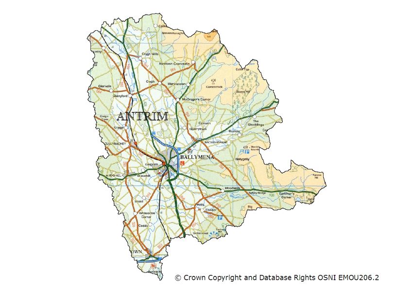
Braid and Main LMA, part of the Neagh Bann River Basin District, drains into
Lough Neagh at Randalstown Forest. The land area covered by the LMA is
approximately 714 km². The main river is the River Main, with a very
significant River Braid draining into the Main near Ballymena. Both the Braid
and the Main have tributaries feeding them such as Kells Water, Ahoghill
Burn, Artoges River and the Clogh River. The rivers and their tributaries also
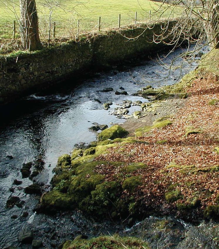
support a wide range of recreational activities including walking, canoeing and
angling.
The main towns are Ballymena and Randalstown and there are several
smaller towns throughout the area, such as Ahoghill, Cullybackey,
Broughshane, Dunloy, Cloughmills and Kells. The main land use is improved
grassland with some forestry and a number of important bogs present in the
LMA. The north and west of the LMA borders on the Antrim Hills and this
region contains the Antrim Coast and Glens Area of Outstanding Natural
Beauty.
1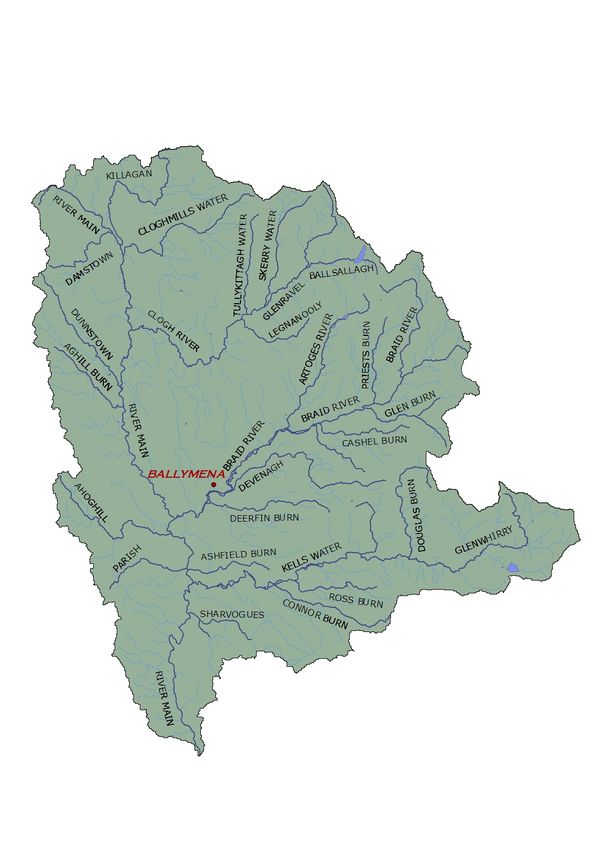
www.ni-environment.gov.uk/wfd

  Key Facts

  LMA area: 714 km²

  WFD water bodies:

  35 river water bodies
  1 groundwater body

  Main land use:

  Improved Grassland 49%
  Arable Horticulture 11%
  Neutral Grass 8%
  Calcareous Grass 5%

  Key industries:

  Agriculture, tourism, fishing

  Main towns and
  populations:

  Ballymena (28717*)
  Randalstown (4956*)
  Ahoghill (3055*)
  Cullybackey (2405*)
  Broughshane (2364*)
  Kells (1745*)
  Cloughmills (1240*)
  Dunloy (1071*)

  *Figures based on 2001
  census.

                                  2
www.ni-environment.gov.uk/wfd
Braid and Main LMA with main rivers identified
3www.ni-environment.gov.uk/wfd
The quality of water bodies in Braid and Main LMA
Our understanding of the state of Northern Ireland’s water environment and
Braid and Main LMA has developed as we have adapted to the requirements
of the Water Framework Directive. Now, when assessing water quality, we
consider both ecological and chemical quality, as well as the pressures that
can affect them.
Some water bodies have been changed to such a degree that they can no
longer be restored to their original condition without compromising their
current use. For example, some have been deepened to allow for navigation,
others have flood defences or have been dammed to provide a source of
drinking water. These are called Heavily Modified or Artificial water bodies
and are required to meet Good Ecological Potential (GEP) rather than good
status.
Sections of Braid and Glenwhirry Rivers and Glenravel Water have been
classified as heavily modified.
What is the current status of surface waters in Braid and Main LMA?
66% of surface water bodies in Braid and Main LMA have been classified as
less than good status. Many of the rivers failed to achieve good status due to
suppressed invertebrates, macrophytes and diatoms.
Table 1: Status of surface waters in Braid and Main LMA
Water body
High Good Moderate Poor Bad GEP MEP PEP BEP
type
River 1 11 16 4 0 0 2 1 0
% 3 31 46 11 0 0 6 3 0
Lake 0 0 0 0 0 0 0 0 0
% 0 0 0 0 0 0 0 0 0
Transitional
0 0 0 0 0 0 0 0 0
& Coastal
% 0 0 0 0 0 0 0 0 0
Total
Surface 1 11 16 4 2 1
Waters
% 3 31 46 11 0 0 6 3 0
Groundwaters (underground water) interact with the surface waters around
them, thus the quality and quantity of an area’s groundwater can affect the
surface waters.
There is one groundwater body within Braid and Main LMA. Ballymena
groundwater body is currently at poor status due to nitrate levels but is
expected to achieve good status by 2021.
4www.ni-environment.gov.uk/wfd
Overall status of water bodies in Braid and Main LMA
5www.ni-environment.gov.uk/wfd
Protected areas in Braid and Main LMA
The LMA supports important habitats and wildlife. These areas have been
designated under European Directives and require special protection. The
protected areas are summarised in the following table.
Table 2: Protected areas in Braid and Main LMA
Protected Area Type Location
Waters used for the abstraction of
drinking water (drinking water
protected areas) There are 5 drinking water protected areas.
Areas designed to protect
economically significant aquatic
species
There are 287 km of rivers identified under the Freshwater Fish
Freshwater Fish Directive
Directive, all designated Salmonid.
(78/659/EEC)
Shellfish Waters Directive
There are no designated shellfish waters.
(79/923/EC)
Bathing Waters
These are bathing waters identified
There are no identified bathing waters.
under the Bathing Waters Directives
(76/160/EEC)
Nutrient Sensitive Areas There is 1 Urban Waste Water Treatment Directive sensitive area;
Areas designated as sensitive under Lough Neagh.
the Urban Waste Water Treatment
Directive (91/271/EEC) and the A total territory approach has been adopted in Northern Ireland for
Nitrates Directive (91/676/EEC) the Nitrates Directive.
Areas designated for the protection
of habitats or species (Natura 2000
sites)
These are areas designated for the
protection of habitats or species
where the maintenance or
improvement of the status of water is
an important factor in their
protection.
There are 3 water dependent Special Areas of Conservation;
Habitats Directive (92/43/EEC) Garron Plateau, Rea’s Wood & Farr’s Bay and Main Valley Bog.
There are 2 Special Protection Areas; Lough Neagh and Lough
Birds Directive (79/409/EEC) Beg and Antrim Hills.
6www.ni-environment.gov.uk/wfd
Why are some waters not reaching good status?
There are a number of pressures that may prevent some waters reaching
good quality. The main ones are considered to be:
• Abstraction and flow regulation
• Diffuse and point source pollution
• Changes to morphology (physical habitat)
• Invasive alien species
3 water bodies in the area were identified as being impacted by abstraction
and flow regulation. Braid River at Ballymena has been altered for flood
defence and is extensively culverted. Glenwhirry River has abstractions at
Crosswater for Killylane WWTW. Glenravel River has an abstraction at the
Dungonnell Dam which has an intake from the Inver River.
A number of the biological and chemical water quality elements used in
classification can be affected by both diffuse and point source pollution.
Table 3: Water bodies not reaching good status due to diffuse and point
source pollution
Classification element Number of water bodies showing impacts
affected* River
Macrophytes 10
Diatoms 8
Phytoplankton N/A
Macroalgae N/A
Angiosperms N/A
Invertebrates 12
Fish 1
DIN N/A
Phosphorous 1
Dissolved Oxygen 7
Specific Pollutants / Priority 1
Substances
*More than one element may be affected in each individual water body.
The specific pollutant in the above table is ammonia.
In this LMA the main impacts were seen in invertebrate and macrophyte
suppression. The rivers affected were: Main, Deerfin, Braid, Aghill Burn,
Sharvogues Burn, Killagan and Skerry Water.
6 water bodies were identified as being affected by changes to morphology
(physical habitat). The main rivers affected were: Clogh, Kells, Braid, Connor
Burn and Skerry Water.
7www.ni-environment.gov.uk/wfd
The water environment in Northern Ireland has been impacted by the
introduction of invasive alien species. Species which have already become
established in this area include:
• Canadian Pondweed (Elodea canadensis)
• Giant Hogweed (Heracleum mantegazzianum)
• Japanese Knotweed (Fallopia japonica)
What improvements do we plan to achieve?
We have set environmental objectives to deliver improvements as shown
below. We aim to achieve good status or better in 71% of our surface waters
by 2015 and good status in 100% of our groundwaters by 2021.
Current status and proposed objectives for surface waters in Braid and
Main LMA
High Good Moderate Poor Bad GEP MEP PEP BEP
2027
2021
Year
2015
2009
0 5 10 15 20 25 30 35
Number of w ater bodies
8www.ni-environment.gov.uk/wfd
How are we going to maintain and improve the water
environment in Braid and Main LMA?
There are a number of measures which will be implemented in Braid and Main
LMA in order to maintain and improve the water environment.
The programme of measures described in the Neagh Bann River Basin
Management Plan has been categorised into two types of measures: existing
and planned and supplementary. Existing and planned measures aim to
ensure that existing water uses are appropriately managed and that the water
environment remains at good status.
Existing and planned measures include those which have been put in place
to meet legal requirements. Those which apply in this LMA include:
• The Birds Directive (79/409/EEC);
• The Drinking Water Directive (80/778/EEC) as amended by Directive
(98/83/EC);
• The Environmental Impact Assessment Directive (85/337/EEC);
• The Sewage Sludge Directive (86/278/EEC);
• The Major Accidents Directive (96/82/EC)
• The Urban Waste-water Treatment Directive (91/271/EEC);
• The Plant Protection Products Directive (91/414/EEC);
• The Nitrates Directive (91/676/EEC);
• The Habitats Directive (92/43/EEC); and
• The Integrated Pollution Prevention Control Directive (96/61/EC).
A number of other existing and planned measures apply in this LMA:
• Cost recovery for water use and promotion of efficient and sustainable
water use;
• Abstraction and impoundment control;
• Point source and diffuse source discharge control;
• Controls on physical modifications to surface waters;
• Prevention or reduction of the impact of accidental pollution incidents;
• Authorisation of discharges to groundwater;
• Priority substances control;
• Controls on other activities impacting on water status.
Further information on existing and planned measures for each sector is
available on the programme of measures section of the website.
The following measures are in place to manage the problems with alien
species:
• Rivers Agency Management protocols (Giant Hogweed and Japanese
Knotweed)
• NIEA/National Parks and Wildlife Service best practice management
guidance for Japanese Knotweed and Giant Hogweed.
• number of codes of practice, educational and awareness leaflets have
been prepared and are available to download from
www.invasivespeciesireland.com
9www.ni-environment.gov.uk/wfd
What measures are agreed for water dependent Natura 2000
sites in unfavourable condition?
Special Areas of Conservation (Habitats Directive) and Special Protection
Areas (Birds Directive) are assessed as being in favourable or unfavourable
condition. These areas have been examined to determine if water
dependent features are present.
There are no specific measures for the Garron Plateau and Rea's Wood &
Farr's Bay Special Areas of Conservation as there are no water related
adverse activities causing the condition assessment of the water dependent
features. The Main Valley Bogs Special Area of Conservation has water
dependent features which are in unfavourable condition.
Table 4: Measures for water dependent features of Special Areas of
Conservation
Name Current condition assessment Measures in place
of water dependent features
Main Valley Active raised bogs unfavourable Investigation ongoing;
Bogs due to water management Management agreement /
(including drainage, dredging or scheme: Wells in place for
alterations to the water table. hydrology assessment
Could be too much water or too
little) and burning
The Lough Neagh and Lough Beg Special Protection Area in this LMA is in
unfavourable condition. Special Protection Areas in unfavourable condition
require investigation to identify external and internal factors. The issues are
unclear; may be changes in migratory patterns, disturbance to high tide roost
sites, water quality and/or ecological factors. The condition of all the features
of Antrim Hills Special Protection Area has not yet been assessed. Further
details on Special Areas of Conservation and Special Protection Areas in
Braid and Main LMA are available in the protected areas section of the
website.
10www.ni-environment.gov.uk/wfd
Supplementary measures required to achieve environmental objectives for
rivers, lakes, transitional and coastal water bodies have been identified for a
number of sectors and pressures in this LMA. Supplementary measures will
be applied during the implementation phase of the River Basin Plans subject
to necessary funding and tests to justify technical feasibility and cost
effectiveness.
Table 5: 1Supplementary measures in the Braid and Main LMA
Key sectors Supplementary measures Additional information
Agriculture Target education, advice and See Table 3 for number of
regulatory action water bodies where
invertebrates are less than
good.
Collection & treatment Assess significance of septic See Table 3 for number of
of sewage tanks and take action water bodies where
accordingly invertebrates are less than
good.
2
Collection & treatment Upgrade WWTWs with a Cloughmills upgrade under
of sewage population equivalent greater PC10
than 250
2
Upgrade of WWTWs under the Duneany and Glarryford to
Rural Wastewater Investment be completed by 2010
Programme
Industry & Other Improve compliance with There are 9 non compliant
Business discharge consents discharges based on 2008
compliance data
Agriculture Assess point source See Table 3 for number of
Collection & treatment phosphorus loads water bodies where SRP,
of sewage Target further phosphorus diatoms or macrophytes are
Industry & Other controls from point sources less than good.
Business Assess diffuse nutrient loads
using mathematical modelling
Target further phosphorus
controls from diffuse sources
Pressures Supplementary measures Additional information
Specific & priority Development and See Table 3 for number of
substances implementation of Pollution water bodies impacted by
Reduction Programmes Specific Pollutants/ Priority
Substances.
Abstraction & flow Develop mitigation measures There are 3 HMWBs atwww.ni-environment.gov.uk/wfd
Responses from the draft River Basin Management Plan consultation were
used to identify the measures below:
• promote efficient use of water;
• introduce seasonal discharge consents, where possible, to promote
installation of reed beds and constructed wetlands for sewage
treatment;
• improve septic tank maintenance, installation and design;
• review and investigate the effectiveness of wetlands in the reduction
of nutrient loadings;
• facilitate River Trusts across Northern Ireland.
The improvements in water quality proposed above will be delivered through a
programme of measures, coordinated by the Department of the Environment.
Some of these measures are already being applied in Braid and Main LMA.
Local measures are also being applied in this LMA. There are a number of
projects and initiatives run, for example, by local communities, angling groups
and voluntary environmental organisations that will contribute to achieving the
objectives we have set for our waters. Some of those happening in Braid and
Main LMA are shown below.
The Main Issue Log is a catchment investigation by NIEA Regional
Operations team into reported point and diffuse pollution sources highlighted
by the Main Angling Club and the Main Enhancement Partnership. Actions
resulting from the investigations have in some cases lead directly to a review
of consents and cessation of direct discharges.
The Main Angling Club’s ongoing River Main River Bank Enhancement
project aims to keep the river banks and waterways free from litter and weeds.
Monitoring is ongoing.
If you are running a project or carrying out work that will assist in protecting
the water environment or water dependant features, or restoring natural
waters then we would encourage you to let us know.
Contact details for your Catchment Stakeholder Group are available on the
public participation section of the website.
12Our aim is to protect, conserve and promote the natural environment and built heritage for the benefit of present and future generations. Northern Ireland Environment Agency Water Management Unit 17 Antrim Road Lisburn BT28 3AL
You can also read