CLIMATE CHANGE IN AFGHANISTAN - WHAT DOES IT MEAN FOR RURAL LIVELIHOODS AND FOOD SECURITY? - UN Environment Document ...
←
→
Page content transcription
If your browser does not render page correctly, please read the page content below
CLIMATE CHANGE IN AFGHANISTAN
WHAT DOES IT MEAN FOR RURAL LIVELIHOODS AND FOOD SECURITY?

                                 Page 1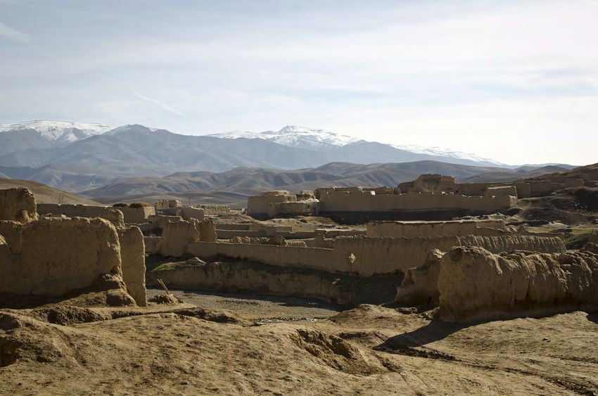
Page 2
FORWARD
Climate change is real. I invite anyone who may still doubt this to In the lead up to the 22nd session of the Conference of Parties to
visit Afghanistan, and witness first-hand the alarming melting of the the United Nations Framework Convention on Climate Change
Pamir/Hindu Kush glaciers in the country’s north-east. Afghanistan (UNFCCC), the Islamic Republic of Afghanistan together with the
has already been, and will continue to be, heavily affected by the World Food Programme (WFP) and the UN Environment Pro-
negative impacts of climate change. And it is the most vulnerable gramme (UNEP) has prepared this technical report, “Climate
people—particularly subsistence farmers and pastoralists who de- Change in Afghanistan: What Does it Mean For Rural Livelihoods
pend on natural resources for their survival – who are suffering and Food Security?”
most.
It is my great pleasure to launch this report and I look forward to
Recognizing this, the Islamic Republic of Afghanistan has made seeing it being used, and referenced in the coming years. There is
many notable achievements towards addressing climate change a lot of work to do for Afghanistan to be able to adapt and re-
over the past decade. At the national level, Afghanistan has suc- spond on climate action, and these technical reports and detailed
cessfully developed a number of policies and plans that target its scientific analyses help immensely in enabling better responses,
most urgent climate change priorities and needs, including the Na- and ultimately providing support to our people for a better life.
tional Adaptation Programme of Action (NAPA), as well as effec-
tively mainstreamed climate change issues into a number of existing
governance mechanisms. And, at the local level, Afghanistan’s many
institutions and partners are working directly with communities and
civil society groups to build grassroots adaptive capacity. Mostapha Zaher
More recently, at the Paris Climate Conference (COP21) held in Director General
December 2015, the Islamic Republic of Afghanistan committed to Member of the Cabinet
pursuing a Low Emission Development (LED) path as part of its
Member of the Council of Ministers
global commitment to limiting greenhouse gas emissions. This com-
mitment is all the more noteworthy considering the many competing National Environmental Protection Agency
development needs and challenges facing Afghanistan today, as
well as the country’s high level of vulnerability to the adverse im-
pacts of climate change.
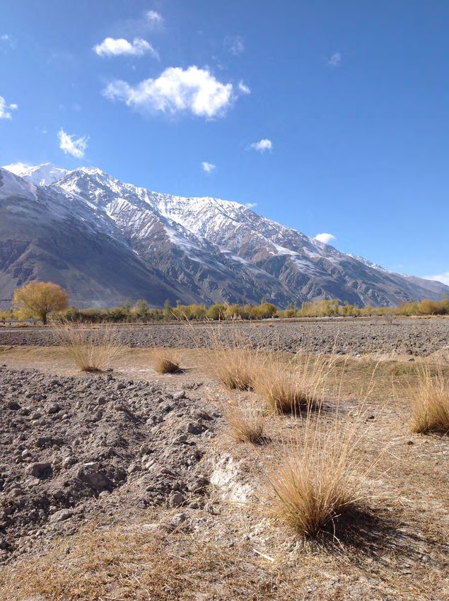
Photo: NEPA/ Mostapha Zaher/ Wakhan District, Badakhshan
Page 3
EXECUTIVE SUMMARY
Climate change in Afghanistan is not an uncertain, “potential” future              We focus on the four climate hazards which pose the largest risk to
risk but a very real, present threat— whose impacts have already                   livelihoods in Afghanistan: drought caused by reduced spring rain-
been felt by millions of farmers and pastoralists across the country.              fall, drought caused by declining river flows due to reduced spring-
In this report, we show how drought and flood risks have changed                   time snowmelt in the highlands, floods caused by increased heavy
over the past thirty years, and what impact this has had on rural                  spring rainfall, and riverine floods caused by heavier and faster
livelihoods and food security in the country. The aim is to inform na-             upstream snowmelt in the highlands.
tional-level prioritization of areas and livelihoods groups for climate
                                                                                   For each of these four hazards, we mapped out where it had be-
change adaptation and disaster risk reduction programmes.
                                                                                   come more severe over the past thirty years, as well as where live-
The poorest people—particularly subsistence farmers and pastoral-                  lihoods were most sensitive to it. We then overlaid these two maps
ists who are often already living on marginal land—are also those                  to highlight “hotspot areas” —i.e. livelihood zones where each of
who suffer most from climate change. Yet it is difficult to get an                 these hazards has had the largest impact on livelihoods and food
overall, national-level understanding of where the impact of climate               security, over the past thirty years. Results are shown on the page
change on food security and livelihoods are most worrying and                      opposite.
need to be addressed most urgently.
                                                                                   We also use climate models to look at how the risk associated with
Climate analyses tend to show which areas have seen—or are ex-                     these four hazards is expected to change in the next thirty years—
pected to see—the biggest change in rainfall, temperature or other                 keeping in mind the high level of uncertainty associated with such
physical climate parameters. However, such climate information on                  climate projections.
its own tells us little about what impact these changes will actually
have on poverty and food security —as this depends on what liveli-
hoods people depend on for food and income.
The guiding question for this analysis was therefore not “where have
droughts or floods become more frequent and severe?”, but rather
“where has the impact of droughts and floods on livelihoods—and
ultimately food security—been most severe?” To answer this ques-
tion, we combine climate information with livelihood zoning to obtain
an overview of which areas and population groups are most vulner-
able to climate change.

                                                                          Page 4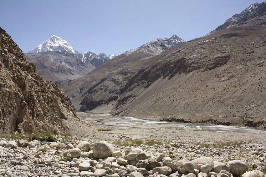
While the climatic risk of rainfall-related drought has
DROUGHT                                                                          increased over the past thirty years across most of the
                                                                                 country, the main areas of concern in terms of negative
                                                                               impacts on food security are concentrated in the north and
                                                                               parts of the Central Highlands. These are areas where the
                                                                               dominant livelihoods—rainfed farming and pastoralism—
                                                                               are highly dependent on rainfall, and where the observed
                                                                                decline in spring rainfall therefore has a direct impact on
                                                                                  households’ ability to produce food and earn income.

                                              The occurrence of snowmelt-related drought—caused
                                               by reduced winter snowfall in parts of the Hindu Kush
                                             mountains— seems to have primarily affected Kabul and
                                               surrounding regions. These densely populated areas,
                                               which produce much of the country’s vegetables, fruits
                                             and cereals —are heavily dependent on irrigation from
                                              the Kabul river and its tributaries, which are partly fed
                                                         by snowmelt from the Hindu Kush.

FLOODS
 Negative impacts of floods caused by
  heavy spring rainfall have been felt
  across a range of different livelihood
  zones – from the mountainous areas in
the north-east and centre of the country,
                                                                                                     Direct impacts of riverine floods
   to the hilly border areas in the south-
                                                                                                     caused by increased spring snow-
 east, all the way down to the flat, arid
                                                                                                     melt in the spring seem to be con-
    southern provinces. These are zones
                                                                                                     centrated along rivers in the eastern
 where heavy precipitation events have
                                                                                                     part of the Helmand river basin—
increased by 10 to 25% in the past thir-
                                                                                                     where increased risk of snowmelt–
    ty years, and where livelihoods are
                                                                                                     related floods overlaps with high
dominated by agriculture and pastoral-
                                                                                                     livelihood vulnerability to flooding.
  ism—both highly sensitive to flooding.

                                                     Page 5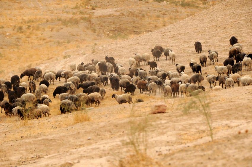
40

     Floods
     Rainfall flood| Snowmelt flood|
     Droughts
28

     Rainfall drought | Snowmelt drought|
24

     Food Security

                                              Page 6
14
     Livelihoods
10   Methodology
     Hazard analysis| Livelihood

                                   CONTENTS
     vulnerability | Hotspot
     Introduction

8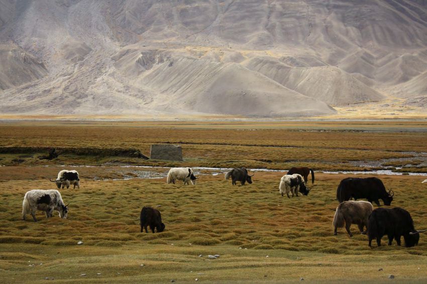
ACKNOWLEDGEMENTS
                                                                                            This report was produced jointly by the World Food Programme
                                                                                            (WFP), the United Nations Environment Programme (UNEP) and
                                                                                            Afghanistan’s National Environmental Protection Agency (NEPA).

                                                                                            The authors would like to thank FEWSNET, who produced the
                                                                                            livelihood zones and profiles used in this report, under their
                                                                                            Livelihood Zones Zoning “Plus” Activity.

                                                                                            The production of this report has been made possible through the
                                                                                            generous contribution of the Government of Sweden through the
                                                                                            C-ADAPT initiative. The Climate Adaptation Management and

50                        58                                          70                    Innovation Initiative (C-ADAPT) is a strategic global initiative that
                                                                                            aims to strengthen the capacity of WFP and partners to deliver
                                                                                            climate services to the most vulnerable and food insecure
                                                                                            communities and build resilience to climate-related risks through
                                                                                            effective climate risk analysis, adaptation planning, and risk
Future climate risks

                                                                      References
                       analysis| 3. Climate projections
                       1. Reference maps| 2. Past Climate
                                                            Annexes

                                                                                            management. C-ADAPT is funded by the Government of
                                                                                            Sweden’s fast-track climate finance.

                                                                                            Published November 2016.

                                                                                   Page 7
INTRODUCTION
Afghanistan’s government has warned that climate change is putting “the foundation
of the country’s economy, stability, and food security under threat”1. Yet the very real
risk posed by climate change to Afghanistan's development is usually overshadowed
by the more immediate and visible concerns around conflict and economic crisis. This
general perception of climate change as a secondary priority suggests that it is still
misconceived as a purely technical, environmental problem—somehow distinct from
socio-economic concerns.
Climate change does not occur in a vacuum: its impacts are intrinsically linked to the
economic and security concerns which are at the top of the government’s priorities.
Climate change will make it extremely challenging to maintain—let alone increase—
any economic and development gains achieved so far in Afghanistan. Increasingly
frequent and severe droughts and floods, accelerated desertification, and decreasing
water flows in the country’s glacier-dependent rivers will all directly affect rural live-
lihoods—and therefore the national economy and the country’s ability to feed itself. It
is now widely acknowledged that “large parts of the [country’s] agricultural economy
will become marginal without significant investment in water management and irriga-
tion.”1 Given the importance of agriculture to Afghanistan’s economy and food securi-
ty— agriculture is a source of income for 61% of the country’s 29.1 million people,
and accounts for 44% of employment (self-employed or salaried)2— this could in-
crease both the number of food insecure people, and the severity of food insecurity
(from transient/ seasonal to chronic, and from moderate to acute).
As conventional crops becomes less and less viable in some areas due to drought and
desertification, rural populations will increasingly be driven to alternative livelihood
options—including the production of less water-intensive poppy and, potentially, in-
surgency. The question of whether and how conflict and climate change are linked is
still hotly debated. However, there is growing empirical evidence that while climate
disasters are rarely the primary trigger for conflict outbreaks, they can exacerbate
existing societal tensions—significantly enhancing the risk that a volatile situation will
break out in conflict, or that a conflict which might otherwise have subsided will per-
sist. A recent study found that the link between climate disasters and conflict was par-
ticularly strong in ethnically divided countries, and was stronger for droughts and
heatwaves than for floods.3

                                      Photos: WFP/ Diego Fernandez/ Mazar-e-Sharif
                                                                                  Page 8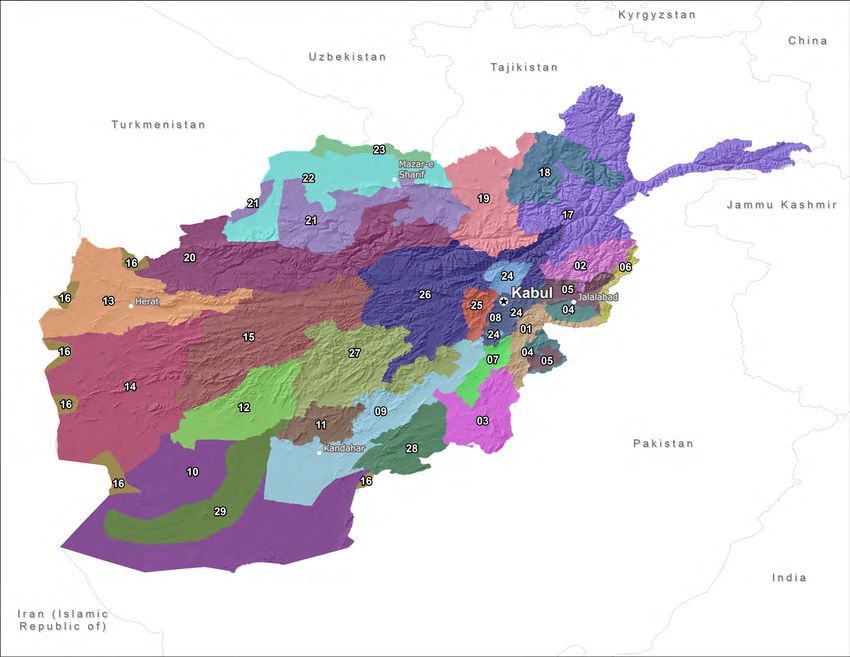
In Afghanistan specifically, some studies have linked reduced rainfall or irrigation flows
in some areas with increased poppy production —which could in turn have helped fi-
nance and fuel the insurgency in the area.4
From a development and humanitarian perspective, climate change most directly and
heavily affects the poorest people—particularly subsistence farmers and pastoralists
who are already living on marginal land. The first step in helping Afghanistan's most
vulnerable people to cope with and adapt to climate change is therefore understand-
ing which areas and livelihoods are being most severely affected. This study is an at-
tempt to better understand how climate hazards impact people—not just geographic
areas. In other words, the aim is to go beyond simply showing which areas are highly
prone to drought or floods, and instead to highlight how these shocks actually affect
the people living in those areas—based on their livelihoods.
The guiding question was therefore not “where have droughts or floods become more
frequent and severe?”, but rather “where has the impact of droughts and floods on
livelihoods—and ultimately food security—increased most?” This helps bridge the gap
between the field of disaster risk reduction (which traditionally focuses on the physical
occurrence of climate hazards) and that of livelihoods and food security analysis (which
focuses on what people do for a living and how they obtain their food), in order to
understand how specific climate risks impact the most vulnerable people.
Climate change in Afghanistan is not an uncertain, “potential” future concern, but a
very real, present challenge— whose impacts have already been felt for years by
millions of farmers and pastoralists across the country. This report seeks to highlight this
by focusing primarily on changes that have already occurred in Afghanistan's climate
over the past thirty years. However, we do present an overview of future risks un-
der projected climate change in the last section. Despite the inherent uncertain-
ties associated with climate projections, they help shed light on how the impacts
on livelihoods that have already been observed might be exacerbated (or alle-
viated) in the future.

1 Islamic Republic of Afghanistan (2015) Intended Nationally Determined Contribution,
Submission to the UNFCCC.
2 Central Statistics Organization (2016). ALCS 2013-14.
3 Schleussner, C. et al. (2016) Armed-conflict risks enhanced by climate-related disas-

ters in ethnically fractionalized countries.
4 Parenti, C. (2015) Flower of War: An Environmental History of Opium Poppy in Af-

ghanistan. SAIS Review of International Affairs.

  Page 9
METHODOLOGY
Livelihood zones—rather than administrative units such as provinces             The second step in the analysis is therefore to identify livelihood zones
and districts—are the key analytical unit used in this study. A liveli-         which are most vulnerable to this type of hazard — i.e. zones where,
hood zone is an area within which people broadly practice the same              were this hazard to occur, it would have the largest negative impact
type of activities to obtain food and income. The livelihood zones              on people’s ability to grow food and earn income (livelihood vulner-
used here (see p.14) were developed by FEWSNet in 2011, in con-                 ability).
sultation with the Afghan government and development partners.
                                                                                We then overlay these two maps to identify “hotspot areas” of con-
This report is structured around the four climate hazards with the              cern in terms of food security—i.e. livelihood zones where this hazard
largest impact on food security in Afghanistan: drought caused by               has not only been occurring more frequently/ intensely over the past
localized lack of rainfall; drought in irrigated areas caused by re-            few decades, but where people’s livelihoods have also been most se-
duced snowmelt in upland areas; floods caused by localized heavy                verely affected.
rainfall; and riverine floods caused by rapid snowmelt in the spring.
While the report does include a section on how Afghanistan’s climate
is projected to change under future climate change (p. 50-57) it
mostly focuses on how climate hazards have already changed over
the past decades.

For each of the four hazards listed above, we start by identifying the
livelihood zones where this hazard has become more frequent and
more severe over the past thirty years (hazard analysis). While this
tells us whether a given area is prone to a particular hazard, it says
little about whether that hazard actually has a significant impact on
the livelihoods of people living there. For example, an area could be
very prone to drought, but the dominant livelihood activities might not
be particularly vulnerable to drought (manufacturing or handicrafts,
for example).

Looking at hazard data on its own, with no contextual livelihood in-
formation, might therefore be misleading when it comes to identifying
and prioritizing areas for development or humanitarian support.
                                                                                            Photo (opposite) : WFP/ Diego Fernandez/ Nahr-e-Shahi , Balkh
                                                                          Page 10
HAZARD ANALYSIS
This report looks at four types of climate hazards—distinguishing be- days per year, winter precipitation, and spring temperatures in the
tween two types of drought and floods because they are caused by Central Highlands, Hindu Kush and Pamir mountains.
different climate variables and affect different areas and livelihood
Most of the climate data used in the report was produced by UNEP
groups:
and NEPA using a combination of climate observations and regional
(1) Drought caused by localized lack of spring rainfall , with the climate models:
highest impact on rainfed agriculture and pastoral areas;
Past climate data was produced through reanalysis—a method
(2) Drought caused by reduced snowmelt in upland areas in spring which combines climate models with observations (satellite and rain
and summer, mostly affecting downstream irrigated areas;
station data). This method was selected due to the scarcity of his-
(3) Floods caused by localized heavy spring rainfall, affecting all torical climate observations for Afghanistan before the start of sat-
livelihood zones;
ellite observations in the 1980s, which would make an analysis
(4) Floods caused by increased snowmelt in highland areas during based solely on observations unreliable. To quantify change in cli-
the spring and summer, mostly affecting downstream agricultural
mate trends, we looked at how much each climate indicator (spring
livelihood zones, particularly areas located along rivers.
rainfall, heavy rainfall, temperature etc.) had changed between
To understand how the occurrence of droughts and floods has the period 1950−1980 and the period 1981−2010 .
changed over the past few decades, we use a combination of differ-
ent climate indicators : Future climate projections were done using CORDEX South Asia
models. Analysis was done for the period 2021-2050 (compared
For drought and flood caused by too little or too much rain, we to the base period 1976−2005), for a moderately optimistic emis-
look at changes in spring precipitation, heavy precipitation events
sions scenario (RCP4.5) which assumes that both global greenhouse
and evapotranspiration.
gas emissions and global average temperatures will continue to
For drought and flood caused by too little or too much snowmelt in increase until 2040, and then plateau thereafter (see Annex 3 for
upstream mountain areas, we look at changes in number of snow details).
Page 11LIVELIHOOD VULNERABILITY TO CLIMATE HAZARDS
The second step in the analysis, after hazards analysis, is assessing information on livelihoods was used for this: the climate change vul-
the vulnerability of each livelihood zone to each of these four haz- nerability matrix in Afghanistan’s National Adaptation Programme of
ards. In other words, for each livelihood zone, we asked the question: Action (NAPA, 2009), the 2013/14 Afghan Living Conditions Survey
how severely are people’s access to food and income impacted by (ALCS), FEWSNet’s Livelihood Zoning “Plus” report (2011), and the
each of these hazards? Livelihood activities are not all equally vulner- provincial Seasonal Livelihoods Programming (SLP) consultations car-
able to climate factors, with agriculture and livestock activities consid- ried out by WFP and partners in 2013. Because most livelihood zones
ered more vulnerable to climate hazards than trade and cross-border include several livelihood activities, our vulnerability classification was
labor migration. Furthermore, a given activity might not be equally based on the dominant activity practiced by the majority of house-
vulnerable to different climate hazards. For example, timber harvest- holds, focusing on the most vulnerable.
ing might be highly vulnerable to drought but only moderately vulner- Again, a zone’s vulnerability to a particular climate hazard does not
able to floods; rainfed crop production might be highly vulnerable to tell us whether people are in fact exposed to that hazard—it simply
localized drought caused by lack of rainfall, but not vulnerable to tells us that livelihoods in that zone would be heavily impacted by
drought caused by reduced availability of snowmelt water for irriga- that hazard if it did occur. For example, a livelihood zone could be
tion. highly vulnerable to drought because most households rely on rainfed
For each of the four climate hazards, we therefore identified the live- cereal production, but have low hazard risk (i.e. the frequency and
lihood zones most vulnerable to that hazard, in order to highlight intensity of droughts has not increased) —in which case it would not
hotspot areas where each hazard could potentially cause the largest be considered a hotspot in terms of food security.
impact on food security and livelihoods. Various sources of
Photo: WFP/ Diego Fernandez/ Mazar-e-Sharif, Balkh
Page 12IMPACTS ON FOOD SECURITY:
HOTSPOT AREAS
Finally, to identify the areas where climate hazards
have most impacted livelihoods in the past thirty years,
we overlay the hazard and the livelihood vulnerabil-
ity maps.
We then use data on food security trends between
2007 and 2014 (see p. 24) to identify areas which sim-
ultaneously have high levels of food insecurity and
where climate risks have particularly high impacts on
livelihoods. While food insecurity in Afghanistan is obvi-
ously driven by many non-climatic factors, this allows us
to highlight areas where reducing climatic risks could
significantly improve food security— even if other driv-
ers such as conflict or remoteness remain.
Photo: WFP/ Challiss McDonough/ Dega Payan, Badakhshan
Page 13LIVELIHOODS
CENTRAL HIGHLANDS
Livelihood zoning map, developed by FEWSNet with the Afghan government
and development partners as part of the Livelihood Zoning “Plus” Exercise
(2011). These livelihood zones—rather than administrative units such as
provinces or districts—are the analytical unit used in this study. Each zone
is linked to a detailed livelihood profile, which describes the key livelihood
activities in that zone (and when they take place throughout the year), the
types and sources of food and income, the key shocks and hazards, and the
level of access/ reliance on markets.
Page 14Livelihood Zones
1 Eastern mixed agriculture and forest zone A livelihood zone is an area within which people broadly practice
2 Eastern agro-pastoral and forest zone the same type of activities to obtain food and income. The physical
3 South-eastern high migration, forest products, and livestock environment—climate, topography, access to water, soil fertility—
4 Eastern semi-arid agricultural is an important determinant of livelihood zones, as it influences the
5 Eastern intensive irrigated agriculture type of natural resources available to people (forest products, pas-
6 Eastern cross-border trade and labor tures etc.), the crops they can grow, or the type of livestock they
Eastern deep-well irrigated agriculture
can keep. Having said that, environmental and climatic factors do
7
Kabul and Logar irrigated agriculture not single-handedly explain the variations in livelihoods across Af-
8
9 Southern intensively irrigated vegetable and orchards ghanistan: conflict, agricultural technology and techniques,
Southern semi-arid pastoral transport, access to markets, poppy eradication campaigns, and
10
Northern Kandahar rain-fed agriculture and livestock proximity to borders all play a key role in determining how people
11
12 South-central agro-pastoral obtain income and food.
13 Western intensively irrigated agriculture zone
Livelihood zones allow us to understand broad differences—at the
14 Western semi-arid agro-pastoral zone
national level—in how households make a living. In the context of
15 West-central highland agro-pastoral zone
this study specifically, they provide key insight in how climate haz-
16 Western and southern cross-border trade and livestock
ards can have different impacts on food security throughout the
17 North-eastern highland agro-pastoral zone
country, depending on what activities households practice.
18 Takhar-Badakshan mixed agriculture zone
19 Kunduz-Baghlan mixed agriculture zone
Of course, the degree to which a particular livelihood zone is neg-
20 Northwestern agro-pastoral zone
atively impacted by floods (for example) will depend not only on
21 Northern rain-fed mixed farming zone
the magnitude of the floods and on how vulnerable livelihoods in
22 Northern intensively irrigated agriculture zone
that area are to floods, but also on poverty levels, conflict, access
23 Amo river irrigated cereals and oilseeds zone
to additional farming inputs or assistance, amongst other things. This
24 East-central vineyard, cereal and horticulture zone
study, however, focuses on the link between climate and livelihoods,
25 East-central orchard and agriculture zone
to provide a “baseline” picture into which other socio-economic/
26 East-central mountainous agro-pastoral zone
political considerations can be factored in.
27 South-central mountain wheat, dried fruit and livestock zone
28 South-eastern Zabul rain-fed cereals and orchard zone
29 Helmand intensively irrigated wheat and cash crop zone
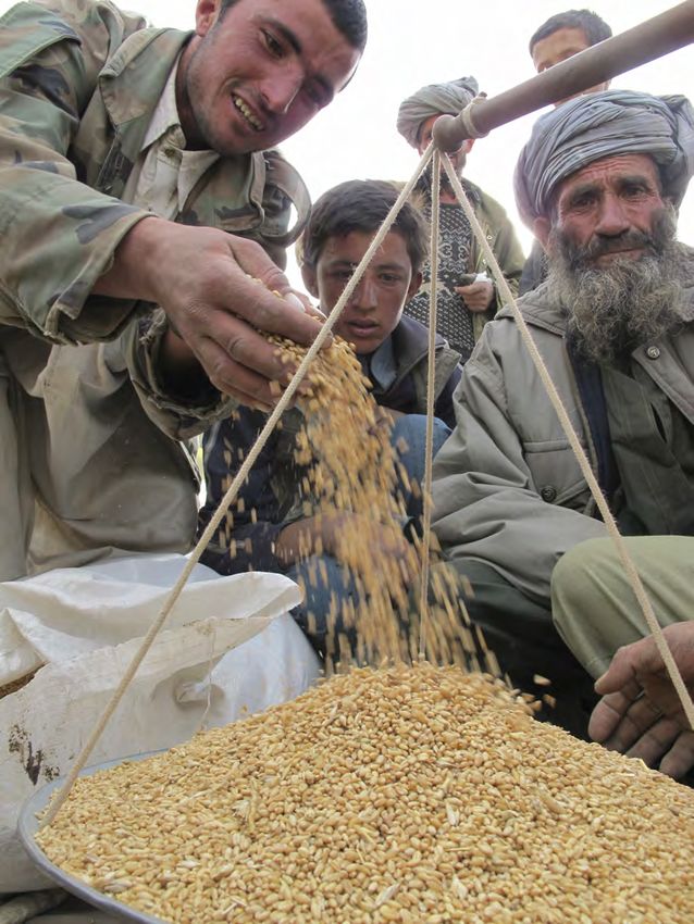
Page 15Livelihoods in Afghanistan are heavily based on farming and live- While the relative importance of agriculture will likely decline with
stock, which together account for about 45% of the active population, economic development, the sector is expected to increase in absolute
and are a source of income for over 60% of all households (and the size, and is the government’s main focus for economic recovery and
primary source of income for 28% of households). 1 poverty reduction.2
Notable exceptions are areas along the border with Iran and Paki-
stan—where cross-border trade and migration dominate– and in ur-
ban areas (which account for about a quarter of the population) 1.
1Afghanistan Living Conditions Survey (ALCS) 2013/14. Photos: (above) WFP/ Djaounsede Pardon; (opposite) UNEP/ Alec Knuerr/
2 NationalEnvironmental Protection Agency (2015) Afghanistan Initial Na- Wakhan, Badakhshan: Amu Darya river separating Afghanistan (left) from
tional Communication to the UNFCCC Tajikistan (right).
Page 16FARMERS produced in irrigated areas1. Rivers and streams are by far the domi-
nant source of irrigation, feeding an estimated 86% of irrigated are-
Wheat is by far the most important crop produced in all areas, as, followed by springs (7% ) and the traditional gravity flow system
though its relative importance is higher in rainfed than in irrigated known as karez (6%). Wells are not a significant source of irrigation
areas—where other crops are much more common (particularly fod- (less than 1% of irrigated areas), though their number and capacity
der crops, potatoes, maize, sorghum, fruits and vegetables). has been increasing due to greater use of modern drilling and pump-
ing technologies1.
Although the lands under rainfed and irrigated cultivation are roughly
the same in terms of geographic area, irrigated farming plays a
larger role in livelihoods and food production: about 36% of all
households have access to irrigated land, compared to 16% of 1 Ministryof Irrigation, Water Resources and Environment (2004): Watershed
households having access to rainfed land, and 80% of all cereals are Atlas of Afghanistan; Afghanistan Research and Evaluation UNIT (AREU)
(2008): How the water flows: a typology of irrigation systems in Afghanistan.
Page 17A distinctive feature of Afghanistan is that irrigation water flows de- east, are also affected by summer monsoon rainfall, and therefore
pend not just on rainfall, but also to a large extent on snow and glacier have two peak discharge seasons: one in the spring, and the other in
melt. Discharge of snowfed rivers tends to peak in the spring when the the summer 1.
snow melts in lower elevation areas, while discharge of glacier-fed riv-
1 Ministry of Irrigation, Water Resources and Environment (2004): Watershed
ers peaks in the summer, when higher elevation areas with permanent
Atlas of Afghanistan; Afghanistan Research and Evaluation UNIT (AREU)
snow cover and glaciers start to melt. (2008): How the water flows: a typology of irrigation systems in Afghanistan.
Some snow-fed rivers, such as the Gomal and Shamal rivers in the south
Photo: UNEP/ Alec Knuerr/ Glacial waters in Badakhshan
Page 18One often overlooked impact of climate change on food security is its im-
pacts on the length of the growing season: shorter growing seasons in
rainfed areas means that only one major crop can be harvested per year,
instead of two. Cropping intensity—or the ability to grow more than one
crop per year, is an important determinant of rural food security.
In Afghanistan, the growing season has gotten longer in much of the coun-
try over the past thirty years, due to warmer spring and fall tempera-
tures—particularly across a band stretching from Herat in the west to
Zabul in the south east. A notable exception is the pocket around
Nangarhar and Laghman in the north-east, where the growing season has
gotten shorter. Not surprisingly, this corresponds to an area where there
has been no increase in temperature (map p. 67).
However, the longer growing season in the west and south-east may not
have necessarily translated in increased in agricultural productivity, as it Change in growing season length1 (difference between 1950−1980 and
was accompanied by a decrease in spring rainfall over the same time pe-
1981−2010). Data from UNEP and NEPA.
riod (map p. 64)—meaning that crop growth could have been impeded
> 10 days longer 5– 10 days longer 0 to 5 days shorter
by lack of rain, despite adequate temperatures.
10– 15 days longer 0-5 days longer > 5 days shorter
1 Growing Season Length (GSL) is a standard index defined by the World
Meteorological Organization (WMO), which counts the days between the
first span of at least six days with daily mean temperature above 5°C and
the first span after July 1st of six days with mean temperature below 5°C, in
a given year (based on assumption that crops don’t grow below 5°C).
Vegetation maximum development (NDVI), 2001-2014. Map by WFP,
using data from Modis/ Terra 250mt.
Bare soil Highly vegetated
Page 19PASTORALISTS AND AGRO-PASTORALISTS
Livestock is also a key source of income and food for many households, either as a
supplement to farming, or as the main livelihood—especially for the nomadic pas-
toral Kuchis. Over 45% of the country’s total land mass is estimated to be under
permanent pasture (almost four times the area covered by arable land)1.
Kuchis, which represent an estimated 5.2% of the population (1.6 million people)2,
were traditionally all nomadic and entirely dependent on livestock—particularly
goats and sheep, as well as camels. Over the past decades, however, many Kuchis
have been forced to sedentarize and seek unskilled work on the outskirts of cities,
due to a combination of conflict over grazing areas, prolonged drought, security,
and unfavorable economic trends3. Nevertheless, most Kuchis remain highly de-
pendent on livestock, with almost 70% of active Kuchis employed in the livestock
sector in 20142 —and as such are one of the groups most vulnerable to rainfall-
related droughts, which have become more frequent in the southern arid range-
lands where many Kuchis spend the winter.
Because Kuchis have traditionally migrated from one area to another rather than
settled in any one place, there is no specific “Kuchi livelihood zone” in the livelihood
zoning used here. However, pastoral and agro-pasoral zones (mostly concentrated
in the country’s arid south and in the Central Highlands), are considered important
Kuchi areas. Rainfall-related drought is therefore of particular concern in these are-
as, given that Kuchis are already amongst the country’s most food insecure and
marginalized population, and given how much their income and food depend on
good pasture conditions.
1 Afghanistan National Risk and Vulnerability Assessment (NRVA) 2011/12.
2 Afghanistan Living Conditions Survey (ALCS) 2013/14. Photos: WFP/ Diego Fernandez/ Mazar-e-Sharif , Balkh (above);
3 Afghanistan Analyst Network (2013). The Social Wandering of the Afghan Kuchis.
Challiss McDonough/ Sarhad-e-Broghil , Wakhan (opposite).
Page 20Page 21
WOMEN’S LIVELIHOODS1
Unemployment and underemployment are a major issue in Afghanistan—
85% of working-age women are inactive or under/
affecting close to 40% of the total working-age population. Women
unemployed (compared to 47% of working-age men)
are particularly affected: over half of women who are of working age
and seeking employment are either underemployed or unable to find a Un/under Employed
job at all (1.1 million people). This is in addition to the 71% of women Inactive and not seeking employment (71%) employed
(14%) (14%)
(5.4 million) of working age who are inactive and not seeking employ-
ment. This means that 85% of the female working-age population (6.5
Of the 28% of
million people) is either unemployed, underemployed or inactive. This women seeking
compares with 47% of working-age men. employment, only
half are fully em-
Trends in women’s employment are worrying. Between 2007 and 2013, ployed
the female unemployment rate almost doubled, in both urban and ru-
ral areas. Interestingly however, the inactivity rates over the same period Figure 1: Employment profile of the working-age female population in Afghanistan.
have followed opposite trends in urban and rural areas—possibly due to
different evolutions of the socio-cultural and security contexts in urban
and rural areas. In rural areas, female inactivity has increased in tandem Of the 1.3 million women who are employed (fully or partially), the vast ma-
with unemployment (going from about 50% to 70%); in urban areas, on jority (73%) are engaged in unpaid family work. In terms of sector of em-
the other hand, inactivity rates actually decreased slightly (going from ployment, livestock production dominates, accounting for 42% of employed
81% to 78%). women. Manufacturing (24%) and farming (21%) are the next most important
sources of employment. Women’s employment rates varies significantly be-
This suggests that active women (i.e. who are employed or seeking em-
tween urban, rural, and Kuchi (nomadic pastoral) populations, being signifi-
ployment) are finding it harder to find a job in both urban and rural
cantly higher among Kuchi women (close to 50%) than rural women (about
areas. However, the number of women who actually want to work is in-
30%) and urban women (about 20%).
creasing in urban areas but decreasing in rural areas. This likely reflects
the fact that working is becoming more and more socially accepted for Unlike men, women rarely migrate internally or emigrate abroad for work
women in cities, but less accepted—and less safe—for women in ru- (77% of internal migrants and 94% of those who emigrate abroad are men).
ral areas. The few women who do migrate or emigrate usually do so for marriage or to
join family members, rather than to seek work.
Inactivity amongst men in rural areas has also increased over the same
period, but much less—reinforcing the idea that this increased inactivity Another major difference with men is that women’s employment does not
amongst rural women is primarily driven by increased social conservatism vary much across age groups: within the 14—60 years of age working-age
and security concerns—rather than purely by the country’s general eco- bracket, women’s employment goes from 29% for girls aged 14, to 33% for
nomic situation. women aged 45-49. In contrast, men’s employment rates within this same
working-age bracket varies vastly—going from a low of 50% for boys aged
14, and peaking at almost 100% for men aged 30-49.
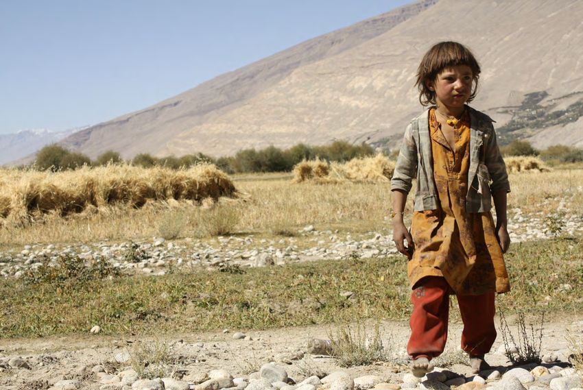
1 All data in this section from ALCS 2013/14. Photo (opposite): WFP/ Silke Buhr/ Shash Pul valley, Bamyan
Page 22Page 23
FOOD SECURITY AND CLIMATE

                                                                                                                     Recurrence of food insecurity above 30%:

                                                                                                                         Low          Medium        High

Food security trends over the past seven years: recurrence of food insecurity above 30%, 2007—2014. Note that although livelihood zones are used as the
analytical unit for the rest of this study, we look at food insecurity by district, because food insecurity in Afghanistan depends on a wide variety of factors that
are not linked to livelihoods – including conflict, access to markets, and food prices in local markets. Some districts belonging to the same livelihood zone there-
fore have vastly different levels of food insecurity, so aggregating results by broad livelihood zone would be misleading. Because of this difference in analytical
units, the food security information presented here is used only to contextualize the results of the analysis, but is not actually overlaid in any of the final
“hotspot” maps. Analysis and map done by WFP in 2016 as part of the Integrated Context Analysis (ICA).

Data source: NRVA 2007/08, NRVA 2011/12, ALCS 2014.                                                  Photo (opposite): UNEP/ Alec Knuerr/ Ishkashem, Badakhshan
                                                                              Page 24
Page 25
Because this report seeks to highlight the impact of climate risks on                This means that even though households purchase most of their food, rural
food security and livelihoods, it focuses on rural areas, and on the two             livelihoods and food security are still closely linked with climatic factors —
underlying factors of food security which are directly affected by cli-              since the amount of daily agricultural labor available throughout the year
mate conditions: local agricultural production and household in-                     depends in large part on agricultural conditions (favorable planting condi-
come. It does not explore the myriad other factors which influence                   tions and good harvest).
food security in Afghanistan, notably conflict, food imports, access to
markets, and food prices.1

In rural Afghanistan, agricultural production and household income are
closely linked. Indeed, the majority of rural households’ income is de-
rived from agricultural production – either from the sale of their own
production (for those who own land), or from wages (for those who
work as daily laborers on other people’s land). Household income is a
major determinant of food security, given that both rural and urban
households tend to rely much more on markets than on their own pro-
duction for food.

Because cereals (particularly wheat) are the main staples in the Af-
ghan diet, the source of cereals consumed is used as an indicator of
where households mainly obtain their food from. The latest data sug-                 Figure 2: Share of purchases in total household cereal consumption, by location
gests that 76% of all households purchase most of the cereals con-                   and food security status (Data from ALCS 2013/14).
sumed by their household, with the remaining 23% relying mostly on
home-produced cereals. Not surprisingly, almost all urban households
(97%) buy the majority of their cereals2. However, purchases are also
extremely important among rural households—73% of which buy
most of their cereals.

Importantly, food insecure households are most dependent on markets:
in rural areas, 80% of severely food insecure households buy most of                 1 The impact of climate risks on prices are, to some extent, implicitly ad-
their food, compared to only 66% of food secure households2. This                    dressed, as climate-related decreases in local production will obviously
particularly high reliance on market purchases among food insecure                   affect prices in that area, thereby impacting households’ access to food.
                                                                                     However, prices in any given area depend not just on local production,
rural households largely reflects the fact that they are often either                but also production in other parts of the country and in neighboring coun-
landless or own too little land to produce enough food for the whole                 tries – especially in Afghanistan’s main import trading partners, Pakistan,
year. As a result, poorer households usually work as daily agricultural              China, Iran and India.
laborers for at least part of the year, and are paid either in cash or
                                                                                     2 Afghanistan   Living Conditions Survey (ALCS) 2013/14.
in-kind, through a sharecropping system known as dekhani.
                                                                                     Photo (opposite): WFP/ Teresa Ha/ Mazar-e-Sharif, Balkh

                                                                           Page 26
Page 27
DROUGHT
This report distinguishes between two types of drought:
localized drought caused by lack of rainfall, and
drought caused by reduced river discharge due to re-
duced snowmelt in upland areas in spring and summer.
This distinction is important because these two types of
drought do not have the same climatic causes and do not
necessarily affect the same areas.
The first type of drought is caused by localized lack of
rainfall during the rainy season, and has a particularly
strong impact on rainfed agricultural areas; the second
type is caused by less winter snowfall in the mountains,
resulting in less snowmelt in the spring and reduced river
or karrez flows downstream.
Some areas are affected by both types of drought,
sometimes during the same year.

Photo (opposite): WFP/ Teresa Ha/ Khram wa Sarbagh , Samangan.
Food distribution as part of a WFP emergency food-for-assets project
implemented following the lack of rain and snow during the 2010-11
winter. The resulting drought conditions caused a significant reduction of
the wheat harvest, leaving 2.86 million people in need food assistance, in
areas that were already chronically food insecure.
                                                                             Page 28
Page 29
LOCALIZED DROUGHT DUE TO LACK OF RAINFALL
      Spring rainfall has decreased across most of the
      country’s north and center—as well as pockets
      along the western border with Iran.

                                                                                      18

                                     20
HAZARD1

                       13

                                                                                                Some livelihood zones (13, 16, 18 and
                                                                                                20) have also seen a decrease in
                                                                                                Standardized Precipitation Evapotran-
                         16                                                                     spiration Index (SPEI)2 —in addition to
                                                                                                the decrease in spring precipitation—
                                                                                                and have therefore likely been particu-
                                                                                                larly affected by increased rainfall-
                                                                                                related drought risk.

                                                              1 SeeAnnex 2 (p. 62-67) for the historical climate data used to create all the
                                                              hazard maps in the report.
                                                              2 TheSPEI is a measure of drought (calculated over a 12 months period), which
                                                              captures both precipitation and potential evapotranspiration levels.

                                                         Page 30
Livelihood zones considered most
vulnerable to rainfall-related
drought are those relying on rainfed
agriculture (particularly cereal pro-
duction) and pastoralism.
LIVELIHOOD VULNERABILITY
4
Livelihood zones dominated by irri-
14 gated agriculture or poppy produc-
tion — both rainfed and irrigated
(LZ 4, 10, 11, 14 and 29) — are
11 considered moderately vulnerable.
29
Livelihood zones dominated by non-
10 agricultural activities—including timber
harvesting, cross-border trade, cross-
border labor migration, and handicrafts—
are considered least vulnerable.
Rainfed-dominated areas (Data from AMIS)
Page 31Over the past thirty years, the impact of in-
creased rainfall-related drought risk on food se-
curity and livelihoods has been most severe in
the north and center of the country. These are
IMPACTS ON LIVELIHOODS— HOTSPOT AREAS
areas where the decline in spring rainfall (areas
in blue on the map p. 30) overlaps with high
livelihood vulnerability to lack of rainfall (i.e.
19 18
livelihood zones dominated by rainfed agricul-
ture or pastoralism, in dark yellow on p.31)
17
21
20
26
1
15
Page 32Low-productivity rainfed mixed farming zones (18 and 21), which
stretch across the north through parts of Faryab, Sari Pul, Samagan,
Takhar and Badakshan. These areas are affected by chronic food
insecurity, in part due to small land size, which means that most
households only produce a few months-worth of food on their own
land. Sharecropping is the main source of food and income for poorer
households: land-poor laborers work on better-off households’ farms,
in exchange for part of the harvest (typically following a ratio of 3:1
Productive rainfed mixed farming zones (1 and 19), or 2:1 land-owner: laborer)1. It is also common for poor households to
which cover most of Kunduz and Baghlan provinces in send one male family member to Iran or Pakistan during the winter, to
the north, as well as parts of Paktia, Logar and Nan- work in construction or other off-farm employment. Labor migration
gahar in the east. These densely populated and gener- and food insecurity are likely to increase further if current drought
ally food secure areas depend on rainfed agriculture to trends continue: not only will poor households produce even less on
produce cereals and cash crops. They provide both their small plots, demand for casual labor on better off households’
surplus grains as well as labor opportunities for the farms will also decline.
surrounding areas. Decreased agricultural productivity
because of declining spring rainfall in these zones can
therefore have significant impacts on food security
and livelihoods well beyond these immediate areas.
Mountainous Agro-Pastoral zones(15, 17, 20, and 26), covering much of
Bagdhis, Sari Pul, Ghowr and Bamyan provinces in the Central Highlands, as
well as most of Badakshan (except the Wakhan corridor, where spring rain-
fall appear to have increased rather than decreased). These zones usually
depend on a mixture of livestock production and farming—mostly rainfed,
though some households also have access to snowmelt irrigation. Though
sparsely populated, most of these areas are amongst the country’s most food
insecure, due to a combination of remoteness, limited access to markets
(especially in winter), and limited agricultural productivity. Any increase in the
frequency and severity of drought in these areas is therefore particularly
concerning, as it risks further exacerbating food insecurity—either increas-
ing the severity of food insecurity, or pushing households which were
previously only seasonally food insecure into chronic food insecurity.
1 FEWSNet (2011). Livelihood Zoning “Plus” Activity for Afghanistan.
Page 33IRRIGATION DROUGHT DUE TO REDUCED SNOWMELT
Whereas drought in rainfed areas is primarily
caused by lack of rainfall locally, drought in
irrigated areas is in large part linked to climate
conditions further upstream. Spring and summer
water flows in all three of Afghanistan's main
irrigation systems— rivers, karez and
springs— depend to a large extent on the
amount of snow that falls the preceding win-
ter in the Hindu Kush mountains or the Central
Highlands, where these systems originate. Low-
er snowfall in winter leads to lower snowmelt in
the spring and summer, leading to reduced wa-
ter flows in downstream irrigation systems. For CENTRAL HIGHLANDS
example, an area which relies on karez irriga-
tion could face drought in the summer—despite
normal local rainfall conditions that year—due
to lack of snow during the preceding winter at
the catchment source in the mountains.
To understand where drought risk has in-
creased most in irrigated areas over the past
few decades, we therefore looked at changes
in winter snowfall in the mountains where the
country’s five major river basins originate. For
livelihood zones located in the Northern, Harirod
-Murghab and Helmand basins, we looked at Change in number of snow days per year (2000—2014) and main river basins. Map by WFP, data from
changes in snowfall in the Central Highlands. For Modis/ Terra.
the Kabul basin, we looked at changes in snow-
fall in the Hindu Kush mountains, further north Snow absent or Strong decrease Light increase
east. Finally, for the Amu Darya basin, which is (> 64 days less) (0—32 days more)
uncommon
part of a larger transboundary catchment origi- Medium decrease Medium increase
nating outside of Afghanistan, we looked at (32—64 days less) (32—64 days more)
changes in snowfall in the Pamir mountains, in the Light decrease Strong increase
Wakhan corridor and in neighboring Tajikistan. (0—32 days less) (>64 days more)
Photo: WFP/Challiss McDonough / Sarhad-e-Broghil, Wakhan
Page 34Page 35
HAZARD

         Page 36
The extent, rate and spatial variation of glacier melt in the Hindu
Kush-Himalaya mountain range is still not well understood, nor is
the impact of this melting on river discharge downstream1.
However, research suggests that many of the region’s glaciers are
retreating 2, 3 . There is also evidence that river flows in the Amu
Darya and its tributaries, which takes its source in the Hindu Kush
and Pamir glaciers, has decreased in recent years.
Despite these uncertainties, there is therefore a very real risk that
river flows in the Kabul and Amu Darya basins will decrease
significantly in the near to medium term future. This would have
serious implications for irrigated agriculture, and water access
more generally, in some of Afghanistan's most populated and pro-
ductive regions.
Over the past thirty years, the risk of drought
caused by reduced snow/ ice melt appears to have
increased the most in north-east Afghanistan, due
to reduced winter snowfall in the upper parts of
the Hindu Kush/ Pamir mountains (in Tajikistan
and Badakhshan).
Note that this map shows the drought risk related to
changes in annual snowmelt in elevated areas,
which have an immediate impact on river flows
downstream. However, it does not capture the
longer term drought risk associated with the
gradual disappearance of permanent glaciers
which also feed into rivers downstream.
1 ICIMOD (2011) Climate Change in the Hindu Kush-Himalayas; and ICIMOD (2010) The Glaciers of the Hindu Kush-Himalayan Region.
2 Sarikaya et al. (2012) Space Based Observations of Eastern Hindu Kush Glaciers between 1976 and 2006, Afghanistan and Pakistan.
3 Haritashya et al. (2008) Space-based Assessment of Glacier Fluctuations in the Wakhan Pamir, Afghanistan.
Page 37Livelihood zones centered on irrigated
crop production (all crops except poppy)
are most vulnerable to snowmelt-
related droughts.
19
LIVELIHOOD VULNERABILITY
26
Livelihood zones dominated by
rainfed agriculture, pastoralism
and non-agricultural activities
(timber harvesting, cross-border
trade, cross-border labor migra-
tion, and handicrafts) are least
vulnerable.
Irrigated zones where poppy production is
a main source of livelihood are considered
moderately vulnerable, since poppy is
more drought resistant than other crops.
Note: Zones where rainfed and irrigated agriculture are equally prevalent
(LZ 19 and 26) are considered highly vulnerable to both types of drought:
rainfall-related (map p. 31) and snowmelt-related (this map). Rainfed-dominated areas (data from AIMS).
Page 38The threat posed by drought to the sustainability of the country’s irrigated
farming is already acutely visible: in 2014, an estimated 31% of the total land
normally available for irrigation was uncultivated—mostly due to lack of wa- Irrigated cereal, orchard and horticulture-
ter in river and water-basin irrigation systems1. The irrigated areas around Ka- producing zones around Kabul (8, 24 and
IMPACTS ON LIVELIHOODS— HOTSPOT AREAS
bul, which produce much of the country’s grain and vegetables, have been 25). These zones, which spread across Kabul,
particularly affected, due to reduced spring snowmelt from the Hindu-Kush Wardak and Parwan provinces, are relatively
food secure, with most household staple food
coming from own production or sharecropping.
Better-off households earn income from selling
surplus grain, fruits and vegetables and some
livestock products to the Kabul market, where it
is then distributed nationally. Reduced produc-
tion due to reduced river flows therefore has an
impact on food availability throughout the
country, beyond the immediate Kabul area.
Eastern Intensively Irrigated Agriculture Zone (5), a
densely populated area which encompasses much of
Khost province. Although intensive irrigation normally
allows cash crops (particularly vegetables) to be har-
24 vested and sold three times a year, much of this zone is
considered highly food insecure. Reduced irrigation
25 flows directly impacts home-production as well as on
8
-farm labor opportunities for poor households—from
both within and outside the zone. Reduced production
also has significant food security implications for Kabul
5
and surrounding areas, which source vegetable, wheat
and maize from this zone.
1 Afghanistan Living Conditions Survey (ALCS) 2013/14. Interestingly, while the proportion of uncultivated land was similar for rainfed areas, the main cause was
poor soil quality, rather than lack of water. This suggests that drought may be a more immediate risk to irrigated areas than rainfed ones.
Page 39FLOODS
There are two main types of floods in Afghanistan:
those caused by heavy rainfall over a short period of
time (causing river overflow and/ or heavy surface run-
off in the surrounding areas), and those caused by rap-
id melting of snow and ice in highland areas during the
spring (causing rivers and streams further downstream
to overflow).
As was the case for drought, this distinction is important
because these two types of floods are driven by differ-
ent climate factors (local heavy rainfall vs. upstream
snowmelt in highlands) and can occur in different areas.
Both types of floods nevertheless have similar impacts
of livelihoods—causing severe damage to crops and
livestock (directly killing livestock, destroying pasture, or
causing disease outbreaks), and hindering access to
markets.
Photo (opposite): WFP/ Wahidullah Amani/ Argo, Badakhshan.
Hundreds of families were affected by a massive landslide caused by
heavy rainfall in spring 2014.
Page 40Page 41
LOCALIZED FLOODS CAUSED BY HEAVY RAINFALL
HAZARD

                                                                     Heavy spring precipitation events
                                                                     have increased by 10 to 25% in the
                                                                     mountainous areas in the north-
                                                                     east and centre of the country, as
                                                                     well as in the hilly border areas in
                                                                     the south east.

                     Heavy rainfall events have increased most in the arid southern provinc-
                     es of Nimroz, Helmand and southern Kandahar—and to a lesser ex-
                     tent in the semi-arid western province of Farah. Though the south typi-
                     cally receive less than 100mm of rain per year, heavy rainfall has in-
                     creased by more than 25% over the past 30 years. In these flat,
                     sparsely vegetated areas, this can quickly lead to flooding, as water
                     runs off on the dry, bare soil.

                           Page 42
LIVELIHOOD VULNERABILITY
All livelihood zones which primarily revolve
around agriculture—rainfed and irrigated
crop production, as well as livestock—are
considered highly vulnerable to flooding trig-
gered by heavy rainfall events. In addition to
causing direct loss of crops and livestock,
floods can also lead to the collapse and sedi-
mentation of irrigation canals, as well as exac-
erbate erosion—especially in mountainous and
increasingly deforested areas in the Hindu
Kush and Central Highlands.
Impacts will be most severe for people living
along rivers, at greater risk of flash floods
and land inundation.
Rainfed-dominated areas (data from AIMS)
Page 43Almost all of the zones were heavy rainfall has increased are
also dominated by agricultural livelihoods—and are therefore Mountainous agro-pastoral zones (2, 17 and 26), which
considered “hotspot areas” in terms of negative impacts on include parts of Bamyan, Wardak and Ghazni provinces in
livelihoods. Notable exceptions are the Southern Semi-Arid the Central Highlands, as well as Badakshan, Nuristan and
IMPACTS ON LIVELIHOODS — HOTSPOT AREAS
Pastoral zone (covering parts of Nimroz, Helmand and Kanda- Baghlan in the north-east. These areas are characterized
by mountainous grassland pastures interspersed with farm-
har) and the South Eastern High Migration, Forest Products
land and fruit or nut trees. Food insecurity is generally
zone (covering much of Paktika), where livelihoods are less
very high, due to a combination of limited market access
sensitive to floods, and where the observed increase in heavy (especially in winter when snow blocks off road access),
rainfall therefore poses less of a food security risk. small plot size amongst poorer households, and limited
labor opportunities. Seasonal migration to other regions
or Pakistan is already common amongst poorer households
in these zones, and could increase further if increased
flooding continues to threaten the viability of agricultur-
Western, semi-arid agro-pastoral zone (14), al livelihoods.
which borders Iran and covers part of Herat,
Farah, and Nimruz provinces, is sparsely populat-
ed. Most settlements and agriculture are concen-
trated around rivers, and are therefore highly
vulnerable to flooding. Food insecurity in parts of
this zone is relatively high, due to ongoing insecuri-
ty, small plot sizes, and periodic disruptions to
cross-border trade with Iran.
14
Helmand intensively irrigated wheat and cash
crop zone (29), located along the Helmand riv-
er, is normally a food secure, cash-crop pro-
ducing area. However, conflict can cause pock-
ets of food insecurity and displacement. In-
creased flooding due to heavy rainfall can also
cause temporary displacement or ruin crops in 29
areas along the river.
Page 44You can also read