Current and Future Impacts of Himawari-8 on Darwin Volcanic Ash Advisory Centre Operations - Chris Lucas Rod Potts
←
→
Page content transcription
If your browser does not render page correctly, please read the page content below
Current and Future Impacts of
Himawari-8 on Darwin Volcanic Ash
   Advisory Centre Operations
                     Chris Lucas
                      Rod Potts
                 Science to Services
               Bureau of Meteorology

          Also: Meelis Zidikheri and Jarrad Denman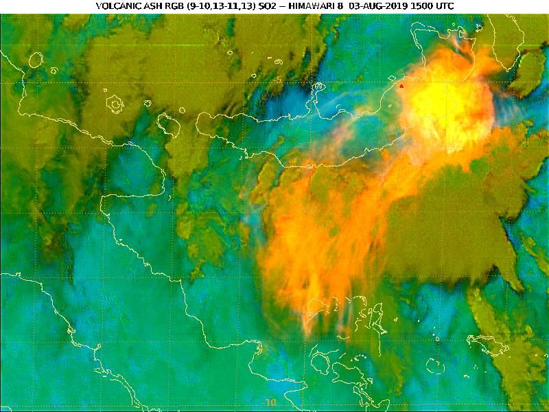
Relevance of Volcanic Ash
• Volcanic ash is a significant aviation
  hazard when encountered in flight

• Significant costs associated when
  volcanic ash impacts airports
   • Doesn’t necessarily have to be a large
     eruption

• Aviation industry supports 9 Volcanic
  Ash Advisory Centres (VAACs) to
  monitor and warn about volcanic ash
   • BoM operates the Darwin VAAC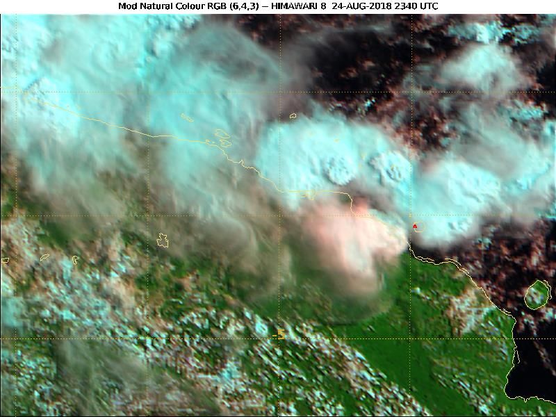
Impact of Himawari-8
Himawari-8 became operational
in July 2015

Number of volcanic ash
advisories per year has more
than doubled since that time

Improved spatial and temporal
                                Himawari-8
resolution and multiple         operational

channels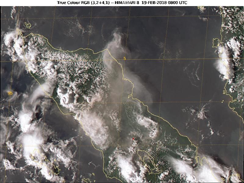
Satellite Data in the VAAC
Satellite data are the primary
tool used by the VAAC to
monitor volcanic activity in
the area of responsibility

'True Colour' RGB looks like a
photograph. However,
interpretation of data can, at
times, be ambiguous

                                 Eruption of Sinabung, northern Sumatra on 19 February 2018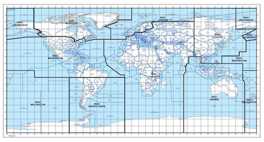
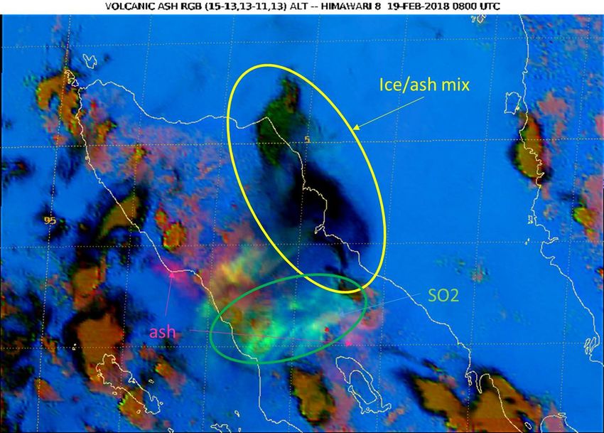
Volcanic Ash RGB
The 16 channels on H-8 allow for
the creation of multispectral
composite imagery (RGBs)

This RGB uses the 12.4 ,10.3 and
8.5 micron channels to identify
different components often found
in volcanic clouds
    green = sulphur dioxide (SO2)
    pink = volcanic ash

Looping of images is very
beneficial
                                    Eruption of Sinabung, northern Sumatra on 19 February 2018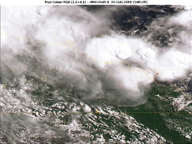
SO2 RGB
Combines 6.9 and 7.3
micron channels (WV) with
8.5 and 11 micron to
detect SO2

Developed by JMA

Yellow = thick SO2 cloud
Orange = high level SO2

No formal requirement for
SO2 alert current           Eruption of Ulawun, New Britain on 3 August 2019
'Ice-rich' eruptions
In the tropics, many deep
eruptions can be hard to
identify as they don’t produce
any of the 'typical' signals

This arises because the ash
becomes 'encased' in ice

Using a near-IR channel (2.2
microns) in a 'Natural Colour
RGB', the volcanic cloud can be
more easily distinguished

                                  Eruption of Manam, PNG on 24 August 2019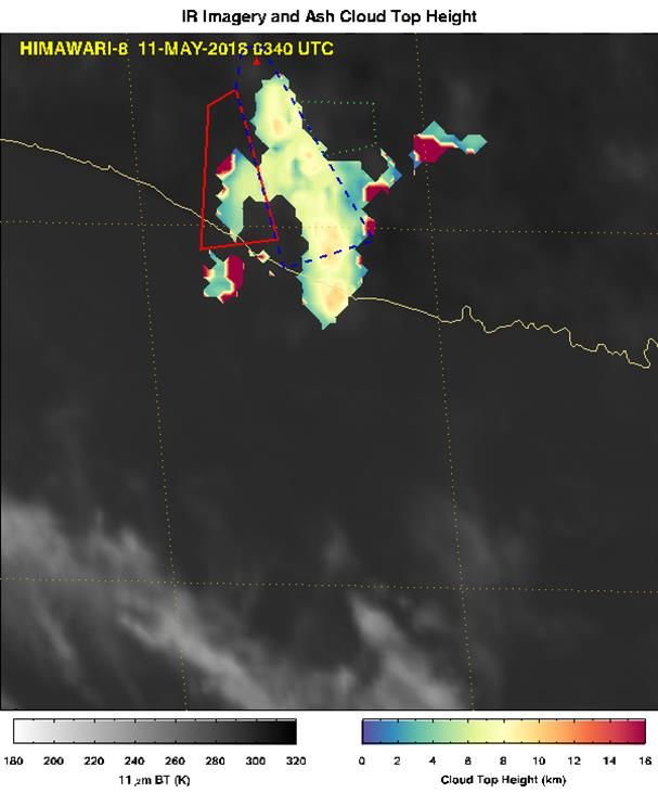
Quantitative Retrievals
The sixteen channels on Himawari-8 allows for the improved retrieval
of quantitative estimates of volcanic cloud properties

The NOAA/NESDIS VOLCAT system has been implemented
   -- Automated alerts
   -- Retrievals of mass load, cloud top height, eff. radius, etc.

Important to understand accuracy and reliability of the retrievals
   -- Approx. an order of magnitude accuracy (for mass load)
   -- Optically thick clouds and very thin clouds not captured
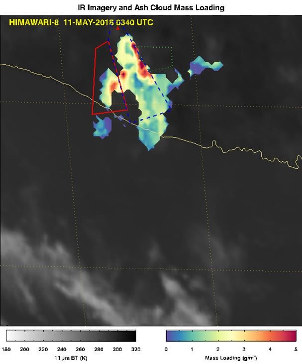
Interpreting Retrievals is Challenging
Even when detections
made, there can still be
significant uncertainty,
even under ideal
conditions

Retrievals behave as
expected on average, but
significant variation from    Height                                      Mass Load
pixel to pixel (and time to
time, in some cases)

                                       Eruption of Merapi, Java on 11 May 2018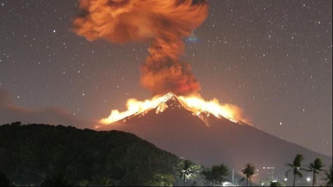
Dispersion Ensemble Prediction System
• New Dispersion Ensemble Prediction System (DEPS) scheduled to be
  fully operational by January 2020
  • Meteorological uncertainty represented by an ensemble of up to 38 NWP
    forecasts (36 from Bureau's ACCESS-GE3 ensemble, ECMWF, GFS)
  • Calculates mass load exceedance probabilities

• Upgraded version (DEPS 2) in development, scheduled to be
  operational by July 2021
  • Improved representation of source term using statistical training methods
  • Assimilation of observed ash polygons for improved short-term guidance
  • Assimilation of VOLCAT mass load data, when available
Agung, Bali eruption
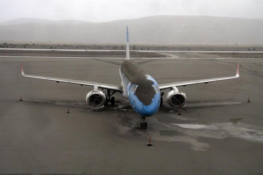
Eruption Details
• 24 May 2019 ~1130 UTC
• Reported Height: FL150 (4.6 km)
• Duration: 4.5 minutes
• VAAC advisory @1208 UTC
Aviation Impacts
• 4 flights to Bali diverted Stunning photos of the Volcano Mount Agung erupting. Picture: BackGrid. Source: BackGrid.
• 5 flight cancellations from Bali
From: www.news.com.au
• Other flights from Bali delayed (Virgin)
A relatively minor eruption, with minimal effects on lives
Other impacts and property
• Heavy ash fall in 9 villages around Agung
• Lava/Incandescent rocks 3 km from crater Nonetheless, it highlights capabilities and provides a
• Alert level NOT raised useful demonstration of the improved ash model (DEPS-
• 4 km exclusion zone maintained 2)Agung 6-hour Forecasts
6-h f/c @ 1200
6-h f/c @ 1300
Observed Ash
Height of plume: 4.6 km (FL150) Height of Plume: 4 – 5 kmSummary Satellite-derived information is critical for the Darwin VAAC's volcano monitoring and ash forecasting for the aviation industry Himawari-8's improved resolution, 10-minute updates and 16- channel multispectral imagers onboard allow for a wealth of new observations and information, including specially designed RGB imagery and quantitative retrievals Satellite-based information will be crucial for the future production of the quantitative and probabilistic volcanic ash forecasts desired by the aviation industry
You can also read


