Dovercourt Road Reconstruction - Welcome Public Drop-In Event 6:30 to 8:30 p.m - City of Toronto
←
→
Page content transcription
If your browser does not render page correctly, please read the page content below
Dovercourt Road Reconstruction
   From Dundas Street West to Sudbury Street

                Welcome

            Public Drop-In Event
                       th
             October 7 , 2019
             6:30 to 8:30 p.m.
Learn more & share your thoughts

Find out more about the City’s plan to reconstruct
Dovercourt Road
• Learn about road safety and greening
  improvements
• Proposed traffic calming options
• Planned construction activities

We value your input!
• Please provide and return your comments either
                                     nd
  tonight or online before October 22 , 2019
• Visit toronto.ca/dovercourt to view
  presentation materials and fill in the feedback
  from
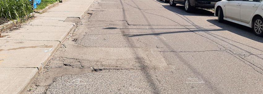
Why are we reconstructing Dovercourt?
 • Dovercourt Road from Dundas Street West to Queen Street West was last reconstructed in 1990
 • The City inspected the pavement surface in 2017 and found it to be in poor condition, with a lot of cracking within the
   road surface
 • Because of the poor road condition, this section of Dovercourt Road requires full reconstruction of the road down to
   the base surface
 • Road reconstruction is a major undertaking and provides an opportunity to also install road safety measures, better
   manage stormwater and add traffic calming
 • As part of the reconstruction, the underground cast iron watermain, built in the late 1800s, will also be replaced
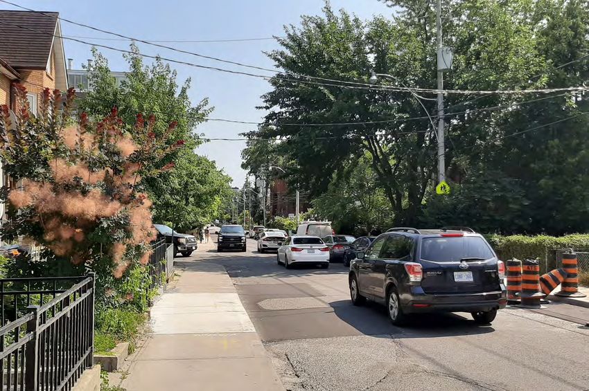
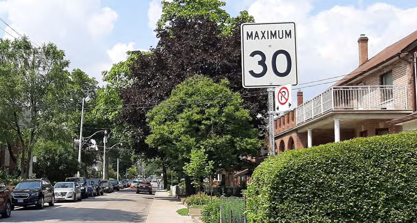
Road Safety
• In 2018, the speed limit was lowered from 40 km/h to 30 km/h
• A mid-block speed study was conducted in July 2019 and found an
  85th percentile speed of 40km/h (the speed at which 85% of
  vehicles travel at or below)

Residents have reported concerns about speeding and vehicles mounting the curb to allow other vehicles to pass.
In 2016, a community consultation event was held to discuss the possibility of turning Dovercourt Road into a one-way
street between Dundas Street West and Queen Street West. Resident feedback was mixed, with many residents
opposed to the impact this would have by diverting traffic onto nearby streets.
Many residents expressed interest in exploring other possible traffic calming measures.
To address community concerns, the City is proposing three options to help calm traffic along Dovercourt Road.
New Road Design Policies
The City has a number of policies and standards
in place to improve the design of streets for all
road users.
They focus on:
• Safety for vulnerable road users
• Mobility for all ages
• Accessibility for everyone
• Sustainability
• Beautifying and creating inviting streetscapes
The Dovercourt Road Reconstruction includes a number of Vision
                                                                Zero measures:
The Vision Zero approach to road safety is to eliminate
fatalities and serious injuries in our transportation system,
because no loss of life is acceptable.                          • Pavement Marking Improvements – stop bars and crosswalks
                                                                  will be repainted for greater visibility
It’s based on the principle that people make mistakes and
the transportation system needs to be designed in a way
                                                                • Accessibility Improvements – tactile plates will be added to
that caters to human error in order to eliminate fatalities
and serious injuries.                                             crossing locations

This means redesigning roadways to make them safer for all      • Corner Radii Reductions - intersection corners will be extended
users – people walking, biking, taking transit and driving        so that they more closely represent a 90 degree angle for
cars.
                                                                  shorter pedestrian crossing distances and to deter drivers from
                                                                  making right turns at high speeds

                                                                • Curb Extensions – curbs will be extended to reduce crossing
                                                                  distances, slow down traffic and provide greater visibility for
                                                                  pedestrians

                                                                • Traffic Calming Measures – adding physical features to slow
                                                                  traffic and discourage cut through traffic
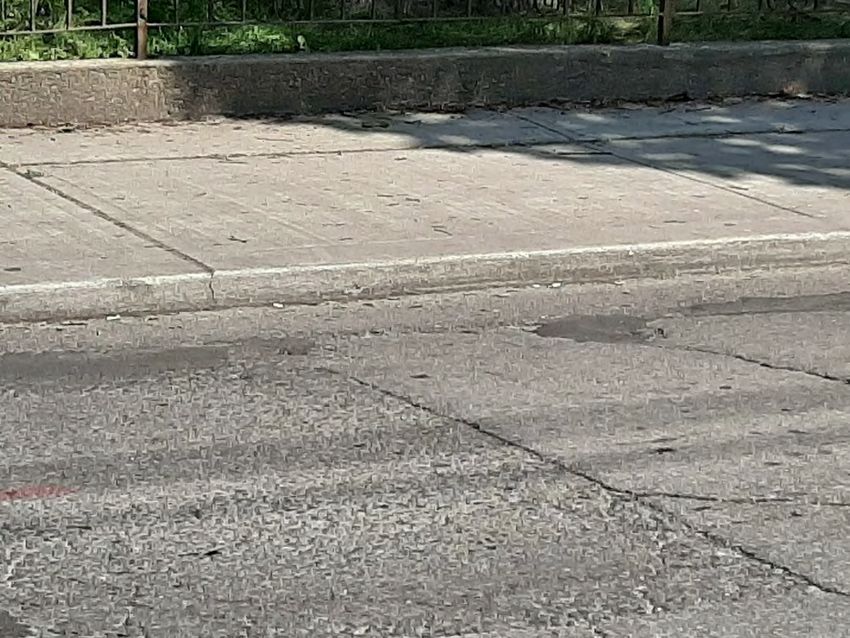
Fixing Curbs

 • Along Dovercourt Road, the curb height ranges from 80 milimetres (mm) to 200 mm
 • As part of the reconstruction the curbs will be raised to a standard 150 mm where possible
 • Raising the curb height will reduce the problem of vehicles jumping the curb
Corner Radii Reductions in Toronto
                                                                             Richmond Street West & Yonge Street

  Corner Radii Reductions
• Corner radii refers to the angle of an
  intersection corner                                                        Before                     After

• A tighter (smaller) corner radii                                           Driftwood Avenue & Yorkwoods Gate
  increases road safety by creating a
  shorter crossing distance for
  pedestrians and slows vehicle turns
• Traditionally, curb radii have been
  designed for the largest possible
  vehicle to be able to turn from curb                                       Before                    After
  lane to curb lane
• This means the radii are overdesigned                                      Davenport Road & Christie Street
  for the majority of vehicles
  (passenger vehicles) therefore
  vehicles can make turns very quickly
  which can be unsafe for vulnerable
  road users such as pedestrians and
  cyclists                                                                    Before                    After

• Wider than required radii result in                                        Bayview Avenue & Kilgour Road
  higher speed turns, lower visibility
  and longer crossing distances

                                           Corner Radii Reductions Example

                                                                              Before                    After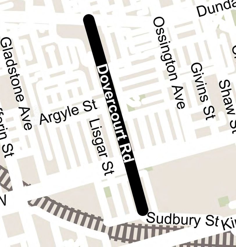
MacKenzie Crescent
Intersection Improvements
                                 MacKenzie Crescent and Dovercourt Road will
                                 feature these improvements:
                                 1.   Curb extensions on Dovercourt Road
                                      (replacing current traffic calming measures)
                 1
                                 2.   Corner Radii Reductions on northwest and
                                      southwest corners
                     2           3.   Repainting stop bar and crosswalk
             4
                                 4.   Tactile plate installation
         3                       Both curb extensions and corner radii reductions
                                 will help to discourage vehicles from turning and
                 4       2
                                 travelling the wrong way down MacKenzie Crescent

                             1
Foxley Street
Intersection Improvements
                        Foxley Street and Dovercourt Road will feature these
                        improvements:
                        1.    Curb extension on Foxley Street (SE corner)
                        2.    Corner Radii Reduction on northeast and southeast
                              corners
        2               3.    Repainting stop bar and crosswalk

            4           4.    Tactile plate installation
                    3   Both curb extensions and corner radii reductions will help
                        to discourage vehicles from turning and travelling the
                4
                        wrong way down Foxley Street
            2
                1
Argyle Street
Intersection Improvements
Argyle Street and Dovercourt Road will feature these
improvements:
1 1. Curb extensions on northwest and southwest
corners on Dovercourt Road
4 2
4 3 2. Corner Radii Reduction on northwest, northeast
2 and southwest corners
3 3. Repainting stop bars and crosswalks
4. Tactile plate installation
3
3
4
2
4
1Humbert Street
Intersection Improvements
Humbert Street and Dovercourt Road will
feature these improvements:
1. Corner radii reduction on northeast corner
2. Repainting crosswalks
3. Tactile plate installation
1 3
2
3Greening the Street Examples
• Where space permits, the City will add plantings to the curb
extensions
• The planted areas are designed to collect and filter the
stormwater from the road so that cleaner water can slowly
infiltrate into the ground
• Plantings will include native plants and pollinator species that
are drought and moisture tolerant
• Trees are not part of this design to maintain clear sightlines at
the intersections on Dovercourt Road Pollinators & Native Plants
Curb extension at Concord
Avenue & Bloor Street
Plantings will be maintained by City staff. If you’re interested in gardening you can
adopt a planted area. Please speak with staff at this event for more information.
Ryerson AvenueWhat is traffic calming and why is it important?
Traffic calming is a term commonly associated with physical features, Examples of types of traffic calming used in Toronto
such as speed humps, that are installed on a road to reduce the speeds
at which vehicles travel, to discourage through traffic, to improve traffic Speed Humps
safety and the comfort levels for all road users.
Traffic calming helps to achieve slower speeds for motor vehicles, and
increase the safety for pedestrian and cyclists. Chicanes
Reducing the speed vehicles travel can save lives.
Traffic Islands
Traffic Circles
On-Street Parking
Diverters
Full Closures
Impact of Speed on Collision Outcome from Vision Zero 2.0 – Road Safety Plan Update, Jun2 13, 2019Overnight Permit Parking
• Dovercourt Road is located within Parking Permit Area 3K
• Area 3K has 1011 spaces and only 818 permits have been issued
• On Dovercourt Road between Dundas Street West & Queen
Street West there are 78 spaces with 40 permits issued
• For both Permit Area 3K and Dovercourt Road there is more
on-street parking spaces than needed
• Many properties on Dovercourt Road also have laneway access
Parking Permit Area 3KTraffic Calming Option 1: Speed Humps
Speed humps are raised sections of the roadway designed to discourage motor vehicle drivers from travelling at
excessive speeds.
NOTE: speed humps can also be combined with other traffic calming options
Advantages Disadvantages
• Helps to reduce vehicle speed •Impact on Emergency Services (Ambulance, Fire, Police) by
slowing down response time and impacting the comfort of
• No loss of parking spaces; parking would remain on west patients being transported
side
• Minimal impact on cyclists as curb edge allows for cyclists to
bypass speed humps
• Little impact on snow clearing
Example of speed humpsTraffic Calming Option 2:
Alternating On-Street Parking by block
Alternating on-street parking by block segments calms traffic by forcing drivers to maneuver around parked cars which
causes drivers to slow down and pay more attention to the roadway.
NOTE: speed humps can be combined with this option
Advantages Disadvantages
• Helps to reduce vehicle speed • Potential impact on people on bikes include restricted
visibility of cyclists and dooring hazards
• Possible reduction in short-cutting traffic or through traffic
• 72 parking spaces would
remain
• Loss of 6 permit parking spaces
• No impact on permit holders
because Parking Permit Area 3K
is undersubscribed
Example of on-street parking alternating at block intervalsTraffic Calming Option 3:
Alternating On-Street Parking by mid-block
Alternating on-street parking by mid-block calms traffic by forcing drivers to maneuver around parked cars which causes
drivers to slow down and pay more attention to the roadway.
NOTE: speed humps can be combined with this option
Advantages Disadvantages
• Helps to reduce vehicle speed • Potential impact on people on bikes include restricted
visibility of cyclists and dooring hazards
• Possible reduction in short-cutting traffic or through traffic
• 69 parking spaces would
remain
• Loss of 9 permit parking spaces
• No impact on permit holders
because Parking Permit Area 3K
is undersubscribed
Example of on-street parking alternating at mid-block intervalsWhat to Expect During Construction
Construction is expected to begin in Summer 2020 and completed by December 2020 (with final restoration completed in Spring
2021)
Before construction begins, the City’s contractor will: The City’s contractor will then:
• Arrange for utility locates to be marked on the ground • Excavate the full road and dig a trench to access and install
• Install catch basin filter cloths and tree protection the new watermain
fencing • A temporary water line will be provided and hooked up to
• Perform visual/photo inspections of private properties properties
• Saw-cut portions of the pavement and sidewalk • City-owned water service pipes that do not meet City
standards will be replaced from the watermain to the
private property line
• Reconstruct the roadway
A Pre Construction Notice will be mailed out 2 months in • All areas affected by construction will be restored
advance of construction.
The Construction Notice will be mailed out 2-3 weeks
prior to construction commencing.
The Construction Notice will detail work hours, road and
sidewalk access, driveway access, traffic management,
parking, garbage and recycling and restoration.
Example of road reconstructionReplacing Substandard Water Services
A water service connection is the pipe that connects your house to the City’s water distribution system to deliver water
into your home.
There are two portions to the water service connection – the privately-owned portion and the publicly-owned portion.
The water service connection is
considered substandard if:
• made of lead or galvanized metal
• leaking or broken
• double connection, delivering water
to more than one residential
property
Illustrative example of privately owned and publicly owned portion of the
water service connectionHow to Prepare for Construction
• If you have landscaping, fences, or other physical
features at the front of your property in the City’s
Right-of-Way, they may need to be removed before
construction to avoid damage
• Let the City know if you have any items in the Right-of-
Way or an irrigation system
• The City will not be responsible for damage to any
privately owned items installed on the City’s property
• The City will mail you a Pre-Construction Notice two
months in advance and a Construction Notice will be
issued 2-3 weeks before work begins with more details
Illustrative example of private property and the City Right of WayNext Steps
Contact us
• Submit your feedback on this project by October nd
22 ,
2019 using: If you have any questions or concerns,
feel free to contact:
• Paper Feedback Form (provided at this event)
• Online Feedback Form (visit www.toronto.ca/dovercourt ) Elysia Leung
• City staff will continue to finalize detailed design and will report on the Senior Public Consultation Coordinator
feedback we have received
• Sign up for the project mailing list elysia.leung@Toronto.ca
416-392-6505
• Report to Toronto East York Community CouncilYou can also read