Dublin Light Rail Line A1 - Belgard to Saggart - Environmental Impact Statement Non Technical Summary - Transport Infrastructure Ireland
←
→
Page content transcription
If your browser does not render page correctly, please read the page content below

A1 EIS NTS Cover.ART:1 15/11/2007 15:25 Page 1
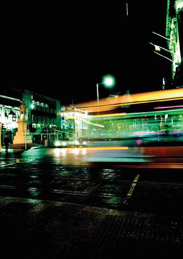
Dublin Light Rail
Line A1 - Belgard to Saggart
Environmental Impact Statement
Non Technical Summary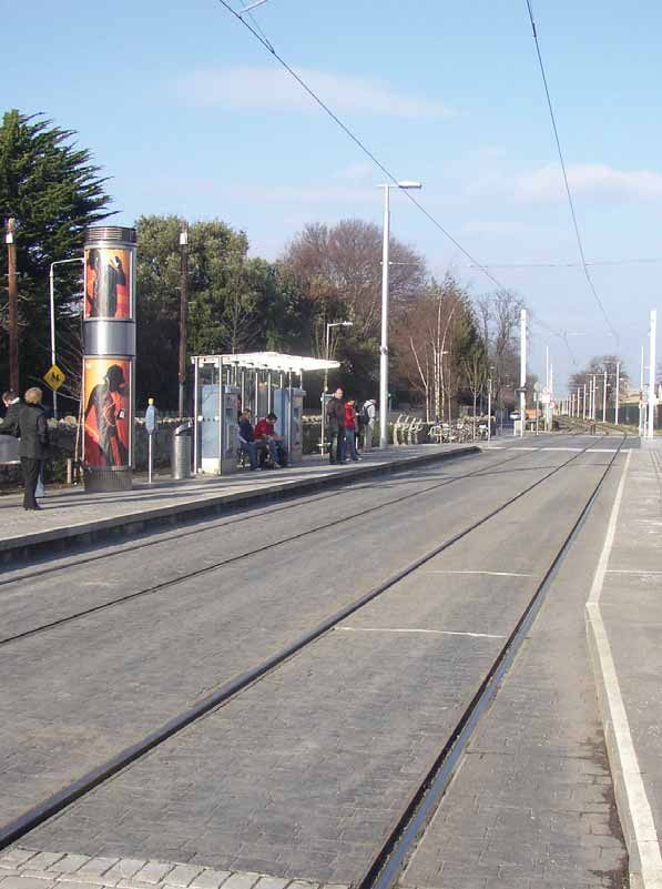
Dublin Light Rail
Line A1 - Belgard to Saggart

 ENVIRONMENTAL IMPACT STATEMENT
      NON TECHNICAL SUMMARY

     AVAILABILITY OF ENVIRONMENTAL IMPACT STATEMENT (EIS)
           Copies of the EIS including the Non Technical Summary are available for
                      inspection and purchase at the following location:
    Railway Procurement Agency, Parkgate Business Centre, Parkgate Street, Dublin 8

   The EIS is also available to download (free of charge) from the RPA Website: www.rpa.ie

                Copies of the EIS can be purchased for a sum of €15.00 each.
                  A CD Version can be purchased for a sum of €5.00 each.
 Copies of the Non Technical Summary of this EIS may be purchased for a sum of €3.00 each.
CONTENTS                                        page

1.0   INTRODUCTION                                 3

2.0   BACKGROUND TO LUAS LINE A1 PROJECT           7

3.0   DESCRIPTION OF PROJECT AND ALTERNATIVES      9

4.0   ENVIRONMENTAL ASSESSMENT                    21
1
    chapter

          1.0         INTRODUCTION
          This is a Non Technical Summary (NTS) of an Environmental Impact Statement (EIS) which has been prepared
          as part of an application for a railway order for Luas Line A1, a proposed 4.2km spur from the existing Luas
          Red Line.

          Luas Line A1 will have new stops at Fettercairn, Cheeverstown, Citywest Campus, Fortunestown and east of the
          junction between Fortunestown Lane and Garter Lane near Saggart. A proposal for a new layout for the existing
          Belgard stop is also included as part of this railway order application. A detailed description of
          Luas Line A1 is provided in Section 3.0.

          An EIS is the report indicating the positive and/or negative environmental impacts that the Luas Line A1,
          if carried out, would have on the environment. An EIS is only written following an assessment of the likely
          environmental impacts. That assessment process is called an environmental impact assessment (EIA).

          The purpose of the EIS is to inform the decision-making process on a railway order for Luas Line A1. Further
          information on that process is set out in section 1.3 below. The objectives of the EIS are summarised as follows:
          ■ To identify the likely significant environmental impacts of the proposed Luas Line A1 during the construction
            and operational phases having regard to the characteristics of the local environment
          ■ To evaluate the magnitude and significance of likely impacts and to propose appropriate measures
            to mitigate potential adverse impacts

          1.1 Study Team
          The EIA study team comprised the following specialist consultants:

                                  Contributor                                                 Input
              Brian Meehan & Associates,                             Co-ordination of EIS, Introduction, Policy and
              Planning Consultants,                                  Planning Context, Description of Project and
              44 Fitzwilliam Place, Dublin 2                         Alternatives, Socioeconomic and Community, Material
                                                                     Assets, Summary of Impacts and Interactions
              Scott Wilson,                                          Transportation
              Unit B First Floor, Bracken Court,
              Sandyford Industrial Estate, Dublin 18

              TJ O’Connor & Associates,                              Soil, Water, Public Utilities
              Corrig House, Corrig Road,
              Sandyford Industrial Estate, Dublin 18
              AWN Consulting, Tecpro Building,                       Air Quality and Climatic Factors,
              Clonshaugh Business & Technology Park,                 Noise and Vibration, Waste Management
              Dublin 17
              Scott Cawley, Ecological Consultants,                  Flora and Fauna
              27 Lower Baggot Street, Dublin 2
              Margaret Gowen & Co,                                   Archaeology, Cultural and Architectural Heritage
              Archaeological Consultants,
              27 Merrion Square, Dublin 2
              Mitchell & Associates, Landscape Architects,           Visual/ Landscape
              Fumbally Court, Fumbally Lane,
              Dublin 8
              ERA Technology Ltd, Cleeve Road, Leatherhead,          Electromagnetic Interference
              Surrey, KT22 7SA, United Kingdom

3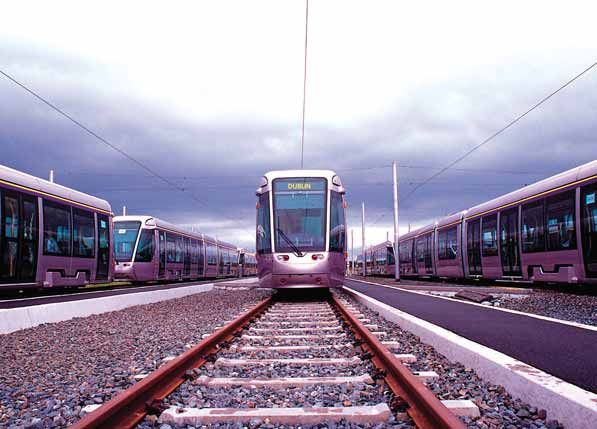
This EIA has been undertaken in accordance with Section 37 of the Transport (Railway Infrastructure) Act 2001
as amended by Section 49 of the Planning and Development (Strategic Infrastructure) Act 2006. The EIA has
also been prepared having regard to the Environmental Protection Agency (EPA) guidance documents in relation
to the preparation and content of an EIS including:

■ Guidance on the information to be contained in an EIS, EPA (2002)

■ Advice notes on current practice in the preparation of an EIS, EPA (2003)

The Railway Procurement Agency (RPA) as the statutory agency with responsibility for light rail and metro
infrastructure projects and for applying for a railway order for the Project also contributed significantly to the
EIA process and to the compilation of the EIS in particular.

1.2       Public Consultation
Public consultation on the proposed Luas Line A1 commenced in February 2006. This involved a public launch at
South Dublin County Council (SDCC) offices in Tallaght, the distribution of two rounds of newsletters (which included
maps), the publication of national and local newspaper notices, an open day at the SDCC offices and a meeting
with Tallaght Partnership (acting on behalf of residents and community representatives from Brookfield). Draft design
drawings of the 4.2km alignment, the location of the Park and Ride (P&R) facility and the indicative locations of
the 5 new stops were available for review at this open-day.

                                                                                                                        4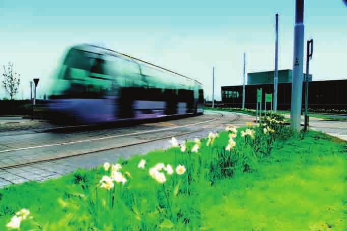
1
    chapter

          The public consultation initiative provided the public with an opportunity to communicate views on the proposed
          Luas Line A1 route alignment and this feedback was considered by the design team. A number of freepost cards
          were returned in response to the two newsletters that were distributed. A review of the responses provided
          feedback as follows:

          ■ the vast majority of views expressed a strong welcome for the scheme

          ■ some views expressed particular local alignment preferences

          ■ one view was expressed concerning tram noise

          ■ some views expressed the need for adequate bicycle storage facilities at stops

          ■ some views expressed the need for adequate P&R facilities

          The process of consultation has confirmed enthusiasm for the Project in the area affected by it.

          1.3      Statutory Consultation
          RPA initiated consultation with bodies with environmental responsibility and interest in February 2006.
          The focus of this consultation was on the environmental assessment and route selection of the Project.

          Discussions between RPA and DTO took place following their submission and DTO has confirmed its
          support for the Project.

          SDCC has also confirmed its support for the Project.

          1.4      EIA Methodology
          The EIA process is a systematic analysis of the proposed development in relation to the existing environment.
          In relation to the current project, there are essentially four stages:

          ■ Outline and Consideration of Main Alternatives

          ■ EIS Scoping

          ■ EIS Preparation

          ■ Oral Hearing

          The EIS methodology will be discussed further in Section 3.0 and 4.0.

5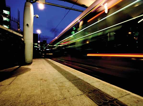
6
2
    chapter

          2.0 BACKGROUND TO LUAS LINE A1 PROJECT
          The Luas Line A1 project is one of a number of transportation infrastructure projects which has been considered
          for the Dublin area against a backdrop of rapid population and employment growth. The Government’s capital
          investment framework for rail infrastructure in the Greater Dublin Area is contained in Transport 21 which was
          announced in November 2005. This outlined the Government’s capital investment plans for transportation
          infrastructure up to 2015. The proposals include 7 new Luas projects, one of which is the Luas Line A1. Transport
          21 provides for Luas Line A1 subject to half of the capital cost of the Project being funded by the private sector.
          RPA has put agreements in place which meet this requirement.

          The proposed development is in accordance with a number of plans and policies including:

          ■ Department of Transport Statement of Strategy 2005 – 2007 (DoT)

          ■ National Spatial Strategy 2002 – 2020

          ■ National Development Plan 2000 – 2013

          ■ The Regional Planning Guidelines for the Greater Dublin Area 2004-2016

          ■ Integrated Framework Plan for Land Use and Transportation in the Tallaght Area

          ■ The South Dublin County Development Plan 2004 – 2010

          ■ Tallaght Town Centre Local Area Plan, 2005

          ■ Cooldown Commons Area Plan, 2006

          ■ Variation No.2 of the SDCC Development Plan 2004 – 2010: Fortunestown Lane & Garter Lane, Saggart

          The proposed Luas Line A1 was designed in the context of a number of significant road infrastructure
          developments within the general area, including:

          ■ The N7 Naas Road Improvement Scheme, which comprised the construction of a third lane in both directions
            for a distance of 14km. This was completed in summer 2006

          ■ An extension to the Embankment Road from Citywest to Belgard Road. This road will run along the reservation
            to the north of the residential areas of Fettercairn, Cairnwood and Kilmartin. Detailed design is currently being
            prepared and accommodates Luas Line A1, while land acquisition and site investigation works are progressing
            (at the time of writing)

          ■ Outer Ring Road Phase 3. The construction of the junction of Outer Ring Road with the Embankment Road
            extension is currently underway (at the time of writing). The detailed design for the scheme accommodates
            Luas Line A1. Provision for Luas infrastructure is being made by the local authority in the construction of
            this key road crossing to mitigate construction disruption once this road becomes live to road traffic.

          These road proposals will enhance the accessibility of the area and facilitate its development in accordance
          with the land use strategy contained in the SDCC Development Plan 2004-1010.

7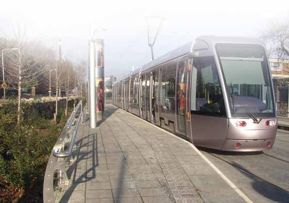
8
3
chapter
3.0 DESCRIPTION OF PROJECT AND ALTERNATIVES
3.1 Route Selection
In 2004, RPA, as part of a strategic review of possible light rail projects in Dublin, adopted a policy that
Luas Line A1 would be developed by RPA only where around 50% of the capital cost of the project could
be recovered from the private sector.
In 2005, RPA entered into negotiations with a consortium of developers interested in developing a spur from
the existing Luas Red Line to Citywest and onto Saggart. These negotiations commenced while Transport 21
was being developed and were informed by RPA’s existing policy on developing new Luas lines and emerging
Government policy in this area. The offer of support being advanced by the consortium was based on a particular
route (the preferred route option). The companies within the consortium would benefit from Luas serving their
respective developments and a large part of the land required for that route was already within the control of
the consortium.
While negotiations with the consortium were at an early stage, an assessment of all route options was undertaken.
From an environmental perspective an environmental desktop evaluation was carried out by
Brian Meehan and Associates in late 2005. The study took account of the environmental objectives of the
previously identified project objectives and also had regard to the work previously undertaken by WS Atkins.
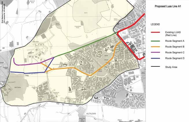
Within this study area 4 feasible route segments (A, B, C and D) were identified (See Figure 1.1). Route segments
A and B cover the eastern part of the study area while route segments C and D extend westwards from Citywest
Business Park to Garter Lane to serve the western areas. From these viable route segments, four possible
combinations were identified i.e. Route AC, Route AD, Route BC and Route BD.
9Figure 1.1: Feasible Route Options
103
chapter
As part of the Environmental Desktop Study completed in 2005, the environmental topics which were
assessed for the 4 route segments included:
■ Human beings
■ Flora and fauna
■ Soil
■ Water
■ Air
■ Noise
■ Light
■ Landscape
■ Material assets
■ Architectural heritage
■ Archaeological heritage
■ Cultural heritage
The nature of the project is such that Impacts relating to climate were not considered to be significant to the
assessment referred to above. ‘Climate’ was therefore scoped out and was not addressed in the desktop study.
Overall, the environmental evaluation concluded that there were unlikely to be any significant environmental
constraints relating to any of the viable route segments examined. In deciding between route segments
A and B it was found that route segment A was considered to be superior on the grounds that it generated
the least impact on existing communities while still providing those communities with convenient accessibility to
the line. In addition, it lay within a reservation or “green route” which provided an opportunity to accommodate
Luas Line A1 along the same corridor as the approved Embankment Road.
The environmental evaluation also indicated that segment D, was preferred on the basis that it did not interfere
with the layout of new residential areas north of Fortunestown Lane and it had obvious planning benefits in
terms of its ability to serve the new Citywest District Centre.
On the basis of the environmental criteria applied to the route selection decision, no route option performed
substantially better than any other. In other words, when the factors described above are taken into account,
the identified routes are largely equivalent.
The availability of financial support for the project along one route was therefore an important, although not
solely determining factor, in selecting the route for Luas Line A1. Taking this economic benefit into account is
in line with RPA and Government policy as outlined above and in keeping with EPA guidance in this area. RPA
assessed the financial benefit of the support being offered to the development by the consortium against the
possible economic gains that would accrue from a Supplementary Development Contribution Scheme, were one
to be made by SDCC for the project. This analysis concluded that the economic benefits to the project under
such a Scheme would not match those being offered by the consortium. In any event SDCC had no plans to
implement such a Scheme.
In December 2006, RPA reached agreement with the consortium supporting the development of Luas Line A1.
That agreement provides for the consortium being responsible for the delivery of a substantial part of the works
for the Line, providing land and making a capital contribution to RPA. All other details are confidential. This
arrangement is in line with RPA and Government policy as outlined above. Furthermore, capturing part of the
increase in the development potential value resulting from the Luas Line A1 represents good value for money
for the Exchequer.
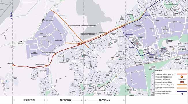
113.2 Description of the Proposed Scheme
3.2.1 Route Alignment
The proposed Luas Line A1 is approximately 4.2km in length and comprises a double track spur from the
existing Red Line at Cookstown to Saggart and a remodelled interchange stop at Belgard. The route can be
described with reference to 3 sections, which are described below.
Cookstown to Outer Ring Road Phase 3 (Section A)
The proposed route diverges from the existing Luas Red Line between the Belgard and Cookstown stops
immediately east of the Cookstown Way / Cookstown Road roundabout. The line will run entirely at grade
adjacent to the approved Embankment Road Extension and follow a green field reservation adjacent to the
communities of Cairnwood, Belgard Green, Fettercairn (proposed stop) and Kilmartin.
Outer Ring Road Phase 3 to Citywest Shopping Centre (Section B)
The route crosses the approved Outer Ring Road linking the N7 and the N81 at grade, arriving at the proposed
Cheeverstown Stop, Kiosk and Park and Ride (P&R). From here it enters the Citywest Campus running adjacent
to the communities of Brookview and Ard Mór and enters the Citywest Campus (proposed stop). It then crosses
the N82 at grade to Fortunestown Stop that is adjacent to Citywest shopping centre.
A substation is proposed to the west of the Cheeverstown Stop and to the northeast of the Brookview
estate within the proposed Park and Ride site.
Citywest Shopping Centre to Saggart (Section C)
From the Citywest Shopping Centre development the route follows Fortunestown Lane, which runs to the
north of the Carrigmore and Carrigmore Crescent residential developments, to terminate east of the junction
between Fortunestown Lane and Garter Lane at the Saggart Stop (proposed last stop). A second substation
is proposed to the north of the proposed Saggart Stop.
Upon selection of the preferred route option AD, the connection to the existing Red line was identified within
the Cookstown area. Considerable liaison took place with SDCC planners and road designers in order to determine
the optimum detailed design for the connection. Consideration was given to improvements to the road network
in the area, existing utilities, planning objectives as well as the safety of both road and rail users. A number of
options in terms of junction type and operational flexibility were considered. Based on possible future demand
for a direct service from Citywest to Tallaght Town Centre, SDCC’s land use and transportation planning
requirements and the emergence of a preferred route for Metro West, the feasibility of a future delta junction
at Cookstown was examined. While it is not proposed to construct this junction at this time, the future provision
of a delta arrangement will be preserved in the scheme design and, as agreed with SDCC, through the imposition
of planning conditions on future development proposals,
Luas Line A1 will allow for passengers to travel between Saggart and Tallaght using a shuttle service.
This will require an interchange facility that will be provided for at Belgard Stop. Passengers from Saggart
wishing to travel to Tallaght would be required to change trams at Belgard. A proposal for a new layout
for the existing Belgard stop is also included as part of this railway order application.
123
chapter
3.2.2 Stops
Five new stops are proposed along this alignment at the following locations and are illustrated in Figure 1.2:
Fettercairn Stop
It is planned to locate the first stop to the north west of Belgard Green housing estate and to the north of the
residential area of Fettercairn, along the approved Embankment Road Extension. The stop will be located adjacent
to a minor junction linking the Embankment Road Extension to Fettercairn Road, thereby providing access to
and from the surrounding residential areas.
Cheeverstown Stop
Cheeverstown stop is planned to be located to the south west of the proposed junction between the Embankment
Road Extension and the Outer Ring Road Phase 3. Citywest Business Campus is located to the north west of
this stop. The stop is also situated to the north east of a number of residential communities, including Brookview
housing estate. Opportunities for strengthening pedestrian connectivity between Brookview and the proposed Luas
stop at Cheeverstown will be explored in consultation with SDCC. There is also a P&R facility located adjacent
to this stop. Access to the Park and Ride will be provided from the approved Embankment Road Extension, the
Outer Ring Road and Citywest Avenue. Provision is also being made at the Cheeverstown Stop for a retail kiosk
for the benefit of P&R users.
Citywest Campus Stop
This stop is planned to be located to the north of the National Digital Park, to the south of Citywest Avenue
and to the east of the N82 Citywest Road. The stop is situated centrally to serve the Citywest Business Campus,
which is located to the north and the National Digital Park and Magna Business Park which is located to the
south. The Citywest Campus Stop is also located immediately adjacent to the housing estate of Ard Mór. The
proposed location for the Citywest Campus Stop is therefore strategically placed to allow for the future integration
with both existing and proposed developments within Citywest Campus. Opportunities for strengthening pedestrian
connectivity between Ard Mór and the proposed Luas stop at Citywest Campus will be explored in consultation
with SDCC.
Fortunestown Stop
It is planned to locate the Fortunestown Stop along Fortunestown Lane, immediately adjacent to the new Citywest
District Centre which includes the newly opened Citywest Shopping Centre. The stop is also located adjacent to
the residential area of Carrigmore. Fortunestown stop will serve these existing and planned residential communities.
Saggart Stop
Saggart stop, which is the proposed terminus is planned to be located on Fortunestown Lane, east of the junction
of Fortunestown Lane and Garter Lane. This stop is located in close proximity to Citywest Hotel and Golf Course
and existing residential communities at Garter Lane. The planned rezoning of lands in this area to provide for
new Residential Communities in accordance with approved Area Plans will ensure continued development in a
sustainable manner.
Reconfiguration of the existing Belgard Stop
It is proposed to reconfigure the layout of the existing Belgard Stop to provide for an additional track and
associated platform alterations. This will include the installation of a new stop canopy spanning the new island
platforms. The new track work arrangement will allow for the arrival, departure and stabling of trams running
between Belgard and Saggart.
13Figure 1.2: Proposed Luas Line A1 Route Alignment
143
chapter
3.2.3 Park and Ride
A 310 space P&R facility is proposed at the Cheeverstown Stop. The location
was chosen based on upgrades to the existing road network in the Tallaght
West Area (approved Embankment Road extension and the Outer Ring Road
Phase 3) and the availability of lands with otherwise very limited development
potential in this area.
The DTO in their Rail Park and Ride Strategy for the Greater Dublin Area
propose a methodology to ascertain the suitable use and size of rail based
P&R. The application of that methodology suggests that the P&R site at
Cheeverstown would best serve local P&R needs and should thus be sized to
accommodate normally no more than 300 parking spaces subject to the
capacity available on the local and surrounding road network.
The P&R at Cheeverstown is divided into 2 separate areas, one on either side
of the tracks. The P&R area north of the alignment is situated between the
Luas track and the Embankment Road. This land has restricted development
potential due to a wayleave of 23m either side of existing ESB 110kV
overhead lines. Similarly, the P&R area south of the alignment is to be developed on land which is subject to
a 17.3m wide watermain wayleave. P&R is thus considered an ideal use for this land.
The P&R will incorporate CCTV coverage and lighting. The lighting will incorporate anti-glare hooded fittings.
3.2.4 Landscaping/ Boundary Treatment
Due to the extent of the permanent land take, soft landscaping directly associated with the proposed
Luas Line A1 will generally be confined to a strip of low level planting outside of the swept path of the trams.
Hard landscaping will include the surfacing of the track bed and the completion of the civil works at the stop
platforms. Landscaping will commence on completion of the track laying and erection of the overhead lines poles.
Soft landscaping for boundary treatment will be provided at the P&R site also.
3.2.5 Substations
The provision of substations is an essential component of the proposed Luas Line A1 alignment as they
are the primary source of power for trams and stop facilities. Two substations will be required to serve the route
in addition to the existing substation at Cookstown. These will be located proximate to Saggart stop and
Cheeverstown stop.
3.2.6 Limits of Deviation
In constructing or maintaining any of the light railway works, RPA may deviate from the design to facilitate onsite
construction and allow a limited degree of flexibility to react to on-site circumstances which may be unforeseeable
at this stage. Such lateral deviations can include up to 2.5m when situated in a public road and 5m elsewhere.
Vertical deviations are permitted to deviate up to 1m when situated in a public road and 2m elsewhere. Similarly
longitudinal deviations are permitted up to 20m.
153.2.7 Future Extensions
The Dublin Transportation Office (DTO) published strategy “A Platform for Change” envisions an extensive rail
based network comprised of Luas, Metro and heavy rail with easy interchange between all 3 modes. DTO’s
Strategy considered an extensive Luas and Metro network planned for the Dublin area in the long term allowing
for a spur from an Orbital Metro line (Metro West) from the Cookstown region to Tallaght West/Moneen Cottages
located to the northwest of the Line A1 study area. In designing Luas Line A1 and specifically the location of
the terminus stop at Saggart, the potential to extend the line northwards to Tallaght West/Moneen Cottages is
preserved.
One of the project objectives is that the new route should allow for a spur to Metro West for which the selection
process for an emerging preferred route is now concluded. Luas Line A1 will be designed to operate initially as
a spur to the existing Luas Red Line and contains no features which would prevent an upgrade to Metro West
compatibility taking place, if necessary. Some of the Line A1 critical design considerations that ensure Metro
compatability are:
■ The proposed structures gauge can accommodate Metro West vehicles
■ Vehicles with low floor will be procured similar to the design of the Luas Red and Green Lines
■ All the platforms are designed to cater for 40 metre long vehicles. Passive provision for 90m platforms
is being preserved in the alignment design to allow metro compatability
■ Protected running can be provided for along the entire length of the route. This means that the tramway
has its own right of way and road traffic only crosses it at junctions
3.3 Construction of the Scheme
Due to the linear nature of the construction site it is possible for certain activities to overlap with others or to
be undertaken at the same time. Generally, construction works will commence with the establishment of site offices
and compound facilities including site clearance, preparation and site security. Two site compounds are proposed
for the storage of materials, plant, equipment and site offices. Construction works will include:
■ Site preparation:
Clearance of hedgerows, scrub vegetation, demolition of derelict structures, etc
■ Establishing site offices, compounds and security:
The site office will be located near the Outer Ring Road and the two compounds will be located at
the proposed P&R site and on lands north of Fortunestown lane between the proposed Fortunestown
and Saggart stops
■ Utilities diversions:
Utilities will be diverted, where necessary to ensure that future operation of the Luas Line A1 is not affected
by future utility maintenance or diversion activities. This will include an existing 110kV overhead line crossing
Fortunestown lane just east of the junction of Fortunestown lane with Garter lane. As this line is supported by
a pylon that is also adjacent to the proposed alignment and terminus stop, it is proposed to remove and relocate
this pylon and re-divert the 110kV overhead line. These works will form part of the Line A1 Railway Order
■ Installation of the track bed and rails:
The installation of track bed will require the excavation of a 6m – 9m wide, 0.8m – 1.2m deep trench. Three
different track bed formations are proposed for the A1 Luas line including ballasted track (where
it will interconnect with the existing Red Luas Line), slab track (between Cookstown way and the Outer Ring
Road junction and at tight radius curves) and embedded track (at all crossings and stops and from the Outer
Ring Road to Garter Lane)
163
chapter
■ Installation of electrical and operating equipment:
The installation of the overhead lines and the power supply facilities will occur once the track bed is complete
■ The development of stops and associated equipment:
As the track works proceed, works will also commence on the construction of the five new stops and the
reconfiguration of the existing Belgard Stop
■ Finishing to surfaces and soft landscaping
A period for testing and commissioning the system will also be required after construction works are complete.
The construction activities described should be regarded as typical of the construction work to be undertaken
along the route. However, a detailed programme and schedule of works will be developed prior to the
commencement of work on site. This will be based on more detailed design work, and the finalisation of the
work methodology with the appointed contractors.
It is proposed that work will start simultaneously at a number of locations and will last approximately 28 - 30
months. Any excavated material will, where possible, be stored on site and reused. Inert materials with some
engineering strength, which may be generated as part of the trackbed construction will be disposed of in a land
reclamation project (where possible).
During the construction period there is a possibility that works associated with the proposed track laying and the
relocation of services, especially in areas of archaeological potential (described in Section 4.4), will reveal
archaeological soils, features or stray artifacts. In order to ensure the appropriate recording of such features, a
project archaeologist has been appointed to the project team and testing and / or monitoring will be carried out
under licence from the Department of the Environment, Heritage and Local Government as required.
The construction works will entail crossing the existing N82 Citywest Road, the Cookstown Road and Cookstown
Way and the Outer Ring Road Phase 3. To address impacts which may arise during the construction phase, a
Traffic Management Plan will be formulated and implemented in advance of construction works being carried out
(See Section 4.11). This plan will be developed in conjunction with SDCC.
3.4 Operation of Luas Line A1
With the provision of Luas Line A1 as a spur to the Luas Red Line, there are a number of operational patterns
which can be considered. Luas Line A1 will allow for passengers to travel between Saggart and Tallaght using
a shuttle service. This will require an interchange facility that will be provided for at Belgard Stop. Passengers
from Saggart wishing to travel to Tallaght would be required to change trams at Belgard. A proposal for a new
layout for the existing Belgard stop is included as part of this railway order application.
While the final overall operating timetable for the Red line, including both the Line A1 extension and the
Docklands extension, has not been finalised, it is envisaged that the peak period service will consist of a service
frequency of 15 trams per hour from the city centre to Tallaght / Saggart.
The initial Luas Line A1 peak service pattern envisages 10 trams per hour departing from Saggart, 5 of which
will run directly to the city centre with the other 5 operating as a shuttle service terminating at Belgard Stop.
On the common section of the Red Line between Belgard and the City Centre there will be a peak service of
15 trams per hour. Additional capacity will be provided between Heuston Station and Connolly Station by a shuttle
service in the morning peak period with a further 3 departures per hour.
17In summary, Luas Line A1 is being provided with spare capacity to maintain the established quality of service
and to allow for future growth in demand. This is likely to result in improved integration with bus services,
increased development in the area, expansion of the Luas network and other transport related measures. Luas
Line A1 is also being designed to be compatible with Metro West. Initially the type of tram utilised on Luas Line
A1 will be similar to those in use on the existing Red and Green lines. They will;
■ Accommodate 310 passengers
■ Measure 2.4 m wide, 40m long, 3.4m high
■ Have a drivers’ cabin at either end and will be bidirectional
■ Have a partial low floor level to facilitate the mobility impaired
■ Travel at a maximum speed of 70km/ hr
■ The tram will operate on 750 volts Direct Current (DC)
The platforms will be of similar design to the existing Red and Green line stops i.e.
■ Approximately 0.28m high above rail level
■ 40m long (provision is made in the alignment design for 90m long platforms if required)
■ Minimum of 3.3 m wide and situated on either side of the tracks
■ Have a 6m ramp at either end where required
■ Have tram ticket vending machines. These will accept coins, notes, credit cards, smart cards and will provide
ticket options (luas only, bus and luas, weekly, monthly or annual journey tickets) and
■ Have public lighting at all stop locations, at crossing points and at the P&R facility
183
chapter
All administration, system control and maintenance for Luas Line A1 will be undertaken at the Red Cow Depot.
A video security monitoring system of the proposed stops, P&R and at key junctions in the system
will be displayed at the control centre.
All construction work in connection with Luas Line A1 will be carried out in accordance with relevant Health and
Safety legislation and best practice.
The planning, testing and commissioning and operation of Luas Line A1 will be carried out in accordance with
the Railway Safety Act 2005 and any consents and directions issued by the Railway Safety Commission under
that Act. A safety case is in place for the operation of the Luas Red and Green Lines and it will be extended
to include Luas Line A1.
A Safety Management System will be in place for the construction and operation of the Luas system.
This safety management system will ensure that all potential hazards associated with the construction
and operational stages are examined, and that the risks identified are eliminated or controlled to an
acceptable degree.
1920
4
 chapter

       4.0 ENVIRONMENTAL ASSESSMENT
       As detailed in Section 1.0 the objectives of the Environmental Impact Assessment include:

       1. Identification of the likely significant environmental impacts of the Luas Line A1 during the construction and
          operation phase

       2. Evaluation of the magnitude and significance of the impacts and proposal of appropriate measures
          to mitigate adverse impacts

       The environmental topics addressed as part of this assessment includes the following:
       ■ Socio-economic and community
       ■ Visual and Landscape
       ■ Flora and Fauna
       ■ Archaeology, Architecture and Cultural Heritage
       ■ Soils
       ■ Water
       ■ Air Quality and Climate
       ■ Noise and Vibration
       ■ Waste Management
       ■ Transportation
       ■ Electromagnetic Interference
       ■ Material Assets including Public Utilities, Property and the Luas Red Line

       Further details of each environmental topic is provided in Sections 4.1 – 4.12.

21
4.1 Socio-Economic and Community
4.1.1 Baseline environment
An assessment of the existing (i.e. baseline) socio-economic and communities adjacent to the proposed Luas
Line A1 was undertaken, as part of the EIA process. This included an evaluation of Central Statistic Office (CSO)
information, from the Electoral Districts of Tallaght-Belgard, Tallaght-Fettercairn, Tallaght-Jobstown and Tallaght-
Springfield. Preliminary results from this assessment noted the following:
■ In 2006, 28,927 people were living in this area (an increase of 10.9% since 2002)
■ Planning permissions granted in the area indicate that there is a demand on housing in the area,
which is likely to sustain high levels of population growth in the short term
■ The number of households in this area increased from 5,753 in 1996 to 7,275 in 2002
■ The average household size has decreased from 3.9 in 1996 to 3.5 in 2002
■ The age profile is very young with 50% of the population aged under 24 and a low proportion of
older people aged over 65 yrs (2.4%)
■ Unemployment rates have decreased from 24% in 1996 to 12% in 2002
Overall, the baseline assessment confirmed the findings of the West Tallaght Study (1999) and West Tallaght
RAPID Revitalising Area Plan 2002. These studies found that the west Tallaght area is characterised by high levels
of unemployment, low incomes, low educational attainment and high levels of single parent families.
4.1.2 Construction Impacts and Mitigation Measures
The construction phase of the proposed Luas Line A1 was assessed with respect to the baseline socio-economic
and community environment. It was found that some loss of amenity, temporary disruption and inconvenience will
be experienced by local residents resulting from traffic and the generation of noise and dust, which is associated
with the construction of infrastructural projects such as this (See Section 4.7, 4.8 and 4.10 for further details).
A Traffic Management Plan will be formulated and subsequently implemented in advance of construction works
being carried out in order to minimise disruption to the general public. Public consultation and ongoing local
liaison procedures will be established in the area to ensure that any queries from relevant parties are dealt with
promptly and efficiently.
4.1.3 Operational Impacts and Mitigation Measures
During the operational phase, it is estimated that an “uplift” in population density directly attributable to Luas
Line A1 could increase the ultimate population of the surrounding area to up to 50,000 people by 2020. This
impact is consistent with the land use strategy and general thrust of planning policy for the area.
Following commissioning, the proposed Luas Line A1 will represent a significant positive impact for the area in
terms of:
■ Economic activity and employment generation
■ Will act as a catalyst for urban regeneration in the surrounding area
■ Will greatly improve accessibility to the surrounding area on both a local and regional level
■ Will increase the value of properties in close proximity to the stops
224
chapter
The potential impact of the Luas Line A1 on the Fettercairn Youth Horse Project was also assessed by equine
health specialists. It was found that there will be no adverse impact on the horses or horse related activities.
Overall, no mitigation measures are required as part of the operational phase of the Luas Line A1.
4.2 Visual and Landscape Impacts
4.2.1 Baseline environment
The route corridor traverses an essentially flat landscape, with little or no topographical relief. The only elevated
topography in the vicinity is a man made embankment at Belgard Quarry and slight undulations, adjacent to
the Citywest Campus around Fortunestown Road. These are not visually significant.
Overall, the receiving environment for the proposed Luas Line A1 is of a generally poor visual quality, principally
due to the transitional state of the sub-urban development landscape, and the extent of dereliction. There are
no significant visual or landscape focuses within, or adjacent to the subject site. The principal areas of visual
quality in the general area are contained within the Citywest Campus and at the Citywest Hotel complex.
4.2.2 Construction Impacts and Mitigation Measures
An impact on the existing landscape is inevitable during construction. The insertion of the track bed with its rails,
kerbs, edges and paved surfaces could have a moderately negative impact on segments of the route. A small portion
of the existing, poorly developed, hedgerows along the route corridor will be removed to allow for the insertion of
the proposed Luas Line A1. The landscape impact of this insertion will be slight and neutral.
Mitigation during construction will be achieved by the implementation of necessary management / planning
measures to minimise disruption and dust from compounds and assembly areas, and particularly along the track
bed. These measures are detailed further in Section 4.7 (Air Quality and Climatic Factors).
Damage to property, to grassland, trees, planting and carriageways will be minimised with the necessary protection
/ hoarding put in place. Where damage cannot be avoided, it will be repaired or replaced.
4.2.3 Operation Impacts and Mitigation Measures
The provision of overhead line equipment will have a slight negative impact on the suburban townscape and
rural landscape. However, this negative impact is greatly outweighed by the positive impacts of the system and
can be minimized by the careful choice of the support system i.e. one line of central poles with cantilevered
arms in both directions. Impacts will be associated with the lighting of the P&R facility and stops. This however
will be mitigated by the provision of hooded light fittings to direct light towards the ground and will avoid glare.
Further landscape mitigation will be provided by the planting of trees and shrubs where possible along the Luas
line corridor and will assist in the integration of the alignment into the existing sub urban landscape environment.
234.3 Flora and Fauna
4.3.1 Baseline environment
The Luas line A1 does not lie within any ecologically designated lands and there are no designated
areas immediately adjacent which could be impacted upon. The Luas Line A1 route corridor primarily comprises
of grassland habitats which are disused or in occasional use for grazing and exercising horses and are of
extremely low ecological value. All species occurring within these areas are commonly occurring within the country.
Additional habitats which fall within the route corridor include areas of built land, (i.e. buildings, roads and other
paved surfaces) and small areas of disturbed ground. There are few semi-natural features of ecological note
within the study area, although small watercourses, wet ditches, hedgerows and a section of immature woodland
habitat lie within the study area. The woodland areas are of moderate to low local importance.
The treeline and immature woodland are of low ecological value and offer more of a screening and visual function
rather than an ecological one. The wet ditches and one of the water courses are of some ecological value;
however, the other 2 watercourses are of extremely low ecological value.
Overall, the entire site has been heavily influenced by human activities. There is a low diversity of habitats within
the site as well as a low diversity of plant species. None of the habitats within the area studied are of high
ecological value and none are of regional, national or international ecological importance.
Despite being of only moderate ecological value, 13 of the hedgerows, one of the watercourses and the three
wet ditches, may provide some level of refuge for small mammals and birds within an area predominantly taken
up by built land of little value for these species. These features have potential to support a number of species
of ecological interest, which are protected by law including hedgehogs, pygmy shrew, badgers and bats.
244
chapter
4.3.2 Construction Impacts and Mitigation Measures
There is the potential to impact on the existing ecological environment during construction, if mitigation measures
are not implemented. The impacts range from major / severe on any bats and badgers to minor / negative on
some hedgerows and drainage ditches. However, if all the recommended mitigation measures are implemented
the impacts will be reduced to neutral on any bats and badgers.
Such mitigation measures include:
■ The exclusion of badgers from their outlier setts (if present) , and subsequent excavation of the sett under
a licence from the National Parks and Wildlife Service (NPWS)
■ A pre-demolition check of structures for bats on the night prior to demolition. Demolition should take place
during October and November preferably
■ The examination of drainage ditches or watercourses prior to works commencing. Any protected amphibians
will be relocated under a licence from the NPWS to a suitable alternative location
■ Avoidance of cutting hedgerows between March and September (inclusive) if possible.
4.3.3 Operation Impacts and Mitigation Measures
There will be no impacts associated with the operation of the Luas Line A1 on ecology and therefore no
mitigation measures are necessary.
254.4 Archaeology, Architectural and
Cultural Heritage
4.4.1 Baseline environment
Luas Line A1 will traverse lands in South County Dublin which are historically associated with defending the Pale.
A desktop study and field inspection was undertaken and where necessary test excavations took place in an
area considered to be of archaeological potential. Field walking did not produce any additional finds or features
of an archaeological nature.
As the Luas Line A1 will terminate within 20m of the upstanding tower house associated with Tassagart House,
which is located within the archaeological constraint area of Saggart archaeological test excavation was
undertaken. In total 9 trenches covering an area of 250 linear metres were assessed and no finds or features
of an archaeological nature were revealed.
4.4.2 Construction Impacts and Mitigation Measures
4.4.2.1 Archaeology
There is a potential that previously unrecorded subsurface archaeological soils, features or deposits will be
uncovered during ground breaking and earthmoving activity particularly in a greenfield site. RPA has appointed
a Project Archaeologist to oversee all archaeological works and liaise with the statutory authorities. The Project
Archaeologist will ensure that a high quality of archaeological assessment in accordance with best practice takes
place during the site preparation and construction stages of the proposed Luas Line A1.
4.4.2.2 Architectural Heritage
As no structures of architectural heritage merit will be subject to impacts, no mitigation measures are considered
necessary.
4.4.2.3 Cultural Heritage
While it is unlikely to reveal any material archaeological remains, it is recommended that the monitoring of the
removal of townland boundaries should be carried out and a representative sample of the boundaries be
recorded (with photographs and a written description).
4.4.3 Operation Impacts and Mitigation Measures
There will be no impacts associated with the operation of the Luas Line A1 on archaeology architectural heritage,
or cultural heritage. Therefore no mitigation measures are necessary.
264
chapter
4.5 Soils
4.5.1 Baseline environment
A desktop survey of the proposed Luas Line A1 alignment was undertaken and supplemented by 45 trial pits
at 100m intervals along the 4.2km alignment. As part of this exercise soil samples were taken and analysed for
a wide range of environmental parameters including heavy metals, volatile organic carbons and total petroleum
hydrocarbons. Some areas of existing fill material were identified which included minimal areas of localised
contamination; however no significant areas of contamination were identified.
In general, the natural subsoils along the alignment ranged from brown firm to stiff sandy gravelly clays
with occasional cobbles and some limestone boulders, to very stiff grey sandy gravelly clays with occasional
limestone cobbles. The depth of the brown clays varied along the alignment from 3.5 to4.6.2 Construction Impacts and Mitigation Measures
The potential impacts on water resulting from the construction phase of the project were identified as
contamination of groundwater and watercourses due to leakages and general construction works. Best site
practices including the implementation of an environmental management plan, installation of silt traps and
settlement ponds will be utilised to ensure that these impacts are controlled.
4.6.3 Operational Impacts and Mitigation Measures
No significant impacts on water quality have been identified
during the operational phase of Luas Line A1. The design
will control surface water runoff with petrol hydrocarbon
interceptors used at all discharge locations to the local
network or watercourses. In addition, lubricants and
herbicides will not be stored along the proposed route
alignment.
4.7 Air Quality and Climatic Factors
4.7.1 Baseline Environment
In terms of the existing air quality environment, monitoring data from Dublin City Council indicates that current
levels of nitrogen dioxide (NO2), carbon monoxide (CO), particulate matter less than 10 microns (PM10), particulate
matter less than 2.5 microns (PM2.5) and benzene are below the European Union (EU) ambient air quality
standards.
4.7.2 Construction Impacts and Mitigation Measures
There is potential for a number of emissions to be released into the atmosphere during the construction phase
of Luas Line A1 including dust, carbon dioxide and nitrogen dioxide. However, by implementing a dust minimisation
plan these impacts will be negligible. Furthermore, it was recognised that construction phase impacts on climate
are negligible.
4.7.3 Operation Impacts and Mitigation Measures
The operational impact of the scheme has been assessed using the UK Design Manual for Roads and Bridges
screening model, which is a recommended screening model for assessing the impact of traffic on air quality.
The findings of this model concluded that the levels of traffic-derived air pollutants will not exceed the ambient
air quality standards either with or without the proposed development in place. Therefore, the impact of the
proposed development in terms of NO2, PM10, PM2.5, CO and benzene is negligible.
The proposed Luas Line A1 will have a positive impact on climate by reducing vehicle related CO2 and NO2
emissions. Therefore, no further mitigation measures are required.
284
chapter
4.8 Noise
4.8.1 Baseline Environment
The existing noise climate was surveyed at 11 locations. The assessment concluded that the noise environment
is typical of a busy urban area at various distances from main roads. Prevailing noise levels were due to road
traffic and local pedestrian activities.
4.8.2 Construction Impacts and Mitigation Measures
Subject to good working practice during the construction phase (including the monitoring of noise, erection of
barriers around noisy equipment, etc.) and the maintenance of the noise limits proposed within the EIS, it is
anticipated that noise will not cause any significant impacts.
4.8.3 Operation Impacts and Mitigation Measures
With the operation of the proposed Luas Line A1, the predicted noise impact ranges from negligible to moderate.
The likely impacts of car park activity and changes in traffic flows on local road networks are not significant;
therefore mitigation measures are not required. The system will incorporate noise control measures to minimise
noise impacts. These include resilient track and tram wheels in addition to anti-wear and anti-squeal measures.
It should also be noted that the existing noise environment along various sections of the route will alter with
the provision of planned new developments, particularly the opening of the Outer Ring Road and extension to
the Embankment Road.
4.9 Vibration
4.9.1 Baseline Environment
The existing vibration climate was surveyed at 11 locations. The results measured during the baseline
survey are typical of those expected for an urban area. No significant levels of vibration were monitored during
the survey period.
4.9.2 Construction Impacts and Mitigation Measures
The impact on the vibration environment due to construction activities will be transient (i.e. short term) in nature
and mitigation measures will be implemented to minimise the impact of construction activities on the vibration
environment including:
■ Application of construction vibration limits and limiting the hours during which site activities likely to
create high levels of vibration are permitted
■ Establishing channels of communication between the contractor, developer, Local Authority and residents
■ Appointing a site representative responsible for matters relating to vibration
■ Monitoring typical levels of vibration during critical periods and at sensitive locations
29■ Selection of plant with low inherent potential for
generation of vibration
■ Locate vibratory plant as far away from sensitive
properties as permitted by site constraints
■ All site access roads will be kept even so as to
mitigate the potential for vibration from lorrys.
4.9.3 Operation Impacts and Mitigation Measures
Vibration measurements carried out in the vicinity of similar Luas
lines shows that significant perceptible ground vibration is
unlikely at distances beyond 5m from the track. Existing
receptors are at distances greater than 5m from the proposed
tracks, therefore the level of perceptible ground vibrations at
these properties will be insignificant.
The measured levels of ground vibration are significantly below
criteria which relate to the structural integrity of buildings.
Operation of the proposed scheme is not expected to give rise
to vibration that is either significantly intrusive or capable of
giving rise to structural or even cosmetic damage.
To reduce vibration transmission from the interaction of wheels on tacks to the ground through to sensitive
areas (i.e. to nearest dwellings along Fortunestown Lane), vibration isolation techniques will be incorporated into
the track and track-bed design.
4.10 Material Assets
4.10.1 Utility Baseline Environment
A desktop study of all existing utilities (including water, gas, sewers / drainage, electricity, telecommunications
and Luas) was undertaken using utility operator records. This data was supplemented by slit trench site
investigation, geo radar surveying and mapping. The location and type of utility crossings and the need or
otherwise to divert or protect these was identified.
4.10.1.1 Utility Construction Impacts and Mitigation Measures
Excavation in the vicinity of existing AC watermains can give rise to problems following backfilling, leading to
potential damage to the pipework. Given the importance of these trunk watermains it will be necessary to replace
any sections of AC pipework encountered along the proposed Luas Line A1 alignment with concrete, ductile iron
or steel pipework as appropriate. The details regarding the diversion of all watermains and drainage culverting
and the adequate protection of all services under or adjacent the proposed route will be identified and agreed
with the Local Authority in advance of any Luas Line A1 works. As per the Construction & Demolotion Waste
Management Plan presented in Section 4.13, the disposal of asbestos materials will be undertaken by a specialist
contract to remove the potential of contamination.
304
chapter
4.10.1.2 Utility Operation Impacts and Mitigation Measures
In respect of public utilities, no operational impacts are anticipated. However, in order to minimise the interaction
between the proposed Luas Line A1 operation and existing services, in the majority of cases additional ducting
or pipes will be laid adjacent to existing services. Furthermore, given the potential for development of adjacent
lands, additional crossings will be provided at various points along the alignment to cater for the possible
eventuality of a need for more services to pass under the proposed Luas Line A1.
4.10.2 Property Baseline Environment
An assessment of the likely direct effect of the construction and operation of Luas Line A1 on property has
been made. Properties have been identified for acquisition both of a temporary and permanent nature along the
proposed alignment.
4.10.2.1 Property Construction and Operation Impacts and Mitigation Measures
The only property demolition proposed as part of the Luas Line A1 works is the demolition of three derelict
residential properties at Fortunestown Lane. Therefore, there will be a slight impact in terms of property.
Where property is acquired, compensation will be payable to property owners. Where required, specific remedial
measures will be put in place to protect the amenities of the existing residential properties in closest proximity
to the alignment. These are addressed in the relevant sections of the EIS.
Reinstatement of the boundary lands acquired will be carried out upon completion of the construction of the
Luas Line A1.
4.10.3 Luas Red Line Baseline Environment
The current Luas Red Line between Tallaght and Connolly Station runs a peak hour service of 11 trams
per hour in both directions between Tallaght and Connolly Station. This service is supplemented in the city centre
with a shuttle service of 3 trams per hour operating between Heuston and Connolly Station.
An extension to the existing Red Line to the Point is also under construction and scheduled for completion
in 2010. This will extend the Red Line by 1.5km into the North Docklands Area. Additional trams are being
purchased to operate the extended line.
Capacity enhancements currently underway on the Red Line will see all of the existing trams increased in length
from 30m to 40m. This is expected to increase the capacity on the line by over 30%. In addition,
new vehicles are being ordered to allow more frequent services to operate over the extended Red Line.
Prior to the opening of Luas Line A1 it is expected that the extended Red Line will operate alternating services
of 6 trams per hour between Tallaght and Connolly and between Tallaght and The Point giving a combined service
of 12 trams per hour over the common section of the Red Line. This service will be further supplemented on the
city centre section of the line with a shuttle service operating between Heuston and Connolly Station of 3 trams
per hour giving a combined service pattern of 15 trams per hour over that section
314.10.3.1 Construction Impacts and Mitigation Measures
For Luas Line A1, the main impact will arise out of the requirement to modify the existing Red Line infrastructure
at Cookstown resevoir, reconfigure the Belgard Stop and construct the physical connection to the Red Line at this
point. The construction of this connection at Cookstown reservoir and the reconfiguration of Belgard will require some
disruption of Red Line services and could require trams to temporarily terminate at, for example, Red Cow over a
number of weekends. This disruption however would be temporary and of short duration.
In order to mitigate against construction impacts, the selected contractor will be required to prepare and
implement a detailed construction plan. This plan will provide details on construction methodology and a
programme of works during operational and non-operational hours resulting in minimal disruption. The selected
contractor will be required to consult with the Operator to make appropriate arrangements for those times where
works may impact the service.
4.10.3.2 Operational Impacts and Mitigation Measures
With the provision of Line A1 as a spur to the main Red Line, there are a number of Luas operational patterns
which can be considered. These are:
■ split the services between Tallaght and Saggart;
■ provide a shuttle service on Line A1 between Saggart and the Red Line at Belgard stop;
■ provide a shuttle service on the Red Line between Tallaght and Belgrad stop; and
■ a combination of these services above.
Increased Passenger Demand
Projections of future demand produced by RPA having considered future year land use development in
the area suggest that the system will be capable of catering for demand on the extended line with the suggested
service pattern.
32You can also read