Eaton Bishop Neighbourhood Development Plan 2017-2031 - Herefordshire ...
←
→
Page content transcription
If your browser does not render page correctly, please read the page content below
Eaton Bishop
Neighbourhood Development Plan
2017-2031
2
Executive Summary
The Localism Act 2011 gives Parish Councils powers, through the preparation of
Neighbourhood Development Plans (NDPs), to shape new development within
the Parish. The Parish Council proposed the preparation of an NDP and following
initial public consultations, paragraph 1.5 lists the key points to be addressed by the
NDP.

The steps involved in preparing the NDP are set out in Section 1. The NDP, when
approved by the community and Herefordshire Council, will be used alongside the
Herefordshire Adopted Local Plan Core Strategy 2011-2031 (hereinafter referred to
as the Core Strategy) and other relevant National and European Legislation to
determine planning applications. This policy framework is outlined in Section 3 of
this document and, in a separate paper, “Eaton Bishop NDP Planning Policy
Assessment and Evidence Based Review, February 2016”.

Section 2 describes some of the history and present day characteristics of the Parish
to provide more background to the considerations leading to the formulation of the
Key Planning Issues and Aims (Section 4) and the Objectives (Section 5) which
underpin the NDP policies.

The Core Strategy requires a growth target for Eaton Bishop Parish of a minimum
of 33 new properties between 2011 and 2031. This represents 18% of the 186
properties existing in the Parish in April 2011. So far a total of 4 new houses have
been completed, with a further 3 developments under construction (see paragraph
6.1.2). Thus, sites for a further 26 properties have to be identified.

To achieve this, a “Call for Sites” was publicised to give those who own property or
land within the Parish an opportunity to offer plots for development. These offers
were subjected to independent, objective assessment by Kirkwells Planning
Consultants, who were engaged by the Parish Council to undertake the exercise.
Details of the analysis and assessment of the offered sites are available in a separate
document, “Eaton Bishop Neighbourhood Development Plan Call for Sites
Assessment Report, January 2016”.

Of the 21 sites submitted for consideration, 6 were approved by the Parish Council
to be taken forward in the plan, potentially providing for around 28 houses over the
next 15 years. When these are added to the houses already completed since 2011 or
under construction, the target for growth in the Parish will have been achieved (see
paragraphs 6.1.4 – 6.1.8).

All the chosen sites relate well to existing built forms of the settlements identified
for development by the Core Strategy and for the required main focus to be on

                                    3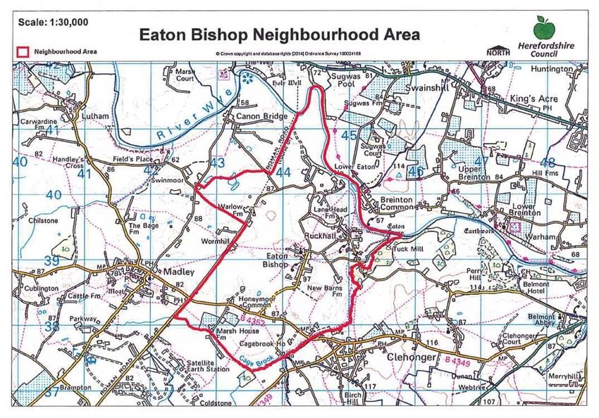
Eaton Bishop with the lesser focus on Ruckhall. The proposed choice of sites will
result in at least 90% of the development located within the settlement boundary of
Eaton Bishop and around 10% within the settlement boundary of Ruckhall.

None of the 6 sites significantly extend the boundaries of existing settlements into
open countryside nor do any reduce the separation of Eaton Bishop and Ruckhall.
Also, none encourage future linear development or encroachment into the wider
countryside, especially the “green gap” between Eaton Bishop and Ruckhall.

The results of the analysis take into account the policies stated in Sections 6.1 - 6.4.
Policy EB1 describes the siting of new developments in the Parish as required by
the Herefordshire Local Plan Core Strategy 2011-2031 and the views expressed from
public consultation within the Parish. Policy EB2 identifies the proposed sites for
future new housing development.

Policy EB3 indicates the types of housing development which the Parish wishes to
see in order to provide for the perceived future needs of the community.

Protection of the local environment and its historic heritage are addressed by
Policies EB4 and EB5 in Section 6.2. Section 6.3 notes that within the Parish only
the church and Village Hall offer community facilities. In addition, several aspects
of the Parish infrastructure are very limited or currently working at maximum
capacity. Examples of this are the inadequate public transport service and the
sewage treatment plant mentioned in paragraphs 2.26 and 2.31. Whilst the NDP can
only address planning for our own Parish, the required expansion of Eaton Bishop
and the neighbouring villages will put increased pressure on shared facilities, such
as schools and the GP surgery. Policy EB6 protects existing community facilities and
supports investment in new infrastructure. Policy EB7 considers the management
of flood risk. An additional Policy EB8 requiring developers to consider the need
for local infrastructure improvements linked to waste water management and water
supply has been added following comments submitted at Regulation 14
consultation stage from Dwr Cymru Welsh Water and Environment Agency.

The Parish recognises the benefits of encouraging rural enterprise to provide local
employment. However, new businesses should be of small scale to protect the
character and landscape of the Parish. Therefore, Policies EB9 – EB12 advise on
measures to achieve this and define conditions for the control of the construction of
larger developments. Policy EB13 sets out criteria for community energy schemes.

Note: The documents “Eaton Bishop NDP planning Policy Assessment & Evidence Base
Review” February 2016 and “Eaton Bishop Neighbourhood Plan Call for Sites Assessment
Report” are available on the Parish website (www.eatonbishoppc.btck.co.uk).

                                    4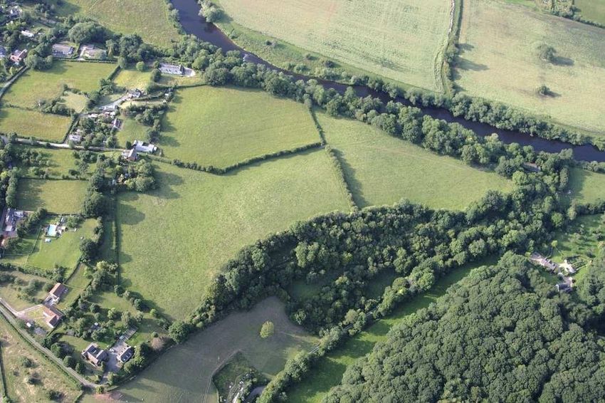
Contents
                                                                     Page
1.0   Introduction and Background                                    7

2.0   The Parish of Eaton Bishop                                     11

3.0   Planning Policy Context                                        21

4.0   Key Planning Issues and Aims                                   23

5.0   Objectives                                                     25

6.0   Neighbourhood Plan Policies                                    26

      6.1 Housing including Options for Site Allocations
      Policy EB1    Supporting New Housing within the Eaton          31
                    Bishop and Ruckhall Settlement Boundaries
      Policy EB2    Site Allocations                                 34
      Policy EB3    Encouraging a Mix of New Housing                 37

      6.2 Protecting and Enhancing the Local Environment
      Policy EB4     Green Infrastructure and Protecting Local       40
                     Landscape Character and Diversity
      Policy EB5     Protecting Built Heritage and Archaeology       42
                     and Requiring High Quality Design

      6.3 Community Facilities and Infrastructure
      Policy EB6  Protecting Existing Community Facilities           47
                  and Supporting New Infrastructure
      Policy EB7  Managing Flood Risk                                48
      Policy EB8  Wastewater Treatment and Water Supply              51

      6.4 Rural Enterprise
      Policy EB9     New Business Development in Former              54
                     Agricultural Buildings
      Policy EB10 Poly-tunnels and Large Agricultural Buildings      56
                     and other Rural Business Buildings
      Policy EB11 Design Guidance for Large Agricultural Buildings   57
                     and other Rural Business Buildings
      Policy EB12 Intensive Livestock Units                          58
      Policy EB13 Supporting Community Energy Schemes                60

      Appendices                                                     61

                                       5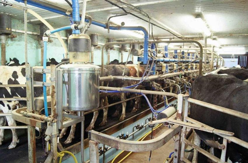
Vision

The following statement underpins the purpose and guides the preparation of the
Neighbourhood Development Plan (NDP):

“To protect and enhance the rural nature of the Parish through
incremental development in an appropriate and sustainable way in
order to maintain and, where possible, enhance the quality of life for
all of the village community.”

                      Acknowledgements

Eaton Bishop Parish Council wishes to acknowledge the help received in the
preparation of this document from the following people:

Louise Kirkup of Kirkwells for her factual advice and assistance with the
preparation of the draft and final editions of the Neighbourhood Development Plan
(NDP).

Yvonne Coleman and Samantha Banks for their expert guidance to the Steering
Group with regard to ensuring that the NDP conforms with European, national and
local legislation.

Tim Hoverd and Julian Cotton for determining the extent of the buffer zone that is
deemed to affect the setting of Eaton Camp in Ruckhall.

The residents of the Parish for their views and comments which have formed the
basis of the NDP and without which no plan could have been produced.

All Maps reproduced under License No.100056048 (Eaton Bishop Parish Council,
Licensee).

                                  6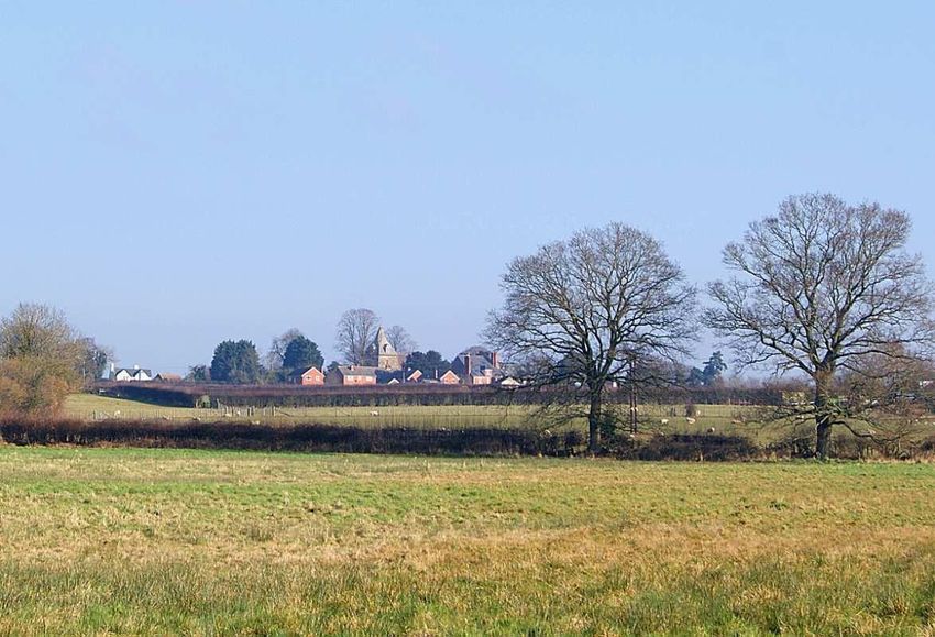
1.0 Introduction and Background
1.1 The Localism Act 2011 gives Parish Councils and other relevant bodies new powers
to prepare statutory Neighbourhood Development Plans (NDPs) to help guide
development in their local areas. Through NDPs, local communities have the
opportunity to shape new development as planning applications are determined in
accordance with the Local Plan, unless material considerations indicate otherwise.
Herefordshire adopted Local Plan Core Strategy 2011-20311 (hereinafter referred to
as the Core Strategy) and Eaton Bishop Neighbourhood Development Plan (once
“made”) will be part of the statutory development plan for the area. In addition, the
National Planning Policy Framework (NPPF)2 is a material consideration in any
planning application determinations.
The steps in preparing a Neighbourhood Development Plan are set out below.
Designation (Eaton Bishop Parish Council propose preparation of NDP)
Preparing the Plan – including informal consultation
Formal public consultation (8 weeks)
Revise Plan
Submission of NDP to Herefordshire Council
Herefordshire Council formal consultation (6 weeks)
Examination
Local Referendum
Eaton Bishop NDP “Made”
(Approved & adopted by Herefordshire Council)
7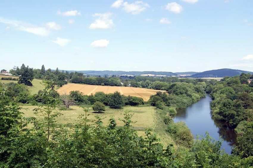
1.2   Eaton Bishop Parish Council proposed the preparation of an NDP for the Parish in
      2014. An application for recognition as a “Designated Neighbourhood Planning
      Area” was submitted to Herefordshire Council on 20th July 2014 and the application
      was approved on 17th September 2014. The Designated Neighbourhood Planning
      Area is shown on Map 1 below.

         Map 1 Eaton Bishop Designated Neighbourhood Plan Area
         Eaton Bishop Parish Council (Licensee) License No. 100056048

Informal Public Consultation

1.3   A Steering Group was set up and an initial public consultation event was held on
      7th March 2015 at Eaton Bishop Village Hall. An invitation was delivered to every
      house in the Parish and the event was attended by more than 100 people out of 324
      on the electoral roll. Detailed questionnaires were available to complete on the day
      or return later. Of those who completed the questionnaire, 87% supported the Parish
      Council's proposal to prepare a Neighbourhood Development Plan. A full summary
      of the responses to the questionnaire is included in the Consultation Statement.

1.4   Much of the feedback from the questionnaire has informed the formulation of the
      Vision, Objectives and overall content for the NDP.

                                         8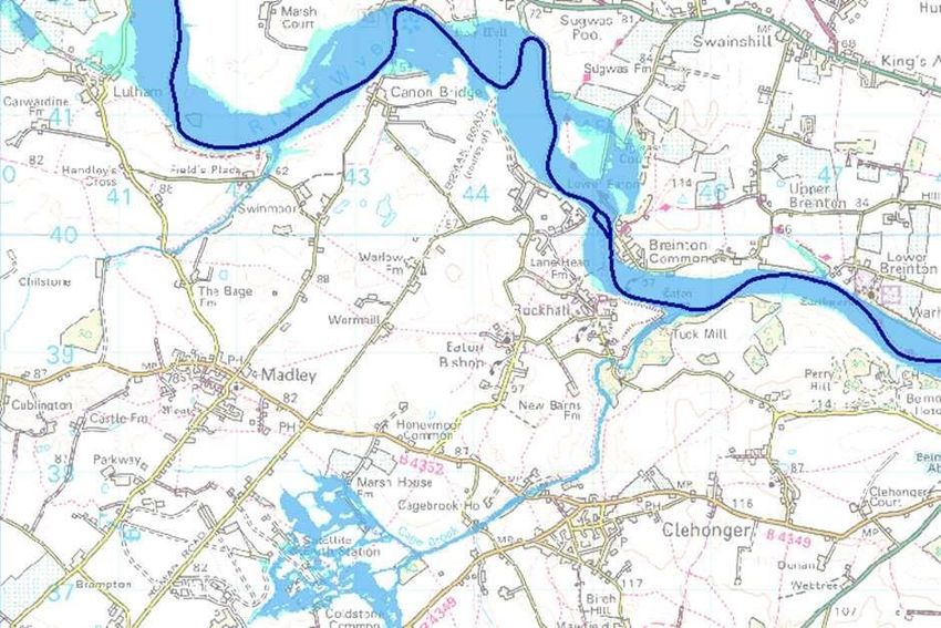
1.5   This early informal consultation and discussions with the Steering Group identified
      the following scope and key themes which should be addressed in the NDP:

       •     The Plan should reflect the small rural parish context, and address a limited
             range of appropriate issues.
       •     Provision of a positive planning framework to support the delivery of at least
             33 new homes in the Parish over the plan period, as required by the Core
             Strategy.
       •     Construction of new housing should be phased to ensure steady,
             incremental growth over the plan period. This will allow for the essential
             improvements to the Parish infrastructure to be brought forward. For
             example, to address the requirement for increased sewage treatment since
             the current treatment works is at full capacity, and the need for affordable
             public transport to give an alternative to private car use.
       •     The very narrow road access within and on the approaches to Ruckhall is a
             problem which must be addressed before additional development could be
             considered.
       •     The site of the ancient Hill Fort, known as Eaton Camp, reduces significantly
             the possible number of sites available for development in Ruckhall. This is
             supported by evidence from Herefordshire Archaeology and Historic
             England.
       •     New developments should be of a high design quality, making use of local
             materials and renewable energy sources where possible, and should be sited
             to be in sympathy with the landscape setting of the settlements within the
             village.
       •     Criteria have been established for Eaton Bishop and Ruckhall to guide
             development to the most sustainable locations taking into consideration
             issues such as the existing built form, access, flood risk, landscape setting,
             protection of important views etc. and to allow settlement boundaries to be
             determined.
       •     Independent assessment using these criteria has been employed to assess
             any sites offered for development.
       •     New housing should include a range of house types, sizes and styles to meet
             local needs, and, in particular, should include cottages / smaller properties
             for first time buyers, and properties designed for older residents.
       •     Housing development should be based on smaller schemes of 1–8 units to
             provide a sense of rural, rather than suburban living, and to promote social
             inclusion and integration with the existing community.
       •     Agricultural and other development which requires planning consent, for
             example, large poly-tunnels and energy schemes, should be sited and
             designed appropriately to protect landscape setting and local biodiversity.

                                         9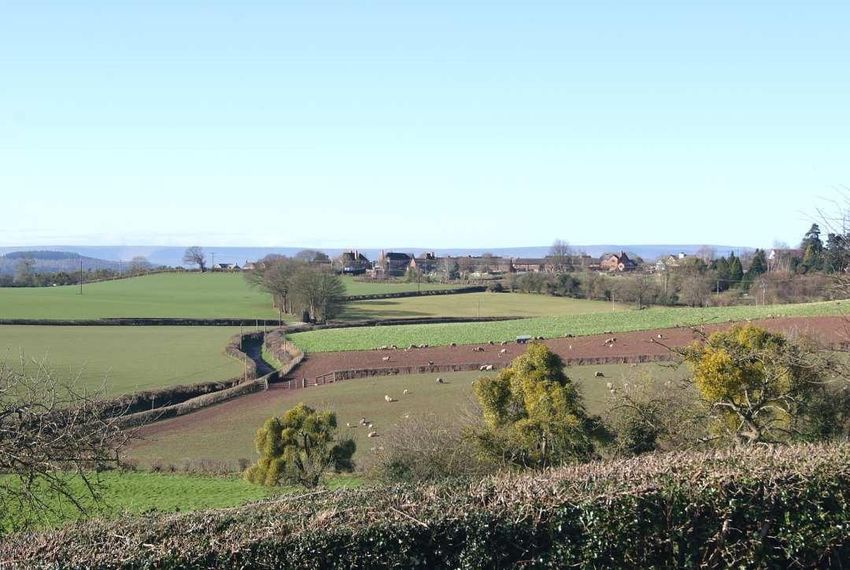
Formal Consultation on the Draft Plan

1.6   The Draft NDP was published for an 8 week formal public consultation (under
      Regulation 14) from 25th July to 17th September 2016. The written responses,
      together with the Parish Council’s consideration of all representations, and any
      resulting changes to the Plan are provided in the Consultation Statement which
      accompanies the submission version of the NDP.

1.7   Herefordshire Council published the plan for a further 6 weeks consultation in
      Autumn 2016 before it was examined by an independent Examiner in February /
      March 2017. The Examiner recommended a number of modifications to the NDP to
      ensure the Plan meets the Basic Conditions, and these changes have been
      incorporated into the final version of the document.

                                      10
2.0 The Parish of Eaton Bishop
View of Eaton Bishop and Black Mountains from Ruckhall Pitch
2.1 Eaton Bishop is a small rural Parish lying approximately 6 miles to the west of the
city of Hereford. The Parish, which extends to over 672 hectares, had 414 residents
in 173 households in 2011 (Census 20113). The population percentage of the Parish
of Eaton Bishop divided into three cohorts is as follows (Census 2011):
Age Group Number of Residents Percentage of the Parish
population of 414
1 – 18 yrs 78 19%
19 – 65 yrs 242 58%
Over 65 yrs 94 23%
11Local Landscape Character
2.2 The Parish is bounded almost entirely by natural features and historic routes: by the
River Wye to the north and north east; the Cage Brook forms most of the southern,
south-eastern and eastern Parish boundary; and a Roman road, known as Stone
(also known as Stony or Stoney) Street, almost entirely straight along its
south west / north east course, forms the western boundary and ends at the south
bank of the River Wye.
2.3 This is a very rural area. The Parish of Eaton Bishop lies within National Character
Area 100 Herefordshire Lowlands4. The Parish lies on Devonian sandstone overlain
by glacial deposits of till and moraine in places. This has given rise to varied soil
quality. The landscape is gently undulating with remnants of ancient woodland of
ash, field maple and oak along with bracken. Around Warlow pool, the landscape
is notable for kames (mounds of sediment deposited along the front of a melting
glacier) and kettle holes (holes or depressions filled with water and formed by
blocks of ice separated from a glacier). The Parish has the following landscape types:
● Principal settled farmlands
● Wet pasture meadows
● Wooded forest.
2.4 Field boundaries are mainly of hedgerow, many contours of which reflect the
diverse local history and are a historic feature in their own right, or as “relic
boundaries” (a boundary that no longer exists but still has an effect on the present
day area), and they have a high biodiversity value. There are around 30 ancient trees
in the Parish providing varied habitats. Some are in open fields indicating previous
field boundaries now removed. There are also some stone walls and stone faced
banks.
2.5 There is a significant number of entire and remnant traditional orchards, some with
potential for restoration. The many veteran orchard trees of over 30 years support
high biodiversity.
2.6 A network of wooded dingles is found along the River Wye and Cage Brook. There
are small areas of woodland on Honeymoor and Littlemarsh commons as well as
around Upper Wormhill and Lower Eaton. Some coppiced small leaved lime and
midland hawthorn have historic significance in the Parish. The parkland at Lower
Eaton also offers an historic landscape.
122.7 The agricultural landscape varies from intensive arable to dairy including mixed
and livestock farms. These range from traditional breeds generally on the smaller,
unimproved pastures to more intensive herds and flocks of commercial livestock on
permanent pasture, short term leys and fodder crops. This variety is an important
feature of the local landscape.
2.8 Dark skies are an important asset of the neighbourhood area. Street lighting at
Bentley Drive and Pulley Avenue has been modified to provide more economic
lighting with the added benefit of enhancing the experience of dark skies in the
Parish.
2.9 Footpaths and the recently installed Jubilee Bench afford magnificent views of the
River Wye valley and landscapes within and surrounding the Parish.
Historical Development
Eaton Bishop
2.10 The Parish of Eaton Bishop has a history dating back to settlements during the
bronze and iron ages through to modern conversions of historic buildings.
2.11 During the Roman period, a road was constructed to cross the river via a bridge or
ford leading towards the Roman regional town of Kenchester on the north side of
the River Wye. The area is rich in Roman features and includes numerous undated
and unexcavated crop marks which may represent sites of houses or temporary
army camps. Eaton Bishop is described in historical documents, including amongst
others, the Doomsday Survey (1086), associated with the Bishop’s Palace at Sugwas,
a Bishop’s rental roll (c.1250), a Henry VIII survey (1537) and detailed accounts of
the rent rolls of the Bishop’s Manors from the 15th to 17th centuries. This historic
land usage informs the features of the landscape and some agricultural activity in
the present day.
2.12 Eaton Bishop and Ruckhall, the two primary settlements, differ dramatically both
from each other and from the other smaller settlements which make up the Parish.
The built environment has a rich mix of quality stone and timber buildings
alongside modern block-work and brick dressed homes and as in all modern
settlements, the mix continues to evolve. There are 21 Listed Buildings and
Scheduled Monuments in Eaton Bishop Parish and these are listed in Appendix I.
2.13 The settlement of Eaton Bishop was originally built around the church in a
traditional cluster village form as shown in the tithe map of 1839. From the 1980's
13through to the current day, the village has evolved into a linear, ribbon development
layout extending south and east with many pastures and fields either side of the
houses seaming the road. From the Clehonger to Madley road into the village, the
church is clearly visible alongside the roofs of other historic buildings dating from
between 16th to 19th century including the Grade II listed timber framed and lime
rendered property, “The White House”.
Eaton Bishop Church
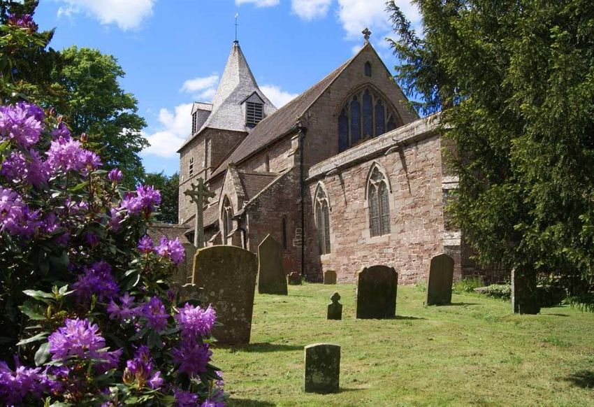
Church of St Michael & All Angels, Eaton Bishop.
2.14 The juxtaposition of the church within its enclosure on a circular mound, and the
Iron Age Camp in Ruckhall, both on higher ground, suggest an ancient connection
between pre-Christian times and the Christian era. The church of St Michael and All
Angels, some parts of which date back to at least the 11th century, is Grade I Listed
and is particularly notable for the exceptional 14th century stained glass in the east
window. The glass is noted by Sir Nikolaus Pevsner as being “the finest Decorated
glass in the county”, praise indeed for a small Parish church. The original graveyard
surrounds the church and dates from at least 1285 but is likely to be considerably
older (c.7th century), and there is a separate, later extension.
14Ruckhall
2.15 Ruckhall is a dispersed settlement made up primarily of cottages above the River
Wye. All of the houses sit well and within their own garden plots reflecting the
commoner/crofter roots of many of them.
Eaton Camp
Aerial view of the Iron Age Hill Fort, Eaton Camp, courtesy of Herefordshire Archaeology.
2.16 To the east of the residential houses in Ruckhall lies the Scheduled Monument,
Eaton Camp. The archaeological remains are in both private and National Trust
ownership and are subject to a detailed Conservation Management Plan, “A
Conservation Management Plan for Eaton Camp, Ruckhall, Herefordshire”,
(Dorling and Hanks, 2013), available on the Parish website
www.eatonbishoppc.btck.co.uk. The Camp dates from the Iron Age and sits on a
promontory overlooking the River Wye.
2.17 An important historical and landscape feature in Ruckhall, the Iron Age Camp hill
fort, is situated in a commanding position on a slightly sloping spur with a view due
15east to equinoctial sunrises over the confluence of the Cage Brook and the River
Wye. The interior of the fort is divided into three fields between two owners and the
ramparts lie within the gardens and paddocks of a further 8 properties.
2.18 The Historic England record for the site advises that despite excavation, site
clearance, partial ploughing and the crossing of pathways and fences, the
promontory hill fort survives comparatively well. Excavations in 2012 and 2013
confirmed that the Camp dates back to the early Iron Age between 500 and 700 BC.
Two ditches within the fort were excavated. The ditch separating the promontory
from the main fort contained fragments of decorated pottery, burnt bone and fire
cracked pebbles as well as an apparent ritual deposit of animal bone. The best
example of a circular building discovered so far from within a Herefordshire hill
fort was found during the second season of excavation in 2013. Evidence of a
permanent hearth was found inside the hut. A large shaft was also found at Eaton
Camp adding further weight to the hypothesis that the eastern end of the hill fort
may have been used for ritual or ceremonial purposes.
2.19 The Conservation Management Plan for the monument, written in 2013, gives
recommendations for a programme to maintain the archaeological and historical
features in their optimum condition. This programme includes work to increase and
maintain the diversity of the ecological features of the hill fort and to encourage
sustainable public access.
2.20 Eaton Bishop Parish Council has taken advice from Herefordshire Archaeology
concerning the need to protect the setting of this nationally significant heritage asset.
Map 2 below indicates the “buffer zone”, supported by Historic England, and within
which new development is considered to be unacceptable as it would impact
adversely on the setting of Eaton Camp.
Map 2 Eaton Camp Buffer Zone
Eaton Bishop Parish Council (Licensee) License No. 100056048
16Lower Eaton, Shepherds Meadow and other Areas of the Parish
2.21 In terms of size, the third of the settlements in the Parish, is dominated by the Lane
Head Farm and Threshing Barn, now converted to domestic use, and the Grade II
Listed Lower Eaton House. Lower Eaton House, also known as “The Manor House”,
was built in 1743 and later extended and embellished in the high Victorian style. It
sits beside the River Wye and has around it former estate buildings – all of which
have been converted into domestic use. Shepherds Meadow is sited away from
public view, in a charming position overlooking the River Wye, and is now in
domestic and commercial use.
2.22 There are two unregistered parks and gardens within the Parish: Cagebrook House
to the south, a small park which may have been improved by John Davenport in the
late 18th century, and Lower Eaton to the north which is a house of the mid-18th
century with later alterations. The surrounding fields formed a deer park in the 18th
century and the river frontage was planted with ornamental beds in the 19th
century.
2.23 Other small developments of farms, barns and dwellings are located within areas
known as Wormhill, Marsh Farm and Littlemarsh Common.
Biodiversity
2.24 The Parish has 3 sites of Special Scientific Interest (SSSI). These are the River Wye,
the bank side of which continues to support native flora, such as wild garlic, despite
the presence of invasive species e.g. Himalayan balsam and giant hogweed; Cage
Brook Valley which includes woodland and unimproved grassland with
monkshood and Littlemarsh Common which contains wet grassland with wild
orchid species. There are 8 Special Wildlife Sites (SWS’s) which include Honeymoor
Common (wet pasture with ponds and scrub), Eaton Bishop churchyard (bat roost),
the hay meadow near Eaton Camp, Warlow pool (large pool with wooded margin)
and the Cage Brook (aquatic and bankside flora). In addition, there is an area of
ancient woodland bordering Eaton Bishop Parish. These are listed in Appendix II
and shown on Map 3.
2.25 The River Wye Special Area of Conservation (SAC) follows the River Wye along the
northern boundary of the Parish. The Environmental Report (Herefordshire
Council, October 2016) in Appendix 1: European Sites sets out further information
about the River Wye:
17“Site features: Water courses of plain to montane levels with the Ranunculion fluitantis
and Callitricho-Batrachion vegetation. Transition mires and quaking bogs. White-clawed (or
Atlantic Stream) crayfish Austropotamobius pallipes. Sea lamprey Petromyzon marinus.
Brook lamprey Lampetra planeri. River lamprey Lampetra fluviatilis. Twaite shad Alosa
fallax. Atlantic salmon Salmo salar. Bullhead Cottus gobio. Otter Lutra. Allis shad Alosa
alosa.
Vulnerability data: Proximity: Developments should not be within 100m of the designated
bank. Some developments beyond 100m may also have impacts based on proximity and these
issues should be addressed where possible when developing NDP policy and choosing site
allocations.”
Map 3 Eaton Bishop SEA Map 1
Eaton Bishop Parish Council (Licensee) License No. 100056048
18Local Facilities
2.26 Apart from the church, the Village Hall, and a small playing field, there are virtually
no local amenities. Indeed, historically there has been a shrinkage, as the only public
house, the small school, village shop and the former post office have all disappeared
from use. Exacerbating this loss of local amenities, the availability of public
transport to adjoining villages and the city of Hereford is extremely limited, thus
impacting on the day-to-day social life and “out of village” activities accessible to
the community.
2.27 There is a Mothers and Toddlers group as well as keep fit, yoga and tai chi classes
held weekly in the Village Hall. The Hall is used for monthly meetings of the
Gardening Club and Parish Council, and there is a Farmer’s Market held on the first
Saturday of each month except January. Community and fundraising events are
organised in the Parish. Examples of these include the village fête, fashion show,
firework display, quiz and curry evenings and the village Christmas lunch. There is
a fortnightly service in the church.
2.28 Pre-schools and primary schools are located in Clehonger, Kingstone and Madley
(2-4 miles) and there is a high school at Kingstone (4.5 miles). There is school
transport available to Madley and Kingstone. Further education is provided in
colleges in Hereford. Bus travel is inadequate and costly although those on low
income may receive help towards travel costs.
2.29 The nearest doctors’ surgery is in Kingstone (4.5 miles), and general hospital
(including A&E) and dental services are available in Hereford. There is an Age
Concern group in Madley. The nearest village grocery shops, post offices and
hairdressers are in Madley, Kingstone and Clehonger. The closest supermarket is
located in Belmont (4 miles).
Employment and Businesses
2.30 There are some small businesses run from the Parish but they do not necessarily
provide employment for local people - see para 6.4.1. Employment of adults is
diverse; some use their homes as home office facilities whilst others commute to
surrounding areas or towns and some travel greater distances for work.
19Drainage
2.31 Both the River Wye and Cage Brook are failing the Water Framework Directive.
Increased pressure from domestic sewage could exacerbate this.
2.32 Drainage is a problem away from the higher ground in the Parish due to the heavy
clay soil. Most houses in the Parish have to rely on their own sewerage facilities. A
small number of properties (about 1/3rd of the properties in the main settlement)
are served by a sewage treatment plant situated to the rear of the recreational area
at the bottom of Pulley Avenue in the centre of Eaton Bishop. The plant was built in
the 1950's to service the Pulley Avenue development of around 40 houses. The
outflow is discharged into the Cage Brook below New Barns Farm. An email from
Welsh Water confirmed that the plant is now operating at full capacity and that
there are no plans to extend the system.
2.33 Poor drainage and local flooding are of particular concern in Ruckhall and there is
no current or anticipated future provision of mains drainage. Expert advice was
obtained which guided the Parish Council to limit further development and ensure
that the identified sites for development are designed to ensure satisfactory surface
and foul water drainage provisions. These issues are dealt with in more detail in
paragraphs 6.1.8, 6.3.7 - 6.3.11, EB Policy 8 “Managing Flood Risk” and EB Policy
9 “Wastewater Treatment and Water Supply”.
Implications for the Plan
2.34 When considering planning and development, it is important to keep in mind the
steadily and continuously evolving character of the Parish and the consequential
impact on its infrastructure and natural habitats. Thus, any changes with respect to
large, increased housing development in the short term should be resisted in favour
of gradual and sustainable small scale developments.
203.0 Planning Policy Context
3.1 National planning policy is set out in the NPPF published in 2012. This document
indicates, in paragraphs 6 and 7, that the purpose of the planning system is to
contribute to the achievement of sustainable development, and that the planning
system has to perform economic, social and environmental roles.
3.2 Neighbourhood planning is addressed in paragraphs 183-185 of the NPPF: 183.
Neighbourhood planning gives communities direct power to develop a shared vision for their
neighbourhood and deliver the sustainable development they need. Parishes and
neighbourhood forums can use neighbourhood planning to:
● set planning policies through neighbourhood plans to determine decisions on
planning applications; and
● grant planning permission through Neighbourhood Development Orders and
Community Right to Build Orders for specific development which complies with the order.
184. Neighbourhood planning provides a powerful set of tools for local people to ensure that
they get the right types of development for their community. The ambition of the
neighbourhood should be aligned with the strategic needs and priorities of the wider local
area. Neighbourhood plans must be in general conformity with the strategic policies of the
Local Plan. To facilitate this, local planning authorities should set out clearly their strategic
policies for the area and ensure that an up-to-date Local Plan is in place as quickly as possible.
Neighbourhood plans should reflect these policies and neighbourhoods should plan positively
to support them. Neighbourhood plans and orders should not promote less development than
set out in the Local Plan or undermine its strategic policies.
185. Outside these strategic elements, neighbourhood plans will be able to shape and direct
sustainable development in their area. Once a neighbourhood plan has demonstrated its
general conformity with the strategic policies of the Local Plan and is brought into force, the
policies it contains take precedence over existing non-strategic policies in the Local Plan for
that neighbourhood, where they are in conflict. Local planning authorities should avoid
duplicating planning processes for non-strategic policies where a neighbourhood plan is in
preparation.
3.3 The local strategic planning policy framework for the neighbourhood plan area
comprises the Core Strategy adopted on 16th October 2015. The key policies
relevant to the NDP for Eaton Bishop are set out in the Herefordshire’s Rural Areas
chapter Policy RA1 - Rural Housing Distribution and Policy RA2, Housing in
settlements outside Hereford and the market towns. Policy RA1 establishes a rural
housing distribution for the county and identifies a target proportional growth
figure of 18% for the Hereford rural housing market area. Eaton Bishop is identified
21in Figure 4.14 as one of the settlements which will be the main focus of proportionate
housing development. Ruckhall is identified in Figure 4.15 as one of
the other settlements where proportionate housing is appropriate. Policy RA2
supports housing growth in and adjacent to these settlements. Other key Core
Strategy policies relate to the protection of landscape and built heritage, including
Policies RA3, RA4, RA5, H2, H4, Policy LD1 Landscape and townscape, LD2
Biodiversity and geodiversity, Policy LD3 Green infrastructure and Policy LD4
Historic environment and heritage assets.
3.4 Further information can be obtained from a summary document, “Planning Policy
Assessment and Evidence Base Review”, which has been prepared as a background
document to aid the preparation of a NDP. This notes the relevant national and local
planning policies and has been used to inform the draft policies in the Eaton Bishop
NDP. The document is part of the evidence base for the NDP and is available on the
websites www.eatonbishoppc.btck.co.uk and www.eatonbishop.org
Note: Also see para 6.0.2
224.0 Key Planning Issues and Aims
4.1 Key planning issues for Eaton Bishop have been drawn from the public consultation
event held on 7th March 2015 and summary of responses to the associated
questionnaire. In addition, the Steering Group has been guided by the need to
promote sustainable development and to ensure that the Neighbourhood
Development Plan is in accord with the NPPF, and the adopted Local Plan Core
Strategy for Herefordshire, and that account is taken of the Strategic Environmental
Assessment and Habitats Regulations Assessment processes as required by
European legislation.
4.2 The NDP addresses the following key issues. The need to:
Plan for Some New Housing.
To:
● Encourage new housing in or adjacent to the two settlements of Eaton Bishop
and Ruckhall.
● Focus development on several small scale sites rather than one or two large
developments.
● Provide some houses in the lower, more affordable end of the market for people
to set up home for the first time in the Parish.
● Encourage development of houses both for sale and to rent to meet changing
local needs.
● Promote development of houses or bungalows suitable for retirement provision,
to enable residents to “right-size” from larger properties but still remain in the
Parish.
● Encourage the provision of warden assisted retirement property for the elderly
to rent or buy.
Protect Local Landscape Character.
To:
● Guide development away from land classed as “Open Countryside” or within
the boundaries of protected areas.
● Promote sustainable patterns of development and avoid extending linear
development within the Parish, especially that which would have the effect of
joining the two distinct settlements of Eaton Bishop and Ruckhall thus losing
agricultural land.
● Guide development towards sites where it would not impact on the skyline.
23Improve Local Infrastructure.
To:
● Focus, within the plan, on improving the existing very poor infrastructure. For
example, roads within the Parish, walking and cycling routes, sewage treatment,
flood alleviation and provision of an open space as a public amenity.
● Encourage provision of better public transport, with regular services into
Hereford that actually serve the two settlements of Eaton Bishop and Ruckhall
and not just pass by the Parish on the Clehonger to Madley road.
Promote Sustainable Development, Reducing the Carbon Footprint, Protecting
the Natural Environment and supporting Local Employment.
To:
● Help reduce Eaton Bishop’s carbon footprint by encouraging renewable forms of
energy and high levels of insulation in both new and existing properties.
● Protect and enhance wildlife habitats and built heritage.
● Encourage business development suited to the rural environment, along with
delivery of better broadband speed to enable working from home where
required.
245.0 Objectives
To:
1. Ensure development preserves and is sympathetic to the character of the
Parish and protects the landscape and environment through attention to the
size and style of new housing.
2. Base all development upon sound environmental principles including,
energy and water conservation, recycling and efficient sewerage
management in order to minimise its impact on the local environment.
3. Encourage new business ventures, which are perceived as beneficial to
the economic health of the Parish and bringing local employment
opportunities, provided that they are in scale with, and sensitive to, the rural
character of the Parish.
Note -The Objectives that apply to each Eaton Bishop Parish Policy are shown in
Appendix III.
256.0 Neighbourhood Plan Policies
6.0.1 This section sets out the Planning Policies specific to the Eaton Bishop
Neighbourhood Development Plan (NDP). These have been drafted by the Steering
Group and approved by the Parish Council and will be used to help determine all
future planning applications in the Parish and so shape the future of the Parish as a
place in which to work and live, as well as visit.
6.0.2 Neighbourhood Plans are required to be in general conformity with local strategic
planning policies and have regard to national planning policies and advice
contained in guidance.
6.0.3 The NDP Policies Map (Map 4) shows the NDP boundary, the boundary of the
Village Inset Maps and environmental areas. The settlement boundaries and
housing allocation sites for Eaton Bishop and Ruckhall are shown on the Village
Inset Maps (Maps 5 and 6).
26Map 4 Policies Map
Eaton Bishop Parish Council (Licensee) License No. 100056048
27Map 5 Eaton Bishop Inset Map
Eaton Bishop Parish Council (Licensee) License No. 100056048
Map 6 Ruckhall Inset Map
Eaton Bishop Parish Council (Licensee) License No. 100056048
286.1 Housing
Some examples of the variety of housing styles in the Parish of Eaton Bishop.
29Quantity and Location of New Housing Development
6.1.1 The Parish Council accepts the Core Strategy’s proposed target growth figure for
the Hereford Local Housing Market Area of 18% and considers that this overall
growth figure would be appropriate for the Parish up to 2031. Thus, the housing
allocation target for the Parish over the period 2011 – 2031 has been calculated to be
at least 33 houses, based on 18% of the existing Parish housing figure of 186
properties as at April 2011 (this figure was provided by the Team Leader of
Neighbourhood Planning, Hereford Council) but the constraints imposed by the
buffer zone of the Hill Fort in Ruckhall also need to be considered as noted in bullet
point 5 of paragraph 1.5.
6.1.2 Development completed or proposed since 2011, which may count towards this
target of at least 33 new houses, includes the following:
● Plot 5 adjacent to Orchard View Completed
● Well House Barn Conversion Completed
● Lane Head Farm “The Nursery” Completed
● Lane Head Farm “The Great Hall” Completed
● Lane Head Farm “The Bull Pen” Under construction
● Barn Conversion Wormhill No 1 Under construction
● Barn Conversion Wormhill No2 Under construction
● Plot 6 adjacent to Orchard View Permission applied for
● Plot 2 adjacent to Orchard View Permission lapsed
6.1.3 In accordance with national planning guidance, the focus for new development
should be within or adjacent to existing settlements. The possibility of permission
for development on land in the open countryside being granted will be assessed on
the individual merits of each application guided by the policies in the Core Strategy
and in the Neighbourhood Development Plan (NDP) to ensure that the two
individual settlements remain distinct from one another. (see Policies EB1 and EB2
below).
6.1.4 Within the defined settlement boundaries for Eaton Bishop and Ruckhall (see
Village Inset Maps 5 and 6 above) at least 33 net new homes will be provided over
the plan period up to 2031. Taking into account the existing commitments of seven
dwellings, the net housing requirement is at least 26 new dwellings over the plan
period.
30Policy EB1 Supporting New Housing within the Eaton Bishop and
Ruckhall Settlement Boundaries
New housing development of at least 26 net additional dwellings will
be supported on suitable sites within the identified settlement
boundaries of Eaton Bishop and Ruckhall as shown on the Proposals
Map in the plan period up to 2031.
The focus for new housing development is Eaton Bishop, but some
small scale new housing also may be permitted in Ruckhall, where
proposals demonstrate particular attention to form, layout, character
and setting of the site and/or they contribute to the social well-being of
Ruckhall.
A mixture of small developments and individual plots is preferred to
larger scale developments.
Layout and design of new developments should protect the
residential amenity of neighbouring occupiers to address issues
such as overlooking, protection of privacy, and access to daylight.
Development proposals should provide suitable access taking into
consideration the rural nature of the roads in and around Eaton Bishop
and Ruckhall.
Outside the identified settlement boundaries, housing development
will only be supported exceptionally where it is accordance with the
NPPF and Core Strategy Policies RA3 and RA4. Affordable rural
housing schemes will be supported where they accord with Core
Strategy Policy H2 on Rural Exception Sites.
31Options for Site Allocations – January 2016
6.1.5 In order to meet the housing growth target for the Parish, a “Call for Sites” exercise
was undertaken to identify the supply of deliverable housing sites. The closing date
for the submission of site proposals was 31st December 2015. Landowners were
asked in the Call for Sites process to suggest proposed housing numbers for each
site. The proposed housing numbers for the sites were put forward by landowners
and are generally below the 25 units per hectare capacity often considered
appropriate for rural areas, but this reflects the existing low density and character
of the settlements of Eaton Bishop and Ruckhall, where detached dwellings often
occupy fairly large plots. In informal consultations on the emerging NDP, local
residents generally supported the approach of low numbers of houses across a range
of plots, and the Parish Council considered that the proposed housing figures for
each site option should be retained in the plan. Twenty one (21) sites were put
forward. An objective assessment of these sites was undertaken by Kirkwells Town
Planning & Sustainable Development Consultants and is set out in their Call for
Sites Assessment Report, February 2016 (available on the Parish websites -
www.eatonbishoppc.btck.co.uk and www.eatonbishop.org ). Sites were assessed in
the context of any constraints that might affect their suitability, ability to be
delivered or availability for development up to the end of the plan period (2031).
Proposed Site Allocations, Spring 2016
The Parish Council concluded that 8 of highest scoring sites should be taken forward
in the neighbourhood plan as “Proposed Site Allocations”. These are shown on
Maps 7 and 8 below.
32Map 7 Map 8
Eaton Bishop Preferred Option Sites Ruckhall Preferred Option Sites
6.1.6 The total potential dwelling capacity of these sites was 30. All chosen sites related
well to existing built forms of the settlements for proportionate development as
required by the Herefordshire Council Local Plan Core Strategy 2011 – 2031 with
the required main focus to be on Eaton Bishop with the lesser focus on the
development of Ruckhall. The proposed choice of sites for development would have
resulted in more than 80% of the development located in Eaton Bishop with less
than 20% in Ruckhall.
6.1.7 None of the 8 sites significantly extend the boundaries of existing settlements into
open countryside nor do any reduce the separation of Eaton Bishop and Ruckhall.
Also, none encourage future linear development or in-filling – especially between
Eaton Bishop and Ruckhall.
6.1.8 Although the majority of preferred site options were generally supported by
residents in the informal consultation on the emerging draft NDP, there were a
significant number of concerns from residents relating to drainage and surface water
flooding issues in Ruckhall. Specifically in relation to potential exacerbation of these
problems arising from the proposed development of housing on the Old Post Office,
Ruckhall and the Paddock c/o Yew Tree Farm (Sites EB2/7 and EB2/8 respectively).
Following careful consideration and receipt of expert advice regarding these
33concerns, the Parish Council agreed to delete these two options from the proposed
site allocations.
6.1.9 There was general support for the other sites and additional text has been added to
Policy EB1 to address specific public concerns relating to traffic on rural roads and
access and impacts on residential amenity.
Policy EB2 Site Allocations
The following sites are identified for new housing development
within the settlement boundaries of Eaton Bishop and Ruckhall. The
site allocations are shown on the larger scale site plans set out below.
Site Allocation EB2/1 Site Allocation EB2/2
Land to the south of The Carpenters, Eaton Bishop
The Pippins, Eaton Bishop Site Area: 0.86 hectares
Site Area: 0.57 hectares Potential Capacity: 8 dwellings
Potential Capacity: 8 dwellings
34Site Allocation EB2/3 Site Allocation EB2/4
Hillcrest, Ruckhall Well House, Eaton Bishop
Site Area: 0.15 hectares Site Area: 0.15 hectares
Potential Capacity - 1 dwelling Potential Capacity - 1 dwelling
Site Allocation EB2/5 Site Allocation EB2/6
Land to the south of The Orchard, Ruckhall
The Pippins, Eaton Bishop Site Area: 0.33 hectares
Site Area: 0.76 hectares Potential Capacity: 2 dwellings
Potential Capacity: 8 dwellings
356.1.10 In rural locations outside the settlements of Eaton Bishop and Ruckhall, new
housing will be strictly controlled to avoid unsustainable patterns of development
which result in isolated, sporadic development at the expense of the landscape and
environment. Residential development will, therefore, be limited to proposals
which satisfy one or more of the criteria in policies RA3, RA4, RA5 and H2 of the
Core Strategy. Details of these policies can be found in the separate publication
“Planning Policy and Evidence Base Review” available on the Parish websites
www.eatonbishoppc.btck.co.uk and www.eatonbishop.org.
Encouraging a Mix of New Housing
6.1.11 In response to views expressed in the 2015 public questionnaire, particular
encouragement and support will be given to the building of properties that are more
affordable and suitable for new families and that enable retired residents to remain
in the Parish. This view is in line with the Core Strategy – see also paragraphs 6.1.15,
6.1.16 and 6.1.18 below.
6.1.12 There is a need to ensure that new development is appropriate to the needs of the
local community. In addition, there is a desire for high quality design in any new
development, which is sensitive to the traditional rural landscape and built heritage
of the Parish. Design is also addressed in Policies EB6 and EB7 below.
6.1.13 The Rural Housing Background Paper, Herefordshire Council, 20135 advises in
paragraph 6.13 that, “In Hereford rural HMA, the main requirement is for three bedroom
market housing. In the affordable sector, smaller one and two bedroom properties, as well as
three bedroom properties are broadly required, although this will vary according to local
needs evidence.“ The Herefordshire Council Local Housing Market Assessment
(2013)6 sets out that up to 2017 “there is a requirement, based on housing needs, for 53.3%
social rented housing, 21.6% affordable rented housing and 25.1% intermediate affordable
housing in the Rural areas.” Policy H3 in the Core Strategy requires residential
developments to provide a range and mix of housing units to contribute towards
the creation of more balanced and inclusive communities.
6.1.14 There is also a requirement to ensure that new housing provision meets the needs
of the ageing population of the Parish. The 2015 questionnaire survey responses
indicated that 38% of respondents thought that they may need to change their
accommodation to warden assisted housing and/or bungalows by the end of the
plan period in 2031. The Study of the Housing and Support Needs of Older People
in Herefordshire, 20127 recommended that, amongst other things, Herefordshire
should “Develop non-specialist, general needs, two and three bedroom houses, flats and
36bungalows for rent and sale that meet lifetime homes standards, across all areas of the county.
These will be of equal benefit to older people, people or families with disabilities and young
families encouraging mixed developments to balance the market, meet the needs of older
people and create genuine lifetime communities”
6.1.15 Policy EB3 is intended to deliver appropriate, sympathetic, robust and sustainable
expansion in the Parish and to enable the young and old of the existing population
to remain in the community.
6.1.16 The NDP policy, EB3 below, supports the following Herefordshire strategic
planning policies:
Policy SS1 Presumption in favour of sustainable development
Policy SS2 Delivering new homes
Policy RA1 Rural housing distribution
Policy RA2 Housing in settlements outside Hereford and the market towns
Policy H1 Affordable housing – thresholds and targets
Policy H2 Rural exception sites
Policy H3 Ensuring an appropriate range and mix of housing.
Policy EB3 Encouraging a Mix of New Housing
New housing development should provide a mix of house types, sizes
and tenures to meet the needs of those seeking affordable homes to
rent and market homes to purchase including first time buyers, young
families and older people. Bungalows and properties designed to meet
the needs of older people are particularly encouraged.
Where a need for affordable housing has been demonstrated, new
housing development on sites of more than 10 dwellings should
include an element of affordable housing in accordance with the
requirements of Core Strategy Policy H1. The type and size of
affordable housing shall be based on evidence from the latest Local
Housing Needs Survey.
376.2 Protecting and Enhancing the Local Environment
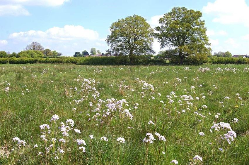
Above: Wild flowers in spring on Honeymoor Common. Below:
View of the River Wye from Ruckhall.
38Landscape Character and Biodiversity
6.2.1 Eaton Bishop Parish has a distinctive rural character with a number of natural and
built heritage assets. It is important that this rural character is maintained and
enhanced and that the design of new developments is appropriate in terms of
materials, detailing, scale, massing, landscaping and energy conservation.
6.2.2 The Herefordshire Landscape Character Assessment SPG, 2004 provides guidance
on how landscaping schemes can incorporate designs to protect and enhance this
local landscape character. These have been incorporated into Policy EB4 below.
Green Infrastructure
6.2.3 Multi-functional green infrastructure is important to underpin the overall
sustainability of a development by performing a range of functions including flood
risk management, the provision of accessible green space, climate change adaptation
and supporting biodiversity. An example of a green infrastructure provision is the
installation of sustainable drainage systems. These can deliver benefits for both
people and wildlife and make a valuable contribution to the local green
infrastructure network. Actions such as re-naturalising watercourses can also bring
many advantages, including benefiting flood attenuation. Woodland planting can
also help mitigate flooding. Research indicates that green/living roofs can reduce
run-off and thereby the risk of surface water flooding, as well as reducing the
requirement for heating and air-conditioning; and providing habitat for wildlife.
Significant Views
6.2.4 There are many important views from points within the Parish towards the wider
countryside, along with views of features within the Parish such as the church.
Development proposals must ensure that key features of any views can continue to
be enjoyed including distant buildings and natural features or features of
importance, areas of landscape and the juxtaposition of settlement edges and open
countryside.
6.2.5 The NDP policies EB4 and EB5 below support the following Herefordshire strategic
planning policies:
Policy SS1 Presumption in favour of sustainable development
Policy SS6 Environmental quality and local distinctiveness
Policy LD1 Landscape and townscape
Policy LD2 Biodiversity and geodiversity
39Policy LD3 Green infrastructure
Policy LD4 Historic Environment and Heritage Assets
Policy EB4 Green Infrastructure and Protecting Local Landscape
Character and Biodiversity
Green Infrastructure
New development proposals should include ecological benefits as part
of landscaping and building design.
Support will be given to enhancements such as sustainable
drainage systems, re-naturalising watercourses, woodland planting,
roosting opportunities for bats, the installation of bird nest boxes
and the use of native species in the landscape planting.
Nature conservation sites and habitats, and important species shall be
retained and protected in accordance with their status as set out in Core
Strategy Policy LD2. The following sites are located in the Plan area and
are shown on the Proposals Map:
Designation Sites
SAC River Wye
SSSIs River Wye
Cage Brook Valley
Littlemarsh Common
Local Wildlife Sites River Wye
(SWS/SINCs/RIGS) Cage Brook
Littlemarsh Common
Honeymoor Common
Cagebrook Valley & Woodlands
Eaton Bishop Church
Field near Eaton Camp
Warlow Pool
40Landscape Design
All new development proposals will be required to demonstrate
consideration of the following landscaping design principles:
1. Development should be designed to take account of local
topography and should not break the skyline.
2. Proposals should seek to preserve or enhance the character of the
Parish, especially those with buildings dating from previous
centuries. The demolition of buildings and structures that
contribute to the character and appearance of these areas will be
resisted.
3. Local habitats and wildlife should be preserved and enhanced
where possible. Existing hedgerows should be retained and
enhanced where practical and the planting of new hedgerows
using locally appropriate native species is encouraged as
boundary treatments.
4. Mature and established trees should be retained where practical
and incorporated into landscaping schemes wherever possible.
The planting of local species will be encouraged. Species should
be appropriate to the location and setting in terms of type, height,
density and the need for ongoing management.
5. Traditional orchards and deciduous woodlands are species rich
and provide habitat of principal importance in England.
Development proposals should avoid the removal of existing local
orchards or areas of woodland unless it can be clearly
demonstrated that the need for, and the benefits of, the
development in that location clearly outweigh the loss of these
habitats. Where orchards or woodland are lost as a result of new
development proposals, developers will be expected to include
fruit and tree species traditional to the local area in landscaping
schemes.
6. Where feasible, all new development should incorporate
sustainable drainage systems which are fully compliant with the
most recently adopted national and local standards.
41You can also read