GUIDE TO THE TMBtent.com - COAST TO COAST WALK - TMBtent
←
→
Page content transcription
If your browser does not render page correctly, please read the page content below
TMBtent.com

   GUIDE TO THE
COAST TO COAST WALK
Welcome

Your adventure starts now!
  Welcome to the TMBtent Guide to The Coast to Coast Walk! The C2C is an unforgettable trek
  however you approach it, but you’ll get the most out of your experience if you plan ahead.

  This guide will give you the tools to plan your perfect Coast to Coast adventure. In addition to
  in-depth information for every stage of the trek, we’ve also included sections on logistics,
  packing, and detailed instructions for navigating using the provided GPS files. You can print the
  entire guide or individual topics as needed. You can also download it to your mobile phone for
  easy access on the trail.

  We created this guide to reflect the insights and experience that we gained from our own C2C
  walk, our ongoing research, and updates from fellow hikers and local experts. We feel confident
  that our guide has the most accurate and up-to-date information available and that it will be an
  invaluable resource for your walk.

  We are so excited that you’ve decided to hike the Coast to Coast Walk and we know that with the
  right preparation you will have an incredible trip. Thank you for letting us be part of the process.

  Sincerely,

                     As passionate hikers and travelers, we've made it our goal to empower fellow trekkers
                     with all of the information they need to have their best backpacking experience.

                     We scour the guidebooks, connect with accommodation providers, and compile tips
                     from other hikers in order to give you the most current, straightforward, and
                     accessible information possible. Happy trails!

 Emily & Ian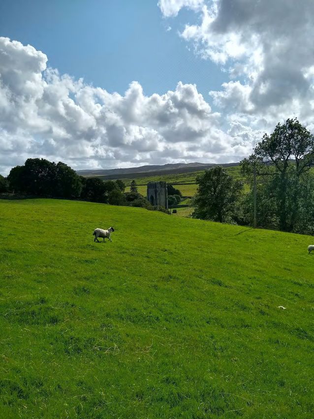
Disclaimer:

Everything presented here is for entertainment and informational purposes only, distributed on an as is basis with no
warranties. TMBtent, LLC makes no representations as to accuracy, completeness, currentness, suitability, or validity of
any information in this guide and will not be liable for any errors, omissions, or delays in this information or any losses,
injuries, or damages arising from its display or use. All information is provided on an as-is basis.

Copyright:

All maps included in this guide are copyright © OpenStreetMap contributors and © TMBtent, LLC.

All other information is copyright © TMBtent, LLC.

All rights reserved.
Contents
Read it cover- to-cover or jump around to the parts that suit you. This guide is organized
                             into six easy-to-navigate sections:

  1
            About the Coast to Coast Walk
            A quick overview of the hike, key stats, and what to expect along the route.

  2         Itineraries & Routes
            A summary of each stage and accommodation options for a 14-day C2C itinerary.
            We’ve also included itineraries for 12-day and 17-day walks.

  3
            Logistics
            Key information about getting to and from the Coast to Coast Walk, as well as
            insights on luggage storage and rest days.

  4
            Packing for the Coast to Coast Walk
            Our tried-and-true gear list for conquering the C2C. The printable format makes
            packing a breeze!

  5
            How to Navigate on the C2C
            Learn how to utilize the custom GPS files included with this guide and navigate
            using your smartphone.

  6
            Training Plan
            Get in shape for your Coast to Coast trek with our custom 15-week training plan!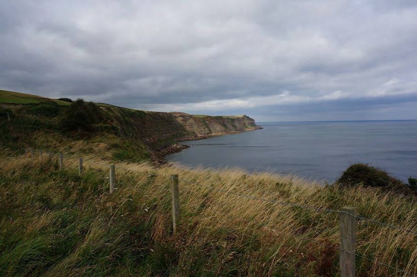
Section 1
About the Coast to Coast Walk
About the C2C
Back in 1973, a legendary man named Alfred Wainwright devised a new walking route across Northern England,
from the Irish Sea to the North Sea and through three incredible national parks along the way. Today, the Coast to
Coast Walk remains an unofficial trail, though it makes good use of the U.K.’s plentiful access paths and public rights
of way. In addition to its varied landscapes and dramatic natural beauty, the rich culture and history found along
the walk make it a truly unforgettable experience.
192
miles long
29,000
feet of elevation gain
14
days to complete
What’s it like?
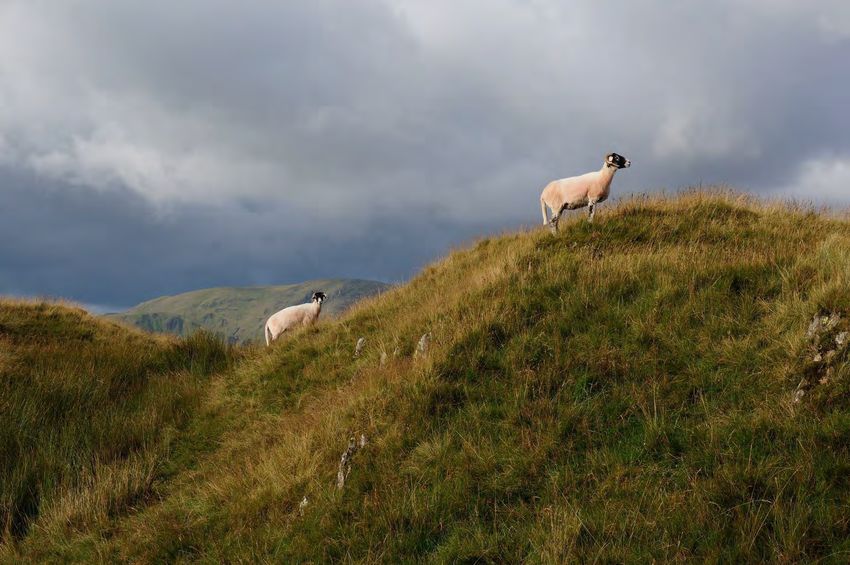
The Coast to Coast Walk is both a natural and cultural adventure. The trail starts in the dramatic mountains
of the Lakes District, makes its way through the rolling pastures of the Yorkshire Dales, the agricultural
heartland, and the bleak and stunning North York Moors before reaching the sea at the picturesque bluffs
near Robin Hood’s Bay. Some sections feel quite remote, but you’re never too far from the next town or pub.
How hard is it?
When it comes to a thru-hike like the Coast to Coast, it is definitely important to respect the distance. That
said, the C2C is quite approachable. The most physically strenuous sections are found in the Lakes District,
where you’ll encounter the biggest elevation changes and steepest climbs. Throughout the walk, you’ll have
some days where you’ll need to cover great distances (often 15-20 miles in a single day). These stages mostly
entail flat, easy walking, but they require endurance and can be challenging nonetheless.
What can I expect in terms of food and lodging?
Walkers of every style and budget will find plenty of excellent lodging options along the Coast to Coast. In
fact, the unique and friendly accommodations are a highlight of many C2C walkers’ experiences. Generally
speaking, each stage of the walk ends at a village or lodging. If you choose, you can purchase meals at the
many pubs and towns along the way, meaning you won’t need to carry much food. On the other hand, budget
travelers can self-cater most meals, with resupply points available every few days.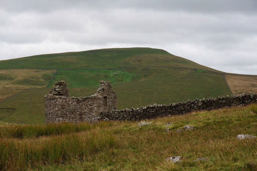
Coast to Coast Basics
                                      Reservations
    If you plan on staying in hotels, guesthouses, and/or hostels, you should plan ahead as
    much as possible. During the peak season (May-August), it is very likely that many places
    will be sold out nearly every night. Even outside of the busy months, it is a good idea to
    make advance bookings for places in resort areas, small towns with few accommodation
    options, and on weekends.

    Most campgrounds on the Coast to Coast Walk do not require reservations, but there are
    a few notable exceptions. You should book ahead for any campgrounds in the Lakes
    District during peak months, and at smaller camping areas like Lord Stones.

    In terms of travel, it may be helpful to purchase your train and/or coach tickets to/from the
    trail ahead of time, even if it’s just a few days in advance. You’ll likely pay less when
    booking prior to your travel dates, and many trains and coaches book up on weekends and
    holidays.

                                   Food & Supplies
    Delicious food and drink are plentiful along the Coast to Coast, making your adventure as
    much a culinary delight as an outdoor endeavor. If you plan on staying mostly in
    guesthouses and B&Bs along the route, expect to fill up on lavish breakfast spreads each
    morning. Many of these accommodations will also provide packed lunches for an
    additional fee. Dinner is served at the many guesthouses, inns, and pubs located at
    frequent intervals along the route, although many require that you book your meal a few
    hours in advance. These meals are generally hearty and delicious, but you’ll pay
    handsomely for the convenience.

    Those on a tighter budget can self-cater quite easily along the Coast to Coast Walk. There
    are grocery stores and shops at several points along the route, allowing you to resupply
    frequently and carry less weight in your pack. Many hostels have communal kitchens
    where walkers can prepare meals, but campers should bring their own stove and
    cookware.

    Always plan ahead to ensure you have enough food with you at all times. Look to see
    where the next restaurant or shop is located, and prepare accordingly. Carry an extra meal
    and some snacks in case your plans change.

                                             Water
    You can fill up on clean drinking water at most pubs and guesthouses along the route. It’s a
    good idea to carry 1-3 liters with you each day, depending on the weather and your total
    mileage.

    Unless you’re certain you’ll be able to refill along the way, fill up for the entire day before
    setting off in the morning. Do not drink from rivers, streams, or other sources without
    filtering first.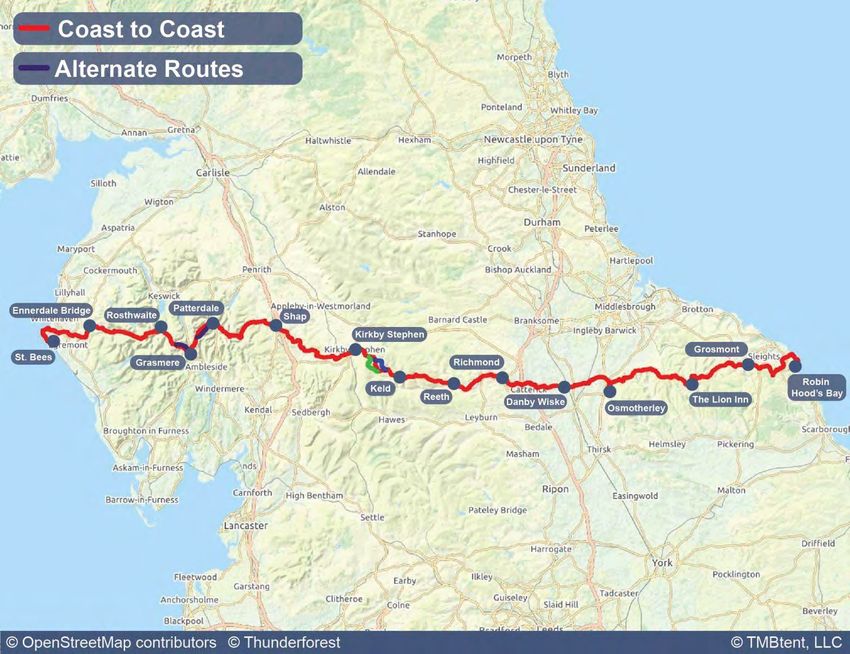
Accomodation
There are accomodation options along the Coast to Coast to suit every budget and travel style. While not all
of these options are available at every stage of the route, you can certainly customize your itinerary to fit
your needs. Check out all of the possibilities below.

                             B&Bs & Guesthouses
                                These are what the Coast to Coast is all about. With their warm hospitality, incredible
                                full English breakfasts, and cozy decor, independently-run guesthouses are at the
                                heart of the C2C experience. Expect to pay about £65 per person in a double room.

                              Hotels
                                 While certainly less plentiful than B&B’s, there are a fair number of hotels located
                                 along the Coast to Coast route, mostly in larger towns. These hotels tend to be
                                 smaller, independently-owned establishments. They vary quite a bit in terms of price
                                 and quality, but most are very well-appointed and include amenities such as wifi,
                                 tea/coffee, and often breakfast. A double room will typically cost you about £100 a
                                 night.

                              Bunkhouses & Hostels
                                 Bunkhouses and hostels provide an excellent budget option for those who are not
                                 keen on camping. Facilities vary widely across the many bunkhouses and hostels along
                                 the C2C, but generally you can expect dorm-style accommodations with shared
                                 bathrooms. Many provide communal kitchens and lounge areas, drying rooms, wifi,
                                 and meals for purchase. Most require you to bring your own sleeping bag and towel.
                                 The average dorm bed in a bunkhouse or hostel costs about £40 a night.

                              Camping
                                 Camping on the C2C is a budget-friendly option that allows for maximum flexibility
                                 and freedom on your walk. Wild camping is not permitted anywhere in Northern
                                 England, although it is possible to pitch your tent in a low-profile way in a few places
                                 along the route, particularly in the Lakes District. There are also many official
                                 campgrounds located throughout the walk, ranging from luxurious holiday parks to
                                 basic pub gardens. Prices vary widely, but average around £10 per person.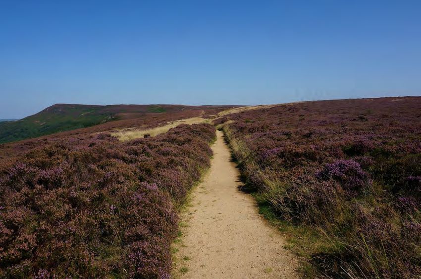
When to Hike
    There are some hearty souls who attempt the Coast to
    Coast during England’s dark, cold, wet winter months,
    but most mere mortals will enjoy it much more in the
    summer season. Due to the fact that you’ll be traversing
    a variety of landscapes and climates, it’s inevitable that
    you’ll encounter a wide range of weather conditions any
    time you walk.

    Generally speaking, here’s what you can expect in each
    month of the hiking season:

                                APRIL
    Cool temperatures, moderate rainfall, and sparse crowds make
    this an attractive month to hike. Be aware of the shorter days,
    which allow for fewer daylight hours on the trail.

                         MAY & JUNE
    The weather tends to be a bit milder and more settled than in
    April and the days are longer, but it’s still pretty quiet on the trail.
    These are great months to walk to C2C.

                     JULY & AUGUST
    School holidays and warm weather mean that these are the
    busiest months on the Coast to Coast. July and August (August in
    particular) tend to be wetter than May and June, but you can also
    get some brilliant sunny days, too.

                         SEPTEMBER
    With few crowds, mild temperatures, and relatively less rainfall,
    September is a wonderful time to be on the trail.

                            OCTOBER
      The days begin to get shorter, colder, and wetter as you enter
      October. You may get some incredibly clear and crisp autumn
      days, but you’ll also need to be prepared for harsh conditions.
Section 2
Itineraries & Routes
Which Direction to Hike
  Wainwright devised the original Coast to Coast route to be traversed from west to east, but
  it can easily be walked in either direction.

  Below we’ve outlined some important considerations for walking in each direction.

                                                                                    West to East
                                                                                            Starts in St. Bees
                                                        ●   Begin with the stunning Lakes District and tackle
                                                            the most challenging terrain with fresh legs.

                                                        ●   Traditionalists will appreciate following in
                                                            Wainwright’s footsteps.

                                                        ●   The prevailing winds are likely to be at your back.

                                                        ●   This is the more popular direction to walk so
                                                            you’ll encounter the same hikers again and again
                                                            along the route.

East to West
Starts in Robin Hoods Bay
 ●   Meet new hikers each day and shake up tradition.

 ●   This direction allows you to save the dramatic
     Lakes section for the grand finale.

 ●   Approach the toughest stages with the enhanced
     fitness you’ve built along the walk.

 ●   International travelers will enjoy the easier
     connection to Manchester upon finishing.
Selecting Your Itinerary
The Coast to Coast Walk is traditionally completed over the course of 14 days
which provides a perfect pace for most hikers. However, there are certainly those
who will want to tackle the trail in fewer days or savor their time by extending
their hike over a longer period of time.
Before selecting your itinerary, be sure to consider your personal abilities, how
much time you’ll have, and what you want your typical days on the Coast to Coast
to look like.
Given the amount of accommodation options on the Coast to Coast Walk, your
itinerary possibilities are nearly endless!
In the following pages of this guide we’ve included three itineraries that we believe
will suit the majority of walkers. Take a look at each of the itineraires and use these
general guidelines when thinking about how many days you’ll need to complete the
C2C:
12 days: Fast pace (8 – 10 hours of hiking each day)
This option is best for experienced walkers who have limited time to complete the
C2C. To traverse the entire route in just 12 days will require you to cover
significant distances each day.
14 days: Average pace (6-8 hours of hiking each day)
This is the standard Coast to Coast Walk itinerary. Spreading the walk across 14
days allows walkers to enjoy their hike while still being plenty challenged. Consider
adding in a rest day or two if you have the time.
17 days: Relaxed pace (6 - 8 hours of hiking each day)
If you’ve got the time, it’s worth considering this 17-day itinerary. With daily
distances averaging a little over ten miles each day, this itinerary is approachable
for a wide range of ability levels while still allowing you to achieve rewarding feats.
Note that this Guide includes GPS data for all three of the above itineraries,
making it easy to change your mind or create your own custom itinerary.Itinerary & Route
14-day Coast to Coast Walk - Main Itinerary
Day Start Finish Distance (mi) Elevation Gain (ft) Elevation Loss (ft)
1 St. Bees Ennerdale Bridge 14.04 2,542 2,214
2 Ennerdale Bridge Rosthwaite 14.71 2,320 2,385
3 Rosthwaite Grasmere 7.91 1,987 1,992
4 Grasmere Patterdale 8.22 1,948 1,739
5 Patterale Shap 15.25 3,291 2,955
6 Shap Kirkby Stephen 19.3 1,714 1,977
7 Kirkby Stephen Keld 11.54 1,910 1,431
8 Keld Reeth 10.66 1,818 2,200
9 Reeth Richmond 10.36 1,360 1,576
10 Richmond Danby Wiske 13.36 427 750
11 Danby Wiske Osmotherley 11.30 829 253
12 Osmotherley The Lion Inn 19.47 3,106 2,506
13 The Lion Inn Grosmont 13.17 504 1,693
14 Grosmont Robin Hood's Bay 14.99 2,115 2,197Itinerary & Route
12-day Coast to Coast Walk Alternate Itinerary
Day Start Finish Distance (mi) Elevation Gain (ft) Elevation Loss (ft)
1 St. Bees Ennerdale Bridge 14.04 2,542 2,214
2 Ennerdale Bridge Rosthwaite 14.71 2,320 2,385
3 Rosthwaite Patterdale 14.77 3,744 3,538
4 Patterale Shap 15.25 3,291 2,955
5 Shap Kirkby Stephen 19.3 1,714 1,977
6 Kirkby Stephen Keld 11.54 1,910 1,431
7 Keld Reeth 10.66 1,818 2,200
8 Reeth Richmond 10.36 1,360 1,576
9 Richmond Ingleby Arncliffe 21.98 702 866
10 Ingleby Arncliffe Clay Bank Top 11.62 2,755 2,162
11 Clay Bank Top Glaisdale 17.51 1,142 1,493
12 Glaisdale Robin Hood’s Bay 19.2 2,186 2,686Itinerary & Route
17-day Coast to Coast Walk Alternate Itinerary
Day Start Finish Distance (mi) Elevation Gain (ft) Elevation Loss (ft)
1 St. Bees Ennerdale Bridge 14.04 2,542 2,214
2 Ennerdale Bridge Black Sail Hostel 9.05 1,269 676
3 Black Sail Hostel Rosthwaite 5.66 1,217 1,875
4 Rosthwaite Grasmere 7.91 1,987 1,992
5 Grasmere Patterdale 8.22 1,948 1,739
6 Patterale Shap 15.25 3,291 2,955
7 Shap Orton 7.84 827 702
8 Orton Kirkby Stephen 13.45 977 1,365
9 Kirkby Stephen Keld 11.54 1,910 1,431
10 Keld Reeth 10.66 1,818 2,200
11 Reeth Richmond 10.36 1,360 1,576
12 Richmond Bolton-on-Swale 7.08 302 574
13 Bolton-on-Swale Ingleby Cross 15.14 497 424
14 Ingleby Cross Clay Bank Top 11.37 2,788 2,159
15 Clay Bank Top The Lion Inn 8.55 924 503
16 The Lion Inn Grosmont 13.17 504 1,693
17 Grosmont Robin Hood's Bay 14.99 2,115 2,19714-Day Itinerary Stage-by-Stage Guide
Stage Zero: St. Bees

    ACCOMMODATION                                       OVERVIEW
        OPTIONS
                                    The Coast to Coast walk officially begins at the seaside
                                    in St. Bees. It’s a good idea to spend the evening in
High end: Stone House Farm          St.Bees before beginning your walk, as the nearest
                                    large city, Manchester, is 3-4 hours away by train.
Mid-range: The Seacote Hotel
                                    There are several good accommodation options in the
Budget: Seacote Caravan Park        village, as well as a handful of places to enjoy an
                                    evening meal (although you’ll want to make
                                    arrangements for dinner earlier in the day).
Stage One: St.Bees to Ennerdale Bridge
OVERVIEW DESCRIPTION
Distance: 14 miles Begin your walk by completing two very important
Elevation: +2,542 ft, -2,214 ft Coast to Coast rites of passage. Head down to the
Estimated hiking time: 7-9 hours water’s edge to dip your boots in the Irish Sea and pick
up a pebble from the beach. You’ll dunk your boots in
the North Sea and deposit your pebble upon finishing in
ACCOMODATION Robin Hood’s Bay.
OPTIONS Once you’ve savored these great traditions, follow the
trail atop ruggedly beautiful seaside cliffs as it makes its
High-End: Thorntrees B&B way out of St. Bees. After you turn inland, it’s mostly
flat walking past farmland and through a couple of
Mid-Range: Fox and Hounds Inn quaint villages. There’s a final climb over Dent Fell (and
phenomenal views) before a few more easy miles to
Budget: YHA Ennerdale reach Ennerdale Bridge.Stage Two: Ennerdale Bridge to Rosthwaite
OVERVIEW DESCRIPTION
Distance: 15 miles Stage Two is arguably one of the most beautiful of the
Elevation: +2,320 ft, -2,385 ft entire walk, and it certainly showcases the best of the
Estimated hiking time: 7-9 hours Lakes District.
Begin on a rugged path that traces the length of
ACCOMODATION Ennerdale Water before winding your way up to the
remote Black Sail Hostel. The hostel is as cozy and
OPTIONS charming as can be, set against a stunningly wild
backdrop. Pop in for a cup of tea before tackling the
High-End: Hazel Bank Country steep ascent to Honister Pass. Finish with a picturesque
House descent into Rosthwaite.
Mid-Range: Royal Oak Hotel
Budget: YHA BorrowdaleStage Three: Rosthwaite to Grasmere
OVERVIEW DESCRIPTION
Distance: 7 miles Enjoy more incredible Lakeland beauty on this stage,
Elevation: +1,987 ft, -1,992 ft which starts with wild landscapes and rugged trails.
Estimated hiking time: 4-5 hours There is one section that requires mild scrambling as
you make your way up to Lining Crag.
ACCOMODATION Cross the vast, boggy Greenup Edge before choosing
between the more straightforward main route down or
OPTIONS the dramatic variant over Helm Crag.
High-End: Heidi’s Grasmere Lodge A delightful evening in Grasmere is the perfect reward
for your efforts.
Mid-Range: Raise Cottage
Budget: YHA Grasmere ButharlypStage Four: Grasmere to Patterdale
OVERVIEW DESCRIPTION
Distance: 7.5 miles This stage begins on a gently climbing path that leads
Elevation: +1,948 ft, -1,739 ft walkers through attractive farmland before entering
Estimated hiking time: 4-5 hours more untamed hillsides.
As you ascend towards Grisedale Hause (the high point
ACCOMODATION of this stage), incredible vistas open up first behind you
and later in front of you. Follow a rocky, rugged path for
OPTIONS a bit before the trail becomes gentler as you approach
Patterdale.
High-End: Old Water View Hotel
Be sure to stop in at the atmospheric White Lion Pub in
Mid-Range: The White Lion Inn Patterdale to commemorate your final night in the
Lakes District.
Budget: YHA PatterdaleStage Five: Patterdale to Shap
OVERVIEW DESCRIPTION
Distance: 15 miles One of the best parts of the Coast to Coast Walk is the
Elevation: +3,291 ft, -2,955 ft way it allows walkers to witness the changing
Estimated hiking time: 7-8 hours landscapes that make up the diverse patchwork of
Northern English terrain. Stage Five is one of the best
examples of this.
ACCOMODATION
The first section is marked by a challenging final climb
OPTIONS to Kidsty Pike, the highest point of the entire walk.
From there, you’ll leave the mountainous Lakeland
High-End: The Greyhound Hotel behind as you descend to Haweswater. It’s a tedious
but scenic walk as you trace the length of the lake.
Mid-Range: Brookfield House B&B
When you finally leave Haweswater, a new landscape of
Budget: New Ing Lodge rolling hills and pastures opens up before you. Take a
short detour to explore the historic Shap Abbey before
resting up in the small village of Shap after a long day on
your feet.Stage Six: Shap to Kirkby Stephen
OVERVIEW DESCRIPTION
Distance: 19 miles Stage Six covers quite a bit of distance, but those weary
Elevation: +1,714 ft, -1,977 ft of the Lakeland climbs will find some relief. The path
Estimated hiking time: 10 hours alternates between colorful moors and tidy farmland,
all while you marvel at the wide-open spaces. The sky
feels boundless and the green stretches on forever.
ACCOMODATION
You’ll learn to use new muscles as you climb over the
OPTIONS many stiles that you’ll encounter as you pass through
farmland. End the day in the well-appointed town of
High-End: Fletcher House Kirkby Stephen, which offers many shops, restaurants,
and other services.
Mid-Range: The King’s Arms B&B
Budget: Kirkby Stephen HostelStage Seven: Kirkby Stephen to Keld
OVERVIEW DESCRIPTION
Distance: 11.5 miles If you brought along your gaiters and waterproof boots,
Elevation: +1,910 ft, -1,431 ft today is the day to use them! Stage Seven packs plenty
Estimated hiking time: 5-6 hours of excitement (and a good deal of challenge) into a
relatively short distance.
ACCOMODATION Start the day with a climb to the legendary and
mysterious Nine Standards Rigg, which marks the
OPTIONS watershed of Britain. From there, the bog-hopping
begins! Pay close attention to the color-coded routes,
High-End: Frith Lodge B&B as the appropriate route varies by time of year to
prevent excessive erosion and environmental impacts.
Mid-Range: Butt House B&B
After a wet and wild traverse of the bogs, descend to a
Budget: Keld Bunk Barn stream set in a picturesque valley. An undulating and
scenic path (with a bit of road walking) carries you to
Keld.Stage Eight: Keld to Reeth
OVERVIEW DESCRIPTION
Distance: 10.5 miles There are two route options between Keld and Reeth
Elevation: +1,818 ft, -2,200 ft and both are splendid.
Estimated hiking time: 5-6 hours
The high-level alternate route takes walkers on a
rugged climb to bleak moorland scattered with
ACCOMODATION fascinating old mining remains. This is the more
challenging option, both in terms of physical exertion
OPTIONS and also because poor waymarking makes navigation
quite difficult.
High-End: The Burgoyne Hotel
The low-level main route ambles alongside the River
Mid-Range: Ivy Cottage B&B Swale for much of the way, providing delightful
glimpses of waterfalls, wildflowers, pastures, and
Budget: Orchard Caravan Park forests. This stage showcases some of the best of the
Yorkshire Dales.Stage Nine: Reeth to Richmond
OVERVIEW DESCRIPTION
Distance: 10.5 miles Stage Nine is characterized by mellow walking through
Elevation: +1,360 ft, -1,576 ft rolling pastures and farmlands. There is a good bit of
Estimated hiking time: 5 hours road walking on this stage, but the numerous points of
interest more than make up for it.
ACCOMODATION At the beginning of the walk, you’ll pass the remains of
the 12th century Marrick Priory (worth a short detour),
OPTIONS in the middle section you’ll pass through the lovely
village of Marske along with its 12th century church,
High-End: The Castle House B&B and you’ll end the day by meandering through the
peaceful woods of Applegarth farms.
Mid-Range: The Turf Hotel
Richmond is a delightful and well-located place for a
Budget: The Golden Lion rest day, should you choose to take one.
BunkhouseStage Ten: Richmond to Danby Wiske
OVERVIEW DESCRIPTION
Distance: 13 miles Begin the day by following an idyllic path along the
Elevation: +427 ft, -750 ft River Swale. Eventually, you’ll bid the river farewell and
Estimated hiking time: 7-8 hours begin a long trek through endless farm fields. It
certainly feels like you’ve made it into England’s
heartland at this point in the walk.
ACCOMODATION
There’s quite a bit of road walking on Stage Ten, but
OPTIONS many trekkers will welcome the easier change of pace.
Be sure to check out the beautiful Norman church
while in Danby Wiske.
High-End/Mid-Range: Ashfield
House B&B (01609 771628)
Mid-Range: Inglenook B&B
Budget: The White SwanStage Eleven: Danby Wiske to Osmotherley
OVERVIEW DESCRIPTION
Distance: 11 miles Stage Eleven is yet again filled with flat, easy, pastoral
Elevation: +829 ft, -253 ft walking. Savor the relaxed pace as you enjoy your final
Estimated hiking time: 5 hours stage in this middle portion of the walk before tackling
the North York Moors.
ACCOMODATION There’s plenty of road walking, although history buffs
will appreciate that part of it is on an ancient Roman
OPTIONS road. Pause for a moment at Ingleby Cross, the official
boundary of the North York Moors National Park and
the final fifty miles of your adventure.
High-End: Vane House
Keep in mind that you’ll need to detour about a mile off
Mid-Range: The Golden Lion Inn the main C2C route if you’d like to spend the night in
Osmotherley.
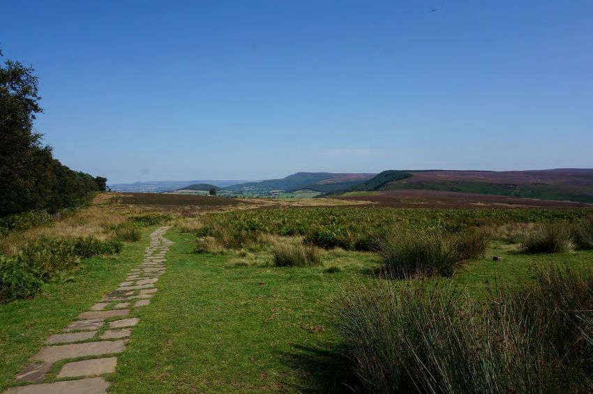
Budget: YHA OsmotherleyStage Twelve: Osmotherley to Blakey Ridge
OVERVIEW DESCRIPTION
Distance: 19 miles The first half of Stage Twelve is largely uphill as you
Elevation: +3,106 ft, -2,506 ft make your way through the scenic Cleveland Hills and
Estimated hiking time: 7-9 hours eventually to the high point at Urra Moor. The incline is
a refreshing change of pace after days of flat walking, as
are the expansive views as you gain elevation.
Once atop Urra Moor, take in the seas of heather
ACCOMODATION (which turn a beautiful purple in late summer and fall)
for miles and miles.
OPTIONS
There are virtually no services between Osmotherley
Mid-Range: The Lion Inn and Blakey Ridge, but most accommodation providers
in the area will pick up and drop off hikers at various
In Great Broughton... points along the way as needed to break up this long
stretch.
High-End/Mid-Range: Newlands
House B&B NOTE: The Lion Inn is the only trailside accommodation
option on this stage. Walkers seeking additional
Mid-Range: Wainstones Hotel accommodation will need to shuttle to nearby Great
Broughton.Stage Thirteen: Blakey Ridge to Grosmont
OVERVIEW DESCRIPTION
Distance: 13 miles There’s a long, bleak stretch of road walking through
Elevation: +504 ft, -1,693 ft the moors at the beginning of this stage, interrupted
Estimated hiking time: 5-6 hours only by the infamous “Fat Betty.” Betty is actually one of
many centuries old moorland crosses that can be found
in the area, but she is unique in that she’s become an
ACCOMODATION informal trading post of sorts for hikers to leave and
take food and gear as they near the eastern terminus of
OPTIONS the walk.
Once the monotony of the road is behind you, you’ll be
High-End/Mid-Range: Geall rewarded by a gorgeous traverse over high moors as
Gallery B&B you descend towards Glaisdale.
Mid-Range/Budget: Intake Farm Once out of the Moors, follow peaceful lanes into the
B&B (Littlebeck) charming village of Grosmont. Be sure to check out the
authentic steam trains while you’re there.Stage Fourteen: Grosmont to Robin Hood’s Bay
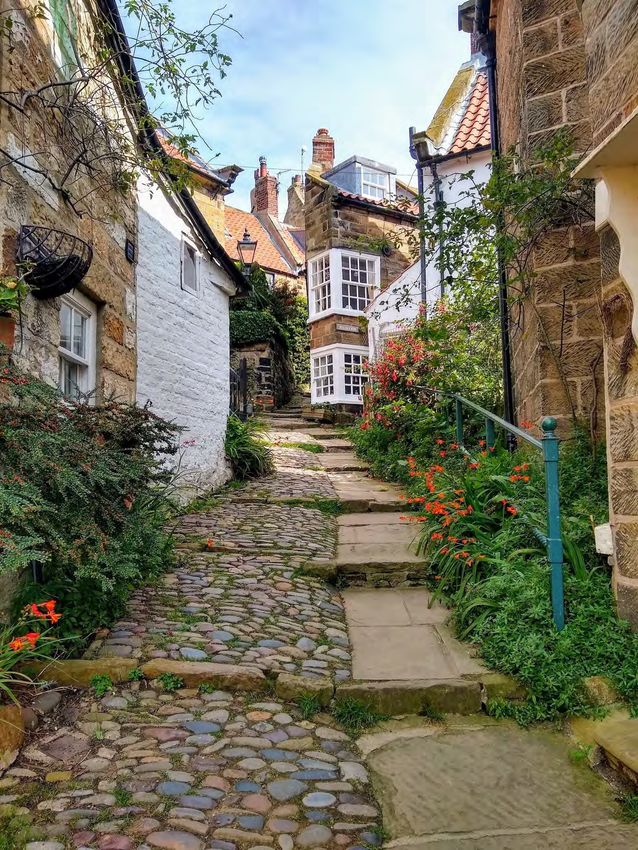
OVERVIEW DESCRIPTION
Distance: 15 miles This final marvelous stage of the Coast to Coast seems
Elevation: +2,115 ft, -2,197 ft to give you a little taste of everything you’ve
Estimated hiking time: 6-8 hours encountered on your journey thus far: woodlands,
moors, bogs, farms, seaside cliffs, villages, and, if you’re
lucky, a variety of weather elements along the way!
ACCOMODATION
After a stunning traverse of the coastal bluffs, you’ll
OPTIONS wind your way down through the incredibly quaint
village of Robin Hood’s Bay. Mark the end of your
journey by dipping your boots and depositing your
High-End: Fernleigh B&B pebbles in the North Sea.
Mid-Range: The Grosvenor Hotel The Bay Hotel, conveniently located at the water’s
edge, is the traditional spot for a celebratory pint and
Budget: YHA Boggle Hole the place to add your name to the C2C logbook.Section 3 Logistics
Getting from Manchester to St. Bees

              THE BASICS
 Cost: £20-£60

 Duration: 3-4 hours

 Transport type: Train

 Advance booking: Recommended

It’s quite easy to travel by train from Manchester to St. Bees, as there’s a railway station in the center of St.
Bees that receives several trains each day (except Sundays). The journey from Manchester Piccadilly
Station to St.Bees takes 3-4 hours and requires 1-2 transfers depending on the booking. Tickets can be
purchased at Manchester Piccadilly or in advance through TransPennine Express.

Depending on how far in advance you purchase your ticket, time of year, and time of day, one-way ticket
prices range from £20-£60.

            Getting from Robin Hood’s Bay to Manchester

             THE BASICS
  Cost: £30-£60

  Duration: 4-8 hours

  Transport type: Bus or Train

  Advance booking: Recommended

The journey between Robin Hood’s Bay and Manchester is not as straightforward as the one between Manchester
and St. Bees. The most budget-friendly option requires you to take a series of buses, and you can expect a full day
of travel. The train is a bit pricier, but it’s also a bit faster and requires less transferring.

Bus: The cheapest option is to travel by bus. Arriva runs a service from Robin Hood’s Bay to Middlesbrough. From
there you can take another coach service to Manchester (Megabus and National Express both offer service). The
entire journey takes 5-8 hours and costs about £30.

Train: If you want to travel by train, you’ll first need to get a railway station in one of the nearby towns, either
Whitby or Scarborough. It’s possible to take an Arriva bus from Robin Hood’s Bay to Whitby or Scarborough.
TransPennine Express operates a rail line that runs from Whitby and Scarborough to Manchester. The entire
journey takes about 4-6 hours and costs about £60.
Where to Stay Before and After the C2C
Below are some of the best accommodation options in St.Bees and Robin Hood’s Bay for
either end of your hike.
St.Bees
Stone House Farm: You’ll start your walk fully energized from the
comfortable beds and lavish breakfast spread at Stone House Farm. The
service is friendly and personalized and the location is convenient. Those
on a tight budget can camp in the lovely garden.
The Seacote Hotel:The oceanfront location of this hotel means that it
provides great views and easy access to the official start of the Coast to
Coast Walk. A full English breakfast is included in your room rate and dogs
are welcome (for an additional fee).
.
Robin Hood’s Bay
Fernleigh B&B: A stay at the luxurious Fernleigh is the perfect way to
celebrate the completion of your Coast to Coast walk. The
freshly-renovated victorian home features top-notch amenities and
beautiful decor on a quiet street near the center of town. The wonderful
owners will make sure you feel welcome and well-fed.
The Grosvenor Hotel: The Grosvenor is a favorite accommodation for
many Coast to Coast walkers and for good reason. Guests at this charming
hotel will enjoy spotless rooms, a delicious breakfast, and a location that’s
just five minutes from the beach.
Luggage Storage & Transfer
If you plan to travel through Manchester on either end of your walk, the
best place to store extra baggage is at the Manchester Train Station Left
Luggage. Additionally, many hotels will store luggage for free, given you
have a reservation for before and after your walk.
There are several companies that will transfer your baggage to each stop
along the route. Bags may not exceed 20kg, and are typically delivered to
your accommodation by 6pm each evening. We recommend using one of
the following transfer services:
The Coast to Coast Packhorse
SherpaVanRest Day Options
If you have room in your itinerary, you may want to consider taking a rest day. Rest days give you the chance
to get to know an area in a deeper way, and they give your mind and body a welcome reprieve from walking
in order to prevent injury and/or burnout. There are tons of great places to spend some extra time along the
Coast to Coast route, but here are our top picks:
Grasmere
Although most hikers will reach Grasmere just a few days into their walk, it
is still worth considering as an early rest day option. First off, your legs may
be begging for a break after the challenges of the Lakes District.
Additionally, it is a wonderful town to explore if you have some extra time.
Not only does the village have plenty of lovely shops and restaurants, but it
is also full of interesting history (including Wordsworth’s famous Dove
Cottage).
Heidi’s Grasmere Lodge: This exceptional B&B is located steps from the
center of town, yet still provides a tranquil setting and beautiful views. The
staff is friendly and the service exceptional, plus there’s a great cafe on site.
Richmond
Situated midway through the Coast to Coast route, Richmond is a great
place to take a breather. Between touring its famous castle and the ancient
Easby Abbey, strolling along the lovely riverside paths, or enjoying a craft
beer at The Station marketplace, there’s no shortage of things to do with an
extra day in this beautiful village!
The Castle House B&B: If by this point in your Coast to Coast Walk you are
seeking a bit of pampering, look no further than the Castle House. Named
for its location steps from the iconic Richmond Castle, this bed and
breakfast feels just as regal as its neighbor. From the nightly turndown
service to the luxurious bathrooms, every detail is impeccable.
Shortcuts & Detours
Regardless of the time of year you attempt the Coast to Coast Walk, there’s a chance you’ll need to adjust your plans due to weather, trail
conditions, or other issues. Fortunately, despite the remote regions it traverses, the Coast to Coast Walk is actually quite well connected
via trains and buses. Here are a few good services to familiarize yourself with in order to make getting around as efficient as possible.
Arriva: Outside of the Lakes District, most of the local bus services along the C2C route are operated by Arriva.
Stagecoach: Stagecoach mainly runs bus service in the Lakes District, but may also be helpful for connections to other regions throughout
the UK.
Moorsbus: This is a wonderful volunteer-run organization that provides bus connections throughout the North York Moors.
Traveline and Rome2rio are great planning tools for finding transportation options anywhere along the route.Section 4 Packing for the Coast to Coast
Essential Gear
 Making smart choices about what to pack (and what to leave behind) is a key part of setting yourself up for a
 successful and enjoyable C2C experience. It’s simple; the heavier your pack, the harder your effort.
 However, with a little thoughtful planning, you can keep your pack weight manageable while still ensuring
 you have everything you need to be comfortable both on and off the trail.

     Footwear                   Waterproofs                    Backpack                   Trekking Poles
Traditional hiking           You will undoubtedly         Make sure you                These are a total
boots, hiking shoes, or      face plenty of wet days      complete several hikes       game-changer on long
trail runners will all       on the C2C, so good          with your bag packed         and varied trek like the
work for the conditions      waterproofs are an           the same way and with        Coast to Coast. You
on the C2C. Bring a pair     important investment.        the same weight you’ll       (and your knees) will be
of boots or trail shoes      At the very minimum,         carry on the C2C. Just       so glad to have them on
that you know from           bring a lightweight rain     like shoes, backpacks        steep and loose
experience don’t cause       jacket, rain pants, and a    need to be broken in,        sections. We
problems for your feet.      pack cover. Some hikers      and your body needs to       recommend bringing
Ideally, you should put      use waterproof packing       get used to the feeling      lightweight, telescoping
at least 30 miles on         cubes as an extra            of wearing it for            poles that can be
them in various terrains     precaution. A hat can        extended periods of          packed away for travel.
prior to your walk to        be nice to keep rain out     time. In terms of size,      Also, it is important to
reduce the chance of         of your face, and a          most hikers will need        hike with your poles
running into issues on       waterproof carrying          between 25 and 45            while training, as it
the trail. Waterproof        case for your map            liters. Don’t forget to      takes a bit of time to
footwear and gaiters         and/or phone isn’t a bad     bring a pack cover to        learn how to use them
are a good idea, too.        idea either.                 protect against rain.        most effectively.

 How much should my pack weigh?
   There are several factors that influence how much is too much for any individual hiker.
   Considerations include:

     ●    How fast are you hoping to hike? Generally speaking, lighter=faster.
     ●    Have you completed a multi-day thru-hike with this specific backpack and this amount of
          weight before? If not, you should really try to keep it below 15lbs (including water!)
     ●    Are you injury-prone or do you have any chronic knee, hip, or back issues? If so, you need to
          make sure your backpack stays as light as possible.
     ●    One last rule of thumb: If you can’t fit everything in a 40L backpack or smaller, you have
          packed too much.
PACKING LIST
HOSTEL GEAR PERSONAL GEAR MISC. GEAR
❏ Sleep sheet ❏ Multi-tool ❏ Guidebook
❏ Travel towel ❏ First-aid kit ❏ Earplugs
❏ Pillow ❏ Hydration bladder ❏ Camera
❏ Sleep mask ❏ Pack cover ❏ Unlocked phone
❏ Backpack ❏ Battery backup
❏ Trekking poles ❏ Biodegradable soap
❏ Headlamp ❏ Travel adapter
❏ Sunscreen ❏ Plastic bags
❏ Toilet paper ❏ Digital watch
WOMEN’S CLOTHING MEN’S CLOTHING
❏ Underwear (3-4 pairs) ❏ Underwear (3-4 pairs)
❏ Socks (3-4 pairs) ❏ Socks (3-4 pairs)
❏ Sports bra (1) ❏ Long sleeve base layer (1)
❏ Long sleeve base layer (1) ❏ Short sleeve hiking shirt (1)
❏ Short sleeve hiking shirt (1) ❏ Hiking pants (1 pair)
❏ Leggings/pants (1 pair) ❏ Running shorts (1 pair)
❏ Running shorts (1 pair) ❏ Down jacket
❏ Down jacket ❏ Rain jacket
❏ Rain jacket ❏ Hiking boots
❏ Hiking boots ❏ Sunglasses
❏ Sunglasses ❏ Gloves
❏ Underwire bra ❏ Hat
❏ Gloves ❏ Sandals/camp shoes
❏ Hat ❏ Buff
❏ Sandals/camp shoes ❏ Rain pants
❏ Buff ❏ Gaiters
❏ Rain pants ❏ __________________
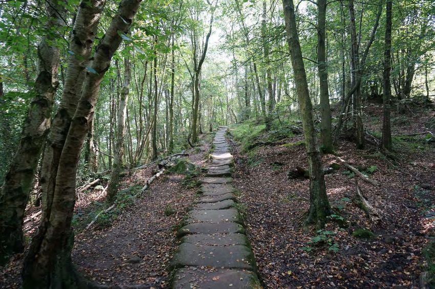
❏ GaitersSection 5 How to Navigate on the Coast to Coast Walk
Should I bring a map on the Coast to Coast?

Given that the Coast to Coast is not a National Trail in the UK, you won’t find the usual trail signs giving
clear direction at every turn. Rather, the Coast to Coast is often very poorly marked and can be difficult to
navigate on. For that reason we highly recommend that every walker have some sort of map (digital or
paper, preferably both) that they bring with them on their Coast to Coast trek.

This Guide includes custom GPS files for three unique Coast to Coast itineraires, and the following pages
provide instructions on how to download and use this data for your own walk.

However, even with the convenience of GPS navigation we still recommend carrying a paper map, or map
booklet for the Coast to Coast. This will provide a bit of insurance should that trusty phone of yours get
dropped in a puddle or soaked in one of the many downpours you’ll surely encounter.

Given the long distance of the Coast to Coast walk we highly recommend bringing a compact map booklet
that contains the entire route. We recommend the version created by Cicerone, which contains Ordnance
Survey (the UK’s national mapping service) maps for the entire Coast to Coast route at 1:25,000 scale.

Keep reading for instructions on how to utilize the custom GPS data provided with this Guide on your
own Coast to Coast walk.
How to turn your phone into a GPS

An offline mobile map of the Coast to Coast Walk is one of the easiest ways to navigate while you’re on
the trail. You’ll simply open up your chosen GPS app (more on that in the next section) and be able to view
your exact location, the overall trail, alternate routes, and stopping points along the trek. You can utilize
this to check that you are still on the route and know how far you've hiked at any given point along the
way.

We think this is far and away the most convenient way to navigate on the Coast to Coast and want to help
you successfully utilize offline mobile maps on your trek. As part of this guide, we've provided a
corresponding GPS download that you can access with the method described below.

Using your phone as a GPS
Modern smartphones are incredible machines. You can send email, video chat with someone halfway
around the world, and check your bank account all with a swipe of your finger. Another great feature of
smartphones is their ability to act as a GPS device. You regularly use this feature when navigating with
Google Maps, Apple Maps, or other mapping software that comes standard on most phones these days.

The problem is your phone relies on having an internet connection in order to download the background
mapping data that needs to be displayed for you to know where you are. You see, the GPS in your phone
only provides a location point, but the really valuable data is the background map that shows the various
streets, businesses and even traffic conditions around you. Without an internet connection to show the
background map, your phone won't have anything to display. You'll only see sad blue dot floating on a
blank gray background.

Solving the background map problem
While the issue of a background map not displaying isn’t typically a problem in cities or towns where
ample cell phone service (and thus internet connectivity) exists, it can be a huge problem when you’re, say,
on top of a high mountain pass on the Coast to Coast without service.

The solution?

GPS Navigation apps that allow for downloadable background maps. These apps allow you to select a
predefined area, in our case the entirety of the C2C, and download the background map to your phone.

This allows you to access the map data without a cell phone connection and still know exactly where you
are! Even though your phone is not connected to cell service or internet, the GPS will still work without
incurring any “roaming” charges.

In the next section we'll help you decide which GPS navigation app is best for you before providing
step-by-step instructions on how to utilize our custom GPS data on your phone.
Which GPS app should I use?

There are two main offline GPS navigation apps that we recommend for those walking the Coast to Coast:
Maps.me and Gaia GPS.

The main difference between the two apps is that Maps.me is free to download and use, but has limited
base maps. On the other hand, Gaia GPS requires a $19.99 annual subscription to use but has superior
offline base maps and more robust navigational tools. Check out the comparison below to see how a
specific section of the Coast to Coast displays in each of the apps.

As you can see, Maps.me can easily display the route as well as location markers along the way. However,
the same section of trail displayed in Gaia GPS gives the user much more information such as adjacent
trails, topographic lines, and elevation shading.

For this reason, we highly recommend you invest the $20 to use Gaia GPS, although we certainly
understand those who prefer to use a free option. Instructions for downloading and accessing the GPS
data for the Coast to Coast for both Maps.me and Gaia GPS are included in the next section.
Using Gaia GPS for your Coast to Coast map
The instructions below provide a step-by-step guide for downloading and accessing the custom itinerary
GPS data we’ve created in Gaia GPS. The first step is to download the .gpx or .kml file that we have
created for your specific itinerary. This file was sent in your order confirmation email.

Step One - Download the Coast to Coast GPS file
A link for the GPS file is included in your order confirmation email. You’ll want to be sure to open the email
and download the .KML file directly onto your phone (as opposed to on another device) to simplify the
process. After completing the download you’ll be prompted to open the file in Gaia GPS, which you should
do.

Gaia GPS will then import the data and you should see the Coast to Coast route and waypoints for your
specific itinerary displayed on the map.
Step Two – Choose your map source
Next, you’ll want to select your base map. This will be the background map that you will eventually
download and use to navigate while hiking, even without cell phone service. There are tons of background
maps available for download, but we highly recommend the “Outdoor” layer for those hiking the Coast to
Coast.

To choose this map source, simply select the layers icon in the top right corner and then select ‘Outdoors’
Step Three – Navigate to the Coast to Coast Walk and download your background map
Once you have selected the “Outdoor” base map, you’ll need to download the entire area of the Coast to
Coast route. Remember, without downloading this data you’ll have no way to know your exact location on
the trail when you don’t have cell phone service. To download the map background data, follow the steps
below:

 1.   Navigate to the area of the Coast to Coast in Gaia GPS
 2.   Select the ‘Create’ button (circle with a plus sign in the upper right hand corner)
 3.   Select ‘Download Map’
 4.   Draw a rectangle with your finger that encompasses the entire Coast to Coast
 5.   Set the ‘Max Zoom’ to 15
 6.   Name your map ‘Coast to Coast’ and select ‘Save’
 7.   Allow the download to complete and you’re done! (you’ll want to be connected to WiFi for this)

 That’s it! Now you’re all set to navigate on the Coast to Coast like a pro with an offline GPS map in Gaia
 GPS. You can now zoom in on specific sections, view trail segments, and see all of the stopping points
 along the route!
Using Maps.Me for your Coast to Coast map
The instructions below show a step-by-step guide for downloading and accessing the custom Coast to
Coast route data we’ve created in Maps.me. Maps.me is an excellent free navigation app that allows you
to download offline background data.

The primary shortcoming of using Maps.me for navigation while trekking is the limited base map data.
You won’t find detailed topographic lines, terrain shading, or other helpful features. However, we know
that many trekkers will be just fine with Maps.me and you can’t beat the price!

Step One - Download the Coast to Coast Walk GPS file
A link for the GPS file is included in your order confirmation email. You’ll want to be sure to open the email
and download the .KML file directly onto your phone to simplify the process. After completing the
download you’ll be prompted to open the file in Maps.me, which you’ll want to go ahead and do.

After opening the GPS file with Maps.me, the app will navigate to your current location and will also
display a message stating that your bookmarks have successfully been loaded. You’ll need to move the
map from your current location to the Coast to Coast and verify that you see the track and waypoints
displayed.
Step Two – Download your background maps
Once you have successfully loaded the GPS data, you’ll need to download the entire area of the Coast to
Coast Route as a base map in Maps.me. Remember, without downloading this data you’ll have no way to
know where exactly you are on the trail. To download the background map data in Maps.me, follow the
steps below:

 1.   Navigate to the area of the Coast to Coast in Maps.me
 2.   Zoom in on the trail until the app prompts you to download a map region
 3.   You’ll need to download three distinct regions in Maps.me to cover the entire C2C. They are:
        a. North West England - Lancaster
        b. Yorkshire and the Humbler
        c. North East England
 4.   Continue to zoom in on different segments of the trail until you have downloaded all of these
      regions
 5.   Verify that you’ve downloaded all of the required base maps by navigating to the ‘Download Maps’
      menu.
 6.   Once you’ve checked that all of the regions have been successfully downloaded you’re all done!
Step Three – Verify that you’ve downloaded the basemaps
To verify that you’ve successfully downloaded the required base map regions in Maps.me follow these
steps:
1. Select the ‘Menu’ in the bottom right hand corner of the screen
2. Select ‘Download Maps’
3. Verify that you have the following maps downloaded:
a. North West England - Lancaster
b. Yorkshire and the Humbler
c. North East England
That’s it! You’re all set to navigate on the Coast to Coast like a pro with an offline GPS map utilizing
Maps.me. You can now zoom in on specific sections, view trail segments, and see all of the stopping points
along the route!Section 6 Training Plan
Your 15-Week Coast to Coast Training Plan
Use this training plan as a general guide to prepare for the C2C. Can’t do every exercise, miss a day, or need to make some substitutions? No problem! You’ll be just
fine on your trek, as long as you go into it with good health and with a decent fitness base. Feel free to make adjustments to this plan to fit your unique
circumstances.
Disclaimer: This training plan is not intended for the treatment or prevention of disease, nor is it a replacement for seeking medical treatment or professional nutrition advice. Do not start any
nutrition or physical activity program without first consulting your physician.
Starting six months before the C2C, focus on building your base. Walk, run, hike, swim, and/or cycle for 30-60 minutes at least twice a week to
establish your cardio endurance.
Weeks until Monday Tuesday Wednesday Thursday Friday Saturday Sunday
C2C
30 min Incline Strength Workout: 30-60 min Strength Workout: 30 min Cardio Long hike or Rest
Cardio 3 sets each Cardio 3 sets each long walk (1.5
OR hours)
-Goblet squats (10 -Goblet squats (10
15 reps) reps)
Rest depending
-Lunges (10 each leg) -Lunges (10 each leg) on how you feel.
-45 second plank -45 second plank
30 min Incline Strength Workout: 30-60 min Strength Workout: 30-60 min Long hike or Rest
Cardio 3 sets each Cardio 3 sets each Cardio long walk (1.5
hours)
-Goblet squats (10 -Goblet squats (10
OR
reps) reps)
-Lunges (10 each leg) -Lunges (10 each leg) Rest depending
on how you feel.
14 -45 second plank -45 second plank
-Side lunges (8 each -Side lunges (8 each
leg) leg)
-Step-ups (10 each -Step-ups (10 each
leg) leg)Weeks until Monday Tuesday Wednesday Thursday Friday Saturday Sunday
C2C
30 min Incline Strength Workout: 30 min Incline Strength Workout: 30-60 min Long hike or Rest
Cardio 3 sets each Cardio 3 sets each Cardio long walk (1.5-2
hours)
-Goblet squats (10 -Goblet squats (10
OR OR
reps) reps)
-Lunges (10 each leg) 60 min Cardio -Lunges (10 each leg) Rest depending
on how you feel.
13 -45 second plank -45 second plank
-Side lunges (8 each -Side lunges (8 each
leg) leg)
-Step-ups (10 each -Step-ups (10 each
leg) leg)
30 min Incline Strength Workout: 30 min Incline Strength Workout: 30-60 min Long hike or Rest
Cardio 3 sets each Cardio 3 sets each Cardio long walk
(2 hours)
-Goblet squats (10 -Goblet squats (10
OR OR
reps) reps)
-Lunges (10 each leg) 60 min Cardio -Lunges (10 each leg) Rest depending
on how you feel.
-45 second plank -45 second plank
12 -Side lunges (8 each -Side lunges (8 each
leg) leg)
-Step-ups (10 each -Step-ups (10 each
leg) leg)Weeks until Monday Tuesday Wednesday Thursday Friday Saturday Sunday
C2C
60 min Incline Strength workout: 30 min Incline Strength workout: 30 min Cardio Long hike or Rest
Cardio 3 sets each Cardio 3 sets each long walk (2
OR hours)
-Goblet squats (10 -Goblet squats (10
OR
reps) reps)
Rest depending
-Lunges (10 each leg) 60 min Cardio -Lunges (10 each leg) on how you feel.
11 -45 second plank -45 second plank
-Side lunges (8 each -Side lunges (8 each
leg) leg)
-Step-ups (10 each -Step-ups (10 each
leg) leg)
60 min Incline Strength Workout: 60 min Cardio Strength Workout: 30 min Cardio Long hike or Rest
Cardio 3 sets of each 3 sets of each long walk (2-3
OR hours)
-Squats w/ overhead -Squats w/ overhead
press (10 reps, press (10 reps,
medium dumbells) medium dumbells)
Rest depending
on how you feel.
-Lunges (12 each leg) -Lunges (12 each leg)
-60 second plank -60 second plank
10
-Side lunges (10 each -Side lunges (10 each
leg) leg)
-Step-ups (10 each -Step-ups (10 each
leg) leg)
-hip bridges (10 reps) -hip bridges (10 reps)Weeks until Monday Tuesday Wednesday Thursday Friday Saturday Sunday
C2C
60 min Incline Strength Workout: 60 min Cardio Strength Workout: 30-45 min Long hike or Rest
Cardio 3 sets of each 3 sets of each Cardio long walk (2
OR hours) with
-Squats w/ overhead -Squats w/ overhead
OR weighted pack*
press (10 reps, press (10 reps,
medium dumbells)
45 min Incline medium dumbells)
Cardio Rest
-Lunges (12 each leg) -Lunges (12 each leg) depending on
9 how you feel.
-60 second plank -60 second plank
-Side lunges (10 each -Side lunges (10 each
leg) leg)
-Step-ups (10 each -Step-ups (10 each
leg) leg)
-hip bridges (10 reps) -hip bridges (10 reps)
30-45 min Strength Workout: 60 min Cardio Strength Workout: Rest Long hike or 45 minute
Cardio 3 sets of each 3 sets of each long walk (2 walk or hike
OR hours) with
-Squats w/ overhead -Squats w/ overhead
OR weighted pack*
press (10 reps, press (10 reps,
medium dumbells)
45 min Incline medium dumbells)
Rest Cardio
depending on -Lunges (12 each leg) -Lunges (12 each leg)
8 how you feel.
-60 second plank -60 second plank
-Side lunges (10 each -Side lunges (10 each
leg) leg)
-Step-ups (10 each -Step-ups (10 each
leg) leg)
-hip bridges (10 reps) -hip bridges (10 reps)Weeks until Monday Tuesday Wednesday Thursday Friday Saturday Sunday
C2C
30-45 min Strength Workout: 60 min Cardio Strength Workout: Rest Long hike or 60 minute
Cardio 4 sets of each 4 sets of each long walk incline walk or
OR hike
-Squats w/ overhead -Squats w/ overhead
OR (Ideally 1,000
press (10 reps, press (10 reps,
medium dumbells)
45 min Incline medium dumbells)
meters
Rest Cardio elevation gain,
depending on -Lunges (12 each leg) -Lunges (12 each leg) 10-15km)
7 how you feel. with weighted
-60 second plank -60 second plank pack*
-Side lunges (10 each -Side lunges (10 each
leg) leg)
-Step-ups (10 each -Step-ups (10 each
leg) leg)
-hip bridges (10 reps) -hip bridges (10 reps)
30-45 min Strength Workout: 60 min Cardio Strength Workout: Rest Long hike or 60 minute
Cardio 4 sets of each 4 sets of each long walk incline walk or
hike with
-Squats w/ overhead -Squats w/ overhead
OR (Ideally 500 weighted
press (10 reps, press (10 reps,
medium dumbells) medium dumbells)
meters pack*
Rest elevation gain,
depending on -Lunges (12 each leg) -Lunges (12 each leg) 10-15km)
6 how you feel. with weighted
-60 second plank -60 second plank pack*
-Side lunges (10 each -Side lunges (10 each
leg) leg)
-Step-ups (10 each -Step-ups (10 each
leg) leg)
-hip bridges (10 reps) -hip bridges (10 reps)Weeks until Monday Tuesday Wednesday Thursday Friday Saturday Sunday
C2C
30-45 min Strength Workout: 60 min Cardio Strength Workout: Rest Long hike or 60 minute
Cardio 4 sets of each 4 sets of each long walk incline walk or
hike with
-Squats w/ overhead -Squats w/ overhead
OR (Ideally 500 weighted
press (10 reps, press (10 reps,
medium dumbells) medium dumbells)
meters pack*
Rest elevation gain,
depending on -Lunges (12 each leg) -Lunges (12 each leg) 10-15km)
5 how you feel. with weighted
-60 second plank -60 second plank pack*
-Side lunges (10 each -Side lunges (10 each If you plan on
leg) leg) using new hiking
boots on the C2C,
-Step-ups (10 each -Step-ups (10 each start breaking
leg) leg) them in now.
-hip bridges (10 reps) -hip bridges (10 reps)
30-45 min Strength Workout: 60 min Cardio Strength Workout: Rest Long hike or Long hike or
Cardio 4 sets of each 4 sets of each long walk long walk
-Squats w/ overhead -Squats w/ overhead
OR (Ideally 1,000 (Ideally 500
press (10 reps, press (10 reps,
Rest medium dumbells) medium dumbells)
meters meters
depending on elevation gain, elevation gain,
how you feel. -Lunges (12 each leg) -Lunges (12 each leg) 10-15km) 10-15km)
with weighted with weighted
-60 second plank -60 second plank pack* pack*
4
-Side lunges (10 each -Side lunges (10 each If camping on the
leg) leg)
C2C, try to turn
-Step-ups (10 each -Step-ups (10 each
this into an
leg) leg) overnight
backpacking trip
-hip bridges (10 reps) -hip bridges (10 reps)You can also read